-
-
-
|
-
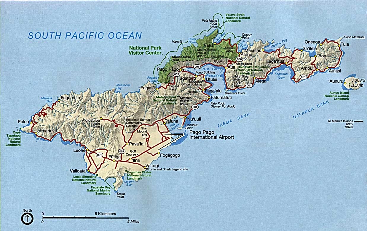
- American Samoa Map
-
|
-
-
-
-
-
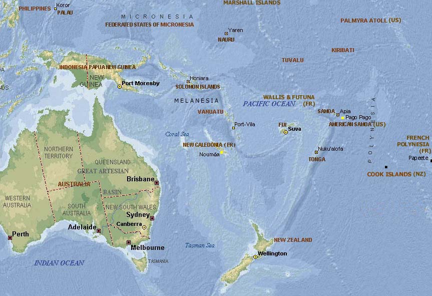
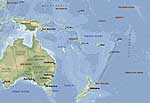
Map of
-
the Pacific
-
|
-
-
-
-
-
|
- latest picture: July 31, 2009
- click a picture to see details
|
-
-
|
-
-
|
-
-
|
- 01
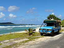
On July 2nd, 2009, we are
- approaching with the ferry “Lady
- Naomi” the island of Tutuila, the
- biggest of the seven islands
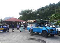
- of American Samoa
|
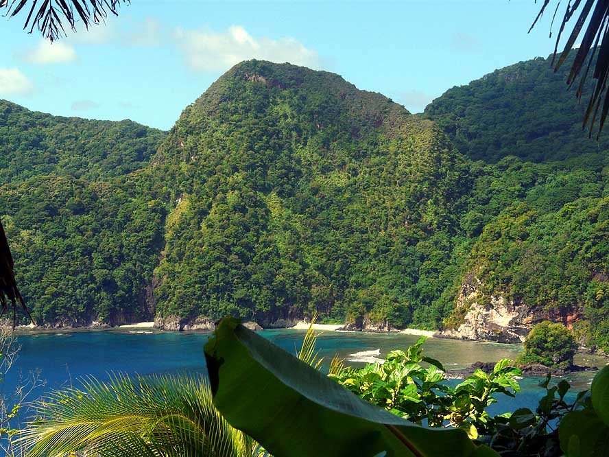
- 02
A television crew is greeting us at
- the port of Pago Pago on our arrival
|
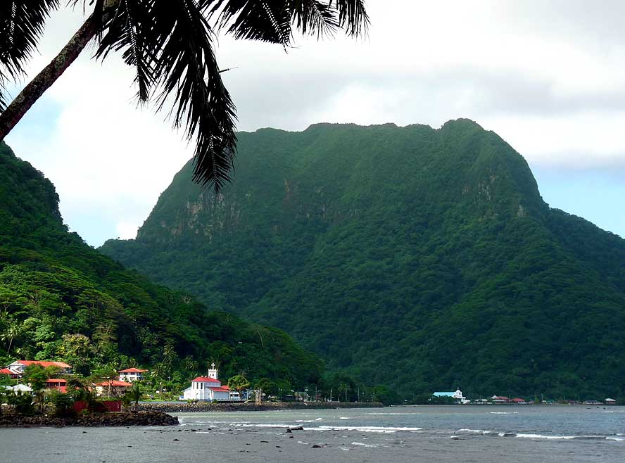
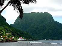
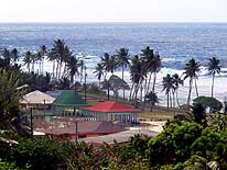
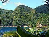
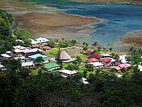
- 03
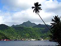
Pago Pago (pop. 11’500) nestles
- wonderfully at the foot of the steep and
- deeply forested Matafao Peak (2’140ft.).
- The port of Pago Pago is known to
- have the highest annual rainfall of any
- harbor in the world
|
-
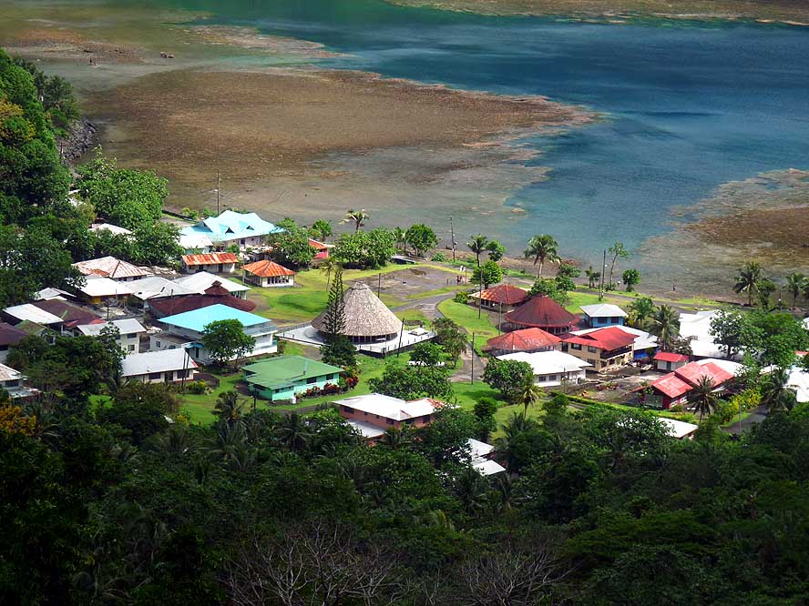
|
-
-
-
-
|
-
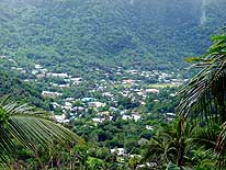
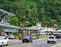
-
|
-
-
-
-

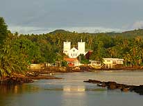
|
- 04
|
- 05
|
- 06
|
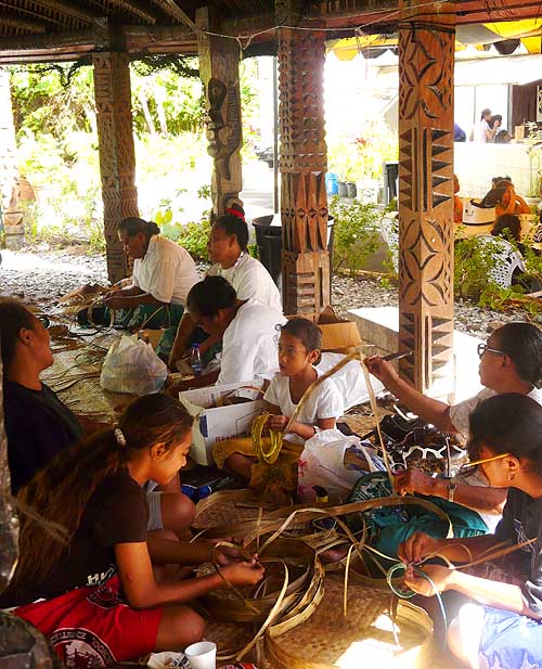
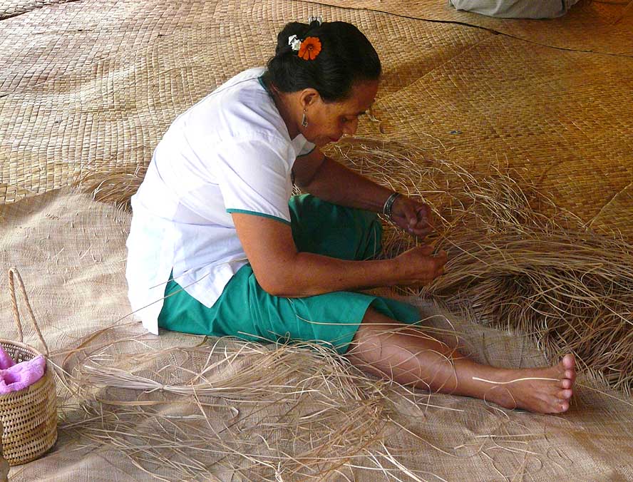
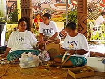
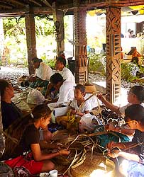
- A group of women and girls are skillfully weaving all kinds of baskets and mats from
Pandanus leaves
|
-
-
|
-
-
|
-
-
|
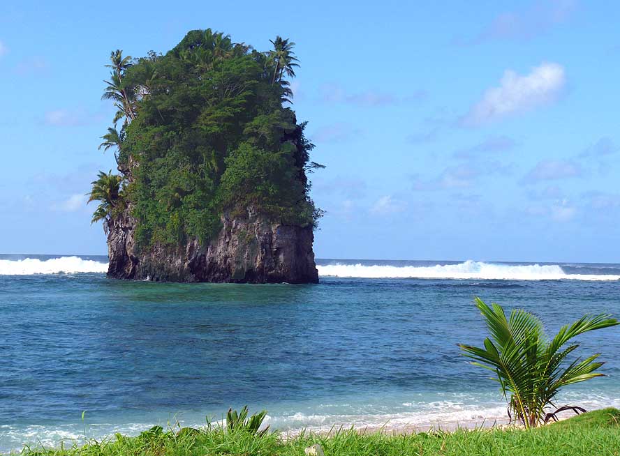
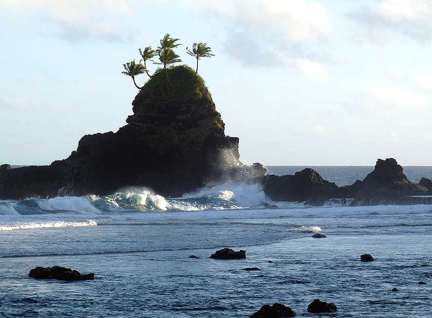
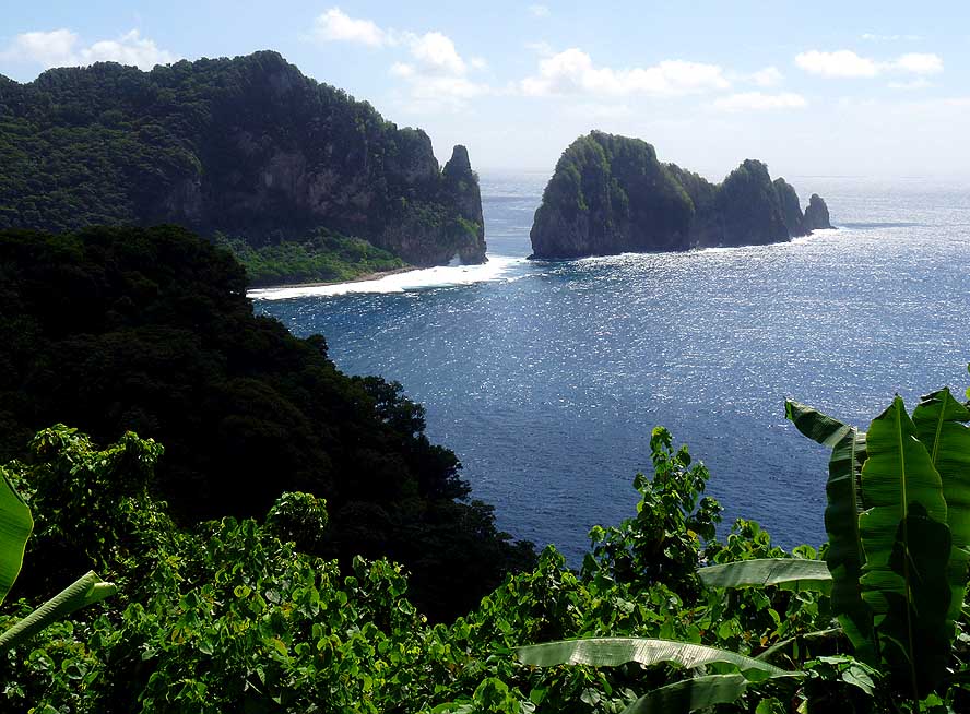
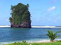
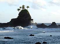
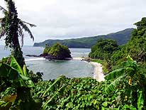
- 07
The „Flower Pot Rock“(Fatu Ma
- Futi) southwest of Pago Pago is a well-
- known land mark of American Samoa
|
- 08
The „Turtle and Shark Site“ at
- Vaitogi’s rough seashore in the Southwest
- is connected with many local legends
|
- 09
The village of Vaitogi sits
- picturesquely among
- coconut palm trees
|
-
|
-
-

|
-
-

|
-
-
|
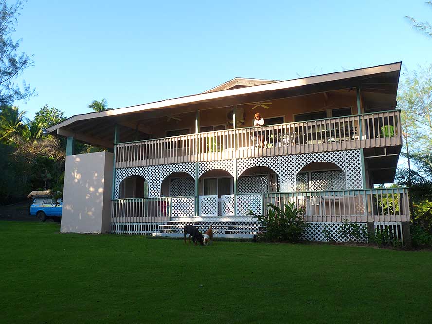
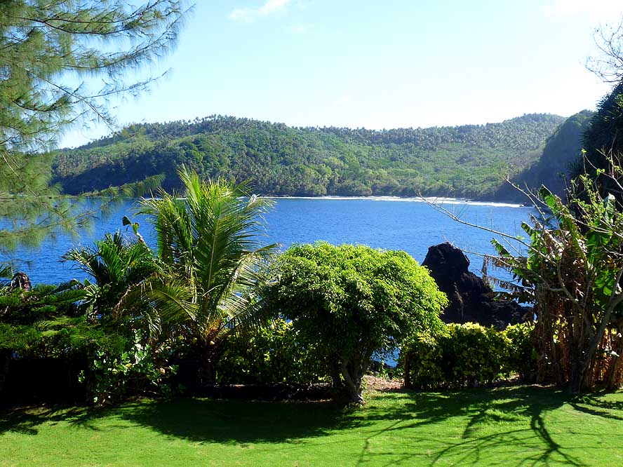
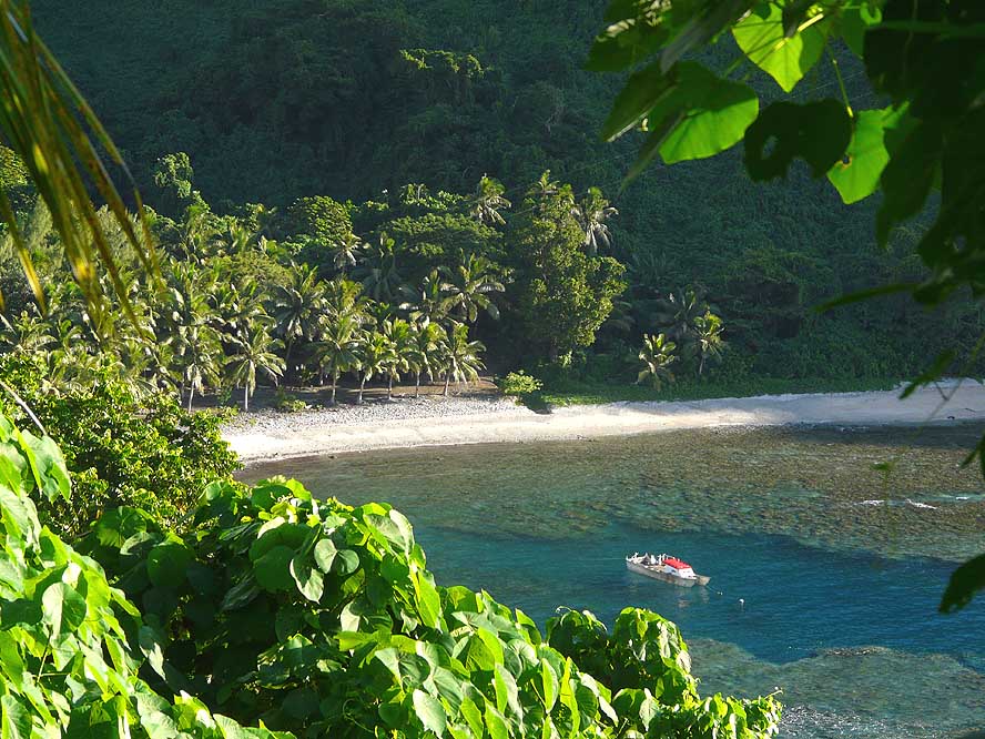
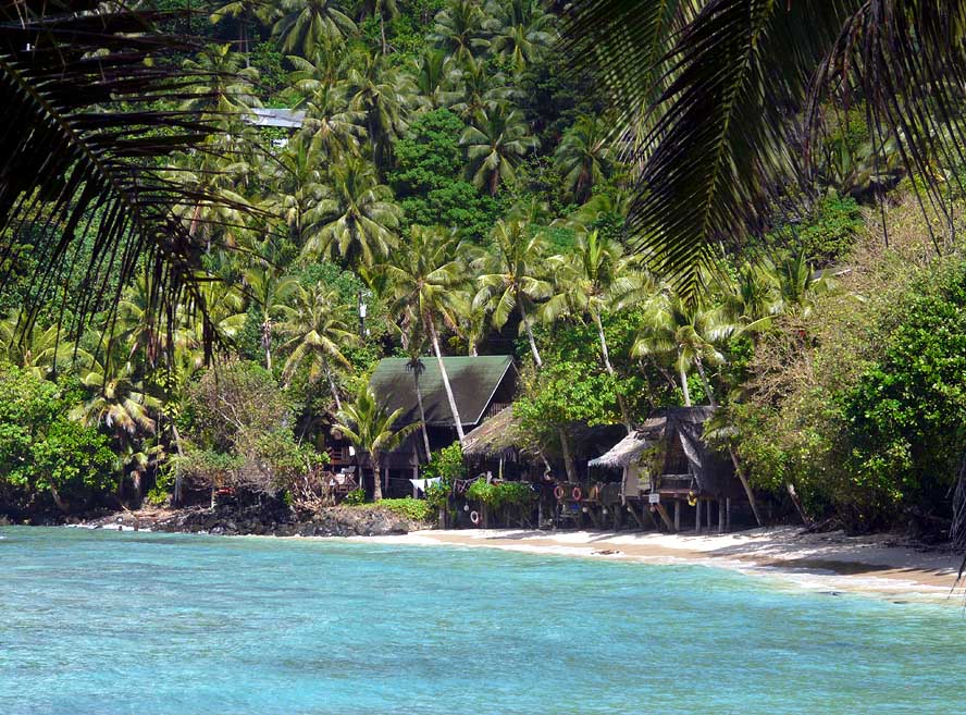
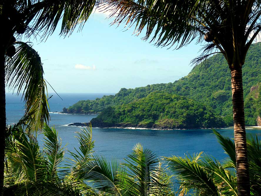
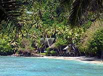
- 10
Our relaxing “home“for one month:
- The peaceful “Turtle & Shark Lodge” –
- 1 mile outside of Vaitogi – is sitting above
- the majestic Vaitogi cliffs with views over …..
|
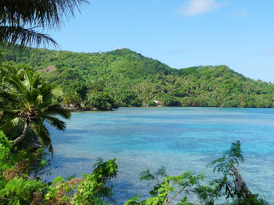
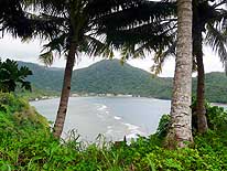
- 11
..... the untouched “Larson”
- Cove with the Fogama'a
- Beach to the West .....
|
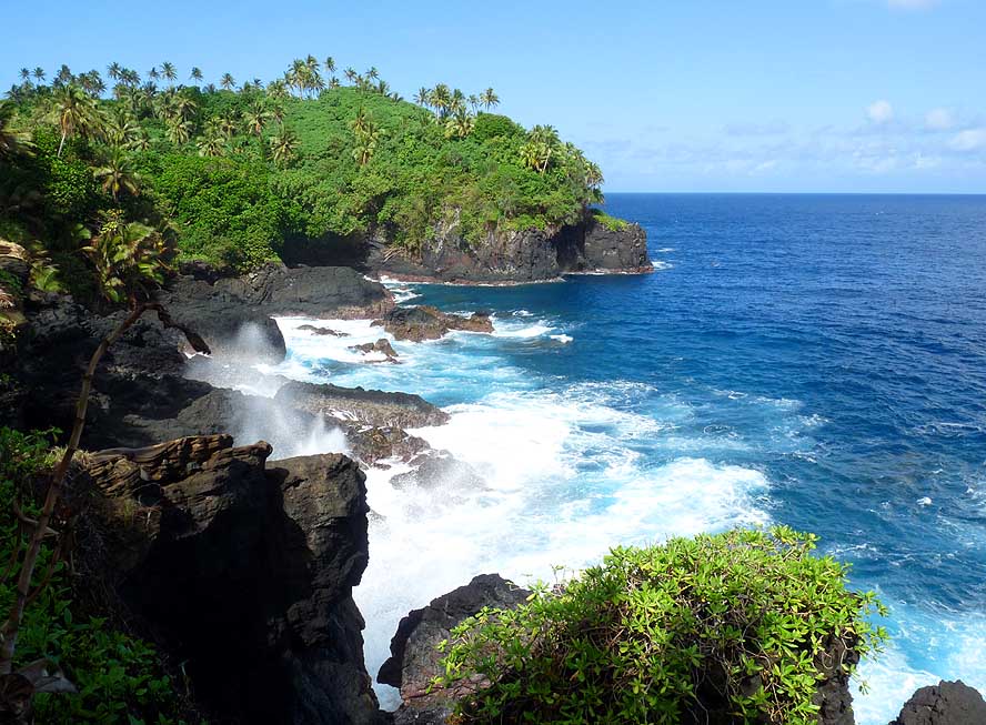
- 12
..... and the waves of the Pacific
- Ocean crashing to the Southern shores
|
-
|
-
-
-
-

|
-
-
|
-
-
-
-
|
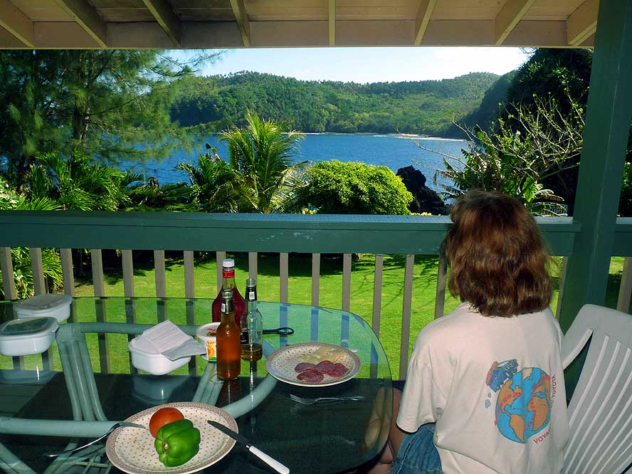
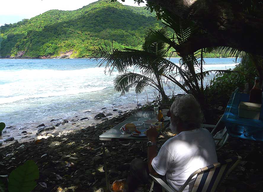
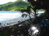
- 13
Lunch on the porch at
- “Turtle & Shark Lodge”
|
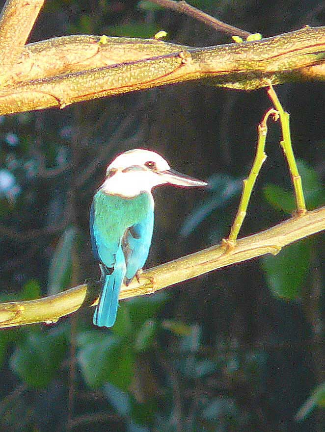
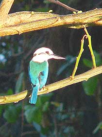
- 14
A Kingfisher is part of our neighbor-hood, besides many Bulbuls
- and Mynas. In contrast to those in
- Samoa (picture 53) its chest is white
|
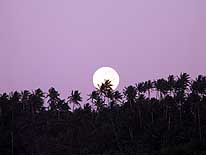
- 15
Early morning: The moon is setting
- behind the palm trees of Larson’s Cove
|
-
|
-
-
|
-
-
-
-

|
-
-
|
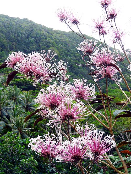
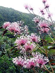
- 16
A tropical tree in full bloom
|
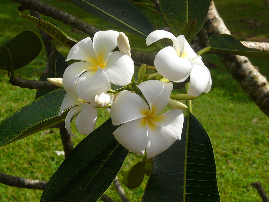
- 17
The Frangipani (“Tiare”) flower
- is the symbol of the South Pacific
|
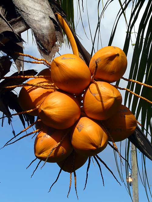
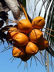
- 18
Coconuts produce the rich milk
- used in the Samoan cuisine as well as pure
- and refreshing water to appease the thirst
|
-
|
-
-
|
-
-
|
-
-
|
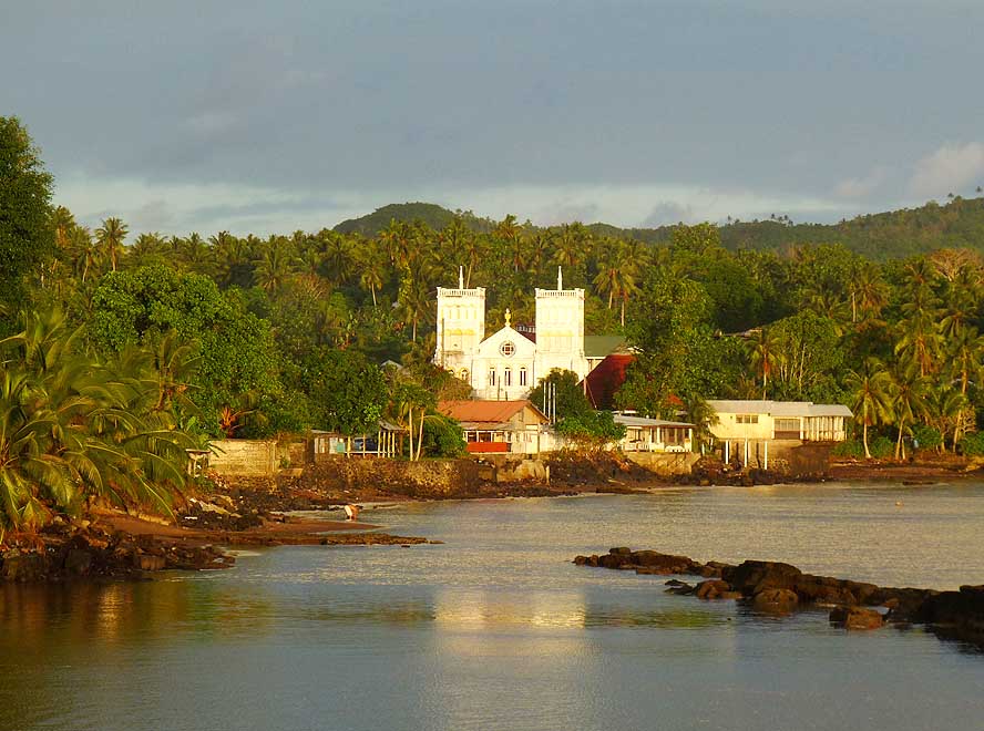
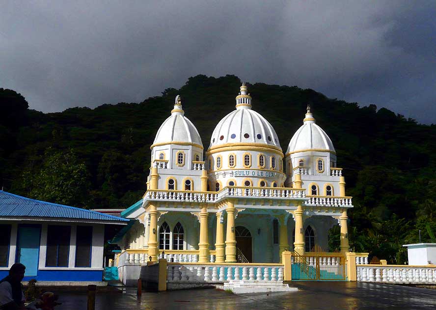
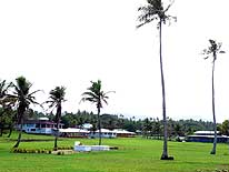
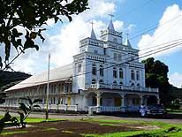
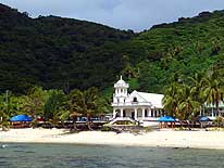
- 19
The two tower church that graces
- the village of Leone in the West. Leone
- with a population of 5’000 is the second
- biggest place in American Samoa
|
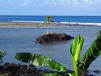
- 20
A tiny rock islet in the West of
- Leone supports just a
- single coconut tree
|
- 21
The three turret church in Leone
- is the work of the first missionary,
- John Williams, who arrived on
- October 18, 1832, to American Samoa
|
-
|
-
-

|
-
-

|
-
-
|
- 22
Inspiring scenery along the
- Southwest coast between
- Leone and Amanave
|
- 23
In the village of Seetaga along
- the Southwest coast sits another
- of the many impressive churches
|
- 24
Five lonely coconut trees took
- roots on the volcanic outcrop near
- Amanave at Cape Taputapu
|
-
|
-
-

|
-
-
|
-
-
|
- 25
View over the lovely village of
- Amanave at the scenic Southwest coast
|
- 26
Waiting for the bus in Seetaga
|
- 27
A private beach short of Fagamalo
|
-
|
-
-
|
-
-
|
-
-

|
- 28
The sleepy hamlet of Fagamalo,
- where the road ends in the West
|
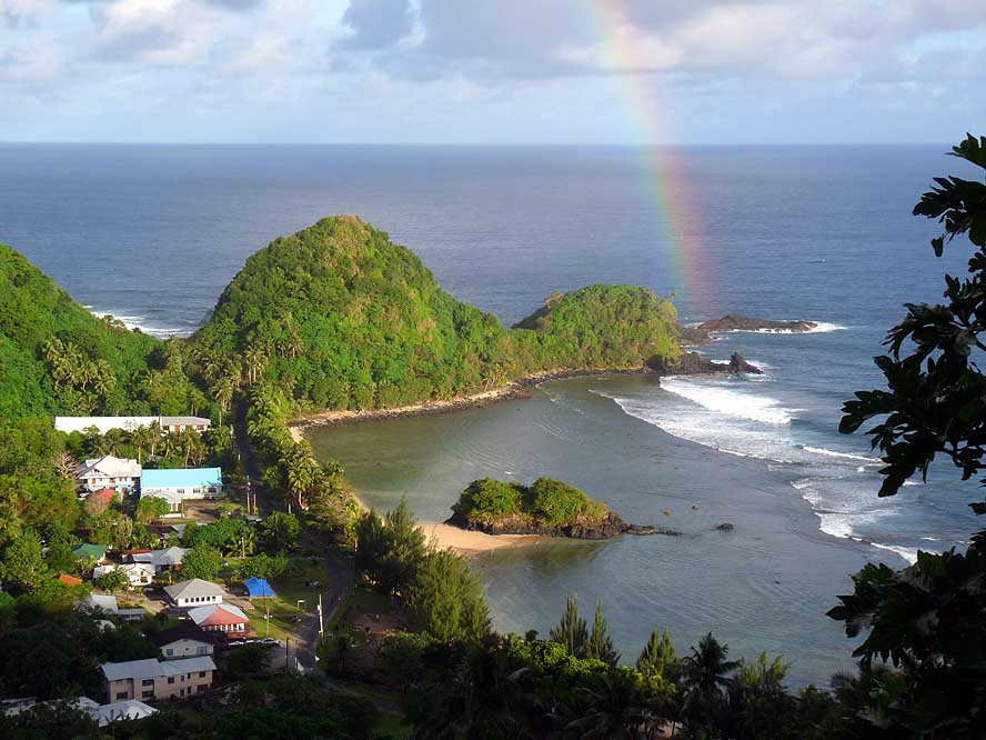
- 29
A rainbow decorates one of
- the many white sandy beaches
- dotting the Southwest coast
|
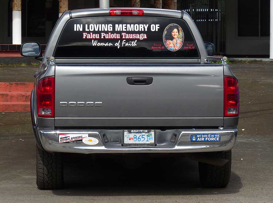
- 30
A nice way for a deceased
- person to be remembered
|
-
|
-
-
-
-
|
-
-
|
-
-
-
-
|
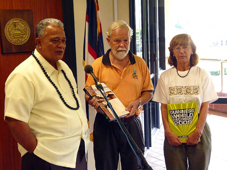
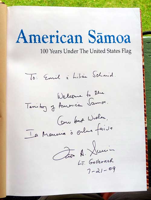
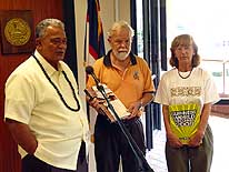
- 31
Courtesy visit at the Honorable
- Lieutenant Governor Mr. Faoa Aitofele Sunia
- on July 21, 2009, at which occasion he presents
- us with the illustrated book “American Samoa,
- 100 Years under the United States Flag” .....
|
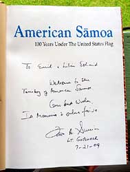
- 32
..... with his personal
- dedication
|
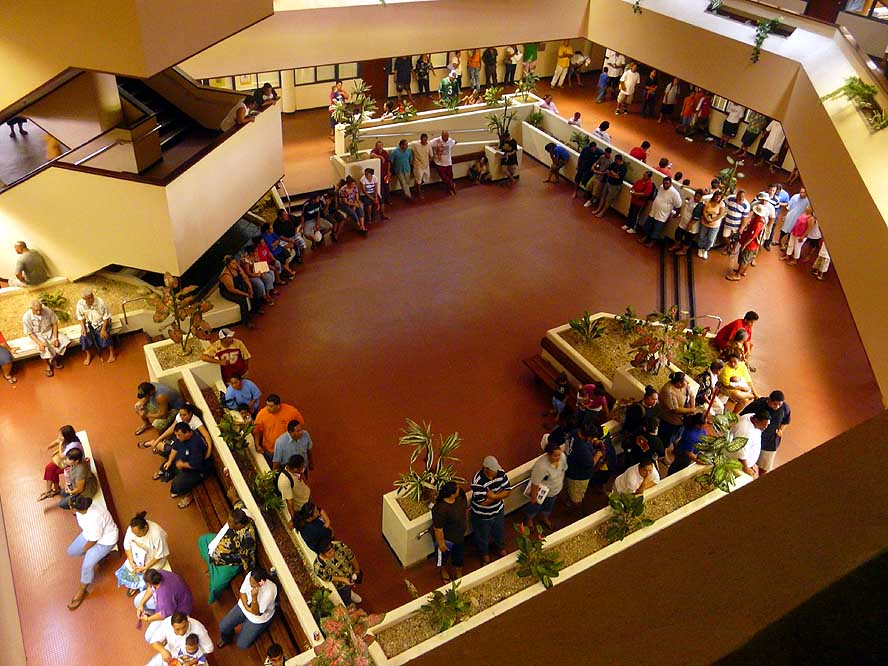
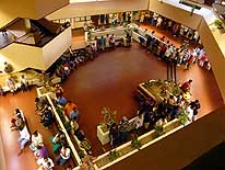
- 33
People wait patiently for their turn
- on the ground floor of the Pago Pago
- Government Building
|
-
|
-
-
|
-
-

|
-
-
|
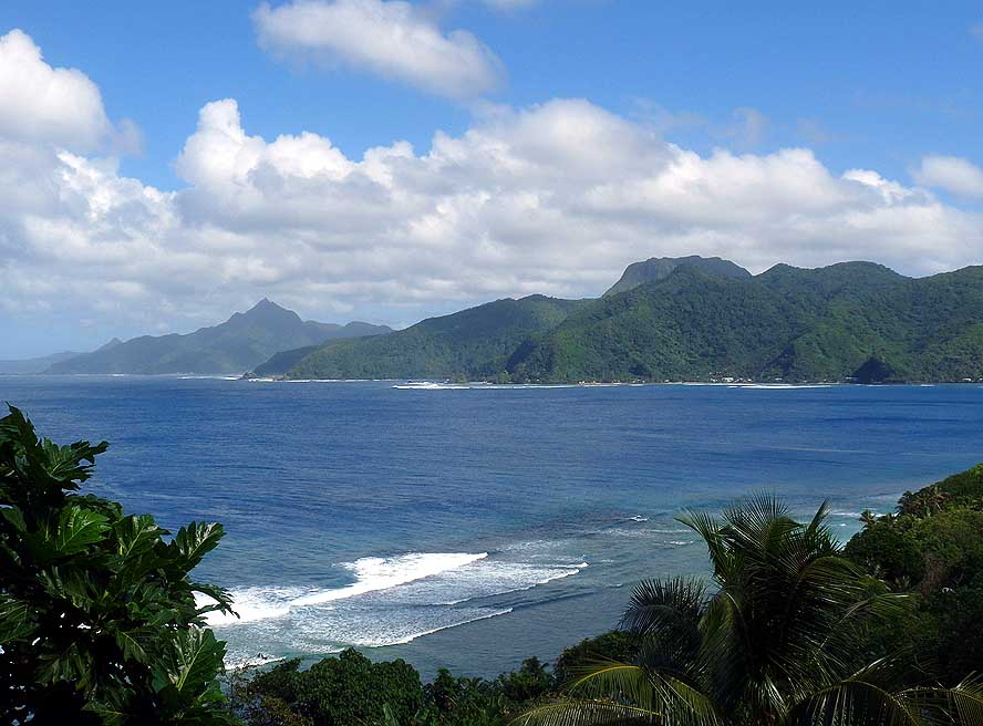
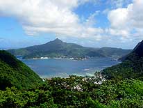
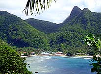
- 34
View from Pago Pago over the
- Bay towards Leloaloa in the North .....
|
- 35
..... and from the North over
- the Bay to the capital Pago Pago
- (part Fagatogo)
|
- 36
The 1’718ft. high „Rainmaiker
- Mountain“ (exactly Pioa Mountain) is
- blamed that the port of Pago Pago receives
- the highest annual rainfall in the world
|
-
|
-
-
|
-
-
-
-

|
-
-
|
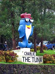
- 37
“Charlie, the Tuna”, is the
- symbol of the Starkist cannery in
- Atuu, the largest tuna processing
- plant in the world
|
- 38
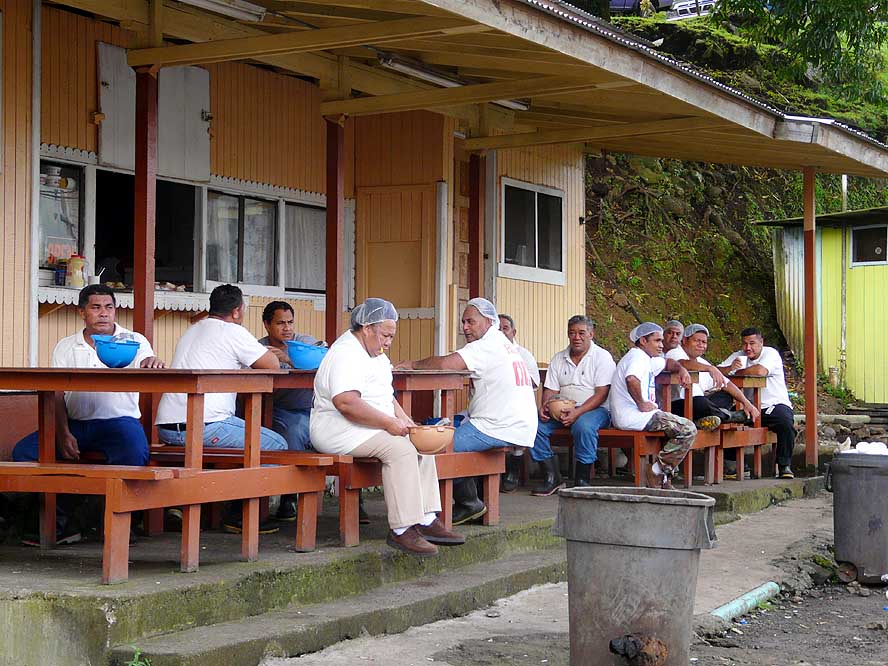
Workers from the tuna cannery,
- mainly from (Western) Samoa and
- Tonga, enjoying their lunch break
|
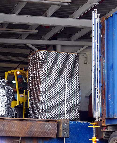
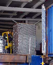
- 39
Cans of tuna are fork lifted into a
- container. While the “Samoa Packing”
- cannery closes in September, the “Starkist”
- will produce furthermore tuna cans
|
-
|
-
-
|
-
-
|
-
-
|
- 40
Coastal scenery before Alega
- towards Cape Matatula, the most
- Easterly point of the island of Tutuila
|
- 41
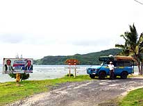
One of the individually owned pick-
- up trucks, modified for public transport,
- which are serving the whole island
|
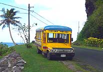
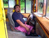
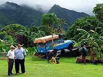
- 42
The driver of such a bus
- is smiling brightly at us
|
-
|
-
-
|
-
-

|
-
-
|
- 43
In Southeastern Tutuila, the
- densely forested hills meet the
- ocean – here near Auasi
|
- 44
View towards the distinctive
- Southern shoreline towards Pago Pago
|
- 45
At the beach of Onenoa ends the
- “Trans-Tutuila-Highway” in the East. In
- the distance are the cliffs of the Pola Isl.
- within the National Park of American
- Samoa along the Northern shoreline
|
-
|
-
-
|
-
-
|
-
-
|
- 46
The small hamlet of Alao in the
- East reflects the peaceful mood
- of the South Pacific
|
- 47
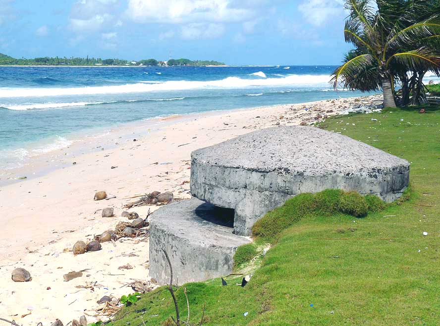
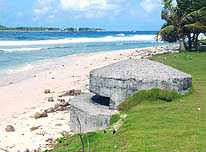
One of the many one-man-
- bunkers along the coast.
- They remember of WWII .....
|
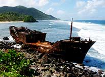
- 48
..... and the skeleton of a vessel is
- a reminder of the unpredictable sea,
- which is mostly unprotected by a reef
|
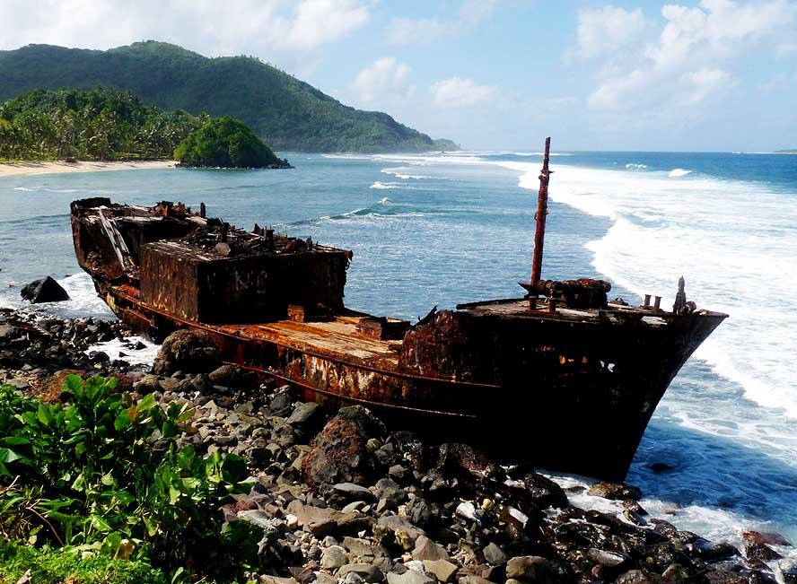
-
|
-
-
|
-
-
|
-
-
|
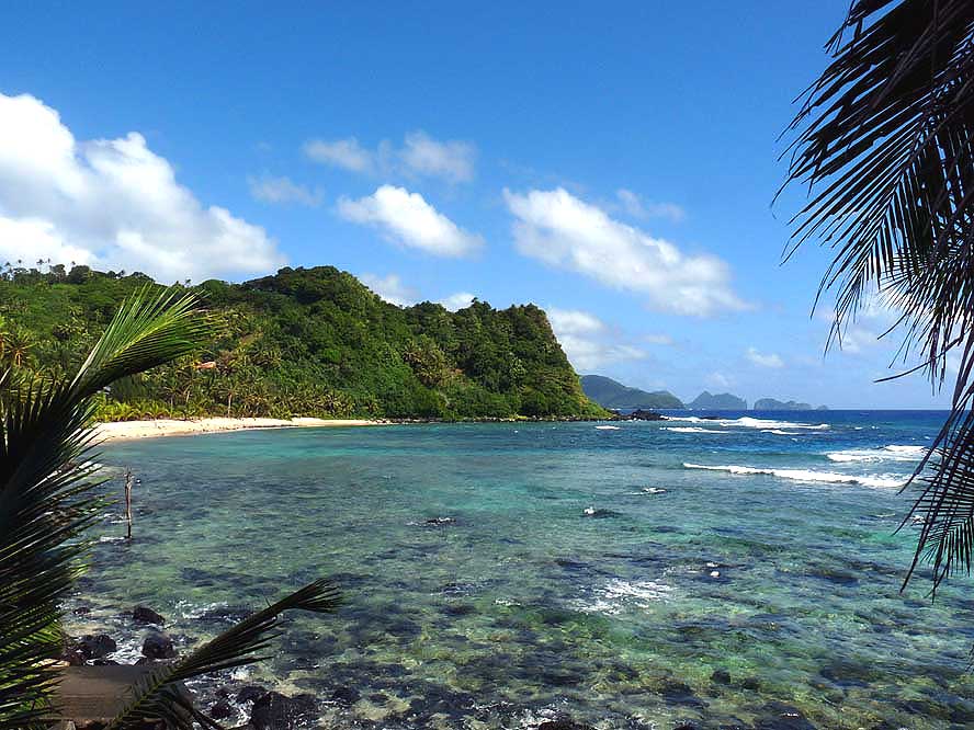
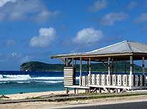
- 49
Breezy „fale“ – a structure opened
- to all sides – inviting to make a break.
- In the background the Aunuu Island
|
- 50
The tiny offshore island of
- Aunuu in the Southeast is very
- close to Auasi on the main island
|
- 51
The “Tisa Barefoot Bar” at
- Alega Beach east of Pago Pago
- is a prominent meeting point
|
-
|
-
-
|
-
-
|
-
-
|
- 52
From the Afono Pass, called also
- “Rainmaker Pass”, we enjoy a
- spectacular view over the tranquil
- harbor bay with the capital Pago Pago
|
- 53
Descending from the “Rainmaker
- Pass” to the village of Afono, Tutuila’s
- pristine North shore comes into view
|
- 54
Near the village of Afono, tiny
- white, nearly inaccessible sandy beaches
- nestle at the foot of steep forested cliffs
|
-
|
-
-

|
-
-
|
-
-
|
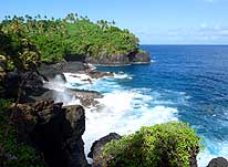
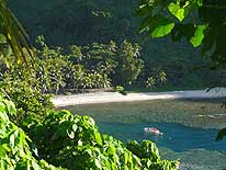
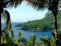
- 55
The cliffs of the tiny uninhabited offshore
- island of “Pola Tai” (Cock’s Comb) near the
- village of Vatia on the northern shore raise
- more than 420ft. straight out of the sea
|
- 56
A spectacular sight: The peaceful
- village of Vatia at the bay with the
- same name on the North shore
|
- 57
A tiny natural arch in the
- cliffs at the end of the Vatia Bay
|
-
|
-
-
|
-
-
|
-
-
|
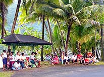
- 58
Picnic within the National Park
- near “Pola Tai” (Cock’s Comb)
- at Vatia Bay on the North shore
|
- 59
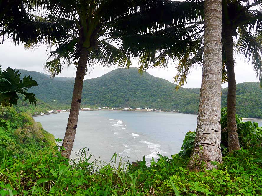
View towards the West from
- Fagasa-Pass to the same
- named coastal village .....
|
- 60
..... and towards the East
- into the Vaipito Valley
|
-
|
-
-
-
-
|
-
-
|
-
-
-
-
|
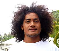
- 61
The young man in Pago Pago
- poses for a picture after we
- answered all his questions
|
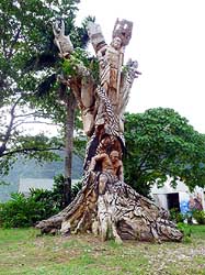
- 62
This beautiful piece of art has
- been carved out of a single tree trunk. It
- stands at the harbor front of Pago Pago
|
- 63
Pago Pago looks more like
- a South Pacific village than a
- country’s busy capital
|
-
|
-
-
|
-
-
|
-
-
|
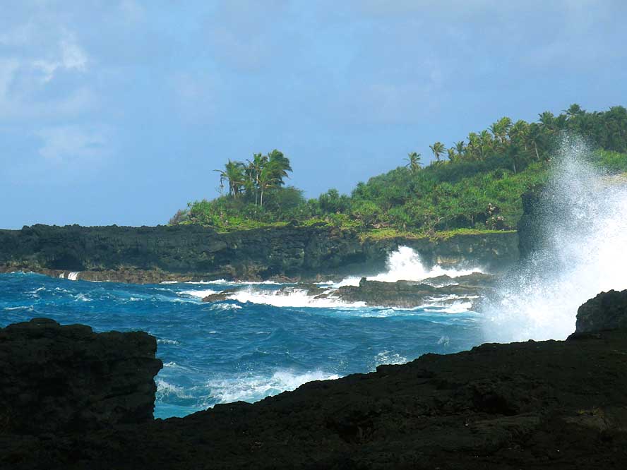
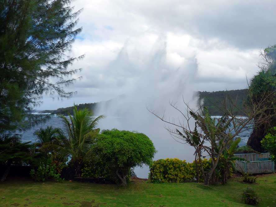
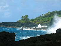
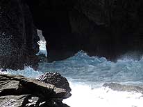
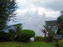
- 64
On a stormy day, the blowhole
- at Larson Cove in front of the Turtle
- & Shark Lodge shoots out fountains
- of water high into the sky …..
|
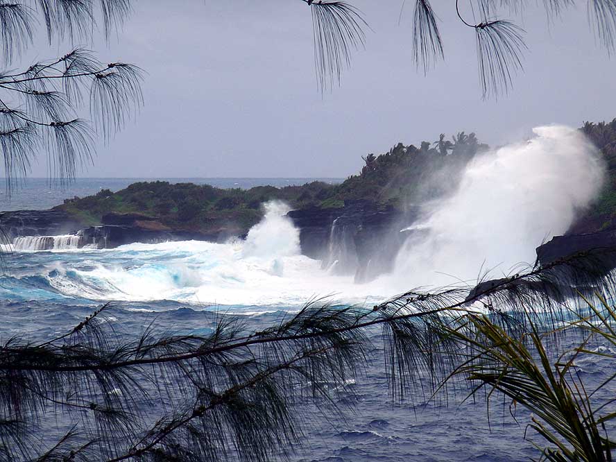
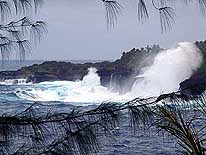
- 65
….. and huge waves are
- crashing with incredible power
- onto the steep coastal cliffs
|
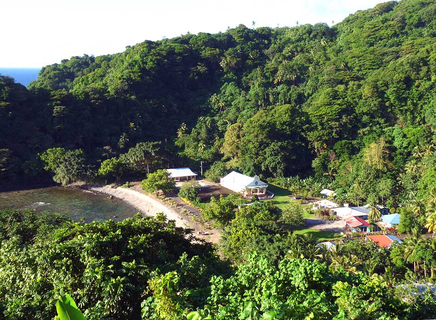
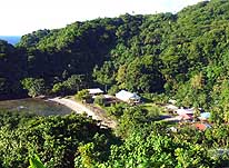
- 66
The sleepy village of Masefau in
- the Northeastern part of Tutuila lays
- in an idyllic setting between the forested
- mountains and the Masefau Bay
|
-
|
-
-
|
-
-
|
-
-
|
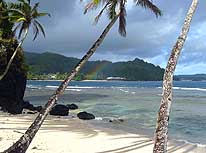
- 67
View over the peaceful and
- remote coast near the village
- of Sailele in the Northeast
|
- 68
Sailele is the village of the Governor
- of American Samoa, Hon. Togiola T.A.
- Tulafono. At the entrance he is pictured
- on a board together with his Lt.
- Governor, Hon. Faoa A.T. Sunia,
- who welcomed us to his island
|
- 69
The white church in Sailele
- shines in the evening light against the
- green of the forested mountains
|
-
|
-
-
|
-
-
|
-
-

|
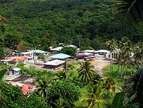
- 70
An American Samoan picture
- book hamlet: Masausi on
- the way to Sailele
|
- 71
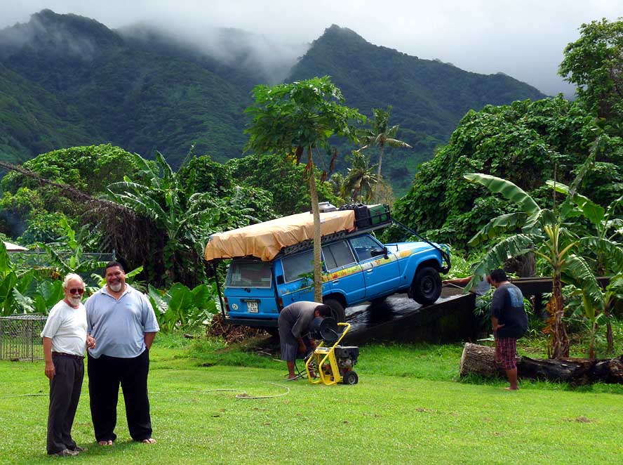
July 31, 2009, day of
- containerizing our LandCruiser:
- The Ministry of Agriculture
- washes the car, while Emil is
- talking to an employee
|
- 72
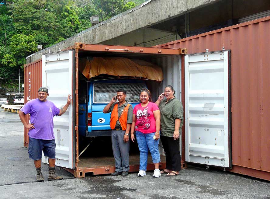
Ready to be shipped to Papeete in
- Tahiti/French Polynesia: Our LandCruiser
- is stuffed in its 16th container. The two
- friendly girls of the “Polynesian Shipping
- Services” – the agent of “Greater Bali
- Hai” – and two port workers pose for
- a remembrance picture
|
-
|
-
|
- Articles in newspapers about us in American Samoa:
- Article: "Governor allows small window of
opportunity for landing non-compliant vehicles", Daily Newspaper "Samoa News" - May 20, 2009
- Article: "Guinness world
record travelers mark 164th destination in American Samoa", Daily Newspaper
"Samoa News" - June 18, 2009
- Article: "Emil &
Liliana Schmid continue their world tour", Daily Newspaper "Samoa
News" - July 10, 2009
|
|