-
-
-
|
-
-
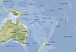
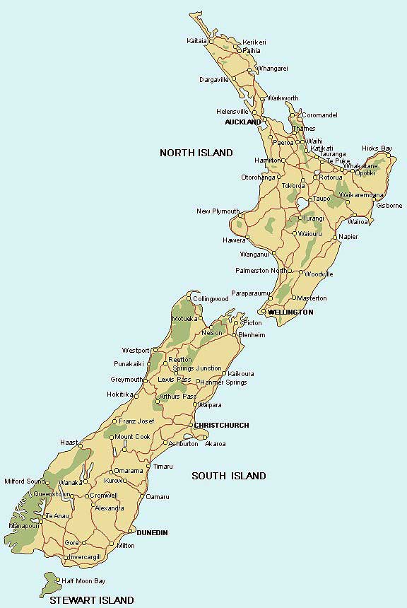
- New Zealand Map
-
|
-
-
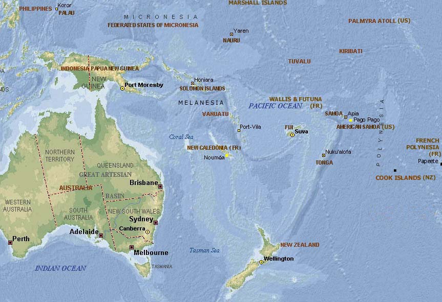
- Map of
- the Pacific
-
-
|
-
-
-
-
-
|
- latest picture: July 15, 2008
- click a picture to see details
|
-
-
|
-
-
|
-
-
|
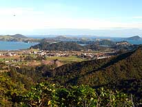
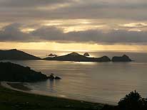
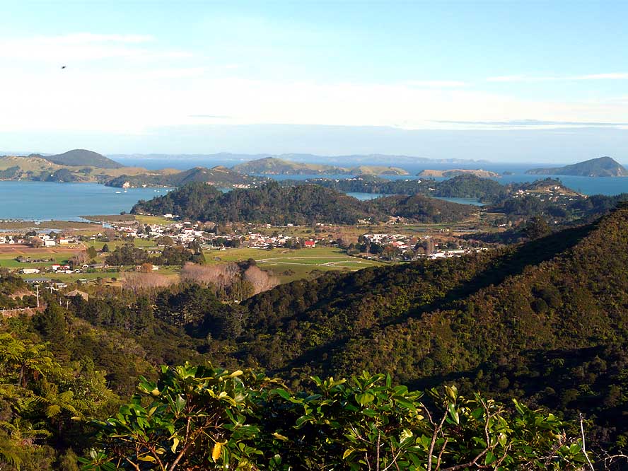
- 331
Descending from the “mountain
- pass” to Coromandel Town, we enjoy the
- beautiful view over the peaceful city and
- the coastal scenery with its many islands
|
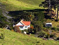
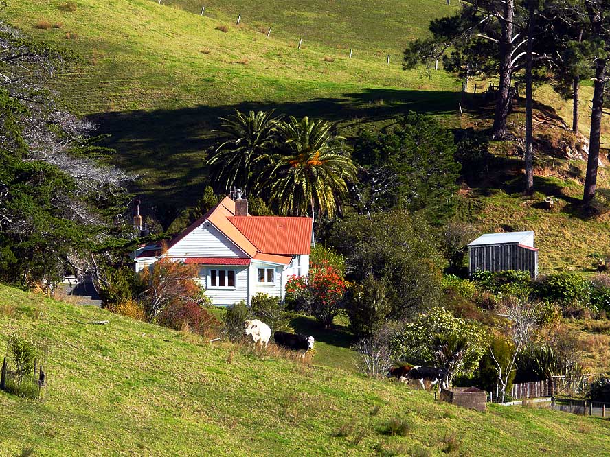
- 332
A peaceful rural scene of a
- farmhouse between Coromandel
- and Thames…..
|
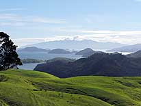
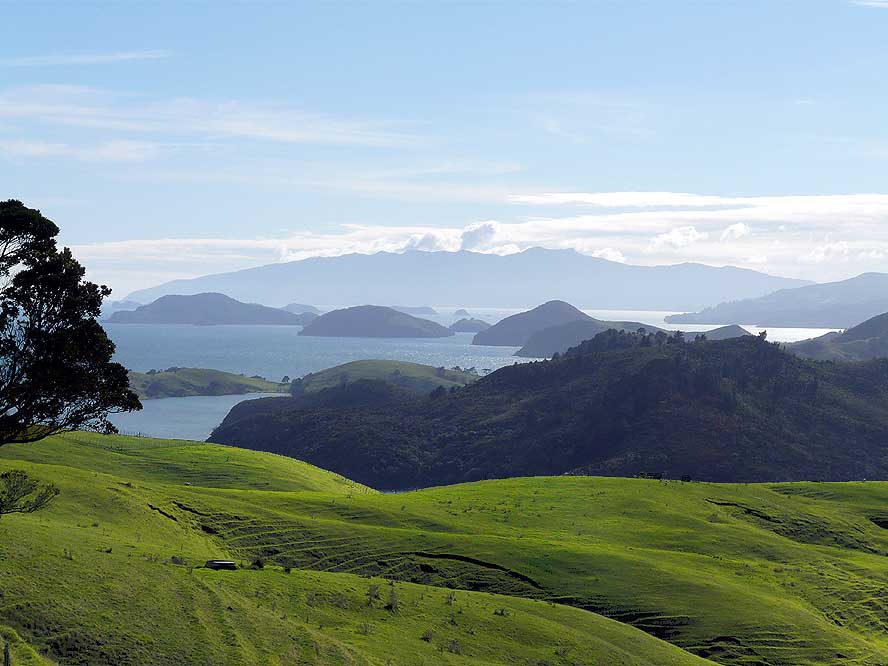
- 333
….. and an impressive
- scenery of the islands off the
- coast of Coromandel Town
|
-
|
-
-
|
-
-
|
-
-
|
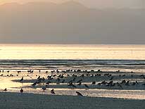
- 334
Amongst others, also migrant
- Oystercatchers from the South Island
- spend wintertime in Miranda situated at
- the ”Seabird Coast” in the Firth of Thames
|
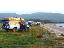
- 335
We join the local campervans
- at the “freedom camping” outside
- of Miranda in the Firth of Thames
|
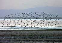
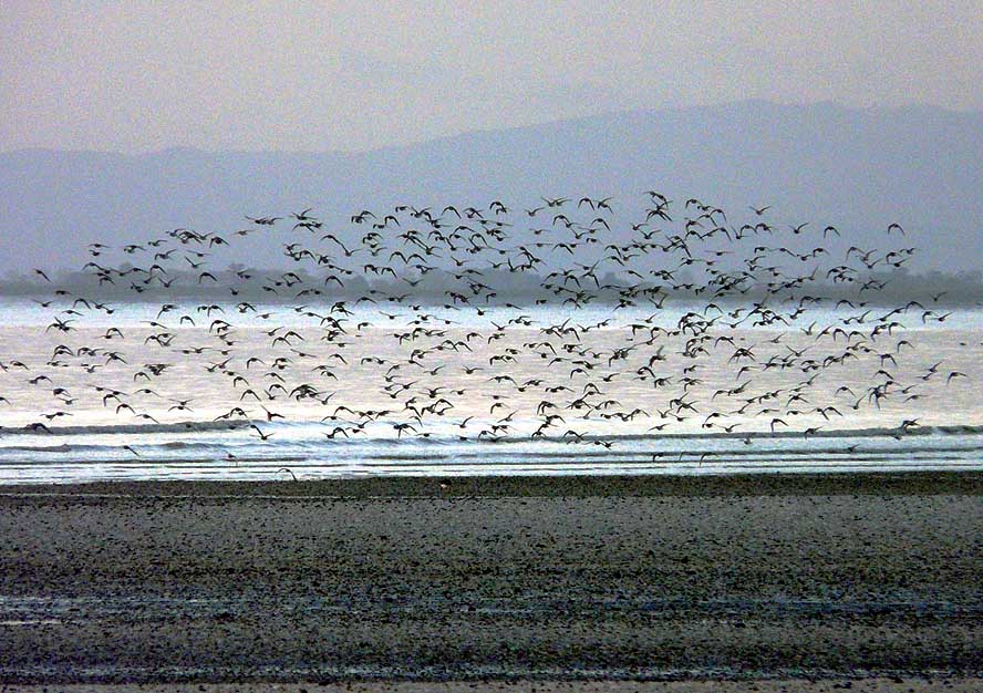
- 336
One of the passing flocks
- of seabirds at the bird
- reserve near Miranda
|
-
|
-
-
-
-

|
-
-
|
-
-
-
-

|
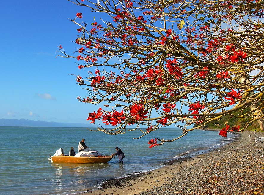
- 337
Fishermen are coming
- back from the sea
|
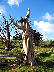
- 338
“Santa Claus” –
- carved from a tree trunk –
- stands at a farm entrance
|
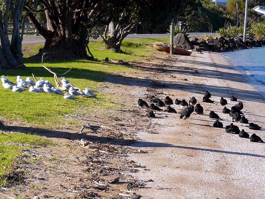
- 339
Black and white divided
- (is it a symbol?):
- Oystercatcher and seagulls
|
-
|
-
-
|
-
-
|
-
-
|
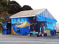
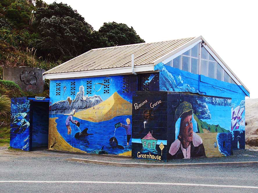
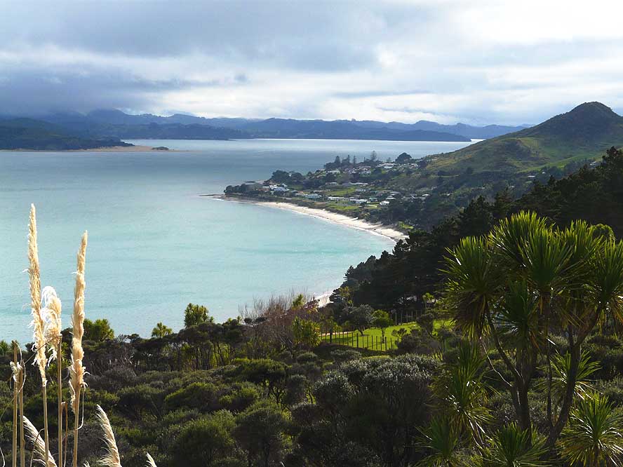
- 340
One of the artwork on the
- many public toilets in the North can
- be admired at Mangawhai Heads
|
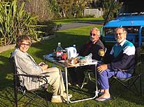
- 341
At Waipu Cove, we meet Jean
- and Rudi from Germany, world travelers
- and birdwatchers, and spend a
- wonderful day in their company
|
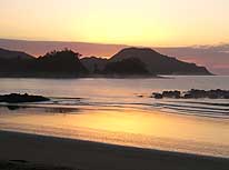
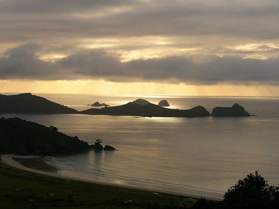
- 342
Sunrise in Oakura in
- ‘Whangaruru Harbour’, South
- of the ‚Bay of Islands’
|
-
|
-
-
|
-
-
|
-
-
|
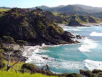
- 343
On our drive Northwards along
- the ‘Bay of Island’, we encounter
- many untouched bays and beaches,
- here near ‘Parekura Bay’
|
- 344
The historic buildings on
- Russel’s water front in the ‘Bay
- of Islands’ are a step back in time
|
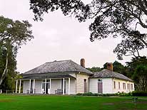
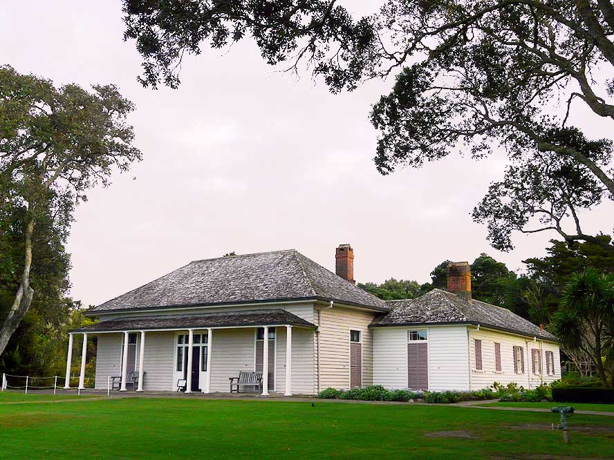
- 345
The British residence in Waitangi in
- the ‘Bay of Islands’, built in 1833-34, is the
- place, where on 6.2.1840 the treaty between
- the Maori people and the British Government
- was signed. Whether the Maori or the Moriori
- were actually New Zealand’s “original
- respectively first inhabitants”, is (still) unclear
|
-
|
-
-

|
-
-
-
-
|
-
-
|
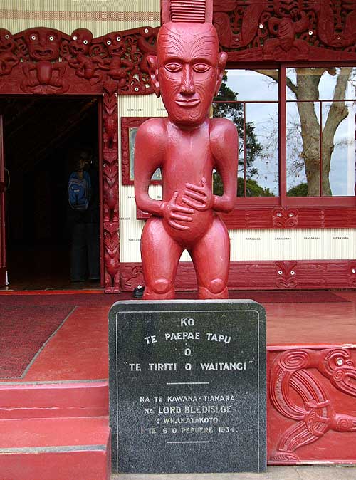
- 346
This carved Maori figure
- stands at the entrance of the “Marae”,
- the Maori Meetinghouse in Waitangi
|
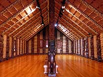
- 347
The interior of the Maori meeting-
- house at Waitangi’s Treaty Grounds is
- richly carved. The carvings depict
- ancestors from many Maori tribes
|
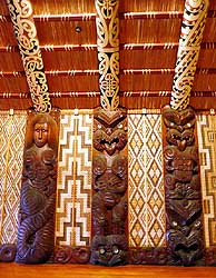
- 348
Detail of the wall carving
- and ceiling painting in the interior
- of the “Marae“ in Waitangi
|
-
|
-
-

|
-
-
|
-
-
|
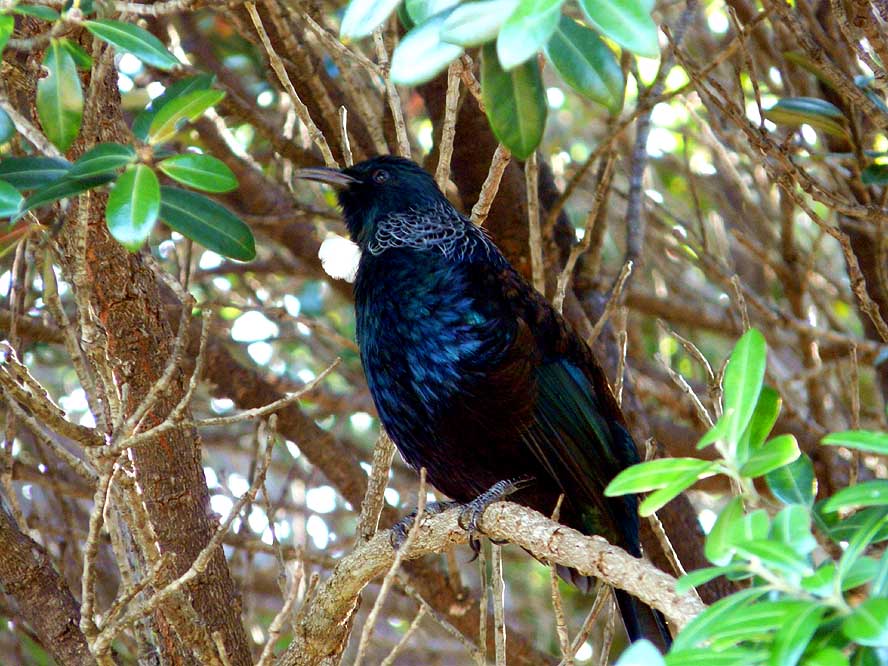
- 349
Tui, an endemic New Zealand
- bird, is an excellent
- and persisting singer
|
- 350
View from Matauri Bay over to the
- Cavalli Islands, where the wreck of the
- Greenpeace flagship “Rainbow Warrior”
- – destroyed by French saboteurs in
- Auckland in 1995 – was transferred to.
- It can now be visited by divers
|
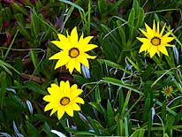
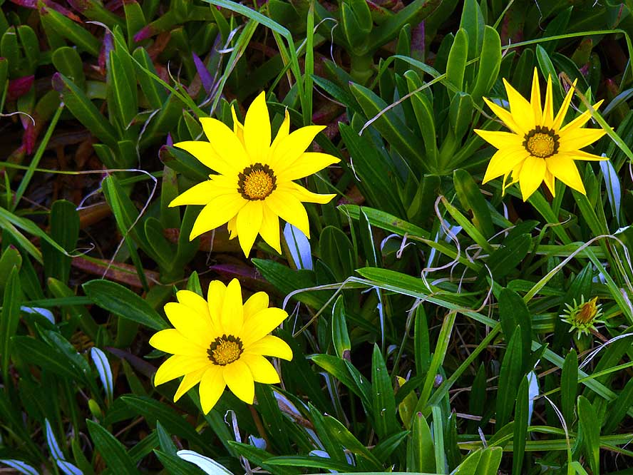
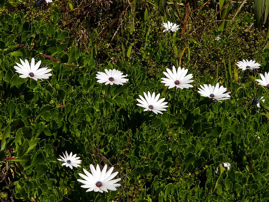
- 351
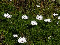
In coastal regions, there are
- carpets of intensely yellow
- glowing daisies
|
-
|
-
-
|
-
-
|
-
-
|
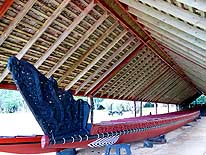
- 352
The Waka “Ngatokimatawhaorua“,
- the Maori War Canoe displayed at
- Hobson Beach in Waitangi, was built
- from three giant Kauri trees. It
- needed a crew of minimum 76 rowers
|
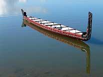
- 353
In the attractive coastal town
- of Mangonui on the Doubtless Bay
- a Maori canoe is reflecting in
- the calm bay …..
|
- 354
….. and in Oakura on the
- Bay of Islands a Maori canoe lays
- picturesquely at the sandy beach
|
-
|
-
-
-
-
|
-
-
|
-
-
-
-
|
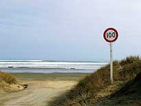
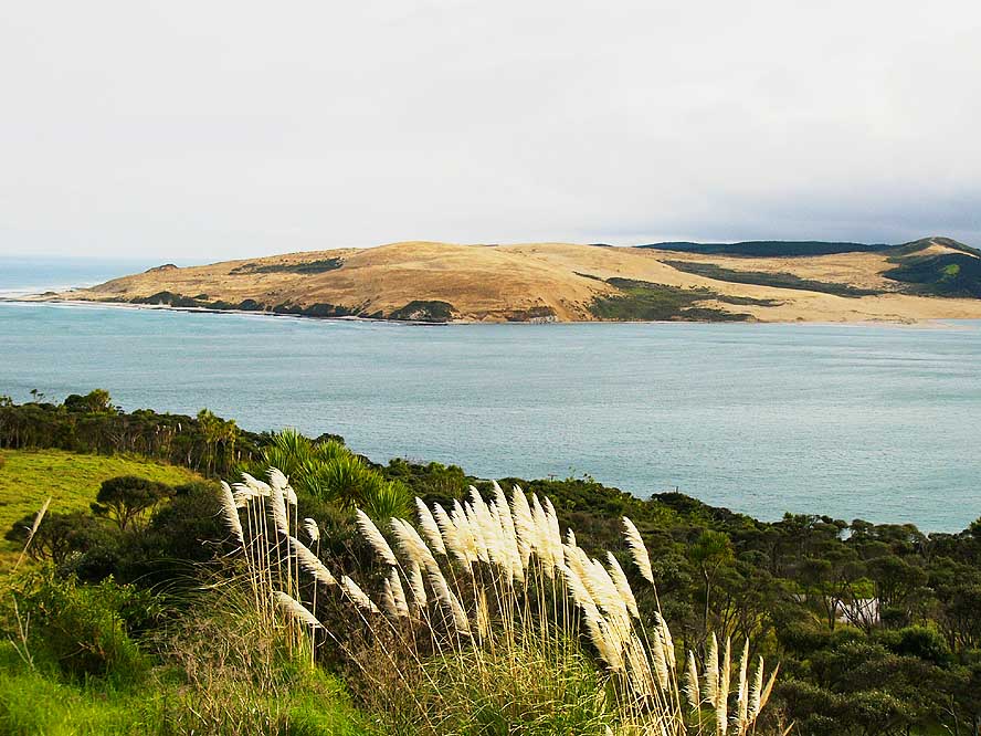
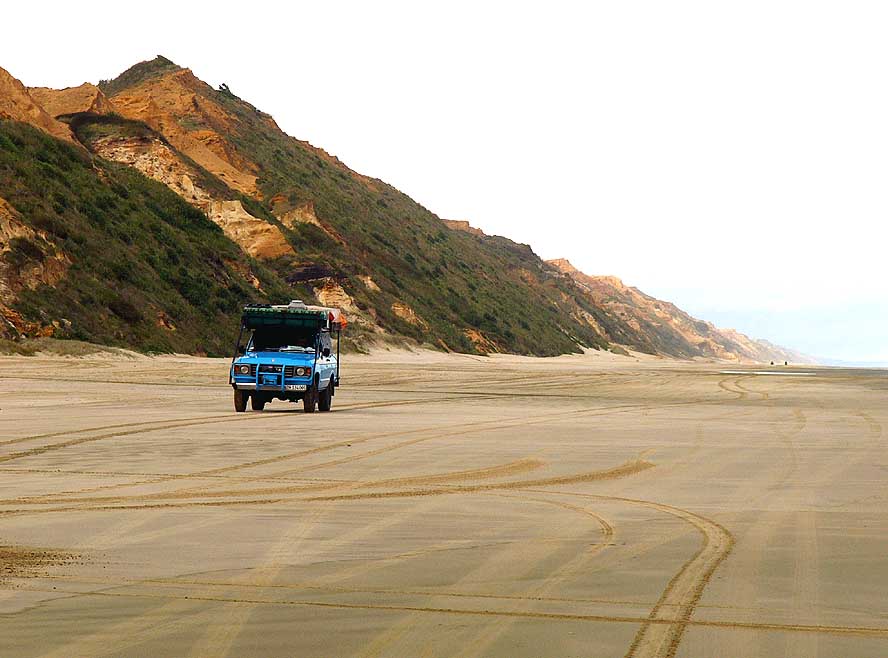
- 355
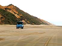
Speed limit sign in Waipapakauri Beach
- at the Southern access of the‘Ninety Mile
- Beach’ to the Aupouri-Peninsula, the most
- Northerly tip of New Zealand. Due to the
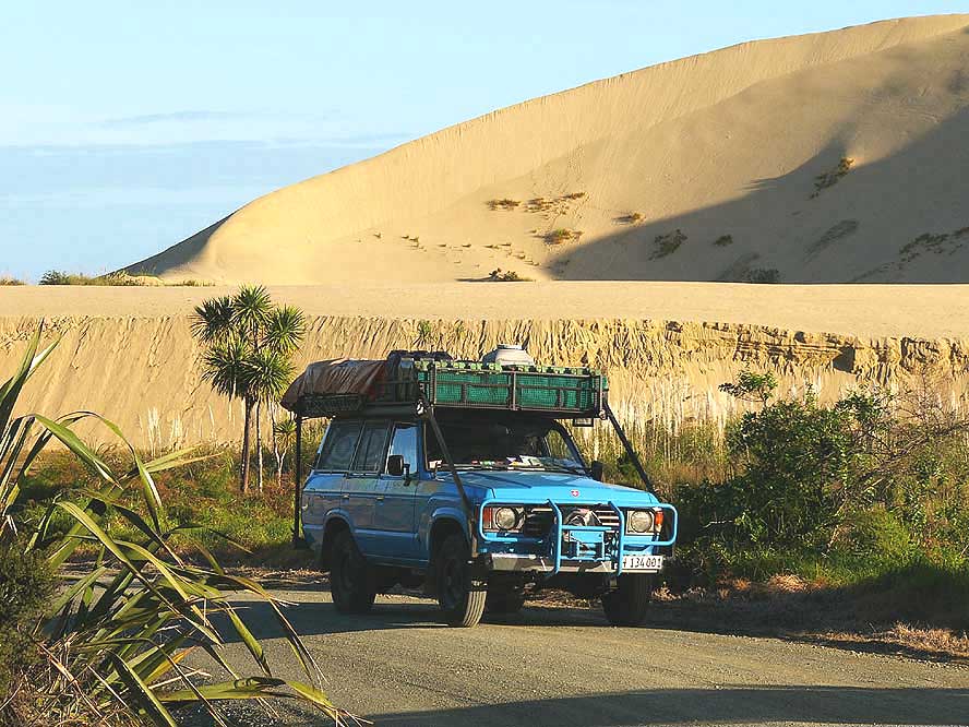
- recent rejuvenation of our LandCruiser, we were
- not keen to expose it to the “salty” conditions
|
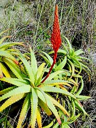
- 356
A flower that blooms
- on the grown over sand dune
- at Ninety Mile Beach
|
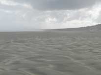
- 357
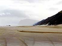
The “Ninety Mile Beach”
- (actually it is only 55 miles = 88 km
- long): Sand, sand and sand as far
- as the eye can see – interrupted
- only by a rain shower
|
-
|
-
-
|
-
-
|
-
-

|
- 358
The white dunes of Ohau Point
- greet on our drive to Cape Reinga, the
- most Northerly tip of New Zealand
|
- 359
Diverse landscapes before
- Cape Reinga: Farmland, marshland
- and sand dunes …..
|
- 360
..... and a valley dotted
- with Pandanus trees
|
-
|
-
-

|
-
-
|
-
-
|
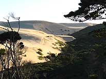
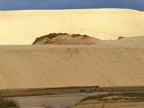
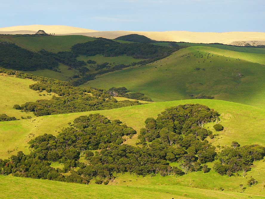
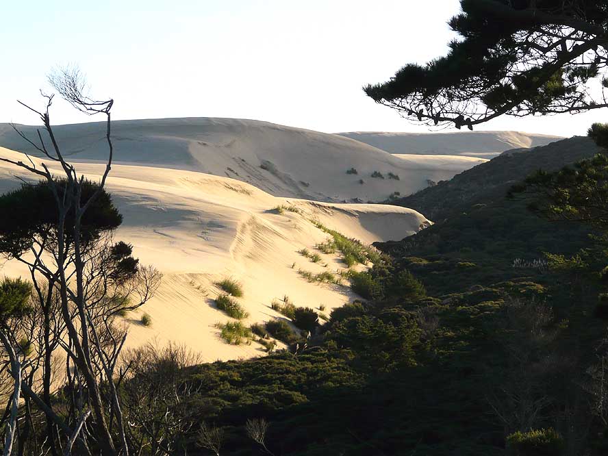
- 361
The giant sand dunes of Te Paki
- appear behind lush green hills
- 11 miles short of Cape Reinga
|
- 362
A lovely contrast: Our blue
- LandCruiser and the walls of the giant
- sand dunes at Te Paki/Cape Reinga
|
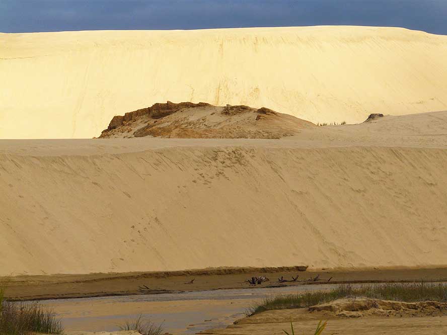
- 363
The sand dunes of Te Paki
- expand for many miles along the
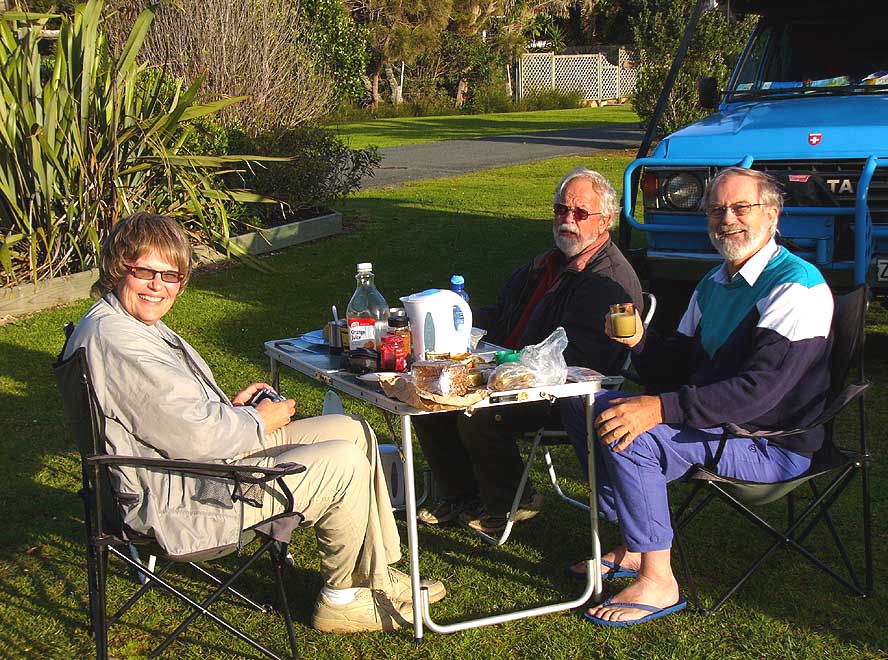
- coast; its height is about 330ft.
|
-
|
-
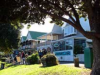
-
|
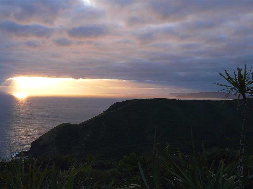
-
-
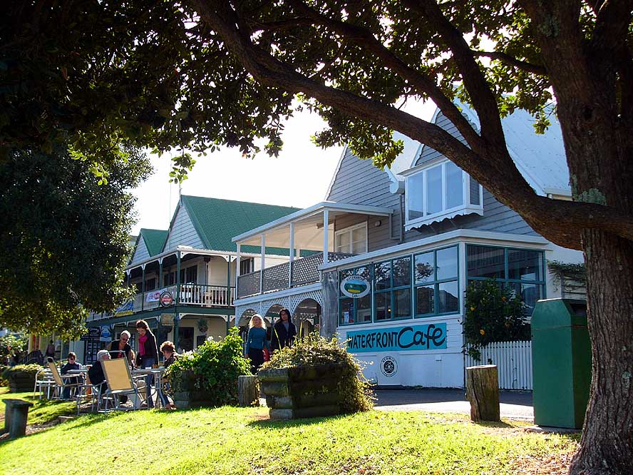
|
-
-
|
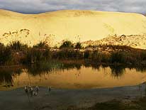
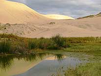
- 364
|
- 365
|
- 366
|
- Exploring the giant sand dunes of Te Paki with its pockets of vegetation was one of the
major joys and highlights of our trip to the Northland
|
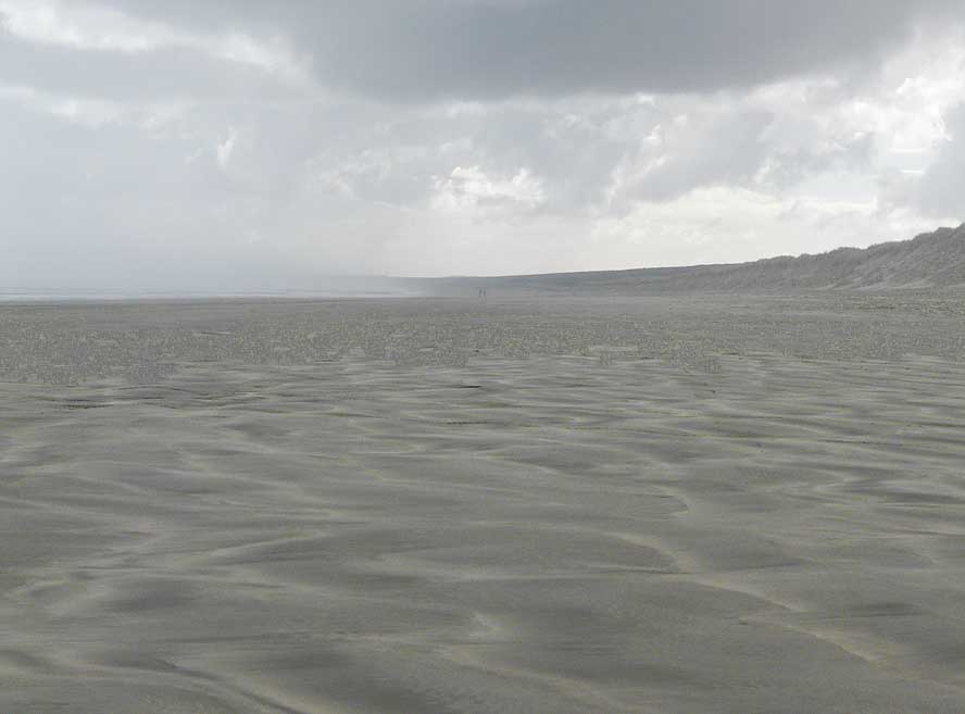
-
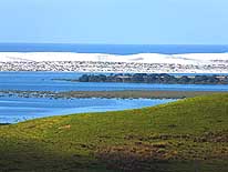
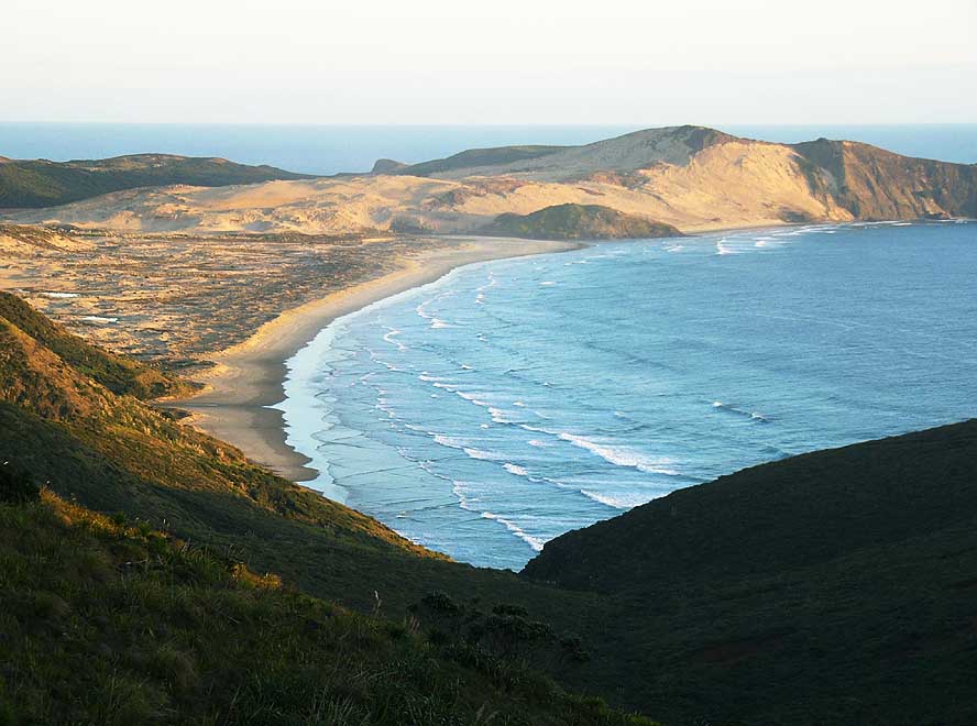
|
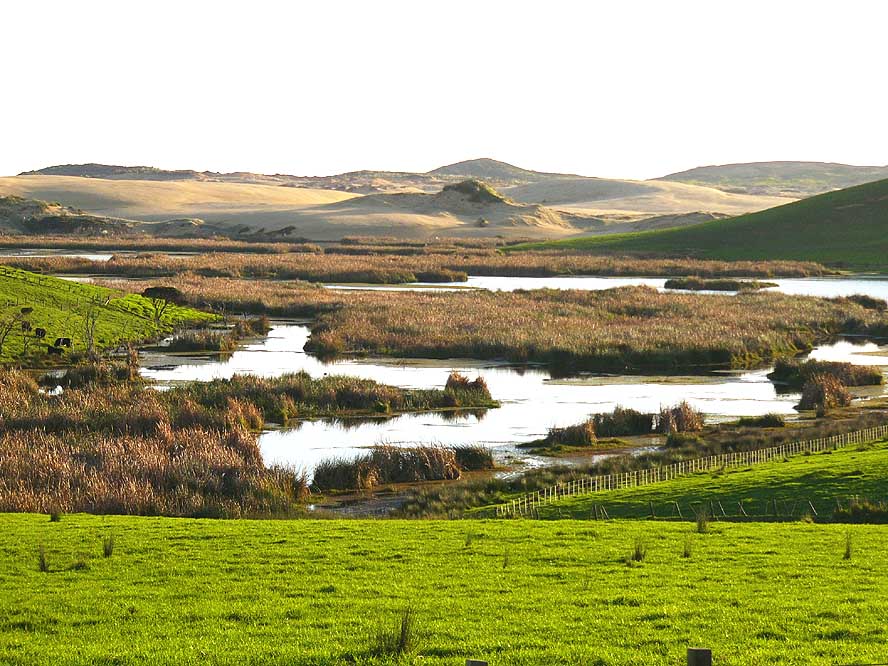
-
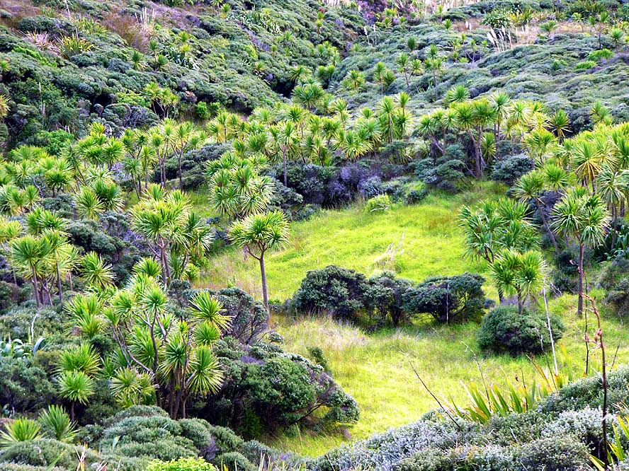
-
-
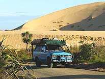
-
|
-
-
|
-
-
-
-

|
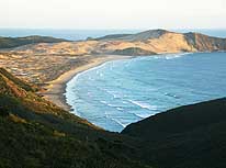
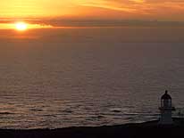
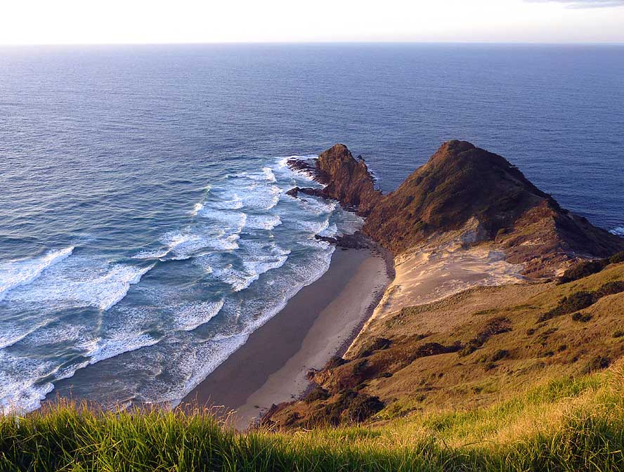
- 367
Cape Reinga, where the
- Pacific Ocean and Tasman Sea
- dramatically merge
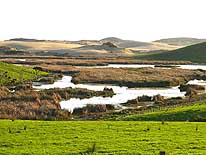
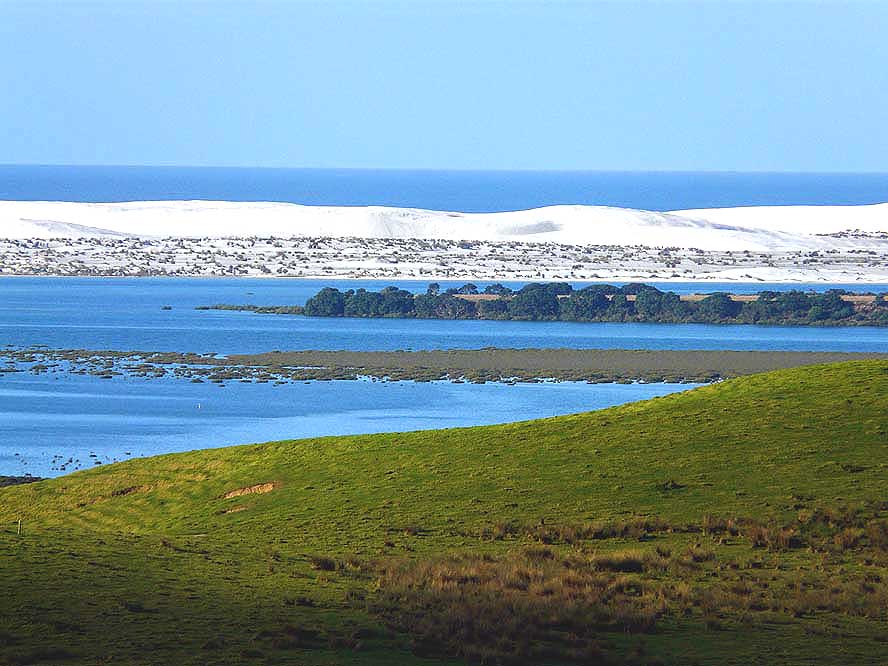
|
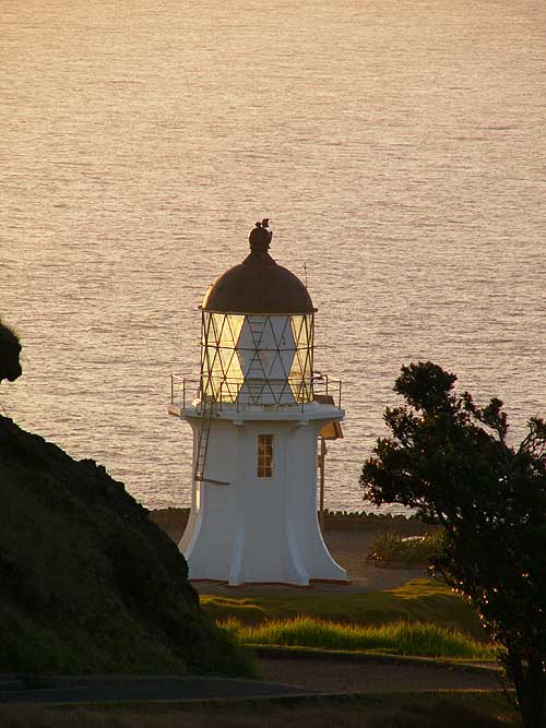
- 368
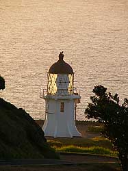
The light tower of Cape
- Reinga in the evening light. It is
- 33ft. high and stands 541ft. above
- sea level. The light flashes every
- 12 seconds and can be seen for
- 19 nautical miles (35 kilometers)
|
- 369
In Maori belief, the cliff of Cape
- Reinga is the departure point for the
- spirits of the recently deceased, who
- were said to climb down the twisted
- Pohutukawa tree on the cliffs (the tree is
- still there, but not visible on the picture)
|
-
|
-
-
|
-
-
|
-
-

|
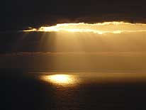
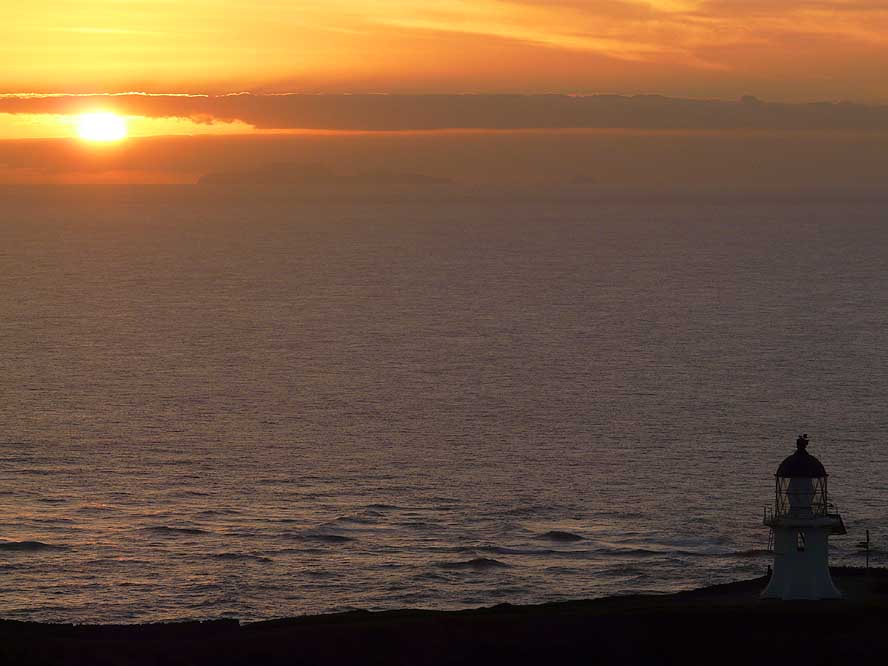
- 370
|
- 371
|
- 372
|
- Beautiful moments at sunset and sunrise at Cape Reinga
|
-
|
-
-
|
-
-
|
-
-
|
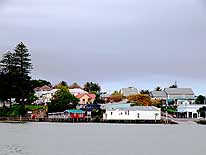
- 373
|
- 374
|
- 375
|
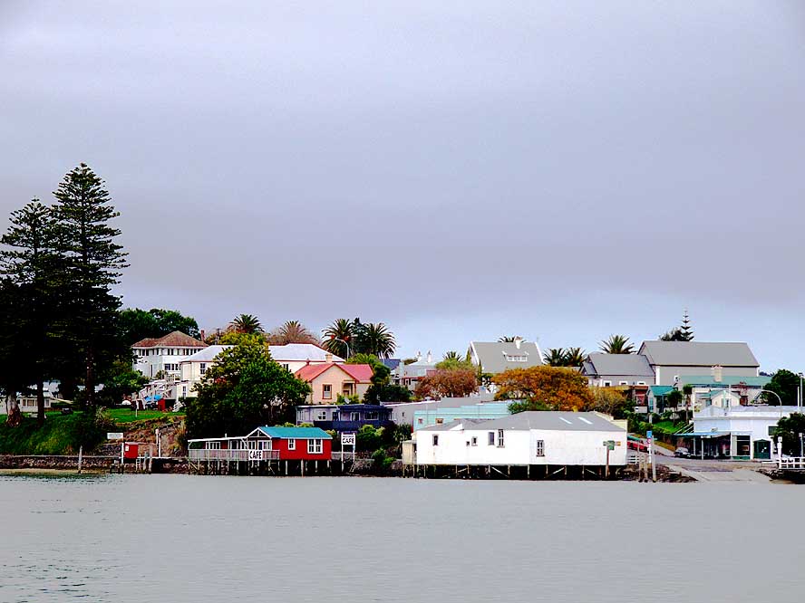
- Rawene, a little village in Hokianga Harbour, has kept its old pioneer charm with its
historic buildings
|
-
|
-
-
-
-

|
-
-
-
-

|
-
-
|
- 376
View from ‘Signal Hill’ towards
- Omapere and Hokianga Harbour .....
|
- 377
..... and the white sand dunes
- of the ‘Te Pouahi Reserve’ on the
- Northern side of Hokianga Harbour
|
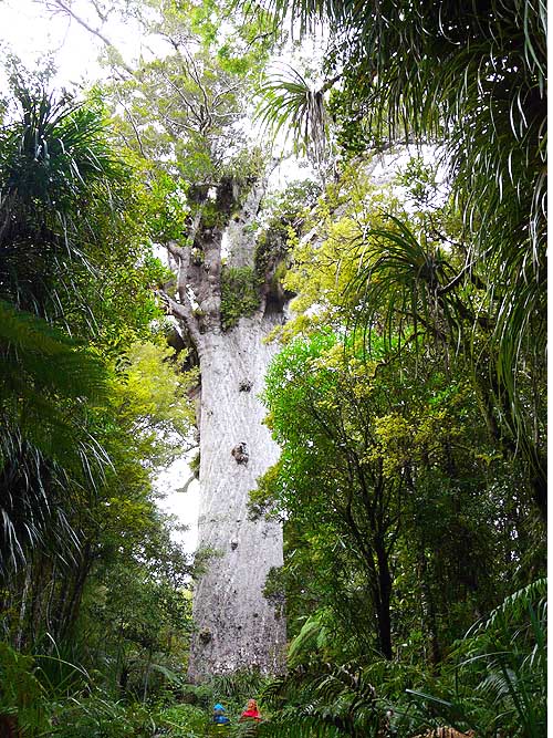
- 378
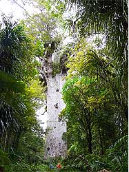
The giant kauri tree “Tane
- Mahuta” in the ‘Waipoua Kauri Forest’
- has a trunk height of 58ft., a total
- height of 169ft. and a girth of 45ft.
|
-
|
-
-
|
-
-
|
-
-
|
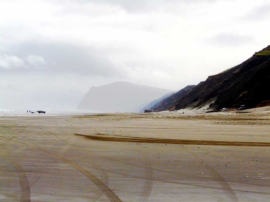
- 379
The wide sandy beach at “Baylys
- Beach” – 9 miles West of Dargaville –
- attracts many off road vehicles. The
- “Ripiro Beach” is drivable from “Pouto
- Point” in the South for more than 62 miles
- until “Maunganui Bluff“– more than the so
- called “Ninety Mile Beach” on the Aupouri
- Peninsula in the Northland that is
- 55 miles (!) long (= 88 kilometers)
|
- 380
A carpet of white daisies at
- Baylys Beach near Dargaville
|
- 381
Also our LandCruiser gets its
- little beach fun at Baylys Beach
- near Dargaville. Due to its recent
- rejuvenation, we didn’t want
- it to become too “salty”
|
-
|
-
-
|
-
-
|
-
-
|
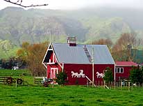
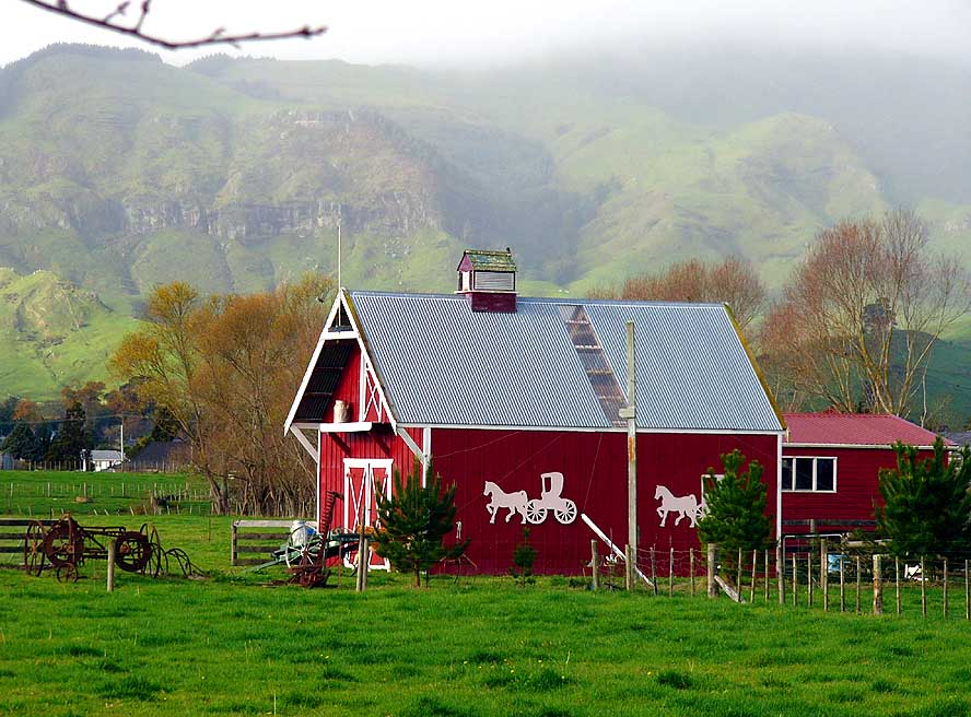
- 382
An attractive barn along
- the road in the Hauraki Plains
|
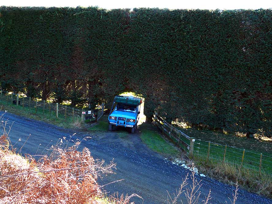
- 383
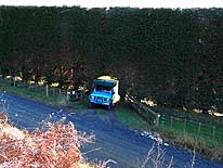
The giant tree hedge at a farm
- with an access for vehicles, provides
- shelter against dust and wind
|
- 384
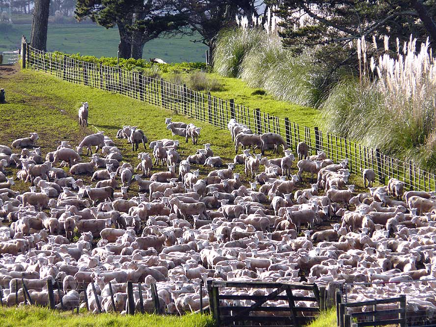
It is getting a bit crowded in
- this fence! Freshly shorn sheep
- are waiting to be released
|
-
|
-
-
|
-
-

|
-
-

|
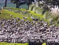
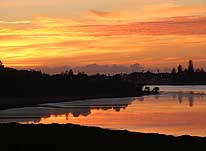
- 385
July 15th, 2008, is the last
- dawn in Tauranga/New Zealand
- for our LandCruiser before .....
|
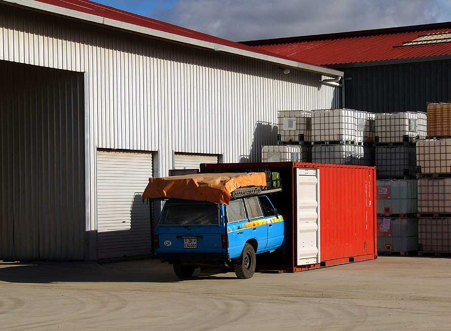
- 386
..... it is caged in the afternoon
- in its13th container for the sea journey
- to Noumea in New Caledonia
|
- 387
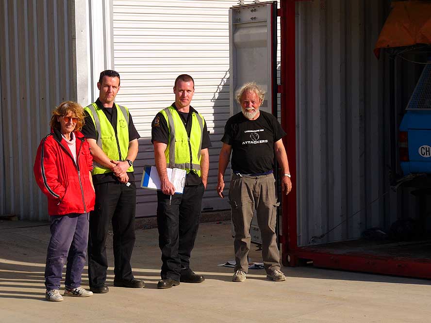
The friendly Customs Officers
- seal the container and stamp the Carnet
- de Passages (customs document)
|
-
|
- More websites from New Zealand:
-
-
|
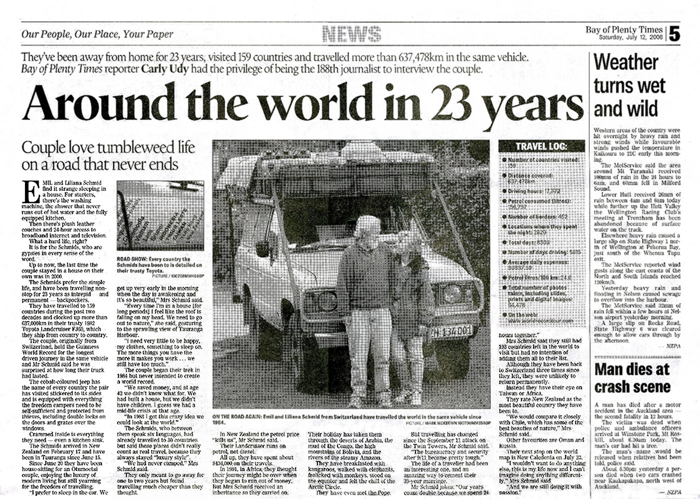
- Articles in newspapers about us in New Zealand:
- Article: "Still
cruising after 628,000km", Otago Daily Times - February 27, 2008
- Article: "Trip into
the record books", Hokitika Guardian - April 3, 2008
- Article: "Around the world in 23 years", Bay of Plenty Times - July 12,
2008
|


