-
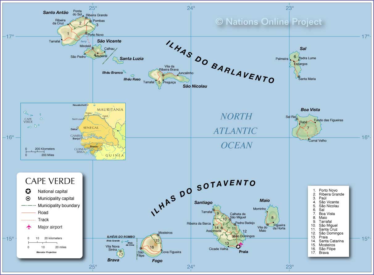
- Cape Verde Map
|
 
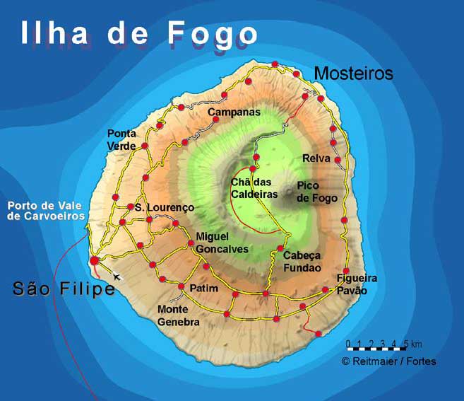
- Fogo Map
Northwest Africa Map
-
|
|
-
|
- latest picture: December 26, 2013
|
|
-
-
|
-
-
|
-
-
|
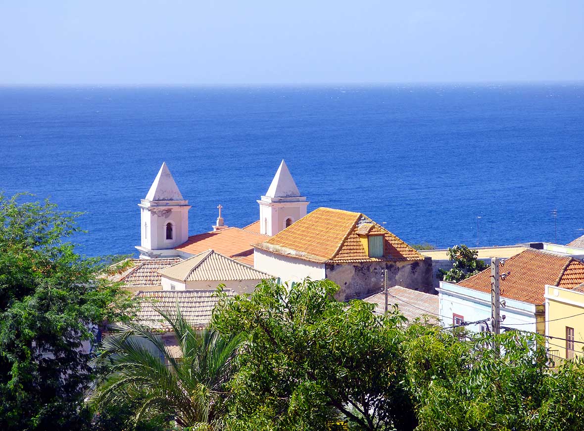
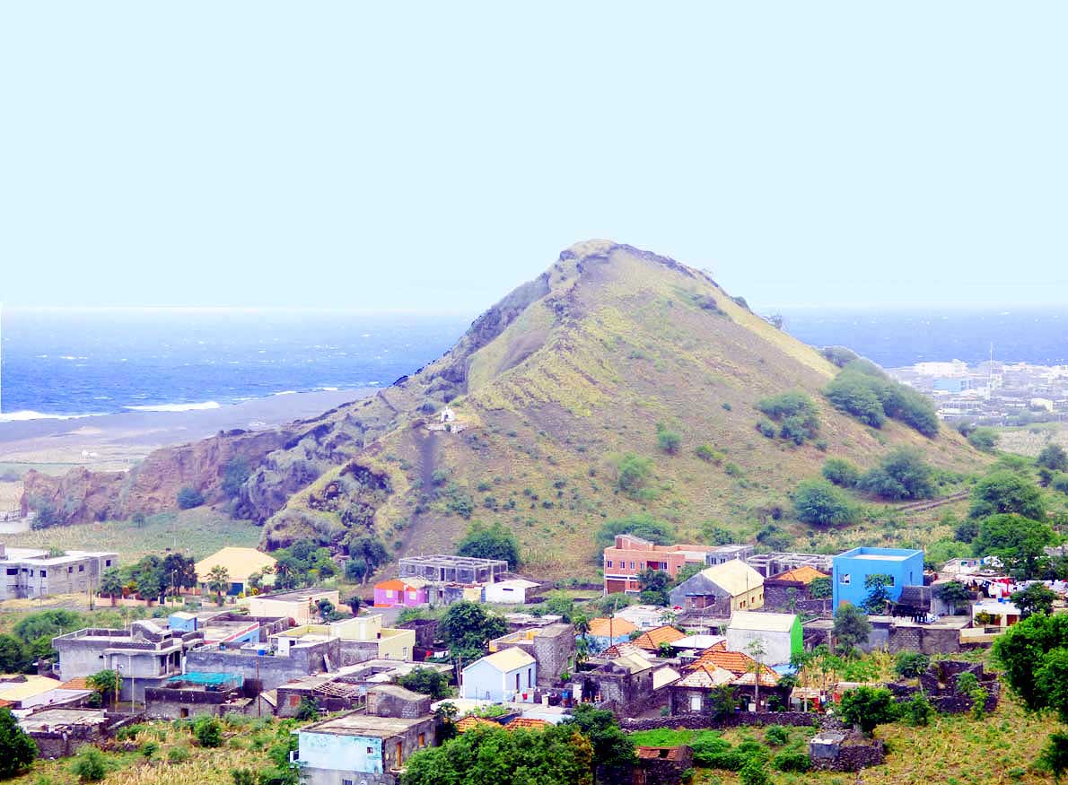
- 101
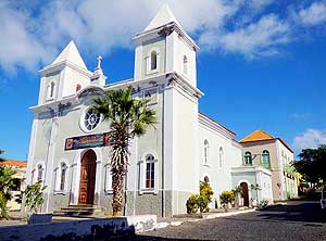
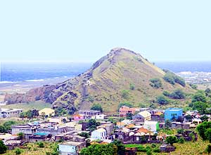
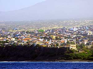
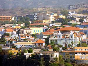
The Church "Igreja Nossa Senhora
- da Conceiçăo" dominates the view of Săo
- Filipe, the capital of the island of Fogo
- with its almost 10'000 residents
|
- 102
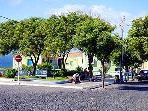
One of the small squares with benches
- under shady trees in the upper part of the
- historic center (Vila Riba). It reflects the
- peaceful atmosphere of the capital
|
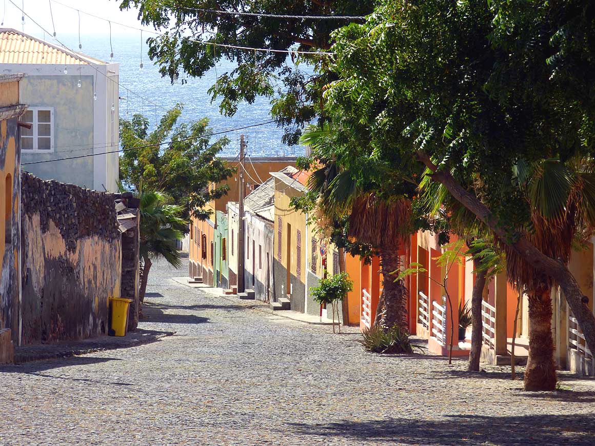
- 103
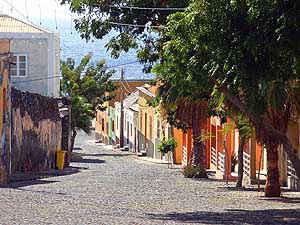
The colorful houses that line the
- cobblestone streets procure the feeling
- of an “ideal world”. Săo Filipe was
- built by the Portuguese around 1500
- as the second town of Cape Verde
|
-
|
-
-
-
-
 -
|
-
-
|
-
-
-
-
|
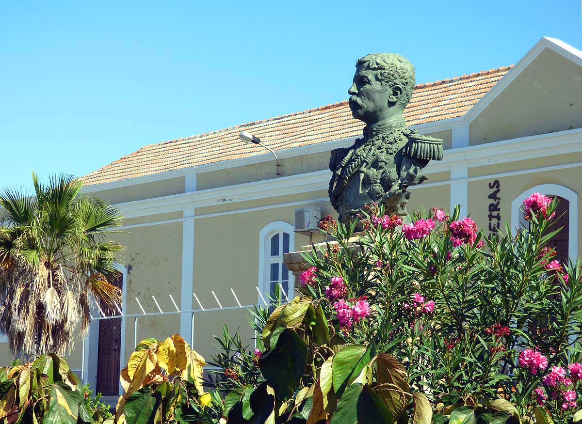
- 104
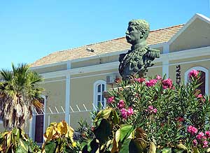
The bust of Lieutenant-Colonel
- Alexandre Alberto da Rocha de Serpa
- Pinto, Portuguese Governor-General from
- 1894 to 1897, surrounded by blooming
- flowers on “Praça do Presídio“
|
- 105
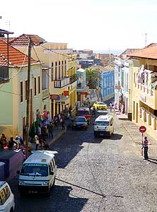
In the mornings the “Rua do
- Mercado” of Săo Filipe is busy. Vendors
- are selling fruits and fish along the sidewalk
|
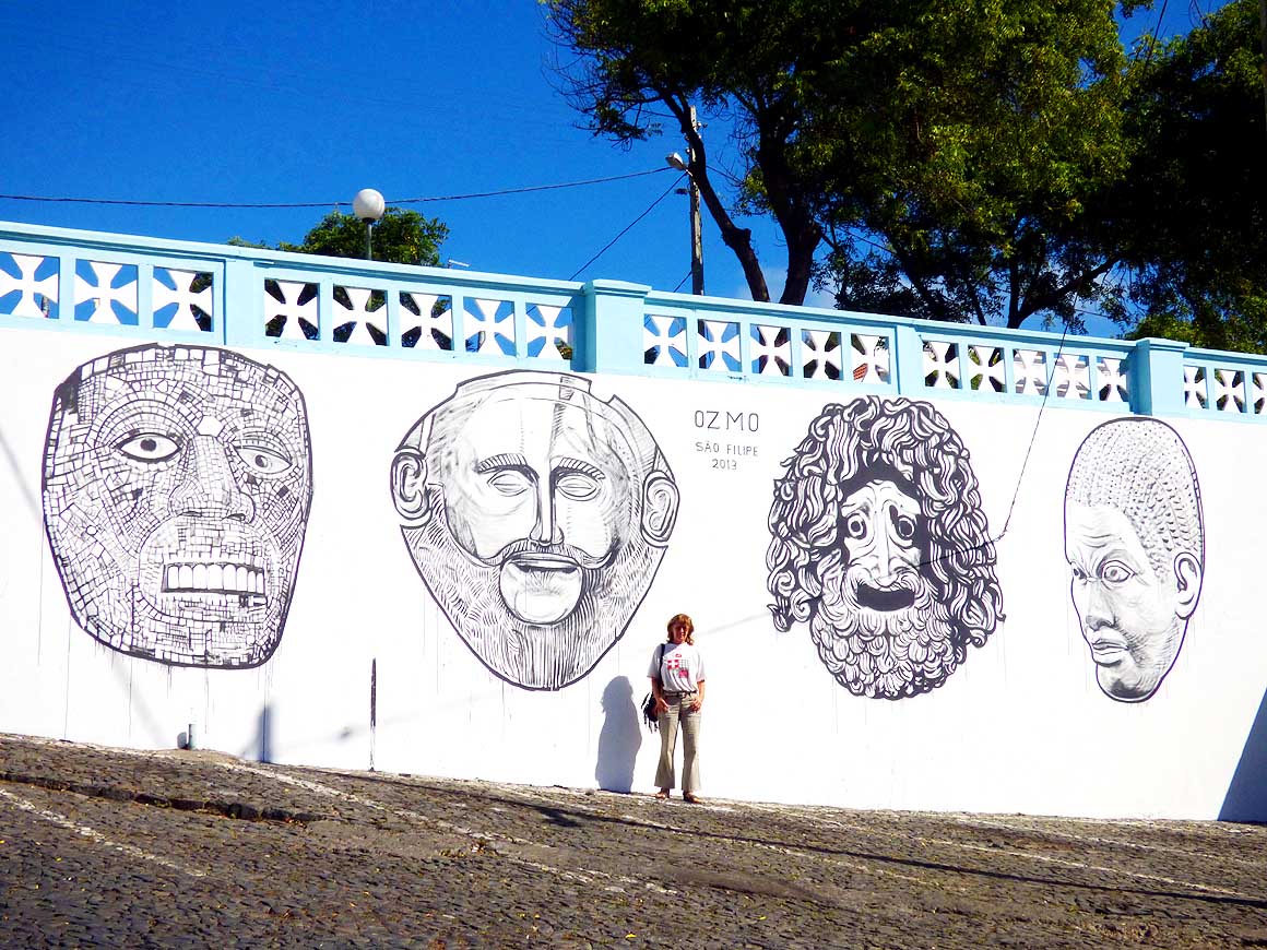
- 106
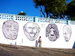
A mural from the Italian artist Ozmo
- at the northern end of „Rua do Mercado“
- on the occasion of the „Festival Sete Sóis
- Sete Luas“ on November 11th, 2013
- (another picture is in Ribeira Grande
- on Santo Antăo
- picture # 532)
|
-
|
-
-
|
-
-
|
-
-
|
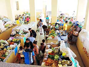
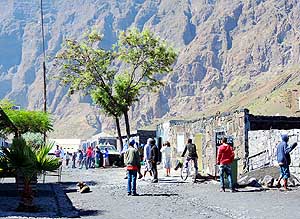
- 107
The offer of vegetable, fruit
- and fish is abundant in Săo Filipe's
- municipal market
|
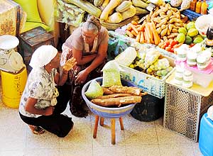
- 108
Cassava roots and pies belong to the
- main diet. Pies are also used for the national
- dish "Cachupa" that most of the locals eat
- already for breakfast
|
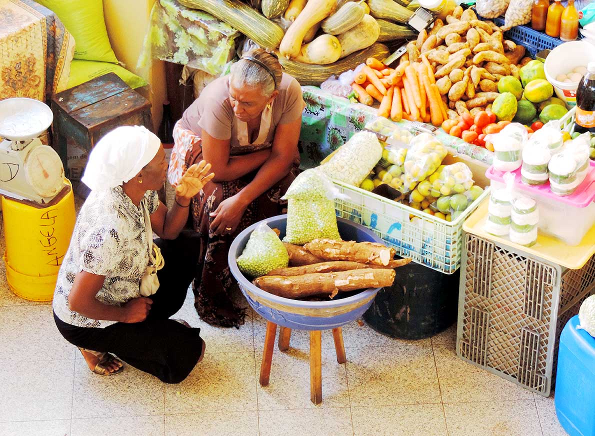
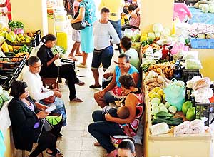
- 109
The market in Săo Filipe is managed
- by women. They gossip and chat, crochet
- or hold their sleeping child while waiting
- for customers
|
-
|
-
-
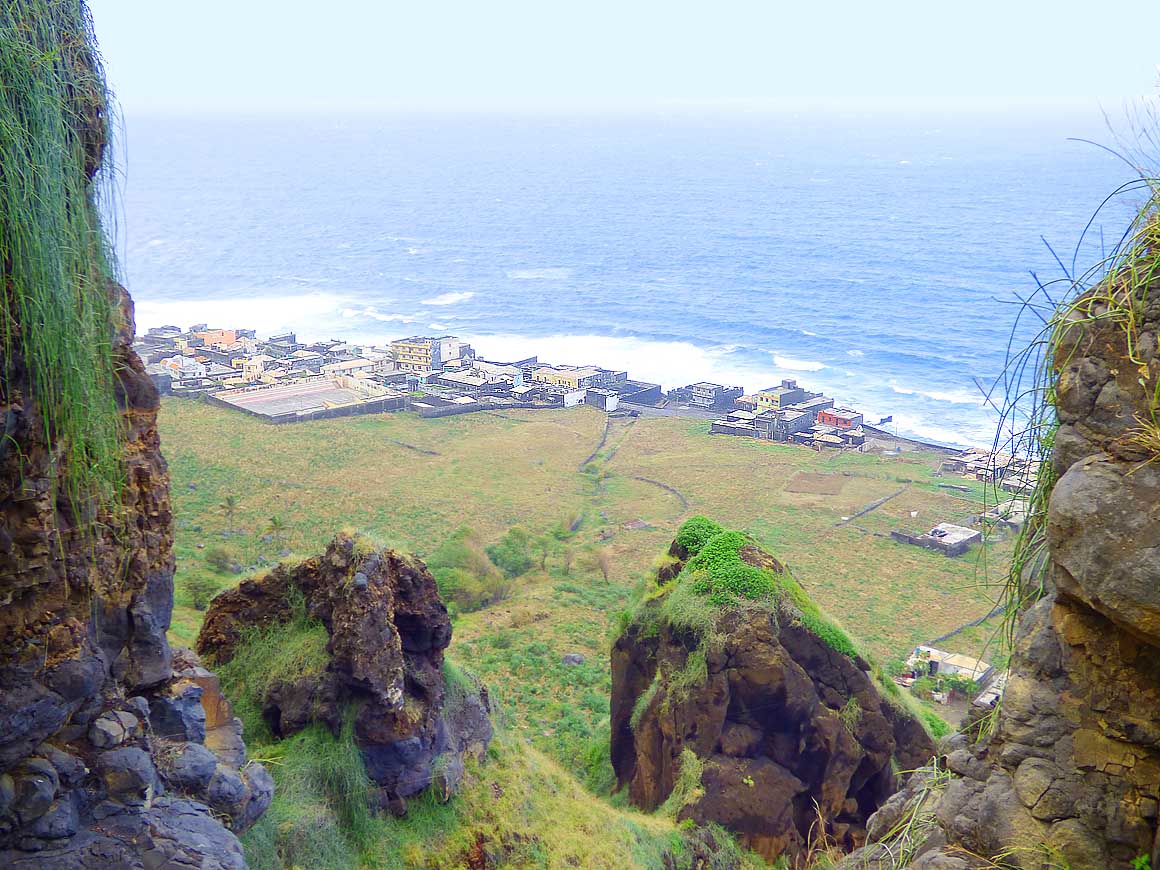
|
-
-

|
-
-

|
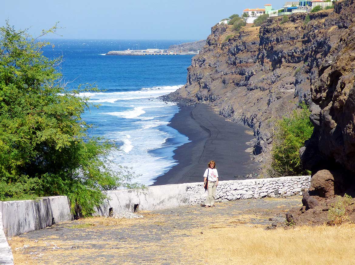
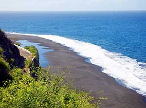
- 110
Săo Filipe's pitch-black sand beach
- of "Praia da Fonte Bila" stretches for miles.
- Due to the strong sea currents it is
- however unsafe for swimming .....
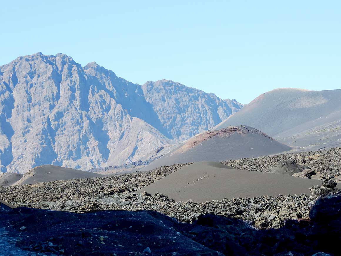
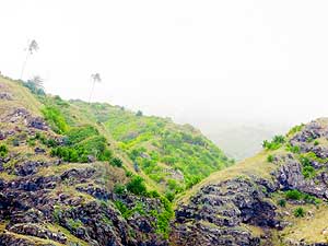
|
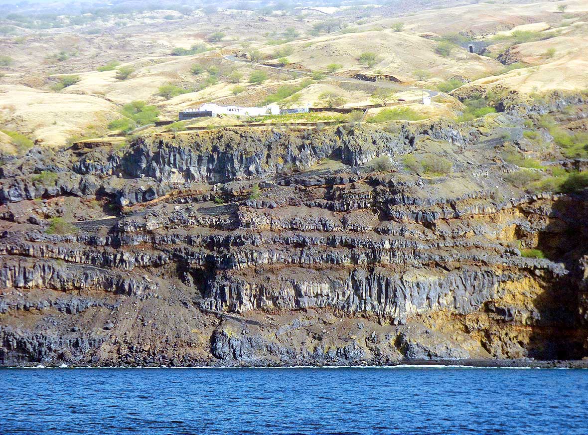
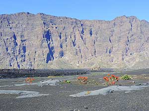
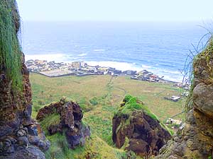
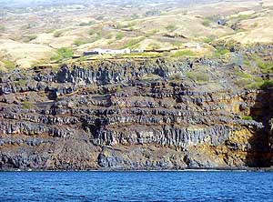
- 111
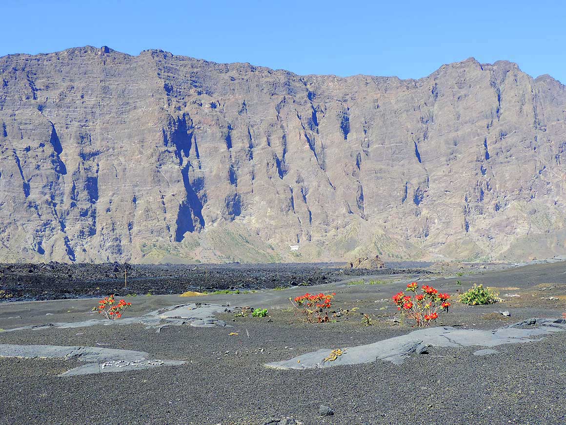
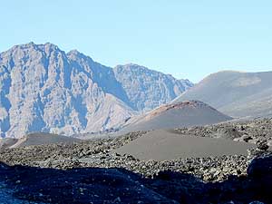
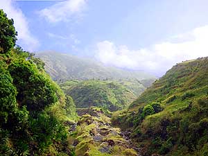
..... it lies at the base of the 230 ft.
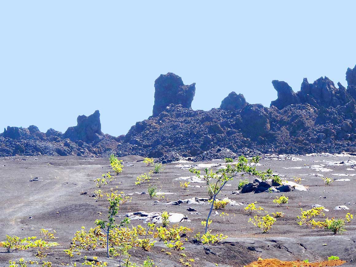
- high cliff on which the capital of Săo Filipe
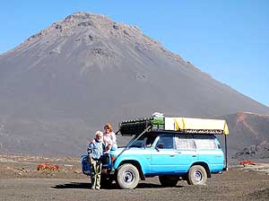
- is built in the west of the island of Fogo
|
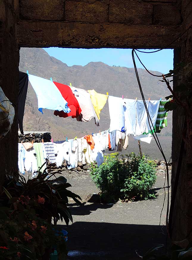
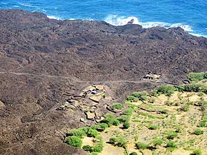
- 112
Thanks to Săo Filipe's commanding
- setting on the cliffs, the sea view is
- guaranteed from everywhere – in front
- the towers of the church “Igreja Nossa
- Senhora da Conceiçăo"
|
-
|
-
-
-
-
 -
|
-
-
|
-
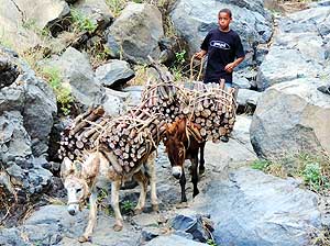
-
-
-
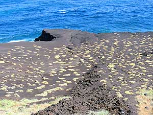
|
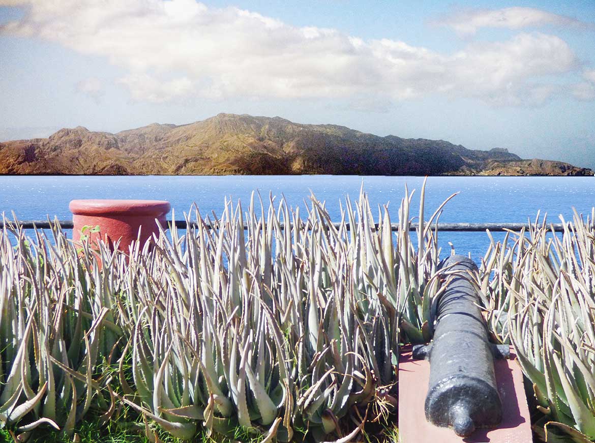
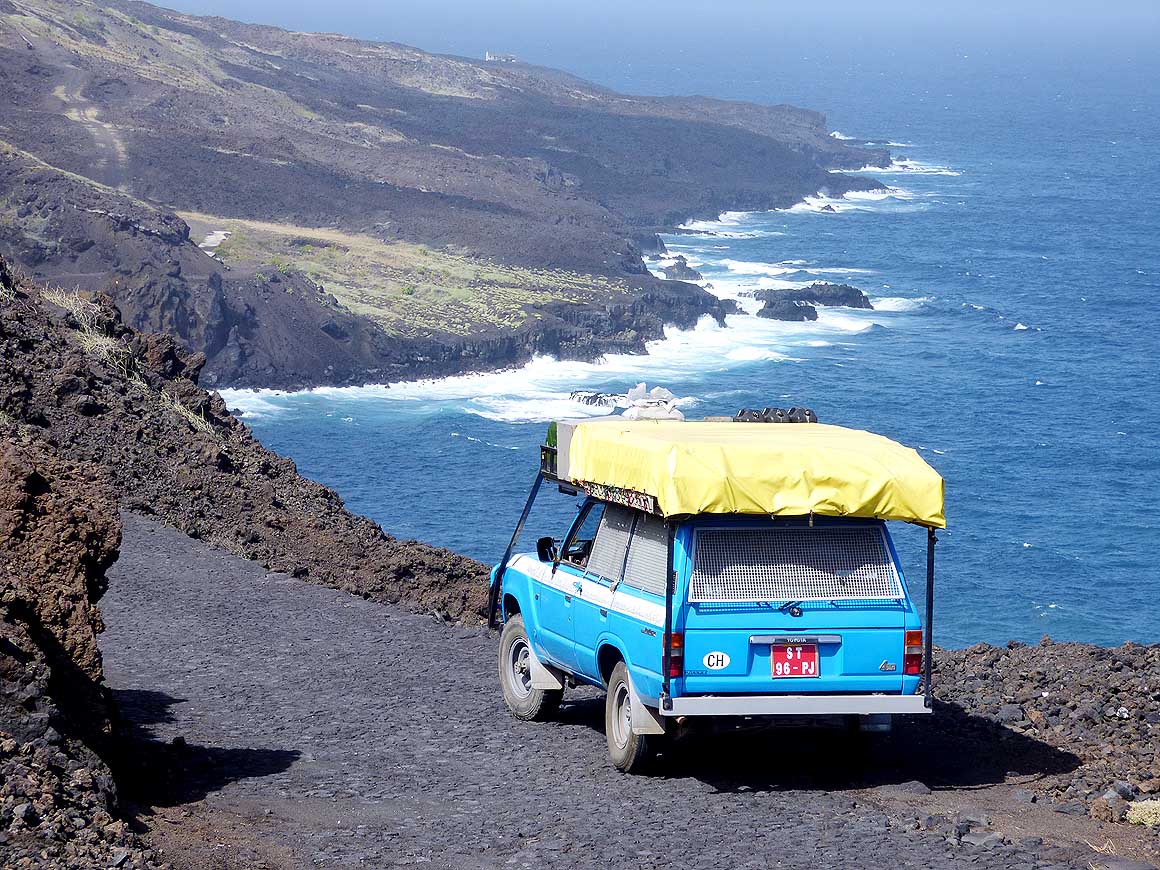
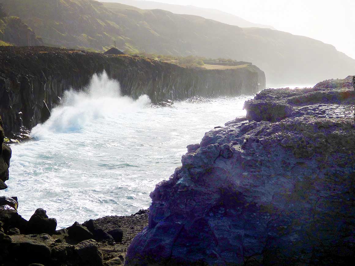
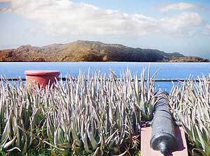
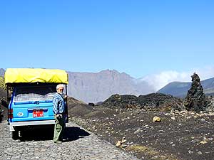
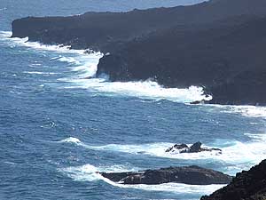
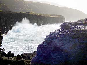
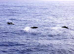
- 113
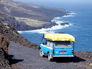
The canon at the tiny „Francisco
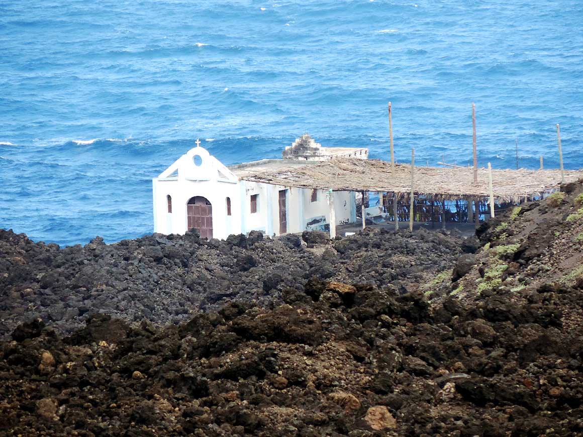
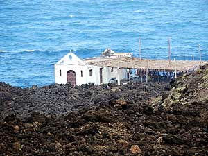
- Craveiro Lopes-Square” of Săo Filipe is
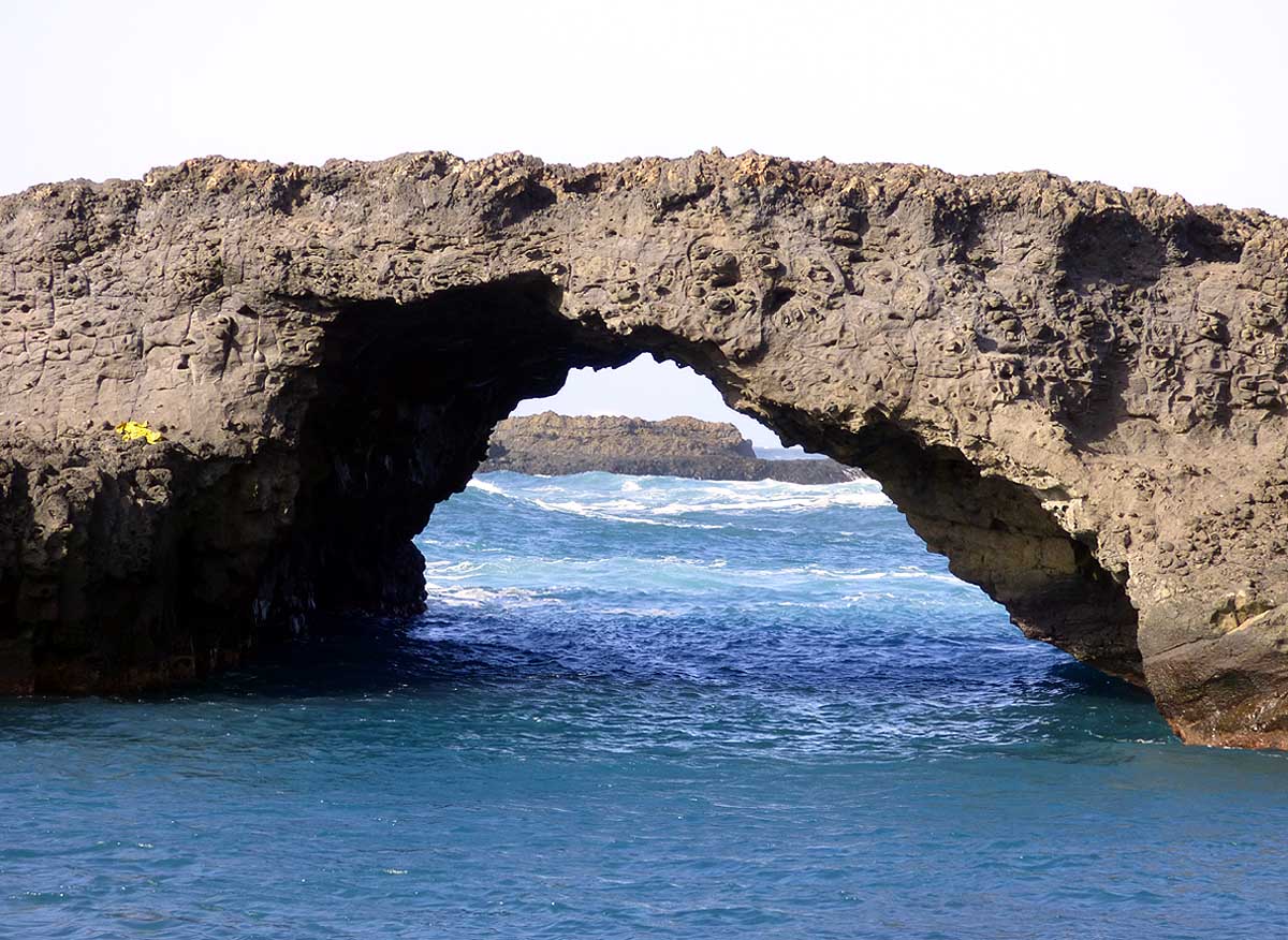
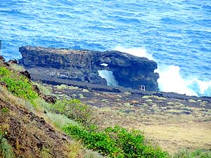
- pointing to the smaller neighbor island of
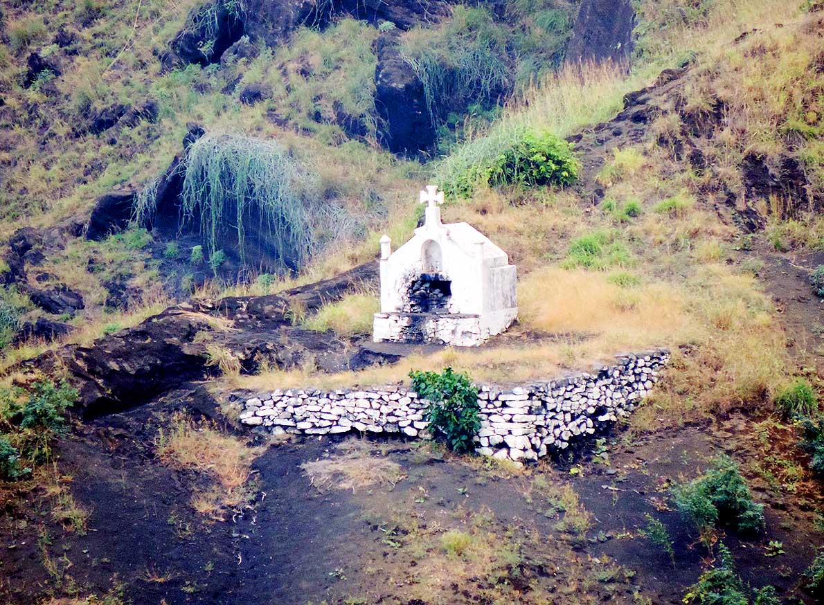
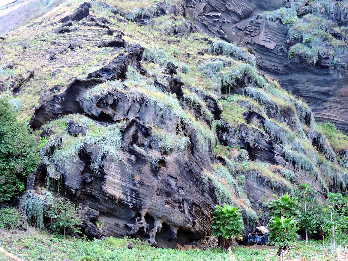
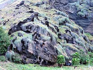
- Brava where we spent Christmas 2013
|
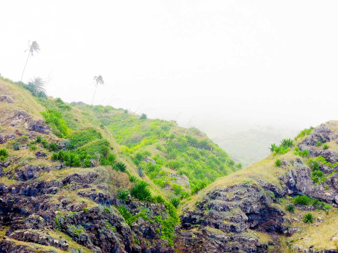
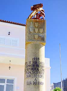
- 114
Monument in honor of the 1955 visit
- in Fogo of the Portuguese President
- Francisco Higino Craveiro Lopes [note the
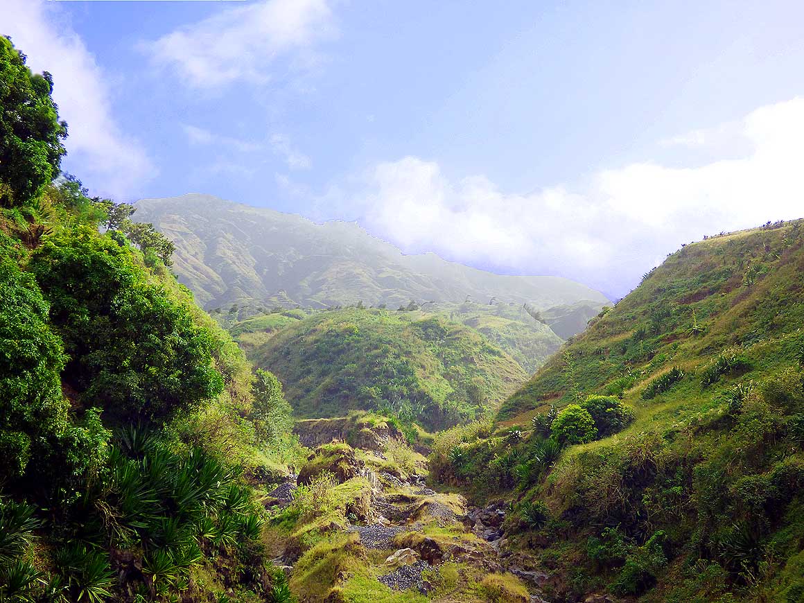
- typical five insignia of the Portuguese Coast
- of Arms, e.g. also in Timor-Leste (East Timor
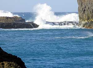
- ex. Portuguese Timor – picture # 11)]
|
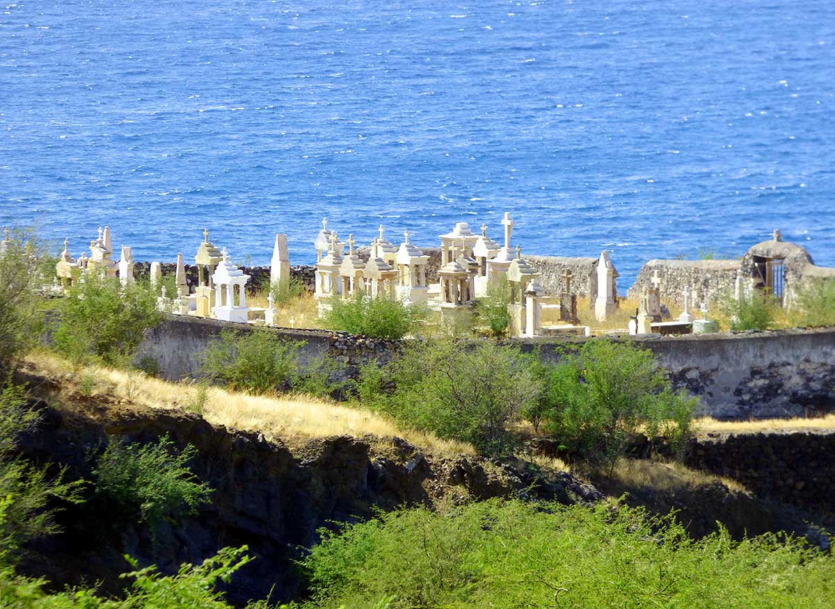
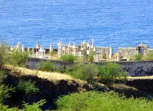
- 115
"In death all are the same"! This
- private cemetery of Săo Filipe lies in
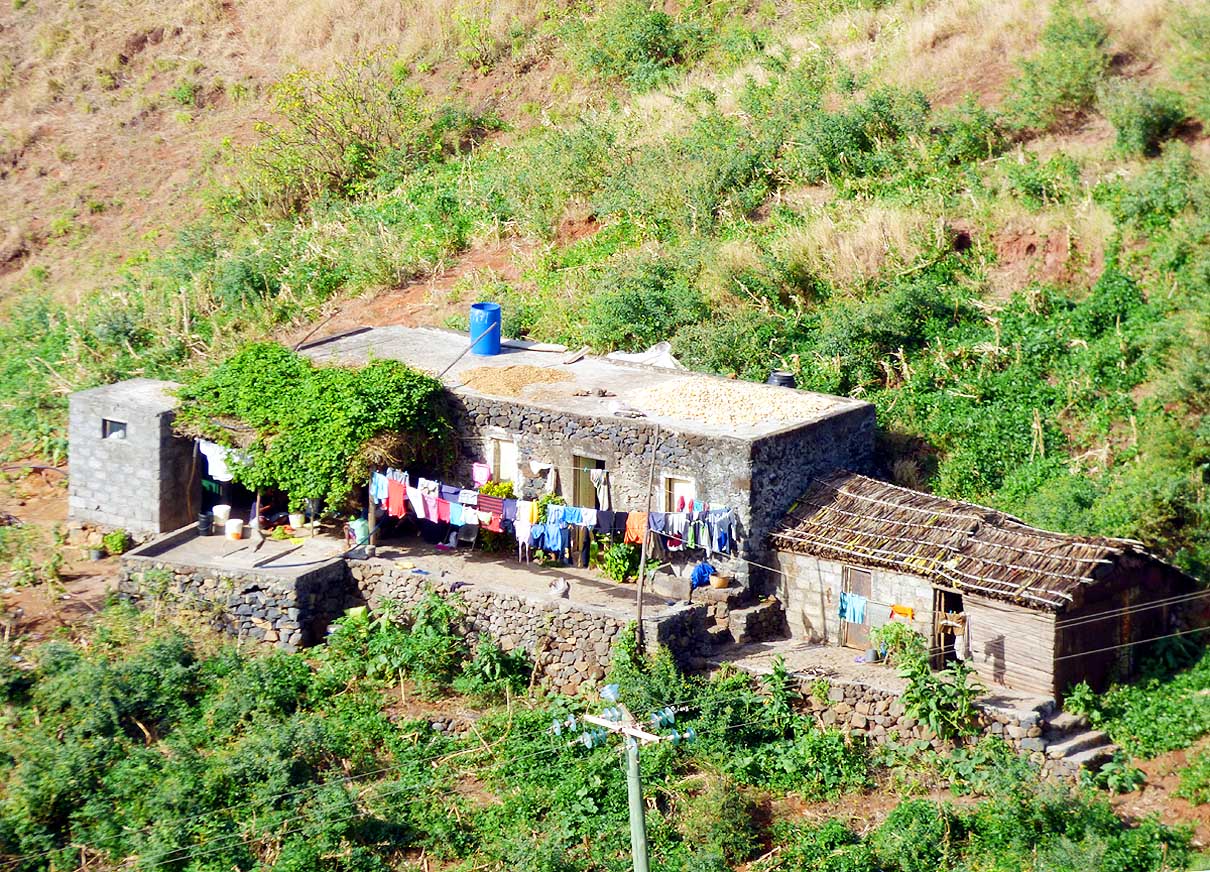
- privileged, elevated seashore setting
- south of the city
|
-
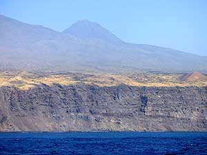
|
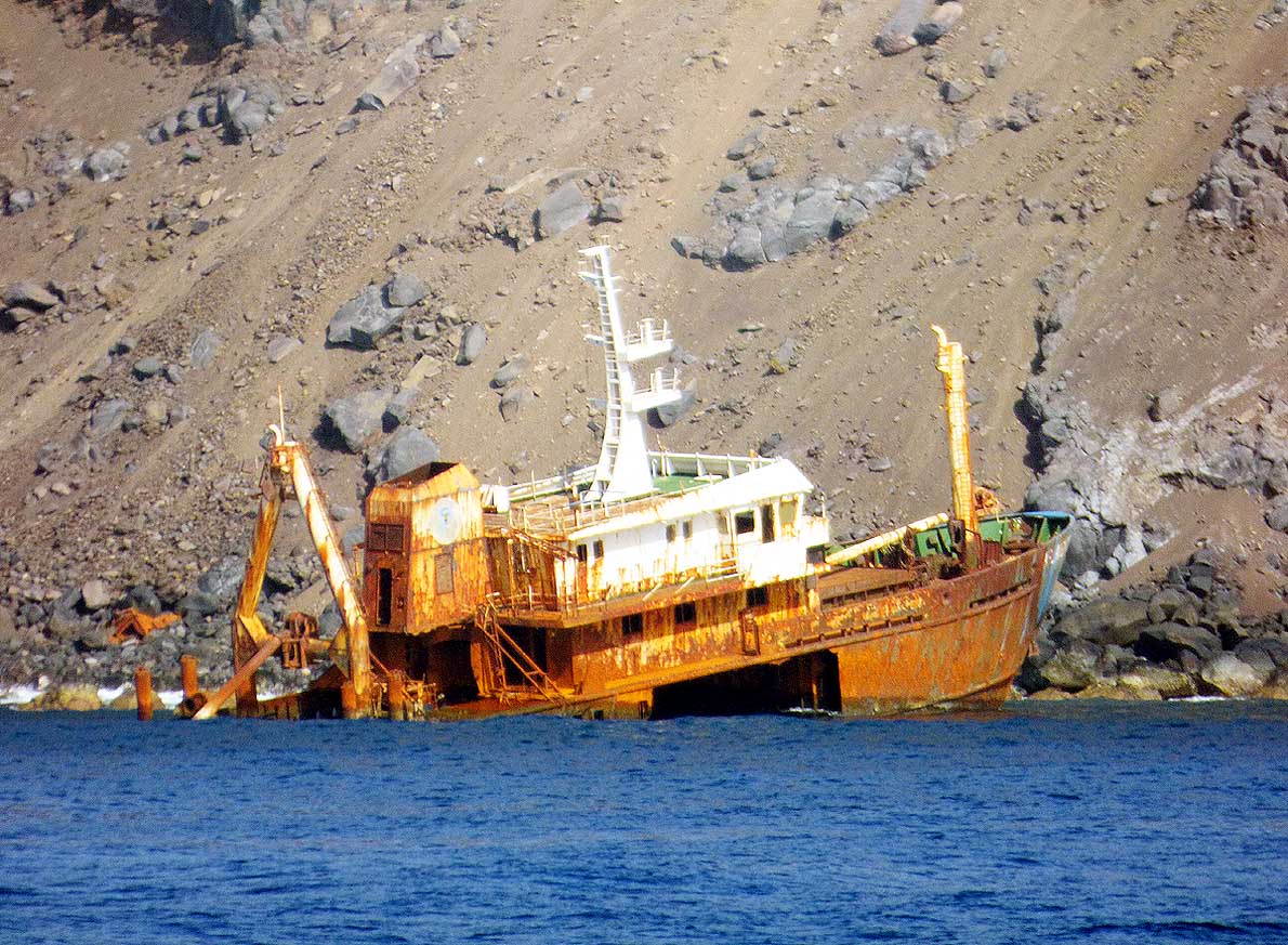
-
-
-
-
 -
|
-
-
|
-
-
-
-

|
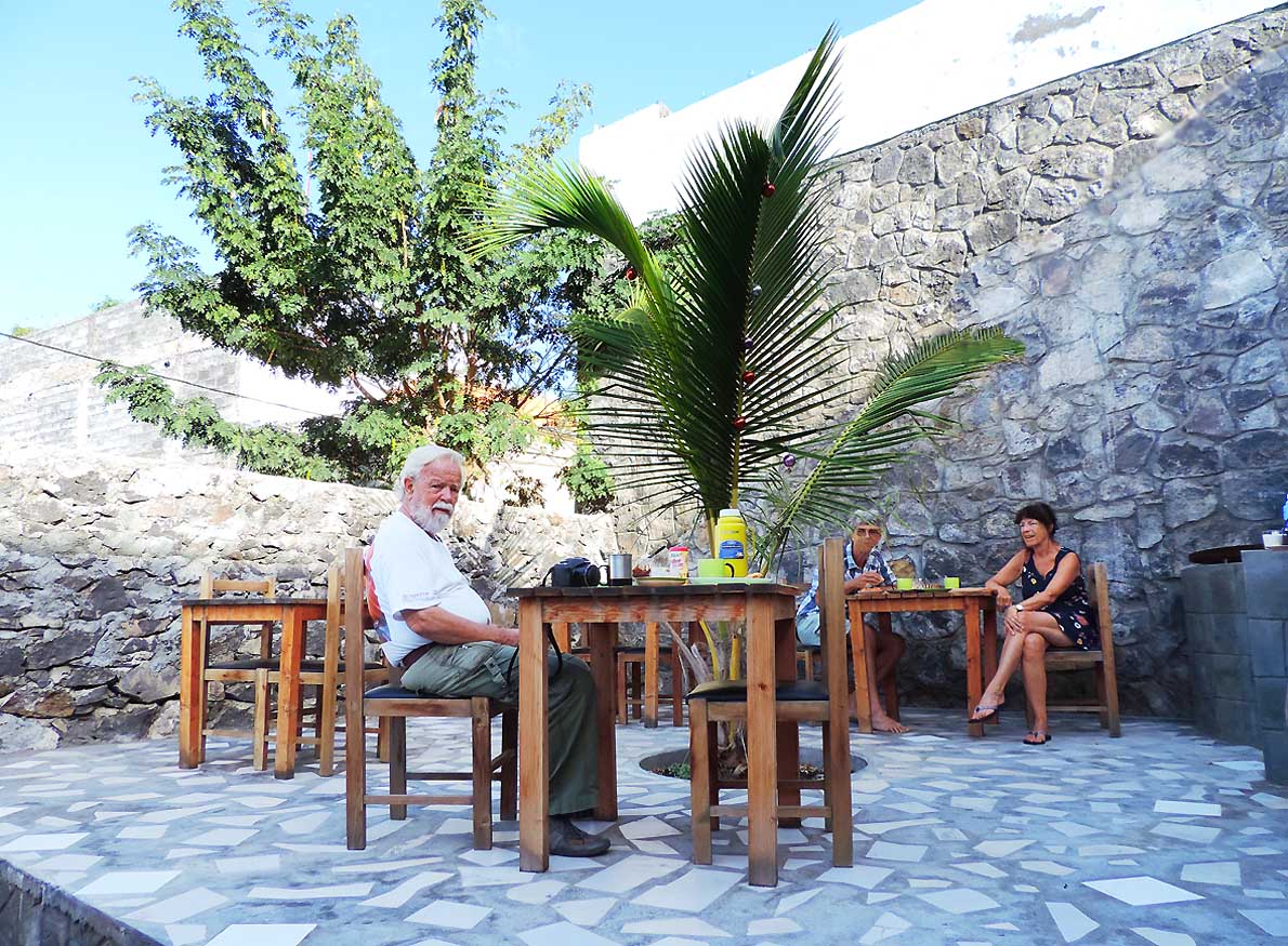
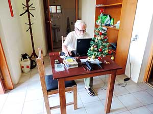
- 116
Emil is checking emails in our room
- at “Casa Beiramar” in Săo Filipe, managed
- by the Germans Monika and Mike. Our little
- tree is spreading some Christmas mood .....
|
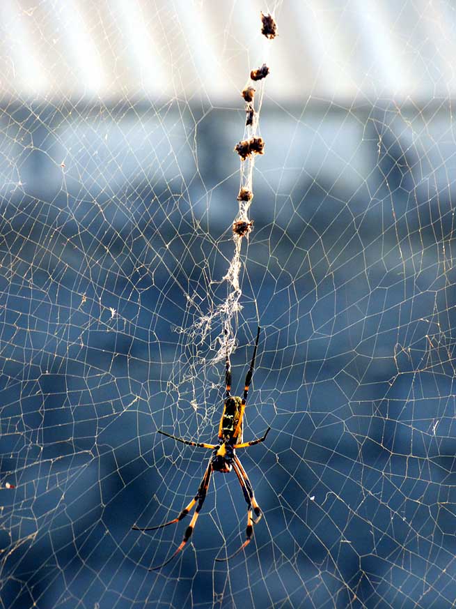
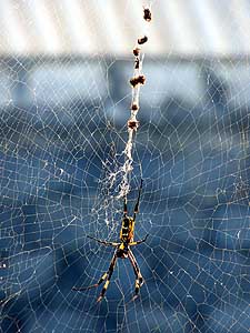
- 117
..... there are also other ‘guests’ than
- the ‘two-legged’ ones: A spider has woven
- its net at the Guava tree in the garden. There
- are no poisonous species here that are
- dangerous for humans
|
- 118
Emil at our breakfast table at
- “Casa Beiramar”. In the background
- are the Swiss guests Judith and Philipp
- who have also an adventurous spirit
|
-
|
-
-
|
-
-

|
-
-
|
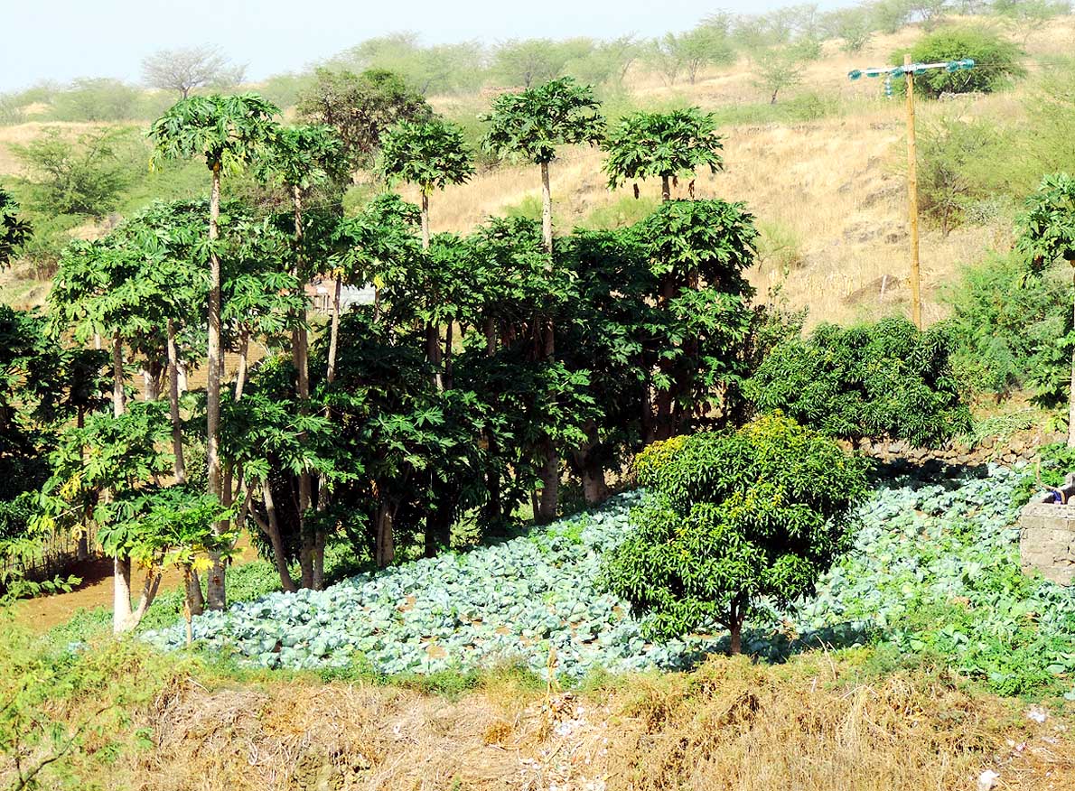
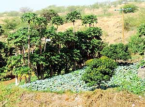
- 119
A small cultivation with pawpaw
- and cabbage in the middle of the dry
- landscape
|
- 120
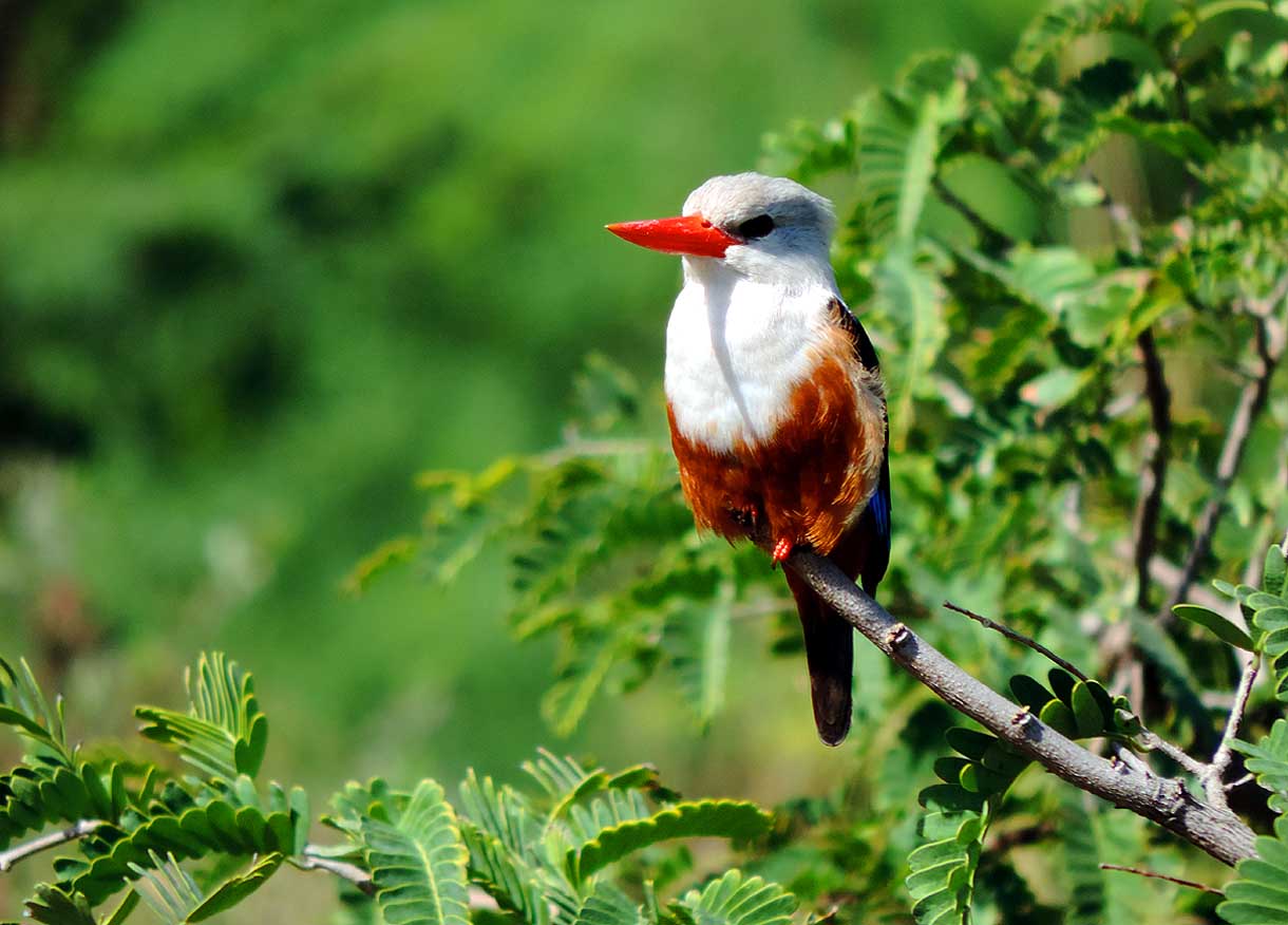
A heart warming sight: A beautiful
- “Grey-headed Kingfisher” (Halcyon
- leucocephala) along the road. We are
- not exaggerating: We see dozens of them.
- They are not shy leaving us plenty of
- time to take pictures
|
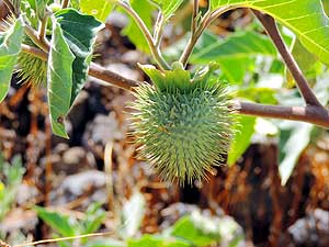
- 121
"Jimson weed" (Datura
- stramonium) manages to survive
- in the dry landscape similar to
- the Sahel zone
|
-
|
-
-
|
-
-
|
-
-
|
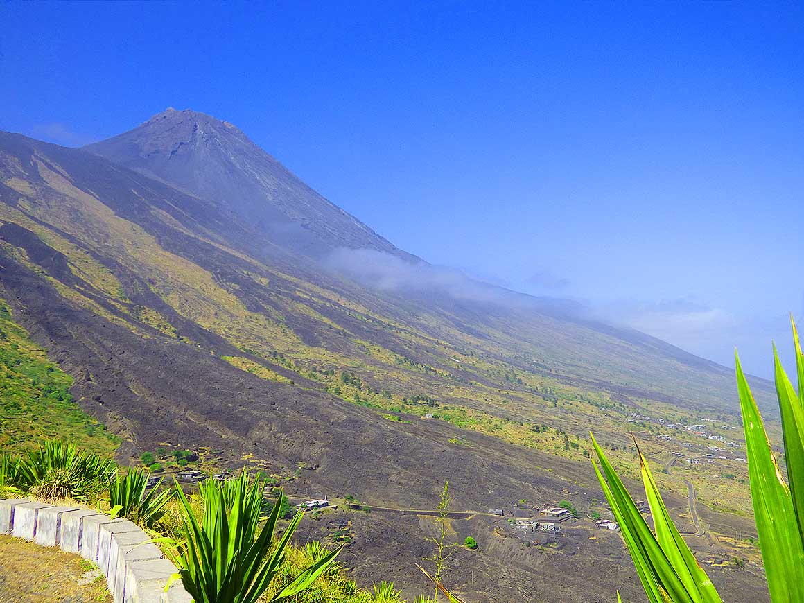
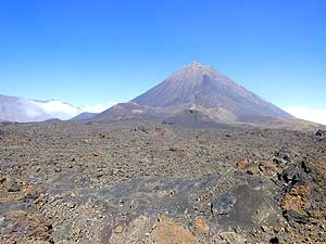
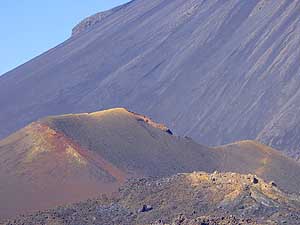
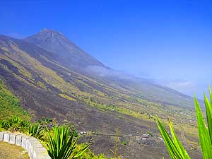
- 122
The still active volcano "Pico de
- Fogo" is the most impressive mark of the
- island. It is 9’281 ft. high; its cone has a
- diameter of 15 miles at sea level, between
- 3 and 5˝ miles at the altitude of the
- caldera (around 5’900 ft.) and the top
- crater is around 150 ft.
|
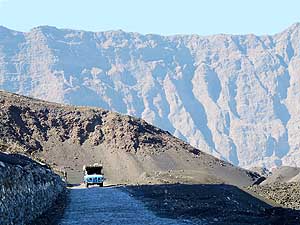
- 123
A cobblestone track leads through
- volcanic scree, ashes and bizarre lava
- formations through a moonscape down to
- the crater floor, which north of Bangaeira
- finally drops down to Mosteiros
|
- 124
On the western side we are closed-in
- by a gigantic half circle rock wall of almost
- 3’300 ft. – called "Bordeira", while in the
- east the "Pico de Fogo" rises up
|
-
|
-
-

|
-
-
|
-
-
|
- 125
Dark lava formations rise ghostly
- from the floor of an ancient crater, called
- "Chă das Caldeiras". From the grey ashes
- plants spring up; nature is returning
|
- 126
The inseparable trio poses happily
- for a picture in front of the perfectly
- shaped cone of "Pico de Fogo" and
- enjoys the eerie silence
|
- 127
Lava fields, scree and ashes cover
- the crater floor of "Chă das Caldeiras"
- on an altitude of around 5’900 ft.
|
-
|
-
-
-
-
 -
|
-
-
|
-
-
-
-

|
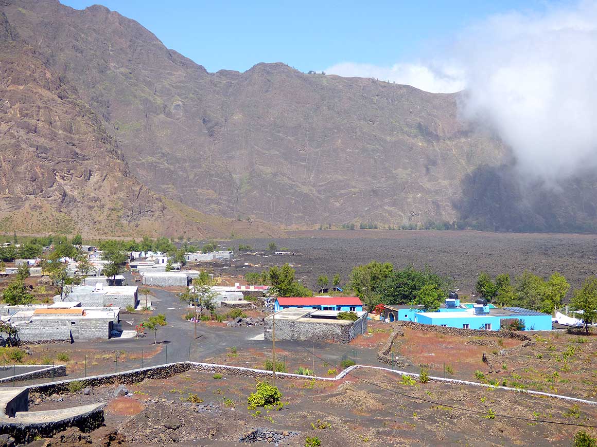
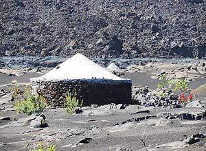
- 128
In all shades of grey and adapted
- to the environment: The 700 people village
- of Portela with its low flat roof houses at
- the base of the 3’300 ft. tall crater wall
- “Borderia” .....
|
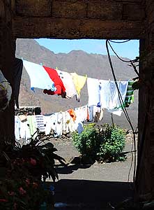
- 129
..... Clothes flutter in the wind
- behind a house. There is only
- collected rainwater available
|
- 130
At the “worlds end” where the road
- ends too: The village of Bangaeira with
- around 800 people, nestled along the
- crater wall, which is open towards the
- right in direction Mosteiros (clouds
- from the sea try to move in)
|
-
|
-
-
-
-
 -
|
-
-
|
-
-
-
-
|
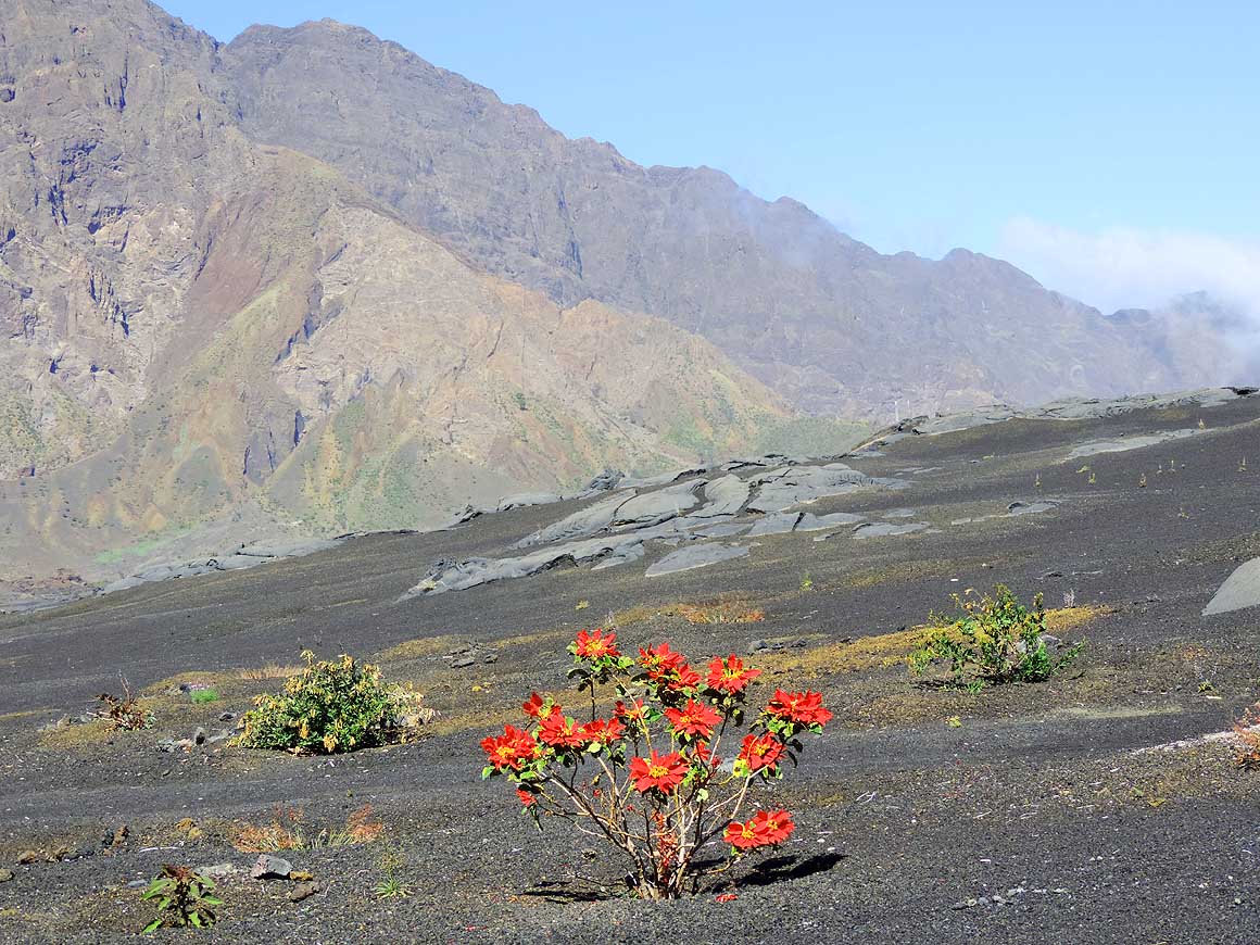
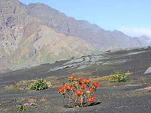
- 131
The "Chă das Caldeiras", the floor
- of an ancient crater, lies at 5’900 ft. The
- strong red color of the Christmas star or
- Poinsettia (Euphorbia pulcherrima) is a
- refreshing dot in the barren moonscape
|
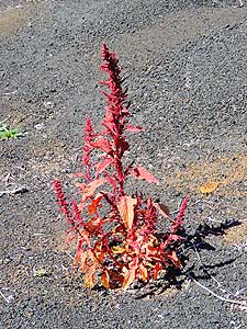
- 132
It is simply amazing how nature
- starts to reproduce again and again
|
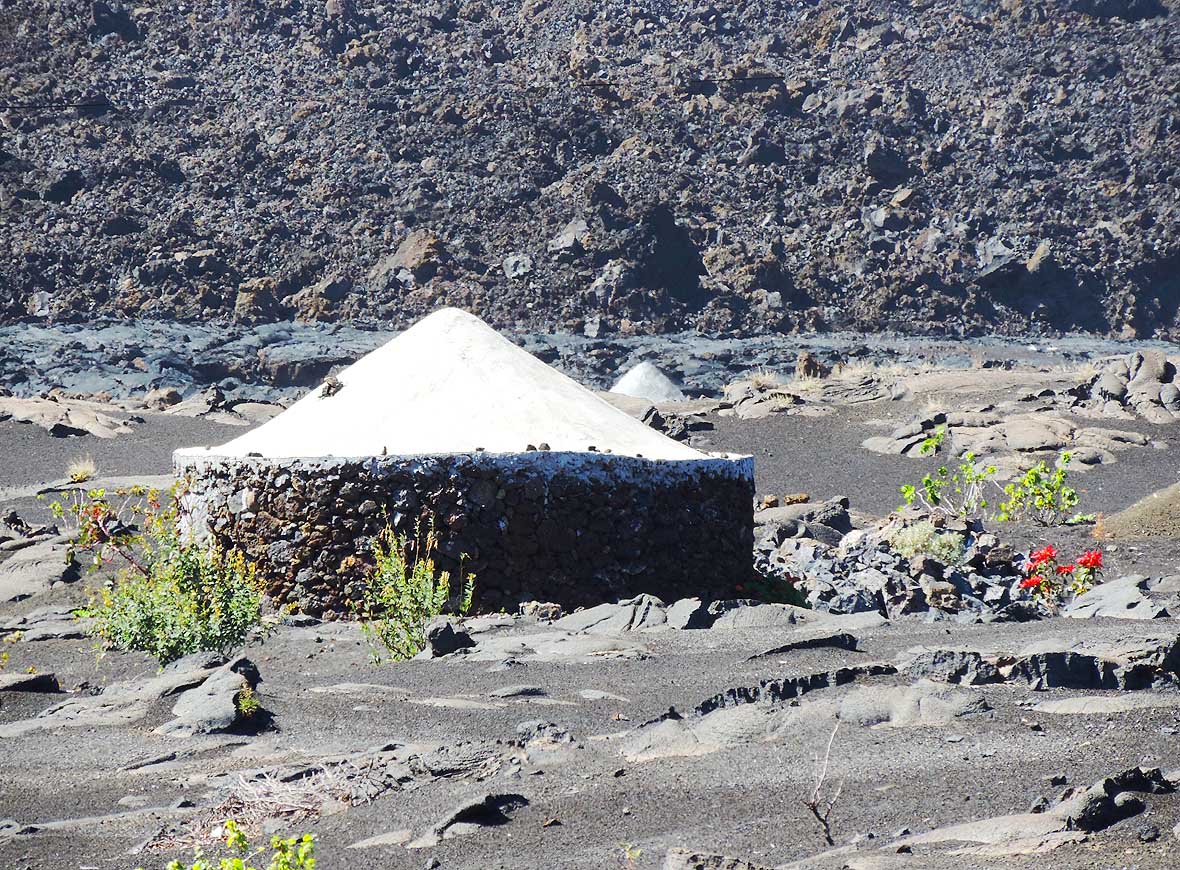
- 133
Roundhouses (called “Funcos”)
- on the former crater floor, built of
- volcanic stones and with a cemented
- peaked roof are part of the picture
- in the "Chă das Caldeiras"
|
-
|
-
-
|
-
-
|
-
-
|
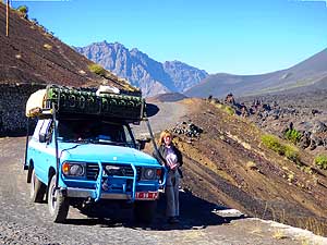
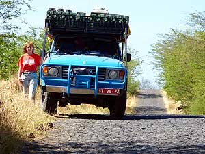
- 134
How insignificant does our Land-
- Cruiser look against the dramatic backdrop
- of the vertically towering crater wall
|
- 135
We leave the "Pico de Fogo" area
- without climbing to the top of the volcano.
- The 3’000+ ft. difference of altitude and
- the 5 to 7 hours strenuous 30-40° climb
- and descent are too much for Liliana
|
- 136
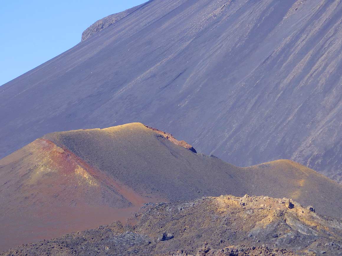
There have been eruptions again
- and again in the past, the latest – after
- an interruption of nearly 100 years –
- in 1951 and 1995. In the foreground
- “Pico Pequeno”
|
-
|
-
-
-
-
 -
|
-
-

|
-
-
-
-
|
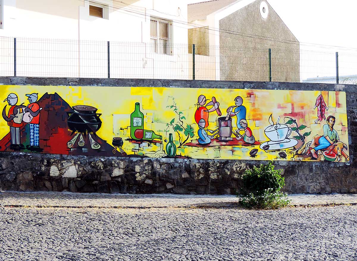
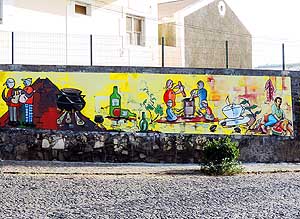
- 137
A mural in Săo Filipe with local
- scenes. Due to the lack of a slaughter-
- house animals still have to end their lives
- the ancient terrible method (far right)
|
- 138
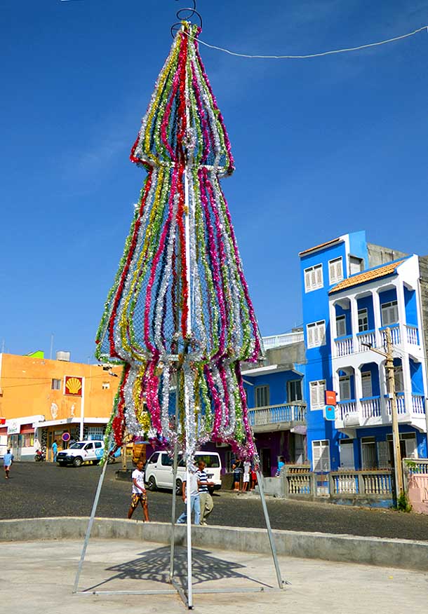
A Christmas tree made of
- glittering colorful garlands in a
- suburb of the main town
|
- 139
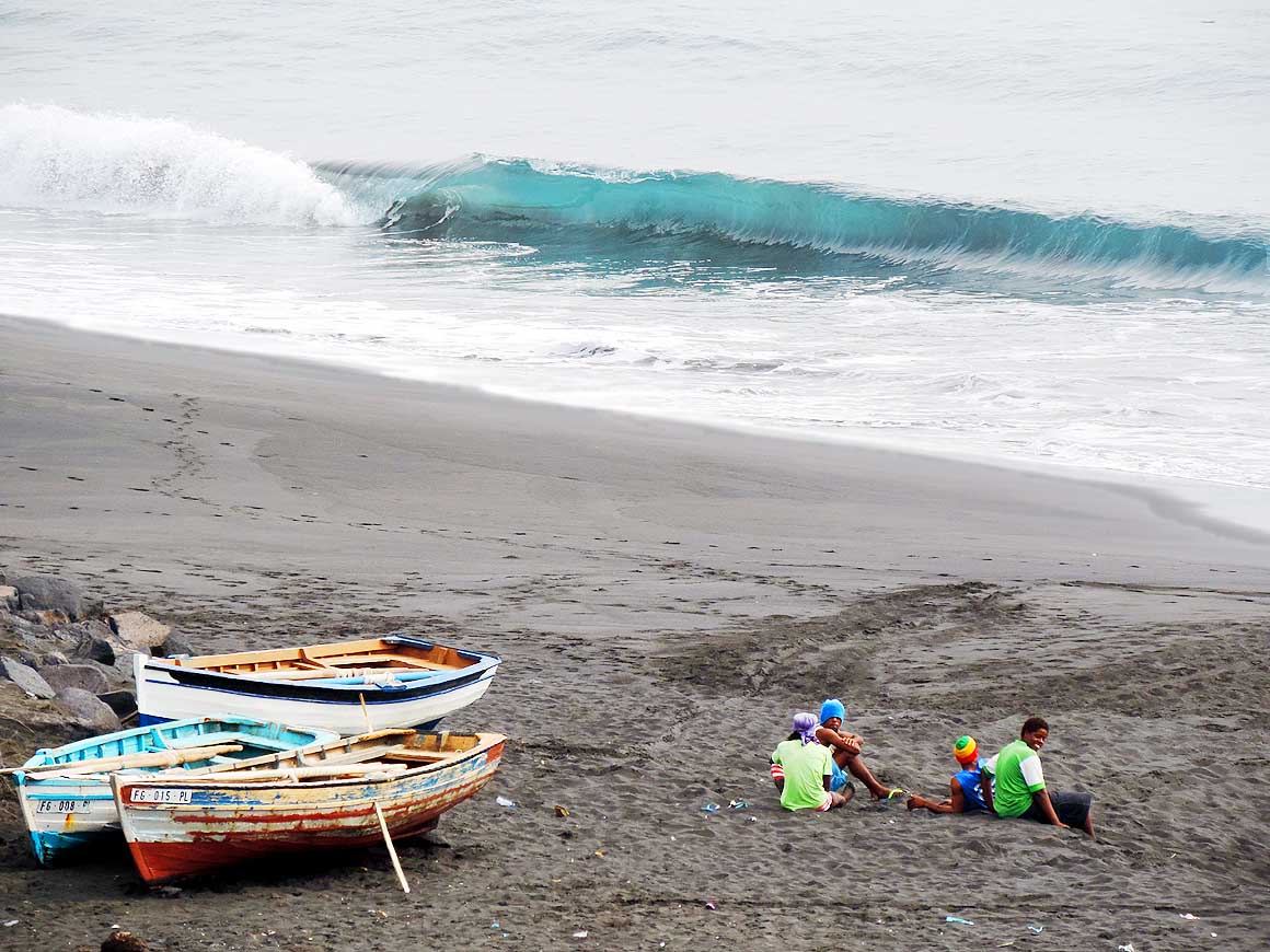
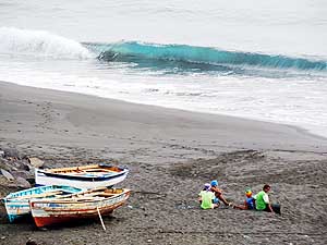
Fishermen and fishing boats are
- resting near the Tortuga B&B, reached
- by a 30-minute walk along the beach
- south of Săo Filipe
|
-
|
-
-
|
-
-
|
-
-
|
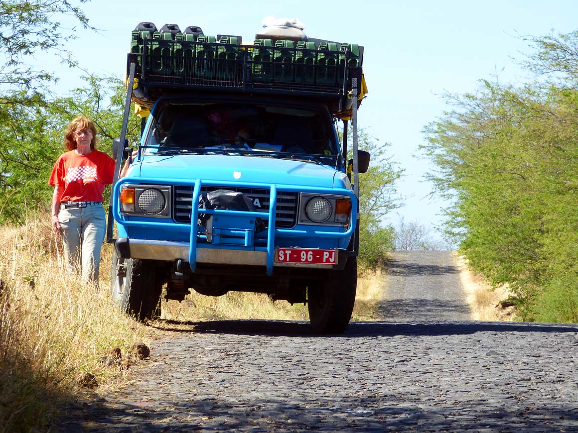
- 140
We just stop for another picture:
- Cobblestone, dried up meadows and
- loneliness accompany us on our
- 50 miles tour around the island
|
- 141
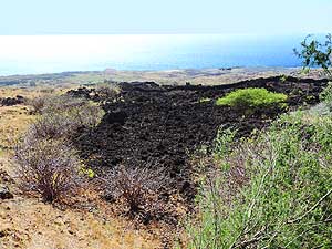
One of the black lava tongues
- stretches down to the sea on the
- south side of the island
|
- 142
Here it comes into view again:
- The "Pico de Fogo" with its eastern
- slope. On the right side of the
- picture the village of Tinteira
|
-
|
-
-
-
-
 -
|
-
-

|
-
-
-
-
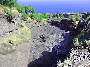
|
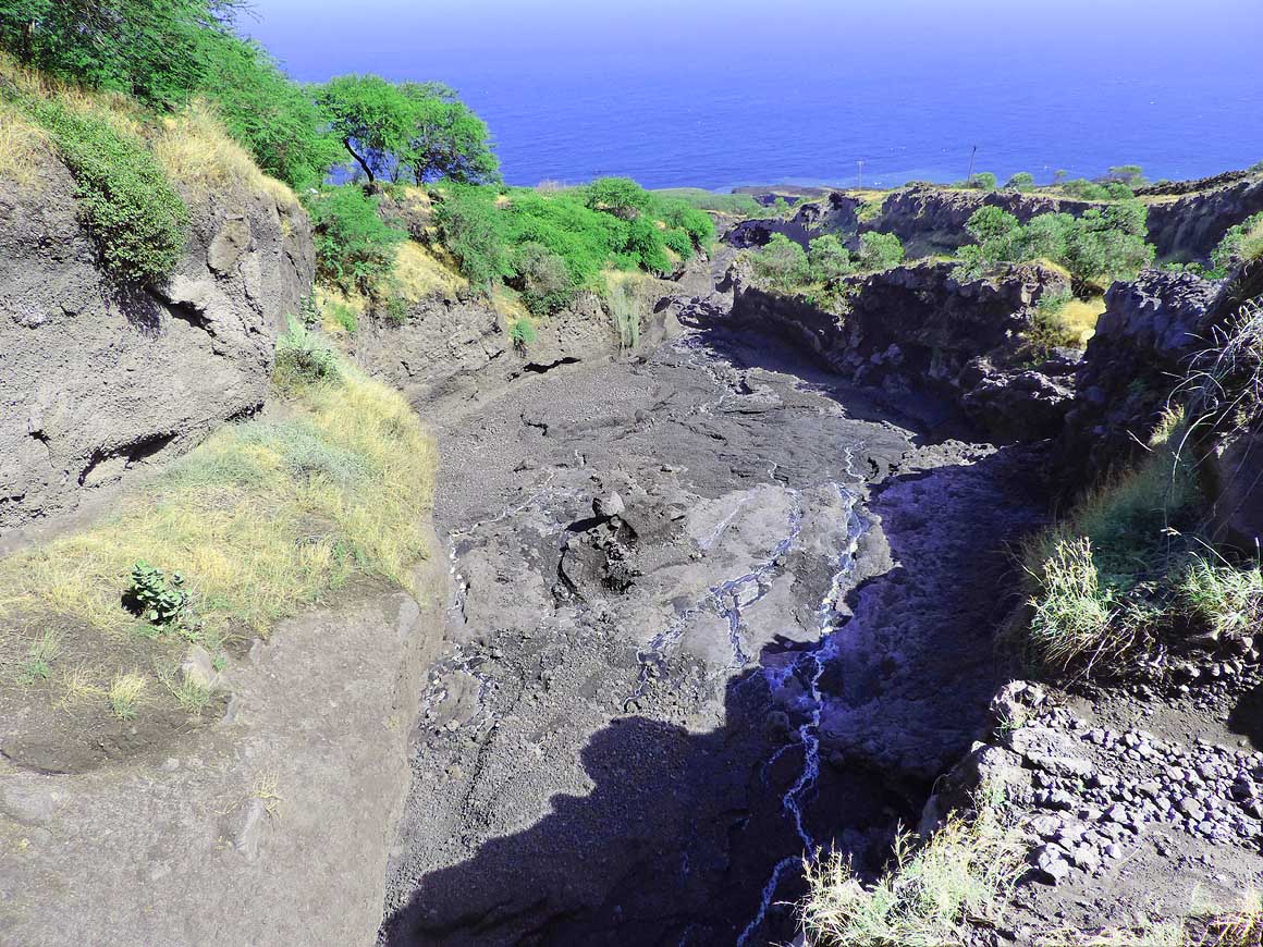
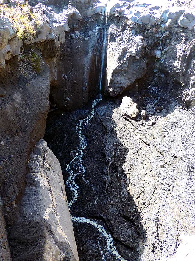
- 143
At a bridge we discover tiny
- watercourses that flow between the dark
- volcanic rocks towards the sea .....
|
- 144
..... a rarity in the Sahel like
- dried up landscape, caused by
- rainfalls a few days before
|
- 145
Again and again we are amazed
- about the wonders of nature [probably
- a kind of cow parsnip (Heracleum)]
|
-
|
-
-

|
-
-
|
-
-
|
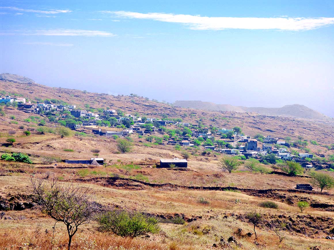
- 146
The village of Dacabalaio between
- thorny acacia trees in the dry landscape
- of the southeast
|
- 147
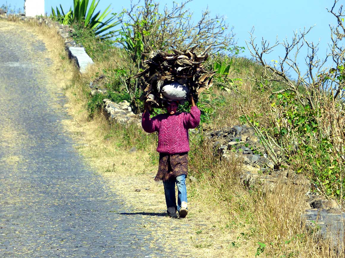
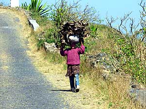
Who does not own a donkey
- must transport the heavy load
- him-/herself
|
- 148
Do people still live in this isolated
- stony place with its beautiful name of
- Bombardeiro along the rocky east coast?
|
-
|
-
-

|
-
-
|
-
-
|
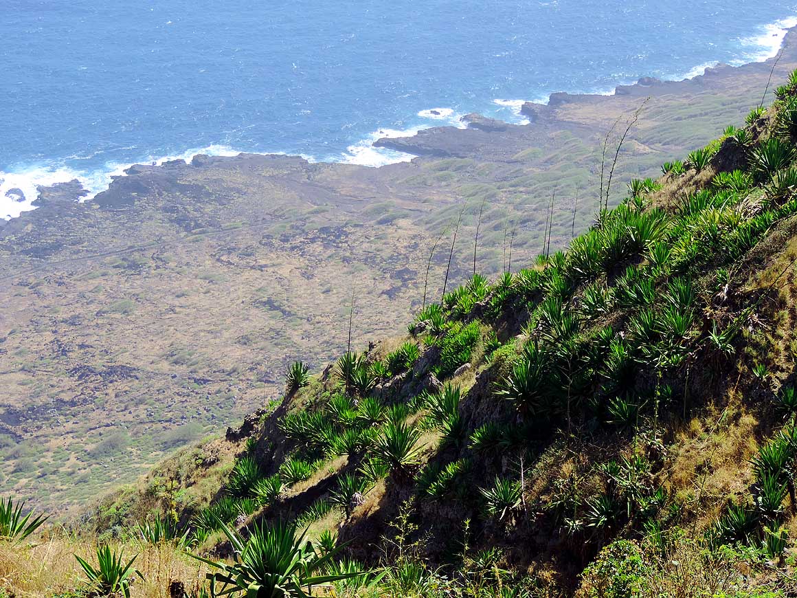
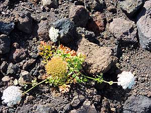
- 149
A forest of agave is spreading along
- the rocky eastern seashore of the island.
- These plants are growing in abundance on
- Cape Verde and can reach a huge size
|
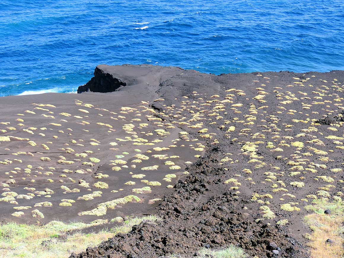
- 150
Cushions of plants have set roots
- again in the lava fields. They are shiny
- dots in the dark and rather
- desolate environment
|
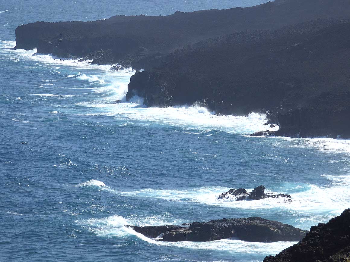
- 151
The north and northeastern coast
- of the island is wild, buffeted by waves
- and wind and rather forbidding
|
-
|
-
-
|
-
-
|
-
-
|
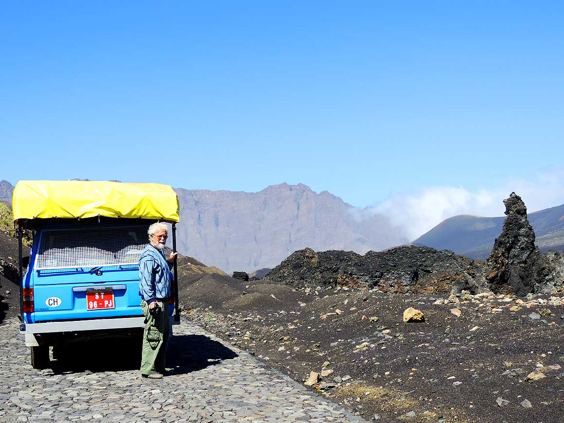
- 152
Rocks battered by waves and lava
- fields ad nauseam. With its yellow tarp
- and local red license plate our blue
- LandCruiser adds some color
|
- 153
Miraculously the destructing
- lava flow stopped before the church
- of Lagoa Atrás
|
- 154
The power of the waves leads to
- bizarre formations at the northeastern
- coast like this bridge of
- “Ponto da Lagoa Atrás“
|
-
|
-
-
|
-
-
|
-
-
|
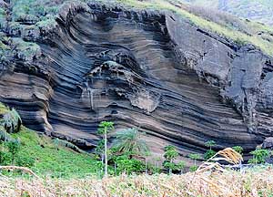
- 155
Above the district village Fajăzinha
- at Mosteiros in the north strange rock layers
- have been exposed by wind and weather .....
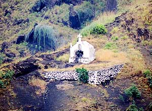
|
- 156
..... close by is a whitewashed
- tomb lonely on a mountain slope
|
- 157
At the cool and foggy northern
- slopes of the volcano sprawl green
- "aerial roots"
|
-
|
-
-
|
-
-
|
-
-
|
- 158
The second biggest city in Fogo –
- Mosteiros with a population of around
- 10’000 – sits picturesquely in the sub-
- tropical northeast between the steep
- mountain slopes and the sea and
- consists of about 7 districts: here in
- the front Sambango, back Laranjo
|
- 159
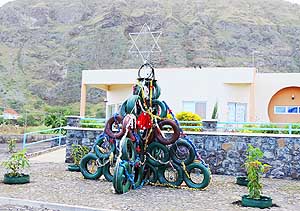
On a small forecourt in Laranjo/
- Mosteiros stands a Christmas
- tree made of tires
|
- 160
A glimpse from the hill down
- to the coast of Fajăzinha, a suburb of
- the spreading coastal town of Mosteiros
|
-
|
-
-
|
-
-
|
-
-
|
- 161
Foggy but green – that’s how
- the north and northeast of Fogo
- showcases itself (at least to us)
|
- 162
With its rough and difficult terrains,
- Fogo’s most suitable mean of transport
- is still the donkey
|
- 163
The humid climate of the north
- favors the growth of coffee,
- pawpaw, mango and banana
|
-
|
-
-

|
-
-
|
-
-
|
- 164
"Ponta da Salina“, approximately
- 10 miles northeast of Săo Filipe. An
- impressive rock bridge separates a
- swimming pool from the ocean .....
|
- 165
..... beside, in a couloir, it rages,
- splashes and churns during rough sea .....
|
- 166
..... the towering water fountains in
- their immaculate white offer a fascinating
- spectacle of nature, particularly when not
- getting wet
|
-
|
-
-
|
-
-
|
-
-
|
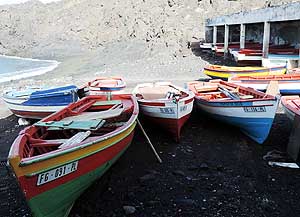
- 167
Colorful fishing boats are waiting for
- their next catch in the protected bay of
- "Ponta da Salina". Behind is a small black
- sand beach – the only one in the region
|
- 168
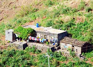
A farmer’s house where corncobs
- are laid out to dry on the roof
|
- 169
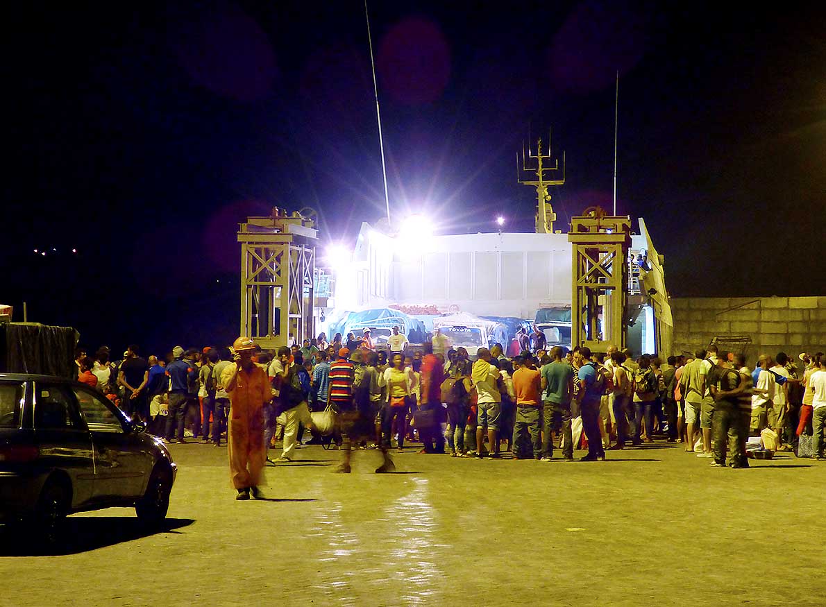
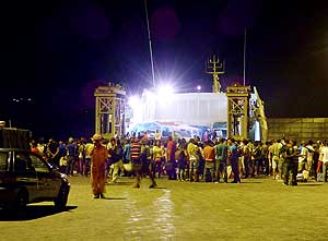
12/23/2013: Arrival of the Fast-
- Ferry 'Kriola' that will bring us and our
- LandCruiser in a bumpy 40-minutes-ride
- to the western neighbor island of Brava
|
-
|
-
-
|
-
-
|
-
-
|
- 170
On our return from the island of
- Brava to the main island of Santiago
the
- FastFerry 'Kriola' makes a stop at Fogo.
- The capital Săo Filipe is greeting in the
- warm morning light .....
|
- 171
..... the second colonial house with
- its puce tiled roof and the balcony to the
- left of the cathedral is the guesthouse
- “Casa Beiramar” where we stayed for
- ten days
|
- 172
The FastFerry 'Kriola' sails along
- the 230 ft. high cliff that protects the
- west side of the island against the
- rough Atlantic Ocean, respectively
- breaks slowly off
|
-
|
-
-

|
-
-
|
-
-
|
- 173
The stormy sea has already
- ended dramatically for many ships
- between the islands
|
- 174
One last time we admire the perfectly
- shaped cone of the volcano "Pico de Fogo"
- before the FastFerry 'Kriola' enters in
- direction east the open sea
|
- 175
The farewell of the island of Fogo
- (means island of fire) could not be more
- beautiful: Dolphins accompany and charm
- us with an unforgettable performance
|
-
|
-
- The "Greater"-Middle East trip 2012/13:
- Sharjah/Dubai/1st Traveler's Festival/Emirates
National Auto Museum - UAE with
car Nov. 2012 to Jan. 2013 - part 1
- Western UAE - Liwa - United Arab Emirates with car in January 2013 - part 2
- Oman 2013 – Part 1 - February
2013: Musandam Peninsula
- Oman 2013 – Part 2 - February
2013: Sohar - Muscat - Rustaq - Nizwa
- Oman 2013 – Part 3 - March
2013: Sur - East Coast - Island of Masirah - Dhofar
- Oman 2013 – Part 4 - March
2013: Salalah & Surroundings (Dhofar) - Nizwa
- Oman 2013 – Part 5 - March 2013: Western Hajar
Mountains
- Al Ain, Eastcoast & Ras al Khaima - United
Arab Emirates with our car in April 2013 -
part 3
- Iran - part 1: Ferry Port Bandar Abbas-Shiraz-Persepolis-Pasargad (between Persepolis and Yazd)
– May 2013
- Iran - part 2: Pasargad
(excl.)-Yazd-Esfahan – May 2013
- Iran - part 3: Esfahan
(excl.)-Chelgerd-Hamadan-Sanandaj-Orumiyeh – May 2013
- Turkey: Iran Border - Esendere - Hakkari -
Van - Dogubayazit - Kars - Ardahan-Hopa - Georgia Border – May
28 to June 4, 2013
- Georgia: part 1: Ajaria - Gori - Tbilisi - Kakheti - Azerbaijan Border –
June 4 to 13, 2013
- Azerbaijan: Georgia
Border - Balakan - Seki - Lahiç - Baku - Xinaliq - Quba - Laza - Baku - Ganca -
Georgia Border – June 13 to 24, 2013
- Armenia part 1: Georgia
Border - Akhtala - Haghpat - Dilijan - Lake Sevan - Selim - Arates - Nagorno-Karabakh – July 2 to 9, 2013
- Armenia part 2: Nagorno-Karabakh - Goris - Tatev - Noravank - Khor Virap - Echmiadzin
- Geghard - Gyumri - Georgia – 17
to 22, 2013
|
-
- Articles in newspapers about us on Cape Verde:
- Article: "Estăo
em Săo Nicolau: Emil e Liliana há 30 anos ŕ volta do mundo", Online Newspaper
"Jornal de Săo Nicolau" - March 6, 2014
- Article: "Cabo
Verde na Volta ao Mundo de Emil e Liliana Schmid", Daily
Newspaper "ASemana" - March 9, 2014
|