-
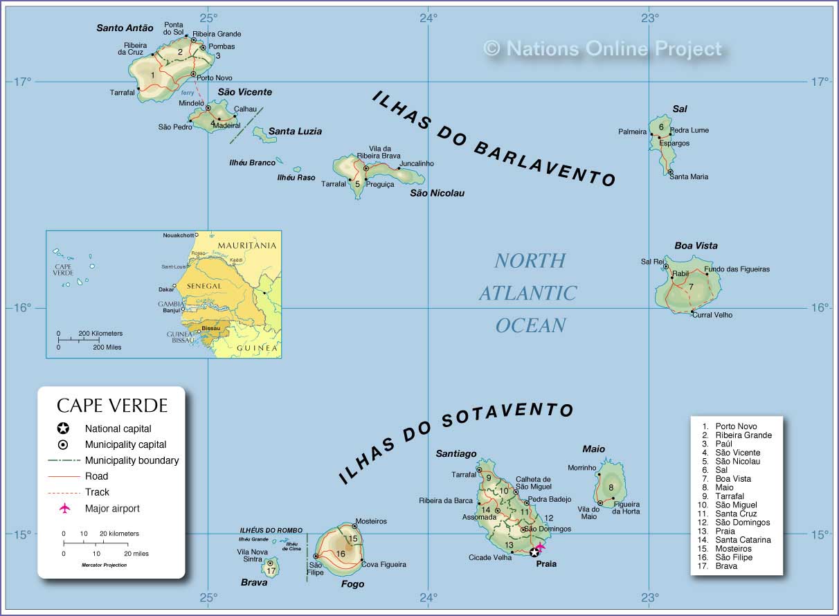
- Cape Verde Map
|
 
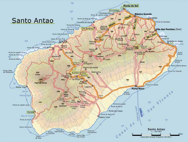
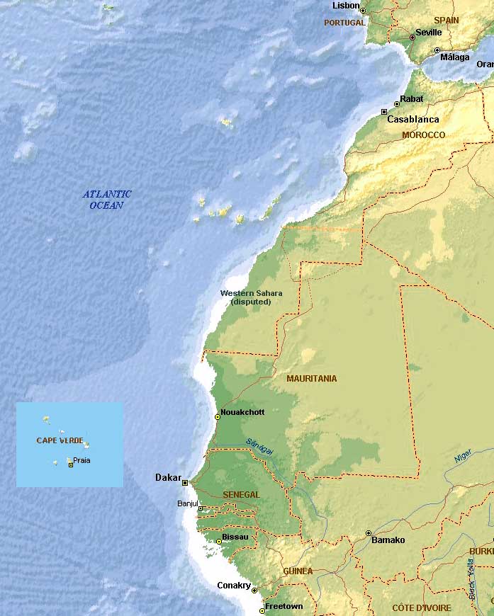
- Santo Antăo Map Northwest Africa
Map
-
|
|
-
|
- latest picture:
April 9, 2014
|
|
-
-
|
-
-
|
-
-
|
-
573
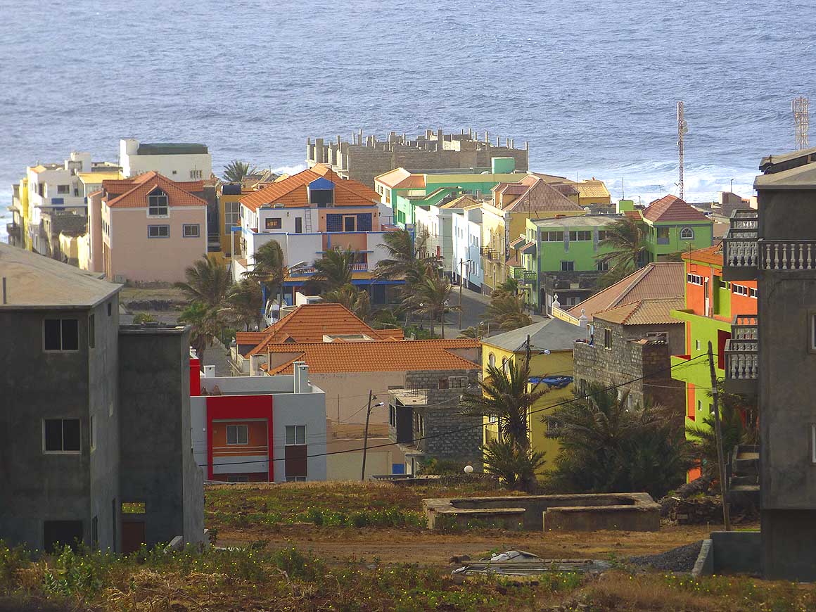
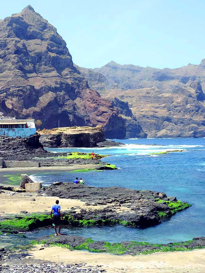
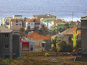
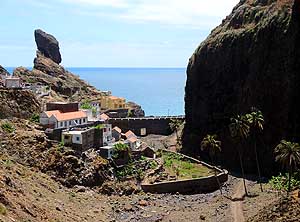
The tranquil small town of “Ponta do
- Sol” with a bit more than 2’000 people lies
- in the extreme north where the road literally
- ends at the sheer cliffs of the Atlantic
|
-
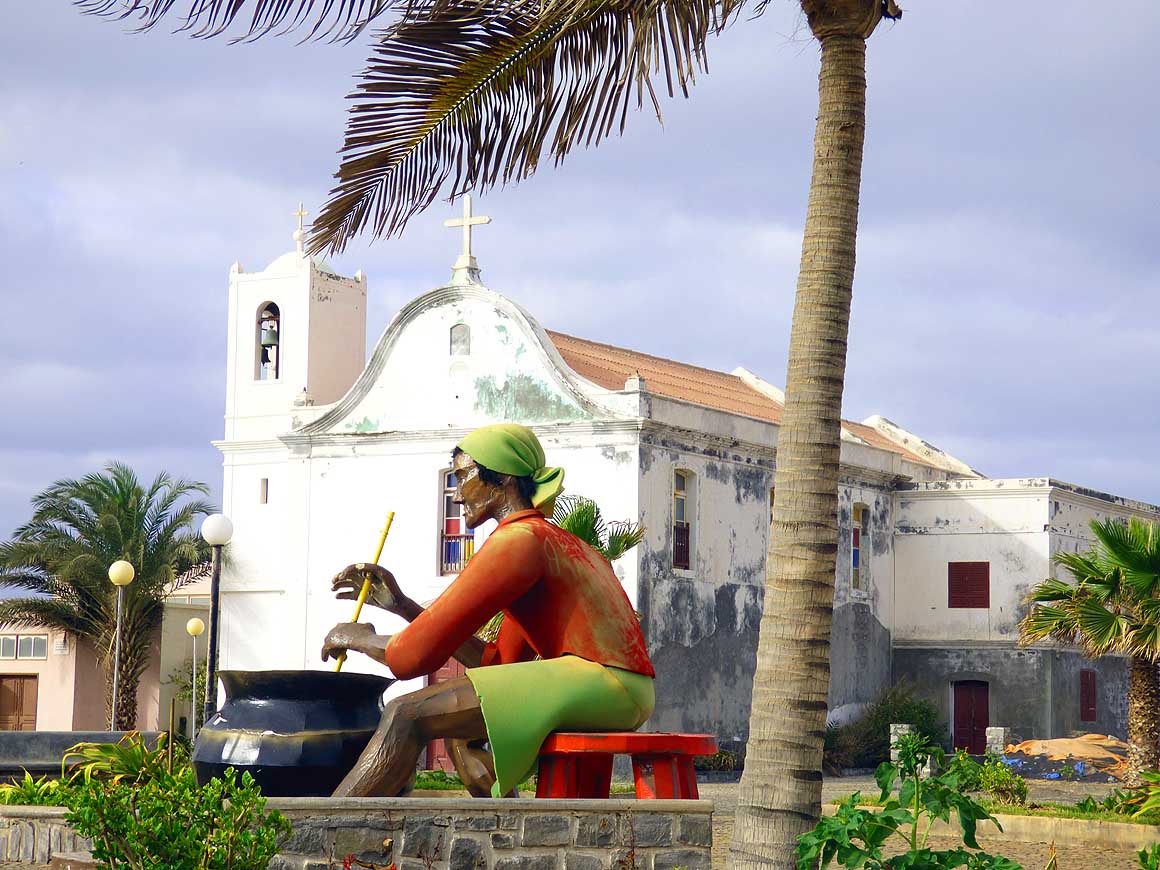
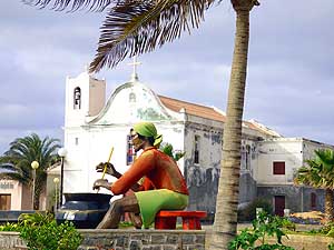
574
The Catholic Church on the main
- square of “Ponta do Sol” needed a new
- coat of paint. The ’woman’ in the front
- seems to originate from the carneval
|
-
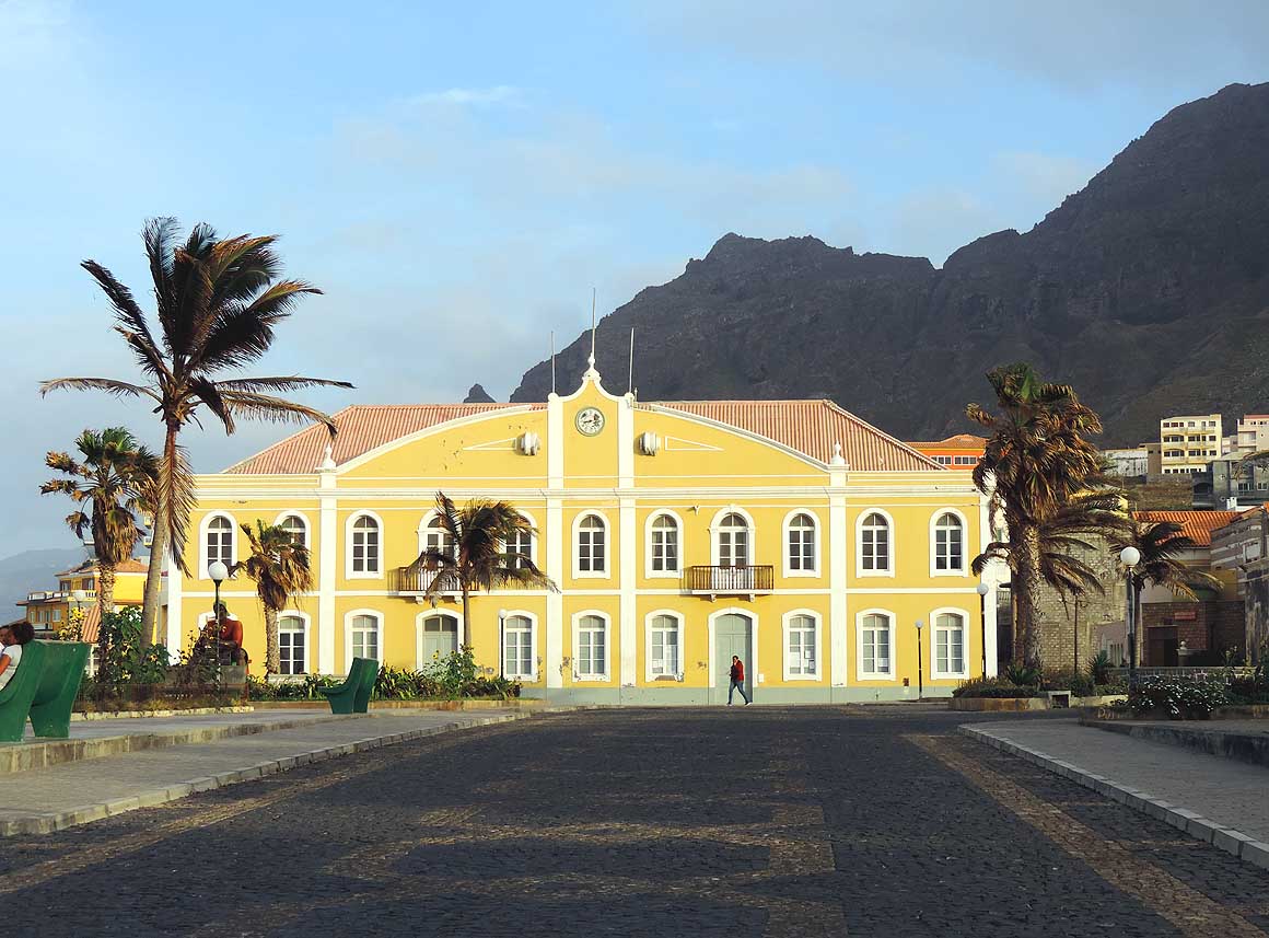
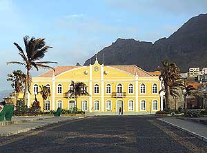
575
The yellow renovated city hall,
- built in 1882, gives a splash of color
- to “Ponta do Sol’s” main square
|
-
|
-
-
|
-
-
|
-
-
|
-
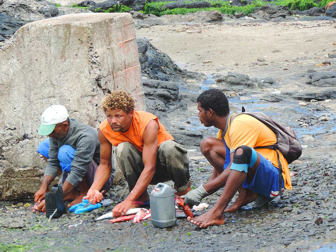
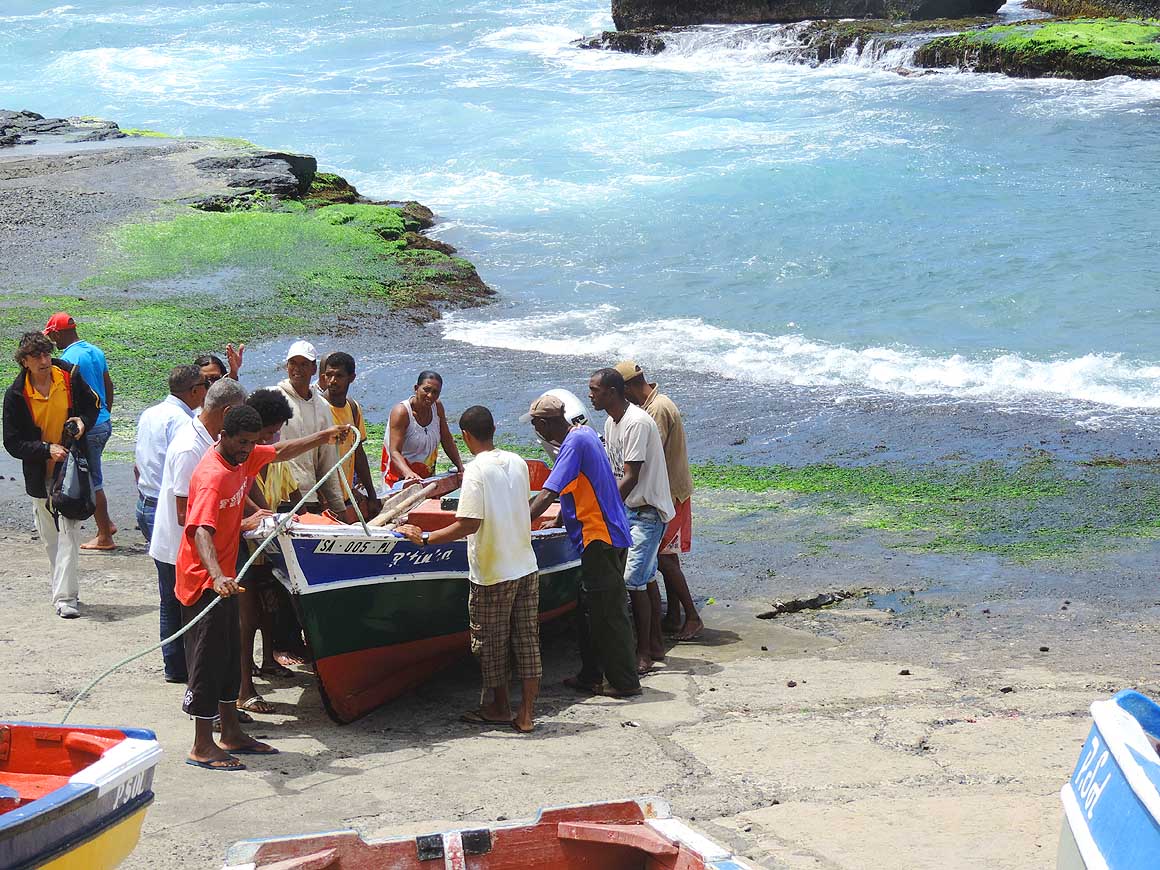
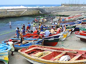
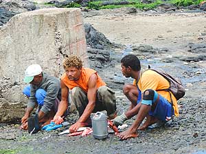
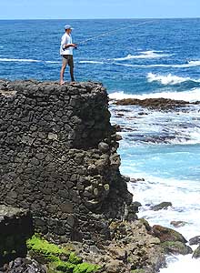
576
At the small fishing harbor of “Ponta
- do Sol” there is activity all day long …..
|
-
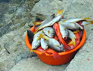
577
….. part of the days catch …..
|
-
578
….. cleaning the fish
- for the next meal
|
-
|
-
-
-
-
 -
|
-
-
|
-
-
-
-
|
-
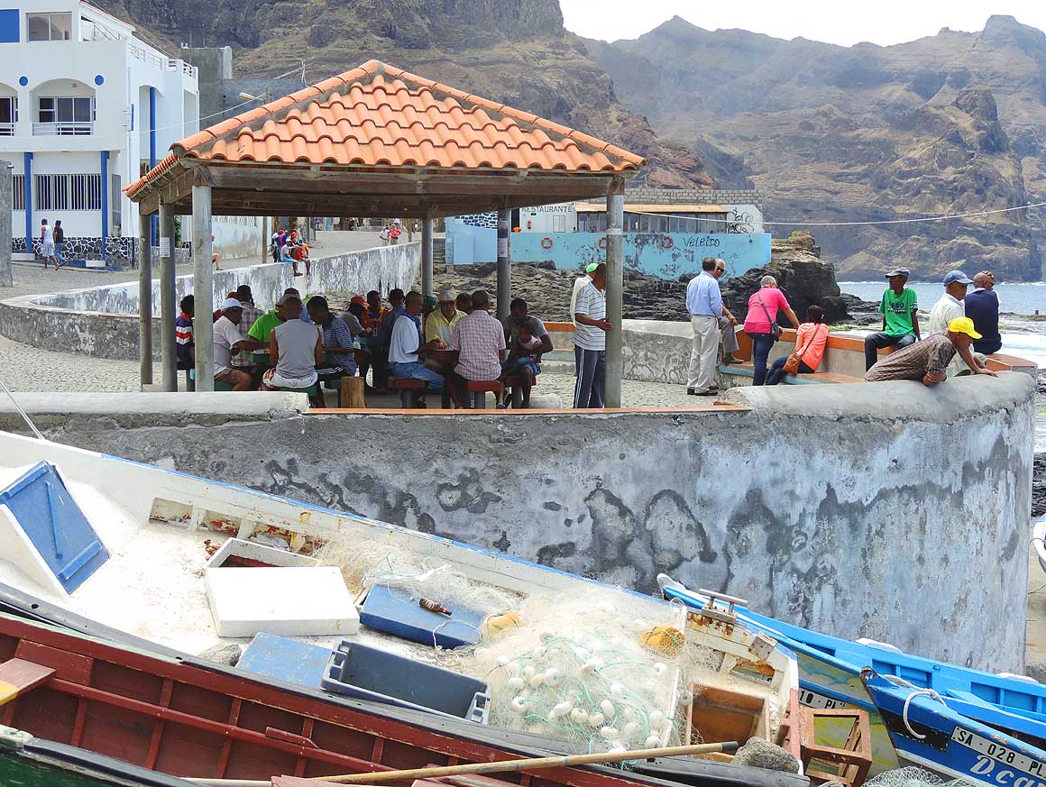
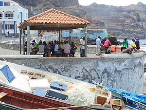
579
Watching the fishermen returning
- with their catch, playing cards, chatting –
- this is the place where people gather in
- “Ponta do Sol”
|
-
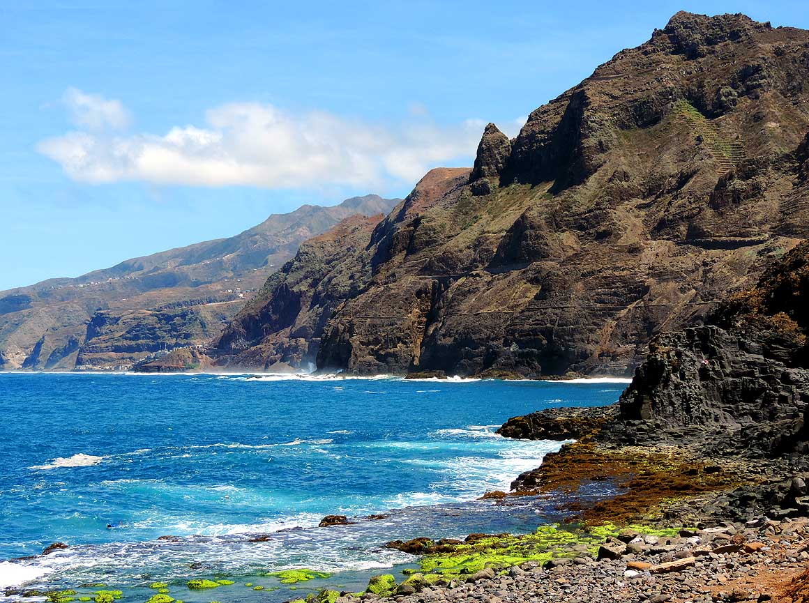
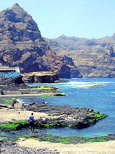
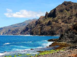
580
View from the fishing harbor of
- “Ponta do Sol” to the west where the
- sheer cliffs of the Atlantic block the
- continuation of the coastal road
- after a few miles
|
-
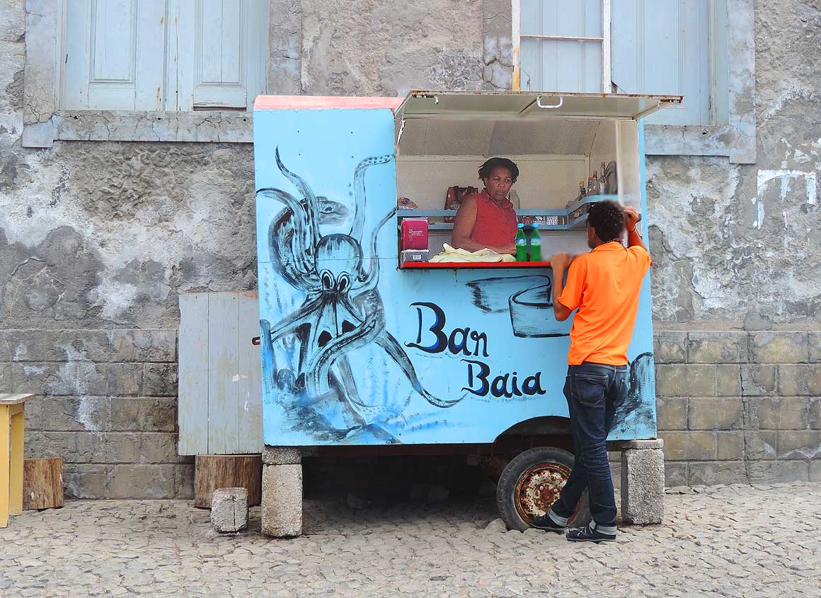
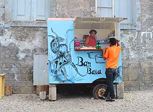
581
The mini kiosk next to the
- fishing harbor in “Ponta do Sol” sells
- drinks and something to nibble at
|
-
|
-
-
-
-
 -
|
-
-
|
-
-
-
-

|
-
582
On the third attempt the fishing
- boat manages to overcome the waves
- and return to the partly protected harbor
|
-
583
“Ponta do Sol” is a fishing community.
- Apart from slowly growing hiking tourism,
- there is little else to make a living
|
-
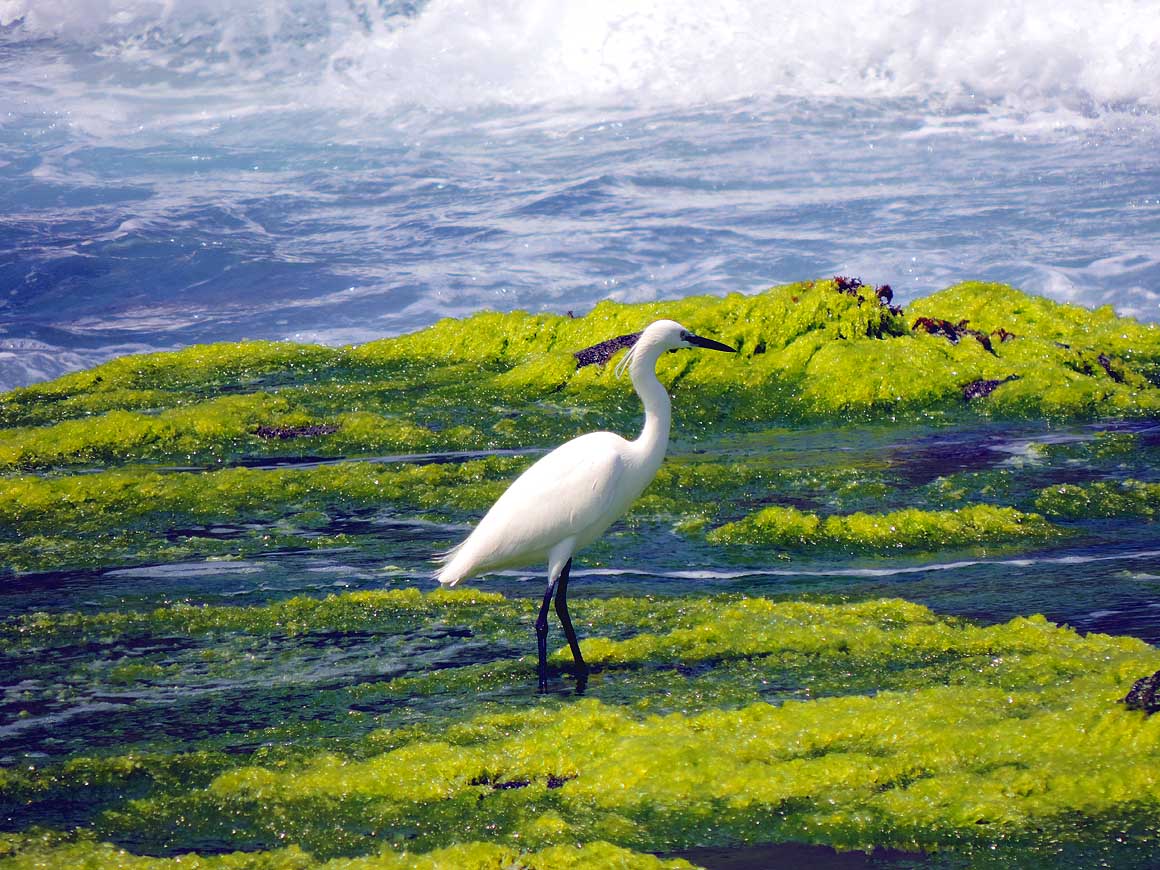
584
A wave is approaching. But the
- egret at the fishing harbor of “Ponta do
- Sol” doesn’t interrupt its search for food
|
-
|
-
-
|
-
-
|
-
-

|
-
585
View over the coast from “Ponta
- do Sol”, where the road runs to the capital
- Ribeira Grande that is 2˝ miles away
|
-
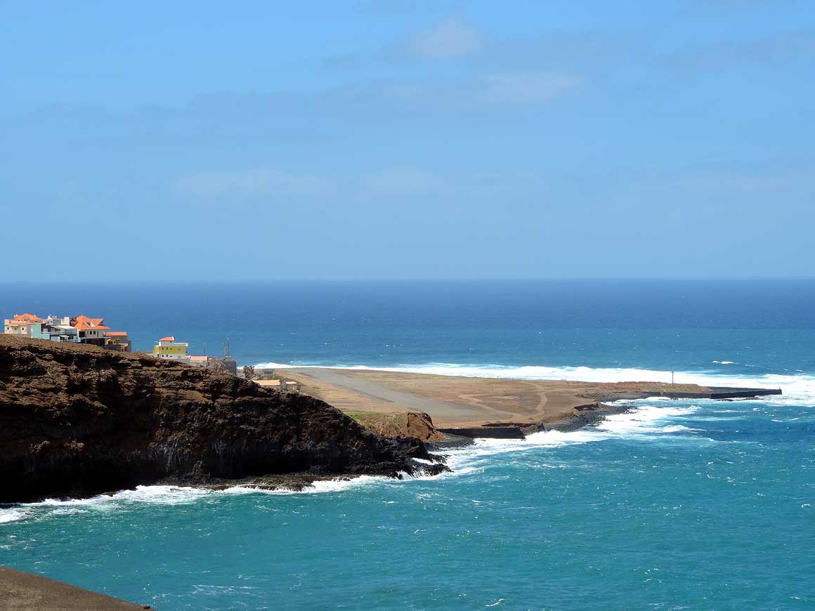
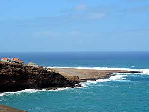
586
Airstrip in “Ponta do Sol”.
- Like at “Fajă d’Água” on the island
- of Brava also
this airport is closed
- due to heavy crosswinds and
- a too short runway (1’476 ft.)
|
-
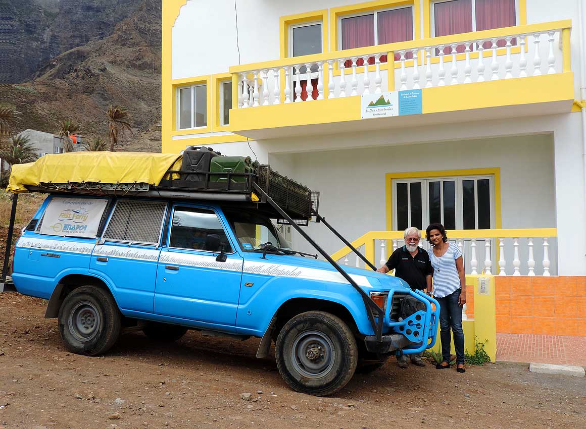
587
A rememberance picture with
- Alcinda, manager of the guesthouse
- “Trilha e Montanhas”
in “Ponta do Sol”.
- We stayed there two weeks and
- can fully recommend it
|
-
|
-
-
|
-
-
|
-
-

|
-
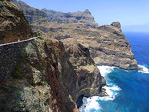
588
From “Ponta do Sol” there is a
- popular walking trail along the cliff coast
- via Fontainhas and Corvo to “Cruzinha
- da Garça” (5-6 hours) …..
|
-
589
….. the narrow cobble stone
- track to Fontainhas is still driveable
- for about 3 miles, running
- along vertical cliffs …..
|
-
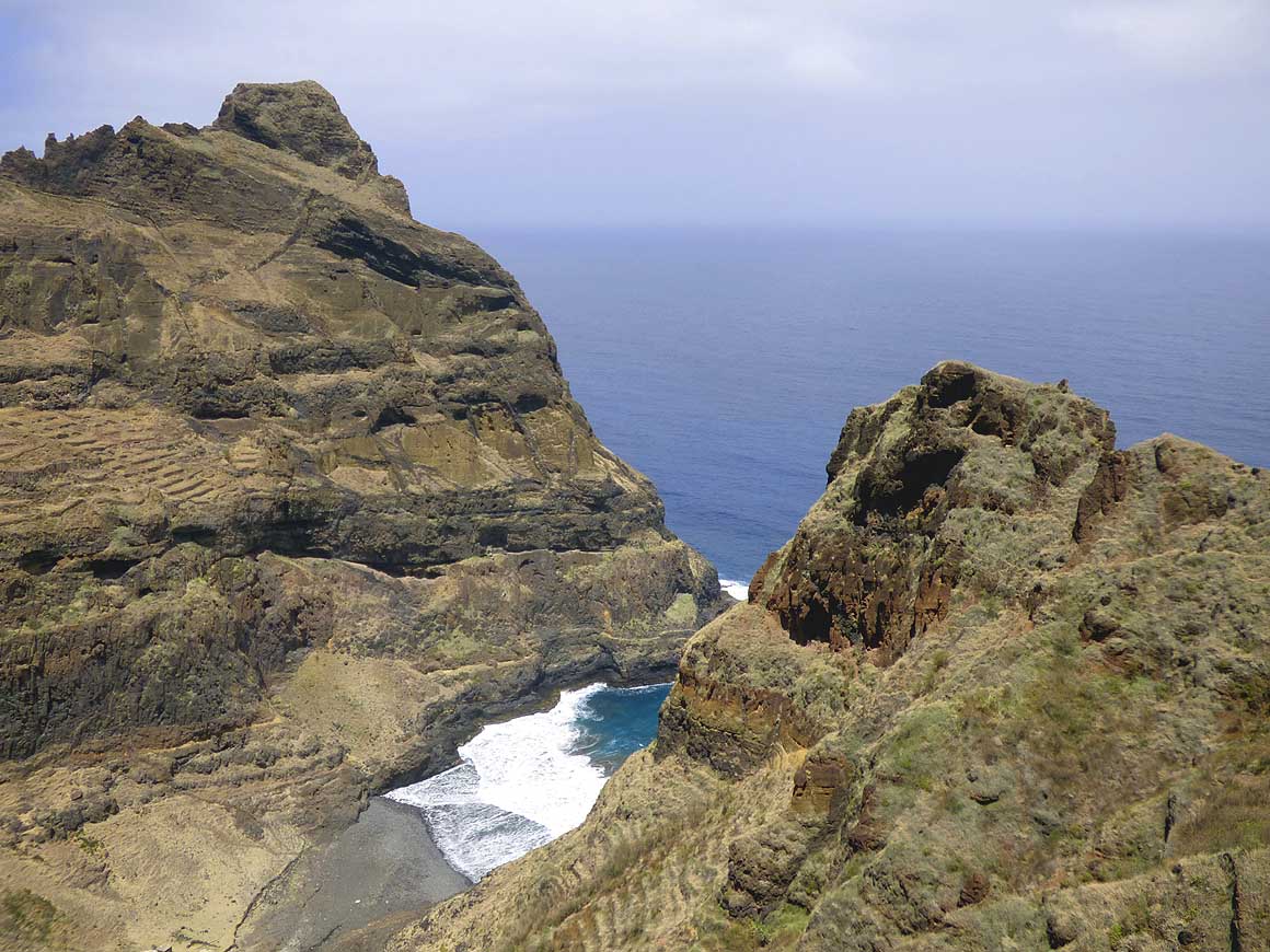
590
….. and reveals views
- to little hidden bays
|
-
|
-
-
-
-
 -
|
-
-
|
-
-
-
-
|
-
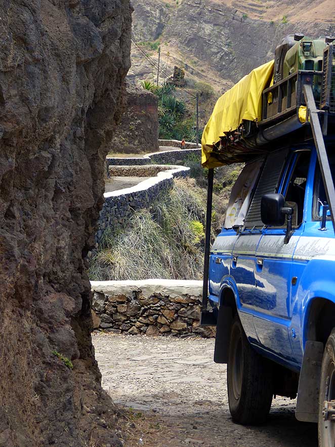
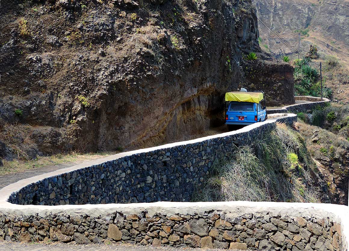
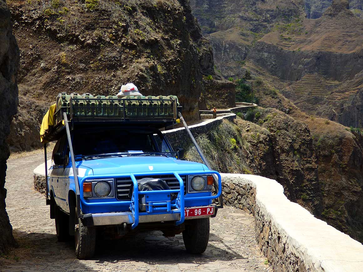
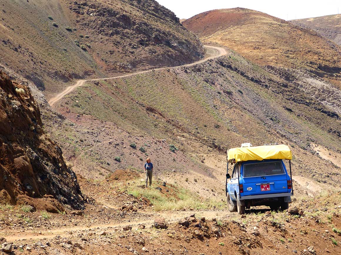
591
Our LandCruiser is on an
- adventure trip along the gigantic walls
- of rock to the village of Fontainhas, on
- the way to ”Cruzinha da Garça” …..
|
-
592
….. here Emil manoeuvres
- around the next tight bend …..
|
-
593
….. it gets critical. Luckily
- Emil knows accurate to an inch
- how wide our LandCruiser is
|
-
|
-
-
-
-
 -
|
-
-
|
-
-
-
-

|
-
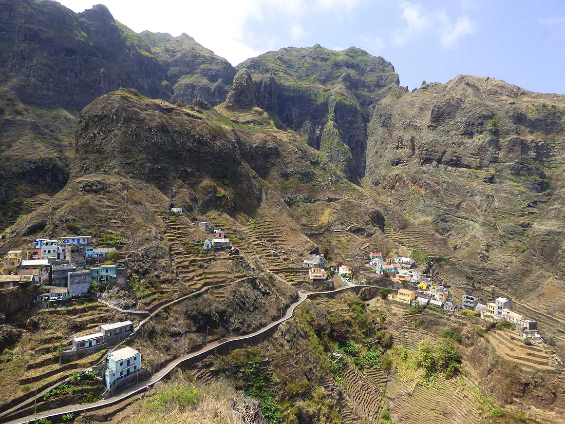
594
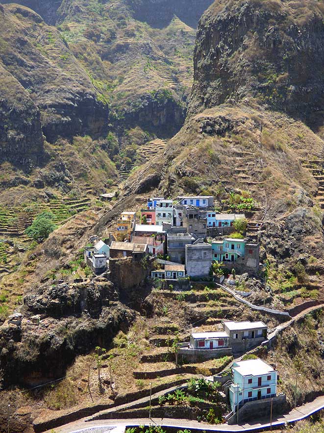
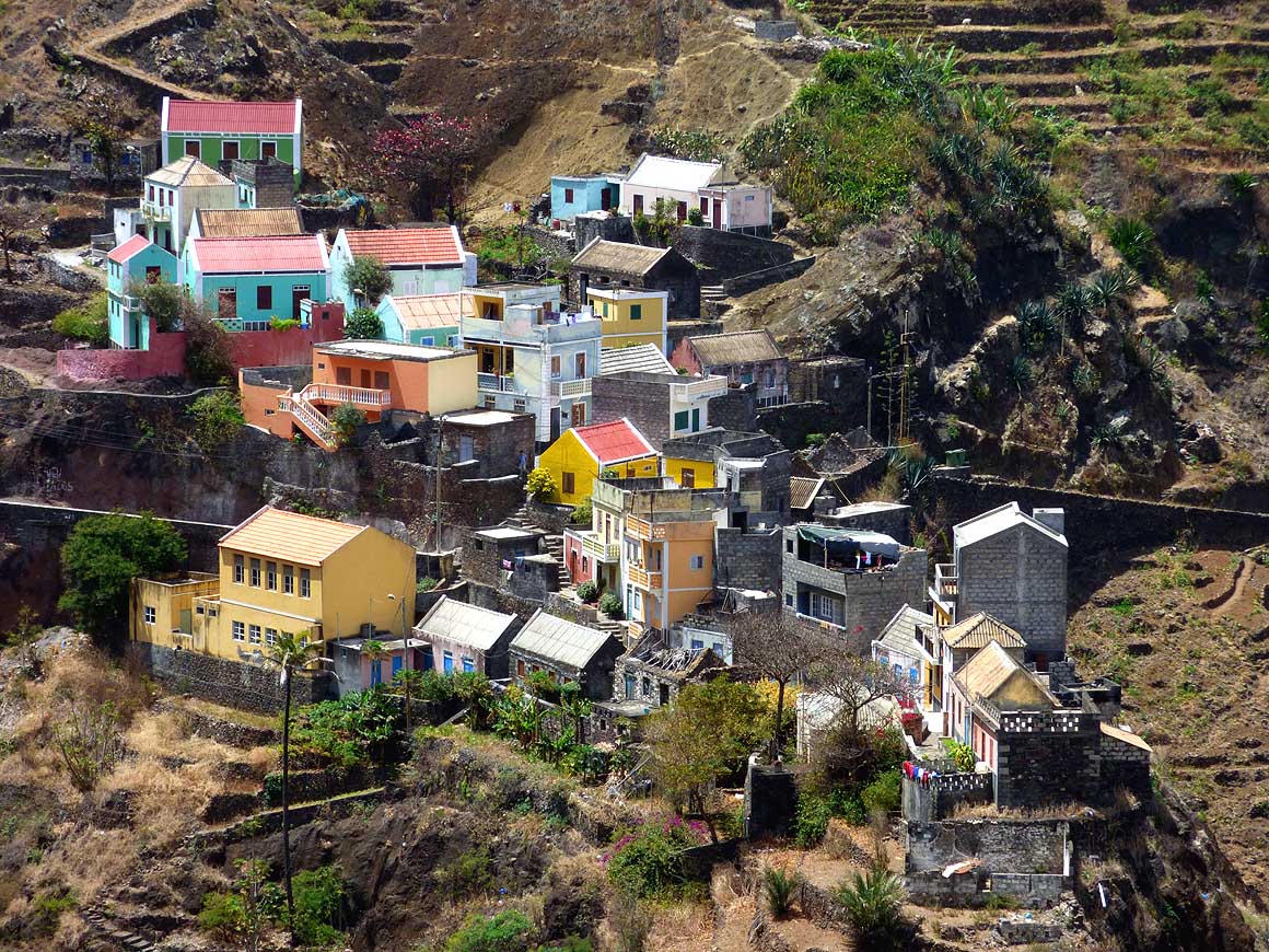
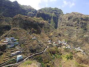
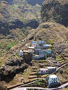
Fontainhas, the most picturesque
- village of Santo Antăo, unrolls in front
- of a grandiose mountain backdrop
|
-
595
….. the houses of the village
- cling to the steep terraced
- mountain slope …..
|
-
596
….. the warm pastel colors
- of the center add to its special look
|
-
|
-
-
-
-
 -
|
-
-
|
-
-
-
-
|
-
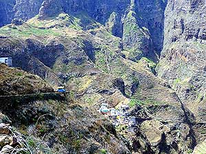
597
Our LandCruiser reached its
- destination! From the last curve we enjoy
- the beautiful view down to Fontainhas
|
-
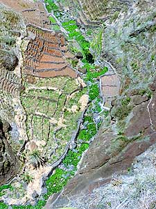
598
Where there is water there is
- life: A green ribbon of cultivated
- fields at Fontainhas
|
-
599
A perfect work of art:
- Terraced fields at Fontainhas
|
-
|
-
-
-
-
 -
|
-
-
|
-
-
-
-

|
-
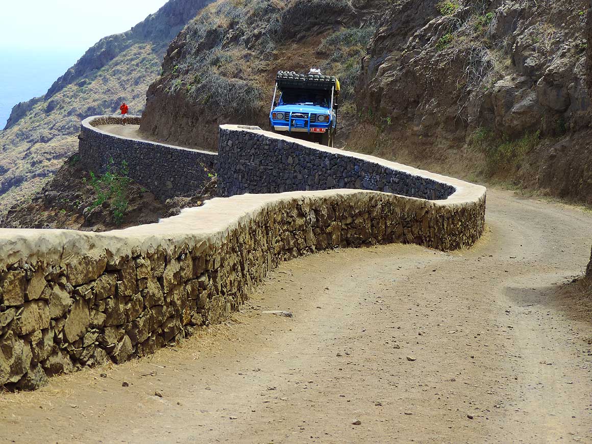
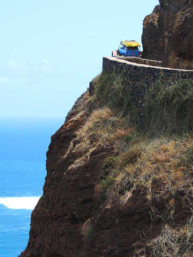
600
On our return from Fontainhas
- to “Ponta do Sol” driving skill is
- necessary once more …..
|
-
601
….. “straight ahead is
- only sky and the sea”
|
-
602
The road was in its days
- a technical masterpiece
|
-
|
-
-
|
-
-
|
-
-

|
-
603
The recent technical marvel of the
- coastal road at “Vila das Pombas”.
- Since summer 2009 it connects the fertile
- northeastern part with the desertlike south
- and therewith by ferry also Săo
Vicente
|
-
604
A few houses, a balancing
- rock at the seashore – that’s
- “Ponta da Ribeira das Pombas”
- about two miles southeast from Paúl
|
-
605
Liliana glances at “Ponta
- da Ribeira das Pombas”into the
- narrow, same-named valley
|
-
|
-
-
|
-
-
|
-
-
|
-
606
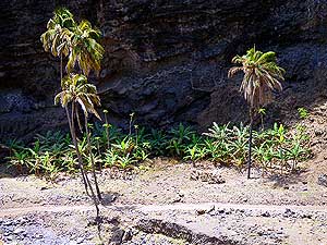
Below an overhanging rock at
- “Ponta da Ribeira das Pombas” plants
- took roots in this arid land
|
-
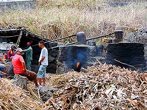
607
One of the many island distilleries
- works also at the coastel road between
- “Ponta da Ribeira das Pombas” where
- it was possible to plant a patch
- of sugar cane
|
-
608
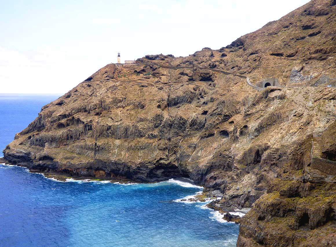
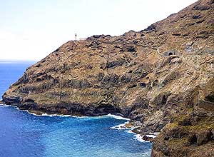
The lighthouse “Farol Fontes Perreira
- de Melo” marks the most westerly point of
- the island. Shortly before is the only tunnel,
- the“Tunnel do Farol”. It reduced the travel
- time from Ribeira Grande to Porto Novo
- from nearly four hours to about one hour
|
-
|
-
-
|
-
-
|
-
-
|
-
609
A white blanket of clouds is
- overlapping the mountain range from the
- northeast, as we roll along the coast
- towards Porto Novo – analog the
- “table-cloth” cloud on the Table
- Mountain of Cape Town/South Africa
|
-
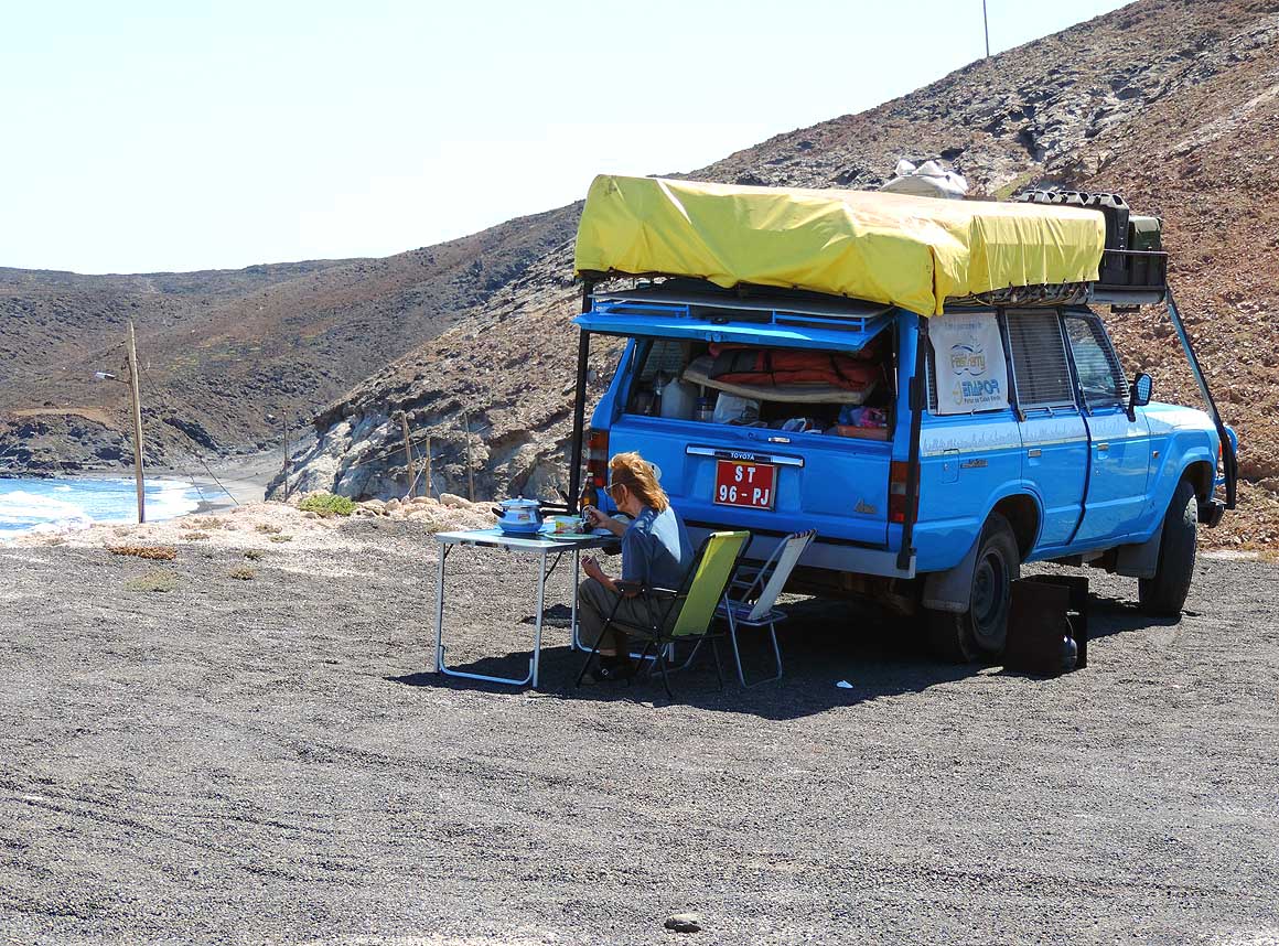
610
Lunchtime at the “Praia dos
- Curraletes” beach east of the
- port town Porto Novo
|
-
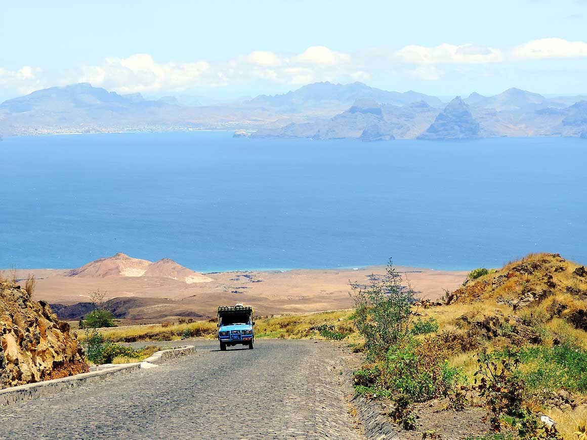
611
View above the village of
- Lagedos, about 9 miles west of
- Porto Novo: A bleak rugged land-
- scape expands to the “Săo Vicente
- Channel”. In the background
- raises the island the same name
|
-
|
-
-
|
-
-
|
-
-
|
-
612
Antonia and her daughter Myriam
- are pounding maiz. They rent basic rooms
- in their rural house “Babilonia” in Lagedos,
- along the road from Porto Novo to the
- “Ribeira das Patas” valley …..
|
-
613
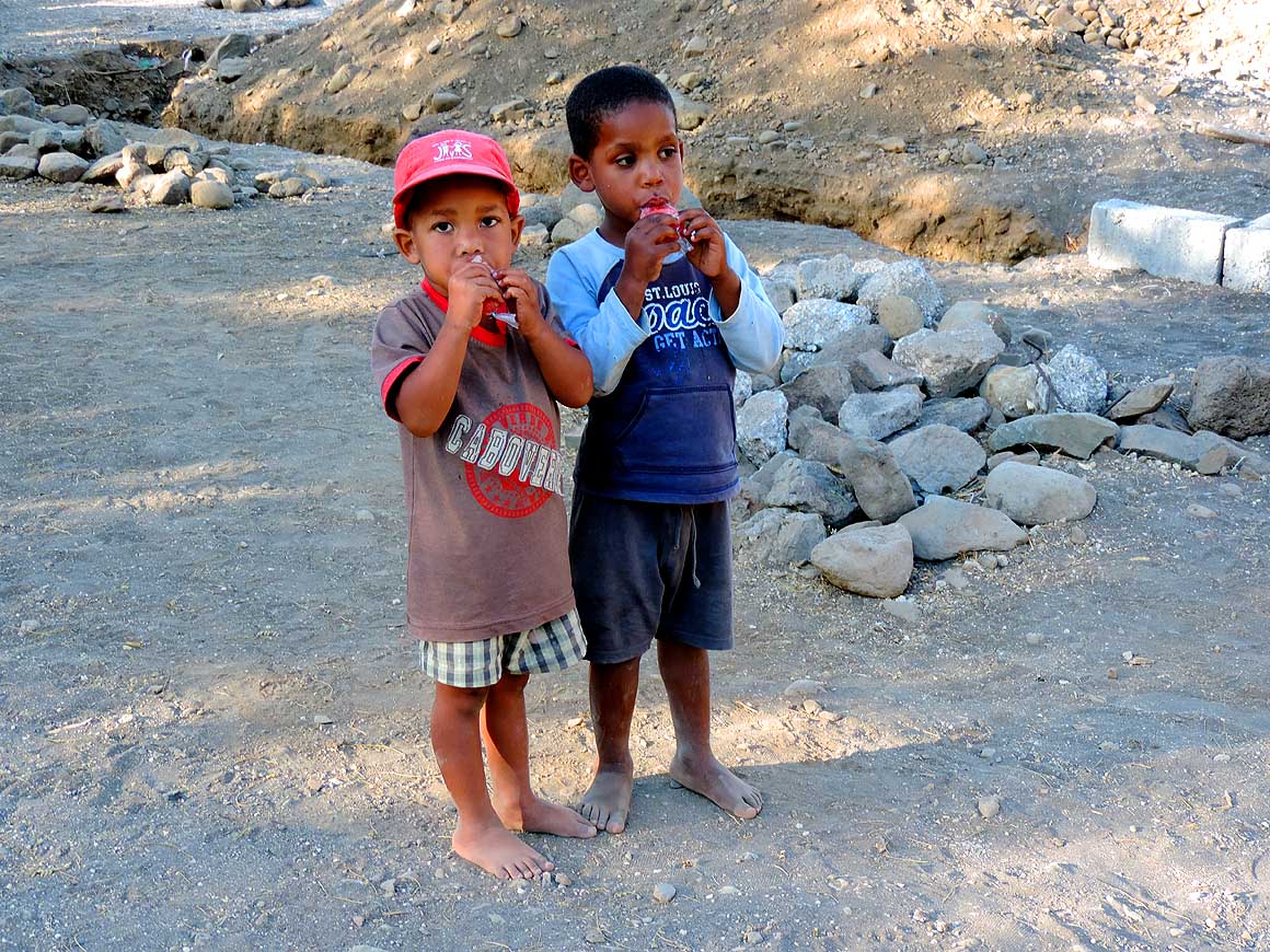
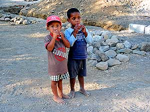
….. two little boys from the
- neighborhood are watching while
- sucking happily their icecream …..
|
-
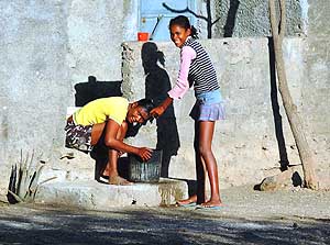
614
….. in front of the neighbor’s
- house a girl washes the hair of her sister
|
-
|
-
-
|
-
-
|
-
-

|
-
615
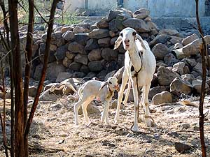
The curious goat with its off-
- spring belongs to “Babilonia’s” menagerie
- like the roosters and its chickens, doves,
- turkeys, dogs, cats, donkeys and pigs
|
-
616
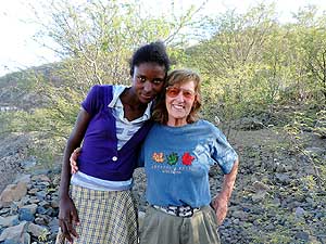
Liliana makes easily friends:
- Here with a girl of “Babilonia’s” village
|
-
617
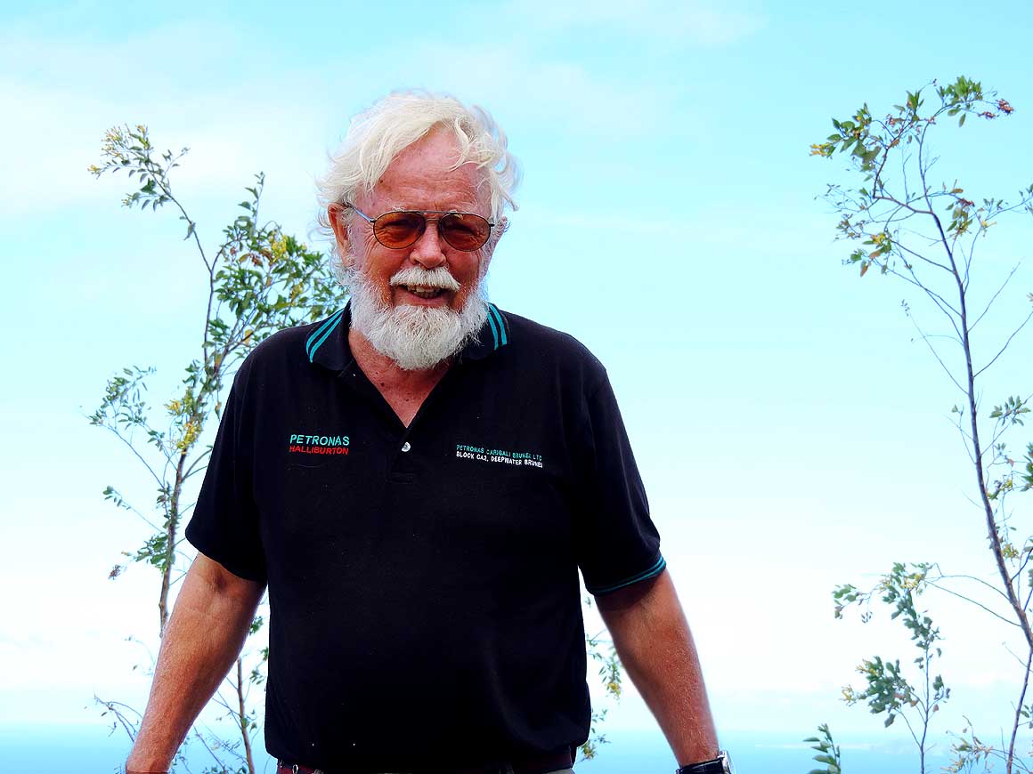
Emil is beaming also in contentment
- and enjoys the “rural” moment
|
-
|
-
-
-
-
 -
|
-
-
|
-
-
-
-
|
-
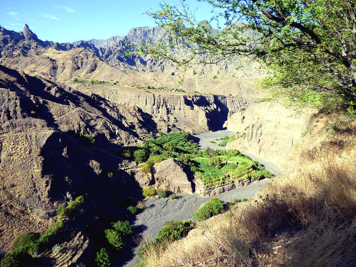
618
There are also dots of green at
- the dried up riverbed of the “Ribeira
- das Patas”
canyon, a bit south of
- “Chă de Morte“. Each
somewhat
- flat patch is used for cultivation
|
-
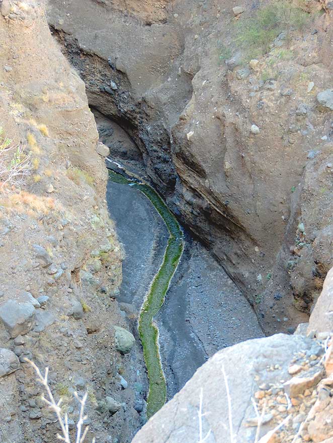
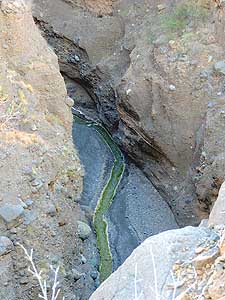
619
One of the deep ravines
- of the “Ribeira das Patas” river that
- form the topography of this wild
- mountainous region (near Lagedos)
|
-
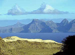
620
The Atlantic Ocean is never far
- away on this small island. Here the
- view from Lagedos to the south with
- the “Săo Vicente Channel”, behind it the
- mountains of the island of Săo Vicente
|
-
|
-
-
|
-
-
|
-
-
|
-
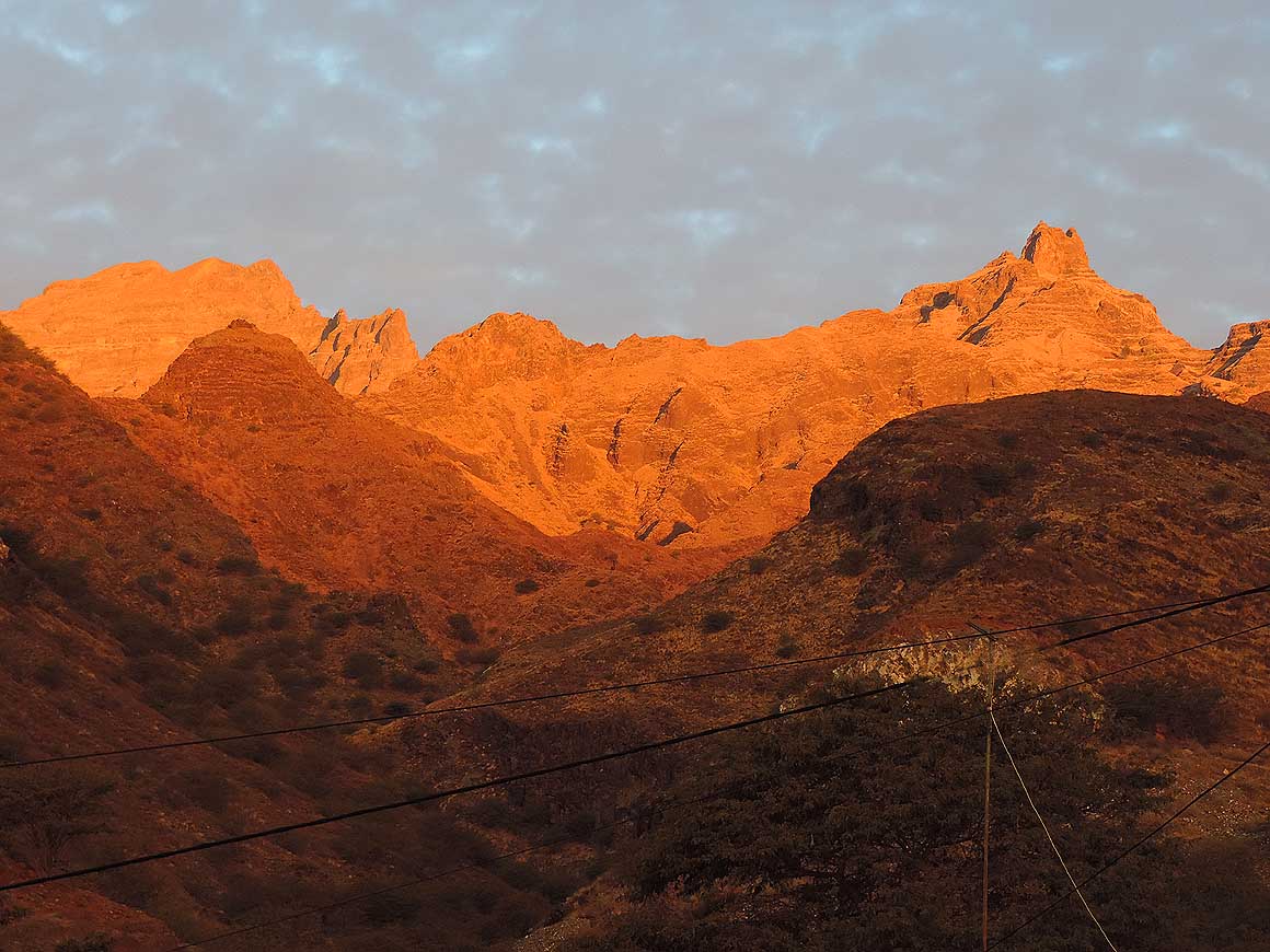
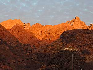
621
The rising sun puts the over 5’000 ft.
- high central mountain ridge (“Pé de Salto”,
- 5’230 ft.) wonderfully ablaze
|
-
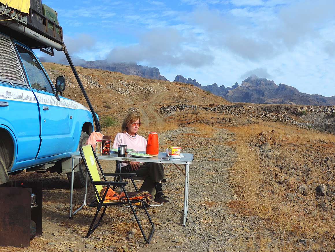
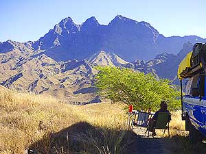
622
Breakfast with a beautiful
- mountain scenery between Lagedos
- and “Chă de Morte”
|
-
623
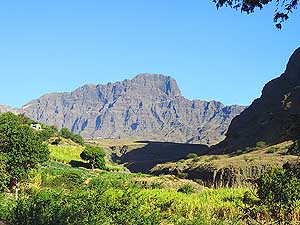
The vegetation of Santo Antăo
- is influenced by the almost up to 6’500 ft.
- tall mountain ranges, which stop the
- drifting tradewind clouds and ensure
- rain and humidity in the northeast
|
-
|
-
-
|
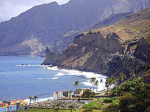
-
-
|
-
-
|
-
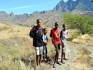
624
This is Africa: We do not know
- where these boys come from, but
- suddenly they are here. Contrary to
- the continent, on Cape Verde they
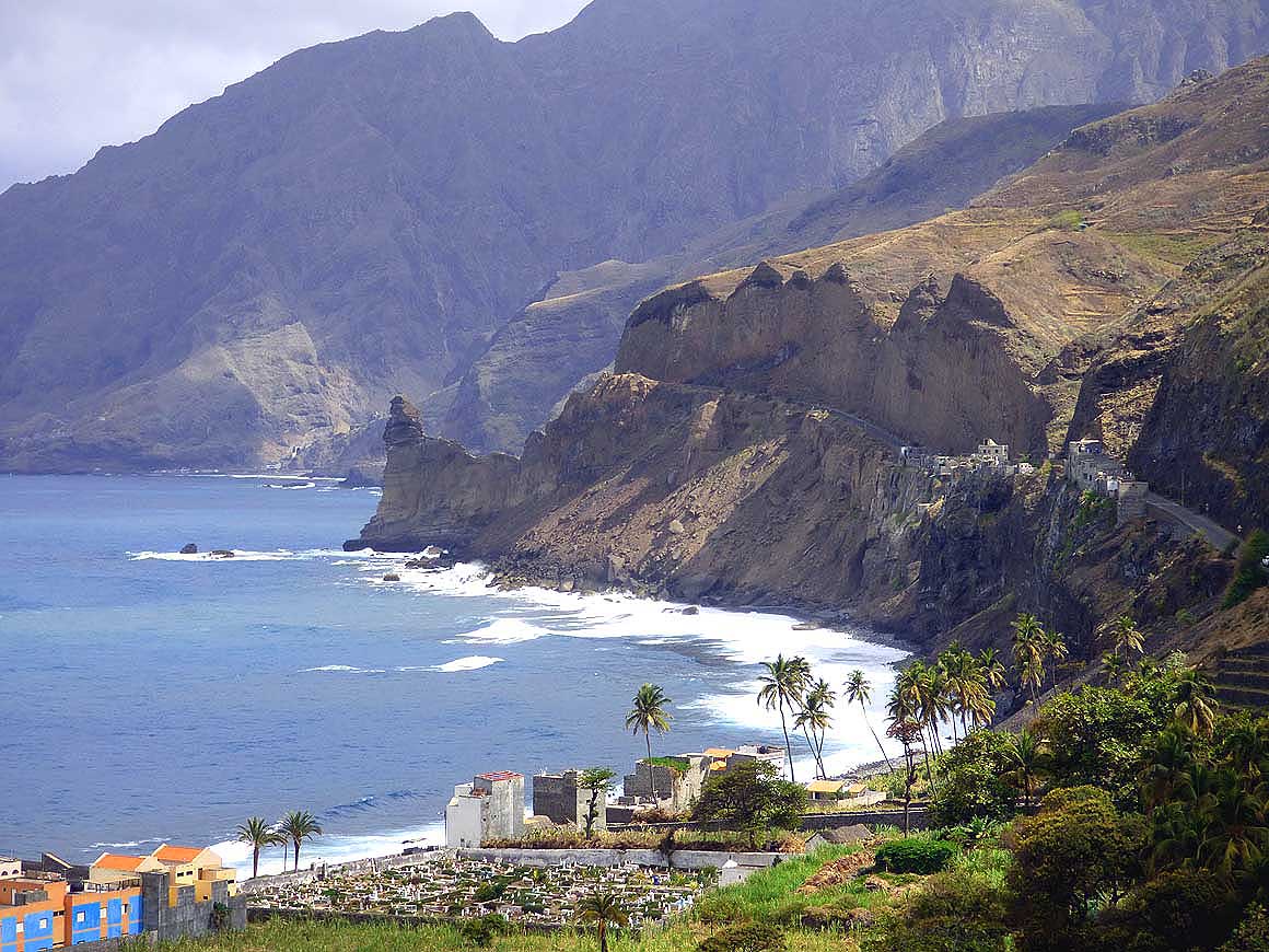
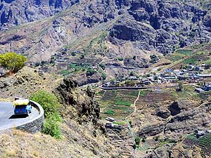
- are (still) very restrained and nice
|
-
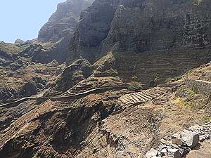
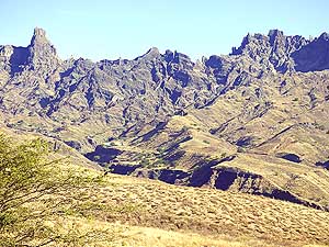
625
Between “Curral das Vacas”
- and “Selada de Alto Mira” a gigantic
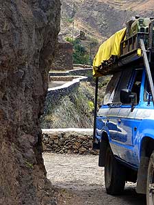
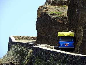
- mountain panorama unfolds
|
-
626
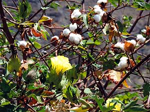
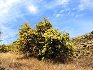
Yellow flowers and white fruitballs
- of the cotton bush (Gossypium) along
- the road to “Selada de Alto Mira”
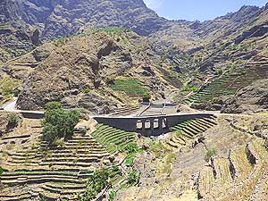
|
-
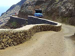
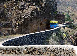
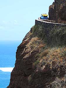
|
-
-

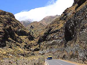
|
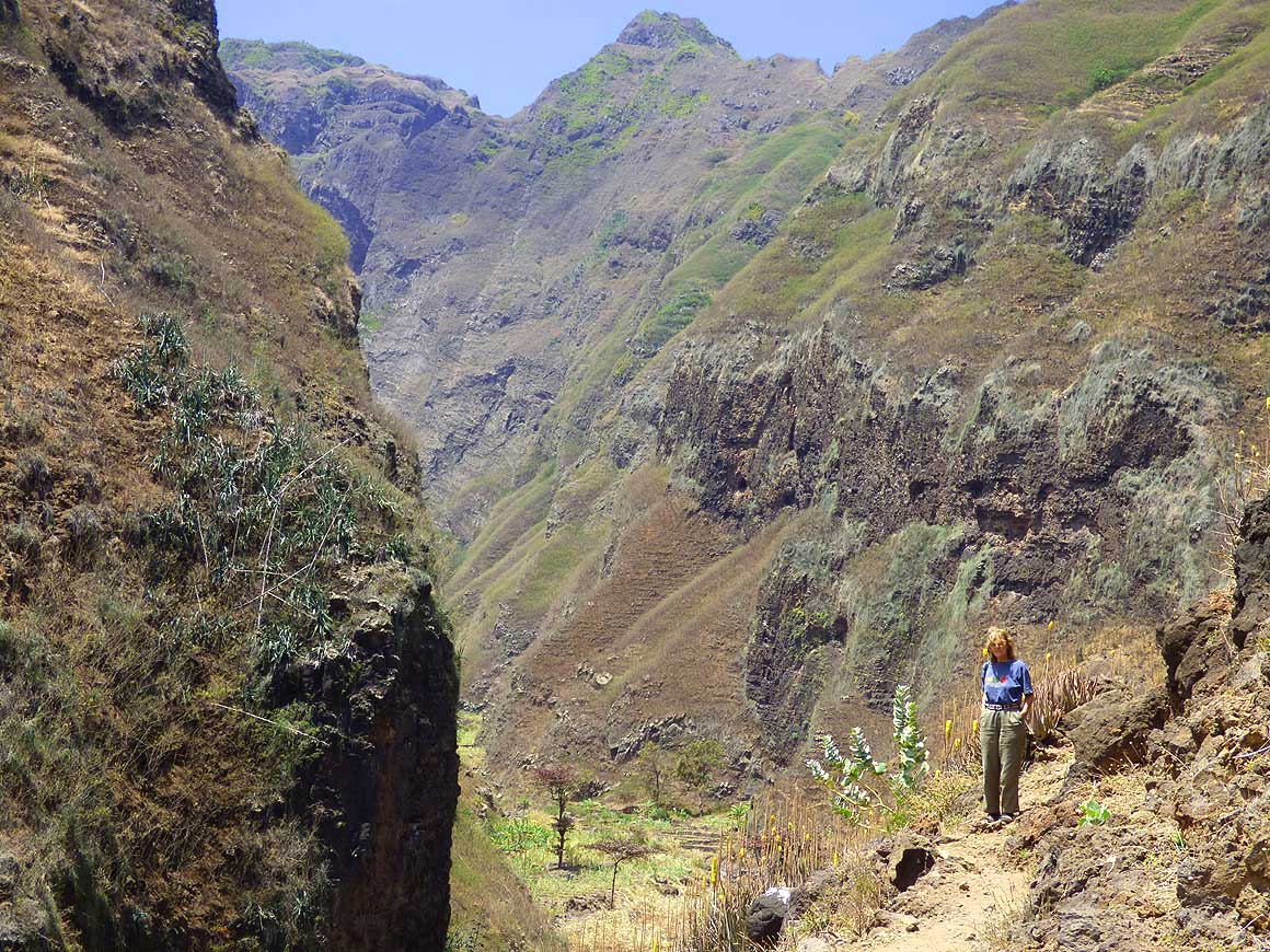
-
-
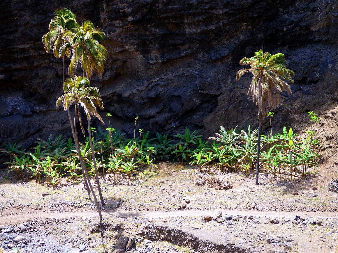
|
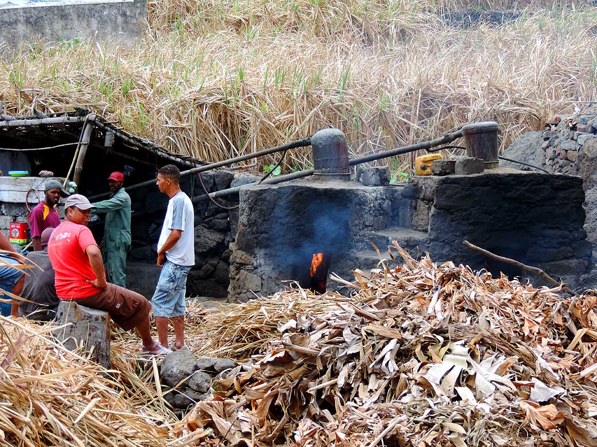
-
-
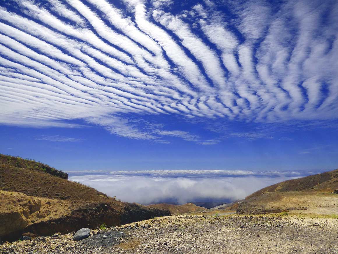
|
-
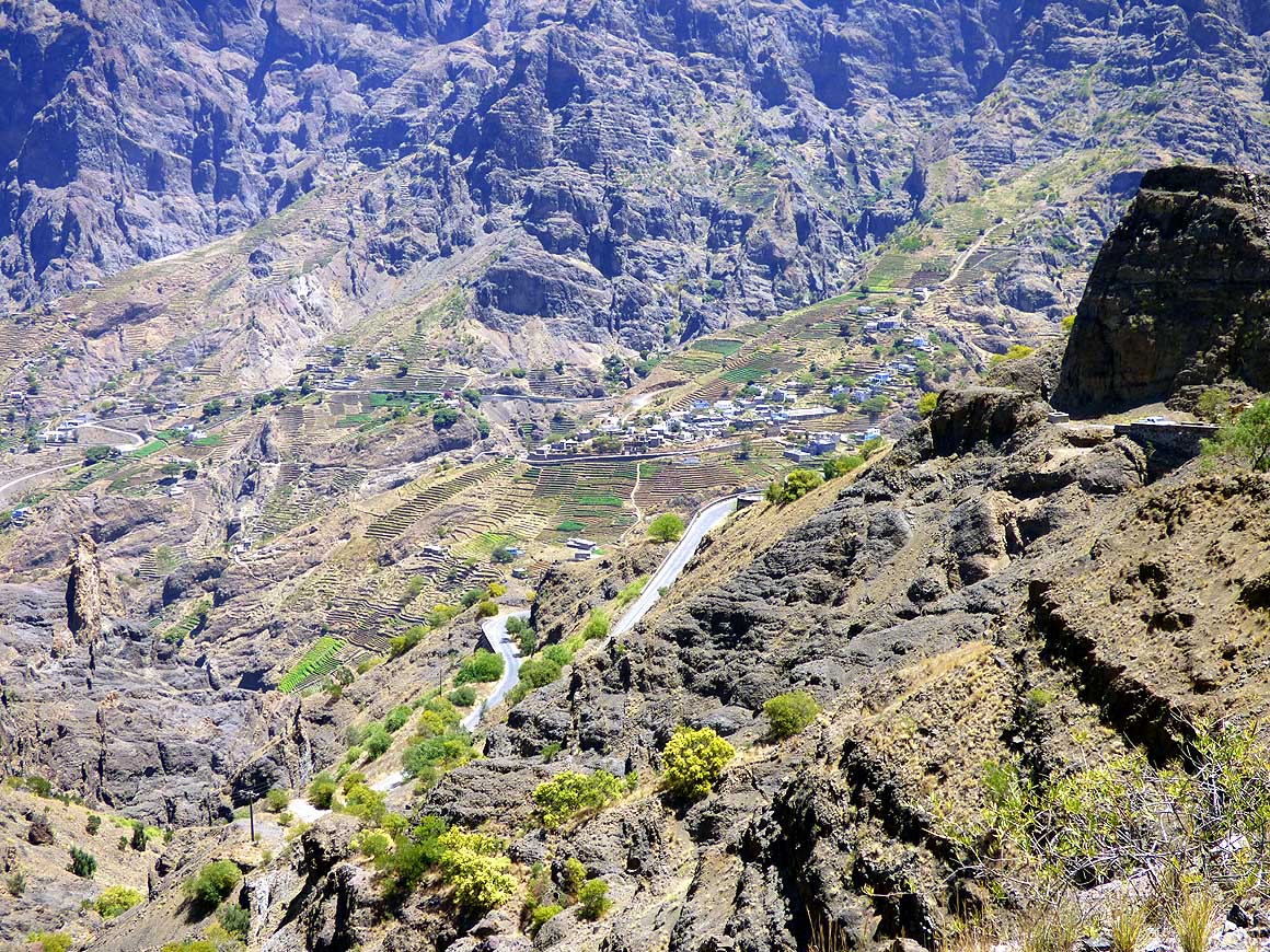
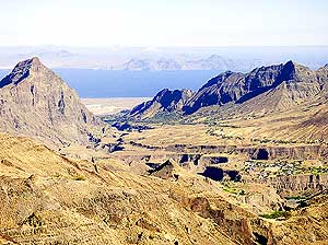
627
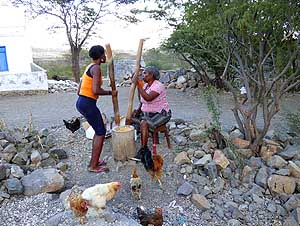
Another magnificent mountain
- scenario unfolds at the village of “Chă
- d’Orgueiro Alto Mira” (right) and
- “Chă Queimado Alto Mira” (left)
|
-
628
We descend on the cobble stone
- road in switchbacks from “Selada de
- Alto Mira” towards the village of
- “Chă d’Orgueiro Alto Mira” …..
|
-
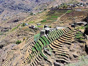
629
….. the lush green starlike
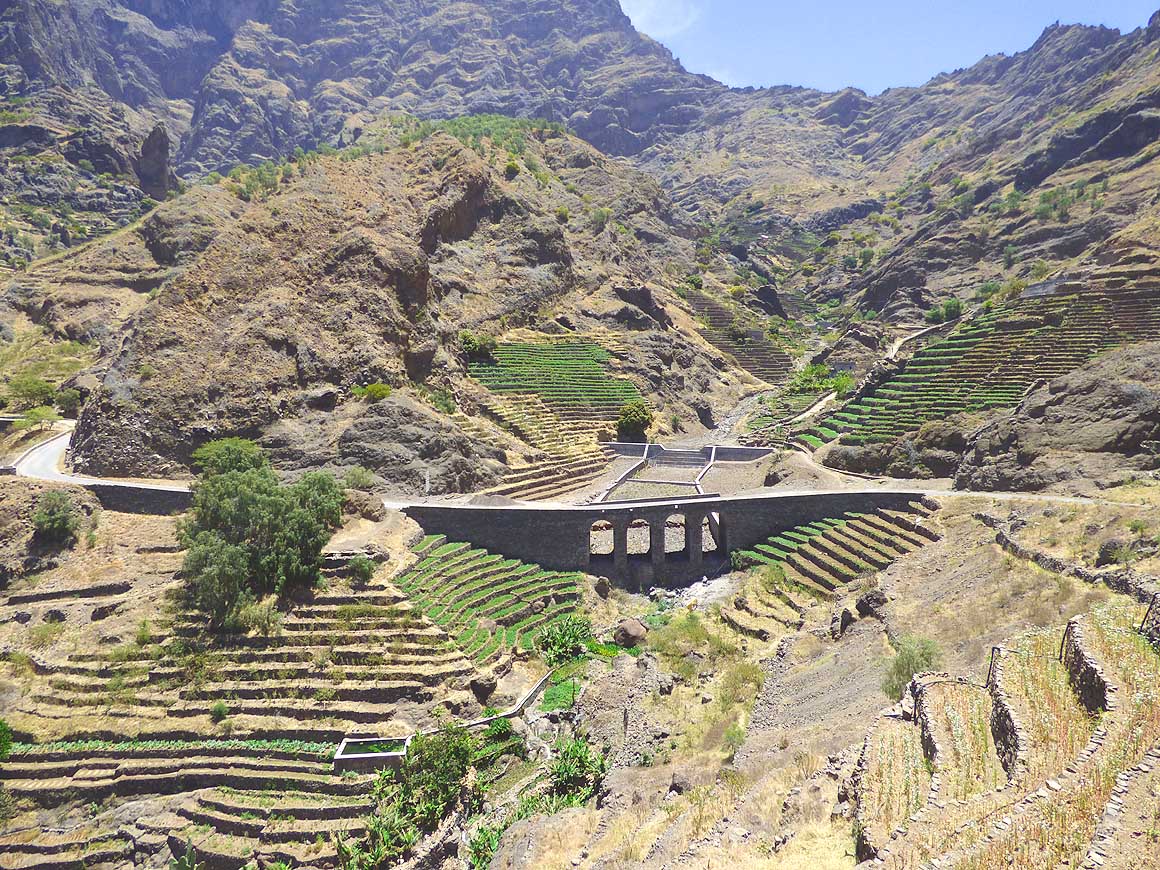
- arranged patterns of terraced fields
- in the “Alto Mira” valley are a striking
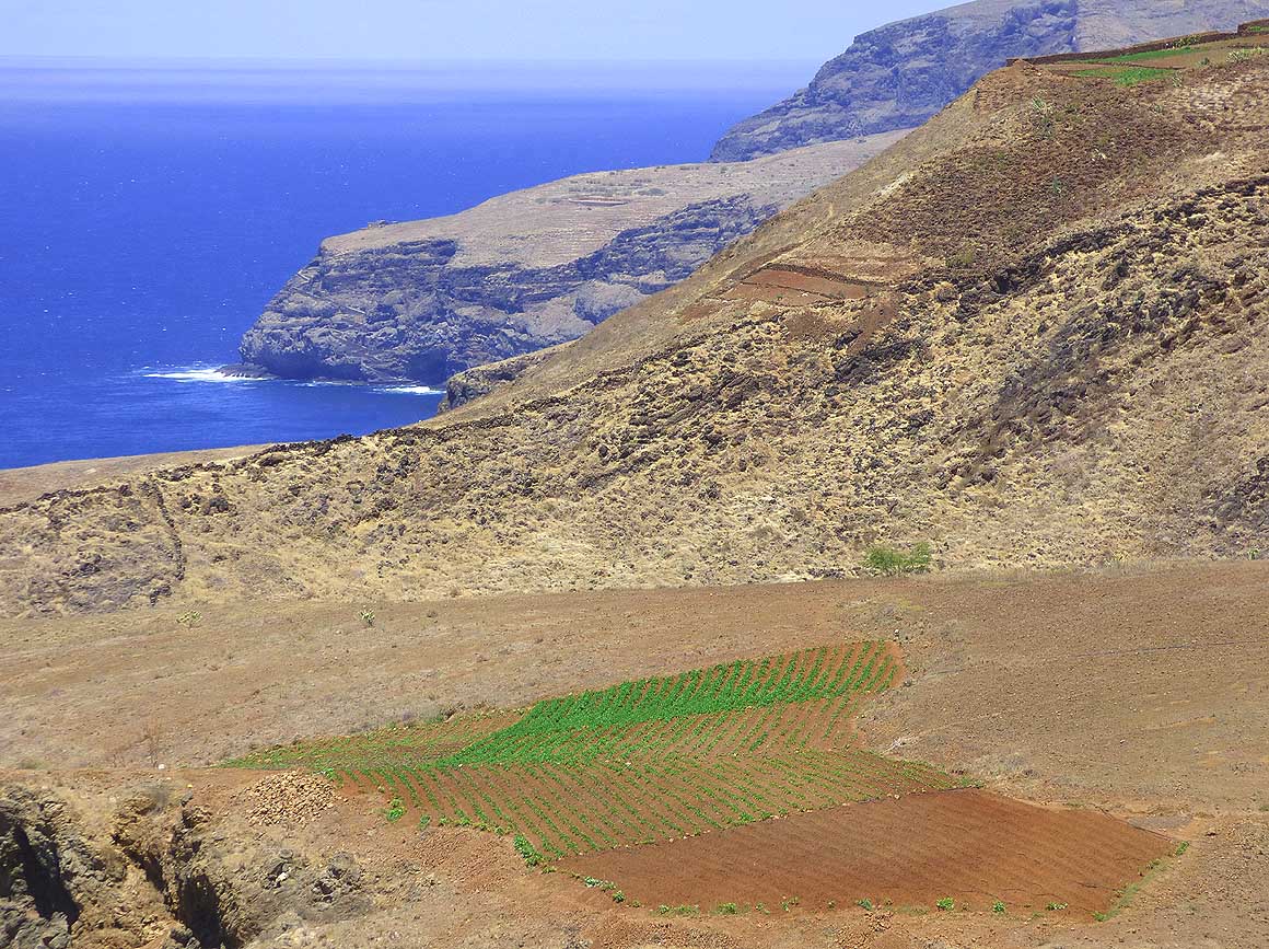
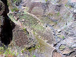
- contrast to the barren land
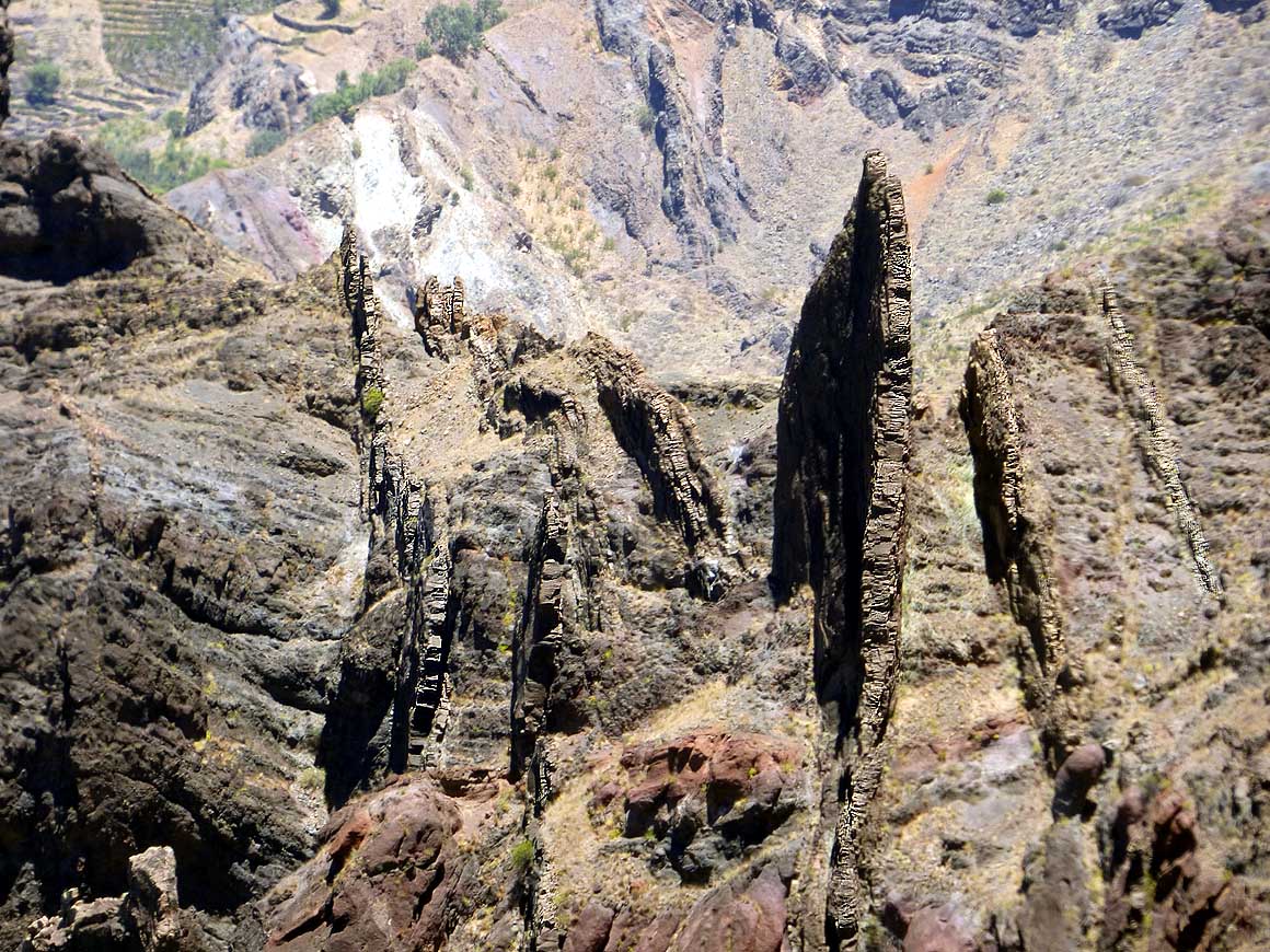
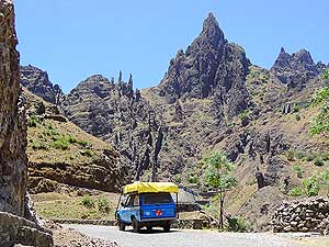
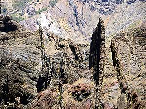
|
-
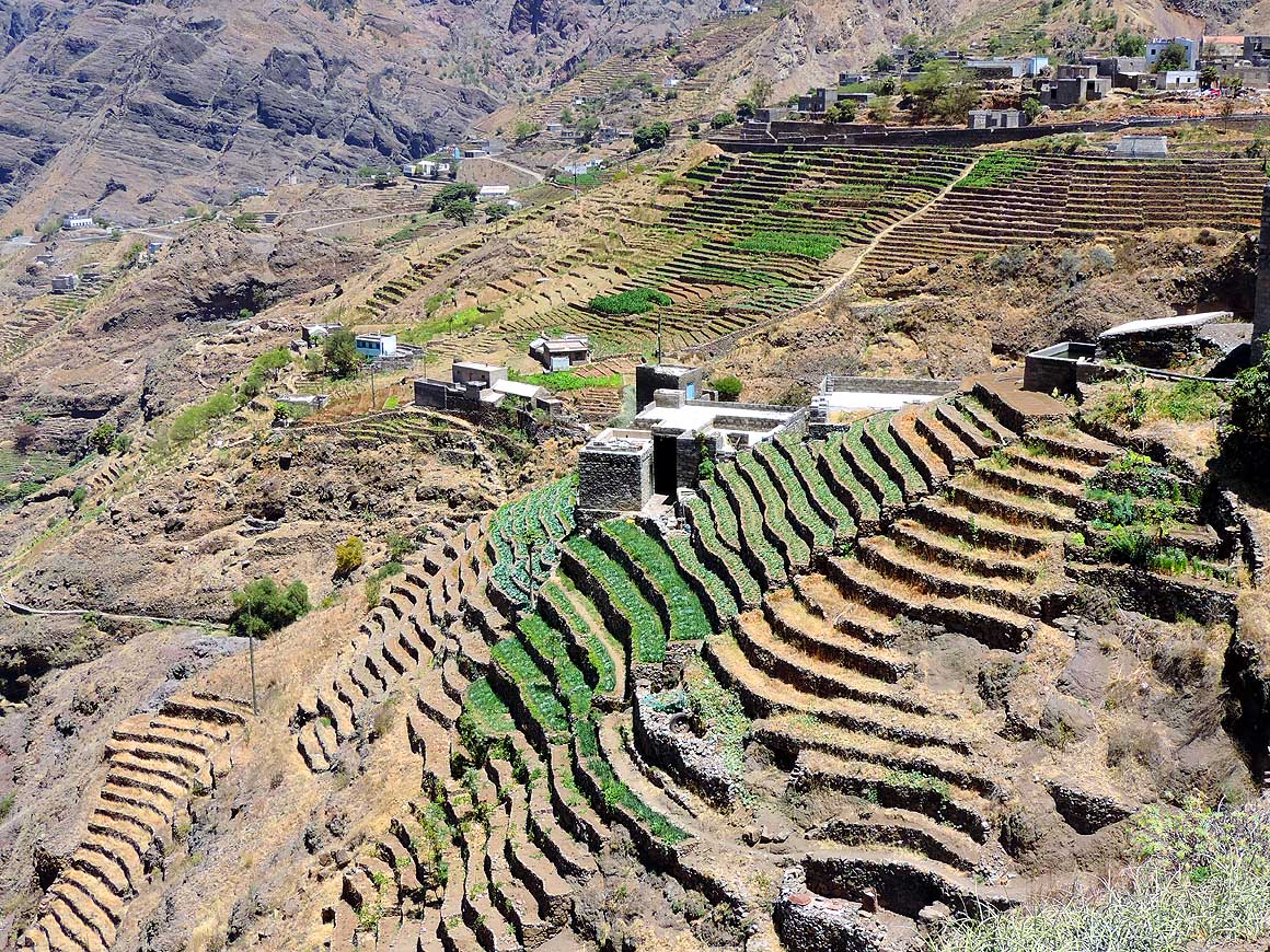
|
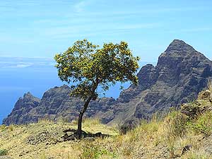
-
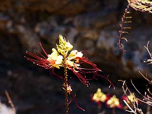
-
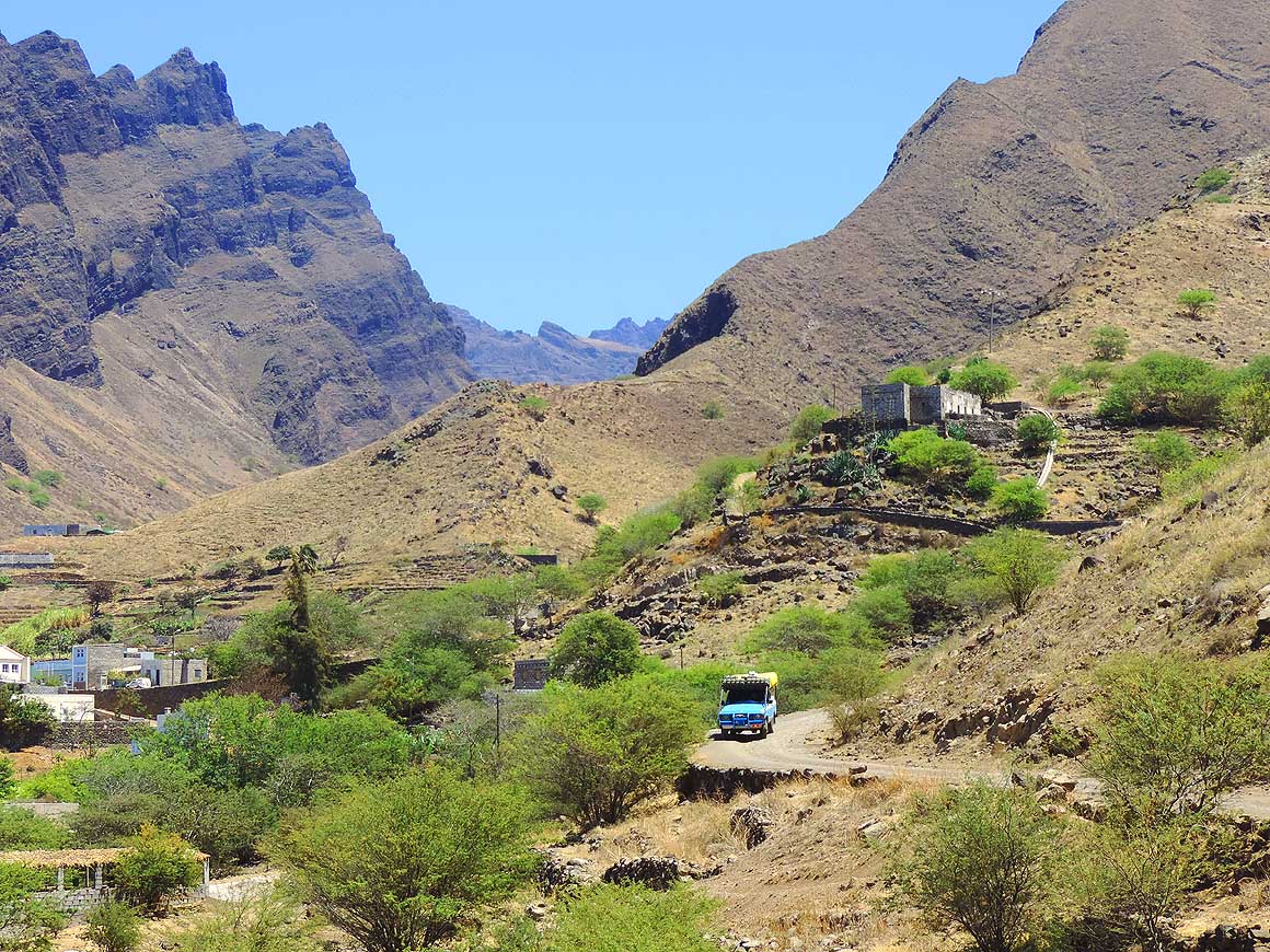
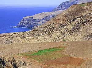
|
-
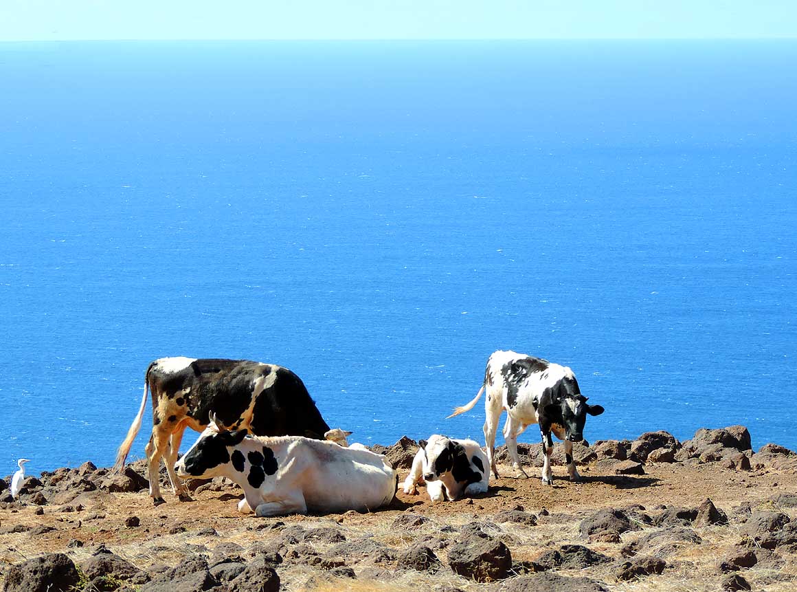
-
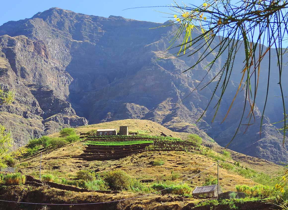
|
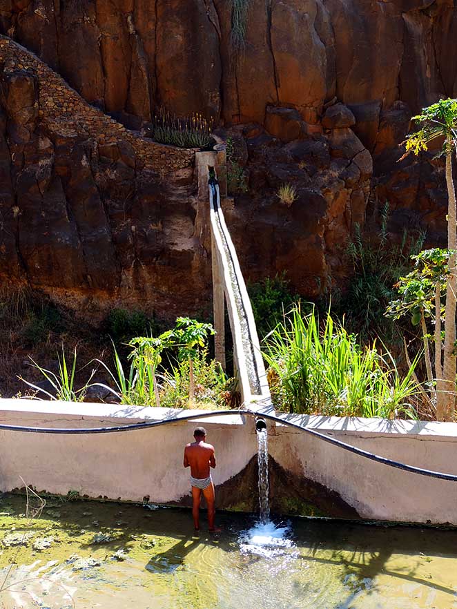
-
-
|
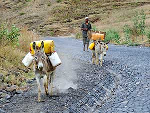
-
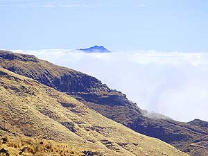
630
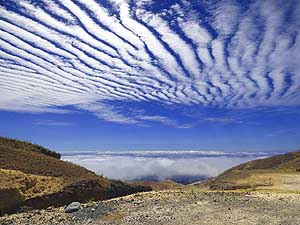
In the southern part of the
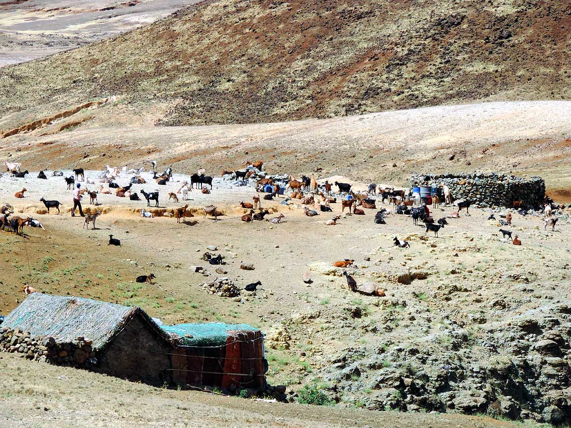
- “Alto Mira” valley rock needles raise
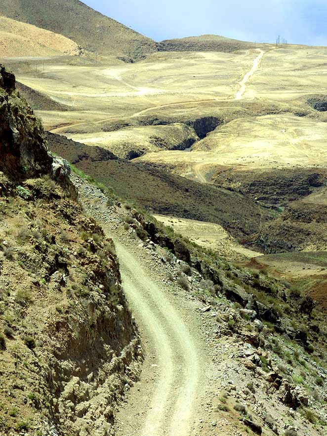
- like vertical fingers into the air
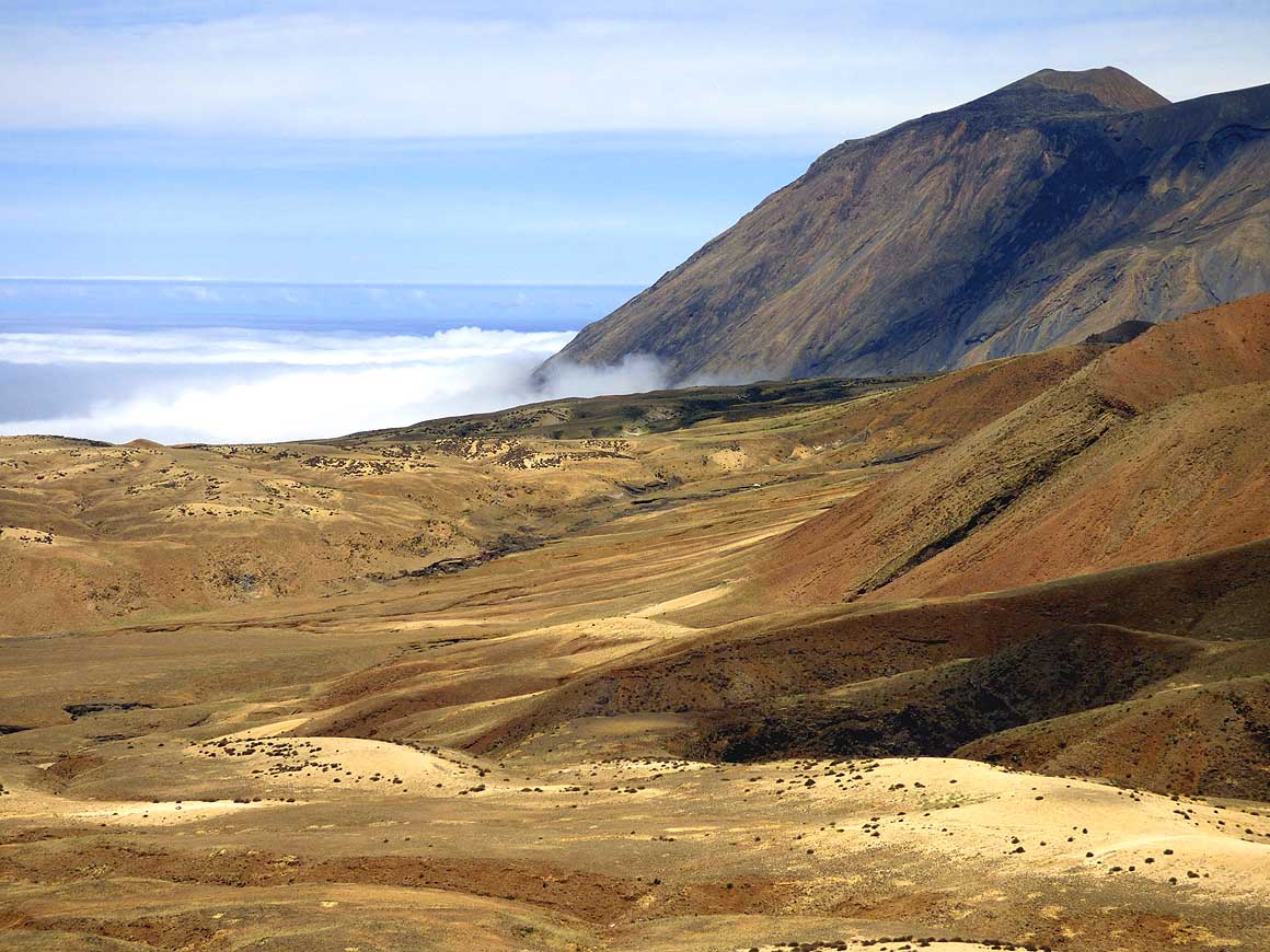
|
-
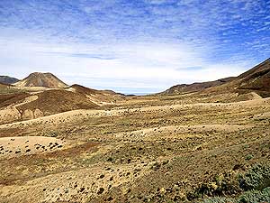
631
Erosions in the “Alto Mira” valley
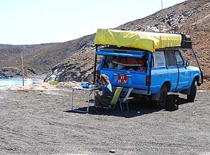
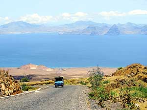
- formed peculiar formations like disks,
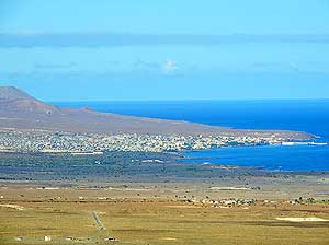
- wheels and staircases
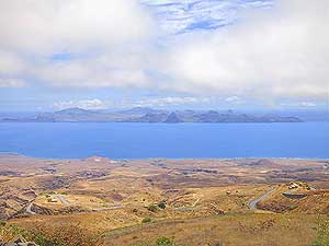
|
-
632
The main feature of the “Alto
- Mira” valley is the plowed terraced
- fields along the steep slopes
|
-
|
-
-
|
-
-
|
-
-

|
-
633
A blooming yellow mimosa tree
- (Mimosa pudica) is a lovely contrast
- to the dark mountain range near
- “Selada de Alto Mira”
|
-
634
In such a barren land
the delicate "bird
- of paradise bush" (Caesalpinia gilliesii)
- sticks out particularly because it's an orna-
- mental plant native to tropical America
|
-
635
From “Selada de Alto Mira”
- the road winds through the “Alto Mira”
- valley down to “Ribeira da Cruz”,
- situated close by the sea
|
-
|
-
-
|
-
-
|
-
-
|
-
636
The rocky shore on the northwest
- coast near “Ribeira da Cruz”
|
-
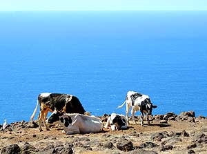
637
“We have little to munch,
- but a wonderful sea view and a
- cooling breeze” - Cattle along
- the cost near “Ribeira da Cruz”
|
-
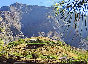
638
A house at “Jorge Luis” tucked
- away with its own cultivated terraces
- and a dramatic mountain background
|
-
|
-
-

|
-
-
-
-
|
-
-
-
-
|
-
639
A ‘falaj’ – an ancient water
- channel irrigation system – serves the
- villagers sometimes also as shower
- (we knew it from Oman and
- the United Arab Emirates)
|
-
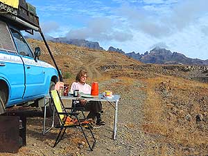
640
Peaceful breakfast with mountain
- and sea view west of “Ponte Sul”
- (south of Lagedos)
|
-
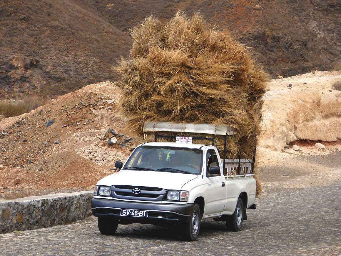
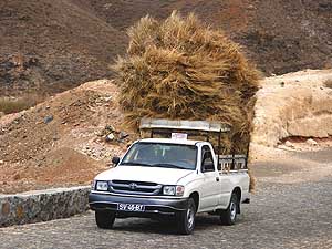
641
Just high, but not overloaded: Back
- from the farmland with a load of hay
|
-
|
-
-
|
-
-
|
-
-
|
-
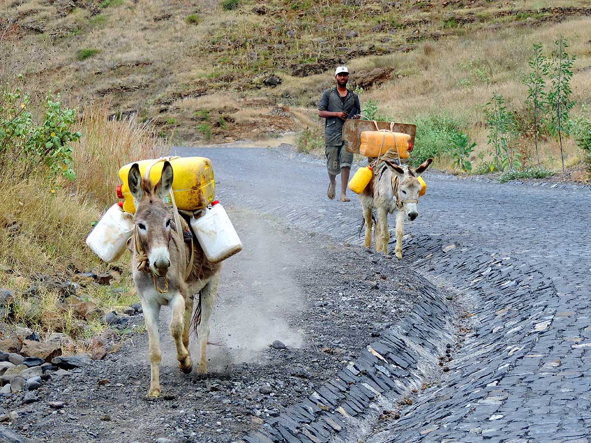
642
The long way to the next water
- supply is part of the daily routine of
- the rural population. Donkeys are
- indispensable carriers
|
-
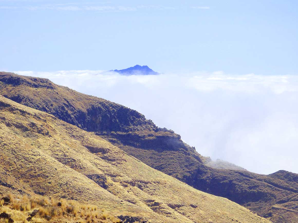
643
On an altitude of about 4’600 to
- 5’000 ft. towards the northwestern
- ‘Norte’ region the fog clears up and in
- the distance a mountain peak from the
- island of Săo Vicente becomes
visible …..
|
-
644
….. unusual and interesting cloud
- formations browse past our heads
|
-
|
-
-
-
-
 -
|
-
-

|
-
-
-
-

|
-
645
Herdsmen of goats have put up
- camp at the end of the new cobble
- stone road at the junction to
- “Tarrafal de Monte Trigo”
|
-
646
The narrow gravel road leads
- to “Tarrafal de Monte Trigo”
- on the west coast
|
-
647
Fog raises from the west coast
- and reaches the 6’493 ft. tall volcano
- “Tope da Coroa”, the highest mountain
- on Santo Antăo, on the way to ‘Norte’
|
-
|
-
-

|
-
-
|
-
-
|
-
648
Liliana is in her element when she
- is able to explore the area: Here in
- ‘Norte’ on the way to Bolona
|
-
649
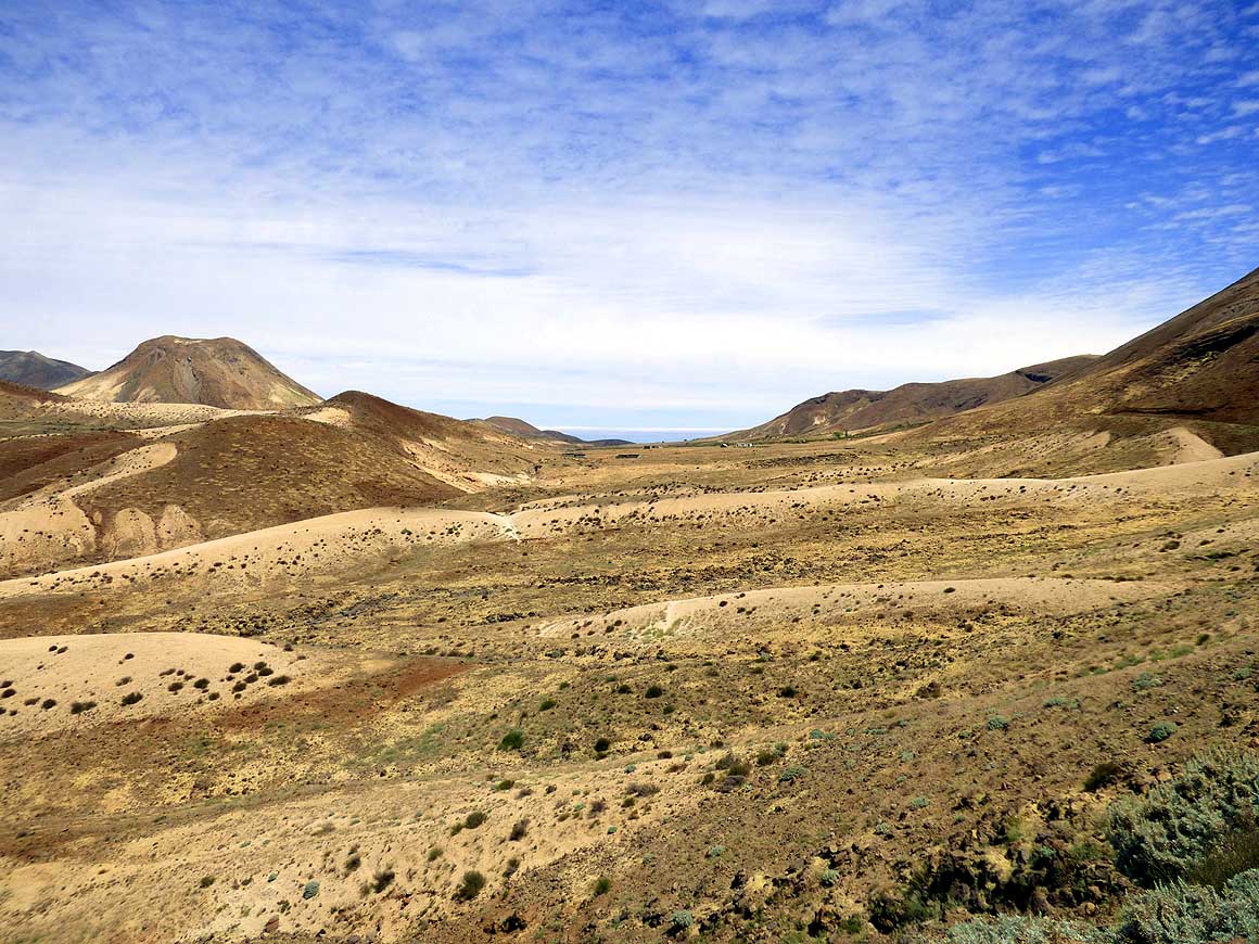
The barren ‘moonscape’ near Bolona
- on the ‘Norte’ plateau captivates with its
- warm shades of beige, brown and white
|
-
650
Mimosas (Mimosa pudica) are in
- full bloom: A lovely bush in the brown grass
- under a blue sky during our decent to the sea
|
-
|
-
-
|
-
-
|
-
-
|
-
651
Our LandCruiser on one of its
- last trips on Santo Antăo. West of
- ”Ponte Sul” the cobble stone
- road climbs steadily uphill
|
-
652
View from the west to the port
- city of Porto Novo, where we arrived
- on March 20th, and from where we
- return on April 10th, 2014 to the
- island of Săo Vicente
|
-
653
View over the “Săo Vicente Channel”
- to the neighbor island of Săo Vicente. To
- the left is the bay of Mindelo, from where
- on April 30th, 2014 our LandCruiser
- leaves the 180th country Cape Verde in its
- 28th container to Walvis Bay in Namibia
|
-
|
-
Preceding page:
Cape
Verde: Santo Antăo/Eastern
side part 1 –
March 20th to April 7th, 2014
|
-
- The "Greater"-Middle East trip 2012/13:
- Sharjah/Dubai/1st Traveler's Festival/Emirates
National Auto Museum - UAE with
car Nov. 2012 to Jan. 2013 - part 1
- Western UAE - Liwa - United Arab Emirates with car in January 2013 - part 2
- Oman 2013 – Part 1 - February
2013: Musandam Peninsula
- Oman 2013 – Part 2 - February
2013: Sohar - Muscat - Rustaq - Nizwa
- Oman 2013 – Part 3 - March
2013: Sur - East Coast - Island of Masirah - Dhofar
- Oman 2013 – Part 4 - March
2013: Salalah & Surroundings (Dhofar) - Nizwa
- Oman 2013 – Part 5 - March 2013: Western Hajar
Mountains
- Al Ain, Eastcoast & Ras al Khaima - United
Arab Emirates with our car in April 2013 -
part 3
- Iran - part 1: Ferry Port Bandar Abbas-Shiraz-Persepolis-Pasargad (between Persepolis and Yazd)
– May 2013
- Iran - part 2: Pasargad
(excl.)-Yazd-Esfahan – May 2013
- Iran - part 3: Esfahan
(excl.)-Chelgerd-Hamadan-Sanandaj-Orumiyeh – May 2013
- Turkey - Iran
Border-Esendere-Hakkari-Van-Dogubayazit-Kars-Ardahan-Hopa-Georgia Border – May 28 to June 4, 2013
- Georgia - part 1: Ajaria-Gori-Tbilisi-Kakheti-Azerbaijan Border – June 4
to 13, 2013
- Azerbaijan - Georgia
Border-Balakan-Seki-Lahiç-Baku-Xinaliq-Quba-Laza-Baku-Ganca-Georgia Border – June 13 to 24, 2013
|
-
- Articles in newspapers about us on Cape Verde:
- Article: "Estăo
em Săo Nicolau: Emil e Liliana há 30 anos ŕ volta do mundo", Online Newspaper
"Jornal de Săo Nicolau" - March 6, 2014
- Article: "Cabo
Verde na Volta ao Mundo de Emil e Liliana Schmid", Daily
Newspaper "ASemana" - March 9, 2014
|