-
- Cape Verde Map
|
 
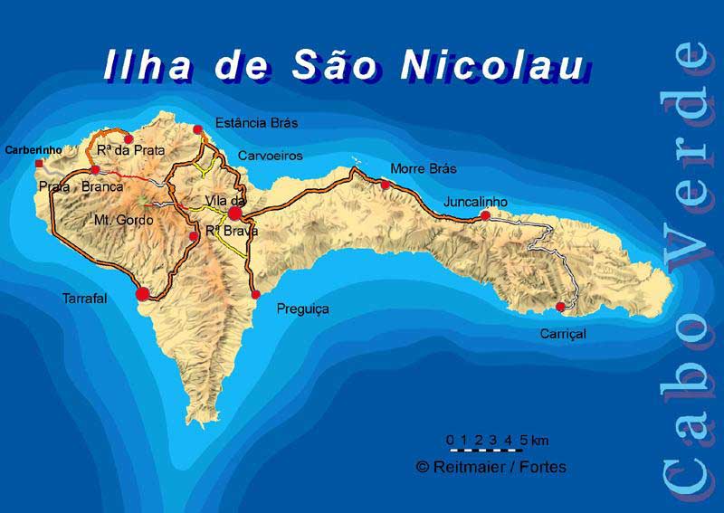
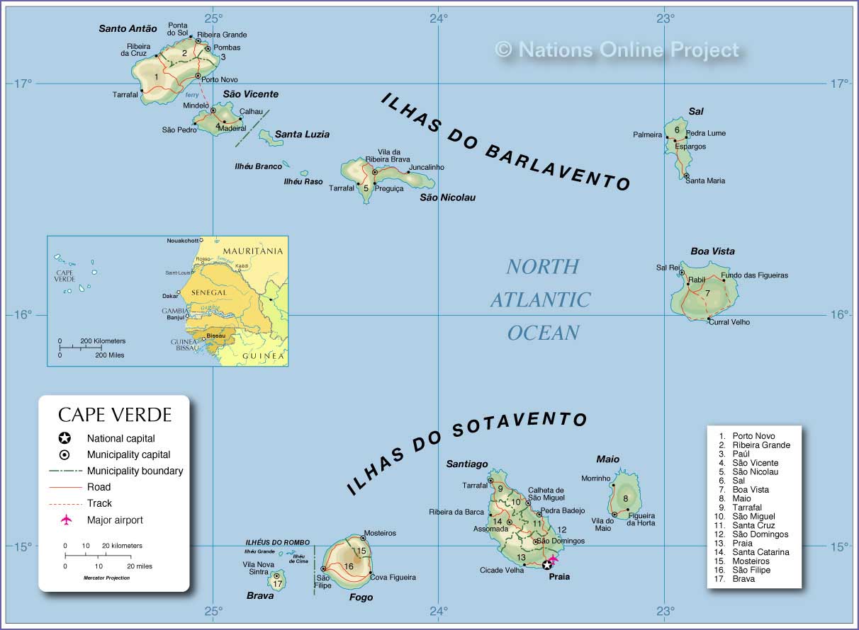
- Săo Nicolau Map Northwest Africa Map
-
|
|
-
|
- latest picture: March 9, 2014
|
|
-
-
|
-
-

|
-
-
|
- 301
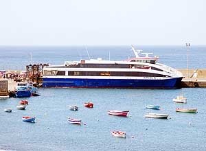
2/28/2014: The FastFerry ‘Kriola’
- arrives at the port of Tarrafal after a
- bumpy ride of 7 hours. We received
- 50% discount on the fare and on our
- arrival short before midnight we were
- greeted by the Mayor of the port city
|
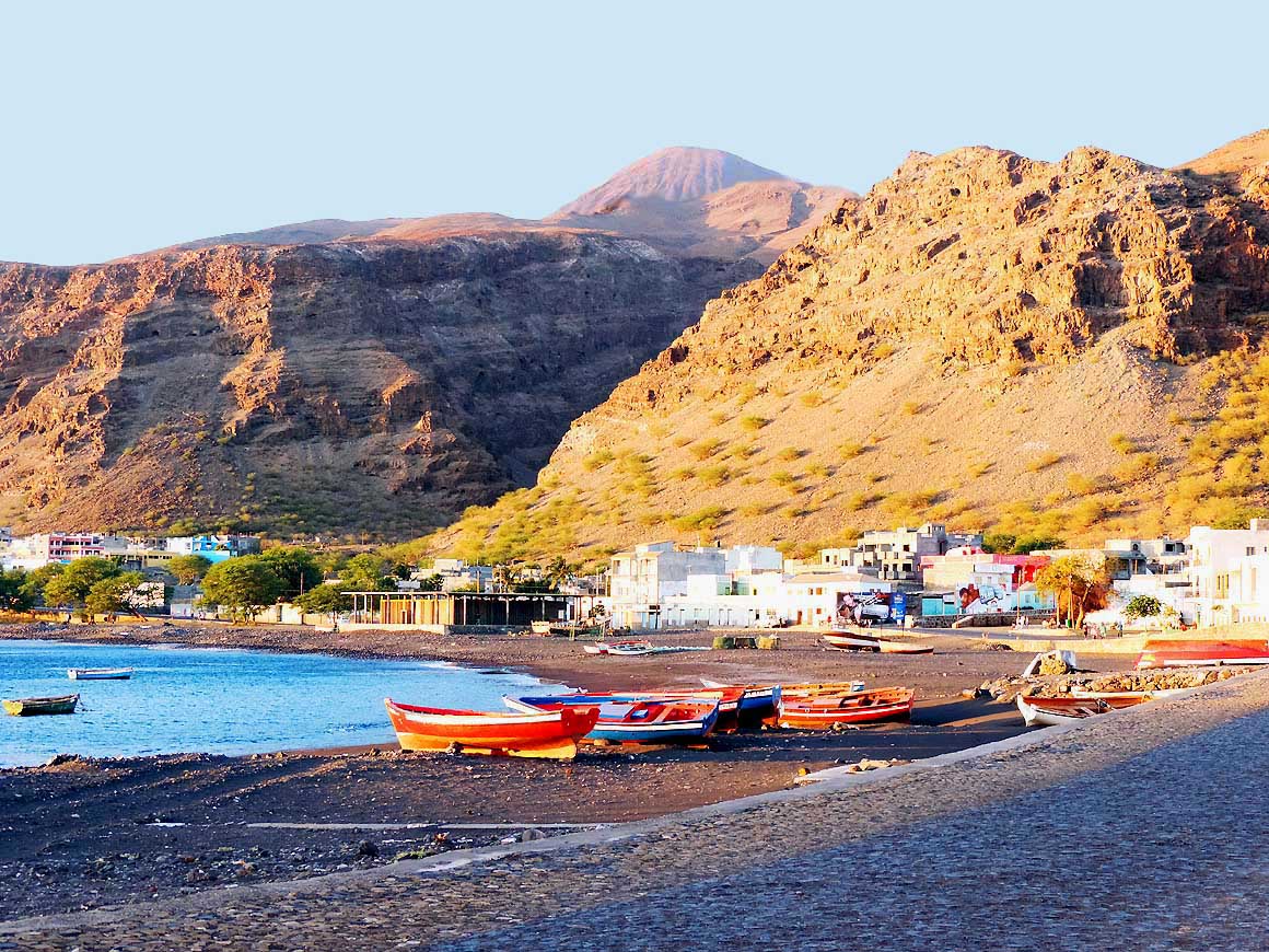
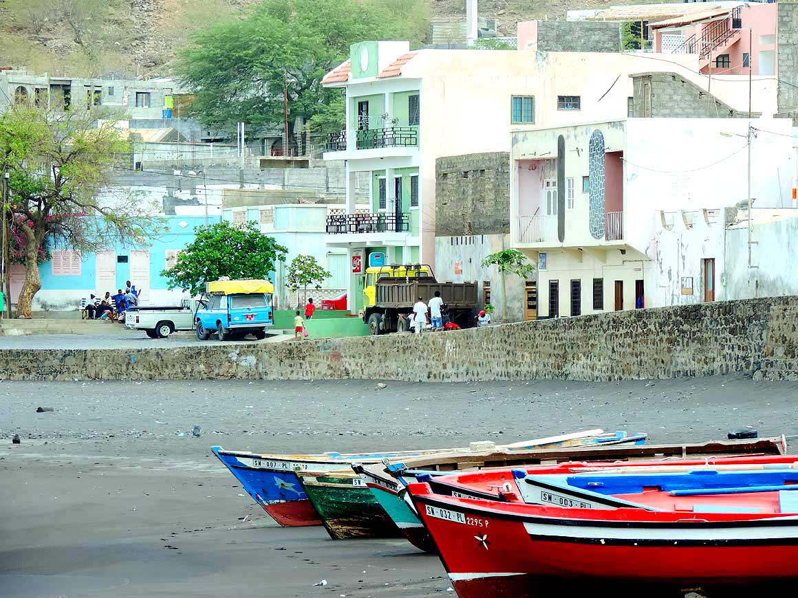
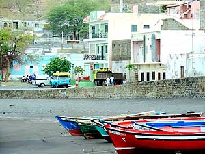
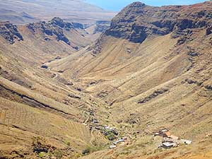
- 302
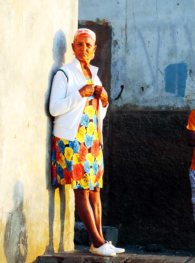
Nostalgic and authentic: The glow
- of the warm evening light catches the colorful
- fishing boats and the lovely painted houses
- of the Tarrafal Bay in the southwest of the
- island. The population of 5’000 makes
- Tarrafal the 2nd biggest place
|
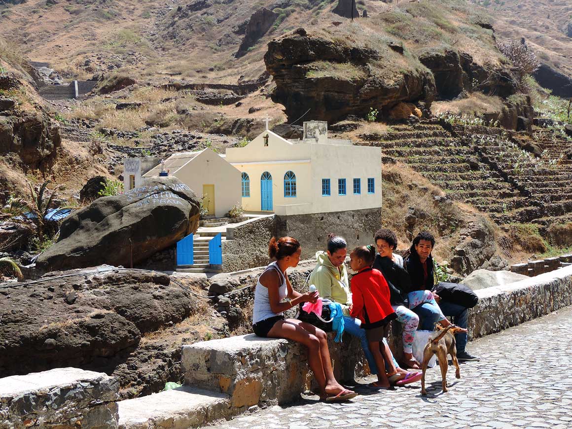
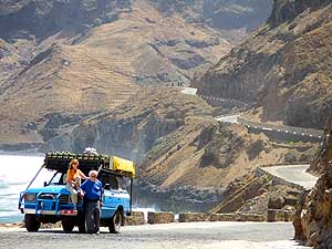
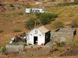
- 303
‘Pensăo Alice’ in Tarrafal – the
- green painted 3-story house on the bay
- with our parked LandCruiser in front –
- is our home on the 150 sq.mi. small
- island. Two nights of the stay are
- offered by the Municipality of Tarrafal
|
-
|
-
-
|
-
-
|
-
-
|
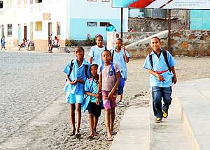
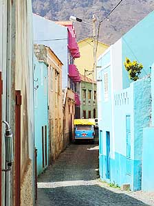
- 304
It is noon. School children return
- home for lunch. Tarrafal is a neat clean
- place with cobble stone streets. Trees
- and flower pots in front of quaintly
- painted houses add to its charm
|
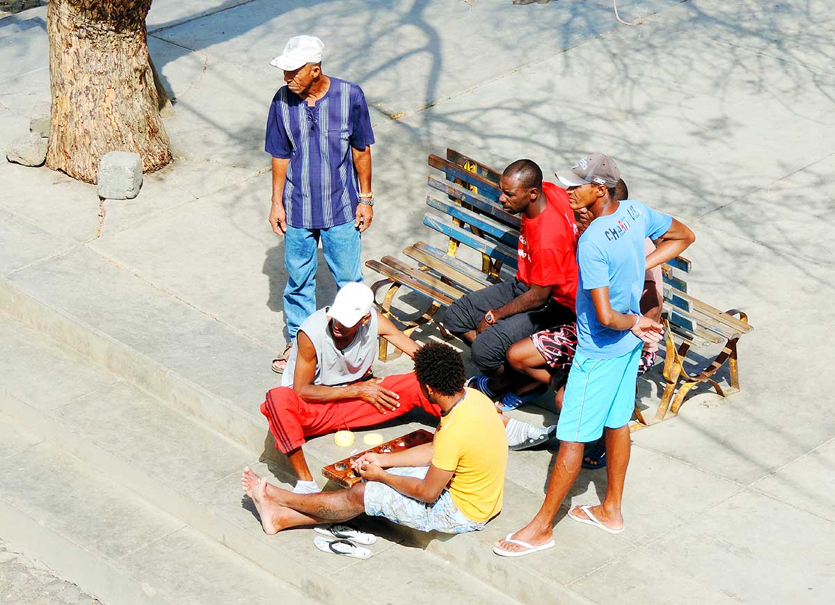
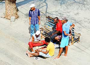
- 305
There is always time for a game:
- On a small square along the Tarrafal
- seashore. Unfortunately the jobless
- rate on the island is big
|
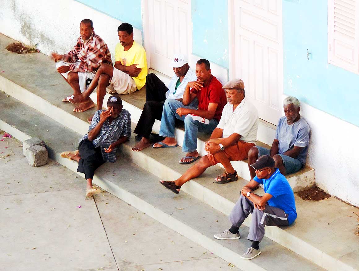
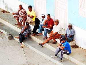
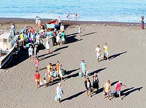
- 306
Life in the fishing harbor of
- Tarrafal: People love to gather for
- a chat – an atmosphere that is rare
- to find. Are the planned ferries
- in the near future changing it?
|
-
|
-
-
|
-
-
|
-
-

|
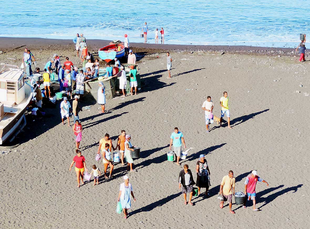
- 307
Scene early morning at Tarrafal
- Bay: Fishing boats returned with their
- catch. Residents walk home with a
- bunch of fresh fish .....
|
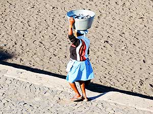
- 308
..... or also with a full container
- carried on the head. Fish is the main
- diet of the islanders besides
- beans, corn and rice
|
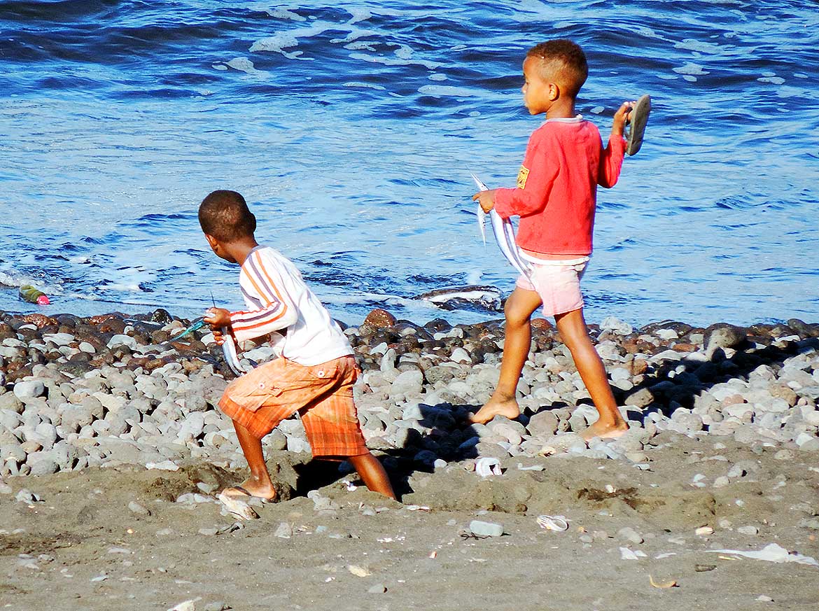
- 309
Nobody goes empty handed:
- Also these youngsters hold silvery
- gleaming fishes in their hands
|
-
|
-
-

|
-
-
|
-
-
|
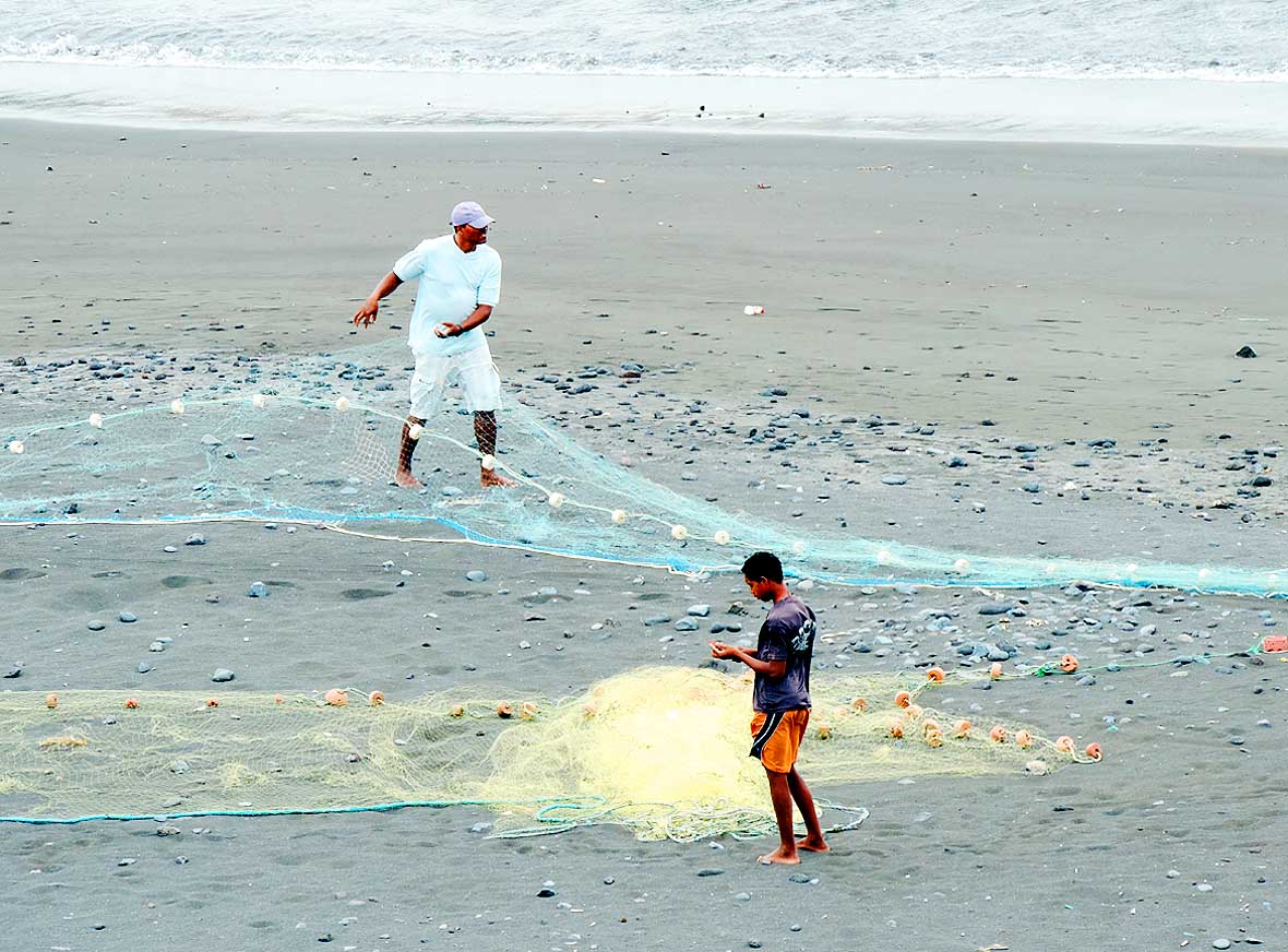
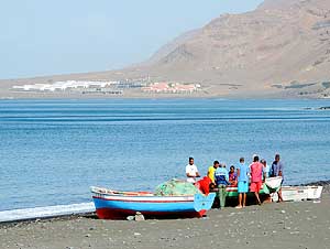
- 310
Fishermen spread their nets at
- the black sand beach on the
- Tarrafal Bay – to dry and to arrange
|
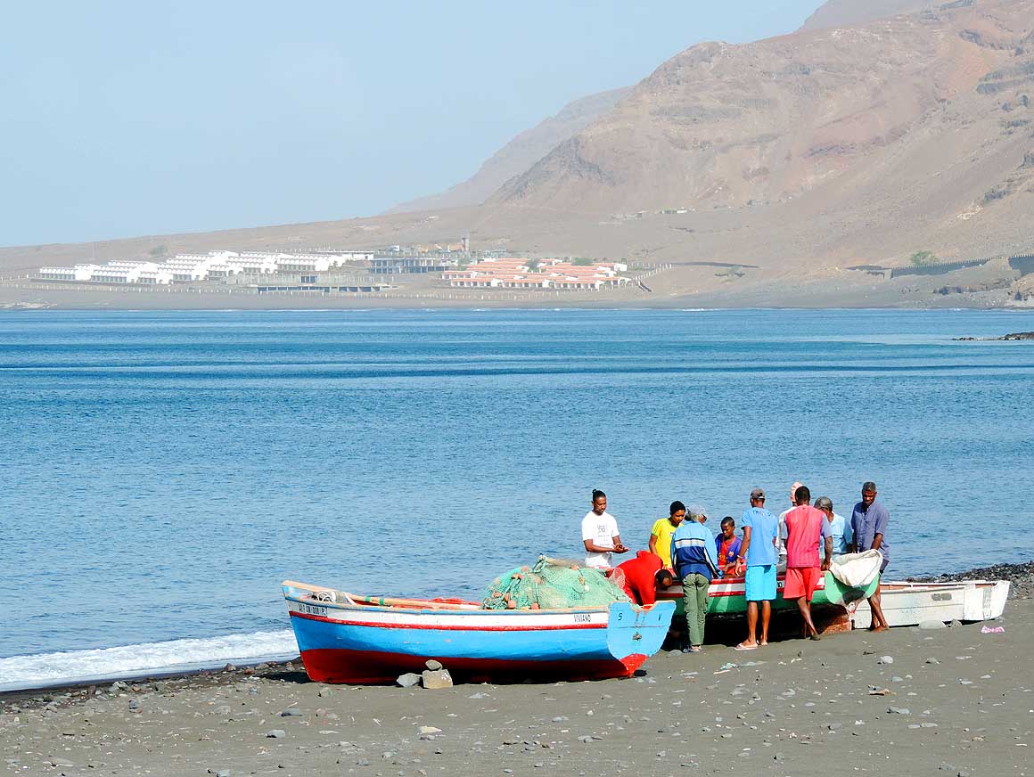
- 311
Gathering around a fishing boat. In the
- background lies the already decaying but
- never used ‘Sanilisa-Project’ of the holiday
- resort ‘Monte Gordo’ in Tarrafal with over
- 190 rooms. Air and sea connections to and
- from this island are currently still too irregular
|
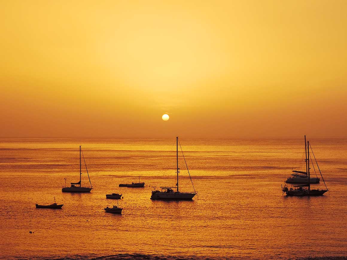
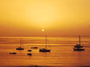
- 312
A glorious sunset over the
- quiet Bay of Tarrafal that is also
- popular by sailors
|
-
|
-
-
-
-
 -
|
-
-
|
-
-
-
-
|
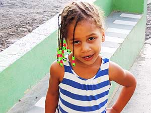
- 313
This girl from Tarrafal looks
- already pretty self-confident
- into the camera
|
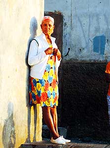
- 314
There is not much entertainment
- in the fishing village of Tarrafal; but
- ‘people-watching’ is always an option
|
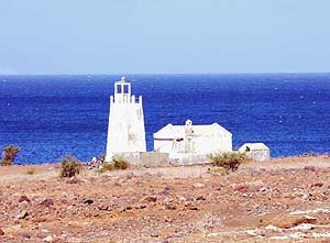
- 315
Out of use but still a landmark:
- The light tower on the west side at Barril
|
-
|
-
-
|
-
-

|
-
-
|
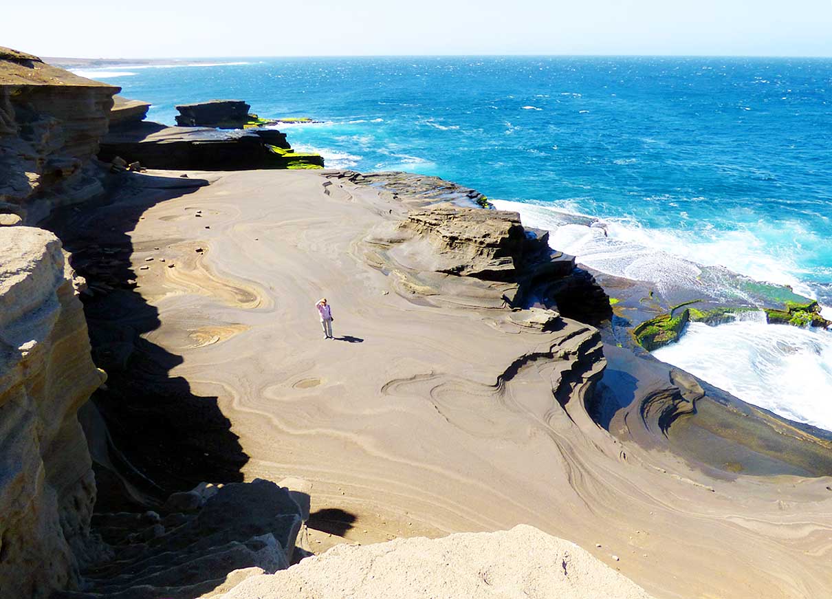
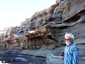
- 316
‘Carberinho’ with its roaring surge
- and the bizarre washed out rock formations
- belongs to the self-proclaimed Natural
- Wonders of Cape Verde. It lies a bit offside
- of the road to ‘Praia Branca‘ on the west
- coast, about 10 miles from Tarrafal .....
|
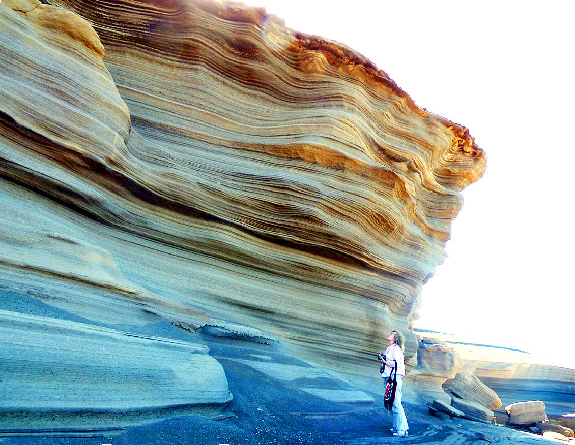
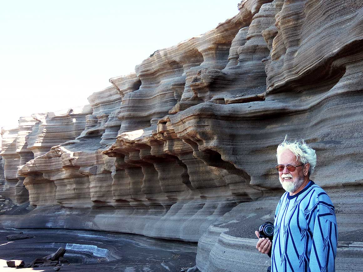
- 317
..... Liliana admires with fascination
- the masterpiece that time and force of
- nature created .....
|
- 318
..... and persuads Emil to
- pose for a picture
|
-
|
-
-
|
-
-
|
-
-

|
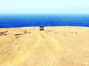
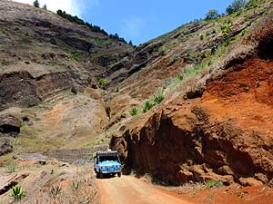
- 319
We are returning on the track to
- the cobble stone road that led us to the
- bizarre rock formations of ‘Carberinho’
|
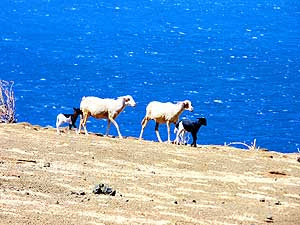
- 320
In a single file along the water’s edge.
- It is easier to withstand the raging wind
- with four legs instead of only two
|
- 321
There is a sensation of freedom on
- the way to ‘Carberinho’ in front of this
- 1’430ft. high remote hill at ‘Praia Branca’
|
-
|
-
-
|
-
-
|
-
-
|
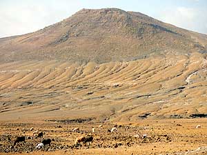
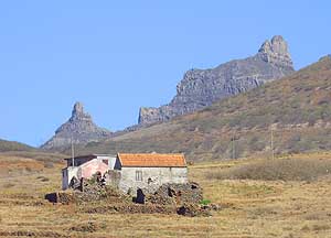
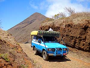
- 322
Dry and arid land dominates the
- landscape to ‘Praia Branca’ in the North-
- west, which remembers us strongly to the
- Sultanate of Oman on the Arabian Peninsula
|
- 323
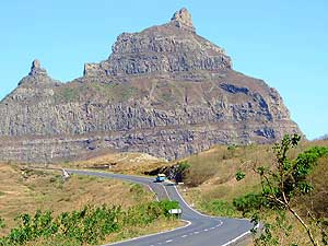
The towering mountain peaks of
- ‘Tope Matin’ (3’500 ft. – left) and ‘Tope
- Moca’ (3’080 ft. – right) pop up east of
- ‘Praia Branca’ in the northwest of the island
|
- 324
After our detour to ‘Carberinho’
- we return to the coastal road and drive
- towards ‘Ribeira da Prata’
|
-
|
-
-
|
-
-
|
-
-
|
- 325
A picturesque sight: The pastel
- colored facades of the houses of
- ‘Praia Branca’ with the bizarre
- mountain ‘Tope Matin’ in the back
|
- 326
Our LandCruiser doesn’t like cobble
- stone roads, but he loves the deserted
- coast in the northwest on the way to
- ‘Ribeira da Prata’
|
- 327
Our remembrance picture at the
- dramatic coastline road between ‘Praia
- Branca’ and ‘Ribeira da Prata’ in the
- northwestern corner of the island;
- afterwards the road ends
|
-
|
-
-

|
-
-
|
-
-

|
- 328
The colorful houses of ‘Ribeira da
- Prata’ nestle on the mountain slope at
- the end of the cobble stone road in the
- northwest, 14 miles from Tarrafal
|
- 329
A bright smile welcomes us at
- this straw covered dwelling built of
- natural stones in ‘Ribeira da Prata’
|
- 330
Waiting for a transport – an
- “Aluguer“ – at the church in ‘Ribeira
- da Prata’. It is the most important
- mean of transport, also for tourists
|
-
|
-
-
|
-
-
|
-
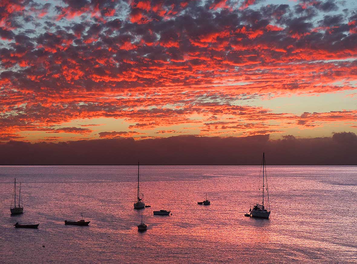
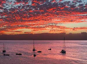
-
|
- 331
Heading back from our excursion
- to the northwest via ‘Praia Branca’
- to Tarrafal
|
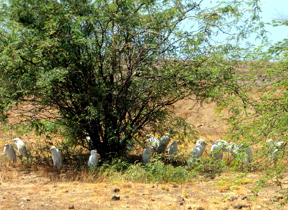
- 332
At the beach ‘Praia Grande’ north-
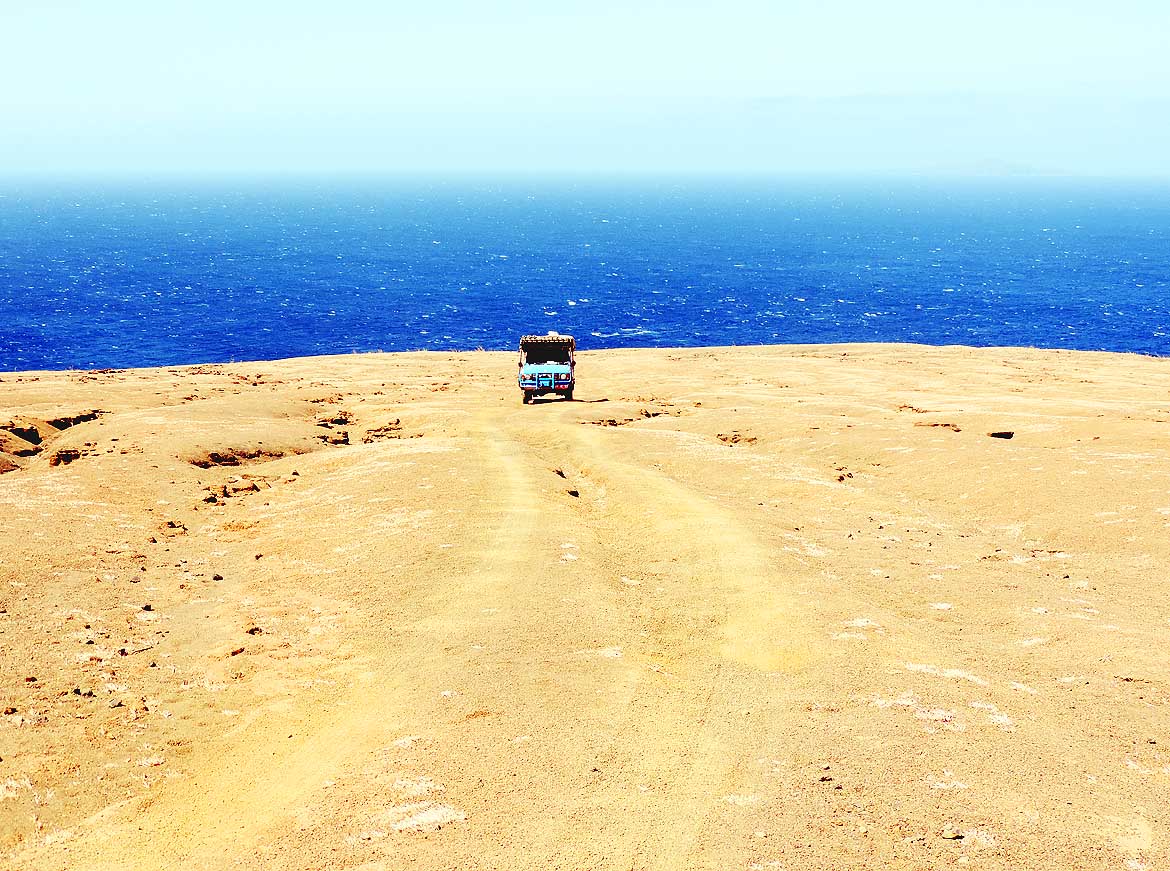
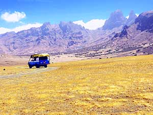
- west of Tarrafal – close to the lighthouse
- of Barril – cattle egrets make a nap
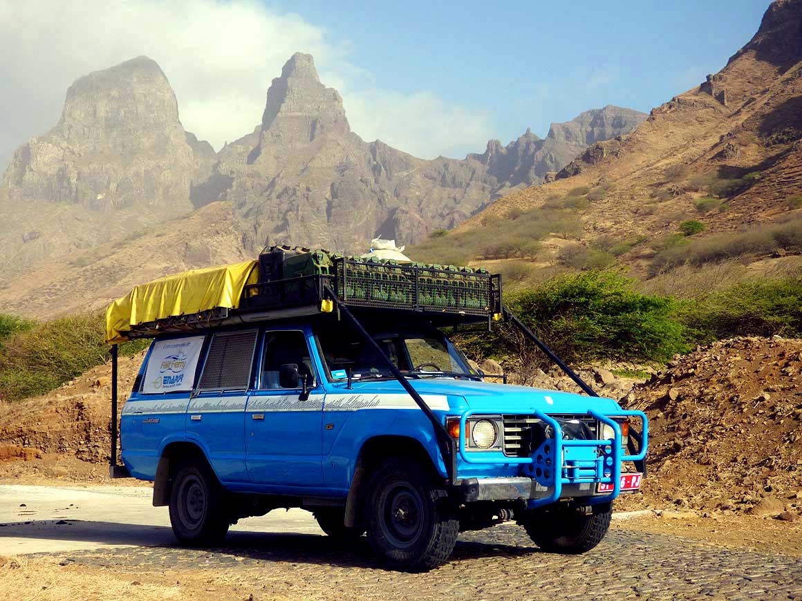
- in the shade of an acacia tree
|
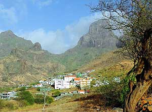
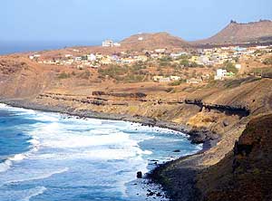
- 333
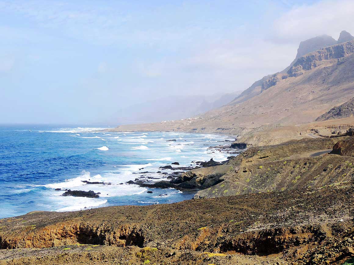
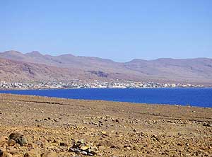
The houses of the harbor village
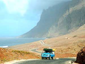
- of Tarrafal nestle on the small coastal
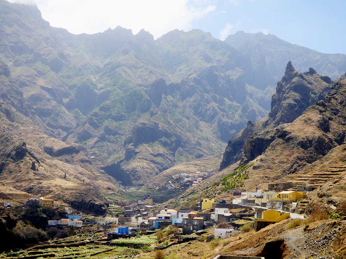
- strip between the sea and the
- barren mountains
|
-
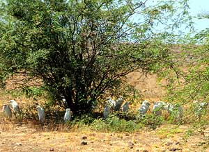
|
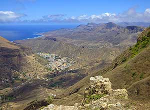
-
-
|
-
-

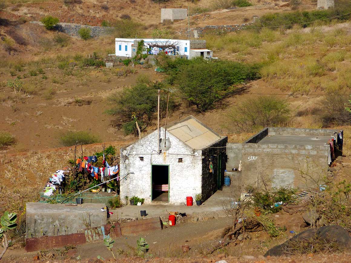
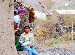
|
-
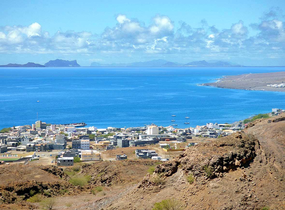
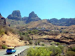
-
|
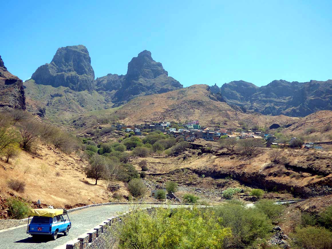
- 334
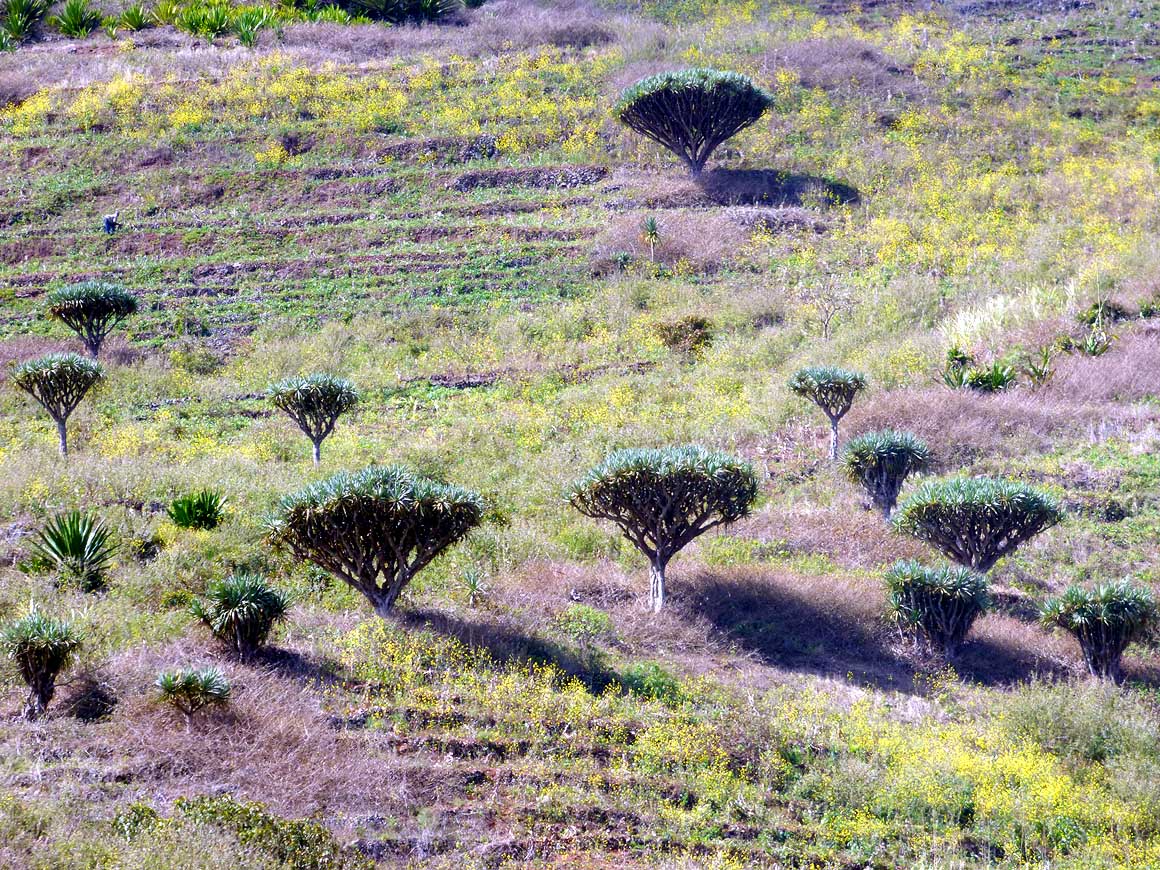
Our LandCruiser is driving on the
- relatively new, 16 miles long tarmac road
- from the harbor of Tarrafal towards the
- capital ‘Ribeira Brava’. In the back-
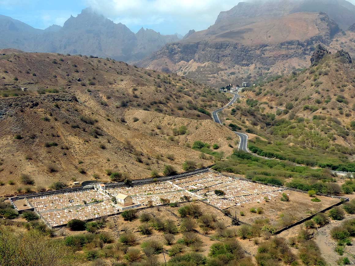
- ground the 3’212 ft. high Monte Cintinha
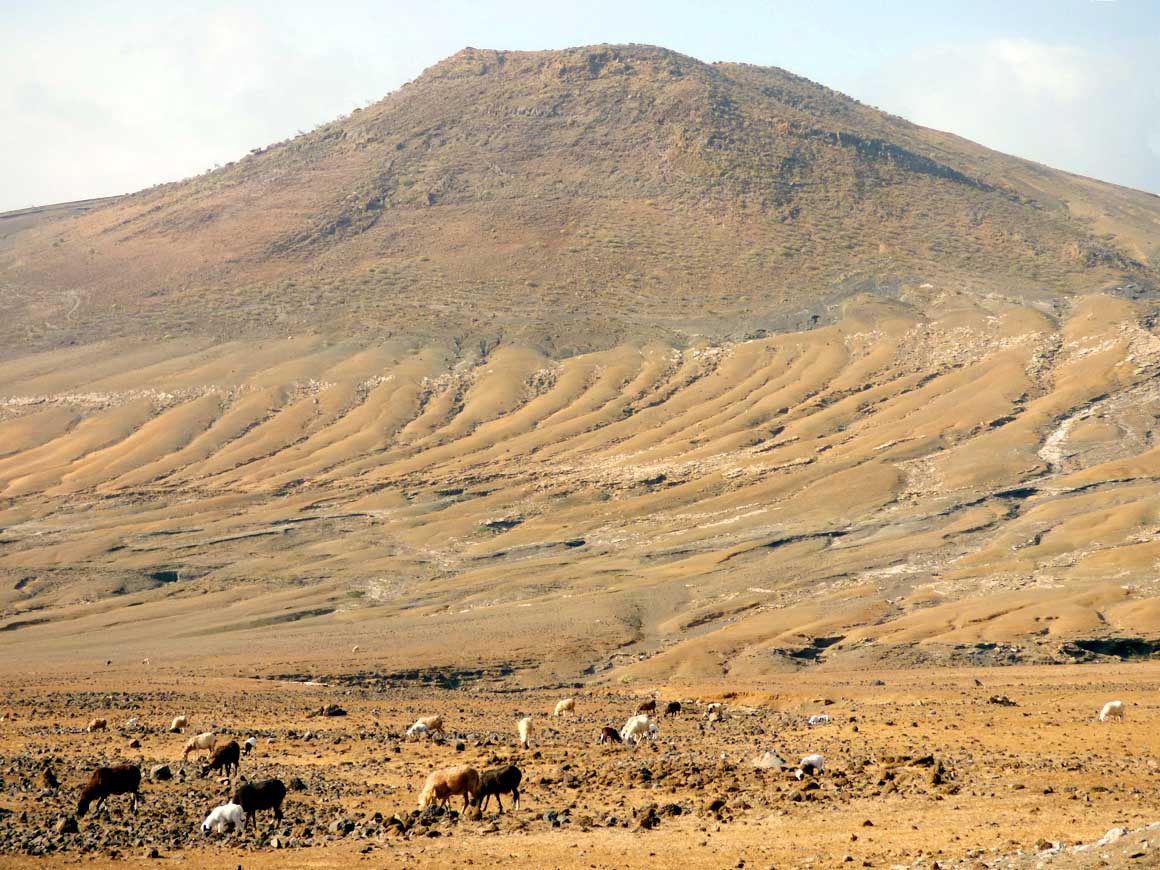
|
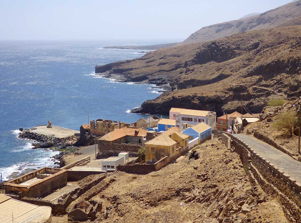
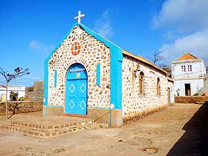
- 335
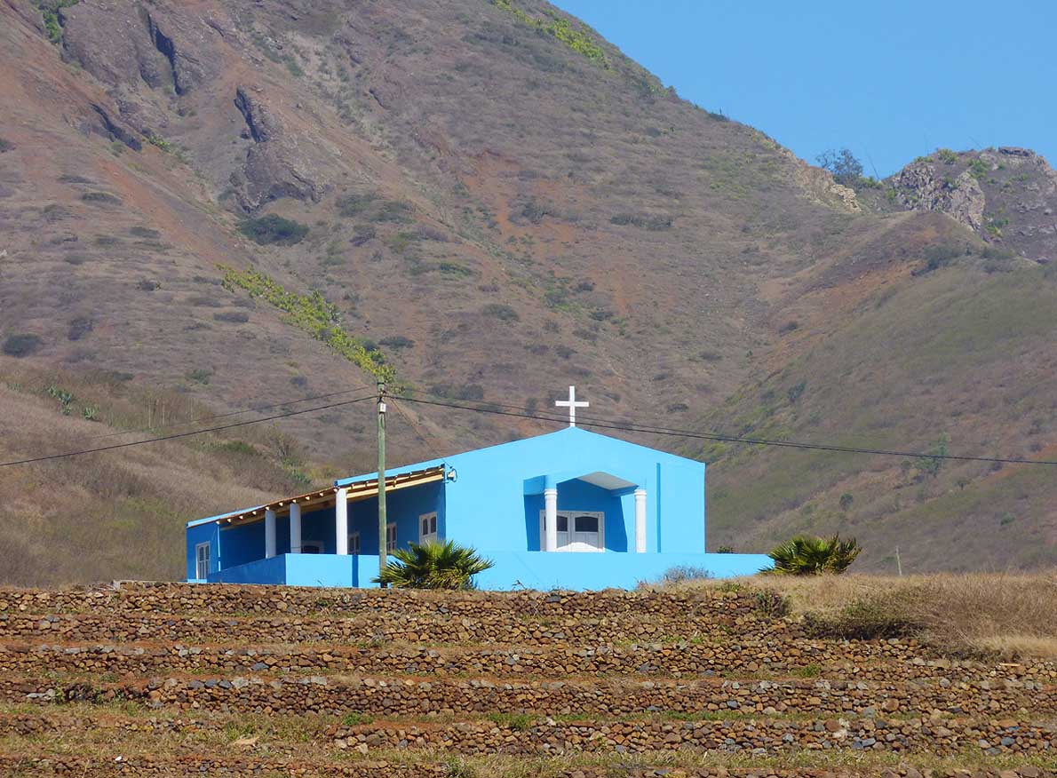
Blue dominates in the choice of
- colors, like here the church of Cabeçalinho
- along the road from Tarrafal to
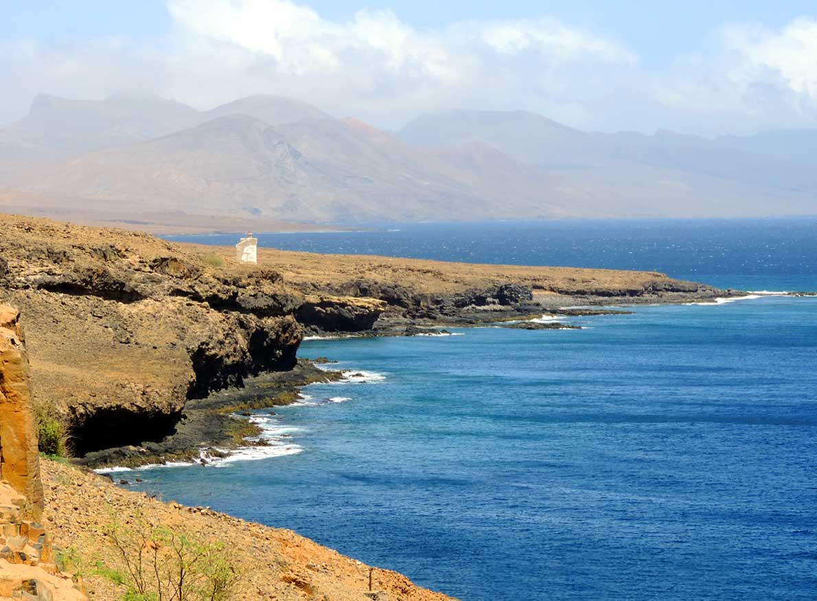
- ‘Ribeira Brava’
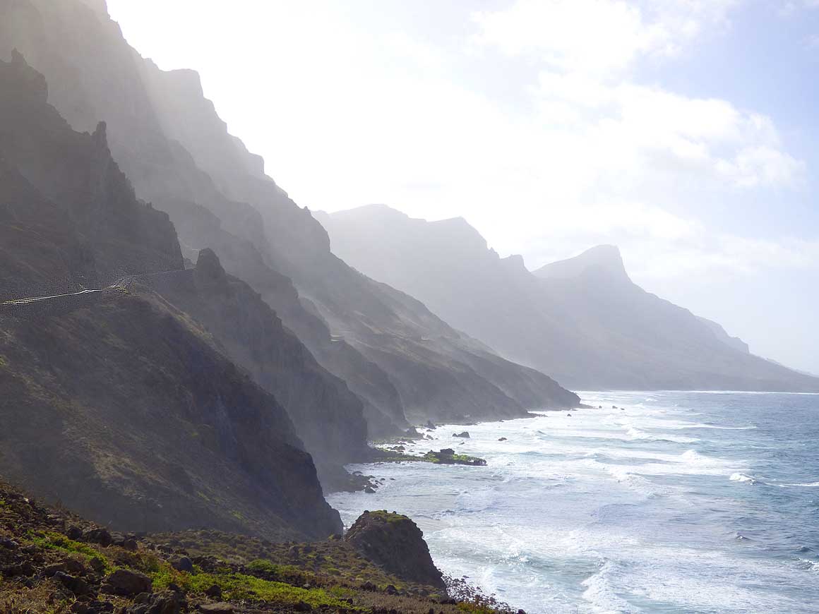
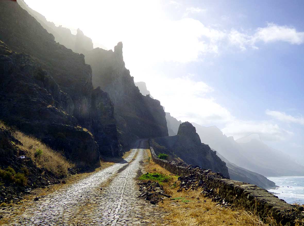
|
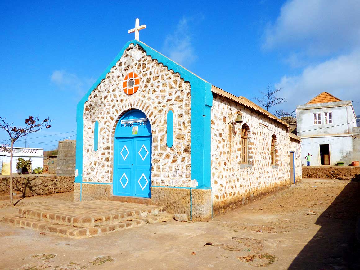
- 336
No neighbors, just the backdrop
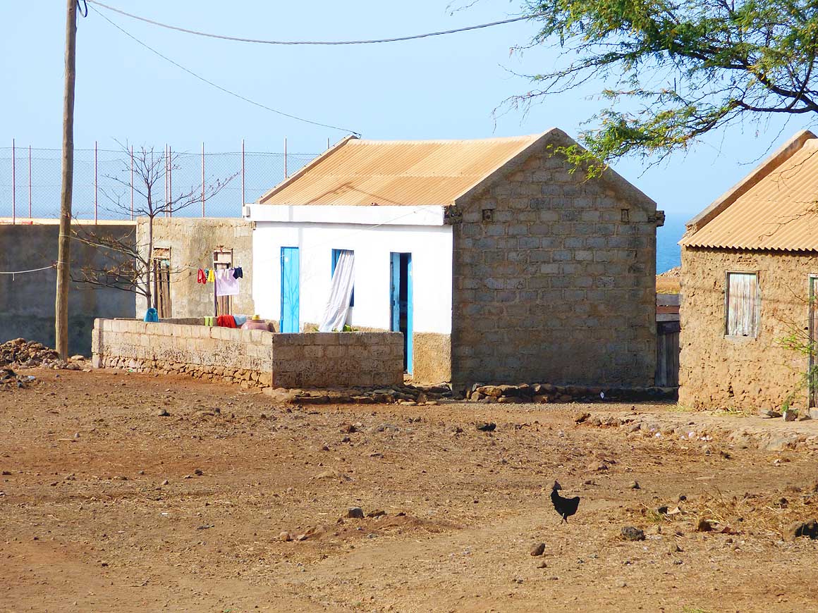
- of the mountains (Monte Cintinha)
|
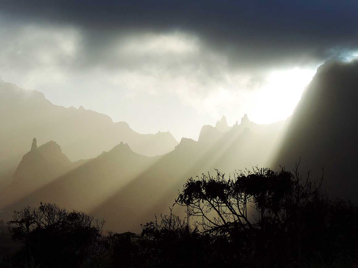
-
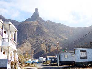
|
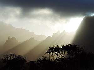
-
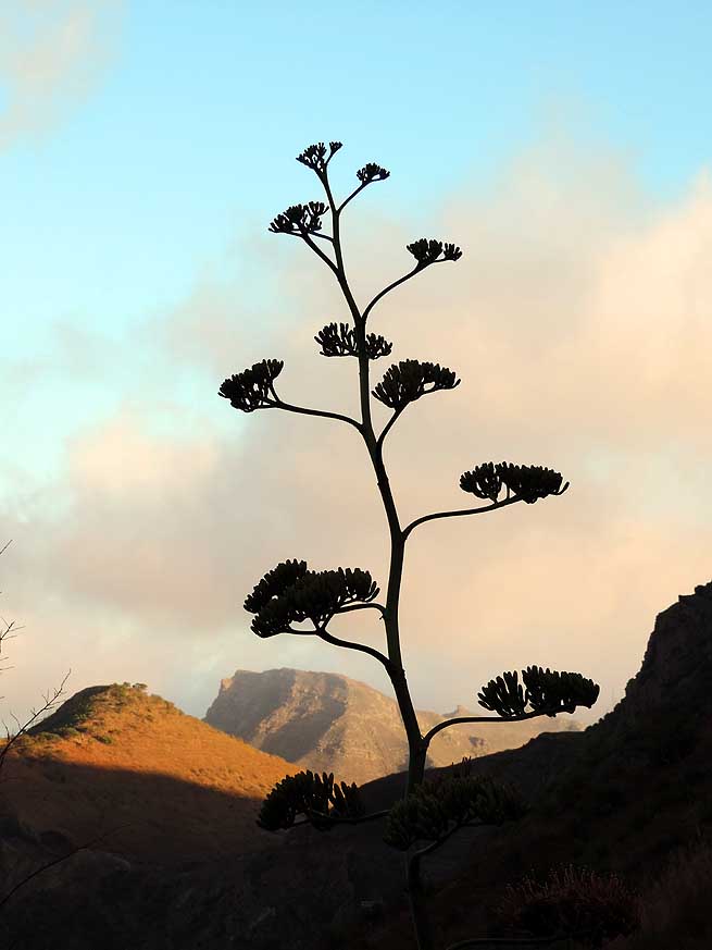
-
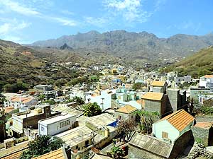
|
-
-
|
-
-
|
- 337
The small white church ‘Senhora do
- Monte’ on the mountain slope of Monte
- Cintinha marks the summit between the port
- of Tarrafal and the capital of ‘Ribeira Brava’
|
- 338
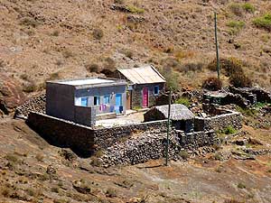
In such remote places there
- is neither running water nor electricity
|
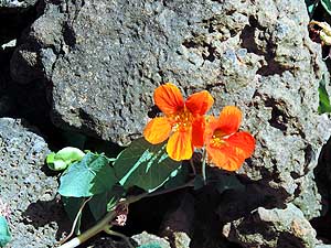
- 339
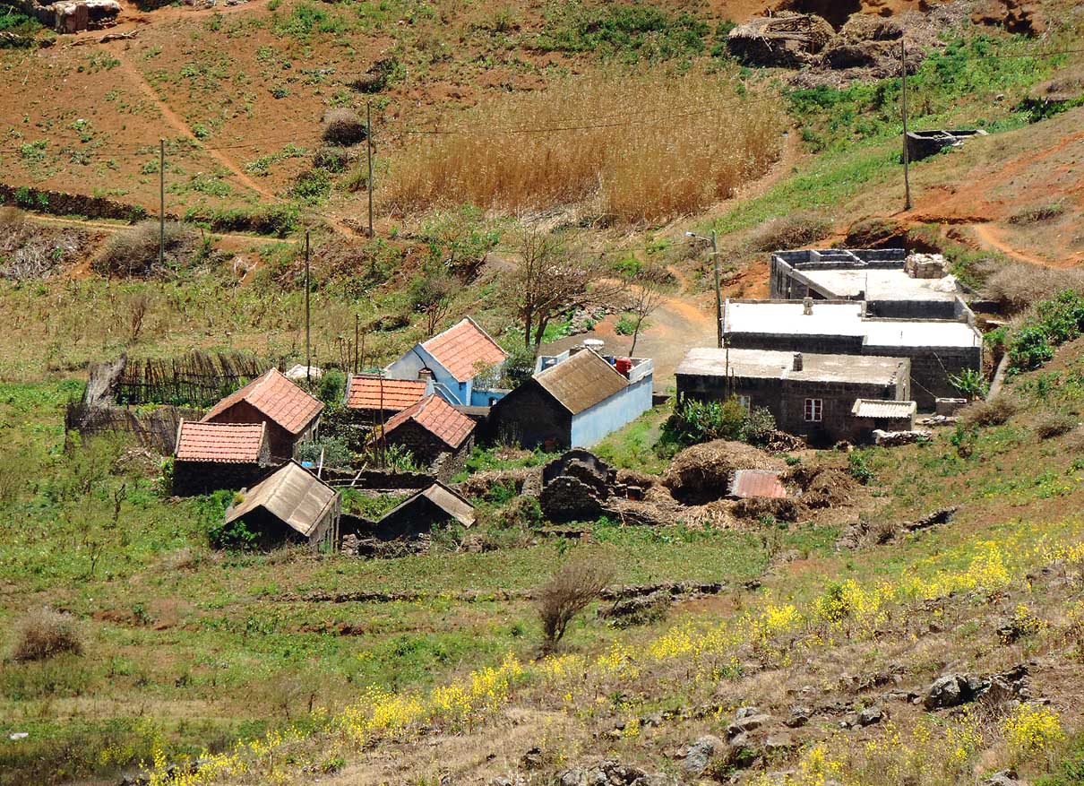
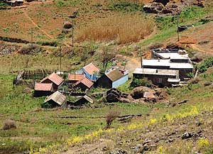
The clouds get stuck at the north-
- eastern side of the mountain ranges which
- enables the growth of vegetables
|
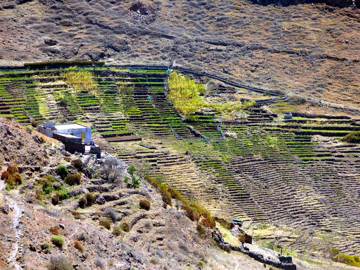
-
|
-
-
|
-
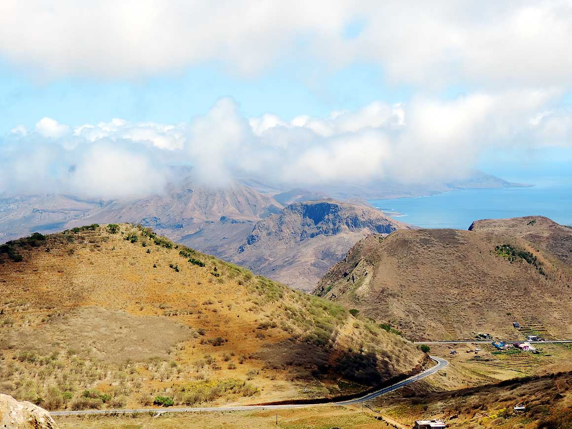
-
|
-
-
|
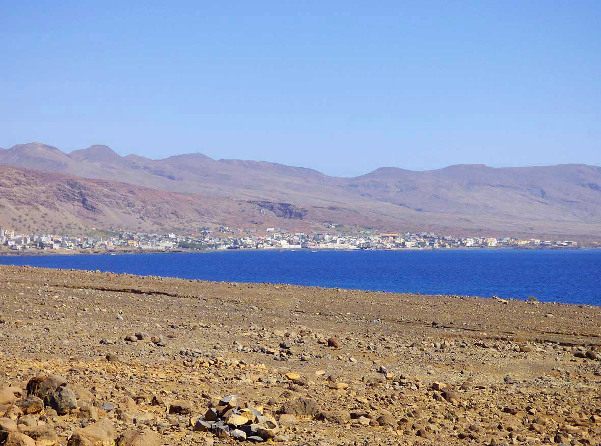
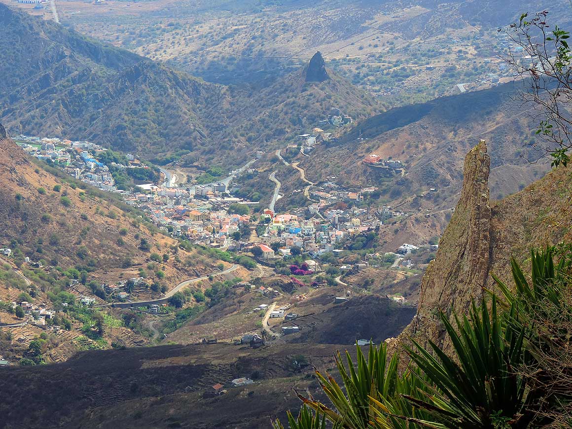
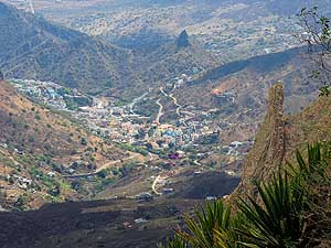
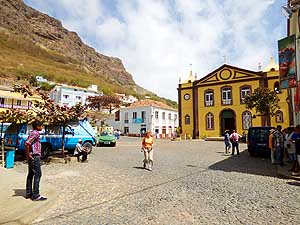
- 340
View from the summit at Cachaço
- to the capital ‘Ribeira Brava’ in the
- northeast with its 5’500 people .....
|
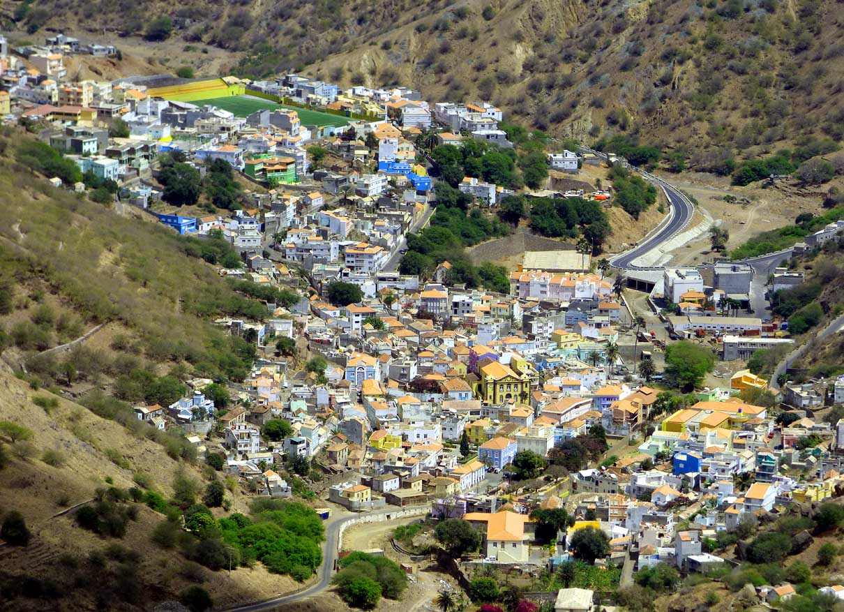
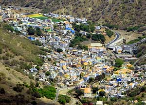
- 341
..... closer view of the capital. It was
- long Cape Verde's religious centre and built
- inland to protect its treasures from pirates .....
|
- 342
..... view from the west side to
- the capital. The dark mountain on the
- right is the 2’021 ft. high Monte Bissau
- on the eastern part of Săo Nicolau
|
-
|
-
-
|
-
-
|
-
-
|
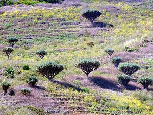
- 343
A group of the still existing 100
- dragon trees (Dracaena draco) on the
- island of Săo Nicolau. They remember
- us to the second kind of dragon trees
- (Dracaena cinnabari) we saw on the
- island of Socotra in Yemen .....
|
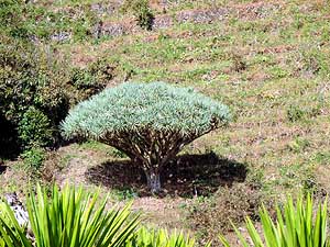
- 344
..... a doozy of a dragon tree. Due
- to the abusive use of its sap (dragon blood)
- in traditional medicine it has almost gone
- extinct. The same type can be found also
- on the Canary Islands, some in Morocco
- and a few on Santo
Antăo (picture # 554)
|
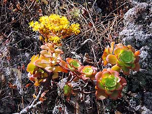
- 345
It is growing on rocky slopes
- and fascinates us with its rosettes
- and its shiny yellow flowers
|
-
|
-
-

|
-
-
|
-
-
|
- 346
The climate on the north coast is
- favorable for growing produce. Here
- near the village of Carvoeiros
|
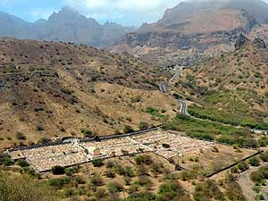
- 347
The typical Christian cemetery of
- ‘Ribeira Brava‘ along the airport road.
- The vast majority (nearly 80%) of Cape
- Verdeans are Roman Catholic
|
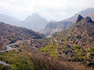
- 348
Dry hill country dotted with acacia
- trees dominate the landscape outside of
- ‘Ribeira Brava’ – left the road to the
- airport and Preguiça, right the one to
- Juncalinho; the mountain in the
- background is Monte Cintinha
|
-
|
-
-
-
-
 -
|
-
-
|
-
-
-
-
|
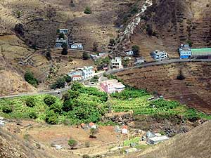
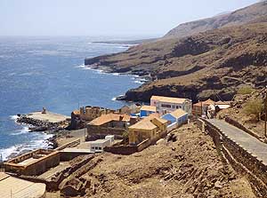
- 349
Preguiça, the sleepy fishing village
- with 600 people, lies at the southeast
- coast, 5 miles from the capital .....
|
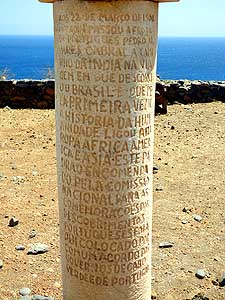
- 350
..... a round memorial pillar about the
- newly discovered Brazil on the journey to
- India of Portuguese Pedro Álvares Cabral
- in 1500 stands at the ruins of the fort
- above the harbor of Preguiça .....
|
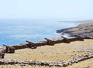
- 351
..... the six canons remind
- of the historic importance of the
- Fort of Preguiça, called also
- ‘Forte do Príncipe Real’
|
-
|
-
-
|
-
-

|
-
-
|
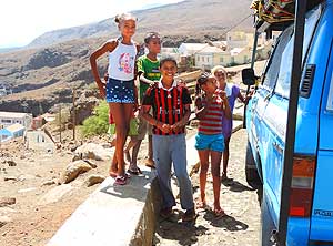
- 352
In the fishing village of Preguiça,
- our LandCruiser is once more the
- attraction. The children are interested
- especially in our country ribbon
|
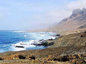
- 353
View from Preguiça to the rocky
- eastern coastline and the barren mountains
- of the eastern part of the island – an
- elongated narrow spit
|
- 354
The northern part of the eastern spit
- is marked by wild, barren and almost
- unpopulated land. The cobblestone road
- follows mostly directly the seashore
|
-
|
-
-
|
-
-
|
-
-

|
- 355
In the pretty village of Juncalinho on
- the picturesque rocky coast of the eastern
- spit live around 500 people. It is about 14
- miles from the capital ‘Ribeira Brava’ .....
|
- 356
..... the showpiece in Juncalinho
- is the ‘Capela da Sagrada Família’,
- built 1960 from natural stones
|
- 357
Modest, but friendly:
- A house in Juncalinho
|
-
|
-
-

|
-
-

|
-
-
|
- 358
On our way back from Juncalinho
- along the northern seashore we experience
- a fascinating evening mood .....
|
- 359
..... the mountain peaks rise
- dramatically towards the sky
|
- 360
The village of ‘Morre Brás’ is
- besides Juncalinho the second settlement
- along the northern part of the eastern
- spit. The mountain peak is named
- Monte Caçador and is 1'821 ft. high
|
-
|
-
-
-
-
 -
|
-
-

|
-
-
-
-
|
- 361
A ghostly, almost surreal mood hits
- us at ‘Fajă de Cima’ towards Pico Agudo
- and Monte Deserto
|
- 362
A sisal agave on the Cachaço
- summit against the backdrop of
- mountain peaks in the soft evening light
|
- 363
View from ‘Pensăo Jardim’ over
- the red tiled roofs of Săo Nicolau’s capital
- ‘Ribeira Brava’, situated in a basin at
- 650 ft. above sea level
|
-
|
-
-
|
-
-
-
-
|
-
-
-
-
|
- 364
“Hopefully it won’t get any
- narrower!“ The winding hillside streets
- of the capital lined with colorfully
- painted houses are reminiscent of
- the Portuguese colonial time
|
- 365
Liliana is crossing the small main
- square ‘Praça Cónego Dias’ of the
- capital with its ochre-colored cathedral
- ‘Nossa Senhora do Rósario’ .....
|
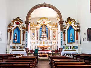
- 366
..... the neat bright interior
- of the cathedral, built in the beginning
- of the 18th century
|
-
|
-
-
|
-
-

|
-
-
|
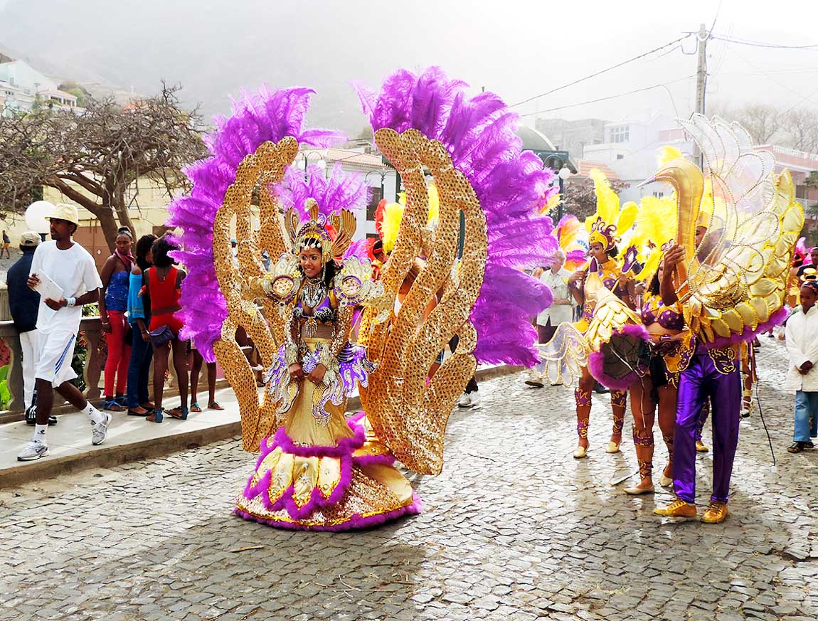
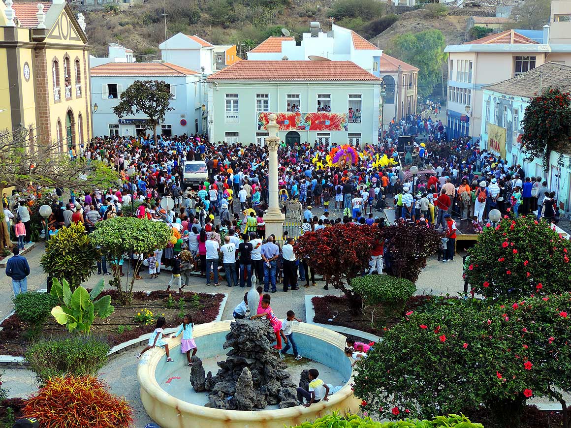
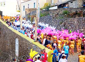
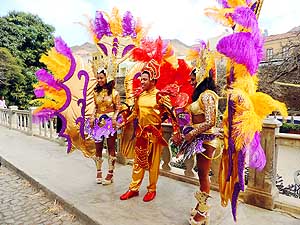
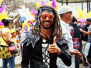
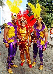
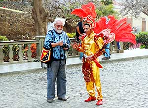
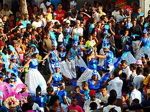
- The carnival in the capital ‘Ribeira Brava’ is ranked as the second best on
Cape Verde after Mindelo on the island of Săo Vicente.
- The carnival of Cape Verde (Ribeira Brava) is our third carnival experience on our worldtrip
- besides Guyana (Georgetown - February 2003) and Grenada (St. George’s - August 2003)
|
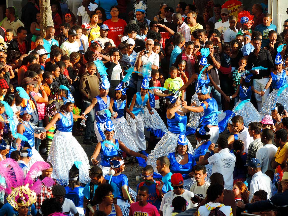
- 367
The participants of the procession
- in their glittering costumes and colorful
- feathery headdress are getting in line
|
- 368
The “Queen” is wearing a
- beautifully elaborated golden costume
|
- 369
A lot of pomp and sophisticated
- details – nothing is too exquisite for one of
- the most important celebrations of the year
|
-
|
-
-
|
-
-
|
-
-
|
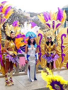
- 370
Three beauties pose for a picture
|
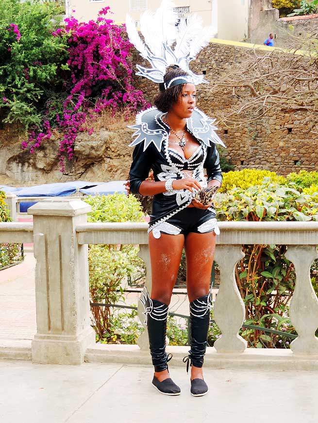
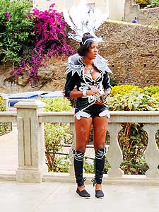
- 371
A sexy lady in black and silver
|
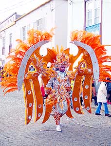
- 372
A richly elaborated costume
- made from satin, beads and feathers
|
-
|
-
-
-
-
 -
|
-
-
|
-
-
-
-
|
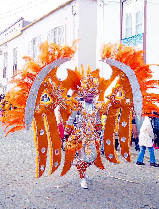
- 373
Already in greatest carnival mood.
- The Creole population is buoyant and
- on carnival of an exuberant love of life
|
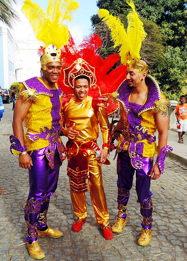
- 374
Also men are dressed
- in elaborate costumes
|
- 375
Carnival is also the time for
- an own remembrance snap
|
-
|
-
-

|
-
-
|
-
-

|
- The carnival of the capital ‘Ribeira Brava’ is unique in the way that at the
end all of the floats and groups end up at the small
- ‘Praça Cónego Dias’ which makes it more ‘intimate’. Spectators mix
with the groups and get caught up by the swinging hips
- and the hot rhythms of drums. In between beautiful fireworks light up the night sky
|
- 376
|
- 377
|
- 378
|
-
|
-
-
|
-
-
|
-
-
|
- 379
On the small mountain road to the
- remote settlement of Hortelăo rises the
- 4’304 ft. high ridge of ‘Monte Gordo’,
- the island's highest peak
|
- 380
In the barren stony landscape
- shiny red flowers are a special feast
- for the eye
|
- 381
Close to the turn off at Cabeçalinho
- to Hortelăo a farmhouse nestles at a
- valley basin
|
-
|
-
-
|
-
-
|
-
-

|
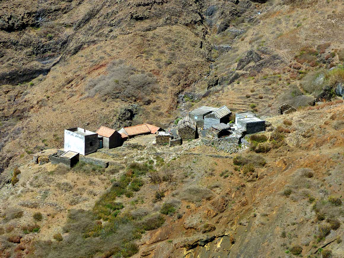
- 382
The side trip to Hortelăo is just
- how we like it: Wild and lonely
|
- 383
People are still living in the remotest
- corners, in the harshest regions, like here
- near Hortelăo. The archipelago of Cape
- Verde lies at the same latitude as the
- Sahelian zone and suffers from extreme
- drought. Only the cities of Praia and
- Mindelo have desalination plants
|
- 384
It still exists – traditional farmhouses
- of natural stones with thatched roofs
- (‘Palhal de Cima’ in the Hortelăo valley)
|
-
|
-
-
|
-
-
|
-
-
|
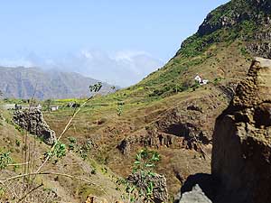
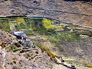
- 385
Terrace cultivation in the Hortelăo
- valley like in Yemen. The endurance of
- the Cape Verdeans to get some produce
- to grow in this arid area is admirable
|
- 386
Life in the remoteness of the Hortelăo
- valley. The preservation of traditions,
- especially the music, helps people to
- accept their often difficult way of life
|
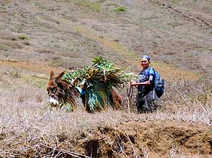
- 387
A woman is on her way back
- home with her donkey. She has
- collected some greens on the
- slopes of Monte Gordo
|
-
|
-
-
|
-
-
|
-
-

|
- Also in desolate and barren corners of the island flowers are sprouting:
|
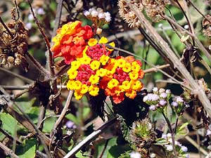
- 388
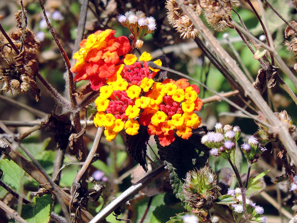
Shrub verbena (on Cape Verde:
- Freira) (Lantana camara)
|
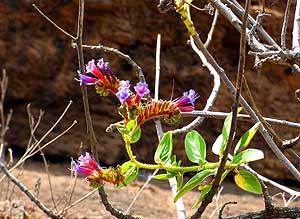
- 389
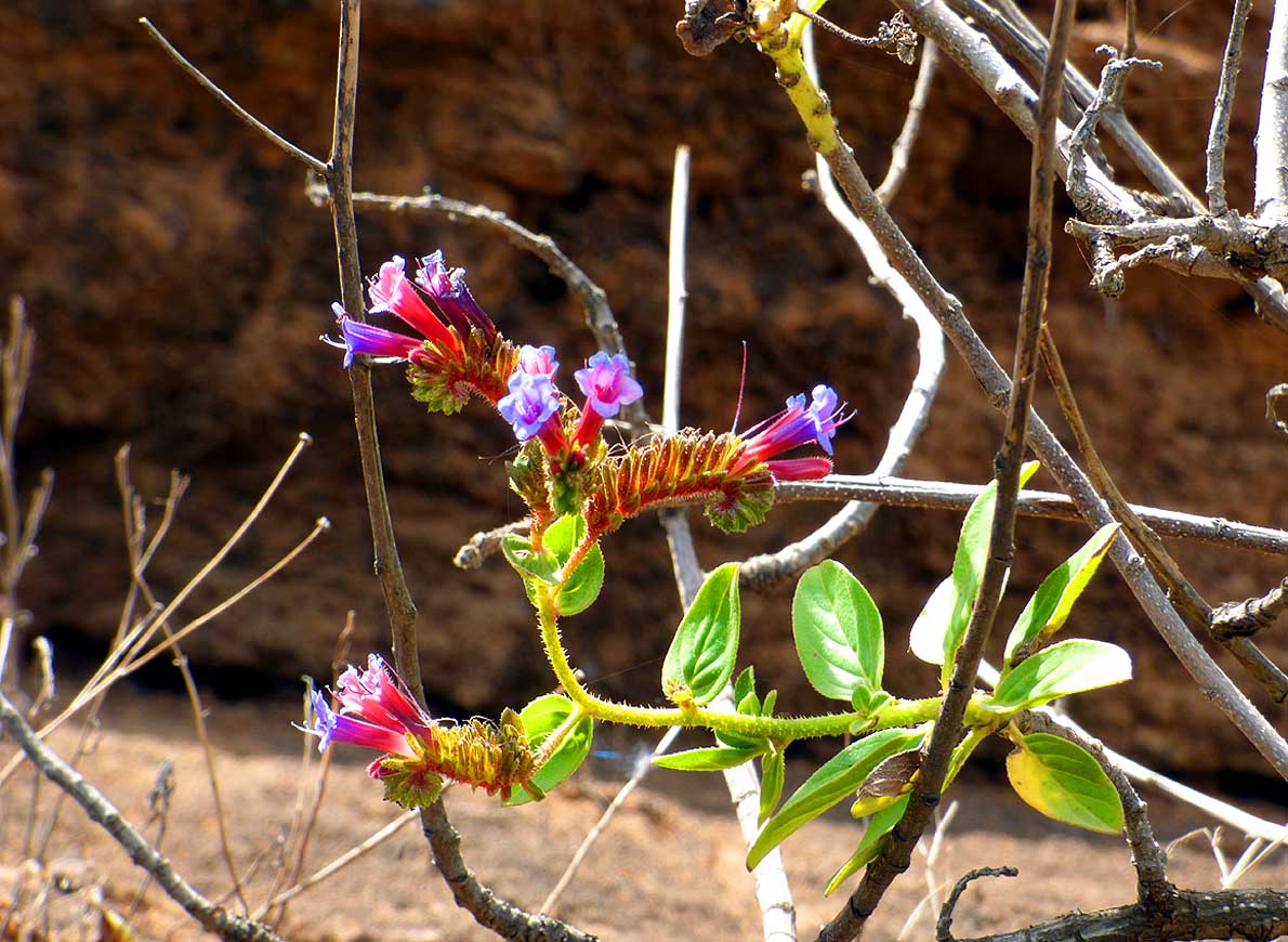
Blue delicate ‘goblet like blossoms’?
|
- 390
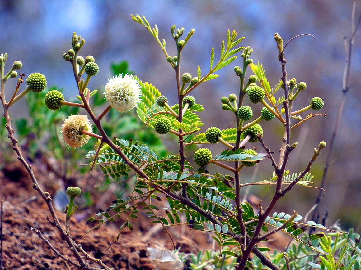
A type of acacia
- (probably Acacia melanoxylon)
|
-
|
-
-
|
-
-
|
-
-
|
- 391
Low sailing clouds over barren
- hills and the Atlantic Ocean – view
- towards the East. In the foreground
- the main road from Tarrafal to
- ‘Ribeira Brava’
|
- 392
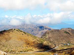
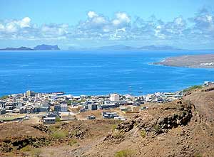
From left to right the islands:
- Ilhéu Raso (2.7sq.mi./538ft./uninhabited),
- Ilhéu Branco (0.1sq.mi./1’073ft./uninhab.),
- Săo Vicente (87.8sq.mi./2’379ft.),
- Santa Luzia (13.5sq.mi./1’296ft./uninhab.),
- behind it Santo Antăo (301sq.mi./6’493ft.);
- in the foreground Tarrafal
|
- 393
The setting sun is putting the sky
- into flames at the Bay of Tarrafal
|
-
|
-
- The "Greater"-Middle East trip 2012/13:
- Sharjah/Dubai/1st Traveler's Festival/Emirates
National Auto Museum - UAE with
car Nov. 2012 to Jan. 2013 - part 1
- Western UAE - Liwa - United Arab Emirates with car in January 2013 - part 2
- Oman 2013 – Part 1 - February
2013: Musandam Peninsula
- Oman 2013 – Part 2 - February
2013: Sohar - Muscat - Rustaq - Nizwa
- Oman 2013 – Part 3 - March
2013: Sur - East Coast - Island of Masirah - Dhofar
- Oman 2013 – Part 4 - March
2013: Salalah & Surroundings (Dhofar) - Nizwa
- Oman 2013 – Part 5 - March 2013: Western Hajar
Mountains
- Al Ain, Eastcoast & Ras al Khaima - United
Arab Emirates with our car in April 2013 -
part 3
- Iran - part 1: Ferry Port Bandar Abbas-Shiraz-Persepolis-Pasargad (between Persepolis and Yazd)
– May 2013
- Iran - part 2: Pasargad
(excl.)-Yazd-Esfahan – May 2013
- Iran - part 3: Esfahan
(excl.)-Chelgerd-Hamadan-Sanandaj-Orumiyeh – May 2013
- Turkey - Iran
Border-Esendere-Hakkari-Van-Dogubayazit-Kars-Ardahan-Hopa-Georgia Border – May 28 to June 4, 2013
- Georgia - part 1: Ajaria-Gori-Tbilisi-Kakheti-Azerbaijan Border – June 4
to 13, 2013
- Azerbaijan - Georgia
Border-Balakan-Seki-Lahiç-Baku-Xinaliq-Quba-Laza-Baku-Ganca-Georgia Border – June 13 to 24, 2013
|
-
- Articles in newspapers about us on Cape Verde:
- Article: "Estăo
em Săo Nicolau: Emil e Liliana há 30 anos ŕ volta do mundo", Online Newspaper
"Jornal de Săo Nicolau" - March 6, 2014
- Article: "Cabo
Verde na Volta ao Mundo de Emil e Liliana Schmid", Daily
Newspaper "ASemana" - March 9, 2014
|