-
- Georgia Map
|
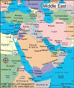  -
- Mid-East Map
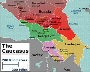
Caucasus Map
-
|
|
-
|
- latest picture:
August 15, 2013
|
-
-

|
-
-
|
-
-

|
-
166
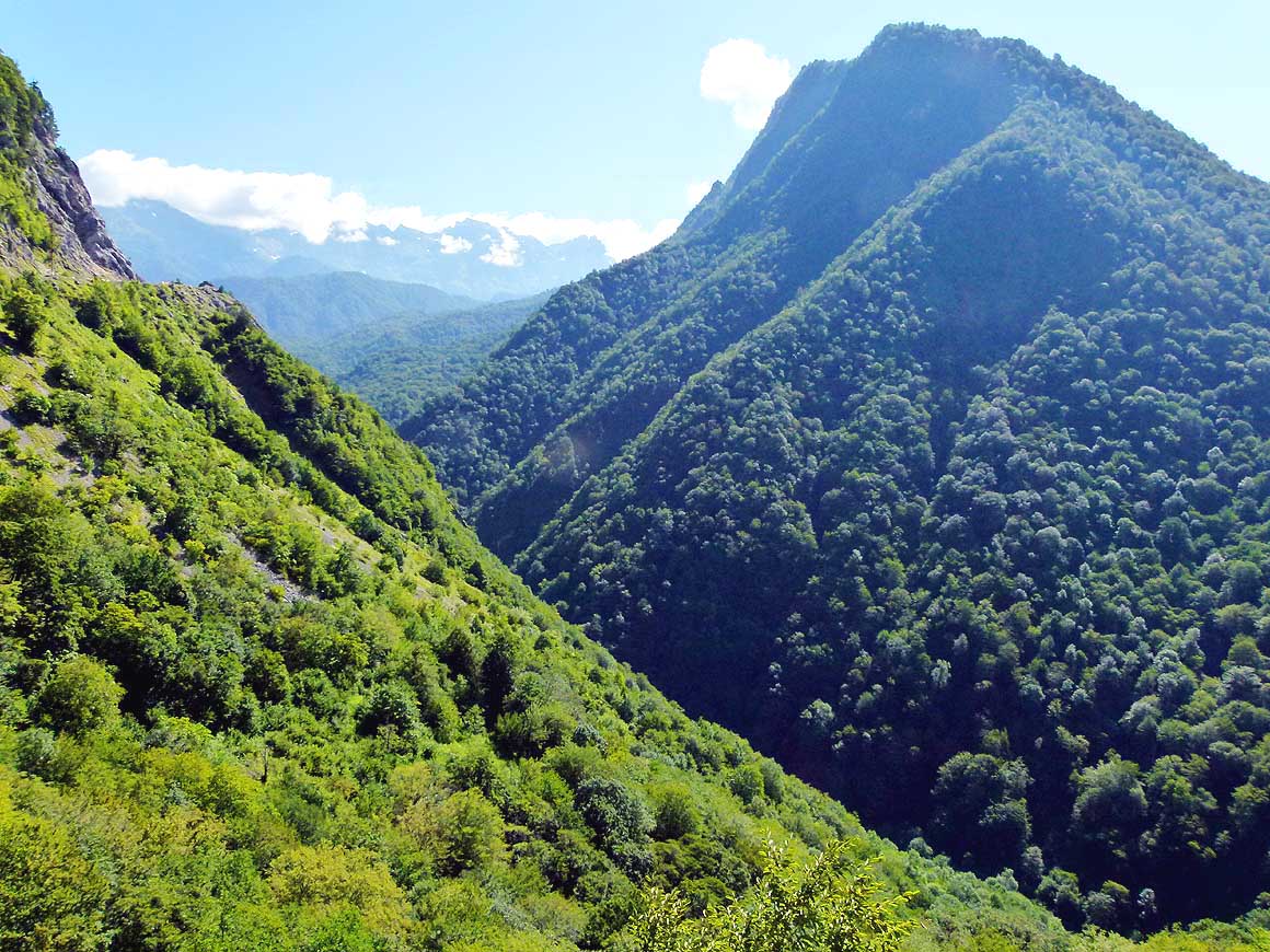
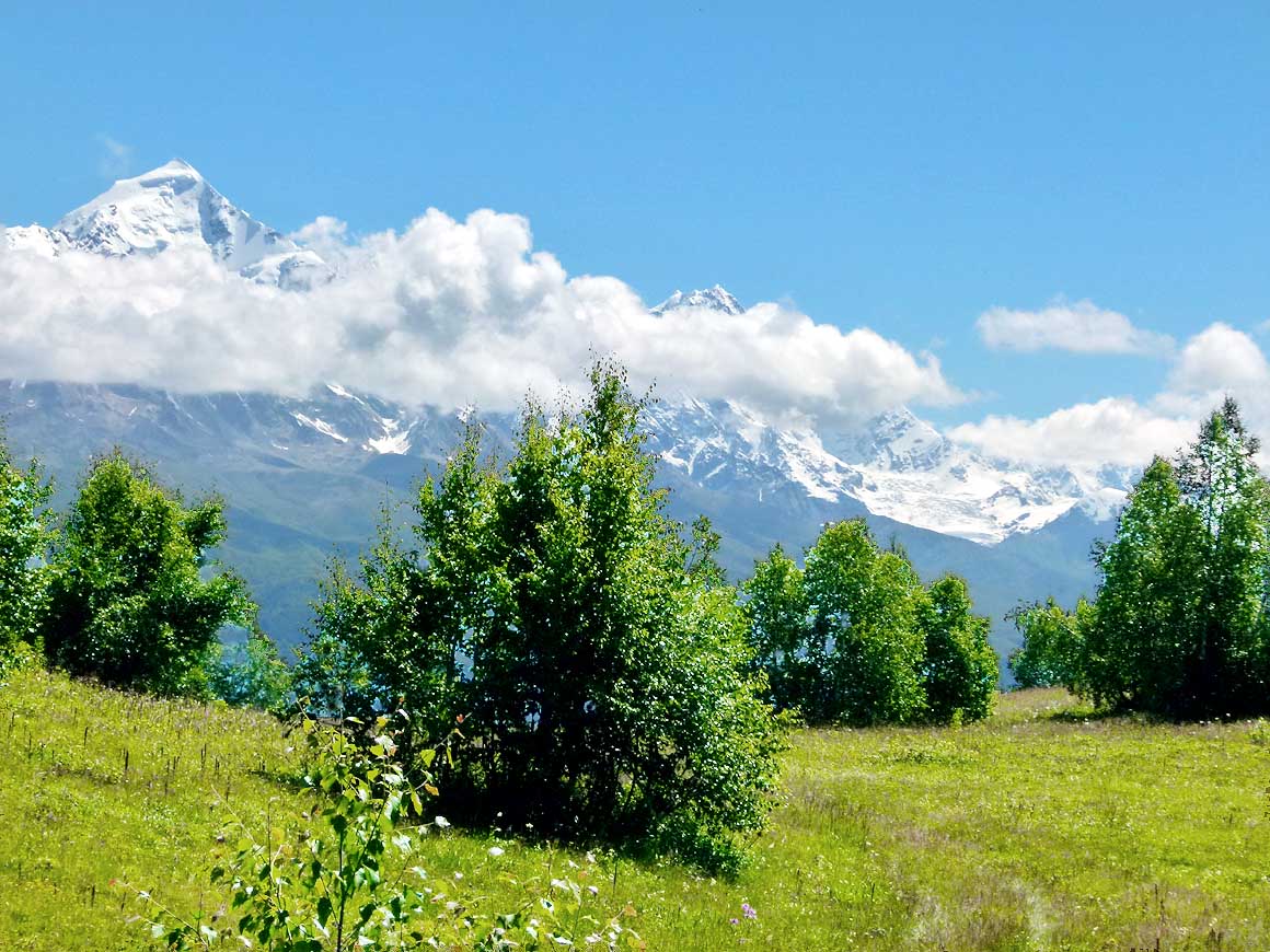
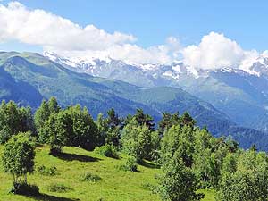
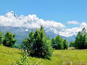
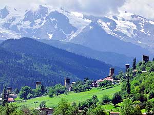
Hidden behind these mountain ridges
- lies the "beautiful, wild and mysterious"
- mountain region of Svaneti, a valley of about
- 60 miles’ length. It is situated in the North
- along the Abkhazian and Russian border
|
-
167
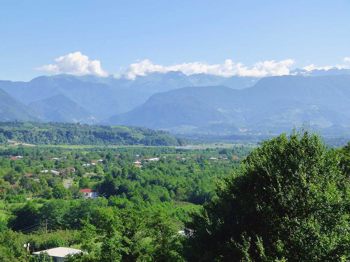
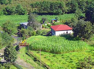
From Zugdidi, the starting point to
- Svaneti, we first cross a plain where farmers
- especially grow corn. The geographical begin
- of the valley starts 4 miles north of Jvari and
- ends at Ushguli, about 30 miles after Mestia
|
-
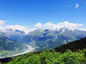
168 Our about 60 miles long
climb to
- Mestia – the main “city” of Svaneti –
- starts behind Jvari, firstly along the 15
miles
- long Enguri (Jvari) Reservoir, afterwards
- through narrow gorges, flanked by heavily
- forested steep mountain ridges .....
|
-
- „Beautiful, wild and mysterious“ – that is how our Lonely Planet
travel guide describes the „Svaneti Area“ along the Abkhazian and
Russian border. The sun is shining, the sky is blue when we set off
to this remote mountain region, lying 87 miles [140km] away. Through
many hairpin bends, narrow gorges, flanked by heavily forested steep
slopes, we drove deeper and deeper into the alpine world. Soon we
arrive at the turquois shining 13 miles [20km] long Patara Enguri
(Jvari) Reservoir,
passing little sleepy villages. The more we gain on
height, the closer snow-covered mountain peaks of the big Caucasus
Range are looming above the forest line.
|
-
-
|
-
-
|
-
-
|
-
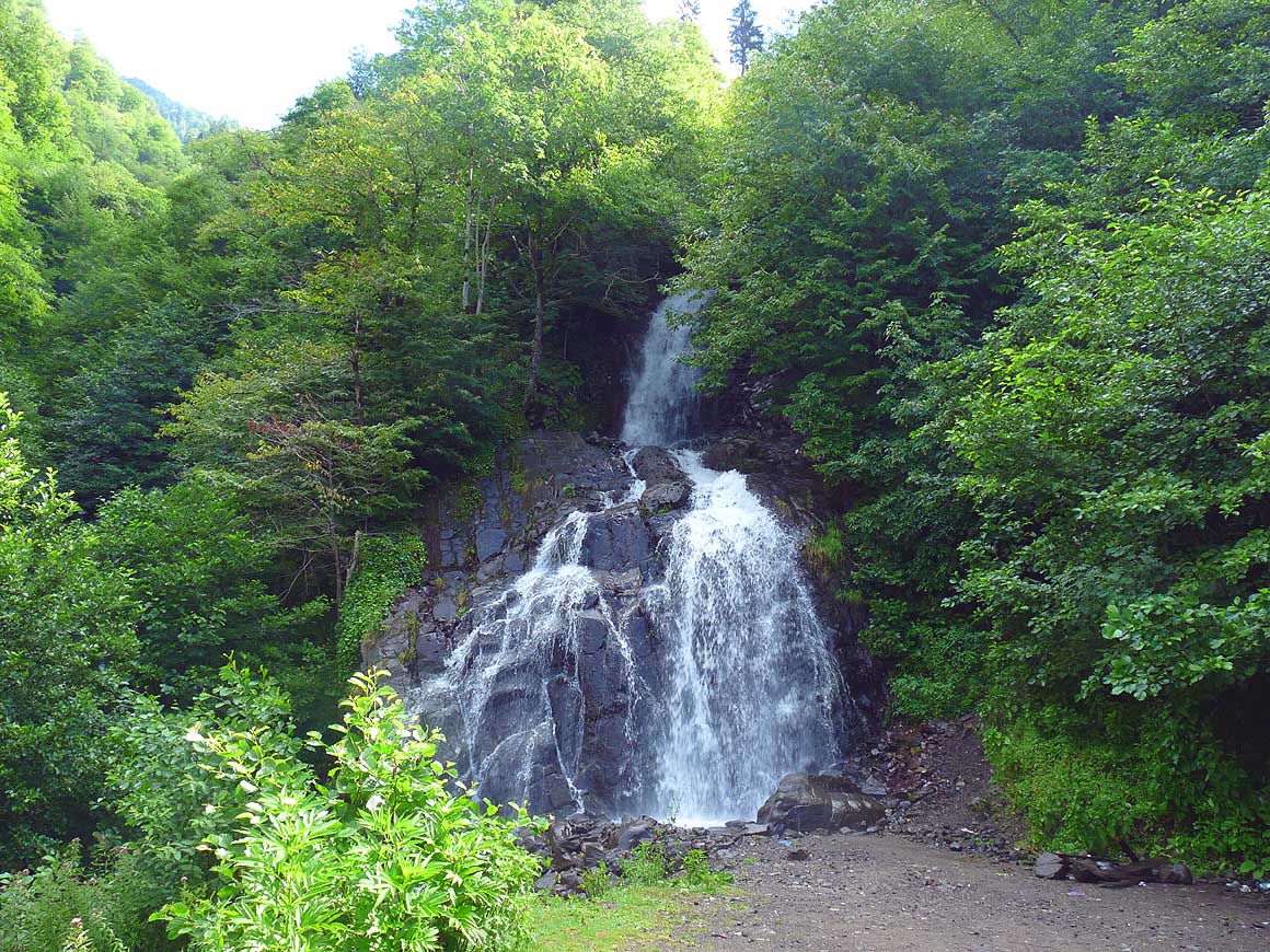
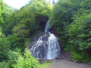
169
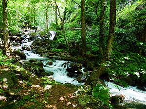
..... right beside the road lovely
- waterfalls cascade down the forested hills
|
-
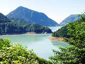
170
The turquoise, about 12 miles long
- Enguri (Jvari) Reservoir located on an
- altitude of about 1’400 ft. belongs
to
- the many scenic attractions along
- the Svaneti route .....
|
-
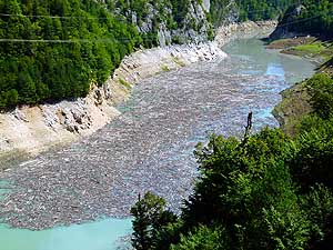
171
..... at the entrance of the Enguri
- river driftwood has accumulated. Police is at
- the spot. They are searching for four Russian
- tourists who fell into the reservoir with their
- car (one week later, they still weren't found)
|
-
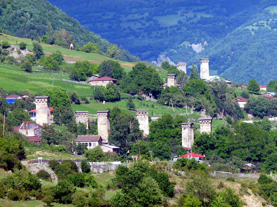
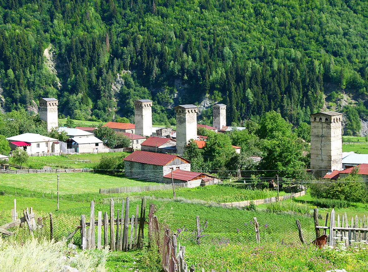
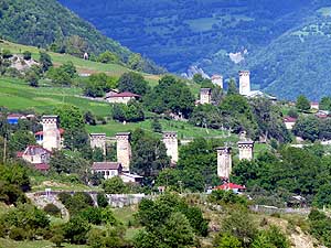
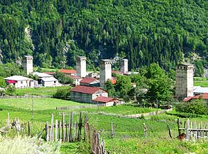
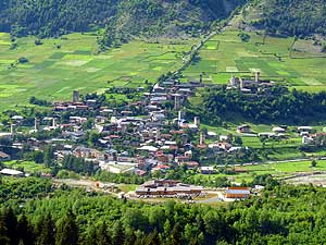
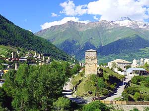
- Already in Lengeri, the first stunning „Koshkebi“ – the
defensive stone towers – appear. They are Svaneti’s emblem of which
still 175 are said to remain. At times of invasions and murderous
blood-feuds they served as hideouts to villagers. In Mestia, the
main town and center of Svaneti, which comprises an agglomeration of
10 neighborhoods, they are particularly plentiful. Here is also an
accumulation of guesthouses. Apart from the main square, which has
been lovingly upgraded, Mestia however turns out to be a dusty
mountain village with broken streets, but framed by a wonderful
mountain scenery.
|
-
-
-
-
|
-
-
|
-
-
-
-
|
-
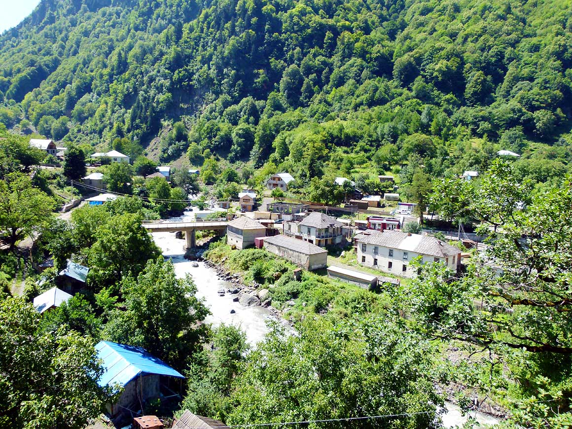
172
We cross the village of Khaishi along
- the narrow river valley while we continue on
- many hairpins into the mountains. Here
- enters the Khaisura river visible on
the photo
- into the Enguri river. Short before the village
- the 661 ft. high Khudoni dam is planned
|
-
173
The Enguri river pushes its way
- through a deeply forested gorge. The
- foreseen construction of the Khudoni
- dam would flood the whole valley and
- the village of Khaisha would have
- to be relocated
|
-
174
A small forest clearance, surrounded
- by the silent dark walls of the forest,
- becomes our relaxing night camp in
- this still (!) untouched mountain region
|
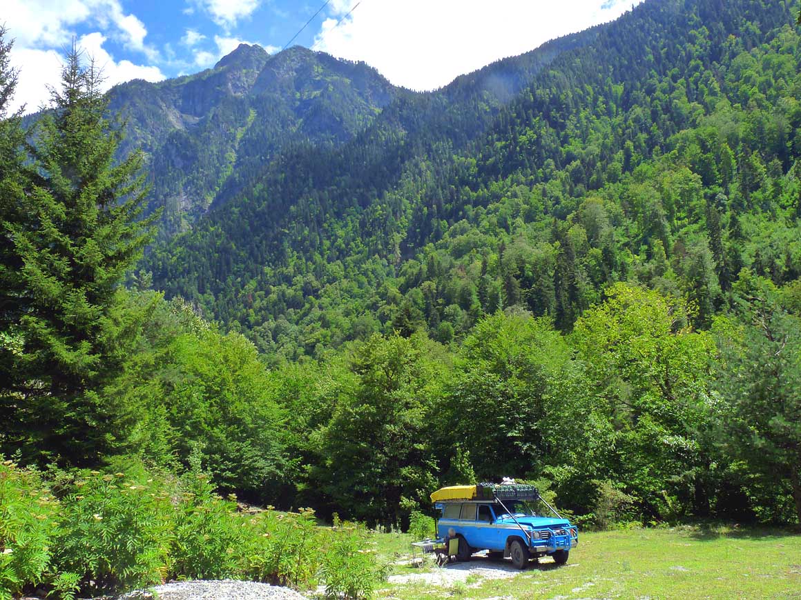
-
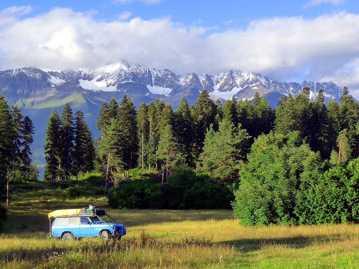
- We immediately realize: Here we cannot camp. May be further up
the road? Thereby we land at the Hatsvali Chairlift Station 5 miles
[8km] further up the road. In this region we set up our camp in an
alpine flower meadow and enjoy the colorful butterflies that fly
from blossom to blossom, the wild strawberries, raspberries and
hazelnut bushes. But especially we are mesmerized by the magnificent
high mountain range panorama that presents us in the most stunning
evening light. We are on an altitude of 6'119 ft. [1'865m]
(43.03054 / 42.73879).
|
-
-
-
-
|
-
-

|
-
-
-
-
|
-
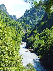
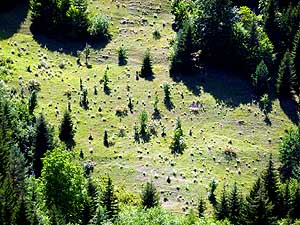
175
The dense forest of the Svaneti
- valley is clearing partially
|
-
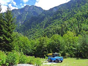
176
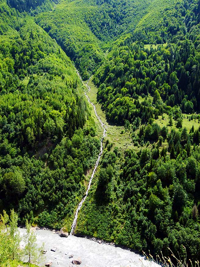
Fed by the melting snow, a thin
- water stream falls from high up through the
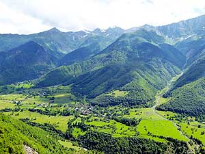
- forest slopes down to the Enguri river
|
-
177
The first sleepy villages at the foot
- of deeply forested mountain slopes come into
- sight. The Svaneti valley widens. Here on the
- south side of the valley the village of Svipi
|
-
- It is 2am. Emil is tossing and turning in bed. What's the
matter? „The starlit skies disappeared. It looks for rain“. He is
affraid that our camping terrain could become marshy by heavy rain.
From experience I know that he will not sleep for the rest of the
night. „Shall we pack up and move to more solid ground, I ask him
half-heartedly“. He immediately agrees.
|
-
-
|
-
-
|
-
-
|
-
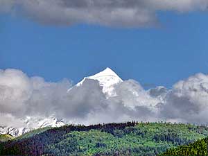
178
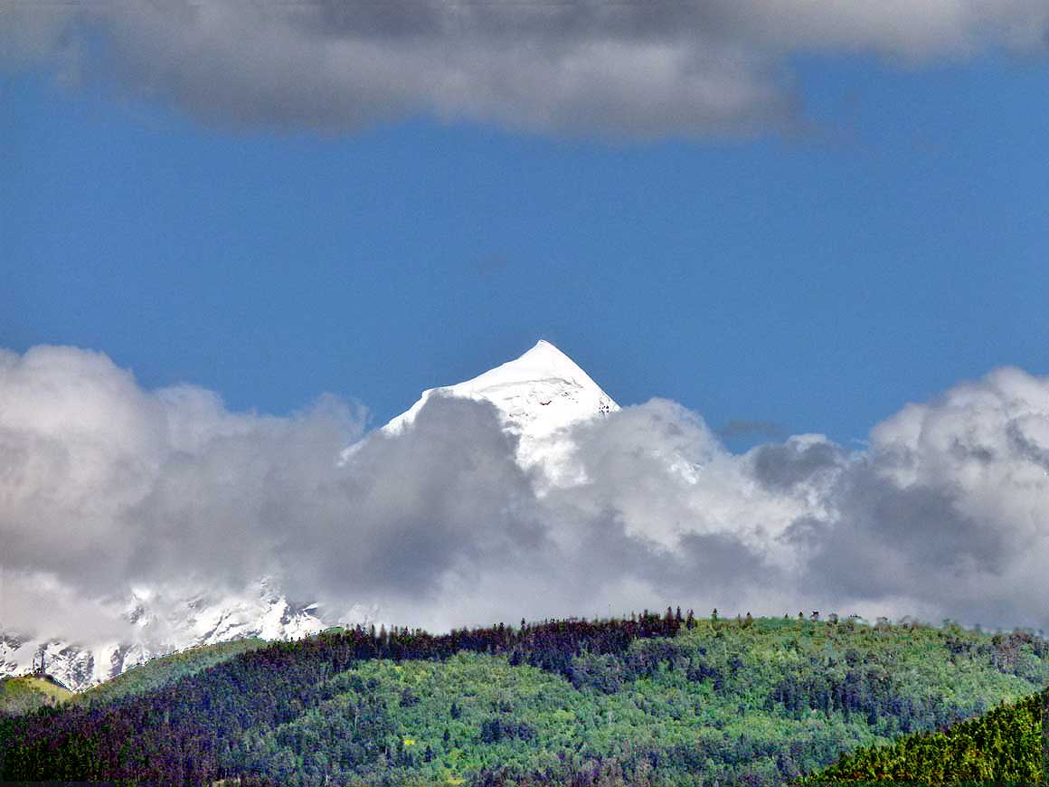
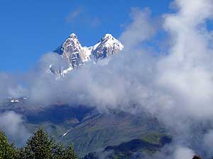
The first snow-covered mountain
- peak of the Great Caucasus greets from far:
- The 17’037 ft. (16’896 ft.? / 16’627 ft.? /
- 17’064 ft.?) tall Shkhara
|
-
179
In the villages of Lenashi-Lengeri
- a few miles before Mestia the first
- "Koshkebi" appear – the defensive stone
- towers that are Svaneti's emblem .....
|
-
180
..... they were designed to house
- villagers at times of invasion and
- murderous blood-feuds
|
-
- Under windy and freezing conditions we rearrange things to get
the drivers seat empty, and in the light of our torch (the
LandCruiser light just happens not to function) we drive the few
yards to the gravel road at the edge of the woods. Duration of
action: Half an hour.
|
-
-
|
-
-
|
-
-
|
-
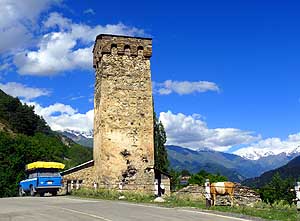
181
The Svan defensive towers are built
- from local stone and rock. Most are 65 to
- 80 ft. tall and have four to five floors that
- are connected to each other via internal
- wooden staircases
|
-
182
Our LandCruiser stands beside one
- of the 175 stunning stone defense towers,
- called "Koshkebi". That many are said
- to still exist in Svaneti
|
-
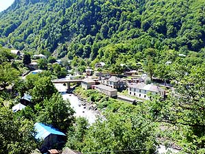
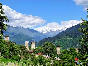
183
Mestia (3’000 people) , the main center
- of "Upper Svaneti" – in Georgian called
- "Zemo Svaneti" – is located 4’920 ft. above
- sea level. It consists of an agglomeration of
- around ten neighborhoods with another
- population of 12’000
|
-
- At 3am we are back in our warm sleeping bags. At 7:30am we wake
up under a glorious blue sky – our hush-hush night operation was in
vain. But prevention is better than curing! For breakfast we return
to our lovely meadow spot. The snow capped mountain peaks of the
Caucasus range around us are cloudless and the glacier that appears
like a half moon between the mountains sparkles especially
beautifully.
|
-
-
|
-
-
|
-
-
|
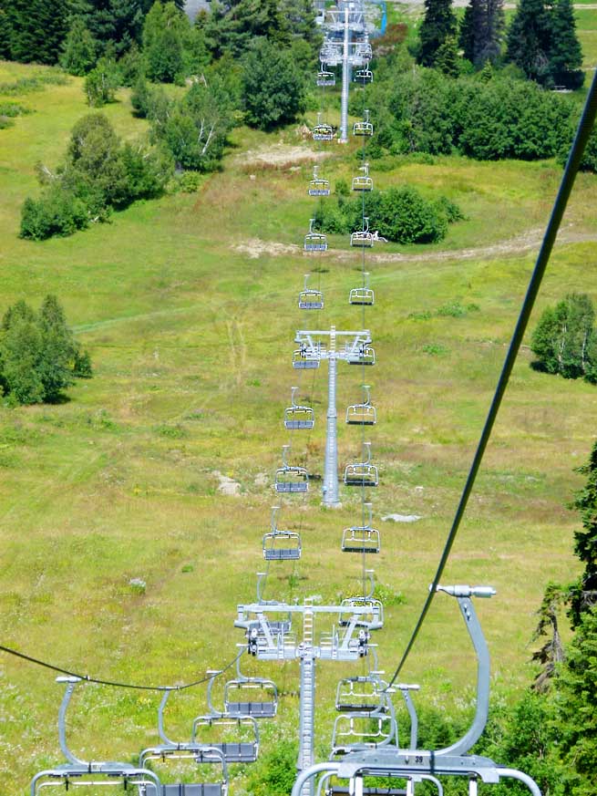
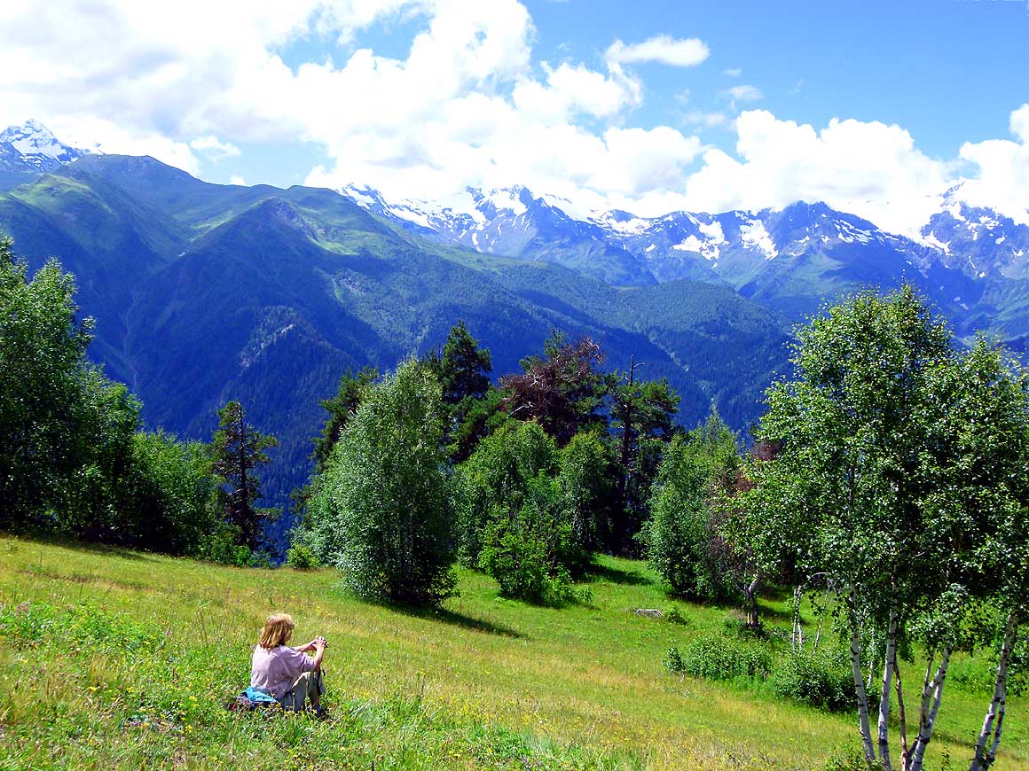
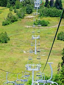
- At the Hatsvali chairlift station, 5 miles south of Mestia on an
altitude of 6’210 ft.,
- we let ourselves enchant by the high mountain panorama with its
snow-capped peaks and glaciers engulfed by the morning mist:
|
-
184
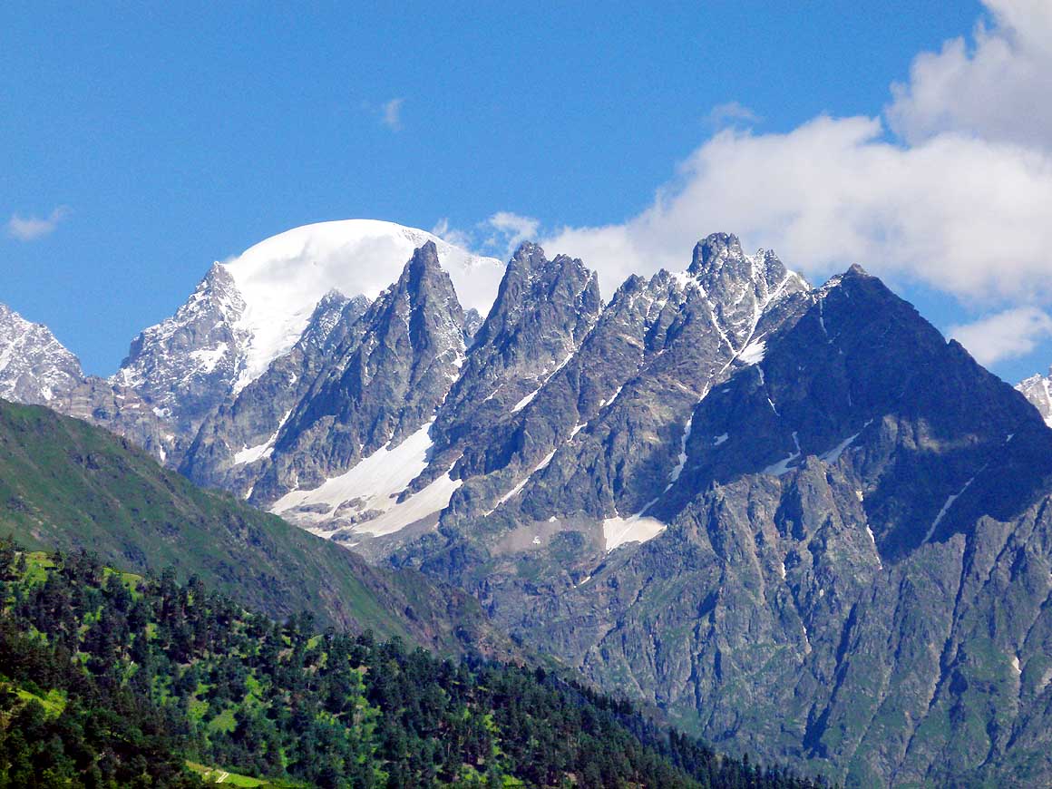
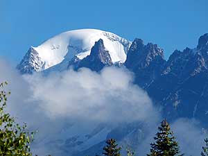
The high twin peaks
- of Mt. Ushba (15’453 ft.)
|
-
185
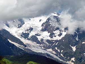
The glacier on the 11'253 ft. high
- Dalakora ridge looks like a half moon
|
-
186
View towards the Svaneti Range with
- the 13'156 ft. high Mt. Lahili south of Mestia
|
-
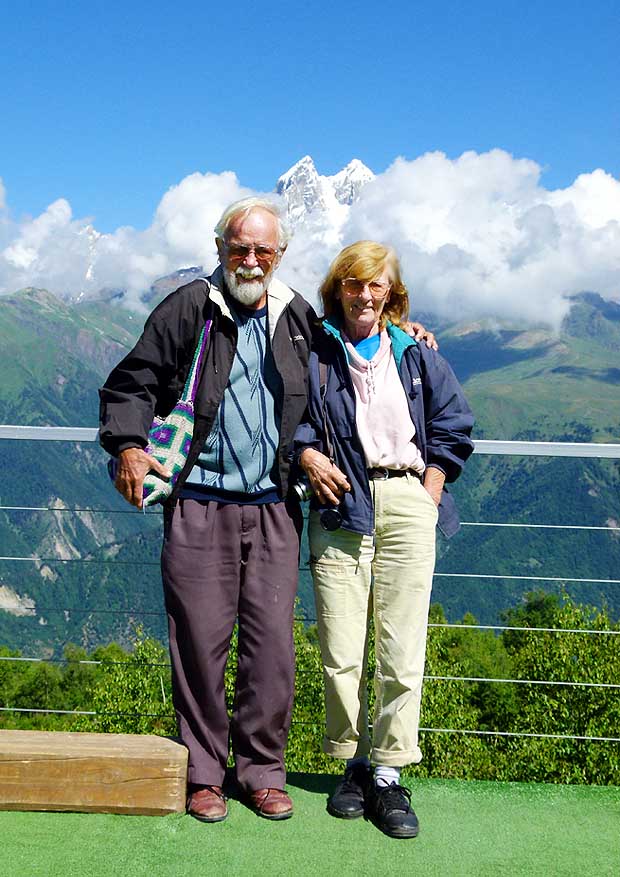
- For only 3 Lari (GEL) (US$1.85) per person, at 10am we take the
first chairlift up to the „Cafe Zuruldi“ platform on 7‘700 ft.
altitude with its viewing terrace. What a magic 360° snow covered
mountain range panorama! It reminds us to the Fitzroy region in
Chile. But we are not only mesmerized by the mountain scenery but
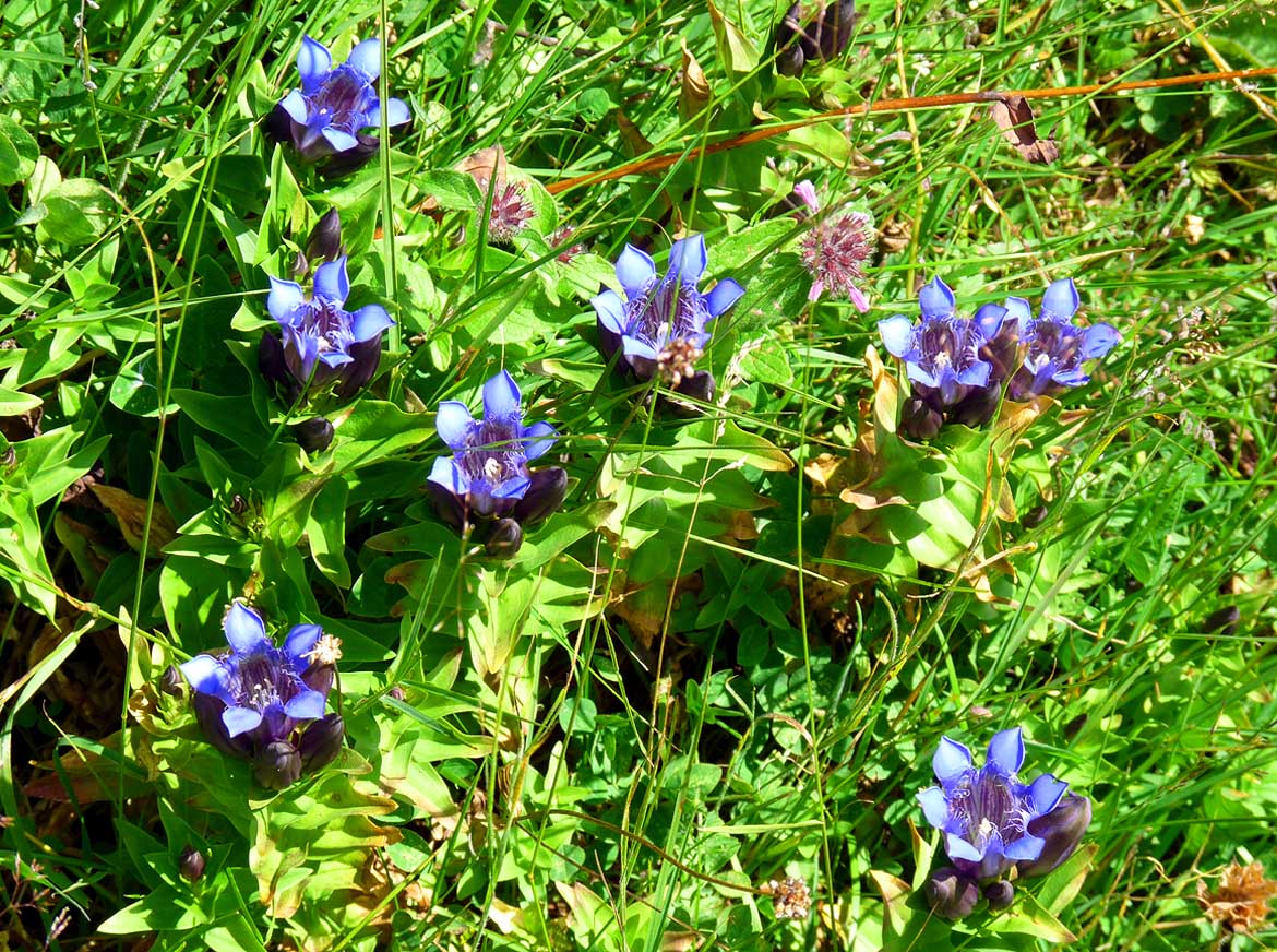
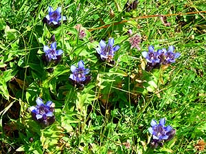
also by the alpine flora. We even spot gentians – the first ones
since we left Switzerland almost 30 years ago.
|
-
-

|
-
-
|
-
-
|
-
187
Our idyllic camping spot on 6’120 ft.
- altitude above the Hatsvali Chairlift Station
- with the white-capped peaks of the Caucasus
- range in the background. Here, on August 1st,
- 2013, we celebrate our 28th Swiss National
- Day far from home between glow worms
- and fire flies
|
-
188
We just can repeat it all over
- again: Nature is a treasure box
|
-
189
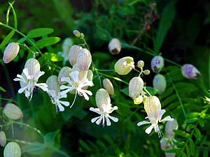
We discover these delicate white
bellflowers between the profusion
- of flowering plants
|
-
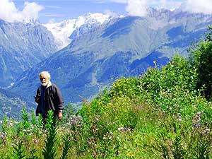
- We savor every moment. Only the increasing cold at the abating
sunrays can drive us away. We return to our idyllic camping spot at
the edge of the forest. In the darkness glow worms spark like
diamonds on the ground, and in the air jumbo fire flies are shining
in a competition – a beautiful natural replacement of our 1st of August
bonfire
back home. Because today our homeland Switzerland celebrates its
National Day 2013.
|
-
-
|
-
-
|
-
-
|
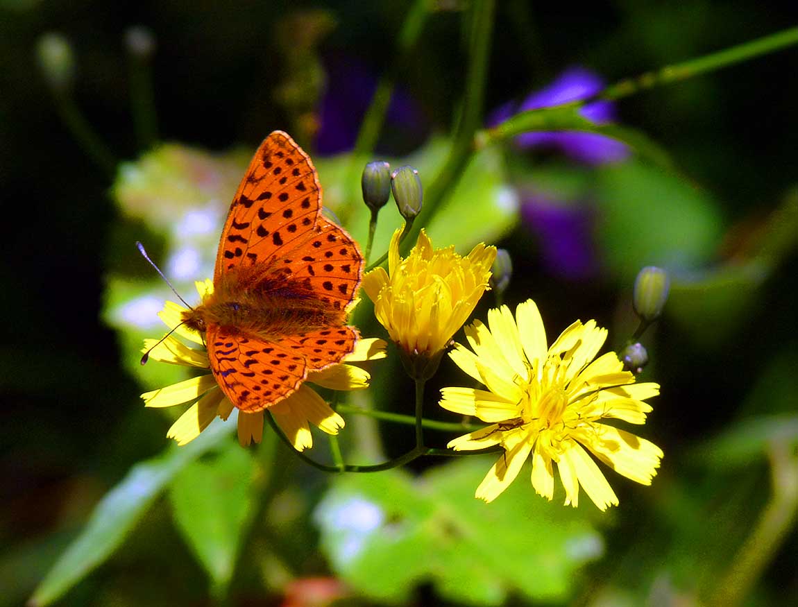
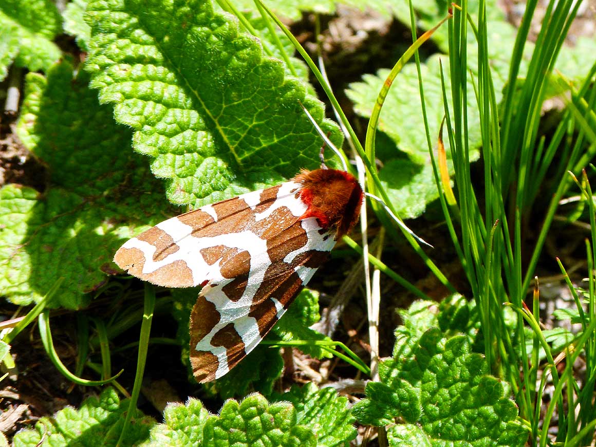
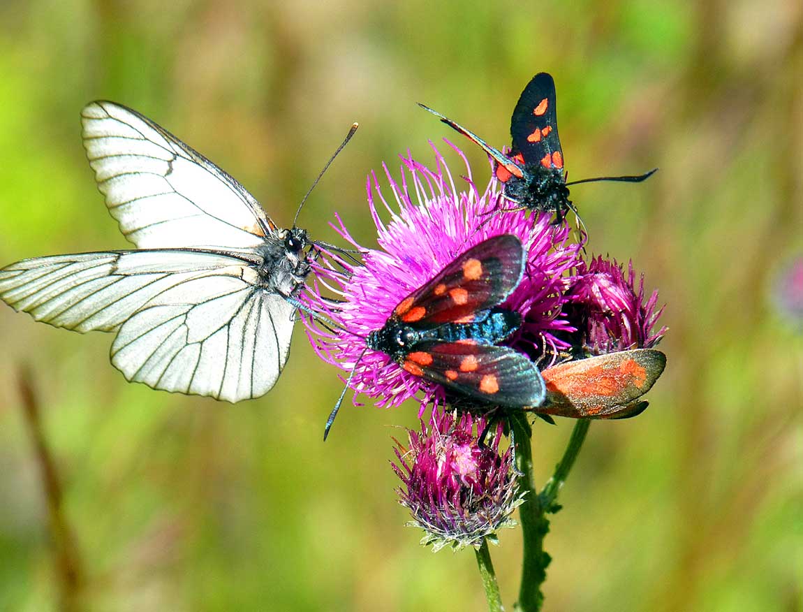
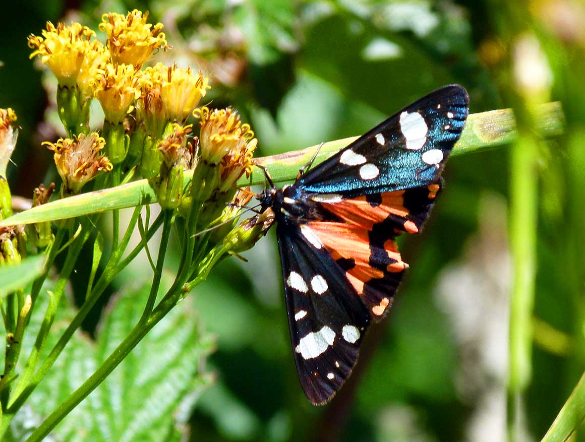
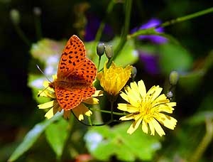
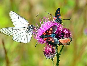
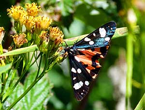
- We can hardly get our eyes off all the beautiful butterflies that
fly from blossom to blossom in the flower-strewn alpine meadows of
Svaneti
|
-
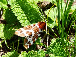
190
Is it a butterfly or a moth?
|
-
191
"Is there still room for myself?"
|
-
192
Even half withered blossoms
- are still tempting
|
-
- We have a hard time to leave this haevenly spot. But we need
bread and water. We find bread at an old woman’s tiny shop in Mestia
and water at a gasoline station a bit out of town. Only now it
catches our eye how really laid back this hamlet still is despite
its recent tourist boom.
|
-
-
-
-
|
-
-
|
-
-
-
-
|
-
193
From 7’700 ft. altitude of the viewing
- terrace of the "Cafe Zuruldi" in the skiing
- and hiking area of Hatsvali, the peaks bet-
- ween 13’000 and 17’000 ft. of the Greater
- Caucasus- and the Svaneti-Mountain-Ranges
- are almost within one's reach .....
|
-
194
..... in 15 minutes and for only
- 3 Lari (GEL) = $1.85 the Hatsvali chairlift
- brings us up to the 360° viewing terrace
- of the "Cafe Zuruldi” on an altitude of
- 7’700 ft. The lift was built by the French
- and has a length of 4’800 ft. .....
|
-
195
..... Emil is on a photo safari.
- He is especially enthusiastic about the
- mountains, but shares now also Liliana's
- enthusiasm for flowers. In the back the
- 7 miles long Lekzhiri Glacier
|
-
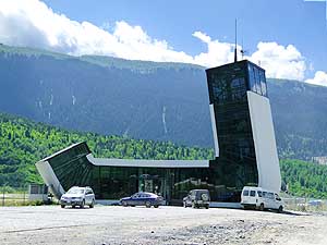
- We go for a spin, drive on a miserable road to the airport and
cannot imagine that an aircraft has ever landed there; but that's
not the case: The Queen Tamar airfield, pic #208 - ultra-modern -
has been regularly serviced by Vanilla Sky Airline since 2011. Queen
Tamar, by the way, ruled the country of Georgia between 1184 and
1213. Then we continue over the bridge to the other river side and
drive past old, partly dilapidated houses
on a even worse earth road back towards Mestia
again. And what do we see in the middle of it? A
camping on a meadow right next to the dusty path with bicycles and
tents.
|
-
-
|
-
-
|
-
-

|
- What can we wish more? A blue sky and a glorious alpine landscape
wherever we are looking
|
-
196
to the East
|
-
197
to the North
|
-
198
to the Southwest
|
-
- How much more romantic is „our“ isolated spot at the edge of the
woods to which we return also this night. We have already jacked-up
when a black Mercedes with tinted windows drives past and the driver
turns down his window. What might he possibly want? He makes
interrogative signs why we have jacked up. It is not his business,
we think and do not open our window.
|
-
-
-
-

|
-
-

|
-
-
-
-
|
-
199
Not exactly the scenery of the "Fitzroy"
- peaks in Chile, but not less impressive: The
- 11’500 ft. high peaks of the Dalakora ridge
- in the Great Caucasus Mountain Range
|
-
200
We do what everybody does: We
- make a souvenir picture from the viewing
- terrace with the 15’453 ft. high twin peaks
- of Mount Ushba in the background
|
-
201
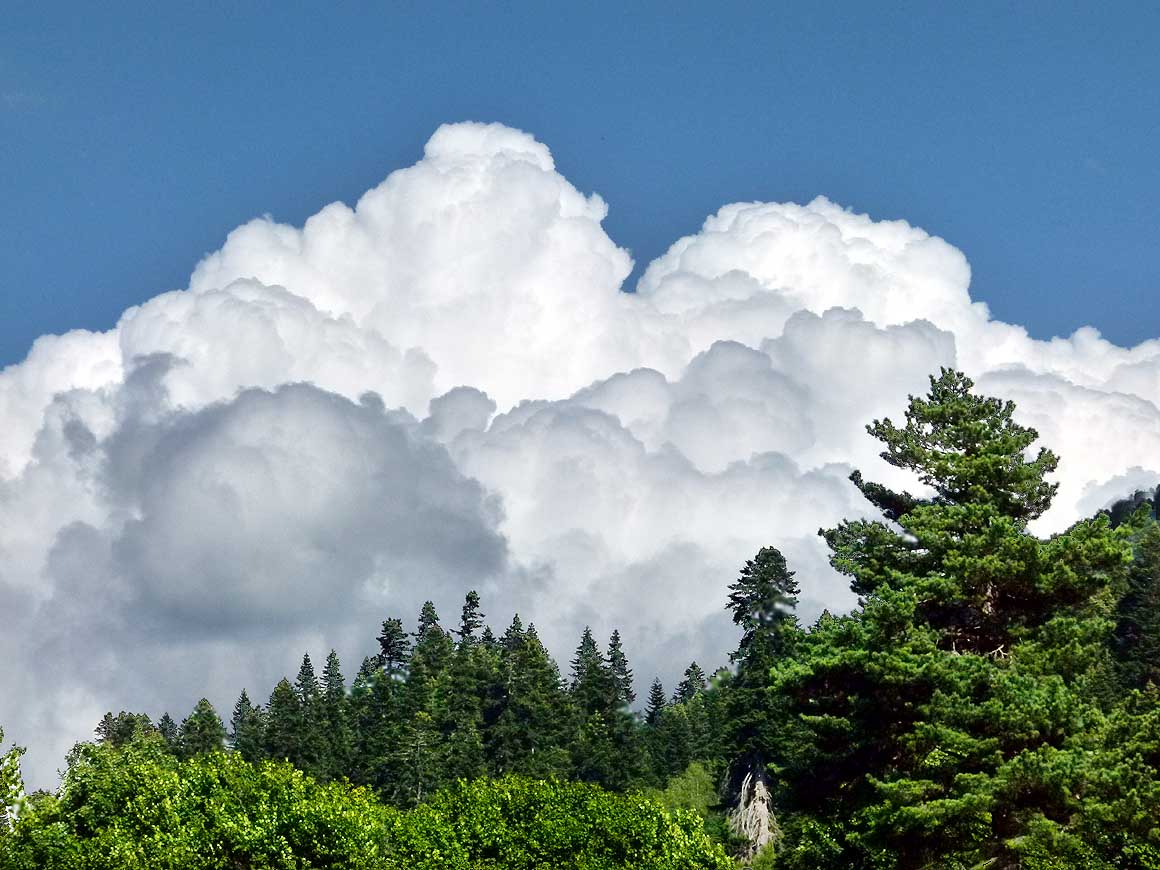
Always a stunning sight:
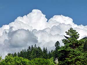
- Piling-up magnificent cumulus cloud
- formations – stands a weather
- change in line?
|
-
- But he doesn't give up. He steps out of his car and
ostentatiously starts to phone heatedly, looking again and again to
our LandCruiser and gesticulating nervously. We are almost sure that
he calls the police. Let him do it, we have nothing to hide!
Eventually the cold drives him back into his car. There he waits for
at least half an hour. Then suddenly he starts the engine and drives
away. Presumably the police has given him the all-clear signal.
|
-
-
|
-
-
|
-
-
|
-
202
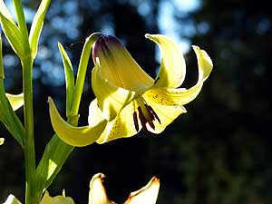
We never expected to find in alpine
- Svaneti a yellow Martagon or Turk's cap
- lily (Lilium martagon)
|
-
203
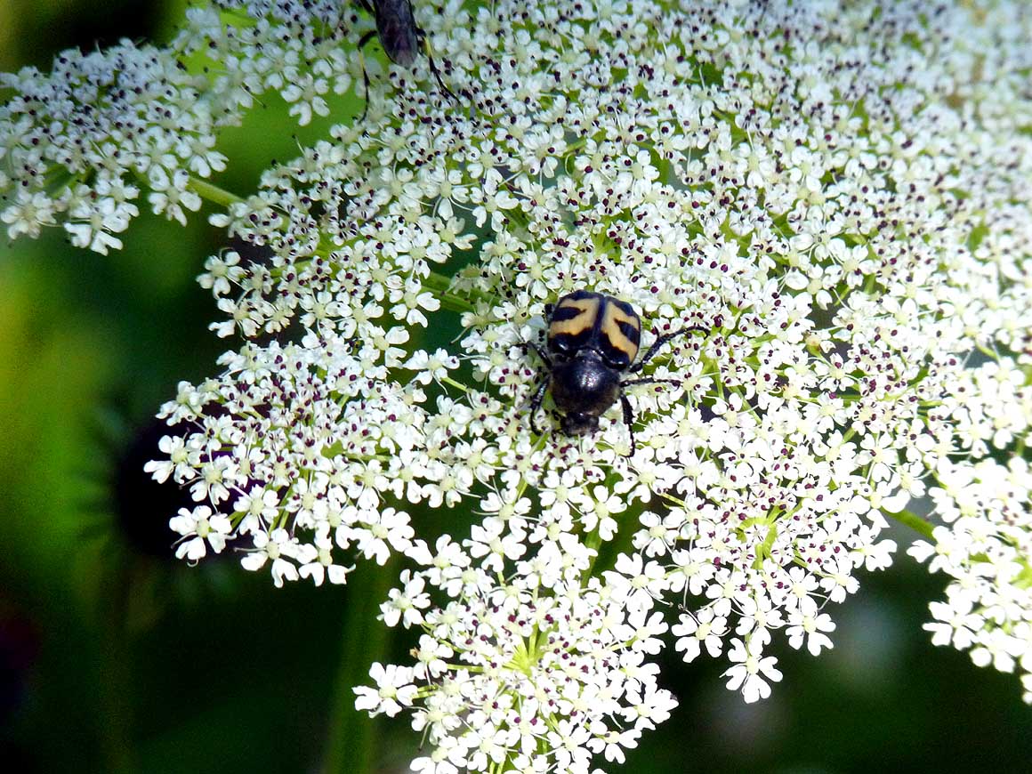
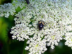
Beetle "in the land of Cockaigne" on
- cow Parsnip (Heracleum) or chervil
- (Anthriscus), which both belong to the same
- family of parsley or carrot (Apiaceae)
|
-
204
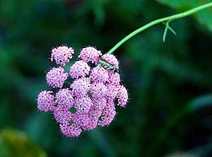
Another beauty of a flower, probably
- from the same kind as # 203 (left) but in
- pink that makes us a happy day with its
- grasshopper
|
-
- Mestia is slowly awakening when after three nights we leave the
region of Svaneti. Reaching the main square we see an Austrian
motorhome parked, but there is no sign of any movement. Therefore we
move on. Together with us, also the sparkling blue skies of the past
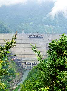
couple of days move on, and on our way to the Enguri dam with its
891 ft. [271.5m] tall wall – the sixth highest in the world – they
change from clouds to short sunny periods. Reaching the dam wall
however, it starts to rain. Haevy downpours follow in short
intervals.
|
-
-
|
-
-
|
-
-
|
-
205
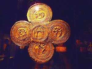
A beautifully elaborated golden altar
- cross at the “Museum of History &
- Ethnography” in Mestia. Svaneti's isolation
- was ideal for safekeeping religious treasures
- during the many invasions of Georgia, also
- due to the many towers
|
-
206
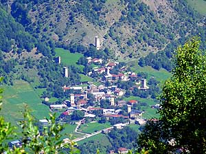
View of Laghami of Mestia “city”.
- Svaneti has never been destroyed by
- enemy forces and the life of the Svan
- population has been little
- influenced from outside
|
-
207
View towards the center of Mestia.
- Ancient Svan people are known for their
- tower settlements, own school for sacred
- wall painting, creation of special musical
- instruments and tradition of woodcarving
|
-
- Nevertheless during the short dry spells I
still manage to pick a full bowl of large sweet berries from the
bulging blackberry bushes surrounding us.
Now we are just missing some whipped cream! Back in
Zugdidi, the town at the Abkhazia border, at a little supermarket
along the road, I think to have found it. But it turns out to be
strawberry yoghurt. But we like it nevertheless. In pouring rain we
check into the Hotel Samegrelo for 70 Lari. There we learn that four
Russian tourists fell into the dam with their car and that their
search is going on already for more than a week.
|
-
-
-
-
|
-
-
-
-
|
-
-

|
-
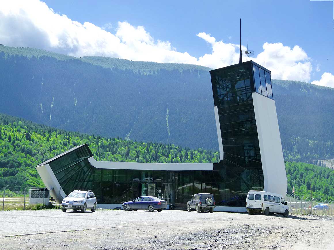
208
The unusual building of “Queen
- Tamar“ airport in Mestia, reachable by
- a broken-up, potholed and dusty road, is
- already operational since 2010, but until
- the end of 2013 hasn’t been served
- by regular flights
|
-
209
Words of the Greek historian and
- ethnographer Strabo about the Svan people:
- "They are noteworthy for their courage and
- power; they reign over almost everything
- around them and control the peaks of the
- Caucasus" – view of Mestia from the east
|
-
210
When will these trees fall down to
- the recently built new road? The first
- road accessible by car from Zugdidi to
- Svaneti was built in 1934. Prior to that
- there were only mountain paths passable
- by carriage, horse or on foot
|
-
- Today, August 5th, 2013, is our last possible entry day into
Abkhazia. In one of the many currency
exchange offices in Zugdidi we change our Georgian Lari into Russian
rubels and set off towards the border. As if our LandCruiser would
try to prevent us to enter a self declared country where travel
advisories are discouraging to visit it, our LandCruiser starts to
stutter and does not run on all cylinders anymore. No, it cannot do
this to us right now! We do not listen to it and shortly after we
reach the exit border of Georgia.
|
-
-
|
-
-
-
-
|
-
-
-
-

|
-
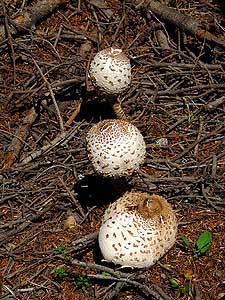
211
Beautiful to look at, but edible?
- Mushrooms in the Svaneti forest
|
-
212
Also gentian (Gentiana) grow on
- these heights – they are the first ones we see
- since we left Switzerland almost 30 years ago
|
-
213
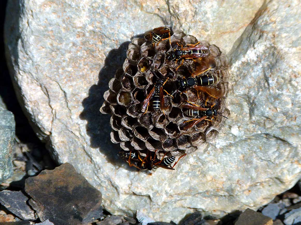
Busy wasps at their nest, astonishingly
- on (and not below) a stone
|
-
- The first thing the border official wants to see is our
„Clearance Letter“ from Abkhazia's capital Sukhumi, i.e. the permit
(TIP) that allows us to visit the country with our LandCruiser. At
the beginning there is some confusion, because the officer is
interpreting its wording „clearance letter from July 25th to August
5th, 2013“ the way that today we would have to leave
Abkhazia.
|
-
-
-
-
|
-
-
|
-
-
-
-

|
-
214
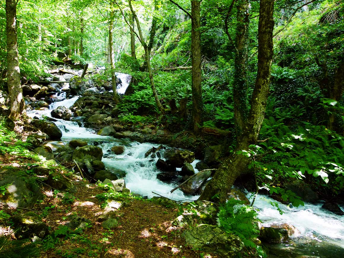
It almost looks tropical: Along the
- Zugdidi-Svaneti-road a small mountain
- river meanders through boulders, moss and
- plants and ends up in the large Enguri river
|
-
215
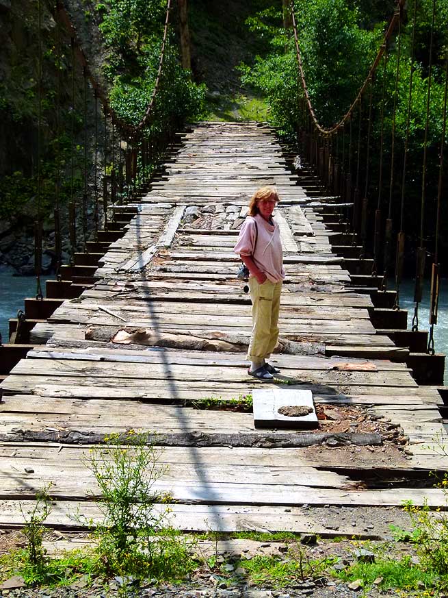
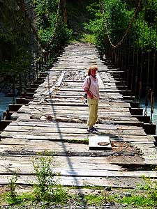
Such not very trustful suspension
- bridges can be seen every now and again.
- A vehicle might be too much, but for pedes-
- trians and animals it’s still OK to cross
|
-
216
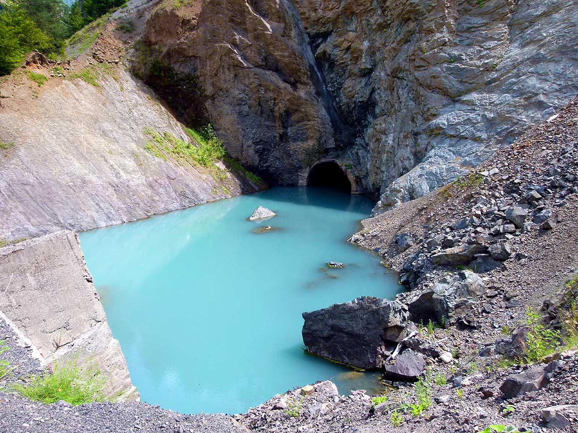
The Soviets had a variety of military
- installations along the Enguri river (short
- before Khaishi). Probably such tunnels and
- walls belonged to them too. Partly they are
- now covered and flooded by the Enguri
- Reservoir, built 1961
|
-
- After some phone calls however the situation clears-up. We are
obviously allowed to enter during this time. There are just hardly
any travelers who visit this special state with their own car.
Without an exit stamp from Georgia – Georgia regards
Abkhazia as a Georgian province – we
leave the country , taking with us wonderful memories of people,
landscapes and cheese tarts.
|
-
|
- On August 5th, 2013, we end after 14 days our third visit of
Georgia – from Tbilisi to Kazbegi and further to Svaneti – and
explore
- our 177th country Abkhazia. From there, we return after 8
days on August 13th, to our 4th but very short visit of Georgia
|
-
-
|
-
-
-
-
|
-
-
-
-
|
-
217
The 891 ft. tall dam of the Enguri
- Reservoir is the sixth highest in the world.
- The length of the crest measures 2’460 ft. and
- catches 1.4 billion ydł. The planned Khudoni
- dam (661 ft. high, 300 billion ydł), 17 miles
- upstream of the Enguri river (before Khaishi
- pic.# 172), hasn’t been allowed yet to start
|
-
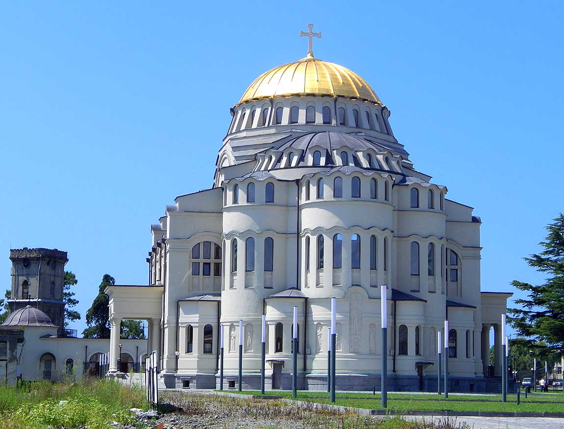
218
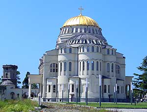
The Cathedral in the center of
- Poti, Georgia's main port, was modeled
- after Istanbul's "Hagia Sofia". Besides
- Batumi, ferries to the
Ukraine run
from here
|
-
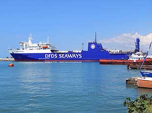
219
Our ferry "Vilnius Seaways" is
berthed
- in the port of Poti. It will sail during three
- days with us to Ilyichevsk near Odessa in
- the Ukraine. There we will set foot on
- European soil for the first time again since
- more than 14 years. On 1/28/1999 we
- left Europe at Gelibolu in Turkey
|
-
|
-
-
-
-
|
-
-

|
-
-
-
-
|
-
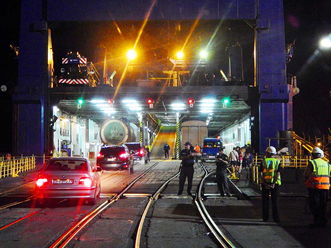
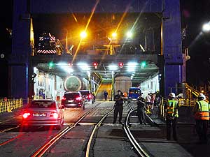
220
8/14/2013 - 10pm: The first cars drive
- into the "Vilnius Seaways". It is 625 ft. long
- and 91 ft. wide and weighs 11'700 tons.
- Together with three other ferries of the
- Lithuanian Shipping Company it made it into
- the Guinness Book for World Records
|
-
221
Guinness Book of World Record
- Certificate of January 1991 for the Lithuanian
- Shipping Company for their four "largest rail
- ferries in the world" – Klaipeda, Vilnius,
- Mukran, and Greifswald. Today the ships
- ‘Vilnius’ and ‘Greifswald’ sail for the
- UkrFerry Company
|
-
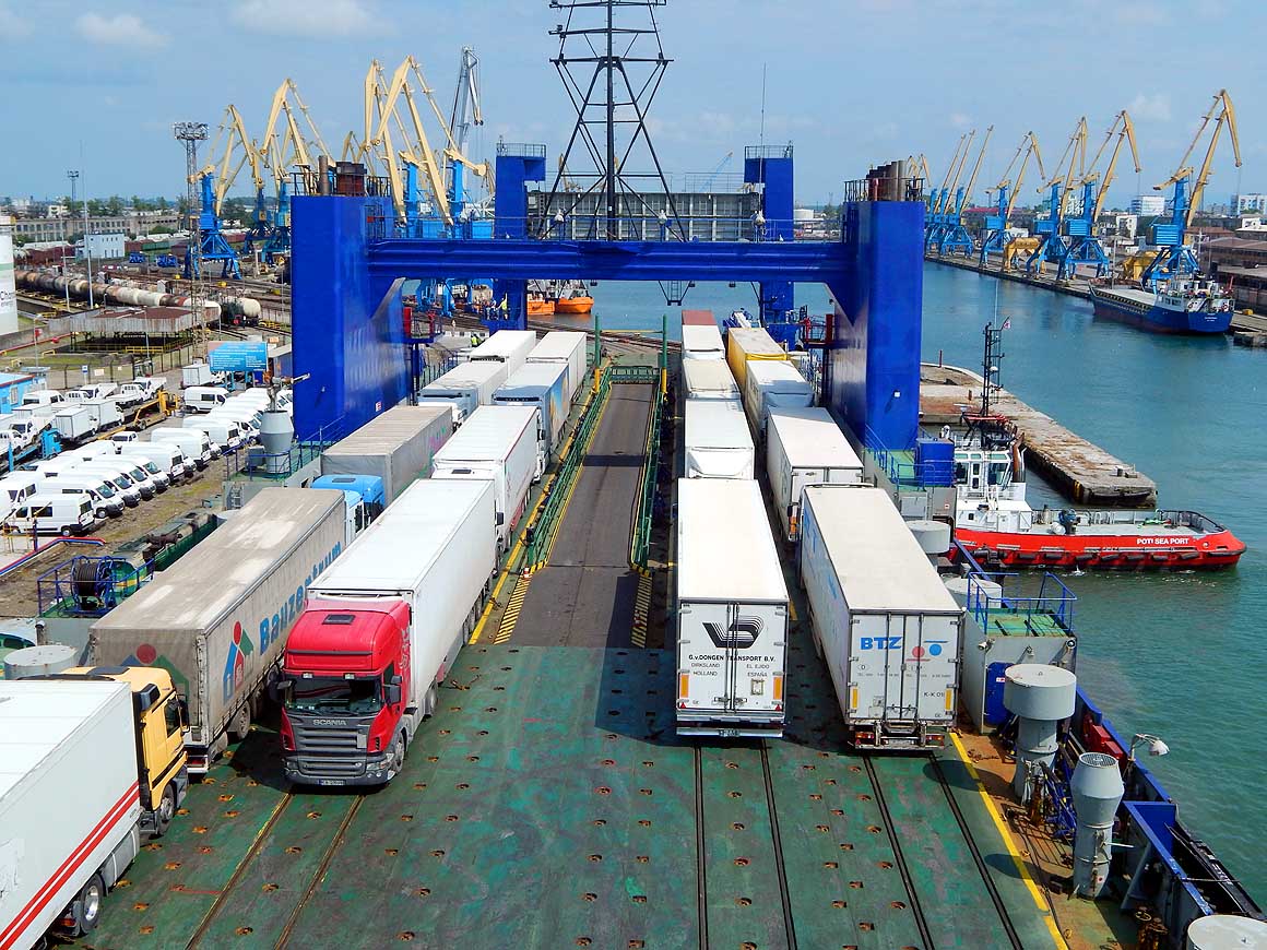
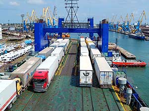
222
From the deck of the "Vilnius
- Seaways" we watch the loading. Fare
- Poti - Ilyichevsk (Odessa) in the
- Ukraine for the LandCruiser $370
- and $125p.P. for a double cabin
- with shower. Very comfortable,
- very clean and very good food
- during the 60 hours’ journey
|
-
|
-
- The "Greater"-Middle East trip 2012/13:
- Sharjah/Dubai/1st Traveler's Festival/Emirates
National Auto Museum - UAE with
car Nov. 2012 to Jan. 2013 - part 1
- Western UAE - Liwa - United Arab Emirates with car in January 2013 - part 2
- Oman 2013 - Part 1 - February
2013: Musandam Peninsula
- Oman 2013 - Part 2 - February
2013: Sohar - Muscat - Rustaq - Nizwa
- Oman 2013 - Part 3 - March
2013: Sur - East Coast - Island of Masirah - Dhofar
- Oman 2013 - Part 4 - March
2013: Salalah & Surroundings (Dhofar) - Nizwa
- Oman 2013 - Part 5 - March 2013: Western Hajar
Mountains
- Al Ain, Eastcoast & Ras al Khaima - United
Arab Emirates with our car in April 2013 -
part 3
- Iran -
Part 1: Ferry Port Bandar Abbas-Shiraz-Persepolis-Pasargad (between Persepolis and Yazd)
– May 2013
- Iran -
Part 2: Pasargad
(excl.)-Yazd-Esfahan – May 2013
- Iran -
Part 3: Esfahan
(excl.)-Chelgerd-Hamadan-Sanandaj-Orumiyeh-Turkey Border
– May 2013
- Turkey: Iran Border-Esendere-Hakkari-Van-Doğubayazıt-Kars-Ardahan-Hopa-Georgia
Border – May/June 2013
- Georgia -
Part 1: Turkey Border-Ajaria-Gori-Tbilisi-Kakheti-Azerbaijan
Border – June 2013
- Azerbaijan: Georgia Border-Balakən-Şəki-Lahıç-Baku-Xınalıq-Quba-Laza-Baku-Gəncə-Georgia Border – June 2013
-
Georgia - Part 2a: Azerbaijan Border-Tbilisi-Armenia
Border –
June/July 2013
- Armenia -
Part 1: Georgia Border-Haghpat-Dilijan-Sevan-Tatev-Goris-Nagorno Karabakh – July 2013
- Nagorno-Karabakh:
Armenia-Stepanakert-Gandzasar-Martakert-Tigranakert-Tnjri-Shoushi-Armenia – July
- Armenia -
Part 2:
Nagorno Karabakh-Goris-Tatev-Noravank-Khor Virap-Echmiadzin-Yerewan-Geghard-Gyumri-Georgia Border – July 2013
- Georgia -
Part 2b: Armenia Border-Ninotsminda-Tbilisi-Mtskheta-Kazbegi-Kutaisi-Zugdidi –
July 2013
- Abkhazia: Georgia-Sukhumi-Tsebelda-Novyy Aton-Lake
Ritsa-Gagra-Pitsunda-Georgia – August
2013
|
|
|