-
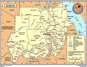
- Sudan Map
|
-
- Map
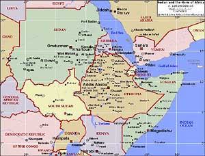
of the Horn of Africa
|
|
-
|
- latest picture:
January 5, 2016
|
-
-
|
-
-
|
-
-
|
-
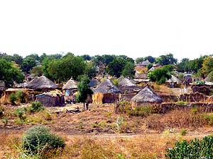
001 12/9/2015: Sudan, our 185th
country,
- greets us in Gallabat still with a typical African
- thatched hut village after leaving the Ethiopian
- border of Metema. Further north
Africa ends and
- Arabia starts with its typical flat brick houses
|
-
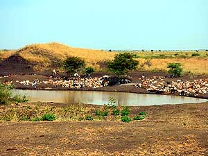
002 Water is scarce in this desert country.
- Nomads therefore set up camp preferentially
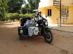
- around a precious pond with their
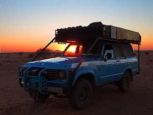
- huge herds of goats …..
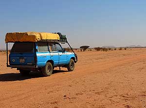
|
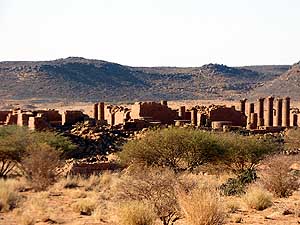
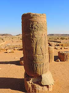
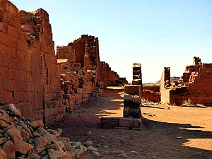
-
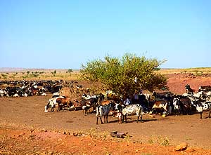
003 ….. next to the water
hole, cattle
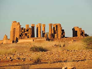
- gather around a single acacia tree that
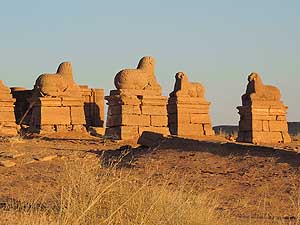
- provides them some shade from the
- hot desert sun
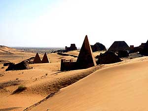
|
-
|
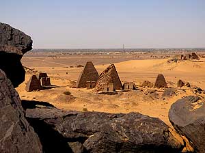
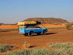
-
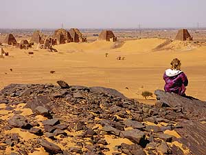
-
|
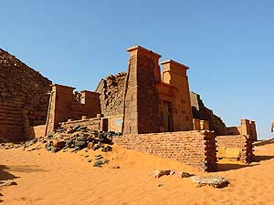
-
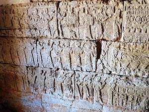
-
|
-
-
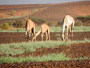
|
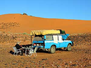
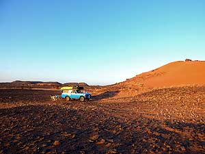
-
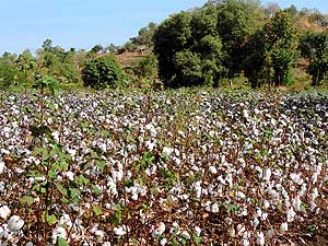
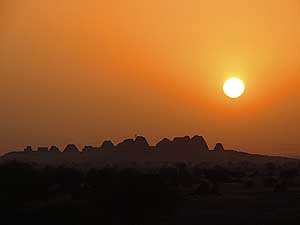
004 A cotton field at its best. Cotton (Gossypium)
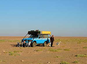
is Sudan’s most important
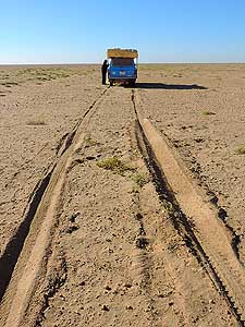
- export. Textiles were always part of
- Sudan’s artisan craftwork
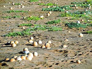
|
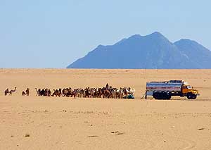
-
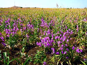
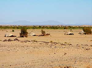
005 Hyacinth flowers (Hyacinthus
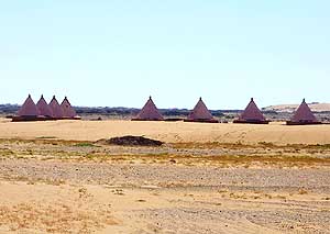
- orientalis) sparkle at the edge of a
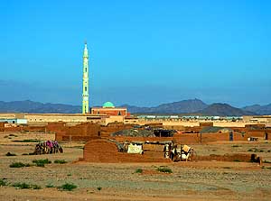
- corn field that stretches for dozens
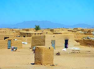
- of miles along the road
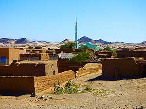
|
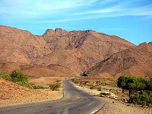
-
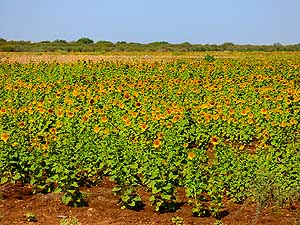
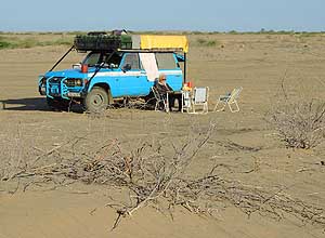
006 Sunflowers (Helianthus
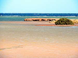
annuus)
- raise their heads towards the sun, giving
- the bleak desert some color
|
-
|
-
-
-
-
|
-
-
|
-
-
-
-
|
-
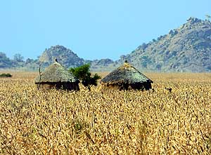
007
Two thatched houses are peaking
- out from a not yet harvested cornfield
|
-
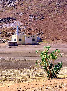
008
Even in the harshest and most
- remote corner we find a mosque in this
- Islamic land deprived of alcohol
|
-
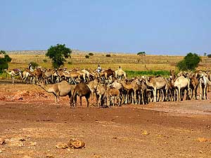
009
Camel herders are moving across
- the desert with their animals. Breeding camels
- is an important income source in Sudan
|
-
|
-
-
|
-
-
|
-
-
|
-
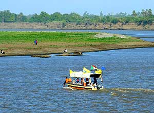
010 At the Istanbul
Restaurant in Wad
- Madani, directly at the shore of the Blue Nile,
- a little passenger boat is crossing to the
- eastern riverside
|
-
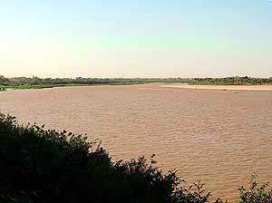
011 An oasis amid the sand: The Blue Nile –
- a lifeline which comes from Tana Lake in
- Ethiopia – holds back the desert and provides
- a narrow strip of fertile land
|
-
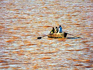
012 With the paddle on the
Blue Nile,
- which looks rather brownish. But also
- the White Nile isn’t better on
|
-
|
-
-
|
-
-
|
-
-
|
-
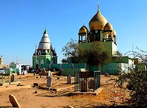
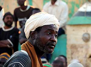
013 The ”Hamad al-Nil“ tomb in Khartoum.
- Sheik Hamad al-Nil was a 19th-century Sufi
- leader of the Qadiriyah order (tariqa) and his
- tomb is the weekly focus for Omdurman’s
- ”whirling dervishes“ (Sufis). Sufis are members
- of a Muslim ascetic-religious orden (tariqa) …..
|
-
014 ….. it attracts every Friday the
- few tourists, local observers as well as
- participants. This local fellow follows
- attentively the happenings from
- the men’s world …..
|
-
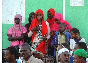
015 ….. while the girls
have
- their own viewing corner
|
-
|
-
-
-
-
|
-
-
|
-
-
-
-
|
-
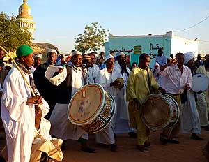
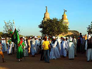
016
After their march across the cemetery,
- participants of the „whirling dervishes“
- ceremony are approaching the ”Hamad al-
- Nil“ tomb singing and drumming …..
|
-
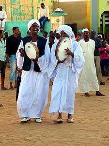
017
….. in the interior of the big
- observer circle two men with cymbals
- (percussion instruments) announce
- the start of the ceremony …..
|
-
018
….. the green banner of the ”tariqa“
- orden is carried by a ”whirling dervishes“
- into the circle and then raised. The ritual
- can begin. In the background the mosque
- of the ”Hamad al-Nil“ cemetery
|
-
|
-
-
|
-
-
|
-
-
|
-
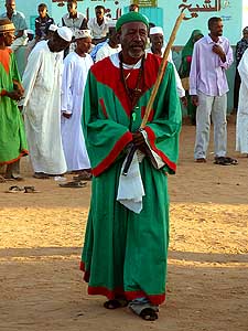
019
A ”whirling dervishes“, dressed in
- traditional green and red, moves around
- the inner circle while the observers sing
- and clap their hands …..
|
-
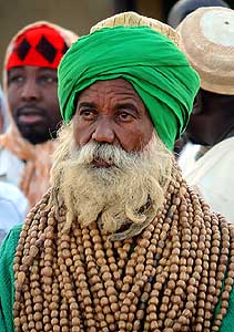
020
….. the chunky beads around
- his neck give this ”whirling dervishes“
- his special look …..
|
-
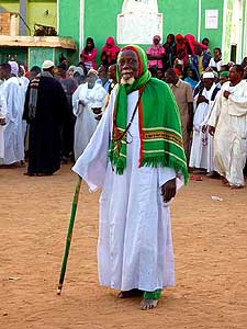
021
….. less decorative, but still wearing a
- scarf with the traditional colors, this ”whirling
- dervishes“ makes a break before joining the
- circling, chanting, bobbing and clapping
|
-
|
-
-
|
-
-
-
-
|
-
-
|
-
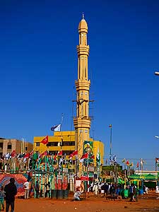
022
At the occasion of religious festivities, the
- Khalifa Mosque with its high minaret in the center
- of Omdurman, the western part of the capital
- Khartoum, is surrounded with rows of flags …..
|
-
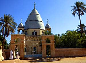
023
….. opposite of the Khalifa Square,
- surrounded by lush green, is the Tomb of
- Mahdi – Muhammad Ahmad bin Abd Allah –
- a religious leader of the Samaniyya order
|
-
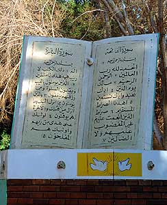
024
A monument of the Quran,
- the central religious text of Islam
|
-
|
-
-
|
-
-
-
-
|
-
-
|
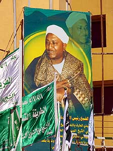
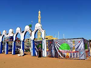
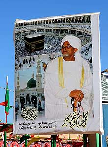
- Religious portraits and wall hangings adorn the Islamic
festivities of Prophet Mohammed’s birthday on
- December 24th, 2015, on Khalifa Square in Omdurman’s city center,
the western part of the capital Khartoum.
- Khartoum consists of three parts – separated by the confluence of
the Blue and the White Nile:
- Khartoum (2012: 2.7 m people), Omdurman (2.9 m people), Bahri
[Khartoum North] (1 m people)
|
-
025
|
-
026
|
-
027
|
-
|
-
-
|
-
-
|
-
-
|
-
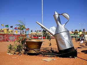
028 A teapot monument in the city center
- of Omdurman. These kinds of monuments
- are popular in the Arab world. They
- symbolize hospitality
|
-
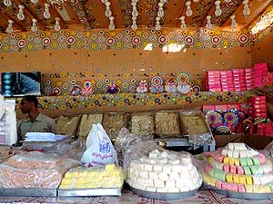
029 Sudanese love sweets. Its choice
- at the neatly decorated shops is big. We
- like the best nougat and sesam pastries
|
-
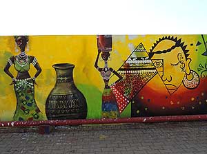
030 A mural at the biggest
supermarket
- in Khartoum, the “Afra Shopping Center”,
- where we are blamed by the security for
- taking this picture
|
-
|
-
-
|
-
-
|
-
-
|
-
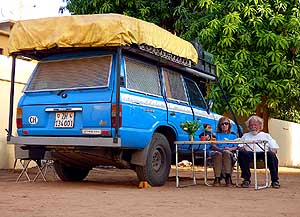
031 Not really Emil’s favorite job: He is
- arranging stuff on our roof rack in the
- Youth Hostel Camping in Khartoum
|
-
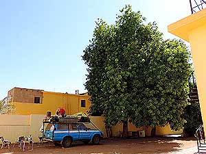
032 Christmas 2015 beneath the big mango
- tree on the camping of the Youth Hostel in
- Khartoum. Instead of Christmas songs we
- listen to an incredible concert of huge flocks
- of birds that returned to their sleeping
- place on the mango tree …..
|
-
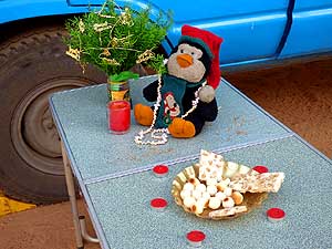
033 ….. our simple,
improvised
- Christmas decoration as we were
- not able to find a Christmas tree
- in Muslim Sudan
|
-
|
-
-
|
-
-
|
-
-
|
-
034 Farewell from Melanie and daughter
- Sophie on the Youth Hostel Camping in
- Khartoum. They travel with a motorbike
- with side car from East London (England)
- to East London (South Africa)
|
-
035 Glorious desert sunset on our bush
- camp near the Naqa ruins on New Years
- evening 2016. The Naqa ruins lie about 12½
- miles [20km] south of Musawwarat es-Sufra
|
-
036 Off to the desert to
the Musawwarat
- es-Sufra ruins (about 25 miles [40km] from
- El Amaren along the main highway): As
- always the desert provokes the feeling of
- freedom and vastness
|
-
|
-
-
-
-
|
-
-
|
-
-
-
-
|
-
037
The temple complex of the Musawwarat
- es-Sufra ruins covers an area of 13½ acres
- [55‘000m²]. Some still standing columns
- within the enclosure is all what remains
- from the former glory of this Meroitic
- site of the Kingdom of Kush …..
|
-
038
….. a well preserved column of
- the largest Meroitic complex in Sudan …..
|
-
039
….. stones and crumbling walls
|
-
|
-
-
|
-
-
|
-
-
|
-
040 View of the ruins of
the Temple of
- Amun of the Meroitic complex in Naqa,
- made of sandstone - 12½ miles [20km]
- more to the south …..
|
-
041 ….. a colonnade of lions at
- the Temple of Amun in Naqa
|
-
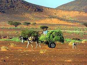
042 A bedouin carries
freshly cut
- grass to his hut with his donkey –
- a precious good in the desert
|
-
|
-
-
|
-
-
|
-
-
|
-
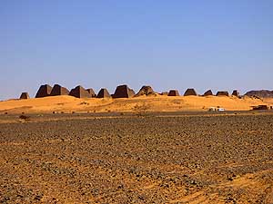
043 The pyramids of the Royal Cemetery
- of Meroë in eastern Sudan are standing next to
- each other on a red sandy ridge. They are all
- “decapitated” because 1834 an idiot of an Italian
- treasure hunter, Guiseppe Ferlini, was convinced
- to be able to grab treasures on that way .....
|
-
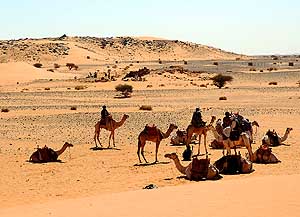
044 ….. a group of camels is
- waiting for tourists …..
|
-
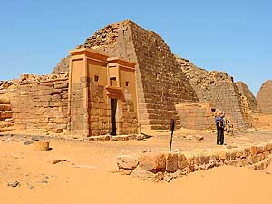
045 ….. Emil is standing
in front of one
- of the kings burial chapels of the former
- Meroitic Kingdom of Kush
- in the Nubian Desert
|
-
|
-
-

|
-
-
|
-
-
|
-
046 From the viewpoint over the pyramids’
- area our LandCruiser looks a bit lost
|
-
047 Just us and the pyramids in the
- Nubian Desert! Liliana enjoys the moment.
- There are said to be 200 of these ancient
- tombs of the former Meroitic Kingdom
- of Kush in Nubia
|
-
048 Panorama from the
viewpoint: Many
- pyramids are tombs of kings and queens of the
- Meroitic Kushite Kingdom, who ruled the area
- for more than 900 years and that spread once
- up to the Mediterranean coast (700 BC)
|
-
|
-
-
|
-
-
|
-
-

|
-
049 Another view of a part of the
- ancient Meroitic Kingdom of Kush in
- Bagrawiya, where the capital of this Nubian
- Kingdom is said to have been situated
|
-
050 Well preserved beautiful reliefs
- on a wall of a burial chapel
|
-
051 The pyramids of Meroë
are
- impressive, but are definitively smaller
- than those of Giza or Saqqara in Egypt
|
-
|
-
-
|
-
-
|
-
-
|
-
052 In the soft evening light, the
- Meroë pyramids in the desert are
- really captivating
|
-
053 We are driving 2 miles [3½km] through a
- very scenic desert towards the Meroe Tented
- Camp – a taste of luxury in the desert …..
|
-
054 ….. where camels are
feeding
- on the green bushes that are
- growing in the stony terrain
|
-
|
-
-
|
-
-
|
-
-
|
-
055 Below the Meroe Tented Camp
- we find a lovely bush camp behind
- a red sand dune …..
|
-
056 .…. and watch from the Meroe
- Tented Camp how the sun disappears
- behind the Meroë pyramids .....
|
-
057 ….. despite of the
sand wind it’s
- a wonderful feeling being able to camp
- in this beautiful silent desert
|
-
|
-
-
-
-
|
-
-
|
-
-
-
-
|
-
058
On our way to Port Sudan, about
- 47 miles [75km] after Ed Damer, we set up
- our night camp far away from the main (truck)
- highway in the monotonous flat desert …..
|
-
059
….. after we had to give up
- our first attempt as we almost got
- stuck in softer sand …..
|
-
060
….. apart from wild watermelons
- (Citrullus lanatus), which surprisingly grow
- well on the dry sandy terrain, there is hardly
- any vegetation in this part of the arid desert
|
-
|
-
-
|
-
-
|
-
-
|
-
061 Despite that camels can travel long
- distances in the desert sun without water, they
- also need to drink now and then. Here a water
- tanker has been dispatched to the desert
|
-
062 Bedouin tents along the road to
- Port Sudan. Matching with the color of
- the desert, they can hardly be seen.
- Interestingly the tents show a certain similarity
- to those of the Afar tribe in Djibouti
|
-
063 Very peculiar huts are
- catching our attention along the
- Khartoum - Port Sudan road
|
-
|
-
-
|
-
-
|
-
-
|
-
064 An impressive high and slim minaret
- towers over the flat adobe dwellings of
- Hayya – a village on the crossroad from
- Port Sudan to Khartoum and Kassala
|
-
065 The special charm of Hayya lies
- in the traditional adobe houses, which also
- reflect the humble life of its inhabitants
|
-
066 Traditional and
modern: Mud brick
- houses and again the striking slim minaret
- of a mosque near Sinkat
|
-
|
-
-
|
-
-
|
-
-
|
-
067 We are driving over the Aqaba
- Pass towards the port city of Suakin.
- The landscape reminds us to Oman
- on the Arabian Peninsula
|
-
068 Our last desert camp in Sudan
- between Port Sudan and the 19 miles
- [30km] further north lying Red Sea Resort.
- We drove in Sudan within 30 days
- totally 1'085 miles [1’746km]
|
-
069 View from the ”Red Sea
Resort“,
- 19 miles [30km] north of Port Sudan, situated
- at the seashore. On January 8th, 2016, we
- leave Sudan and with it Africa at the port of
- Suakin and take the ferry to Jeddah/Saudi
- Arabia with the next destination: United
- Arab Emirates for the fifth time
|
-
|
- Back to the 2nd part of the Ethiopian trip:
Ethiopia
Part 2
–
November 27th to December 9th, 2015, from
Djibouti to
Sudan
|
-
Next website of our 2nd
Central and North Asia trip 2016 to Russia:
-
Saudi Arabia – From the
ferry port Jeddah in transit to United Arab Emirates border – January 9th
to 12th, 2016
|
-
- The "Greater"-Middle East trip 2012/13:
- Sharjah/Dubai/1st Traveler's Festival/Emirates
National Auto Museum - UAE with
car Nov. 2012 to Jan. 2013 - part 1
- Western UAE - Liwa - United Arab Emirates with car in January 2013 - part 2
- Oman 2013 – Part 1 - February
2013: Musandam Peninsula
- Oman 2013 – Part 2 - February
2013: Sohar - Muscat - Rustaq - Nizwa
- Oman 2013 – Part 3 - March
2013: Sur - East Coast - Island of Masirah - Dhofar
- Oman 2013 – Part 4 - March
2013: Salalah & Surroundings (Dhofar) - Nizwa
- Oman 2013 – Part 5 - March 2013: Western Hajar
Mountains
- Al Ain, Eastcoast & Ras al Khaima - United
Arab Emirates with our car in April 2013 -
part 3
- Iran - part 1: Ferry Port Bandar Abbas-Shiraz-Persepolis-Pasargad (between Persepolis and Yazd)
– May 2013
- Iran - part 2: Pasargad
(excl.)-Yazd-Esfahan – May 2013
- Iran - part 3: Esfahan
(excl.)-Chelgerd-Hamadan-Sanandaj-Orumiyeh – May 2013
- Turkey - Esendere-Hakkari-Van-Dogubayazit-Kars-Ardahan-Hopa-Georgia
Border – May/June 2013
- Georgia - part
1: Ajaria-Gori-Tbilisi-Kakheti-Azerbaijan
Border – June 2013
- Azerbaijan: Georgia Border-Balakən-Şəki-Lahıç-Baku-Xınalıq-Quba-Laza-Baku-Gəncə-Georgia Border – June 2013
-
Georgia - Part 2a: Azerbaijan Border-Tbilisi-Armenia
Border –
June/July 2013
- Armenia part 1 – July 2 to 9, 2013: Georgia Border - Akhtala - Haghpat
- Dilijan - Lake Sevan - Selim - Arates - Nagorno-Karabakh
- Nagorno-Karabakh:
Armenia-Stepanakert-Gandzasar-Martakert-Tigranakert-Tnjri-Shoushi-Armenia – July
- Armenia -
Part 2:
Nagorno-Karabakh-Goris-Tatev-Noravank-Khor Virap-Echmiadzin-Yerewan-Geghard-Gyumri-Georgia Border – July 2013
- Georgia -
Part 2b: Armenia Border-Ninotsminda-Tbilisi-Mtskheta-Kazbegi-Kutaisi-Zugdidi –
July 2013
- Georgia -
Part 3a:
Zugdidi-Swaneti-Zugdidi-Abkhazia Border – July/August 2013
- Abkhazia: Georgia-Sukhumi-Tsebelda-Novyy Aton-Lake
Ritsa-Gagra-Pitsunda-Georgia – August
2013
- Georgia - Part 3b: Abkhazia Border-Poti-Ferry to Ilyichevsk/Ukraine
– August 2013
|
-
|
![]()
