-
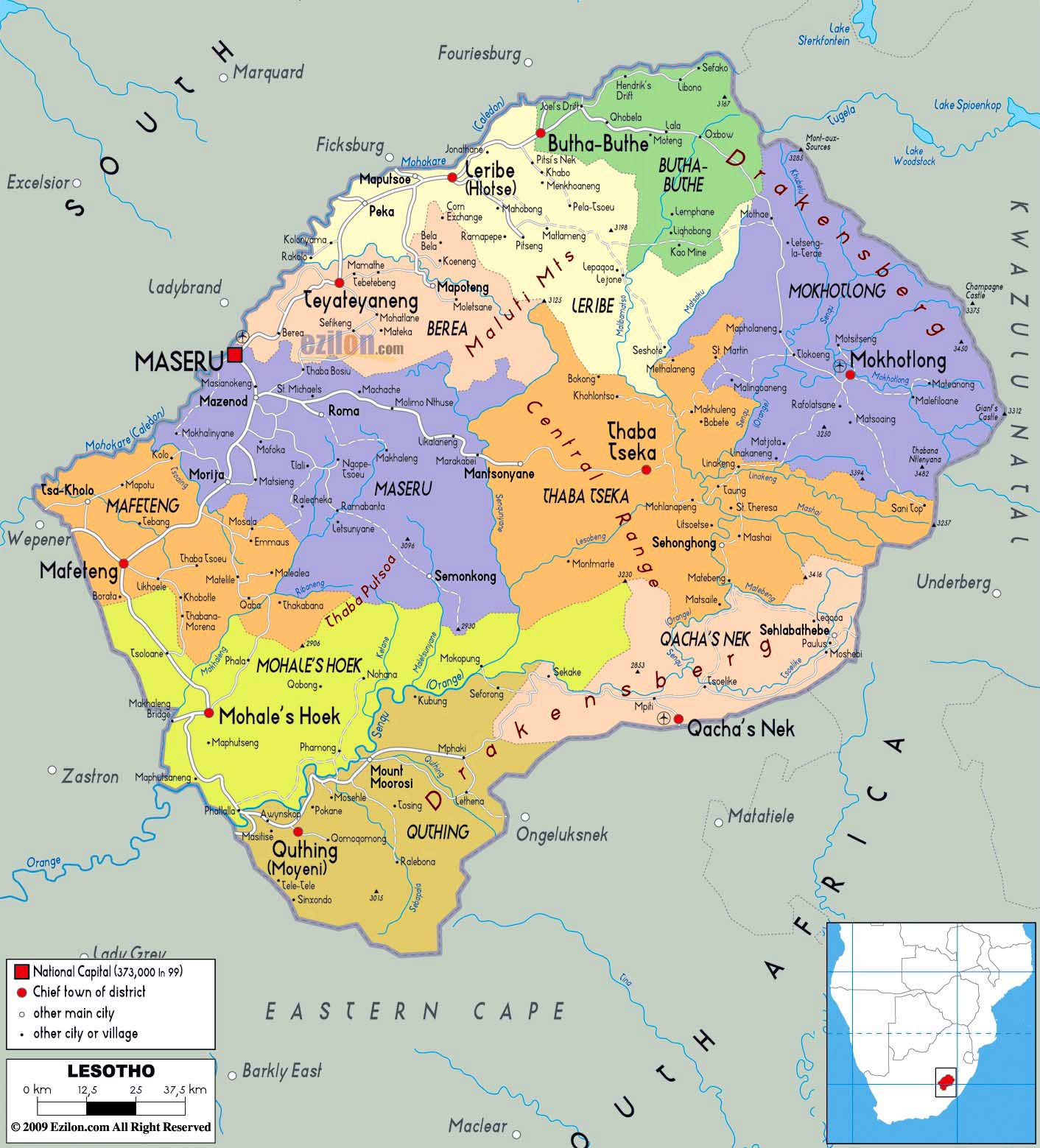
- Lesotho Map
|
-
-
Southern Africa Map
|
|
|
- latest picture:
April 15, 2015
|
-
-
|
-
-
|
-
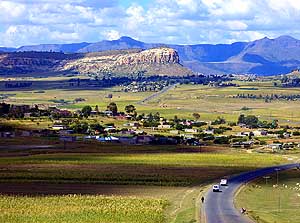
-
|
- 001
On April 7th, 2015, we enter the
- Kingdom of Lesotho at the ”Van Rooyens
- Gate“ in Wepener. The country with two
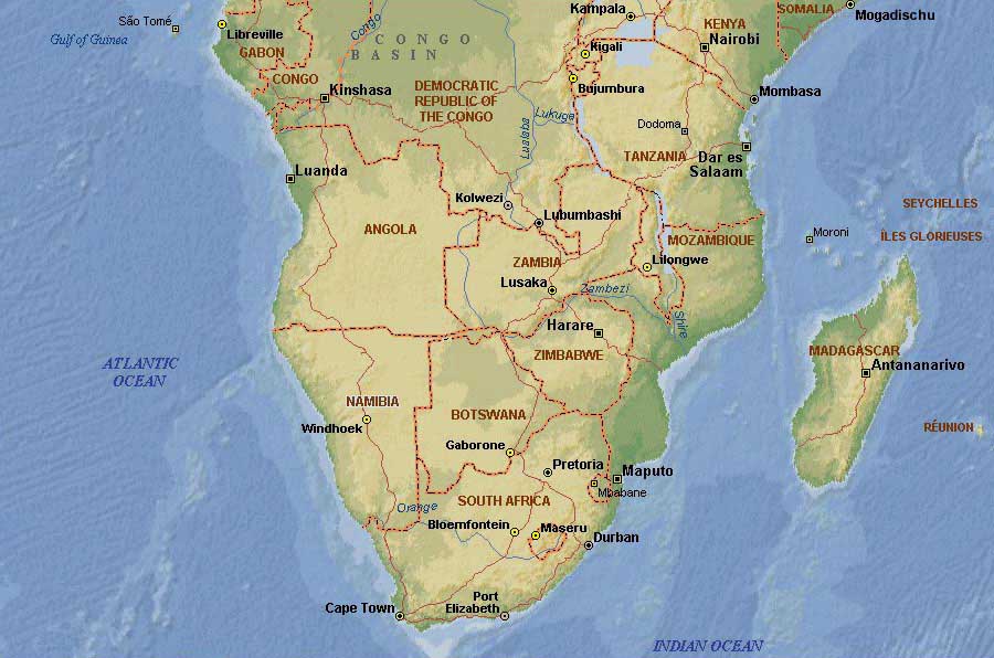
- million people is entirely surrounded by
- South Africa and covers an area of
11’720
- sq.mi. [30‘000km˛]. It is also known as
- ”Kingdom in the Sky“ as the entire country
- lies 4’600 ft. [1’400m] above sea level
|
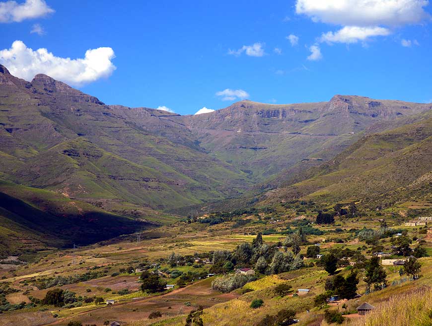
- 002
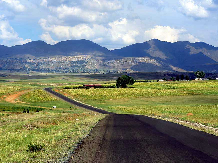
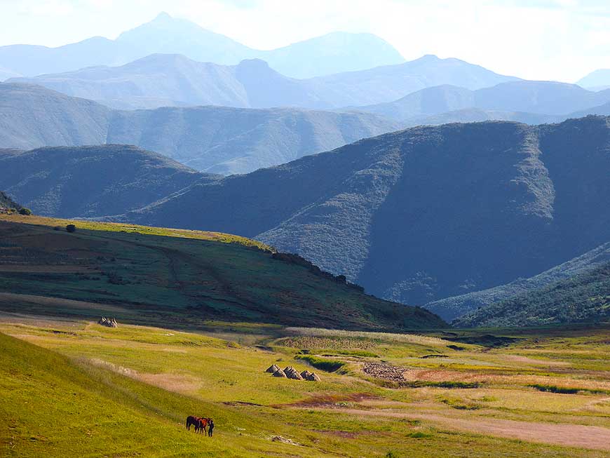
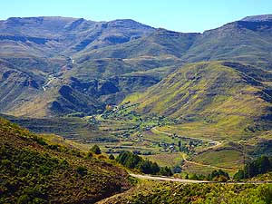
The approach to the Malealea Lodge
- in the interior leads us during the last
- 4˝ miles [7km] deeper and deeper
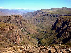
- into a wide mountain valley
- with impressive views …..
|
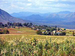
- 003
….. and past the peaceful little
- village of Malealea that nestles between
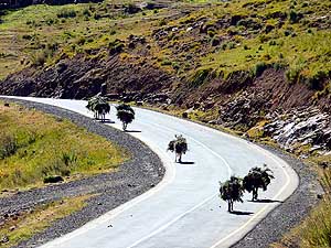
- cornfields and the mountain ranges
|
-
|
-
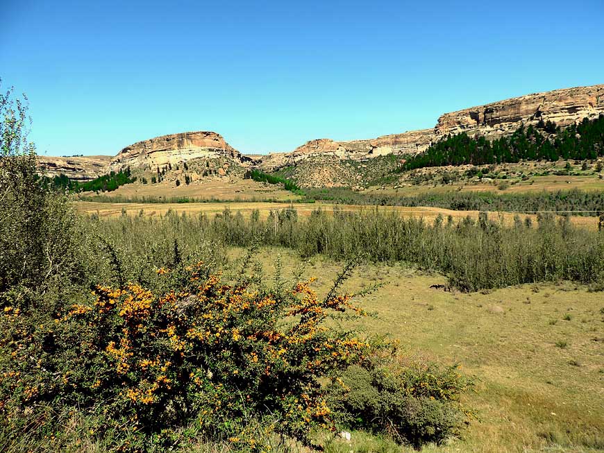
-
|
-
-
|
-
-
|
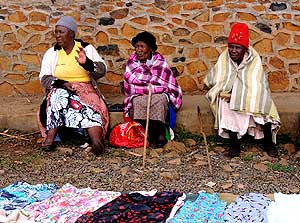
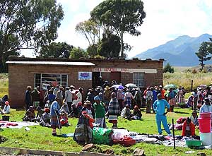
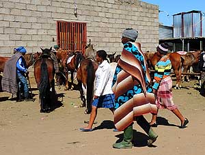
- 004
At the gates of the Malealea Lodge,
- some locals have set up a little ”market“
- hoping that tourists are in buying mood
|
-
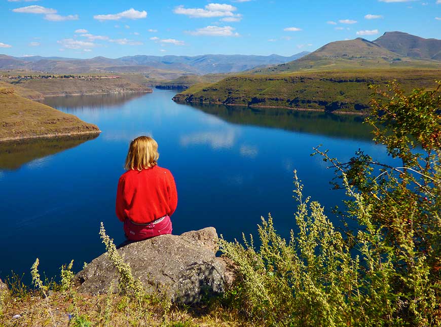
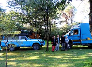
005
A blue LandCruiser and a blue Iveco
- at the Malealea Lodge Camping. Julie and
- Marcus from England (Tucks‘ Travels)
- explored Southern Africa with their Iveco
- truck. Next is Europe and South America
|
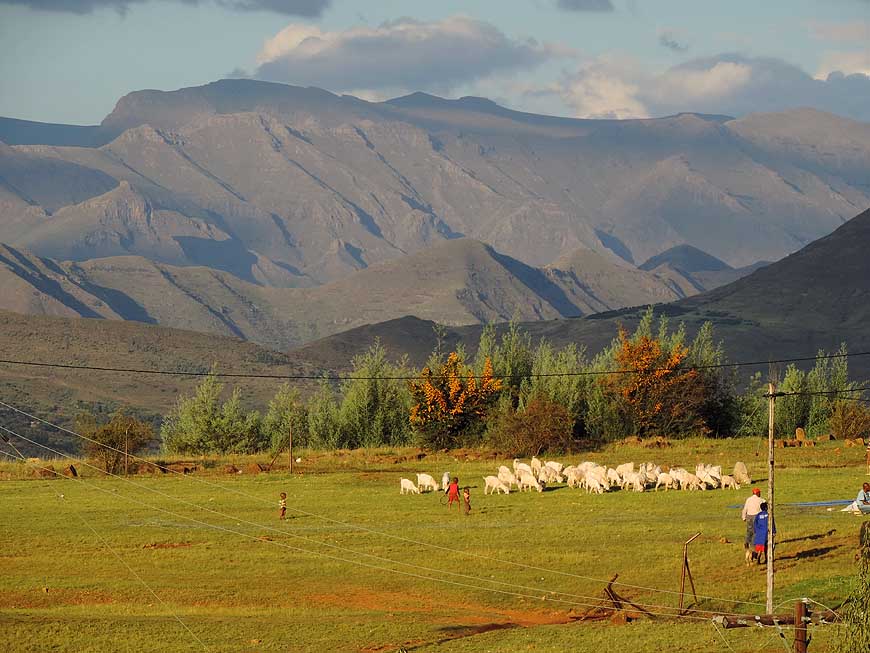
-
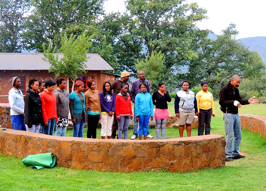
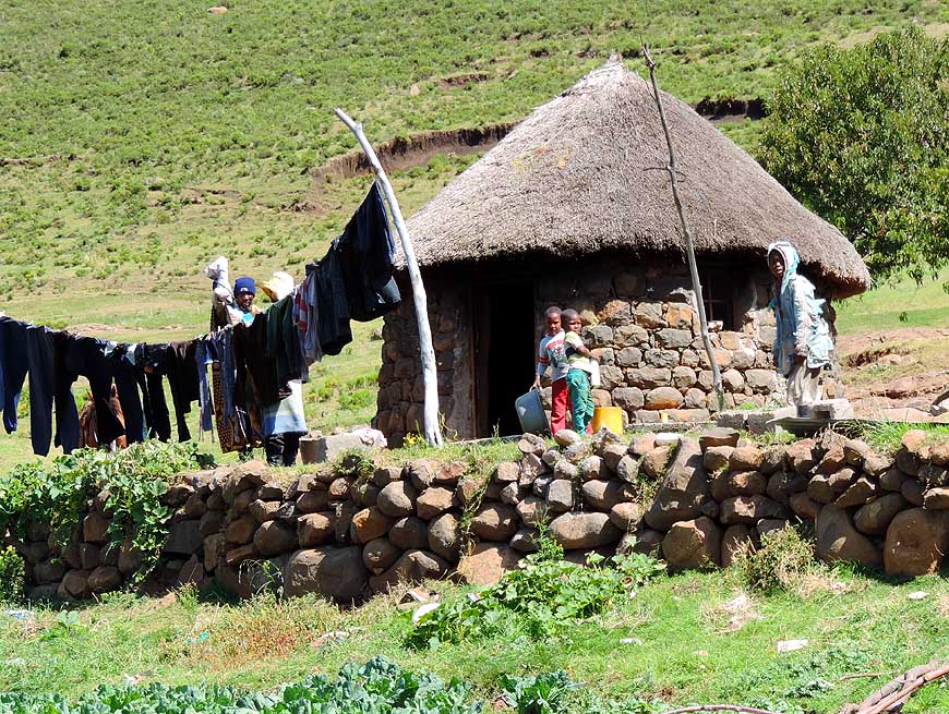
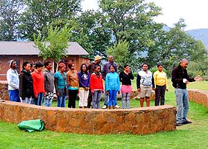
006
Local singers entertain the tourist
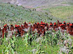
- groups at the Malealea Lodge
|
-
|
-
-
-
-
|
-
-
|
-
-
-
-
|
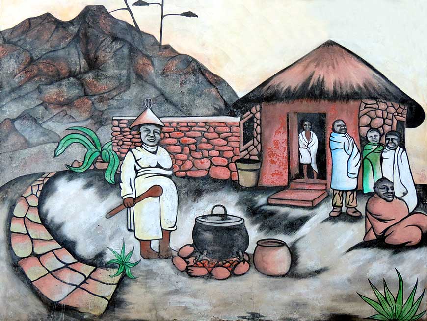
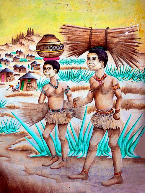
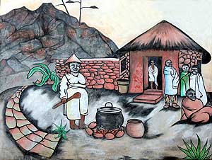
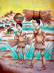
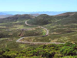
- The walls of the restaurant and bar at the Malealea Lodge are
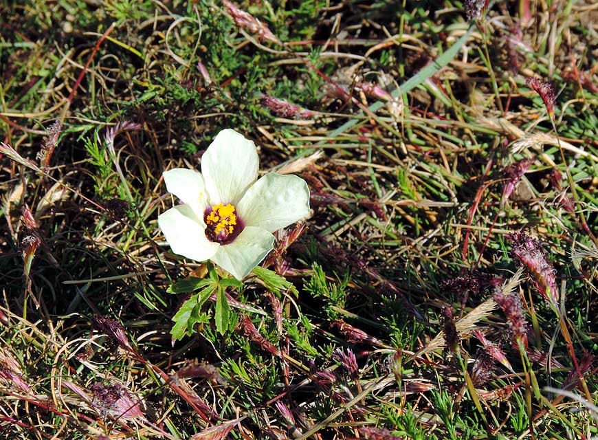
painted with nostalgic traditional motifs,
- bringing us the simple way of life of the Basotho people closer
|
- 007
|
- 008
|
- 009
|
-
|
-
-

|
-
-
-
-
|
-
-

|
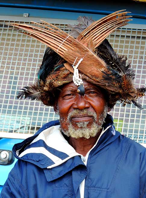
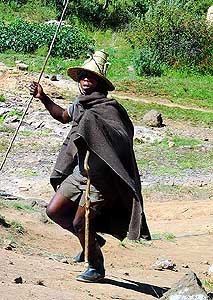
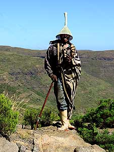
- 010
The old man with his outstanding
- headdress poses proudly behind our
- LandCruiser for a picture
|
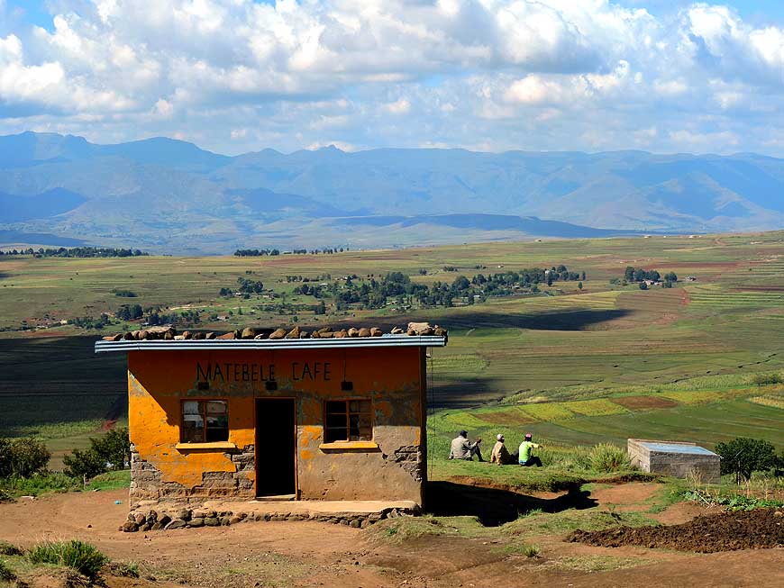
- 011
Like in the old days people meet at
- the Matebele Cafe between the Malealea
- Lodge and the ”Gate of Paradise“ Pass.
- It is the only cafe far and wide
|
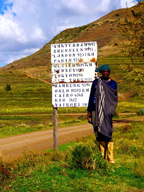
- 012
The herdsman probably cannot
- understand why we take a picture of
- this dilapidated sign. We are a bit
- surprised to read the distances to
- some world cities in this remote place
|
-
|
-
-
-
-

|
-
-

|
-
-
-
-
|
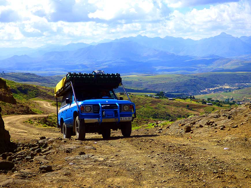
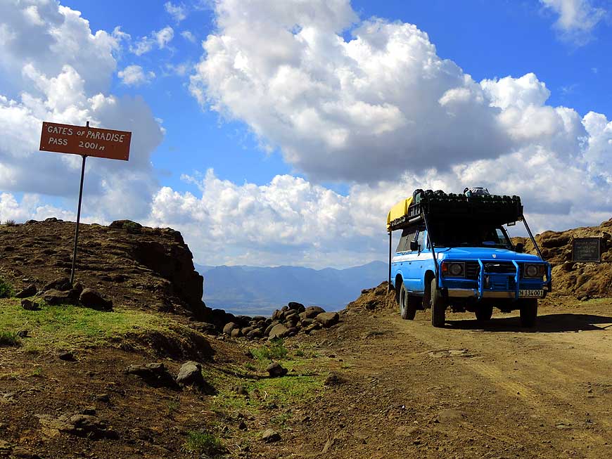
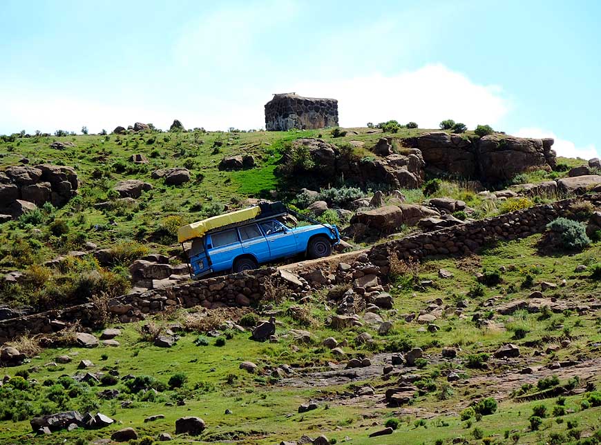
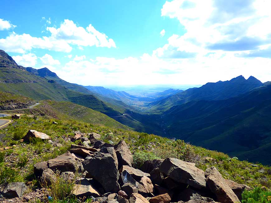
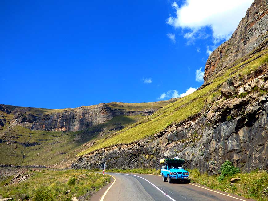
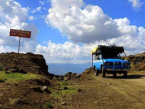
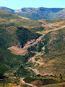
- 013
Our LandCruiser tackles the last yards
- to the 6’565 ft. [2’001m] high ”Gate of
- Paradise“ Pass leaving behind the glorious
- scenery of the Thaba Putsoa mountain range
|
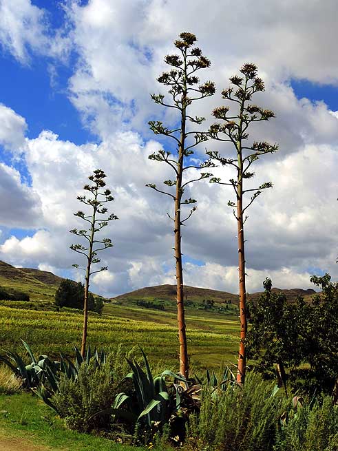
- 014
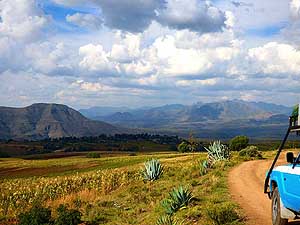
Tall sisal agaves (Agave sisalana)
- rise towards the sky. The plant grows up
- to 20 ft. [6m] and blooms only once
|
- 015
Our LandCruiser reaches the ”Gate
- of Paradise“ Pass on an altitude of 6’565 ft.
- [2’001m]. The tarmac ends here and the
- washed out dirt track starts
|
-
|
-
-
-
-
|
-
-
|
-
-
-
-
|
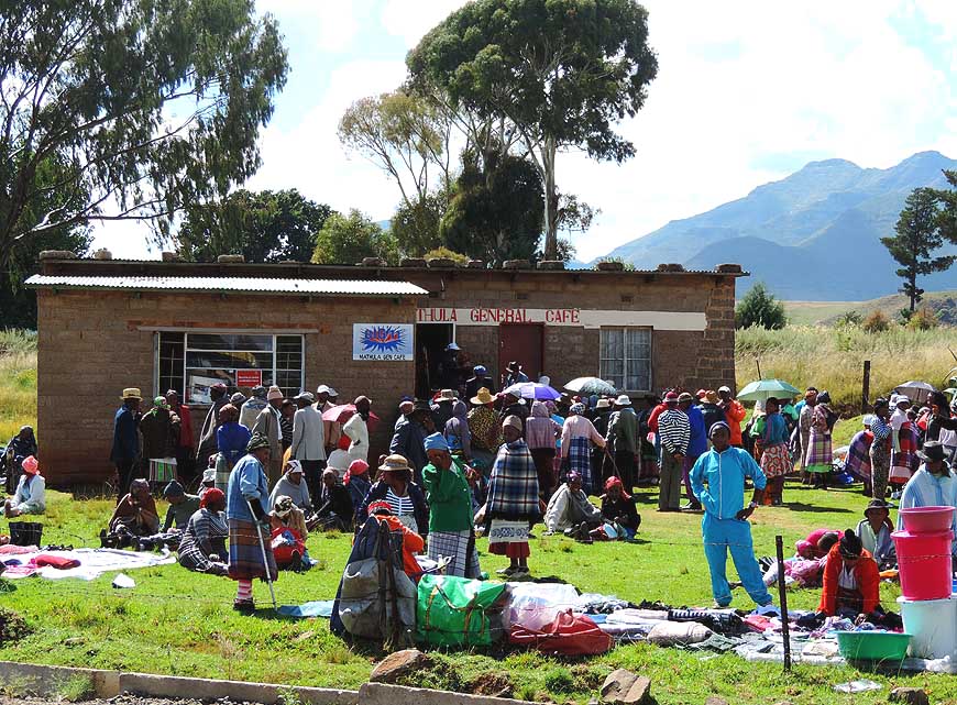
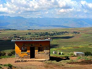
- 016
A general store in the countryside
- of Matelile. It is the place where people
- meet, stock up their supplies, do some
- trade and exchange the latest gossip.
- It’s bustling of activities
|
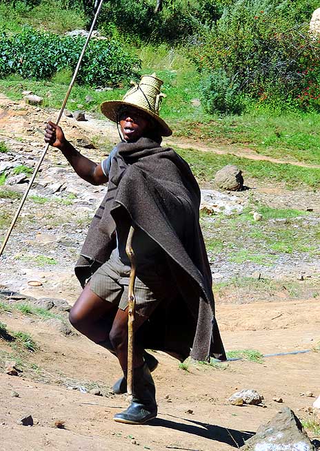
- 017
A blanked clad horseman with his
- conical shaped hat makes some dancing
- moves while spotting us. The Basotho
- hat is the symbol of the country
|
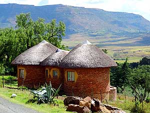
- 018
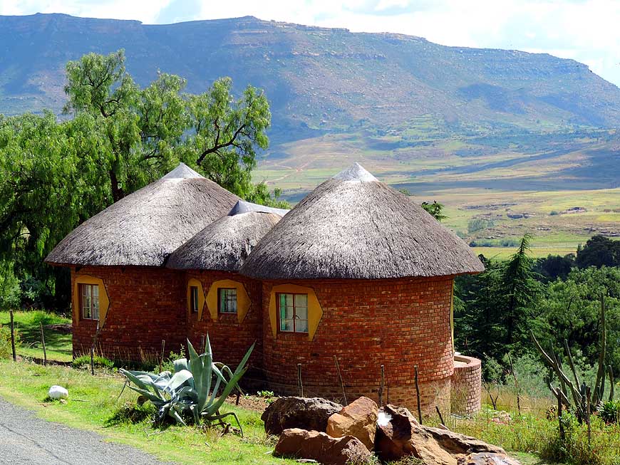
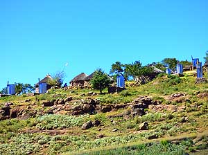
Three lovely thatched rondavels
- overlook the plain and the mountains
|
-
|
-
-
|
-
-
|
-
-
|
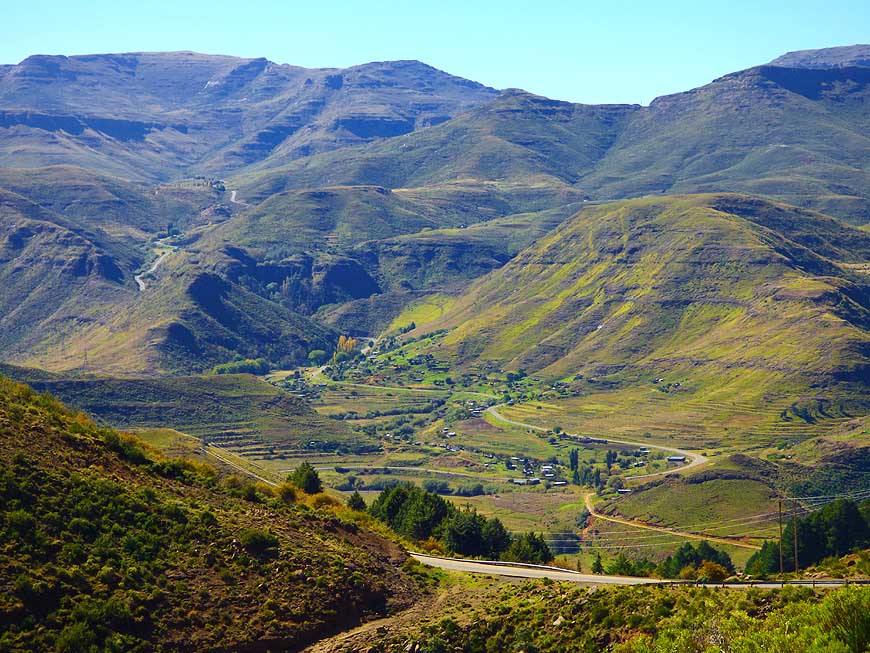
- 019
About 15 miles [23km] east of the
- capital Maseru the road splits at the sand-
- stone formation of Saint Michaels: Either
- over the passes of the central Highlands or
- via Roma towards the south at Qacha’s Nek
|
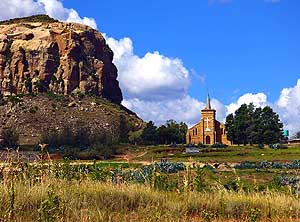
- 020
Next to an imposing sandstone rock
- at the begin of the Roma Valley, the little
- mission church of Saint Michaels nestles
- between two stately trees
|
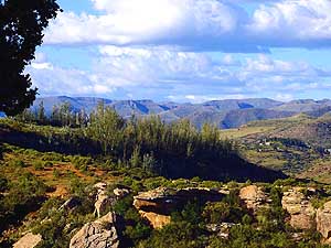
- 021
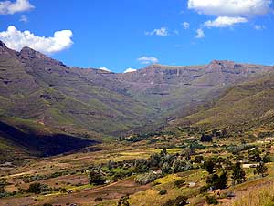
The scenery at the Ramabanta Trading
- Post Lodge in Nkesi, about halfway between
- Roma and Semonkong at the Makhaleng
- River, reveals some of the wild beauty of the
- ”Kingdom in the Sky“, as Lesotho is also called
|
-
|
-
-
-
-
|
-
-
|
-
-
-
-

|
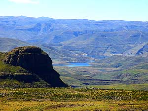
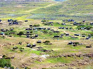
- 022
A small settlement near Nyakosoba
- at the foot of the southern foothills of the
- Maloti Mountains
|
- 023
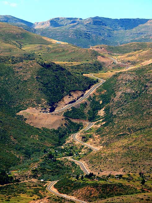
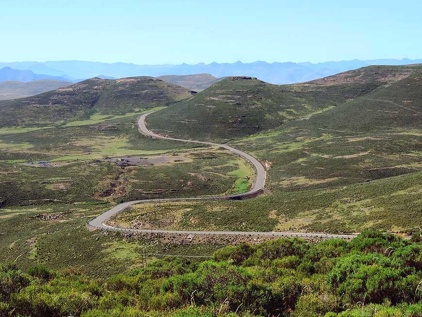
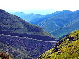
The ascent near Ramabanta is a
- remarkable feat of Chinese engineering.
- It's the longest and steepest in Lesotho
- although it’s paved
|
- 024
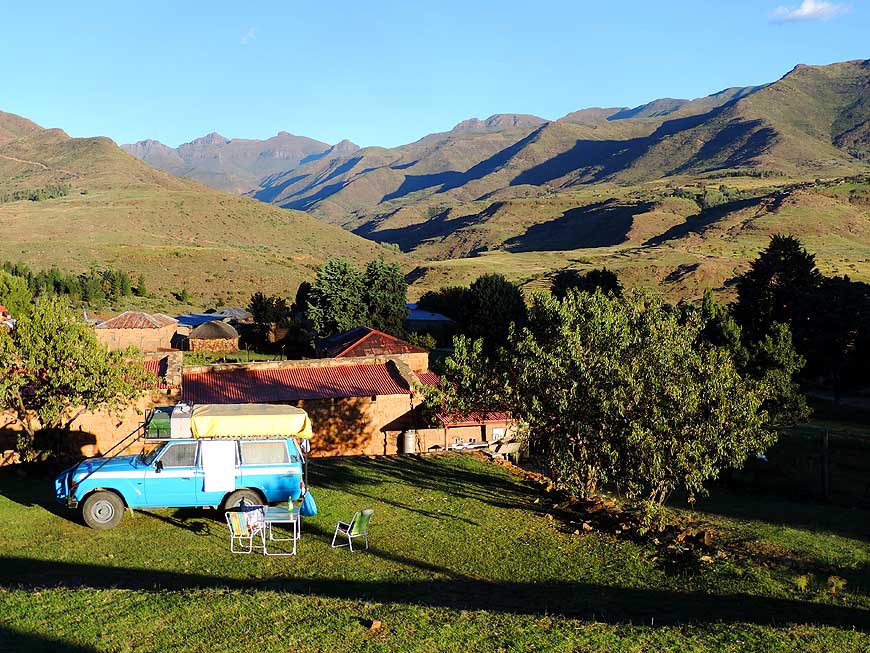
At the Ramabanta Trading Post
- Lodge, hidden deep in the mountains,
- we camp with beautiful views to
- Lesotho’s alpine world
|
-
|
-
-
|
-
-
|
-
-
|
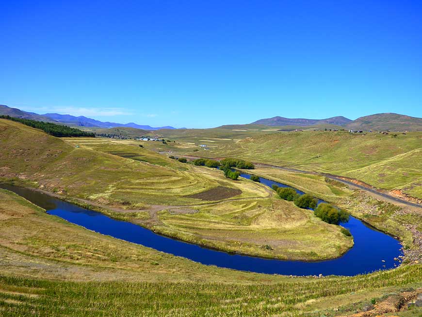
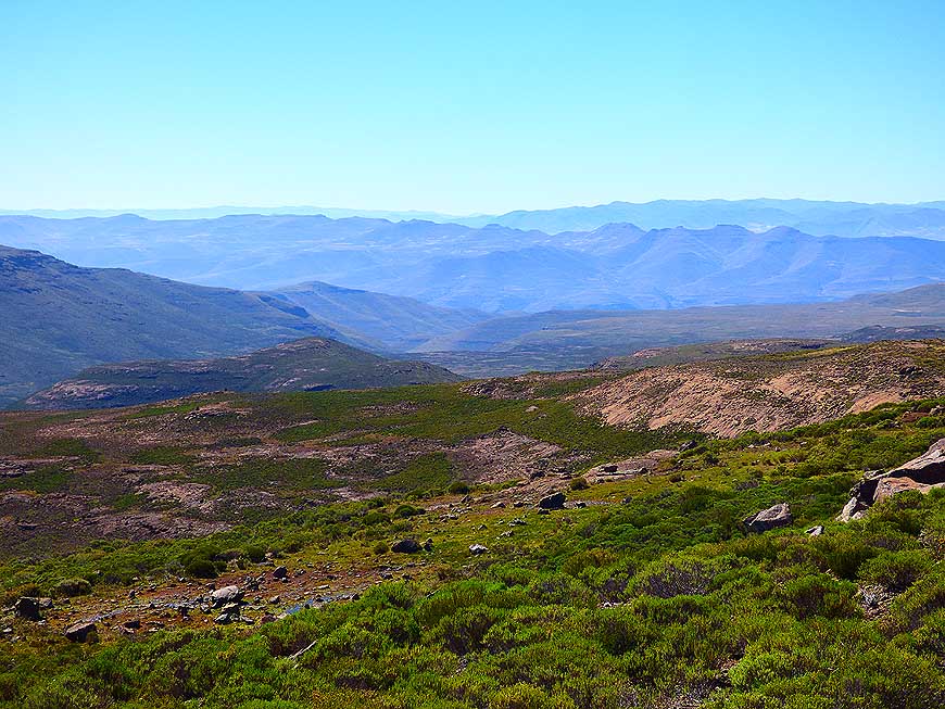
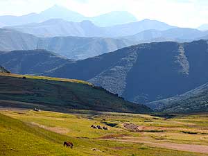
- 025
The mid-morning sunlight underlines
- the imposing Thaba Putsoa mountain ranges
- in all its beauty – on the way from Ramabanta
- to Semonkong – seen towards the north
|
- 026
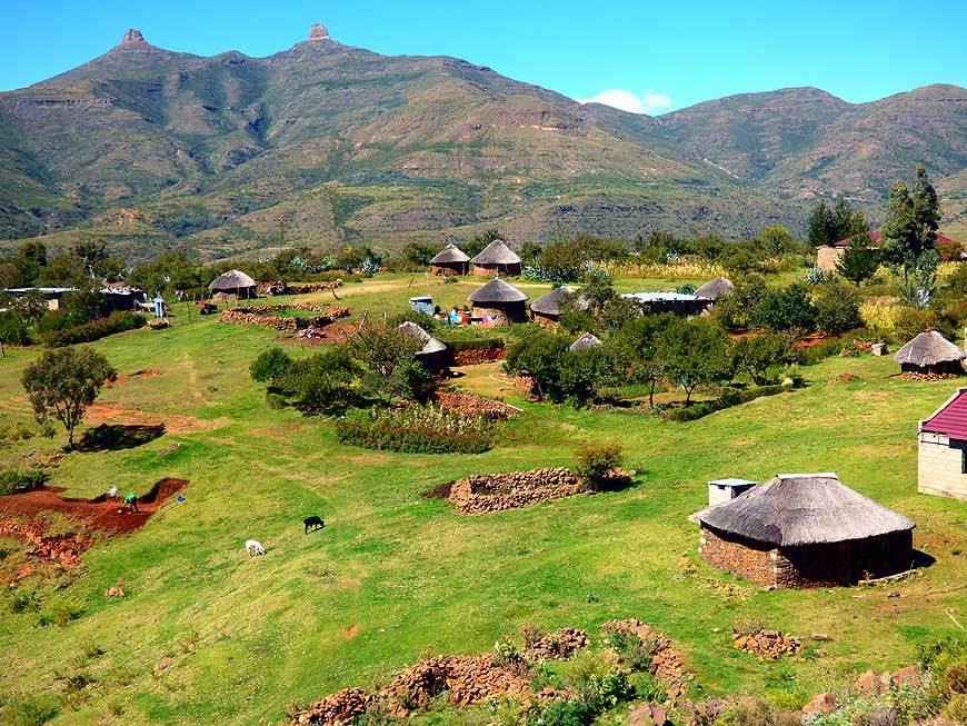
A cluster of thatched houses built from
- natural stones with adjacent kraals on the slope
- of a hill along the road to Semonkong
|
- 027
The blue ribbon of the Maletsunyane
- River flows through the pristine beauty of
- the Lesotho highlands
|
-
|
-
-

|
-
-

|
-
-
|
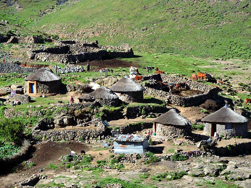
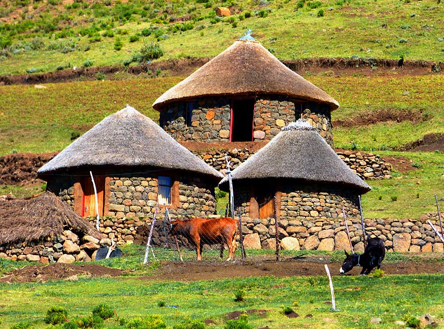
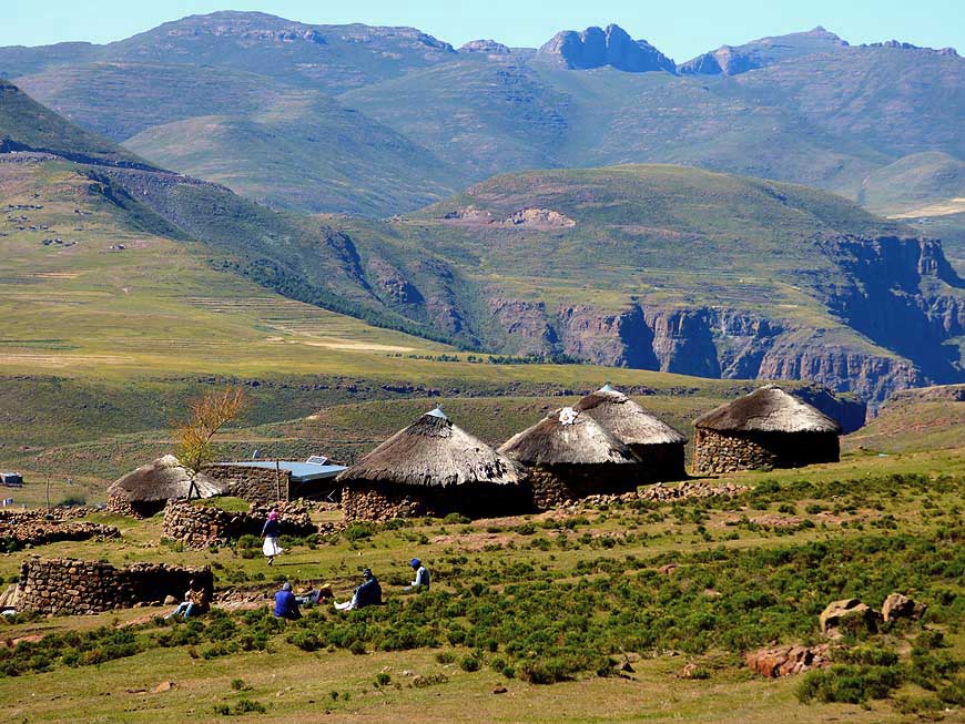
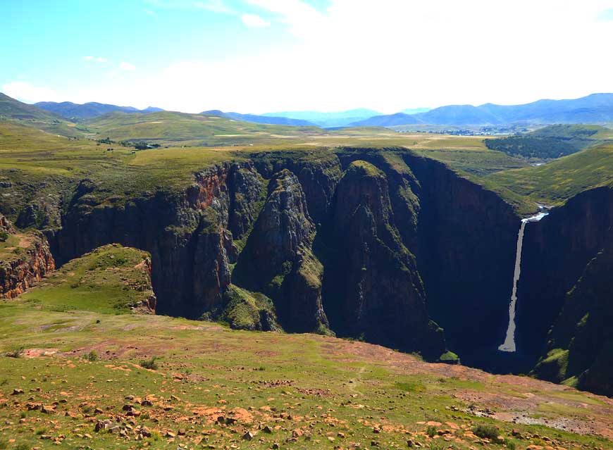
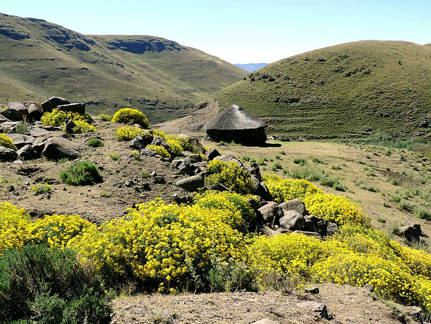
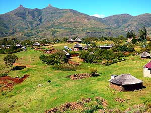
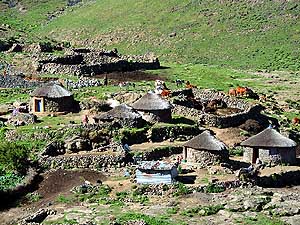
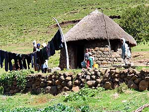
- 028
The three traditional Basotho huts
- are built in the rondavel style and
- with local materials
|
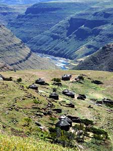
- 029
Is there a more peaceful setting?
- A small settlement at the edge of the
- Maletsunyane Falls canyon
|
- 030
Despite of the new tarmac roads built
- by China, life on Lesotho’s highlands is still
- genuine and tranquil and takes its course
- as it has for decades, if not centuries
|
-
|
-
-
-
-

|
-
-
|
-
-
-
-
|
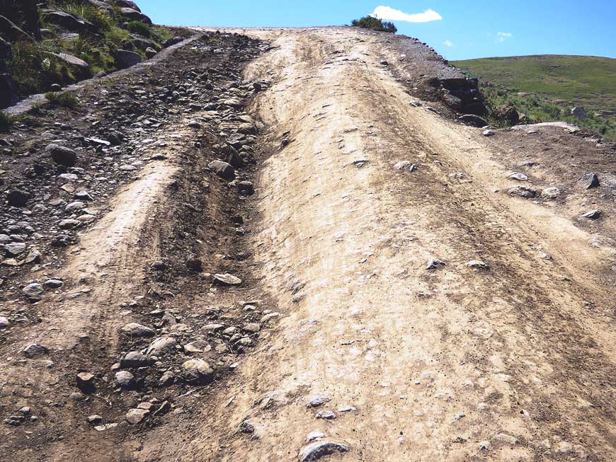
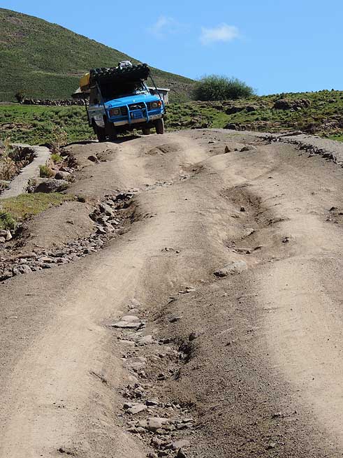
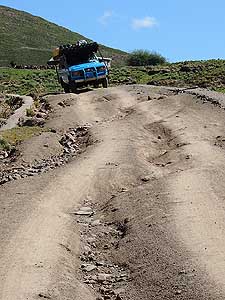
- 031
The washed out, rutted and stony 4x4
- track starts, which our LandCruiser will have
- to tackle for the next 5 miles [8.1km] from
- Semonkong to the Maletsunyane Falls. It
forks
- off before the bridge over the same-named river
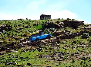
|
- 032
Off we go! .....
|
- 033
….. only a couple of more strenuous
- yards, then the two seniors have braved
- the difficult 4x4 ride!
|
-
|
-
-
|
-
-

|
-
-
|
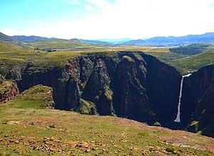
- 034
The Maletsunyane fall near Semonkong
- is 6’300 ft. [192m] high and in the “Guinness
-
Book of Records” for ”the highest
- commercially operated abseil in the world“
|
- 035
At the Maletsunyane fall we park on
- open land with the backdrop of some
- thatched huts nestling on the slope
|
- 036
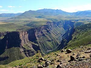
Panorama from the view point over
- the impressive Maletsunyane canyon in the
- Maletsunyane valley near Semonkong
|
-
|
-
-
|
-
-
|
-
-
|
- 037
At the village square in Semonkong it is
- teeming with horses that transport the heavy
- bags with corn flour to the outlying huts
|
- 038
The Maletsunyane canyon landscape
- near Semonkong – downstream
|
- 039
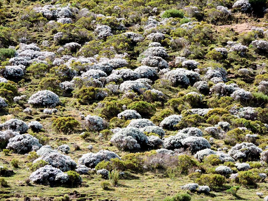
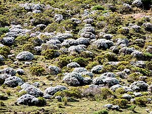
Bushes with short-stalked white flowers
- – so called white moos (Leucobryum) –
- cover big areas on the highlands
|
-
|
-
-

|
-
-
-
-
|
-
-

|
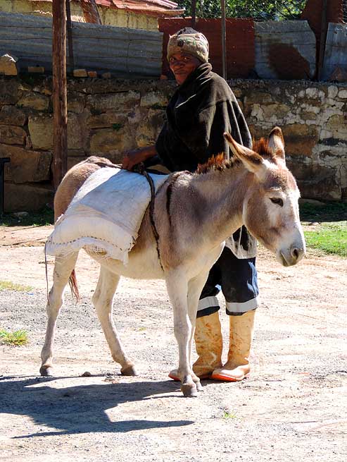
- 040
A man is loading his donkey.
- Donkeys are still used for transports
- of any kind. Trading still takes place
- as in the ”Good old Days“
|
- 041
Highly loaded with grass and
- scrub, donkeys head homewards
|
- 042
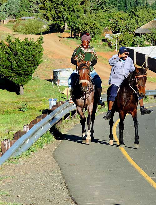
Basotho horsemen nowadays prefer
- the new tarmac road, built in 2014 towards
- the south till Qacha’s Nek, instead of the
- difficult mountain terrain
|
-
|
-
-
|
-
-
|
-
-

|
- 043
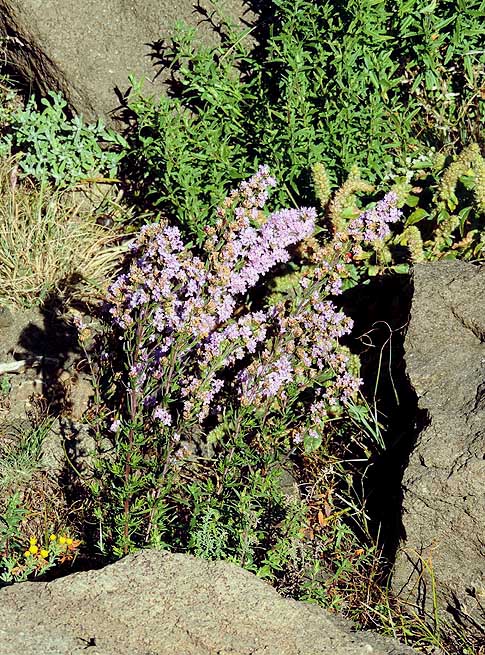
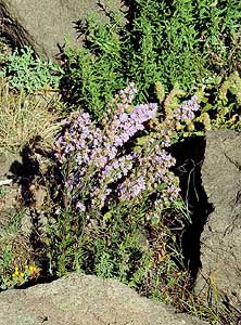
Delicate pink flowers of the sage
- family (Salvia) add some color to the
- rocky scenery
|
- 044
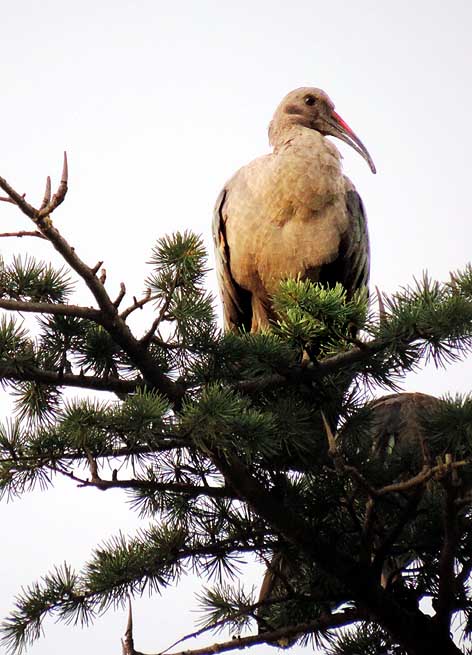
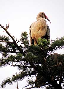
Our feathered neighbor, a hadada ibis
- (Bostrychia hagedash), is snoozing on a tree
- at the “Trading Post Guest House” in Roma.
- These ibises feed mainly on earthworms and
- other larger insects on the ground and are
- therefore particularly welcomed on golf greens
|
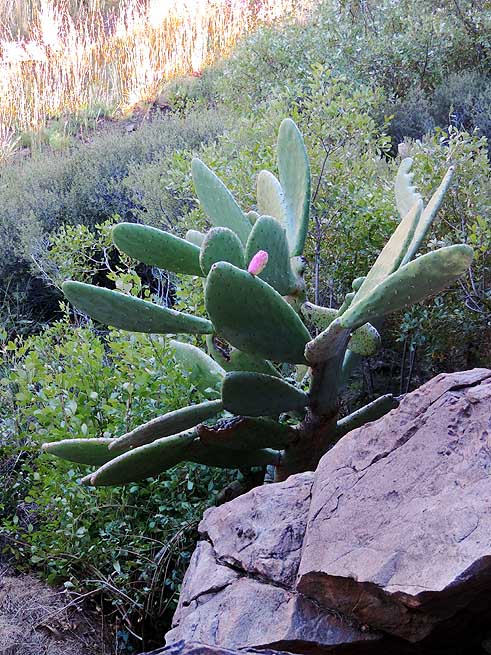
- 045
A prickly pear cactus (Opuntia
- ficus-indica) with a single fruit grows
- in the rugged area of the highland
|
-
|
-
-
|
-
-
|
-
-
|
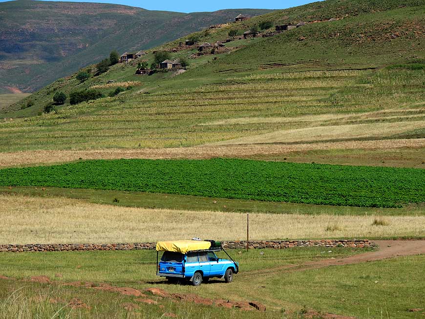
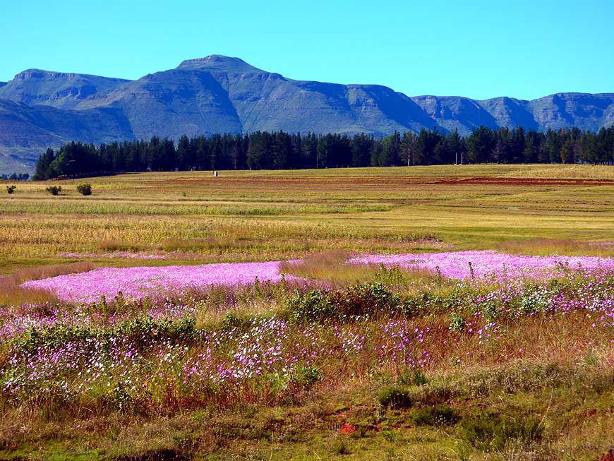
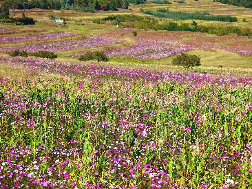
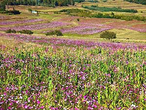
- 046
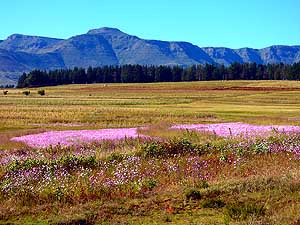
Patches of pink-colored cosmos
- flowers (Cosmos bipinnatus) gleam
- against the dark Maloti Mountains that
- rise steeply to over 11’424 ft. [3’482m]
|
- 047
Below us the Makhaleng valley
- opens up in its wild beauty
|
- 048
A floral splendor: Carpets of pink-
- colored cosmos flowers (Cosmos
- bipinnatus) cover the plain in autumn
|
-
|
-
-
|
-
-

|
-
-
|
- On the ”Roof of Africa“ – between Maseru and Thaba-Tseka – we
cross in less
- than an hour three mountain passes, all over 7’425 ft. [2‘263m]
altitude:
|
- 049
At 11.59am the ”Bushmen’s Pass“
- at 7’425 ft. [2263m] altitude
|
- 050
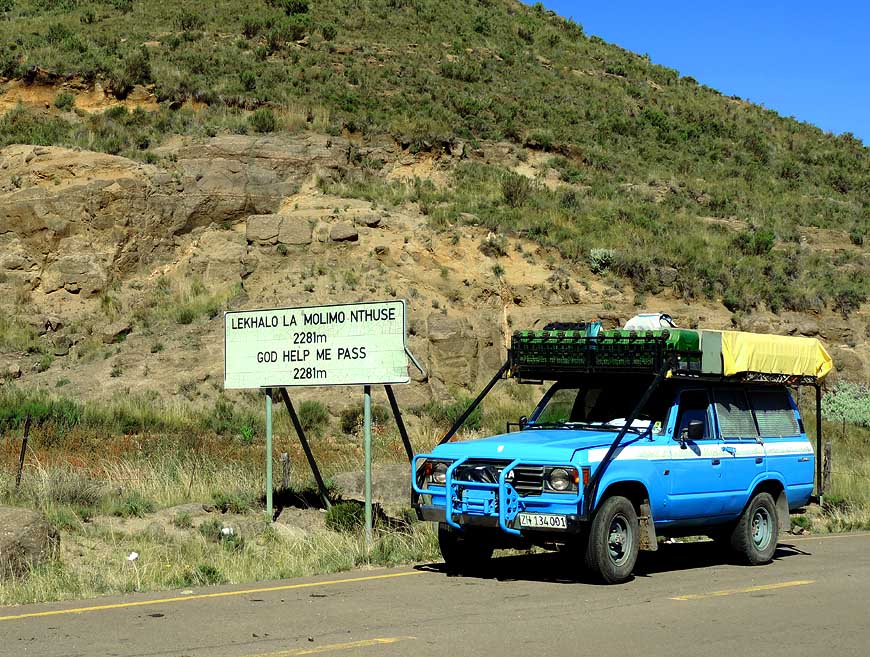
At 12.27pm the ”God Help Me Pass“
- at 7’484 ft. [2’281m] altitude
|
- 051
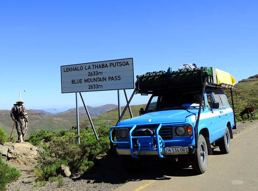
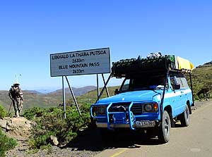
At 12.52pm the ”Blue Mountain Pass“
- at 8’638 ft. [2’633m] altitude
|
-
|
-
-
|
-
-
-
-
|
-
-
-
-

|
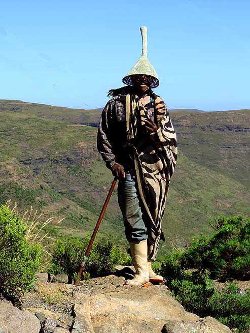
- 052
The herdsman in his typical traditional
- outfit – particularly his hat – at the ”Blue
- Mountain Pass“
|
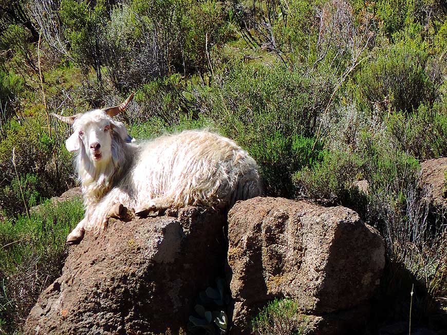
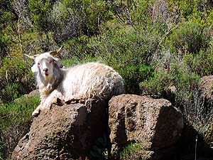
- 053
A white long-hair angora goat is warming
- up on a boulder. It’s delivering the mohair
- fabric, the specifically lightest textile fiber
|
- 054
A little alpine brook trickles shortly
- on the surface and then disappears again
- below the rugged mountain terrain
|
-
|
-
-
|
-
-
|
-
-
|
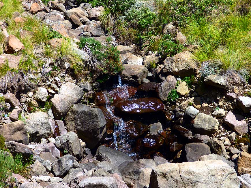
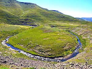
- 055
Formed by the course of a clear
- water stream, a little island has emerged
- in the alpine grassland – shortly before
- Likalaneng at the Mohale dam
|
- 056
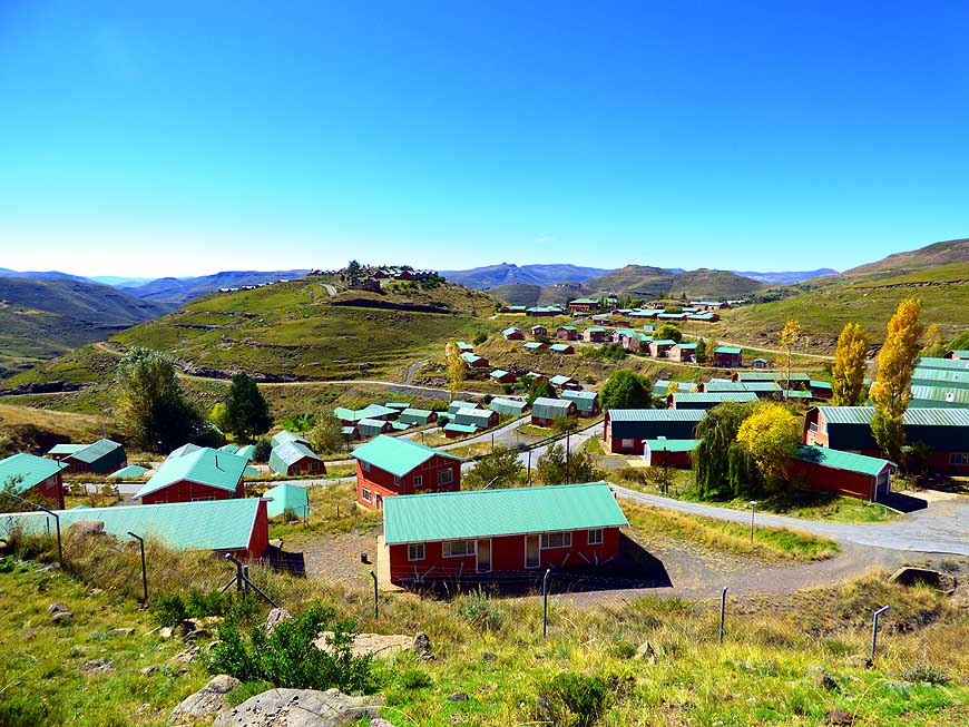
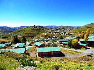
The small settlement Likalaneng
- (Ha Mohale) was built to house the people
- for the construction of the Mohale Dam
|
- 057
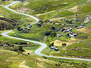
The road winds in a serpentine line
- past green pasture and small settlements
- towards the Mohale Dam – here about
- 2˝ miles before the same-named place
|
-
|
-
-
|
-
-
|
-
-
|
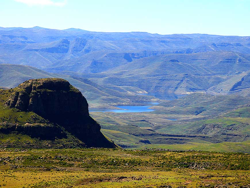
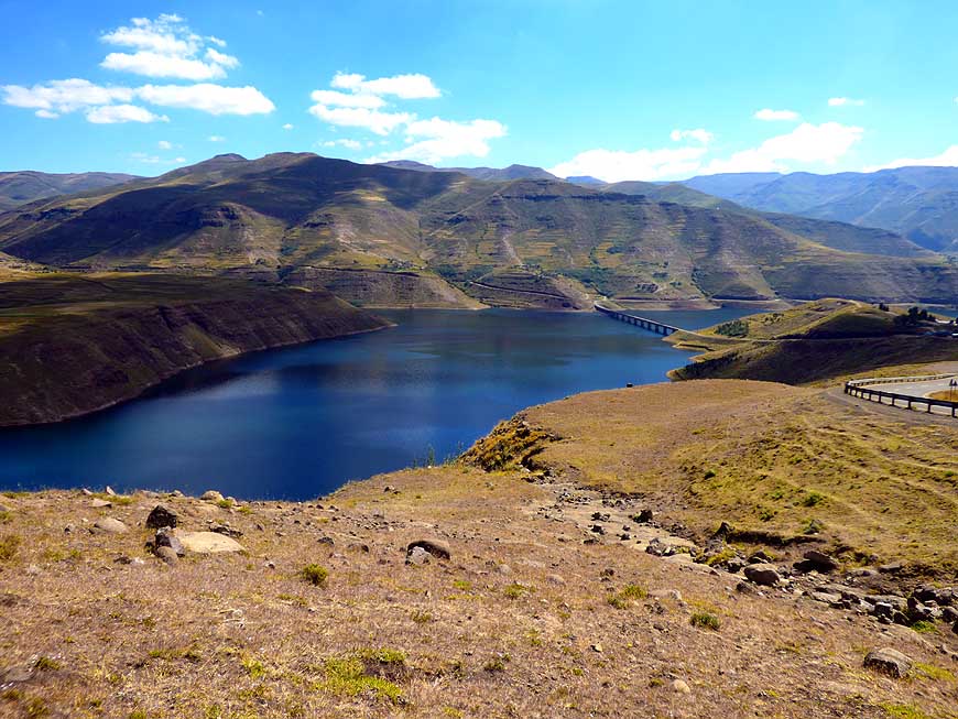
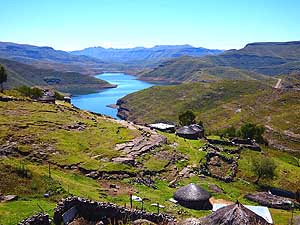
- 058
The first glimpse of the Mohale
- dam, embedded into fantastic
- mountain scenery, is promising …..
|
- 059
….. the second glimpse, with the
- background of the Maloti Moutains,
- captivates us immediately. It shows more of
- its beauty, its calmness and serenity …..
|
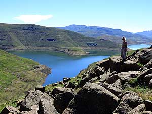
- 060
….. and the third glimpse is from its
- shore: Emil admiring the Mohale dam
|
-
|
-
-
|
-
-
|
-
-
|
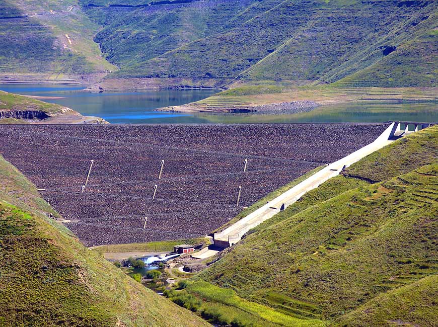
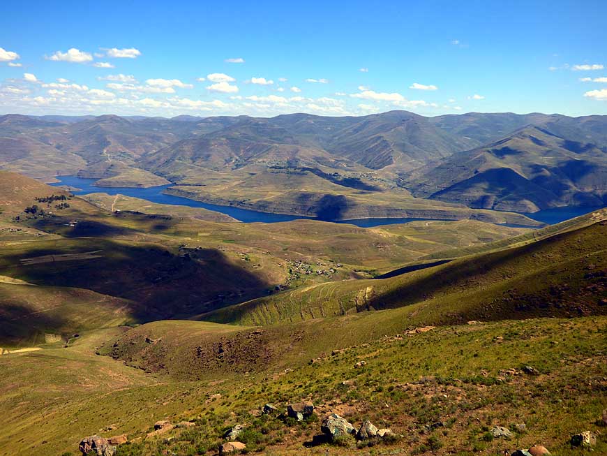
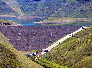
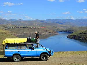
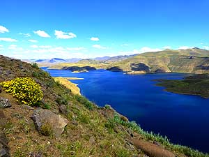
- 061
Mohale Dam and its overspilling.
- The 4’757 ft. [145m] high concrete-faced
- rockfill dam is the highest of its kind in
Africa.
- It was built to increase the volume of water
- to be delivered to South Africa
|
- 062
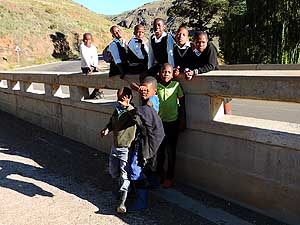
In Marakabei at the Senqunyane
- River children hang out after school and
- love to have their pictures taken
|
- 063
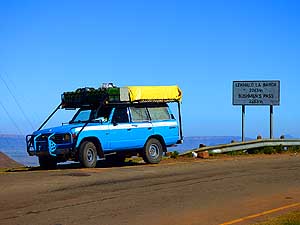
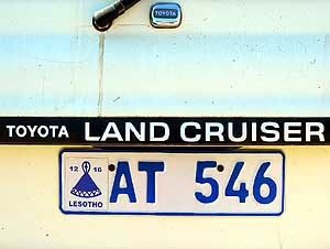
Toyota LandCruiser with the
- exotic Lesotho license plate and the
- symbolic hat on the left side
|
-
|
-
-
|
-
-
|
-
-
|
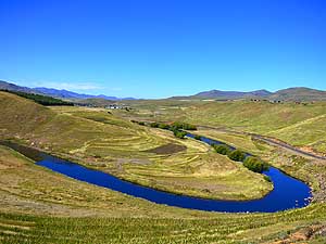
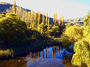
- 064
Poplars in their golden yellow
- autumn color reflect picture-perfect in
- the deep blue of the Senqunyane River
- in Marakabei
|
- 065
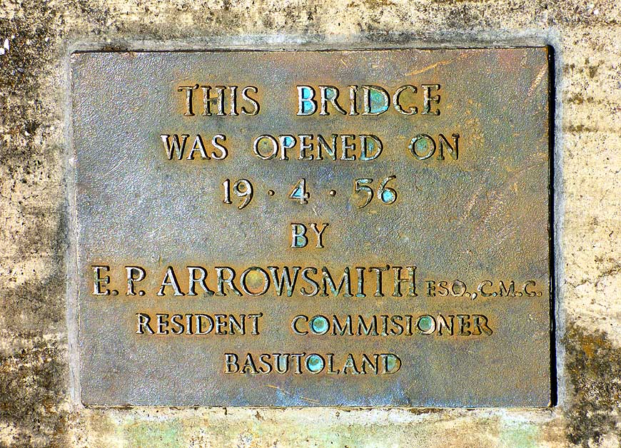
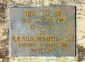
The bridge over the Senqunyane River
- in Marakabei was opened on April 19, 1956,
- by the Resident Commissioner of Basutoland,
- by then a British Crown colony
|
- 066
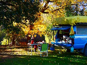
We are camping below the golden
- autumn foliage in the garden of the
- Marakabei Lodge at the Senqunyane River
- on an altitude of 6’040 ft. [1’841m]
|
-
|
-
-

|
-
-
|
-
-

|
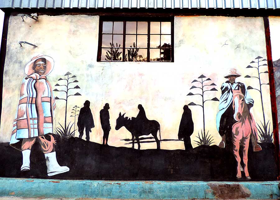
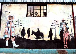
- 067
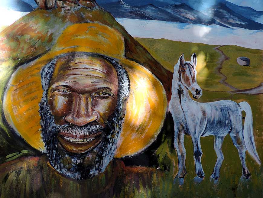
The wall painting at the Marakabei
- Lodge shows a typical Lesotho resident
- and his indispensable horse
|
- 068
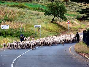
Herdsmen are moving their sheep
- on the street. In the eyes of the Basotho
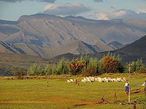
- people large herds signal wealth
|
- 069
A typical hut in the flowering highland
- on a bend on the way to Thaba-Tseka.
- From Roma to Thaba-Tseka there
- are said to be 1’437 bends!
|
-
|
-
-
|
-
-
|
-
-
|
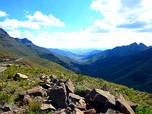
- 070
View from the ”Roof of the World“,
- the 9’383 ft. [2’860m] high Mokhoabong
- Pass, over the northeastern highland
|
- 071
A kind of procession marches
- through a cornfield towards the road
|
- 072
The road is winding and descending
- slowly from the highlands towards Thaba-
- Tseka, where as part of the “Lesotho
- Highlands Water Project” the new Mashai
- Dam should emerge by the dammed
- Senqu respectively Orange River
|
-
|
-
-
|
-
-
|
-
-
|
- 073
In the villages they have nowadays
- also toilettes. The blue corrugated iron shacks
- are in great numbers. They were constructed
- by the „Lesotho Highlands Water Project“
- to protect the reservoirs from contamination
|
- 074
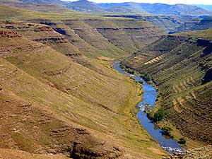
Not a ”Grand Canyon“, but the
- Malibamat'so River is still impressive. It is
- dammed further north by the Katse Dam. Water
- that isn’t directed straight to South
Africa flows
- near Thaba-Tseka into the Senqu/Orange River.
|
- 075
A village (also with new latrines)
- between Thaba-Tseka and Katse dam.
- Its inhabitants are pastoralists
- and agriculturalists
|
-
|
-
-
|
-
-
-
-
|
-
-
|
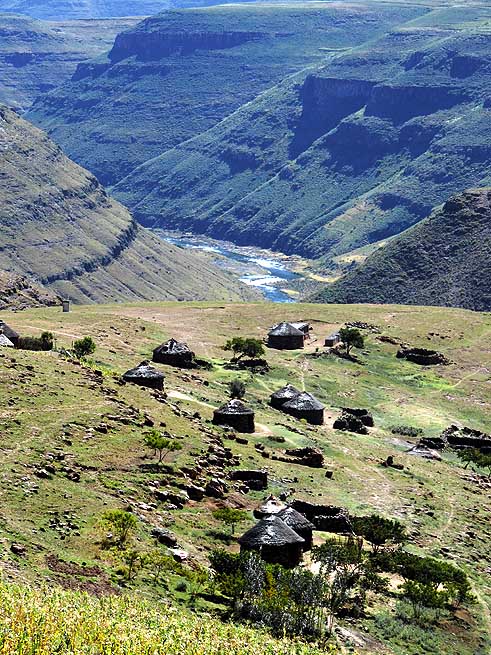
- 076
A little settlement at the edge
- of the Malibamat'so canyon
|
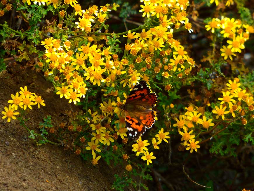
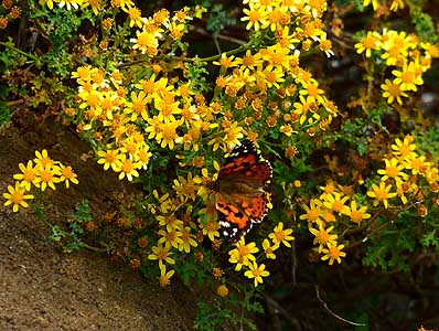
- 077
A butterfly sucks the nectar from
- these short living highland daisy flowers
|
- 078
The blooming season is short in
- the highlands. During this time, nature
- awakes in its utmost beauty
|
-
|
-
-
|
-
-
|
-
-
|
- 079
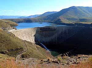
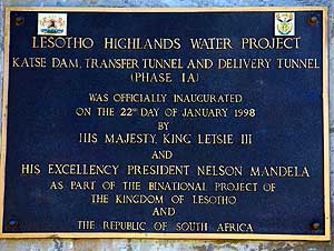
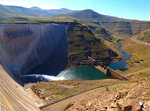
Katse Dam was built within the ”Lesotho
- Highland Water Project“ at 6’560 ft. [2‘000m]
- above sea-level. It’s connected with a 19.9
- mile [32km] long tunnel with the Mohale dam.
- With its staggering 607 ft. [185m] high wall it
- represents the highest dam in Africa
…..
|
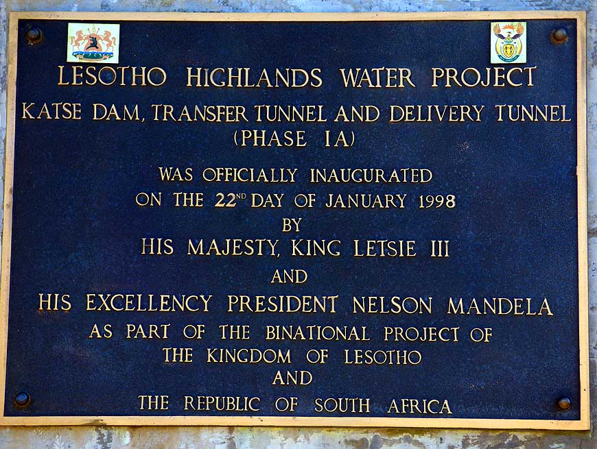
- 080
….. it was officially inaugurated on
- January 22, 1998 by King Letsie III and
- President Nelson Mandela. The dam is not
- only used to produce electricity but also to
- deliver water to the South African province
- of Gauteng (Johannesburg/Pretoria etc.)
|
- 081
Katse Dam is 607 ft. [185m] high,
- 2’329 ft. [710m] long, was finished 1996;
- the reservoir contains 467.8 cu.mi.
- [1’950kmł] water and has a surface of
- 13.8 sq.mi. [35.8km˛]; it’s part of the ”Lesotho
- Highland Water Project“ of finally 5 dams
|
-
|
-
-
|
-
-
-
-

|
-
-
-
-
|
- 082
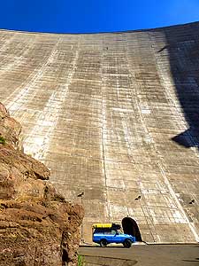
In front of the 607 ft. [185m] high
- dam our LandCruiser looks shrinking small
|
- 083
A moment of absolute peace: Liliana
- enjoys the serenity of the Katse Lake …..
|
- 084
….. while Emil is busy with gasoline
- jerrycans on the LandCruiser’s roof rack
|
-
|
-
-

|
-
-

|
-
-
|
- The scenic beauty of Katse Lake that meanders for many miles
through the rugged mountain scenery does not stop to marvel us
|
- 085
|
- 086
|
- 087
|
-
|
-
-
|
-
-
|
-
-
|
- 088
The tarmac road meanders from
- the 10’137 ft. [3’090m] high Mafika Lisiu
- Pass endlessly westwards through
- mountains and valleys
|
- 089
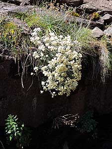
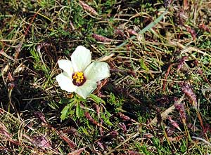
In the barren highland, a single flower
- is all the more eye-catching: Presumably a
- “member” of the buttercup respectively
- crowfoot family (Ranunculaceae)
|
- 090
In the often rainy mountains and
- cold highlands the cute rock hyrax (dassie)
- (Procavia capensis) is enjoying the
- warming sunrays
|
-
|
-
-
|
-
-

|
-
-
|
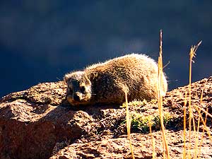
- 091
Only the ribbon of the tarmac road
- interrupts the stunning mountain scenery –
- here the descent from Mafika Lisiu Pass
- to Pitseng
|
- 092
Our LandCruiser on the descent to
- the valley from over 10’137 ft. [3’090m].
- It deserves great praise. Without complaining
- it made it through the steepest and highest
- mountain passes
|
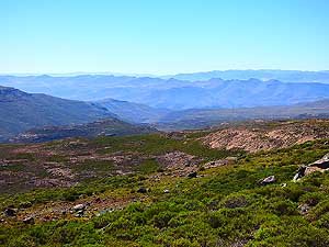
- 093
View from Pitseng over the basin,
- where our 8-day-Lesotho journey
- comes to an end
|
-
|
-
-
|
-
-
|
-
-

|
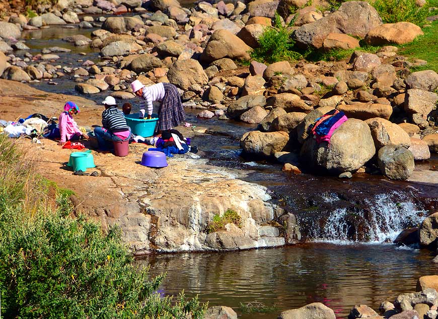
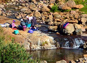
- 094
Laundry day at a mountain
- stream near the city of Pitseng
|
- 095
Glorious evening mood over the
- fantastic alpine world from our ”Aloes
- Guesthouse“ camping in Pitseng
|
- 096
On our way to Caledonspoort, the border
- village to South Africa near Botha-Bothe, we
- drive along the Drakensberg mountains. We
- leave Lesotho on April 15, 2015, having driven
- 488 miles [786km] in the ”Kingdom in the Sky“
|
-
|
-
- The "Greater"-Middle East trip 2012/13:
- Sharjah/Dubai/1st Traveler's Festival/Emirates
National Auto Museum - UAE with
car Nov. 2012 to Jan. 2013 - part 1
- Western UAE - Liwa - United Arab Emirates with car in January 2013 - part 2
- Oman 2013 – Part 1 - February
2013: Musandam Peninsula
- Oman 2013 – Part 2 - February
2013: Sohar - Muscat - Rustaq - Nizwa
- Oman 2013 – Part 3 - March
2013: Sur - East Coast - Island of Masirah - Dhofar
- Oman 2013 – Part 4 - March
2013: Salalah & Surroundings (Dhofar) - Nizwa
- Oman 2013 – Part 5 - March 2013: Western Hajar
Mountains
- Al Ain, Eastcoast & Ras al Khaima - United
Arab Emirates with our car in April 2013 -
part 3
- Iran - part 1: Ferry Port Bandar Abbas-Shiraz-Persepolis-Pasargad (between Persepolis and Yazd)
– May 2013
- Iran - part 2: Pasargad
(excl.)-Yazd-Esfahan – May 2013
- Iran - part 3: Esfahan
(excl.)-Chelgerd-Hamadan-Sanandaj-Orumiyeh – May 2013
- Turkey - Esendere-Hakkari-Van-Dogubayazit-Kars-Ardahan-Hopa-Georgia
Border – May/June 2013
- Georgia - part
1: Ajaria-Gori-Tbilisi-Kakheti-Azerbaijan
Border – June 2013
- Azerbaijan: Georgia Border-Balakən-Şəki-Lahıç-Baku-Xınalıq-Quba-Laza-Baku-Gəncə-Georgia Border – June 2013
-
Georgia - Part 2a: Azerbaijan Border-Tbilisi-Armenia
Border –
June/July 2013
- Armenia part 1 – July 2 to 9, 2013: Georgia Border - Akhtala - Haghpat
- Dilijan - Lake Sevan - Selim - Arates - Nagorno-Karabakh
- Nagorno-Karabakh:
Armenia-Stepanakert-Gandzasar-Martakert-Tigranakert-Tnjri-Shoushi-Armenia – July
- Armenia -
Part 2:
Nagorno-Karabakh-Goris-Tatev-Noravank-Khor Virap-Echmiadzin-Yerewan-Geghard-Gyumri-Georgia Border – July 2013
- Georgia -
Part 2b: Armenia Border-Ninotsminda-Tbilisi-Mtskheta-Kazbegi-Kutaisi-Zugdidi –
July 2013
- Georgia -
Part 3a:
Zugdidi-Swaneti-Zugdidi-Abkhazia Border – July/August 2013
- Abkhazia: Georgia-Sukhumi-Tsebelda-Novyy Aton-Lake
Ritsa-Gagra-Pitsunda-Georgia – August
2013
- Georgia - Part 3b: Abkhazia Border-Poti-Ferry to Ilyichevsk/Ukraine
– August 2013
|
-
|