-
-
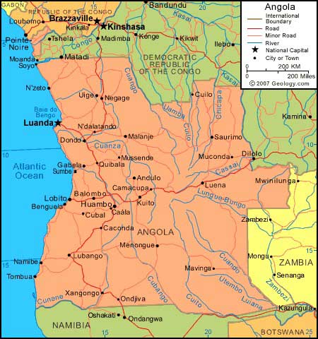
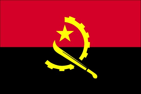
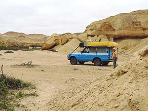
- Angola Map
|
-
-
-
-
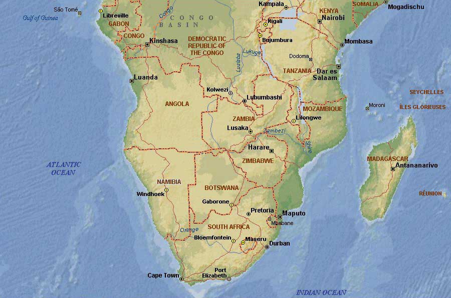
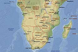
Southern Africa Map
-
|
|
-
|
- latest picture:
October 4, 2014
|
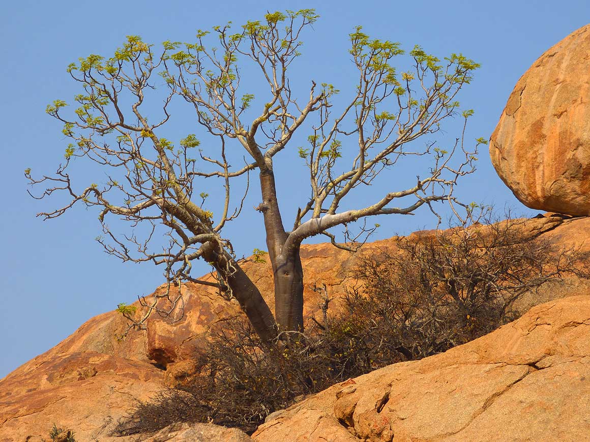
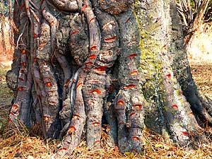
|
-
-
-
-
 -
|
-
-
|
-
-
-
-

|
-
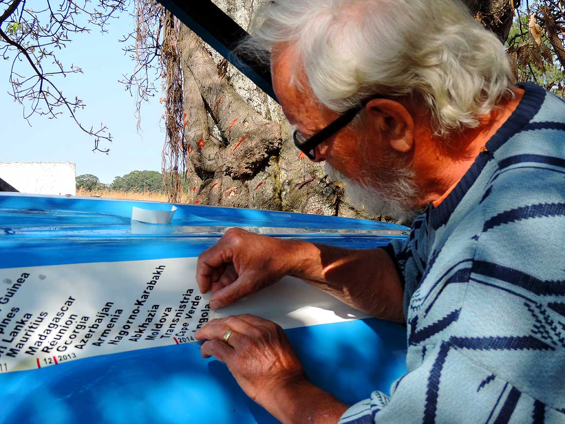
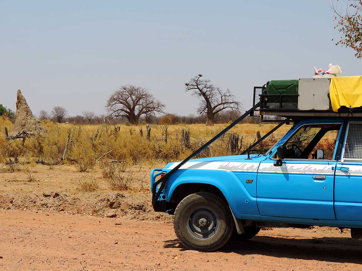
001
9/26/2014: After paying Kwanza
- 6336 (̴ US$ 65) for the road permit, we
- enter our 181st country at the very quiet
- border post of Omahenene/Calueque –
- 18 miles east of Ruacana. Emil adds the
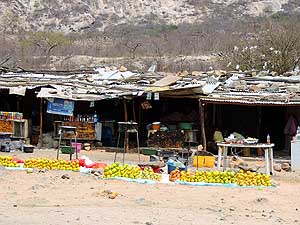
- Angola sticker to our country ribbon
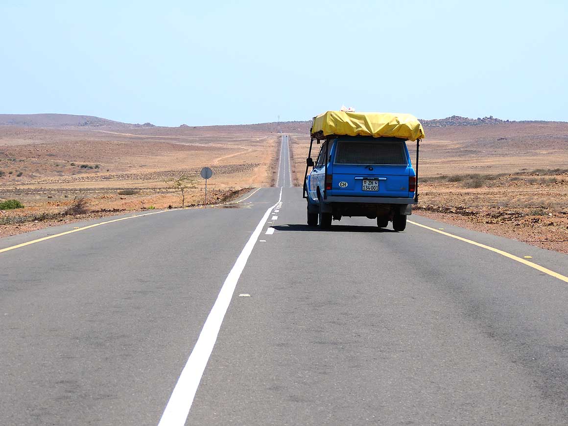
|
-
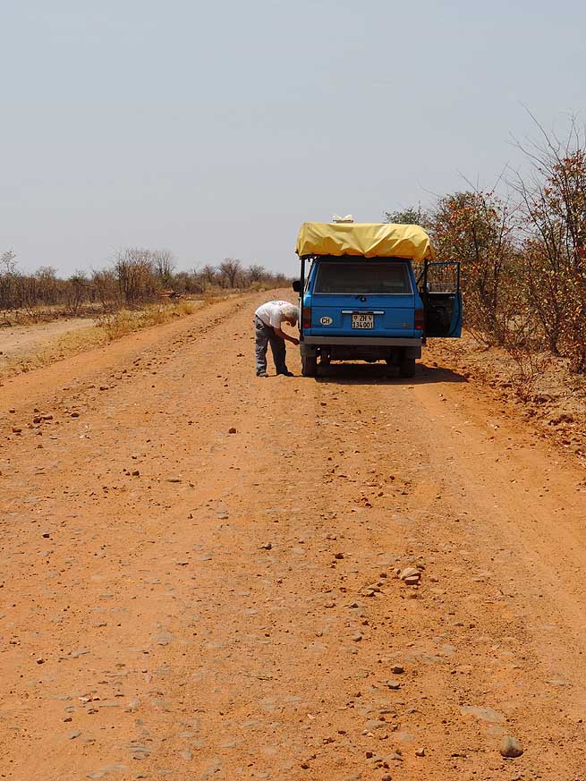
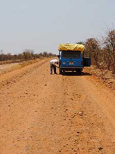
002
Emil deflates the tires as we
- will be driving for the next 50 miles
- from Calueque to Xangongo on a
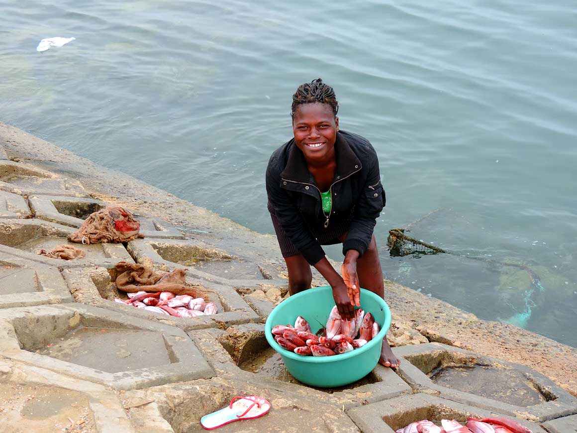
- rough gravel road
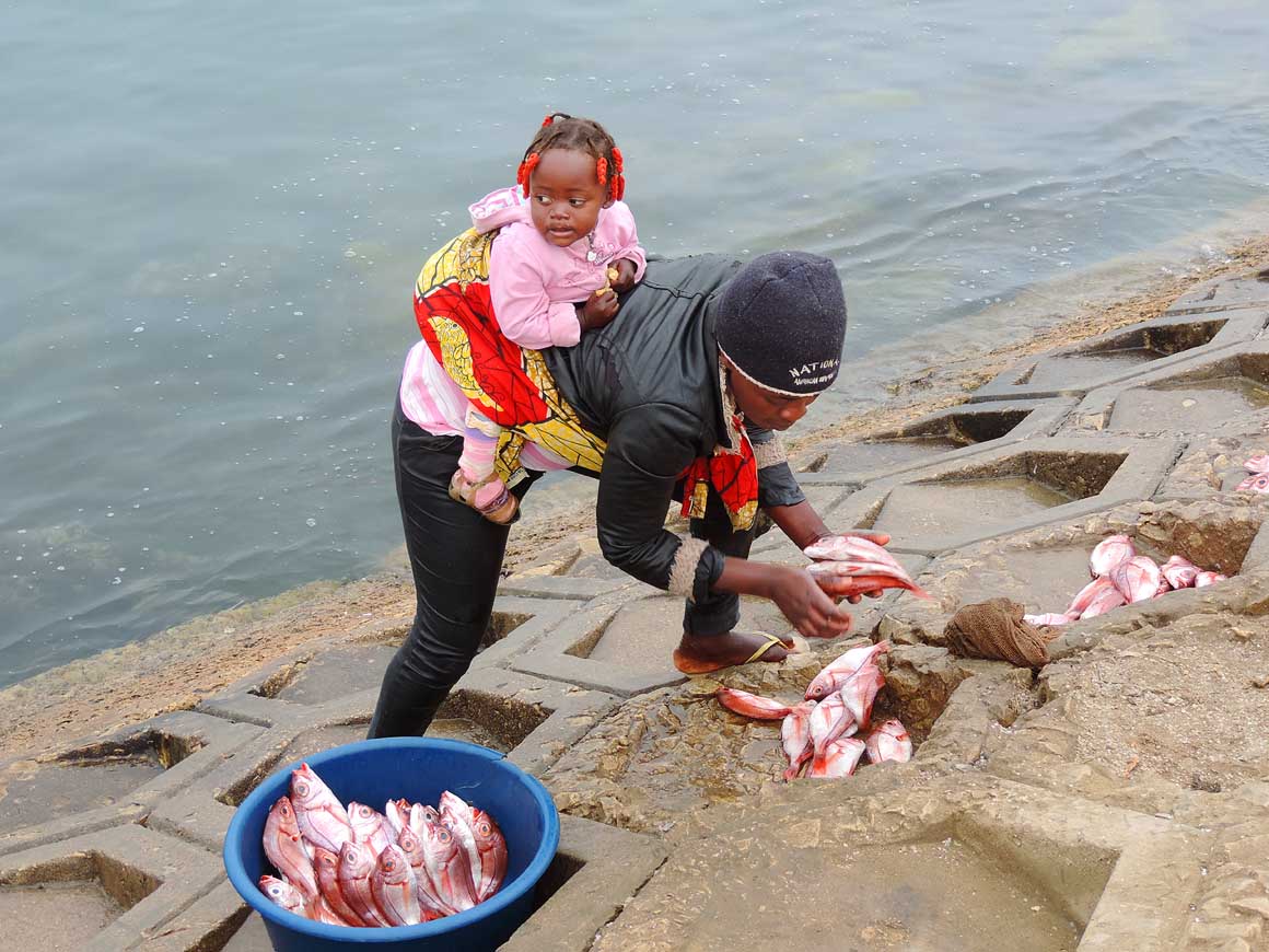
|
-
003
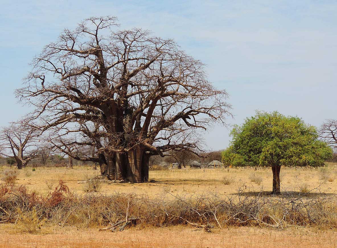
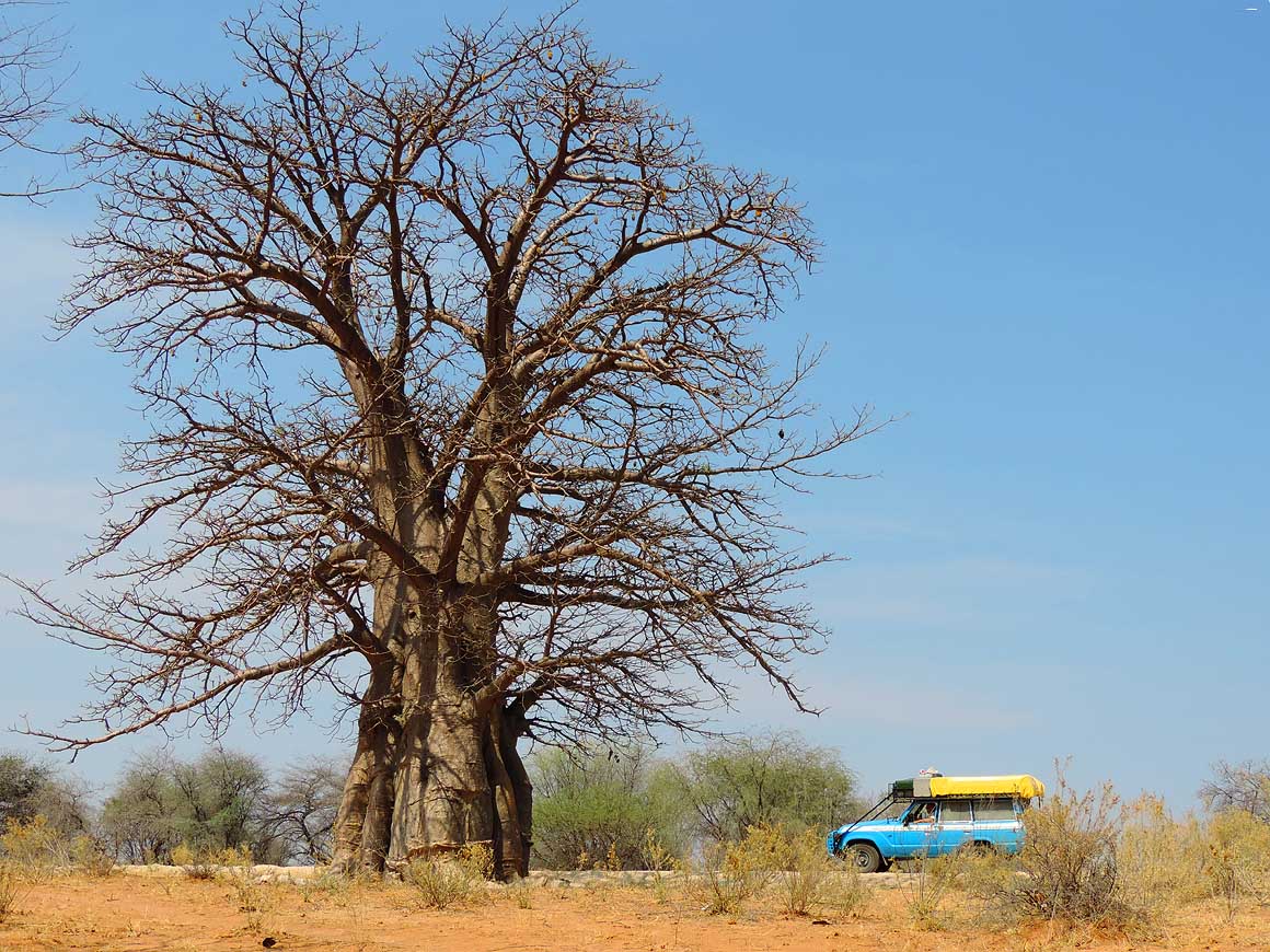
Dry yellow grassland, Baobab
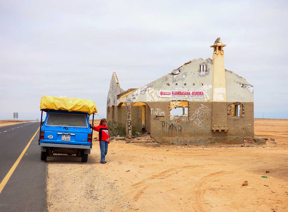
- trees and termite mounds dominate the
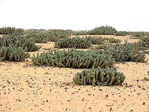
- landscape of our first miles in Angola
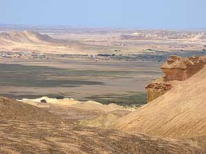
- as before in Namibia
|
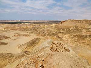
-
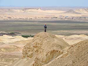
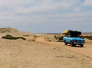
|
-
-
|
-
-

|
-
-
|
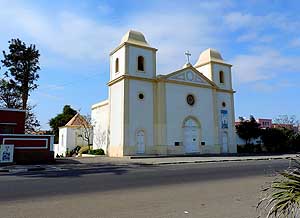
-
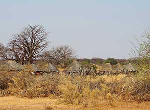
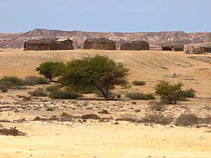
004
A couple of thatched huts where
- the head of the family lives with his wives
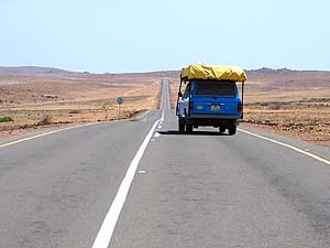
- and children. Mostly they are shielded
- off by a wooden fence
|
-
005
Side by side: A leafless Baobab
- and a tree in brilliant green in the sparse
- landscape leading to Xangongo
|
-
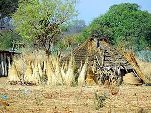
006
Straw is stacked in conical
- ’hats’ in front of an indigenous hut.
- It is used for reroofing
|
-
|
-
-
|
-
-
|
-
-
|
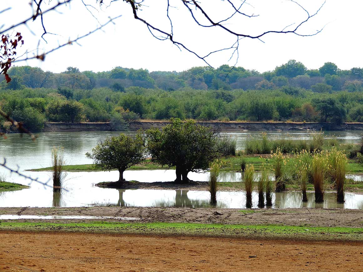
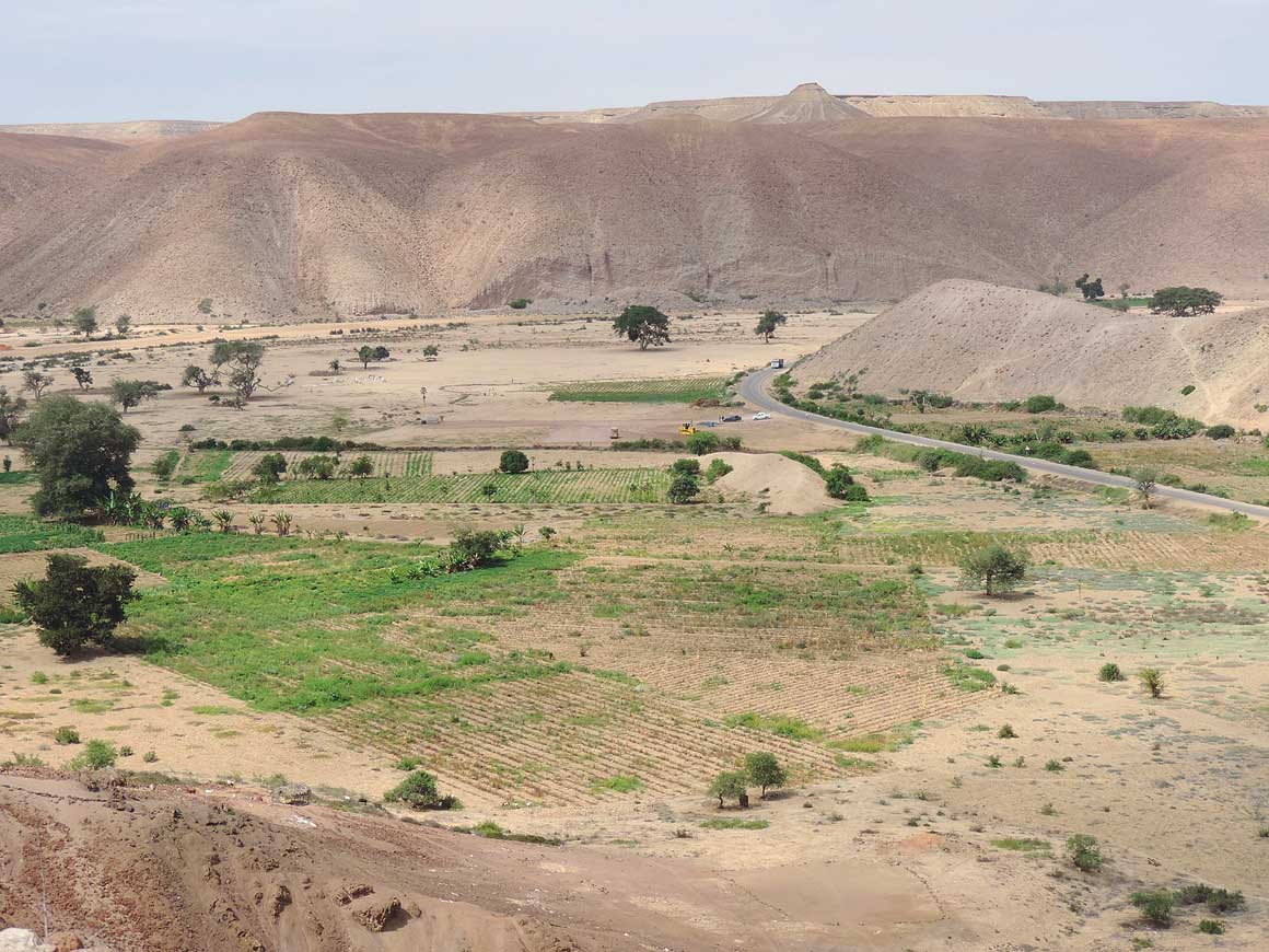
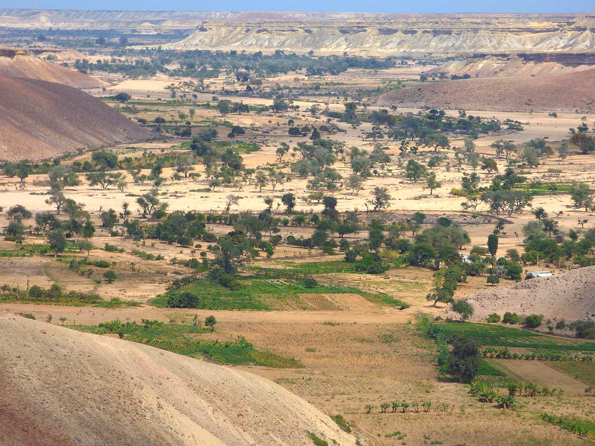
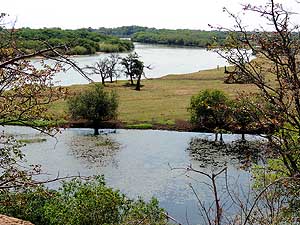
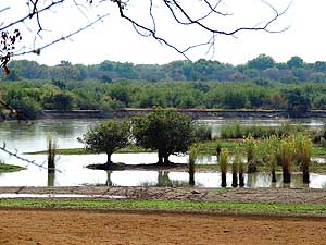
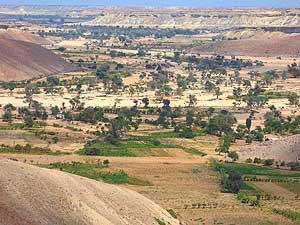
- Between the border of Omahenene and Xangongo the Cunene River
often runs close to the sandy road.
- The fresh green is a blessing for our eyes after the bleak
landscape
|
-
007
|
-
008
|
-
009
|
-
|
-
-
|
-
-
|
-
-

|
-
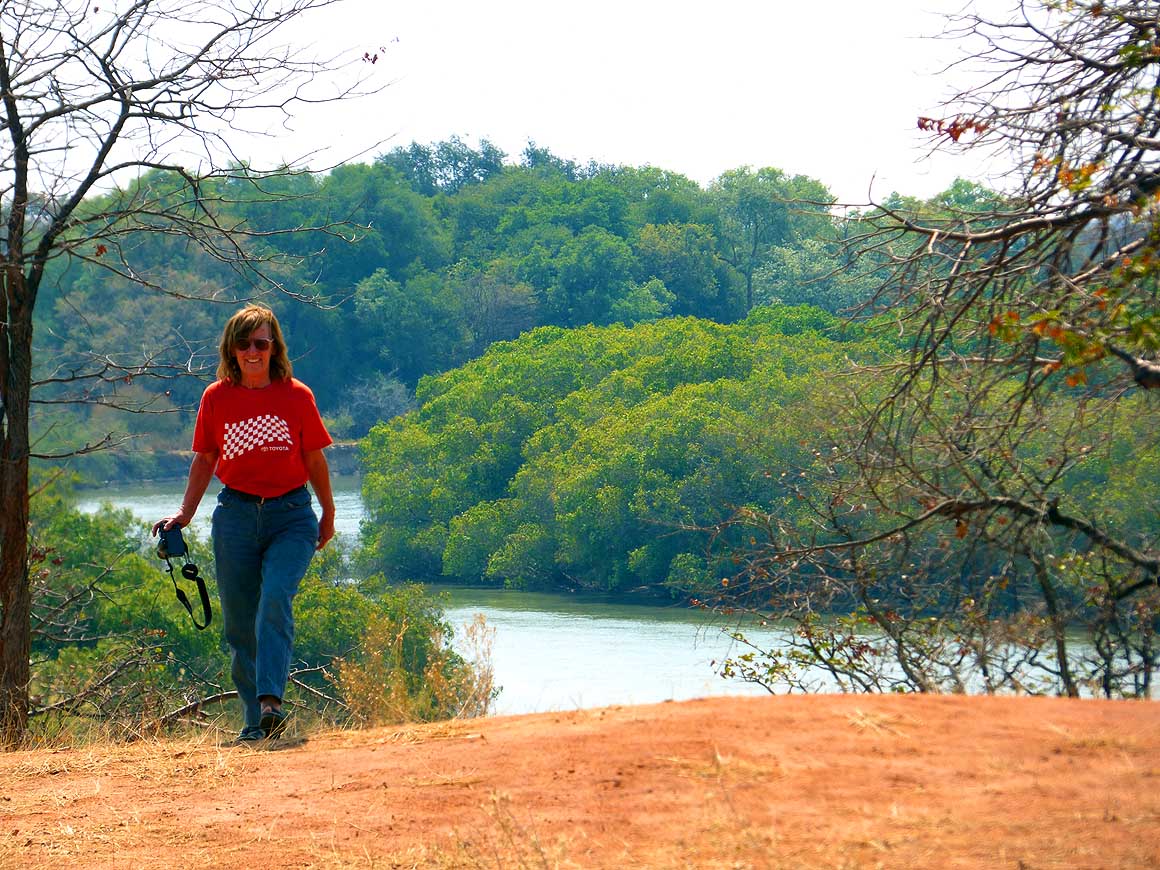
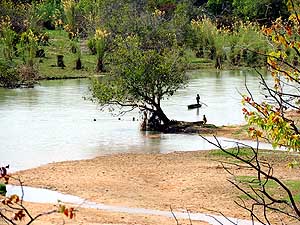
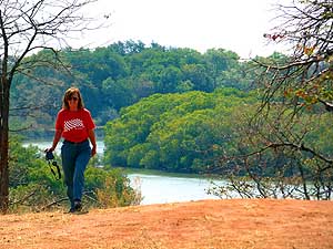
010
Liliana returns happily from
- one of the lovely outlooks
- over the Cunene River
|
-
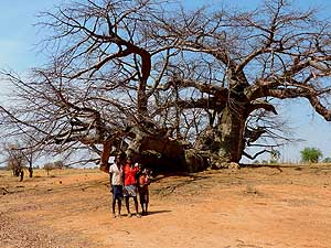
011
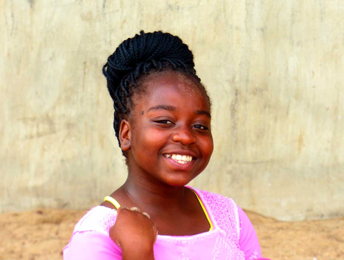
We see no huts, but still these girls
- spotted us. They happily pose for a
- picture in front of the giant Baobab
- (or are there two trees?)
|
-
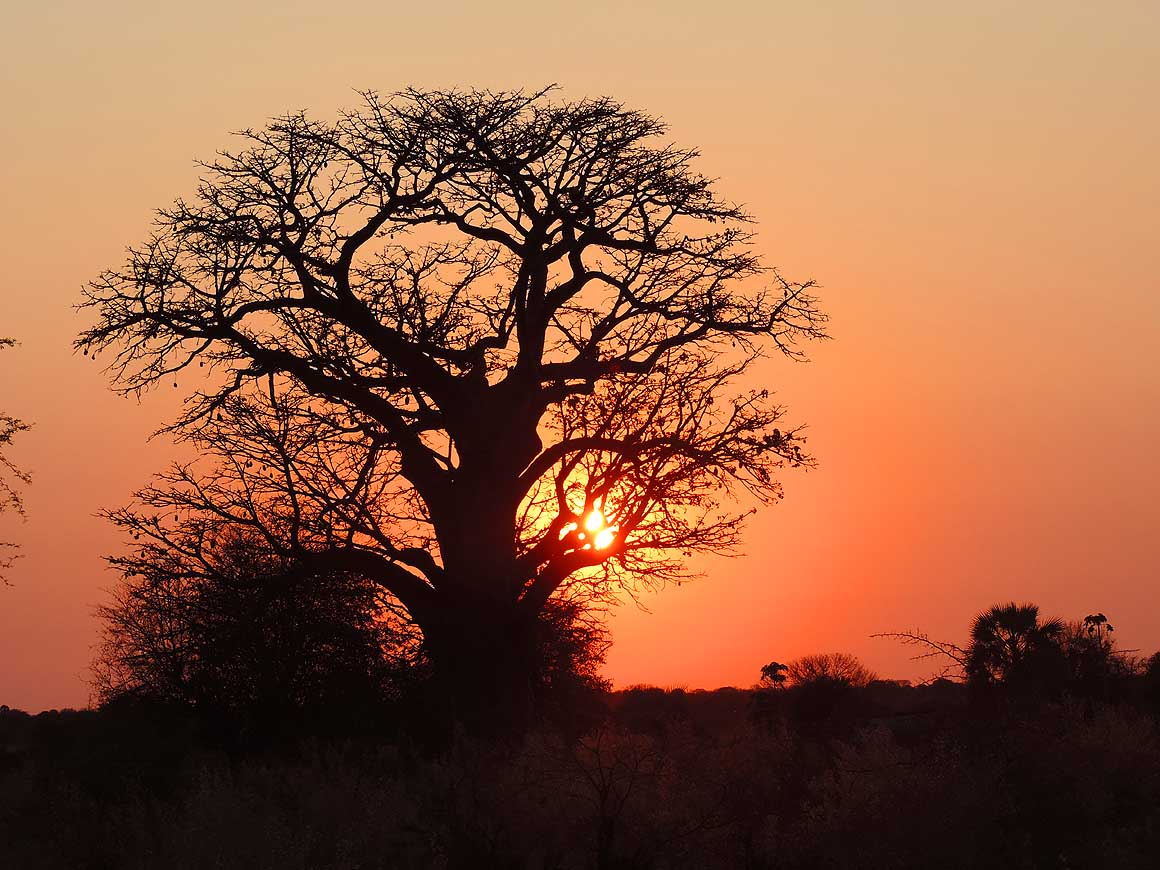
012
The warm light of the setting sun
- shimmers through a majestic Baobab tree
|
-
|
-
-

|
-
-
|
-
-
|
-
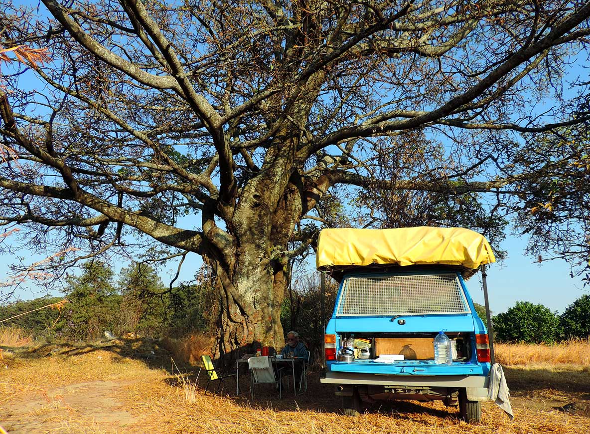
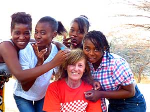
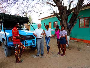
013
The Dr. Martin Lutero village school
- in Shangalala, about 7 miles before
- Xangongo, allows us to camp in its
- compound. Some of its 300 studying
- pupils from all over Angola gather
- around our LandCruiser …..
|
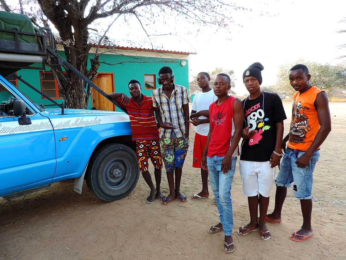
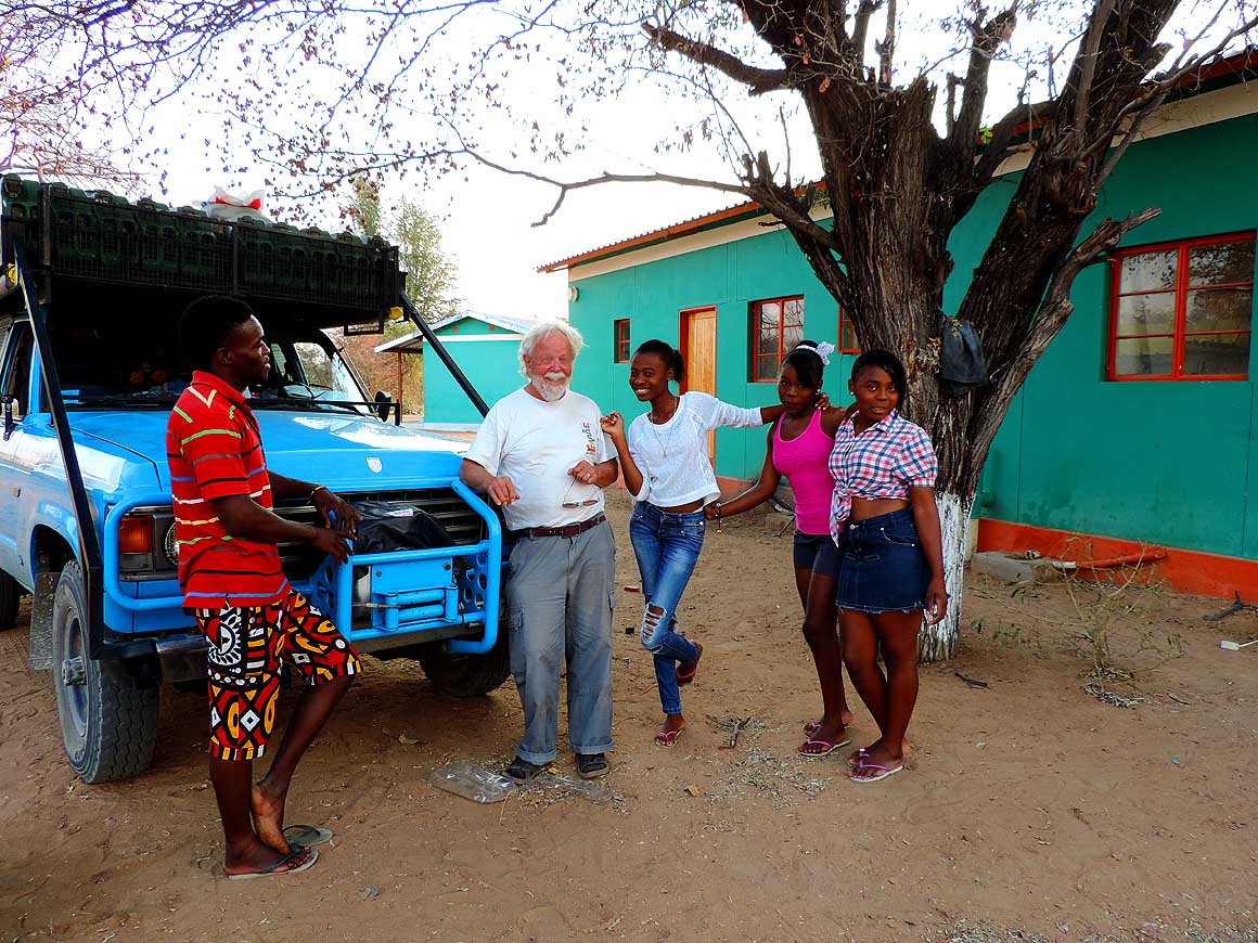
-
014
….. four girls aged between 15
- and 18 years admire Liliana’s soft hair
- and insist on combing it …..
|
-
015
….. they banter with Emil
- while their teacher is watching them
|
-
|
-
-

|
-
-
|
-
-
|
-
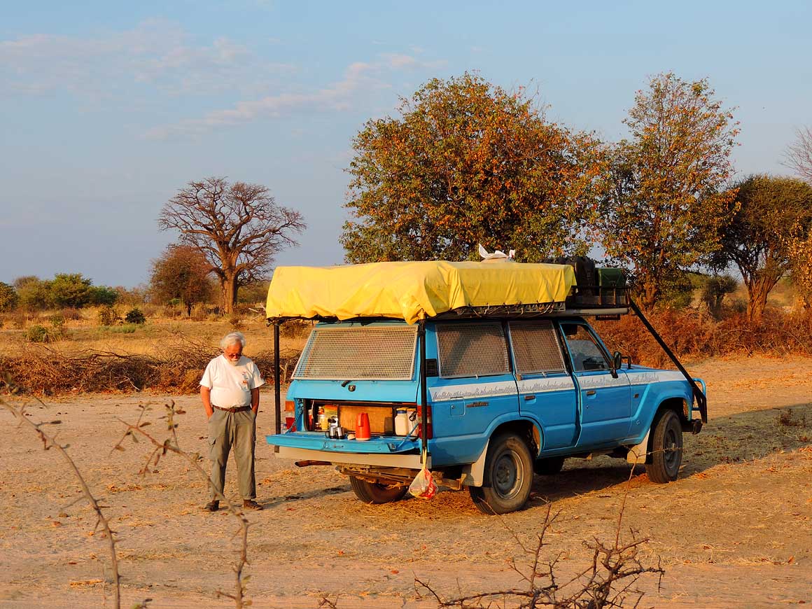
016
What is going through Emil’s
- mind at our coffee break in the
- Angolan savannah?
|
-
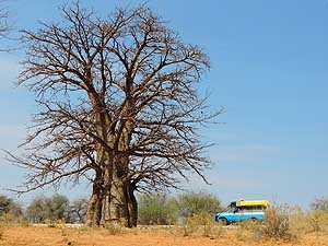
017
Despite that this Baobab is not as
- impressive as its members of the same
- species in Madagascar, it is still
striking
|
-
018
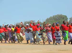
On the Cunene River Bridge in
- Xangongo, clapping, dancing and
- singing women cross our path.
- They are on their way to church
|
-
|
-
-
|
-
-
|
-
-
|
-
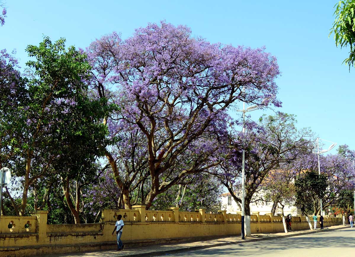
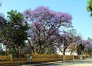
019
Everywhere it is shining purple.
- The Jacaranda trees are in full bloom
- when we arrive in Lubango, the
- second largest town in Angola
|
-
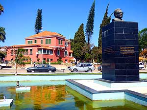
020
The main square of Lubango,
- Jardim Central, is lined by lovely buildings
- and shady trees. The statue on the right is
- in honor of António Agostinho Neto, the
- first president of Angola (1975-1979)
|
-
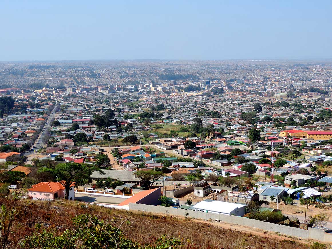
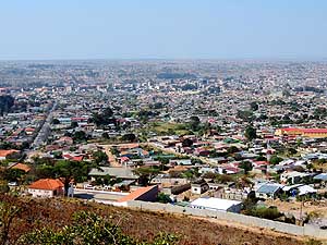
021
Bird’s eye view from Lubango:
- The city nestles in a cool central valley
- on 6’000 ft. and counts approx. 200’000
- people (agglomeration up to 1m). It
- emerged relatively unscathed from the
- 40 years of civil war
|
-
|
-
-
|
-
-
|
-
-
|
-
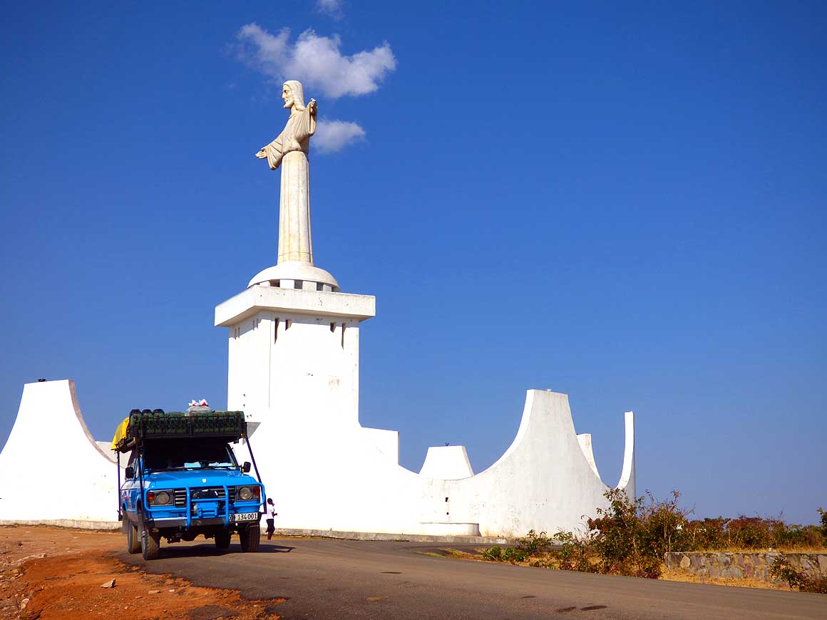
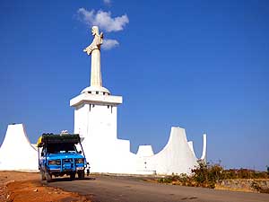
022
Pilgrim to the Jesus statue “Cristo Rei”
- in Lubango. The monument is also
- the background for weddings etc. …..
|
-
023
….. the statue of Cristo Rei
- (46 ft. tall) – a ‘mini version’ of
- Rio de Janeiro’s “Christ the
- Redeemer” (98 ft. tall) – spreads
- its arms over the city of Lubango …..
|
-
024
….. another pilgrim
- at the Cristo Rei statue
|
-
|
-
-
-
-
 -
|
-
-
|
-
-
-
-

|
-
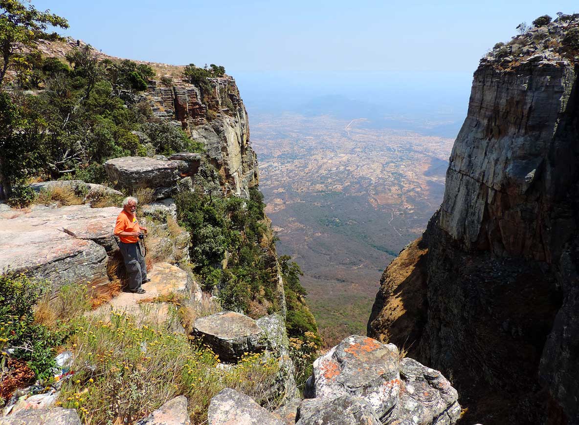
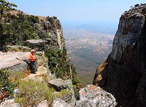
025
The Tundavala Gap, a natural wonder
- 11 miles northwest of Lubango on 7’350 ft.
- altitude. The Bié Plateau drops here about
- 4’000 ft. down to the plain west of Namibe
|
-
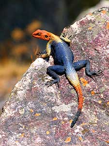
026
A rainbow agama (Agama agama)
- basks in the sun on a rock
- at the Tundavala Gap
|
-
027
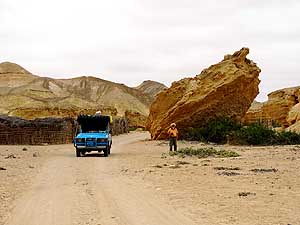
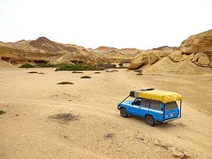
On our way to the Tundavala Gap,
- we pass a spot with weird shaped rocks;
- some of them are on top of each other
|
-
|
-
-
|
-
-
|
-
-
|
-
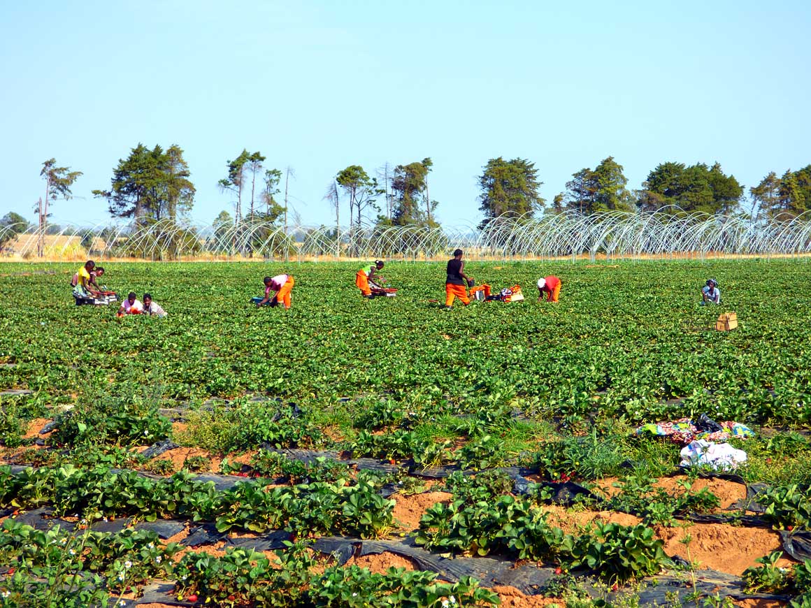
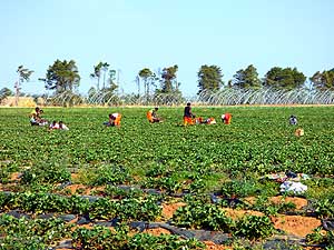
028
Pickers are at work at the straw-
- berry farm “Fazenda Jamba” in Lubango –
- situated along the road to Namibe on an
- altitude of about 6’400 ft., just before
- reaching the village of Humpata
|
-
029
“Dorsland Trekkers” Cemetery from
- the early Boer settlers from the 18th century
- on the territory of the strawberry farm
- Jamba in Lubango. There are about
- 20 barrel-shaped graves
|
-
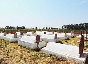
030
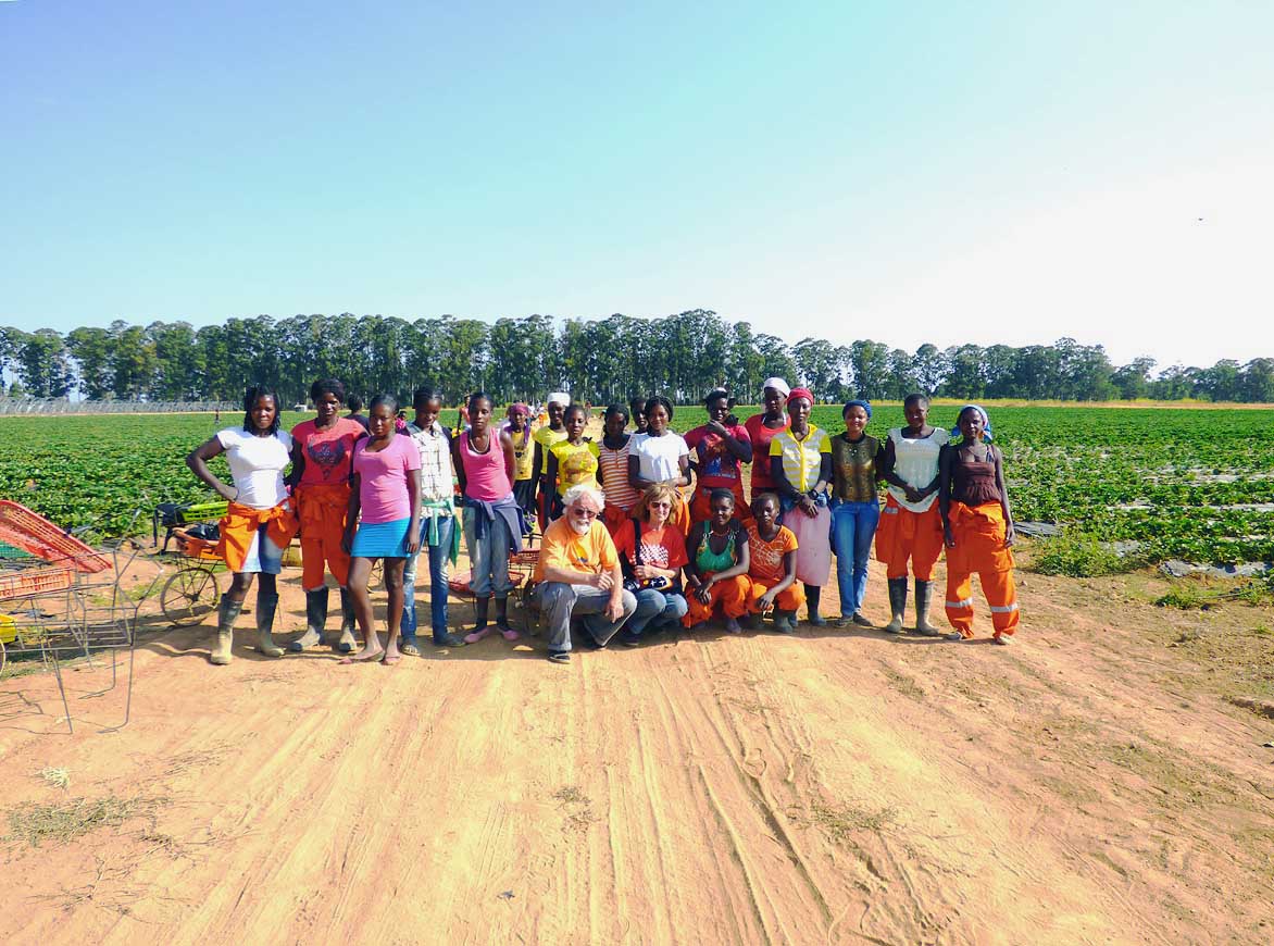
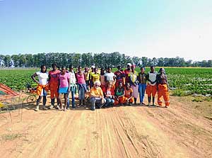
A remembrance picture with the
- pickers of the strawberry farm “Jamba”
- in Lubango. Yudo Borges, the owner,
- employs 60 women
|
-
|
-
-

|
-
-
|
-
-
|
-
031
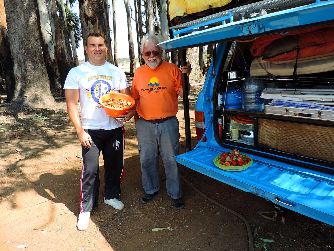
Yudo, the owner of the strawberry
- farm “Jamba” in Lubango, gives us a
- bowl of fresh sweet strawberries
|
-
032
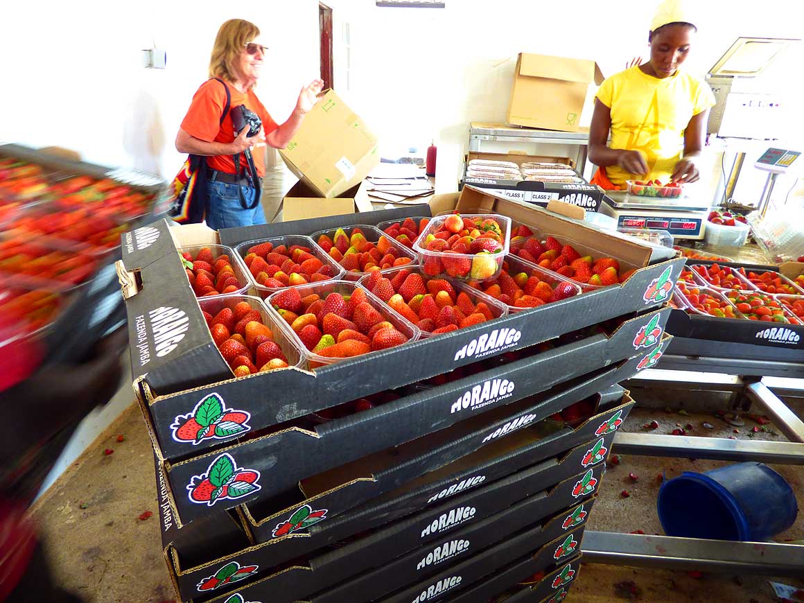
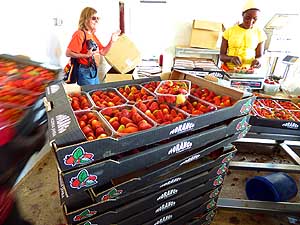
Packing room: The lion’s share,
- approx. 600 boxes in 60 crates, is
- transported three times weekly in a night
- shift nearly 600 miles to the morning
- market of the capital Luanda. Faulty
- ones are processed into yoghurt and
- marmalade, the rest given away
|
-
033
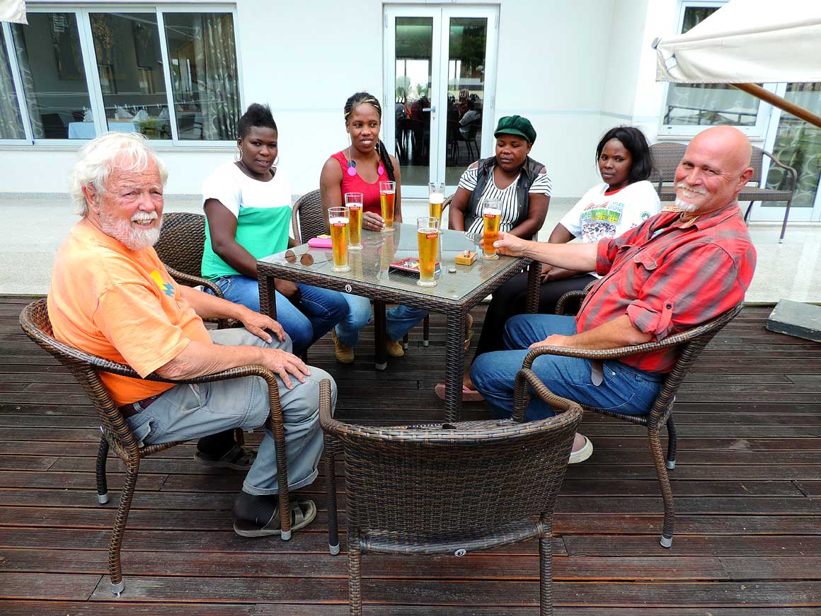
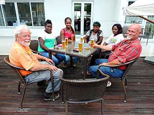
Hanspeter – a Swiss – producing
- yoghurts in Lubango (and probably also
- soon cheese), invites us to an Angolan
- N’gola beer at the Chela Hotel. Present
- are also his wife Magda (in the red top)
- and three of his totally 20 workers
|
-
|
-
-

|
-
-
|
-
-
|
-
034
Our lovely camping spot under a fig
- tree at the strawberry farm “Fazenda Jamba”
- in Lubango about 2 miles before Humpata
- on the way to Namibe (camping spot can
- be used free by anyone who is completely
- self-contained: Coordinates Google Earth
- 15º00'28.40 S - 13º24'26.50 E)
|
-
035
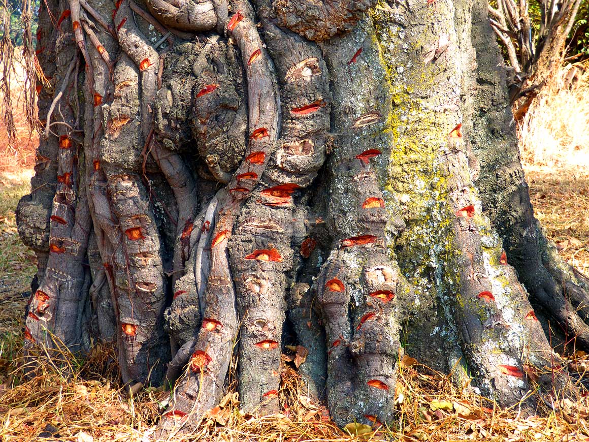
What do the fresh cuts on this
- fig tree (Ficus carica) mean?
Locals
- collect the sticky resin to catch birds
- because they get caught on it
|
-
036
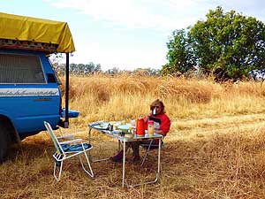
Liliana is enjoying her morning
- coffee at our campsite at the strawberry
- farm in Lubango/Humpata
|
-
|
-
-
|
-
-
|
-
-
|
-
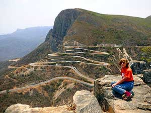
037
Liliana poses for a picture at the
- viewpoint overlooking the switch backs
- of the “Serra da Leba” Pass. It leads
- from 6’550 ft. to the plain of Namibe and
- was built in the 1970’s by the Portuguese
|
-
038
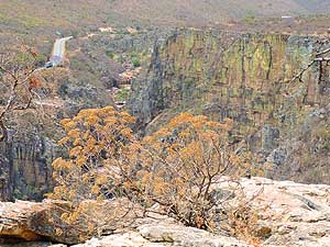
The Leba Pass switchbacks
- pass past dramatic vertical cliffs that
- shimmer in different colors
|
-
039
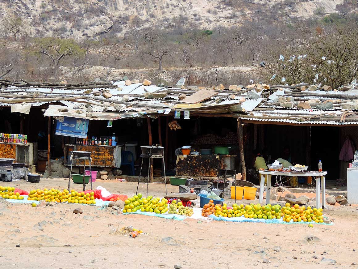
At the bottom of the Leba Pass
- a row of stalls sell oranges
|
-
|
-
-
|
-
-
|
-
-
|
-
040
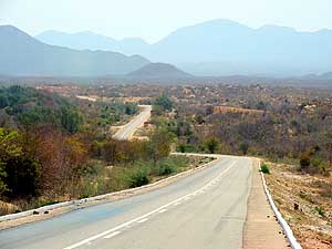
The good tarmac road is twisting
- down from the Leba Pass towards the
- Atlantic coast. The mist that dominates
- the whole western coastal strip from Cape
- Town in South Africa nearly up to Luanda,
- announces itself already from far. It’s
- formed by the cold Benguela current
- originating in the Antarctic region
|
-
041
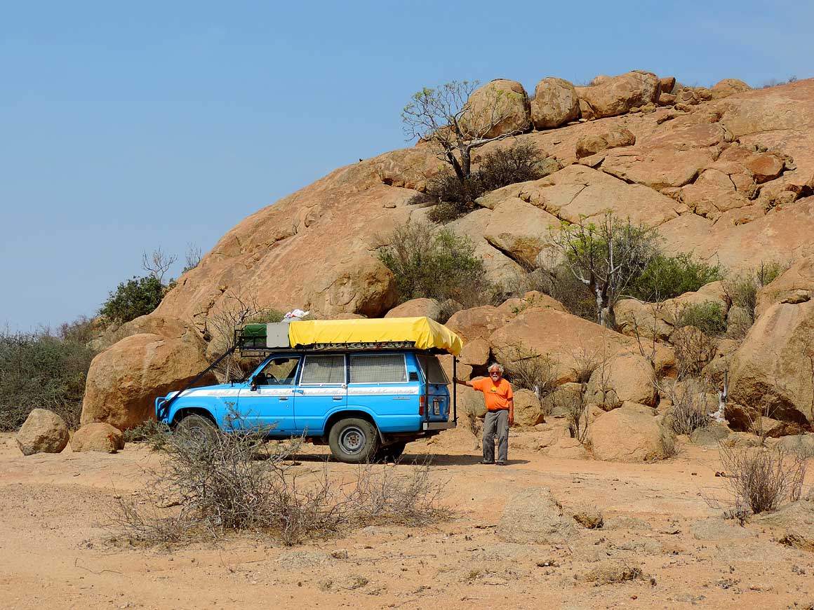
A beautiful boulder with sprouting
- plants and trees out of cracks is our late
- lunch break offside the main road to
- Namibe (a bit west of Caraculo) …..
|
-
042
….. it is the pristine beauty
- of nature that attracts us also here
|
-
|
-
-
|
-
-
|
-
-

|
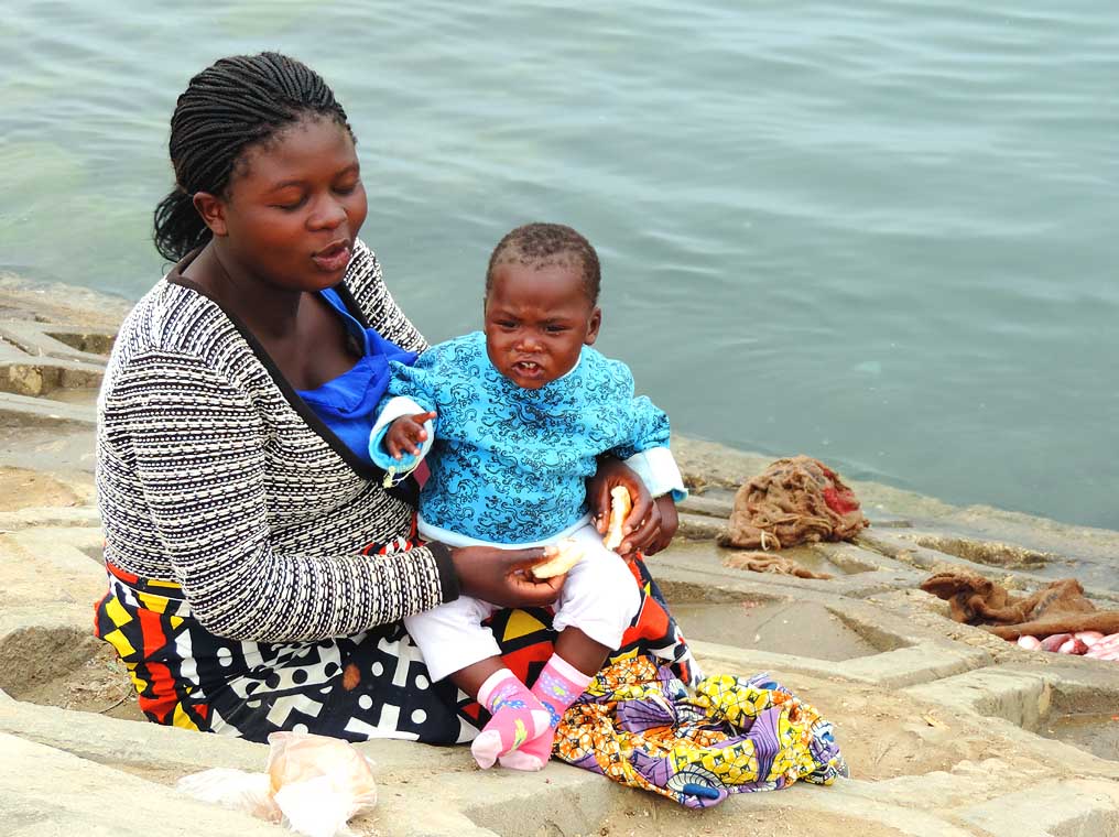
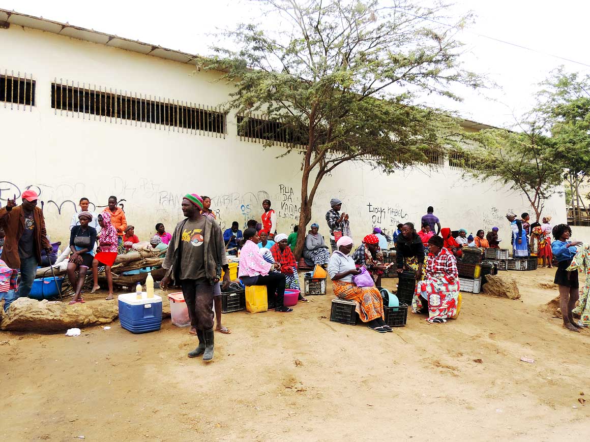
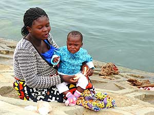
- Early morning at the seashore near the fish market in Namibe:
Women sort out the night’s catch.
- Their small children are always with them, be it sitting on their
lap or wrapped to their back
|
-
043
|
-
044
|
-
045
|
-
|
-
-
-
-
 -
|
-
-
|
-
-
-
-
|
-
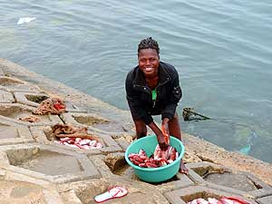
046
The fish market in Namibe is in
- full swing in the early morning hours
|
-
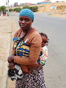
047
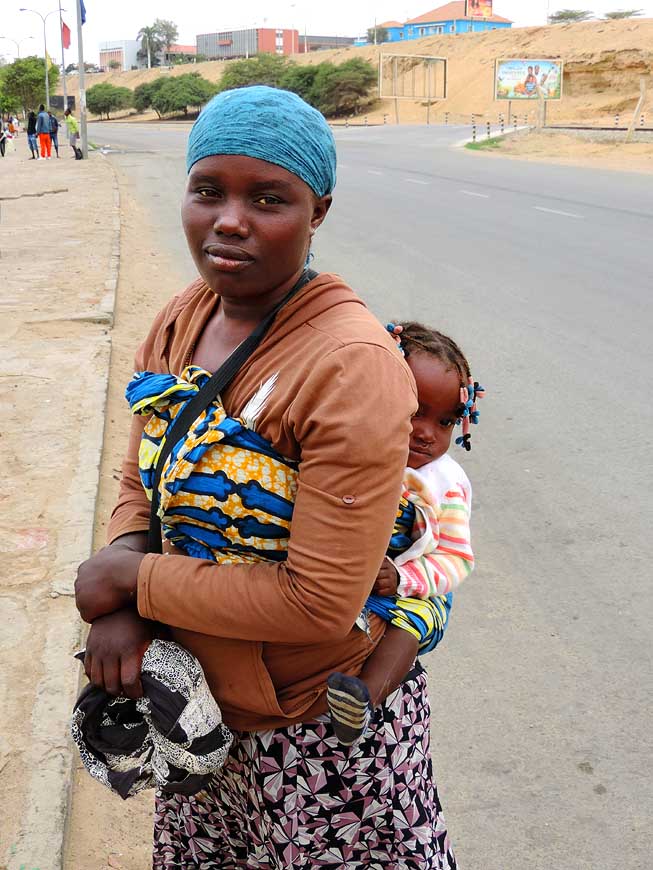
This is typically Africa: A mother
- in the coastal town of Namibe with a
- baby strapped to her back
|
-
048
Boys are playing around joyfully in
- the sand of Namibe Bay. In the back the
- port of Namibe – the third largest port
- of Angola after Luanda and Lobito
|
-
|
-
-
-
-
 -
|
-
-
|
-
-
-
-
|
-
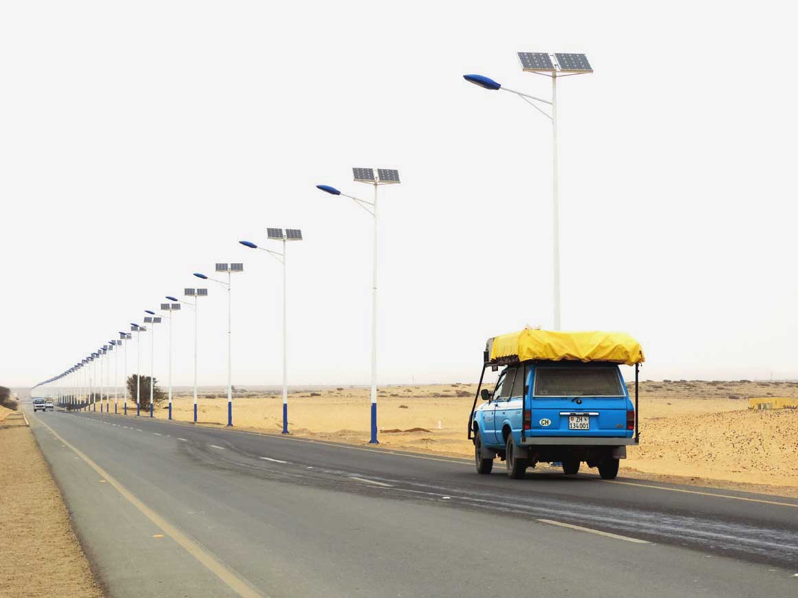
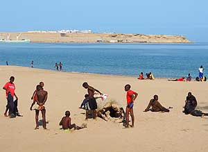
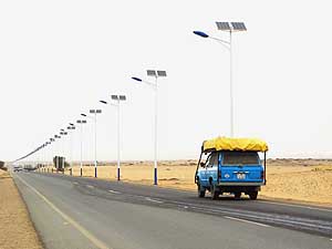
049
On the outskirts of Namibe towards
- the south, we are astonished about the
- modern streetlights, running on solar panels
|
-
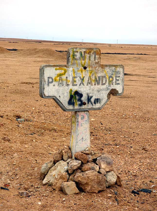
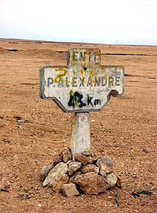
050
A remnant of the Portuguese era: A
- road sign to Porto Alexandre – today called
- Tombua, 62 miles south of Namibe
|
-
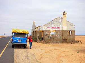
051
A destroyed building along the road
- from the 40 years of war. Was it a
- checkpoint? Such partly smashed little
- houses can be seen nearly everywhere
|
-
|
-
-
|
-
-
|
-
-
|
-
052
‘Hoodias’ (Hoodia gordonii)
- have spread in the flat sand desert south of
- Namibe. Despite of looking like cacti they
- belong to the family of ‘milkweeds’
|
-
053
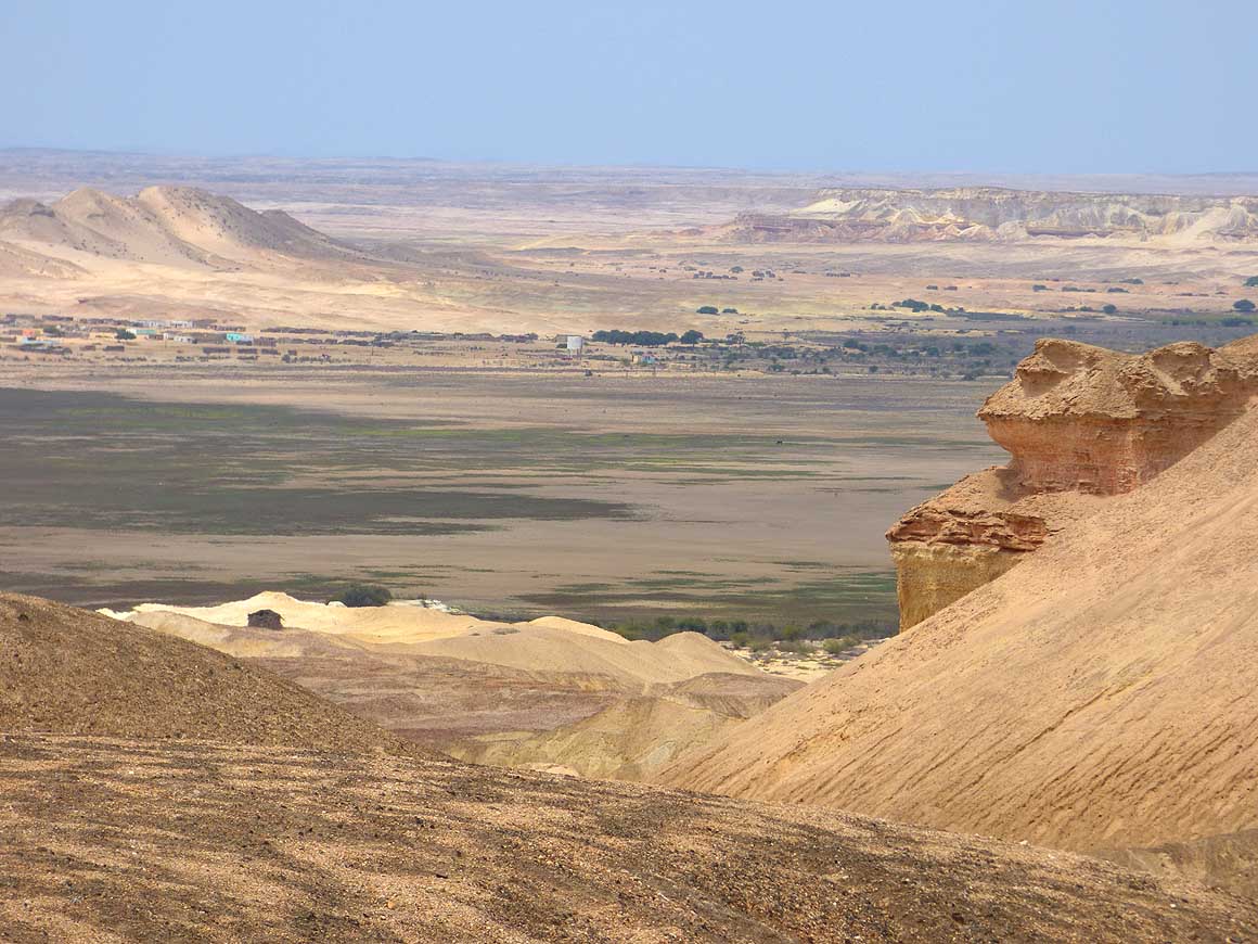
View to the completely dry Arco
- Lake, about 42 miles south of Namibe,
- with Camilunga in the background. The
- lake is formed by the Curoca River if
- there’s enough water …..
|
-
054
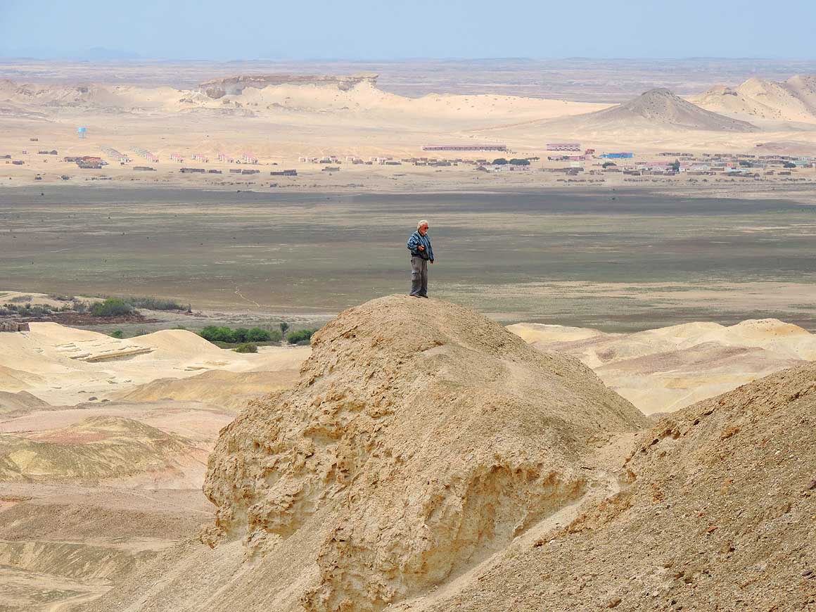
….. Emil is enjoying the vast view
|
-
|
-
-
|
-
-
|
-
-
|
-
055
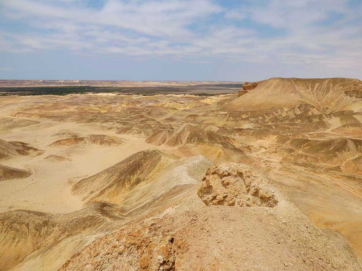
Arco Lake is surrounded by
- deep canyons and ditches, shining rocks
- and a lovely eroded landscape
|
-
056
We are on a discovery tour around
- the dried-out Arco Lake (Lago do Arco
- do Carvalhão). The road – later a 4x4
- track – leads finally towards Ruacana/
- Namibia, and is an alternative to
the
- splendidly constructed ‘Transafrica
- Highway No. 3’ for off-road enthusiasts
|
-
057
No pollution, no traffic noise:
- Modest huts at Arco Lake
|
-
|
-
-

|
-
-

|
-
-
|
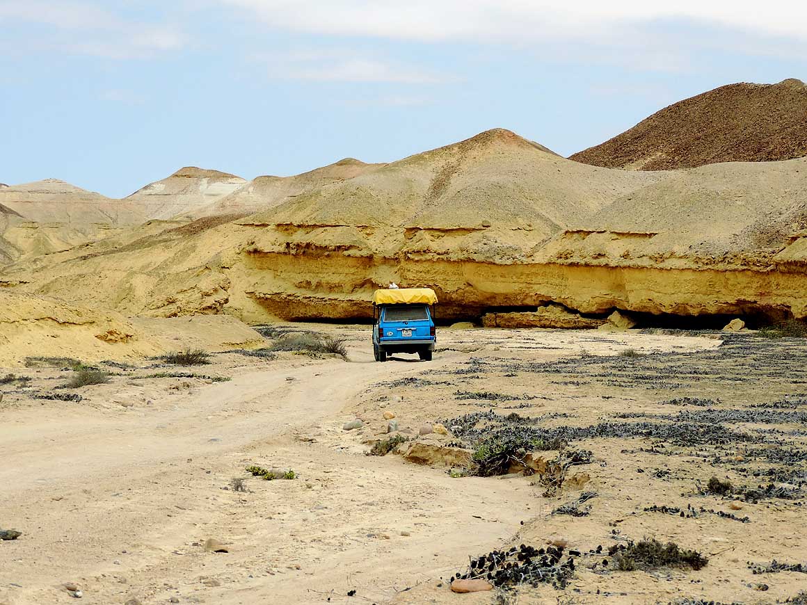
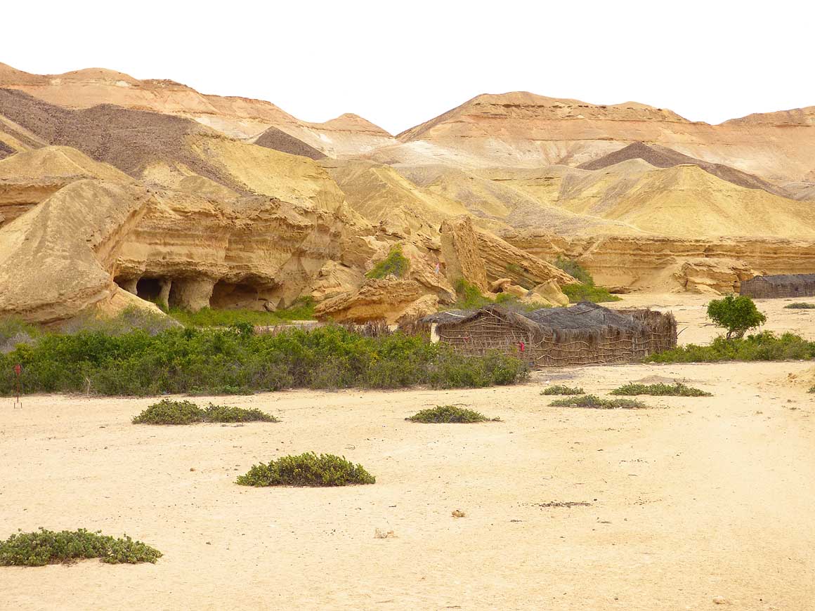
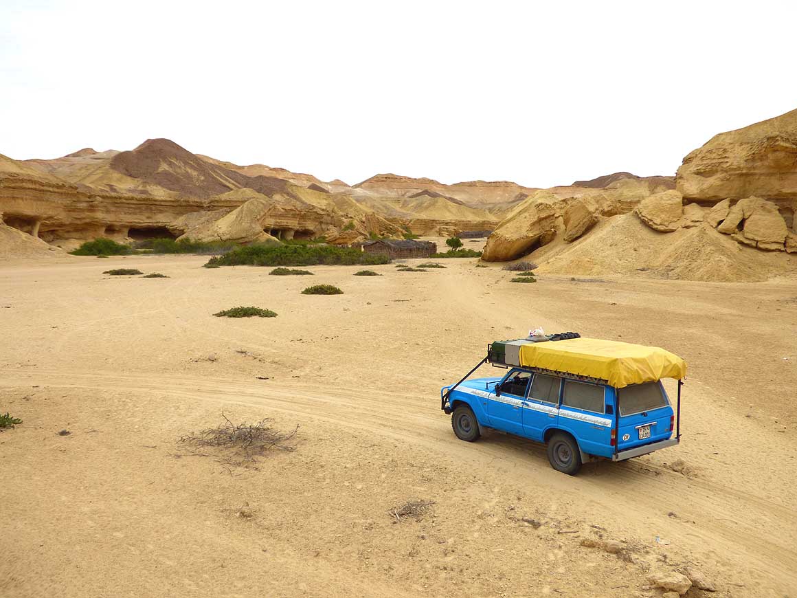
- 2 miles south of the widened main track to the dried-out Arco Lake
we discover another smaller access. A sandy track is twisting
- downhill through a narrow canyon. The sight at the bottom is
magnificent: Gorges, pillars, towers and arches, shaped from
sandstone.
- In between are simple huts with empty water jerry cans in front.
All of them seem to be deserted –
- possibly the region is only inhabited when water is in the lake
|
-
058
|
-
059
|
-
060
|
-
|
-
-
|
-
-

|
-
-
|
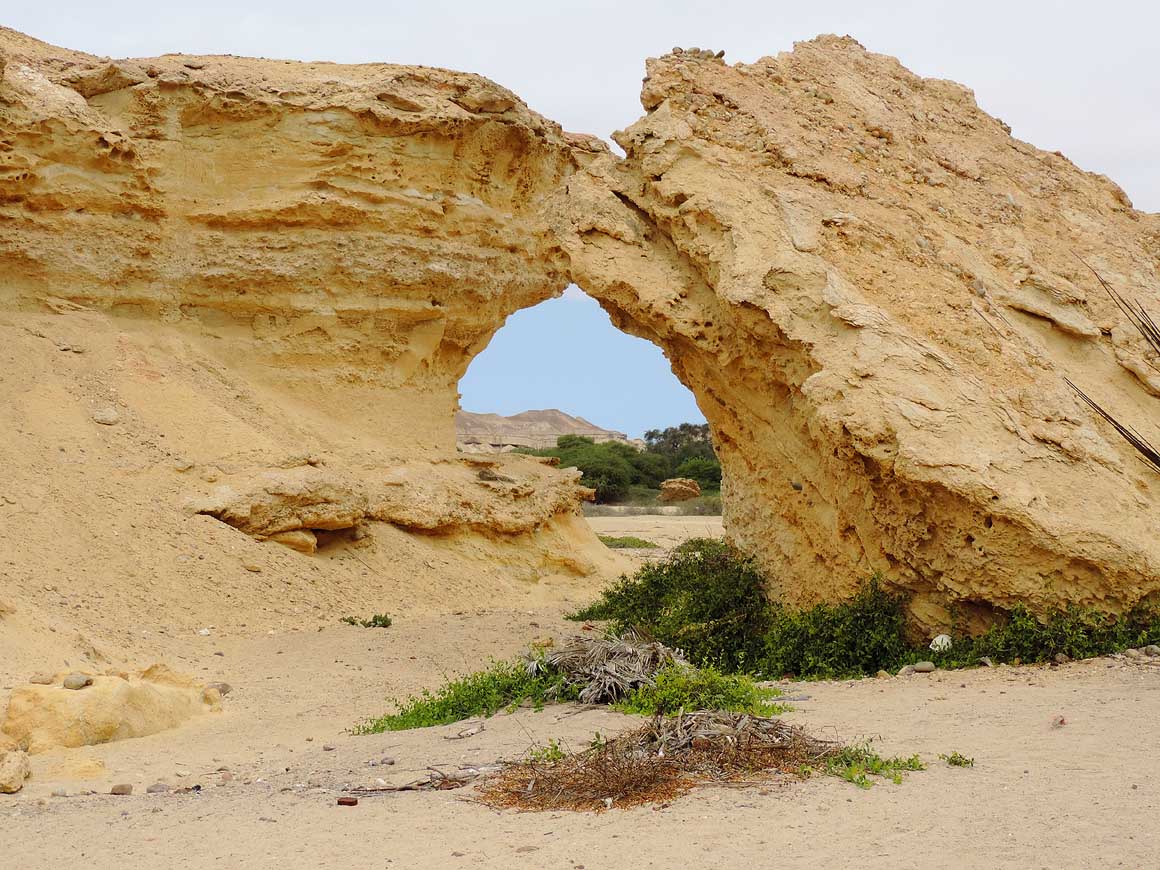
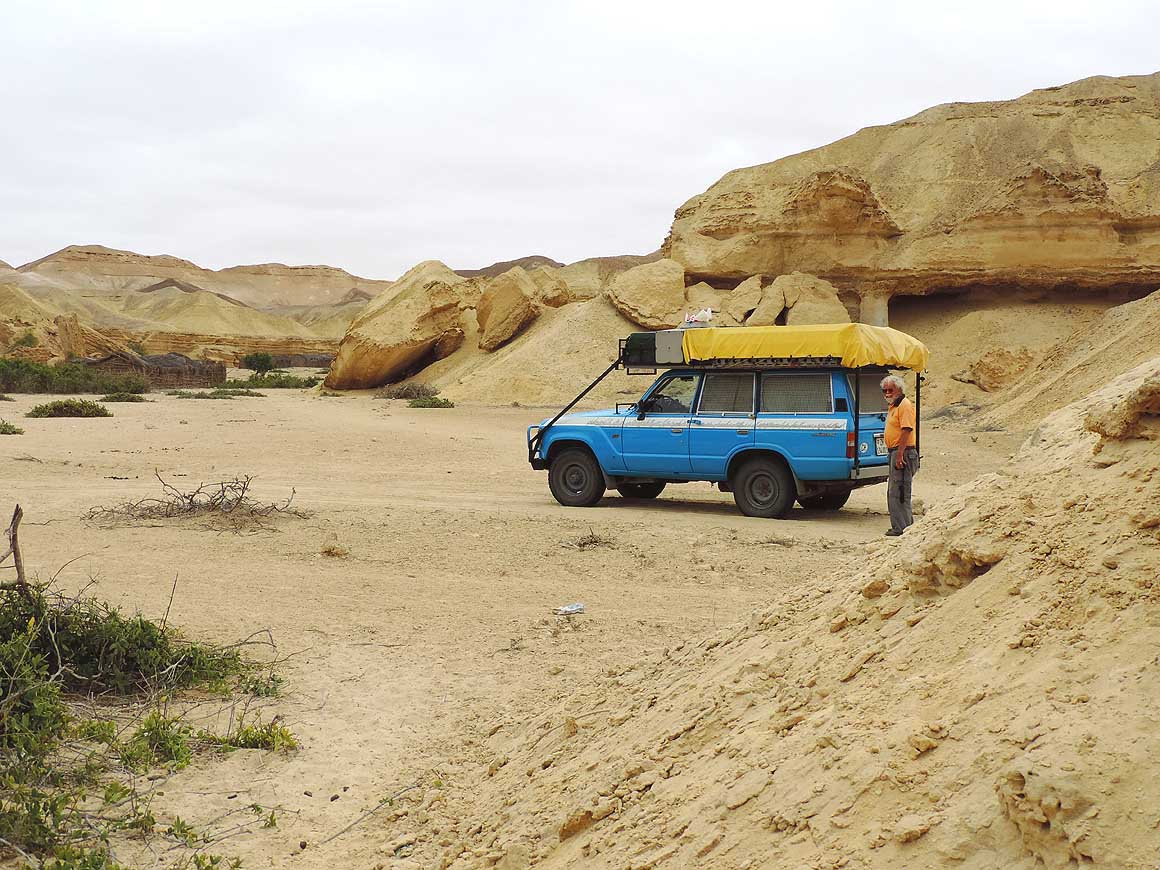
- Not a sound is to be heard in this fascinating labyrinth of
sandstone formations at Arco Lake. We feel like placed into another
world
|
-
061
|
-
062
|
-
063
|
-
|
-
-

|
-
-

|
-
-
|
-
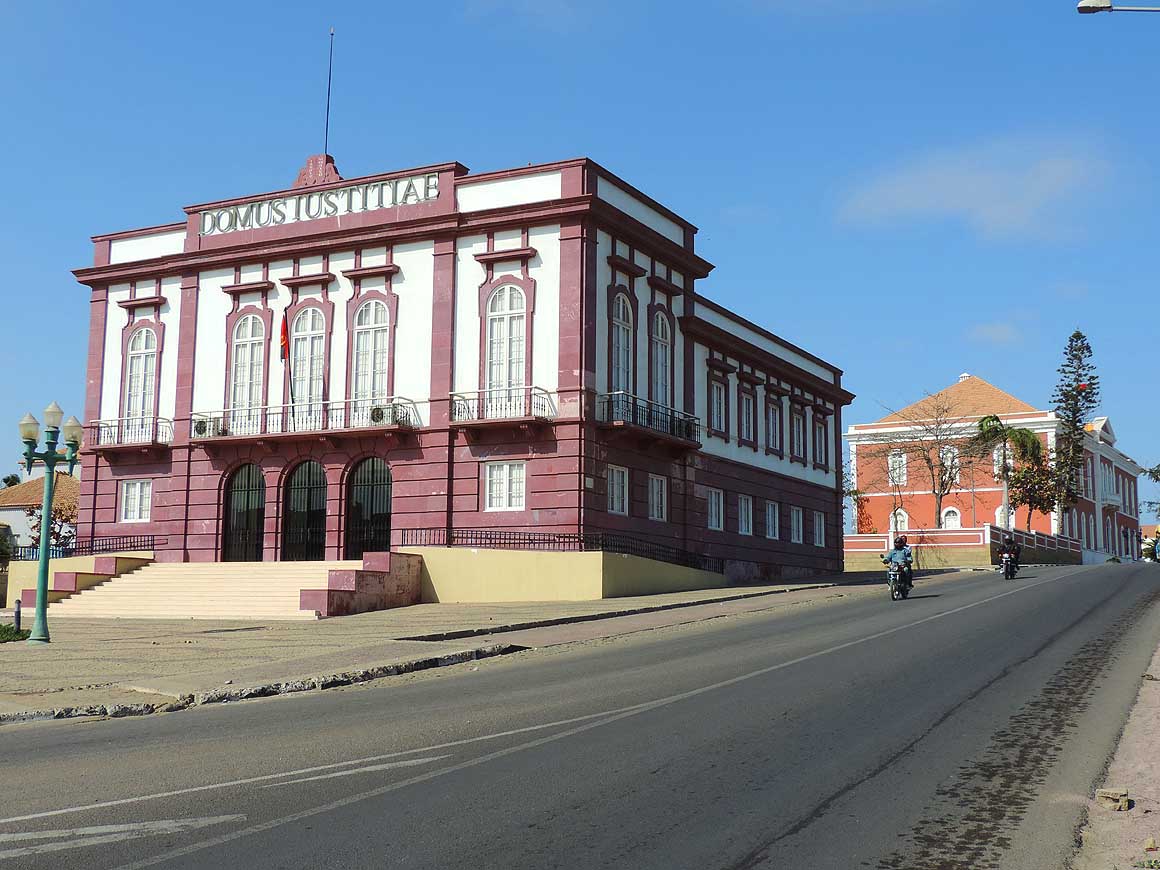
064
Beautiful buildings line the main road
- of the coastal town of Namibe: In front the
- provincial court, behind it the seat of the
- government of the province of Namibe
|
-
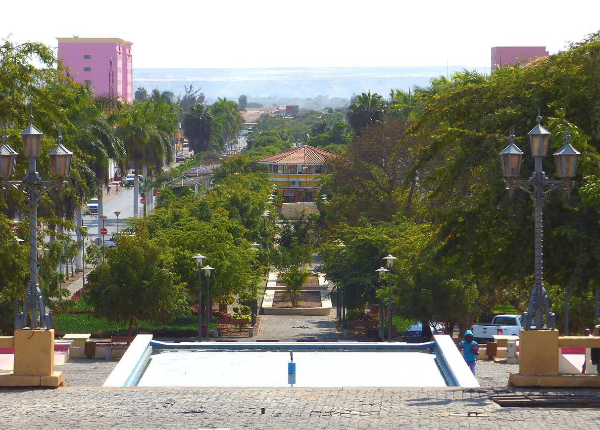
065
The tree-lined Avenida Eduardo
- Mondiane in the city center of Namibe
|
-
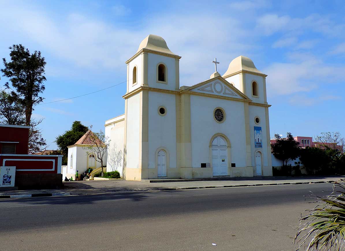
066
The “Paróquia de Santo Adrião”
- in Namibe, built in the Portuguese
- architecture
|
-
|
-
-

|
-
-

|
-
-

|
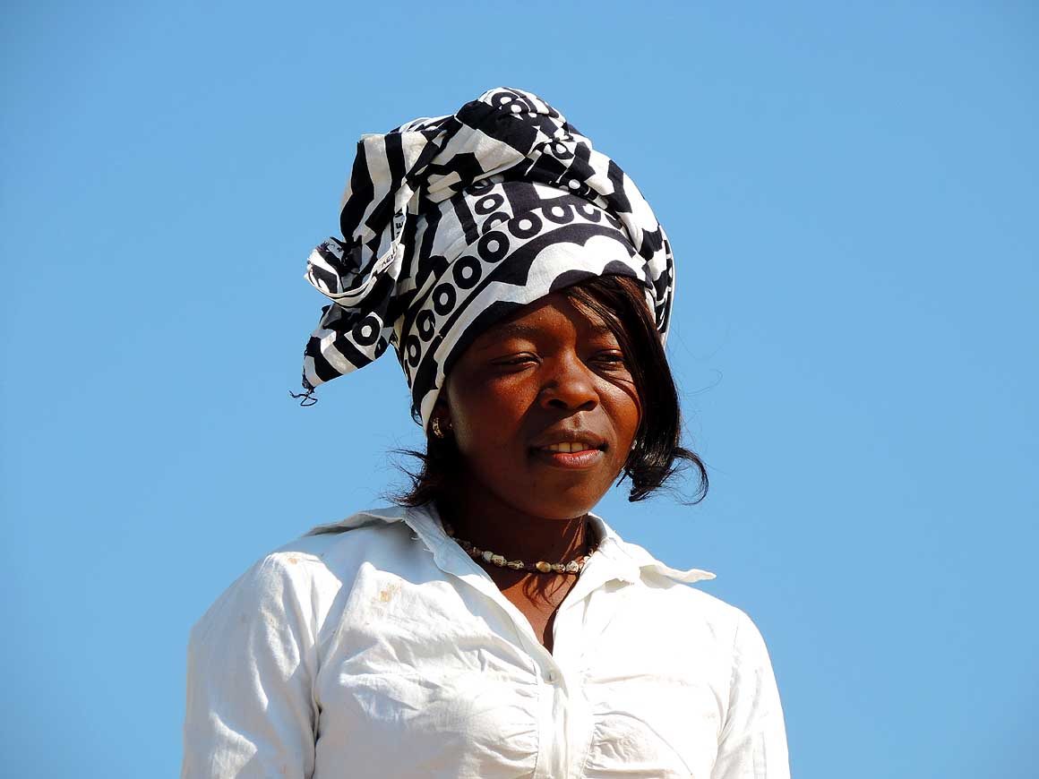
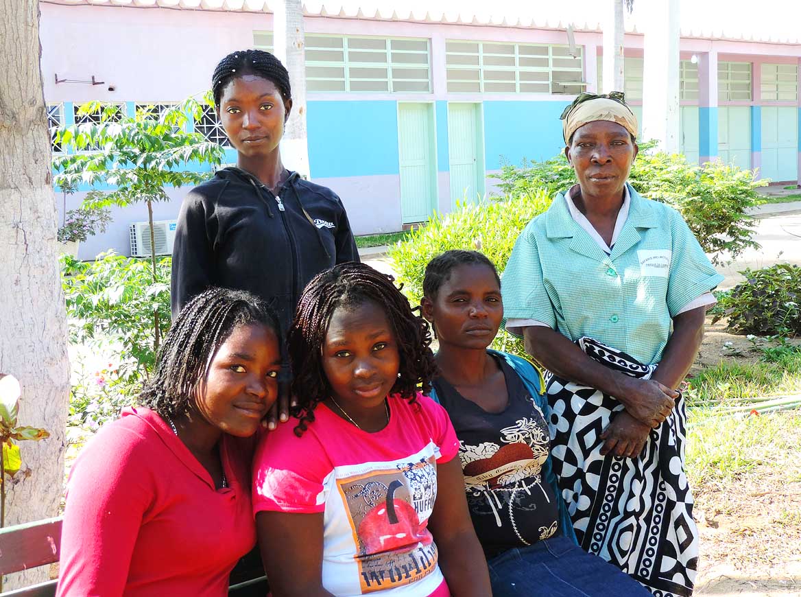
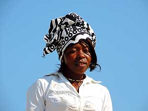
- All smiles: The people of Angola meet us with genuine friendliness
and bright smiles
|
-
067
|
-
068
|
-
069
|
-
|
-
-
|
-
-

|
-
-

|
-
070
The coastal road from Namibe to
- Lucira is tarred and in a perfect condition.
- It mostly leads through uninhabited land
- what conveys a feeling of vastness.
- Unfortunately it is in a very bad state due
- to (discontinued) constructions between
- Lucira and Dombe Grande before
- Benguela…..
|
-
071
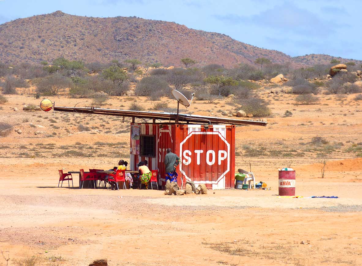
….. a quaint little kiosk along
- the road that cannot be missed
|
-
072
A Bedouin camp along the road
- from Namibe to Lucira. The shelter exists
- of a simple wired tent frame, which they
- cover with blankets. The frame remains
- when they move on
|
-
|
-
-
|
-
-
|
-
-
|
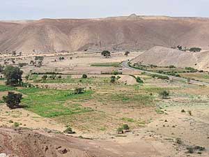
- Barren hilly land and green valleys dominate the landscape on the
- coastal stretch Namibe-Lucira – here at Giraul de Cima
|
-
075
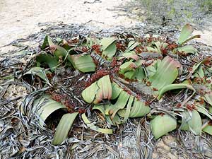
Liliana admires the ‘mini’ Baobabs
- respectively ‘Elephant's Foot Plant’
- (Pachypodium rosulatum) that we know
- also from Madagascar (pic # 161)
|
-
073
|
-
074
|
-
|
-
|
-
-
|
-
-
|
-
-
|
-
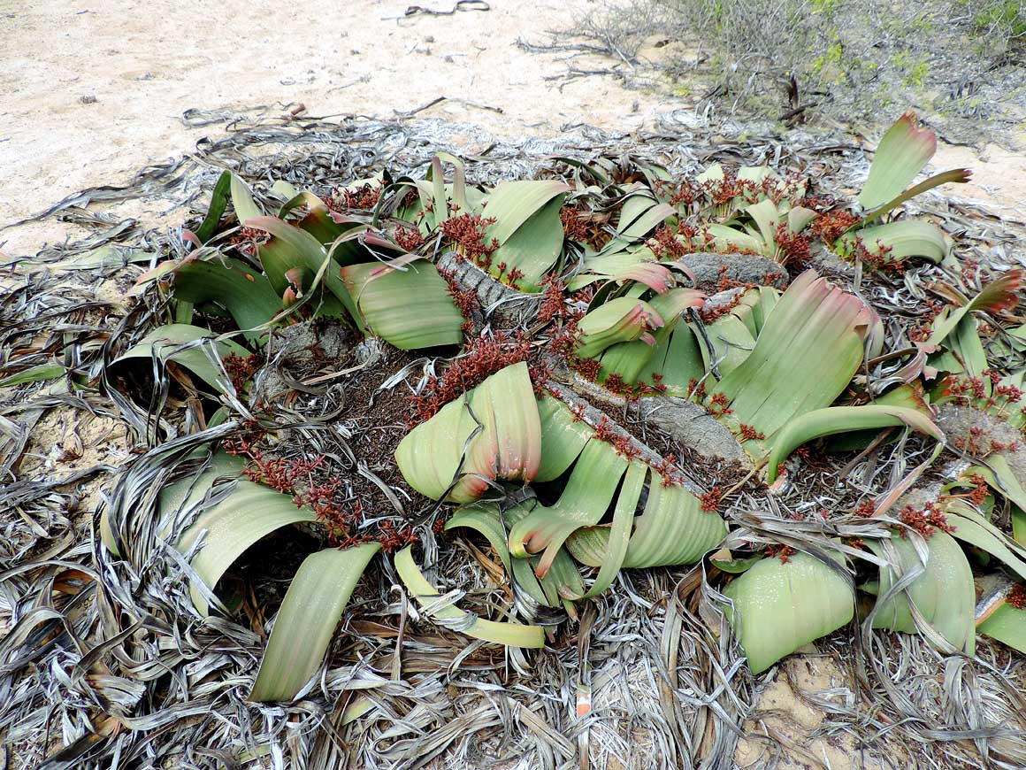
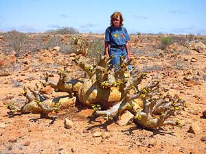
076
The Welwitschia (Welwitschia
- mirabilis) is growing in the desert and can
- live up to 2'000 years. This strange plant
- is only found in Angola and Namibia
|
-
077
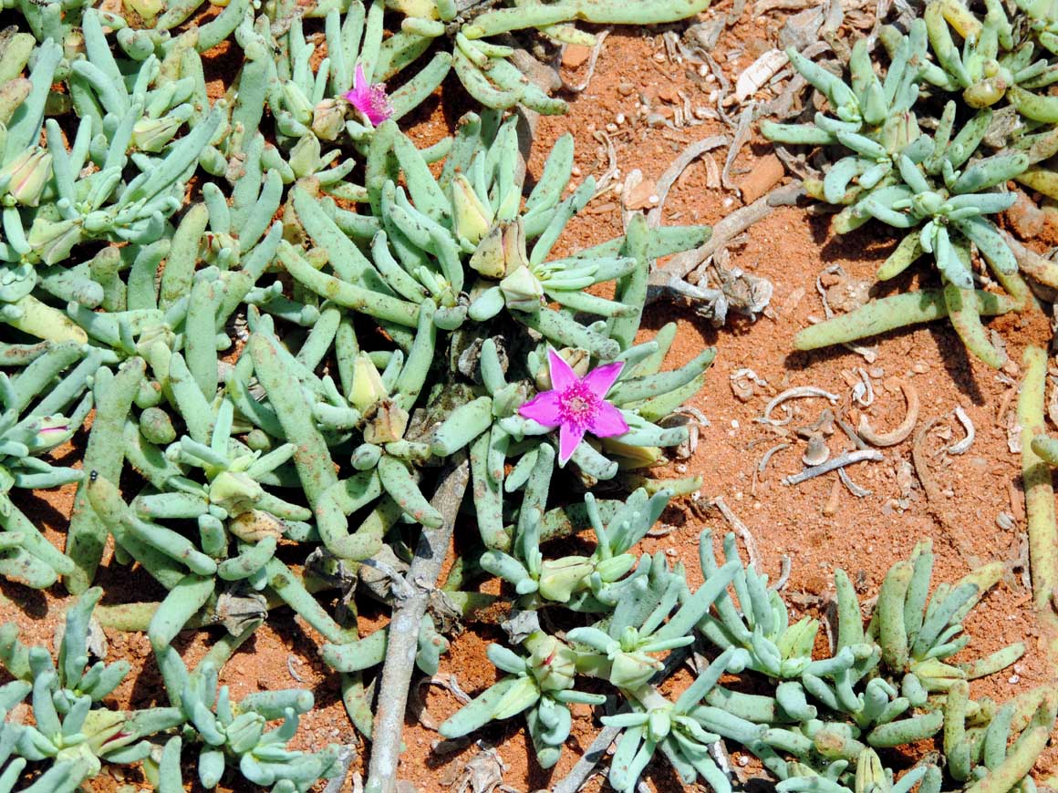
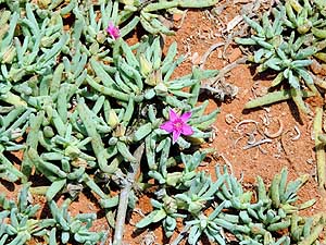
This delicate flower grows in the
- red soil at a bay between Namibe and
- Lucira; presumably a ‘Dead man fingers’
- plant (Dactylopsis digitata)
|
-
078
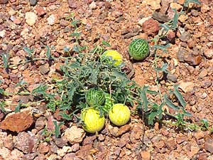
These citron melons or tsamma
- melons (Citrullus lanatus) are both
- food and drink to the animals
|
-
|
- Continuation to the next Angola page: Angola Part 2
–
October 4th to 22nd, 2014
|
-
- The African trip
2013-15:
- CapeVerde: Santiago/Praia
part 1 – November18th to December 13th, 2013
- CapeVerde: Fogo
– Dezember13th to 23rd, 2013
- CapeVerde: Brava
– December 23rd to 26th, 2013
- Cape Verde: Santiago/Praia
part 2 – December 26th, 2013 to February 28th, 2014
- Cape Verde: São Nicolau – February
28th to March 13th, 2014
- Cape Verde: São Vicente/Mindelo part 1
– March 13th to 20th, 2014
- Cape
Verde: Santo Antão/Eastern side part 1 –
March 20th to April 7th, 2014
- Cape
Verde: Santo Antão/Western side part 2 –
April 7th to 10th, 2014
- Cape
Verde: São Vicente/Mindelo part 2 –
April 10th to 29th, 2014
-
Namibia Part 1 –
from Walvis Bay to Windhoek
- Angola Part 2 –
October 4th to 22nd, 2014
-
The unusual 30th Travel Anniversary in
Angola
-
Namibia Part 2 –
from Windhoek to the Angolan border and back again
|
|
|
|