-
- Sarawak Map
|
-
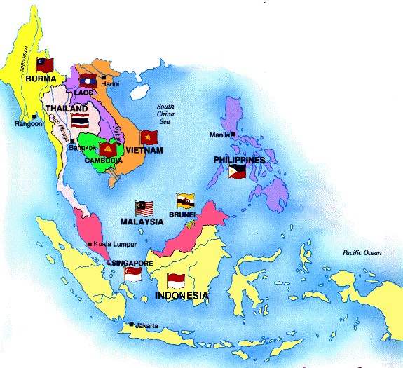
- Map of Southeast Asia
|
- Indonesia
-
-
|
- latest picture:
November 23, 2017
|
-
Ternate
|
-
-
|
-
-

|
-
-
|
-
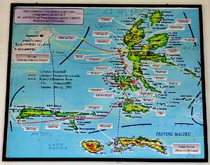
208 Section of map regarding the ferry links
- within and to the North Moluccas (we used the
- "yellow lines" from the west [Bitung], in the
- center [Bastiong, Rum, Sofifi] and eastwards
- [Weda, Patani, Gebe])
|
-
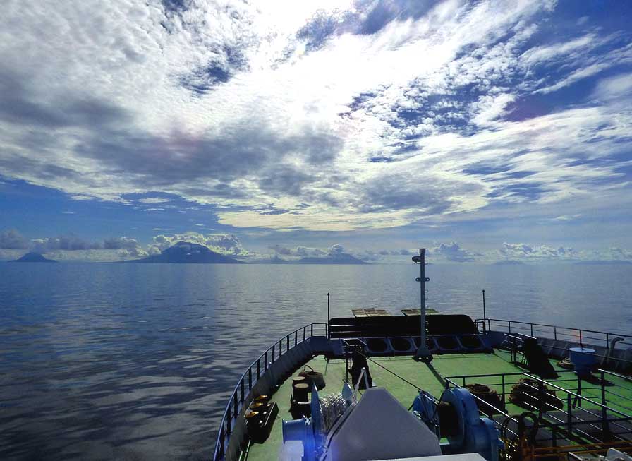
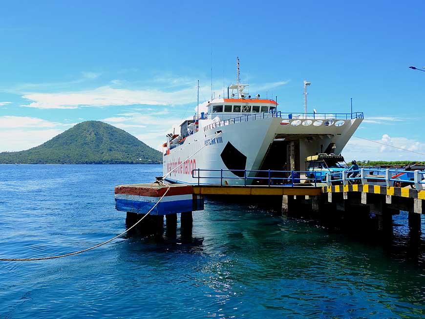
209 On 11/16/2017 our ASDP ferry
- ìPortlink VIIIî sets sail at the Northeastern port
- of Bitung in Sulawesi and heads to the islands
- of the North Moluccas. It's our 3rd ferry trip in
- Indonesia. The commercial center of the northern
- Maluku group (Ternate and Tidore) appears
|
-
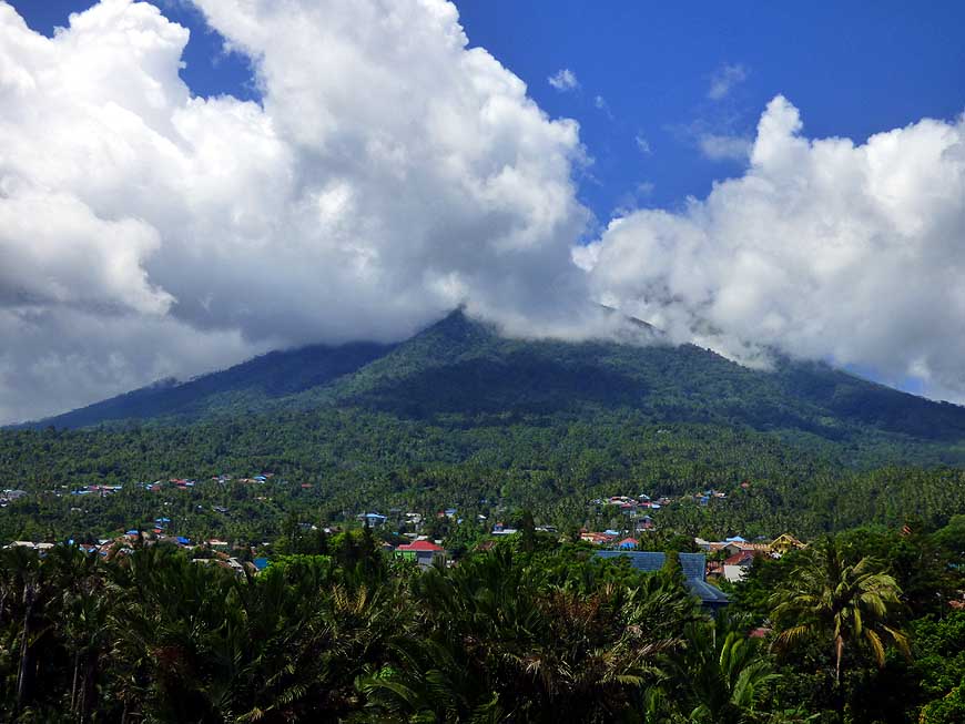
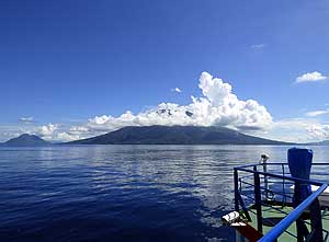
210 Ternate with the
near-conical volcano
- Gamalama 5'627 ft. [1'715m] is our first North
- Moluccan island. It's greeting with a beautiful cap
- of white clouds, measures 43 sq.mi. [111km≤],
- counts about 210'000 people and the road
- around it is barely 30 miles [50km] long
|
-
|
-
-

|
-
-

|
-
-
|
-
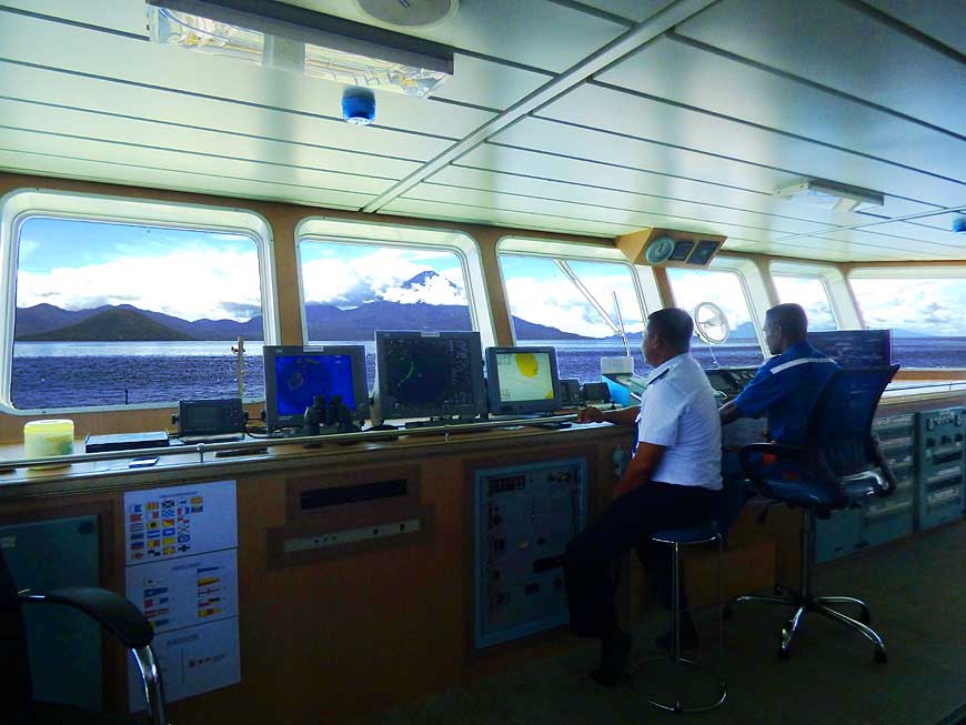
211 We are welcomed on the bridge of the
- relatively new ASDP ferry ìPortlink VIIIî
- (built 2016), where the captain offers us a coffee
|
-
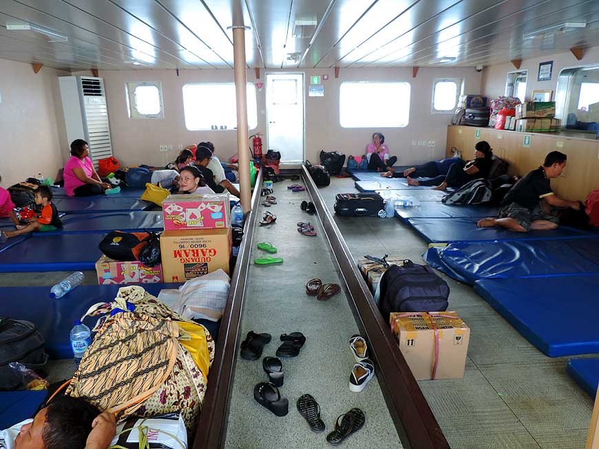
212 Happy are the ones, who are able to grab
- for the night-time sea journey a sleeping mat.
- After the captainís intervention, we are
- also among them. There are no cabins
|
-
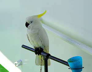
213 ìActually I would
rather be in the
- air than on the waterî ñ a white cockatoo
- (Cacatua alba), which is amazingly quiet
|
-
|
-
-
|
-
-
|
-
-
|
-
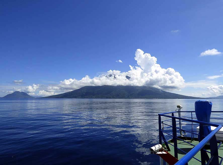
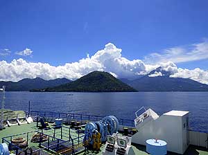
214 Our ship is approaching after a 15 hours,
- 167 miles [268km] long but quiet sea journey the
- ASDP ferry terminal ëBastiongí of Ternate. South
- of it (on the picture) are the contours of the island
- of Tidore (5'676 ft. [1'730m]), in the front the
- 1'266 ft. [386m) tall Maitare Island
|
-
215 Equipped with his camera, Emil is
- standing at the railing of the ferry putting himself
- in the right mood for the spice island of Ternate
|
-
216 Settlements are
sprinkled particularly on
- the east and south side on the coastal slopes
- of the tropical volcanic island of Ternate. Its
- volcano Gamalama is pretty active; it was
- since 2012 through all the years restless
- with smoke, ashes and earth tremors
|
-
|
-
-
|
-
-

|
-
-

|
-
217 On 11/17/2017, 11am, our ferry berths
- at the port of Bastiong in Ternate. Emil is
- waiting his turn to drive ashore
|
-
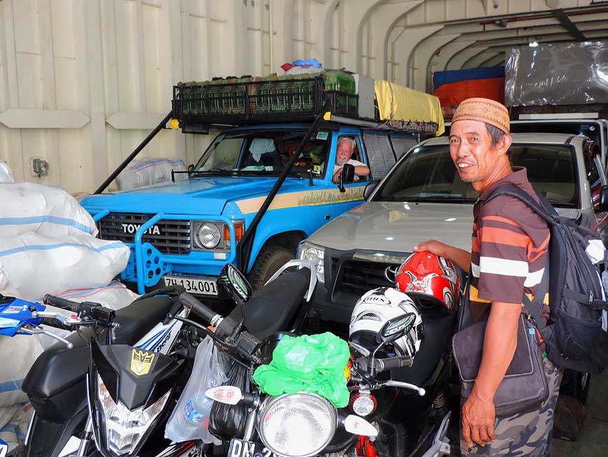
218 The time cas come: Our LandCruiser
- is able to leave the hull of the ferry after
- 20 minutes and drives onto new territory: The
- North Moluccas or also called North Maluku
|
-
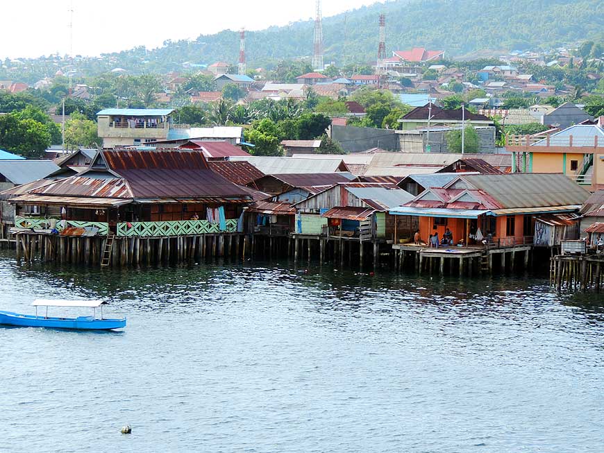
219 Houses on stilts line
the shore
- of Ternateís ferry terminal of Bastiong
|
-
|
-
-
|
-
-
|
-
-
|
-
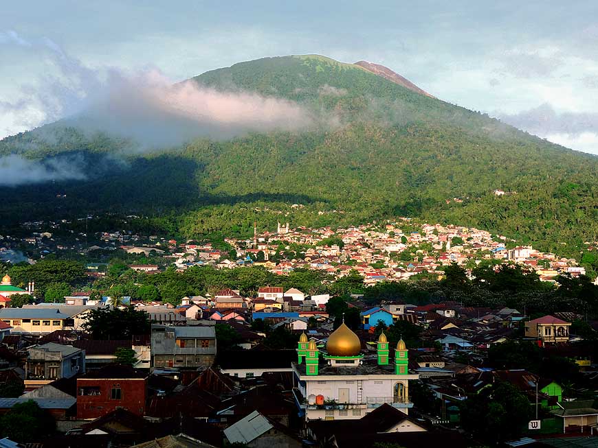
220 We enjoy the view from the 6th floor
- of the Muara Hotel in Ternate of the near-
- conical, 5'627 ft. [1í715m] high Gamalama
- volcano that dominates the city Ö..
|
-
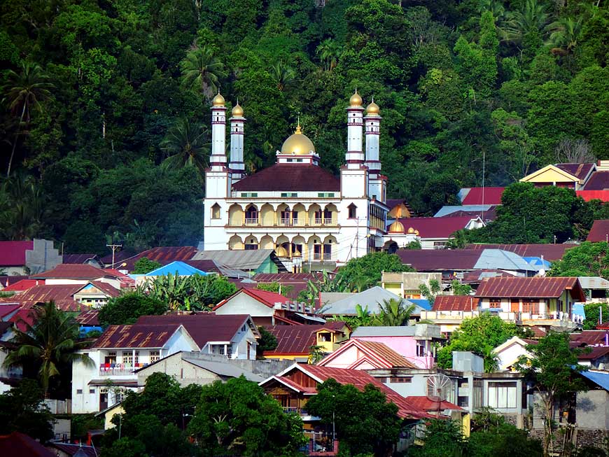
221 Ö.. one of the many impressive mosques
- on the tropical slope dominating Ternate ñ
an
- ancient Islamic Sultanate. North Maluku consists
- of four former major sultanates: Ternate, Tidore,
- Jailolo on Halmahera and Bacan in the south
|
-
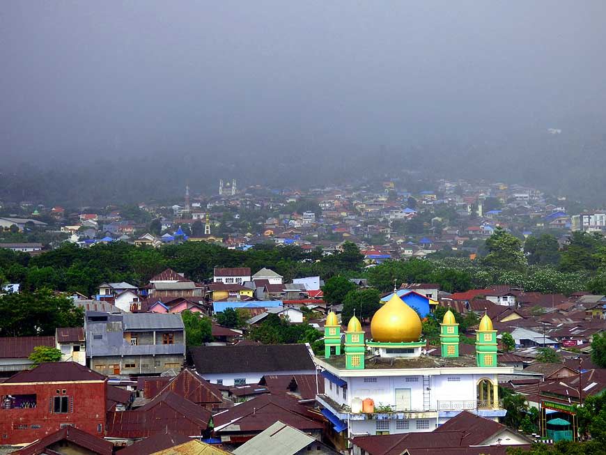
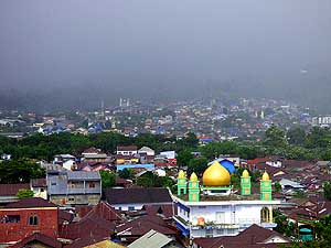
222 A new weather
condition, another
- view: A tropical rainy front passes by
- and engulfs the Gamalama cone
|
-
|
-
-
|
-
-
|
-
-
|
-
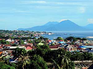
223 View to the eastside of the city of Ternate.
- In the background Jailolo Mountain on
Halmahera
- Island, reachable by a 2 hoursí ferry ride
- from Bastiong to either Sofifi or Sidangoli
|
-
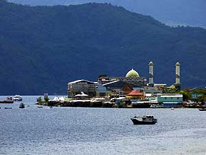
224 At the most beautiful sea location lies
- the mosque Raya Al Munawwar. Ternate first
- of all, but also the whole province of North
- Maluku, is predominantly Muslim
|
-
225 Ternate City spreads
along the seashore.
- The perfectly shaped peak in the background
- is the volcano Kiematabu (5'676 ft. [1'730m])
- on the island of Tidore
|
-
|
-
-
|
-
-

|
-
-
|
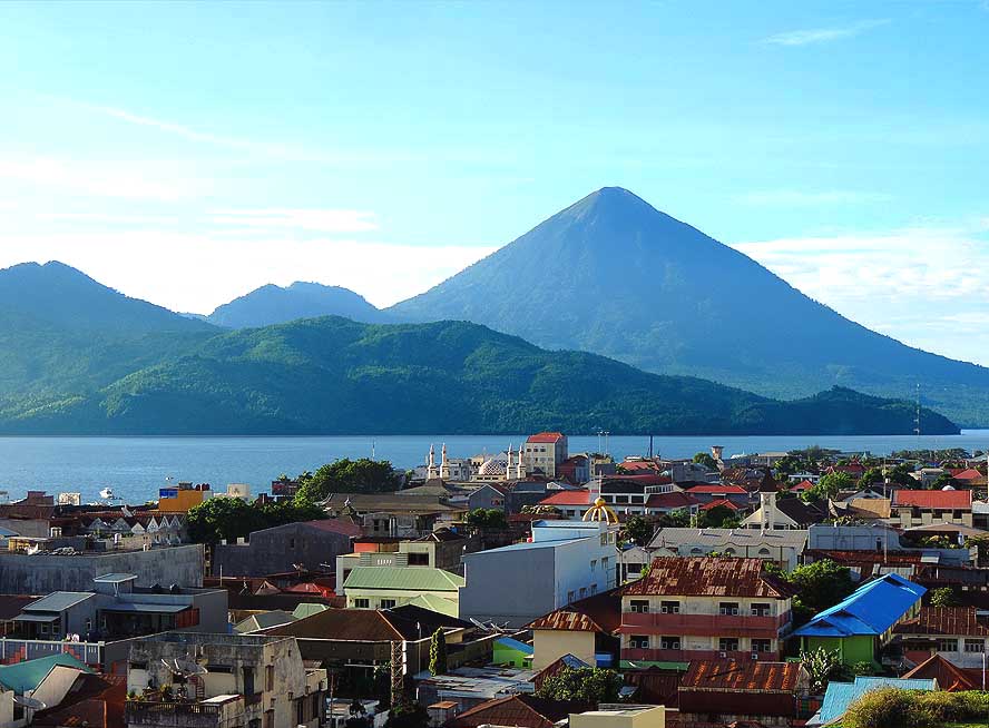
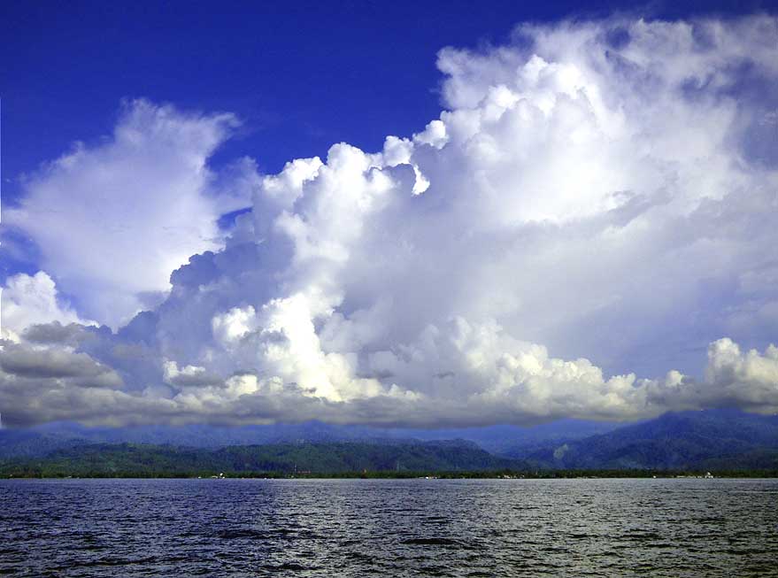
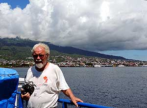
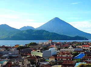
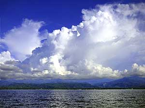
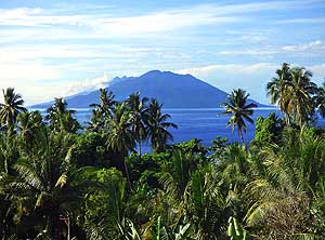
-
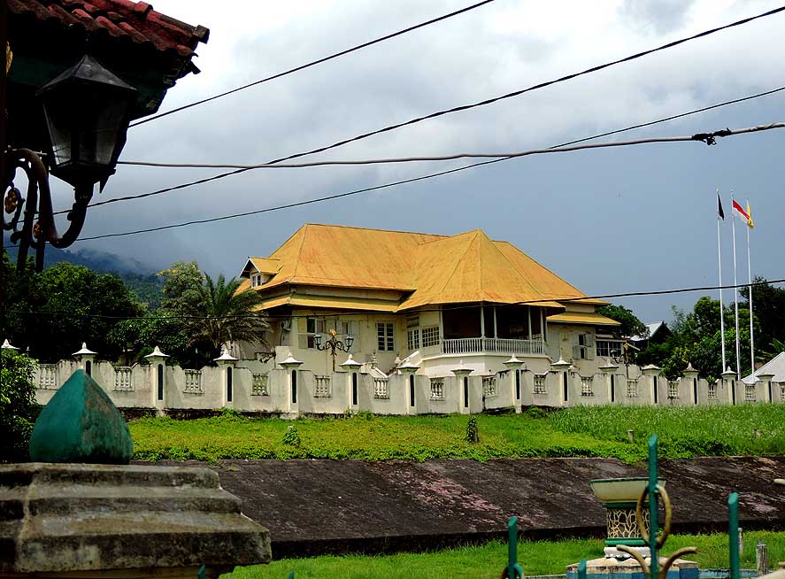
226 ìKedatonî ñ the former Sultanís Palace
- was built in 1796 and is now converted into a
- museum (since the death of the last
sultan in
- 2015 'temporarily' closed)
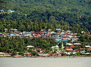
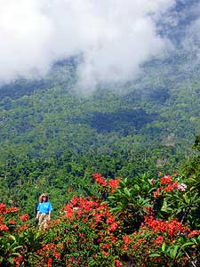
|
-
227 Bob Marley, Jimi Hendrix, Michael
- Jackson, B.B. King, Nelson Mandela und
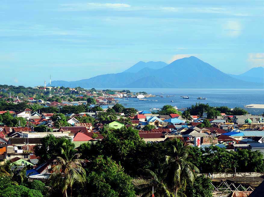
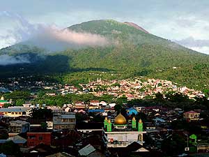
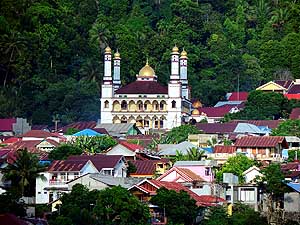
- Martin Luther King (fltr) are greeting from a house
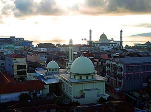
- wall opposite of the Sultanís Palace of Ternate
|
-
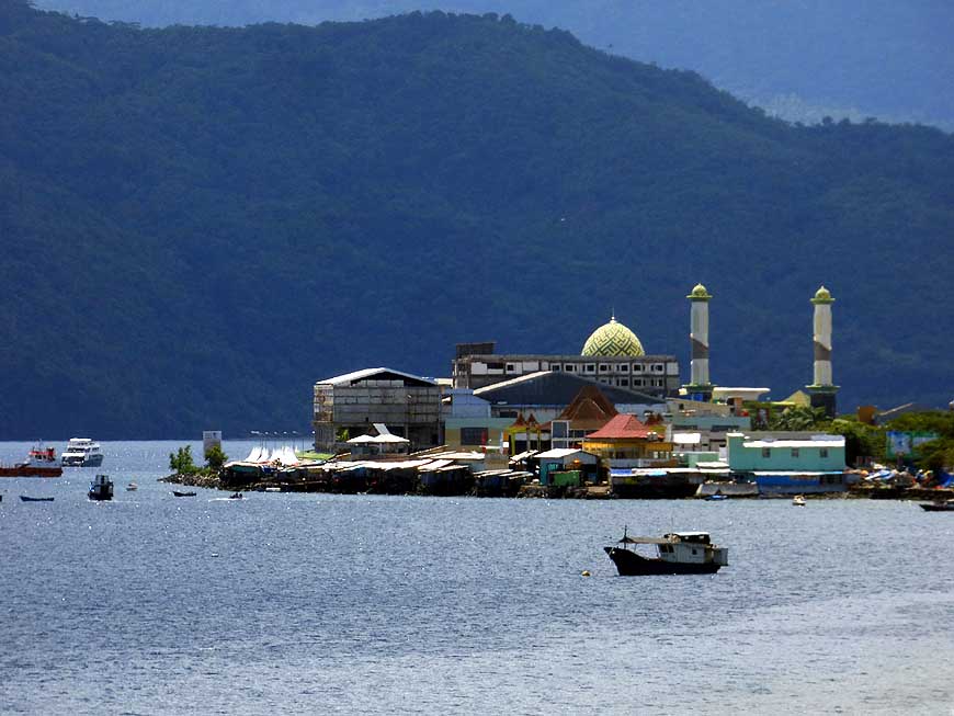
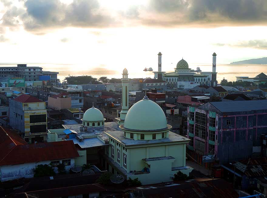
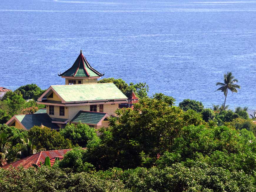
228 Domes and minarets
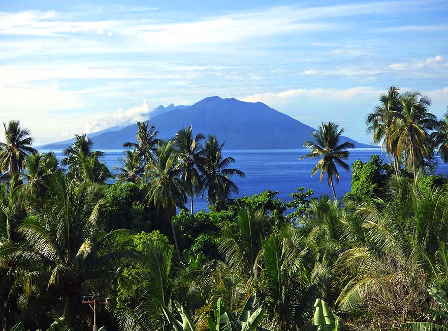
(front Al-Muttaqien
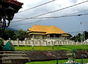
- and back Raya Al Munawwar) dominate the
- townscape of Ternate ñ
- here in direction Southwest
|
-
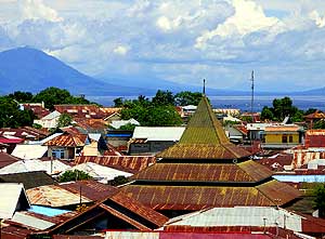
|
-
-
|
-
-

|
-
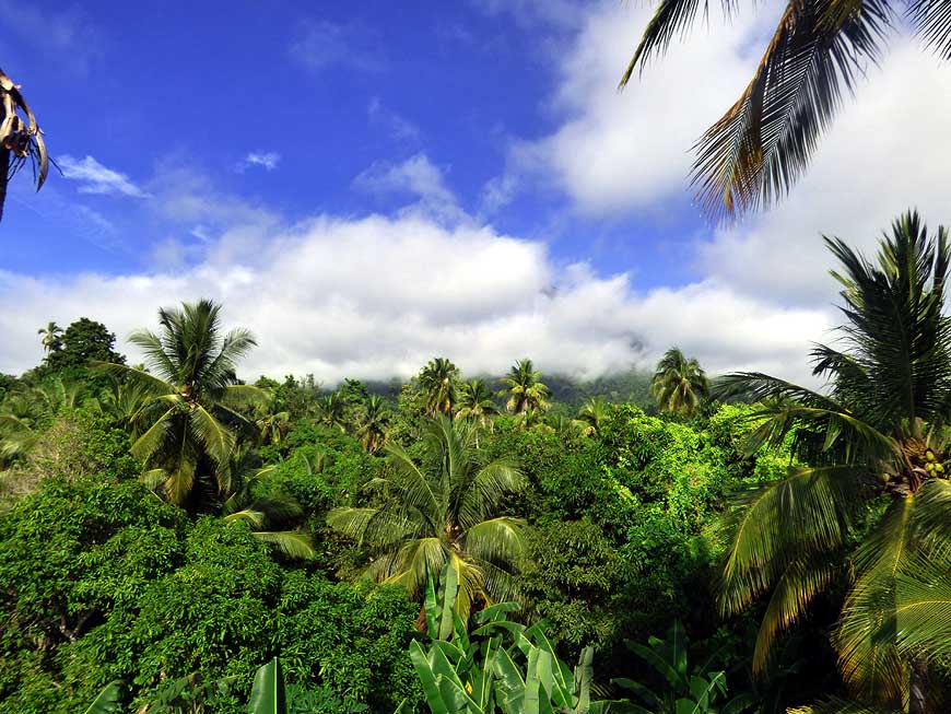
-
|
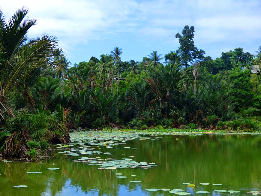
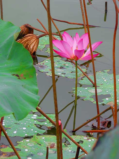
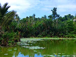
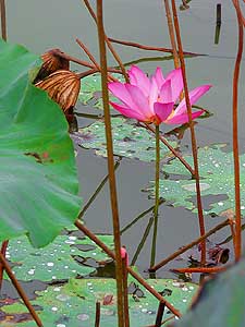
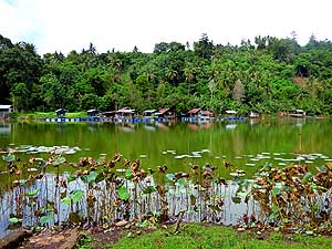
-
229 Liliana at Tolukko Fort. It was built
- by the Portuguese in the 16th century to
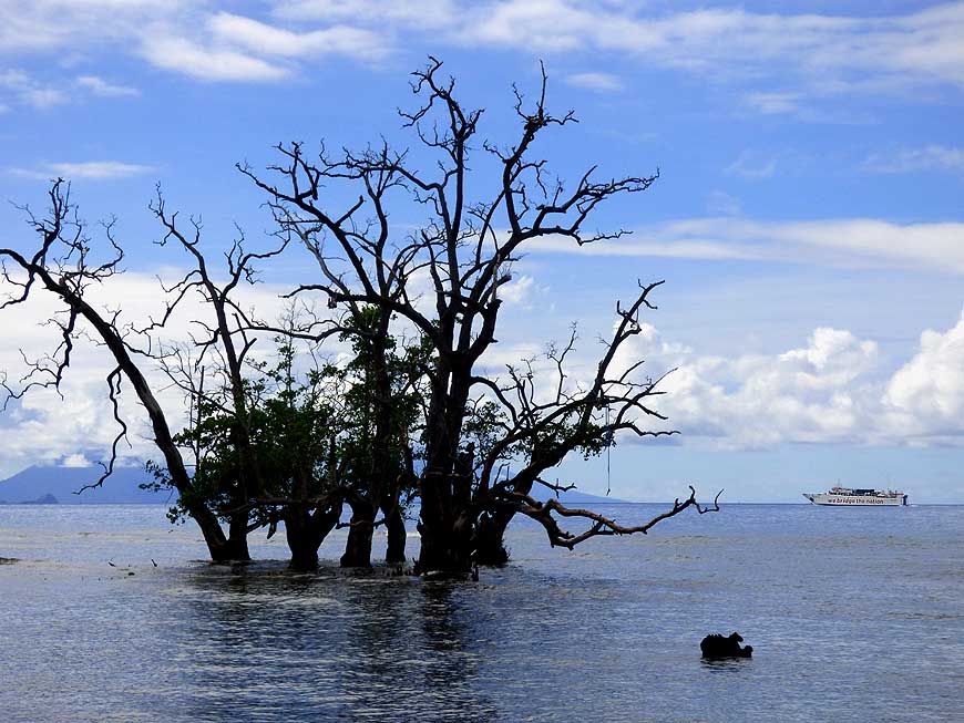
- control the trade of gloves. From its seaside
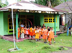
- cliff it offers superb views Ö..
|
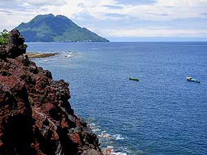
-
230 Ö.. to the forest covered slopes
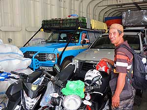
- of the still active Gamalama volcano
- with its scattered settlements Ö..
|
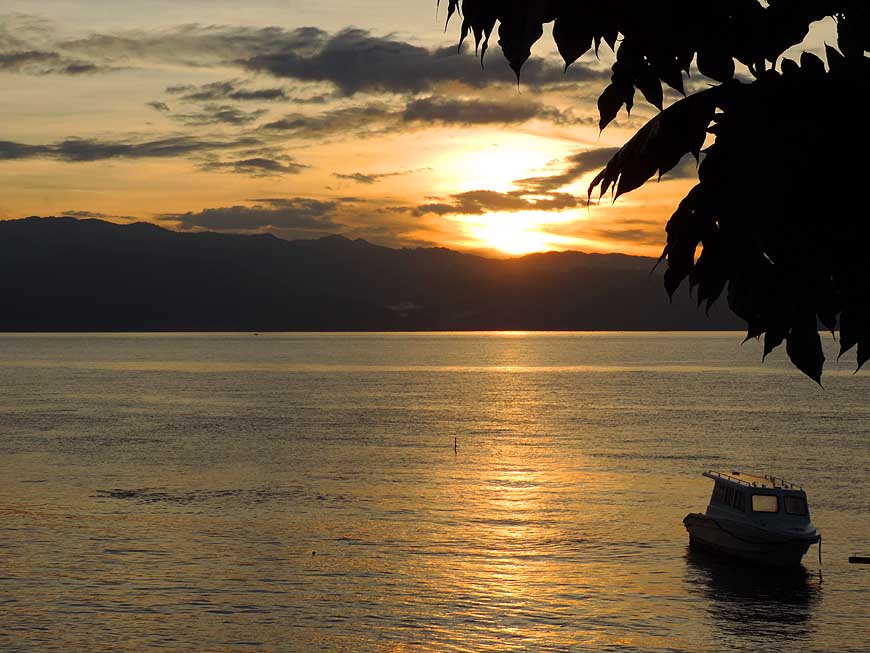
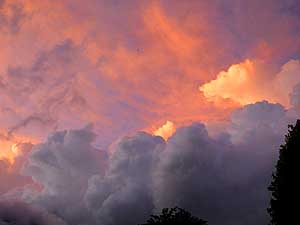
-
231 Ö.. and across the
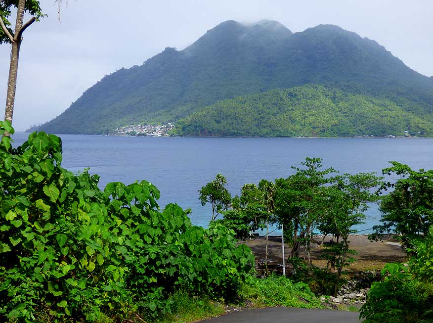
rusty corrugated
- iron roofs of Ternate towards
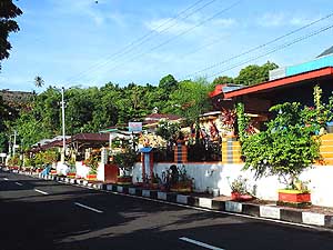
- the island of Halmahera
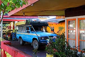
|
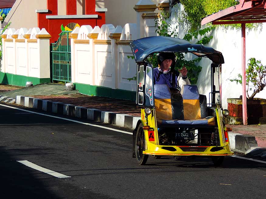
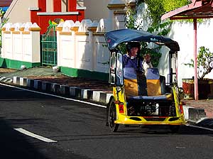
-
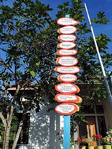
|
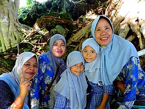
-
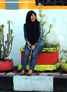
-
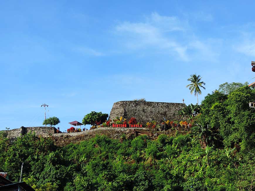
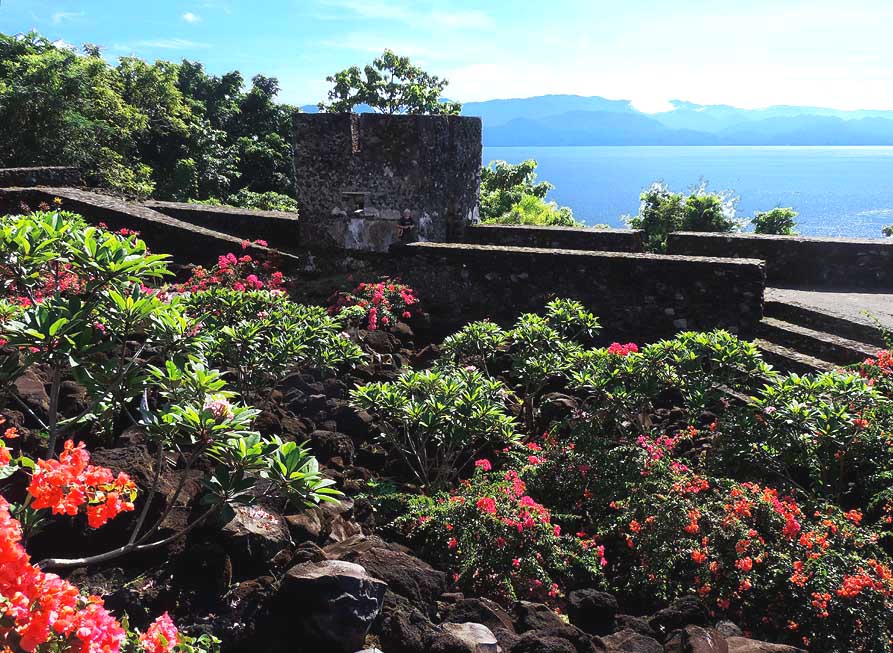
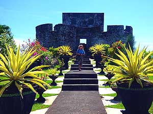
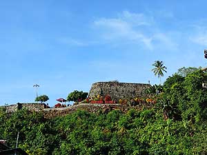
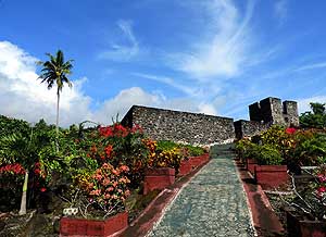
|
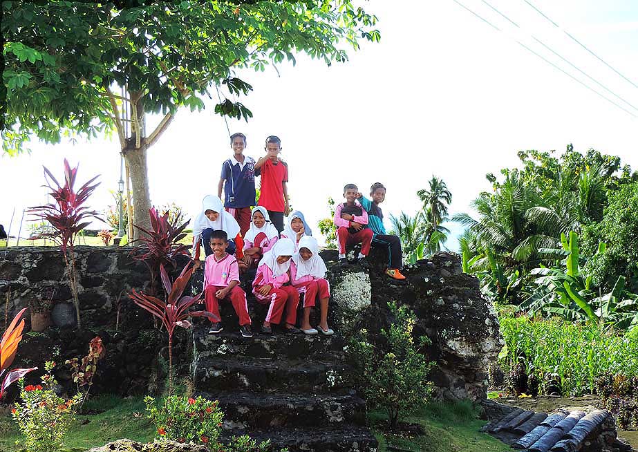
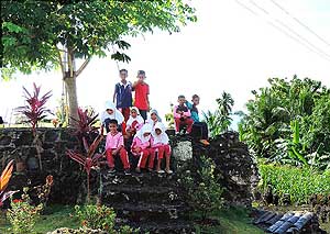
-
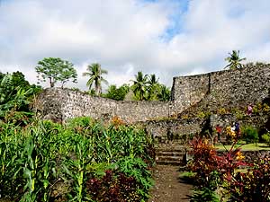
-
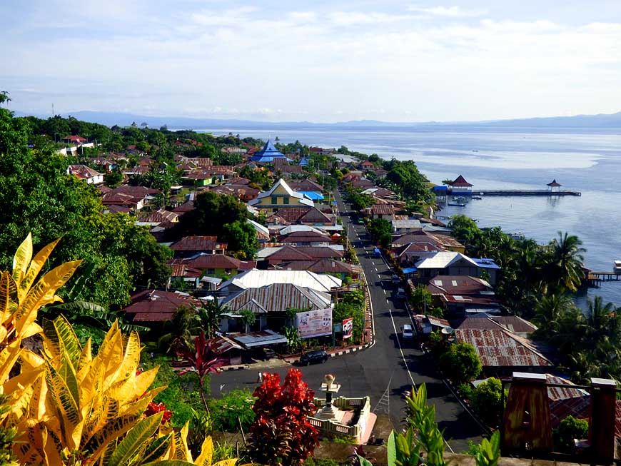
|
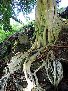
-
-
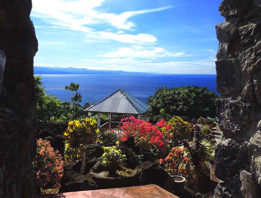
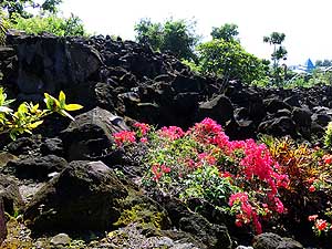
|
-
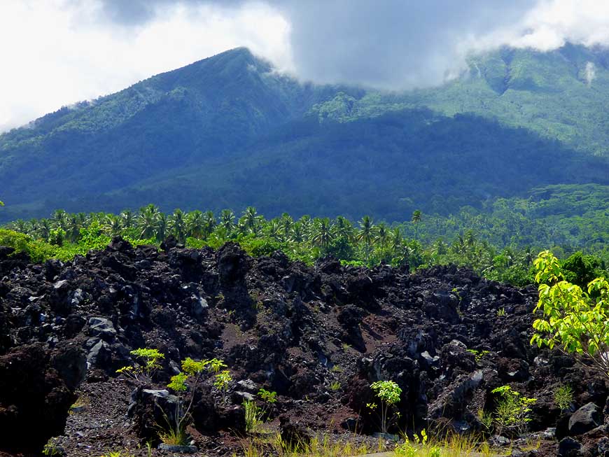
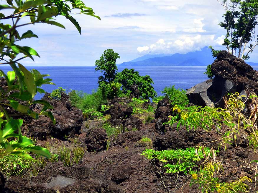
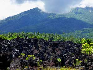
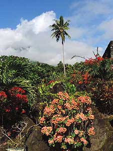
232 ìBatu Angusî (burnt rocks) was formed
- by a lava flow from an eruption of the
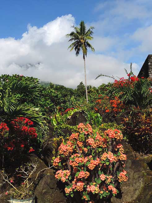
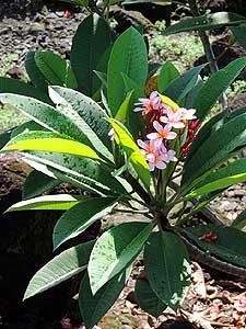
- Gamalama volcano in 1673 Ö..
|
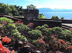
-
233 Ö.. the lava flu into the sea and
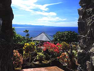
- continued under water for quite a distance Ö..
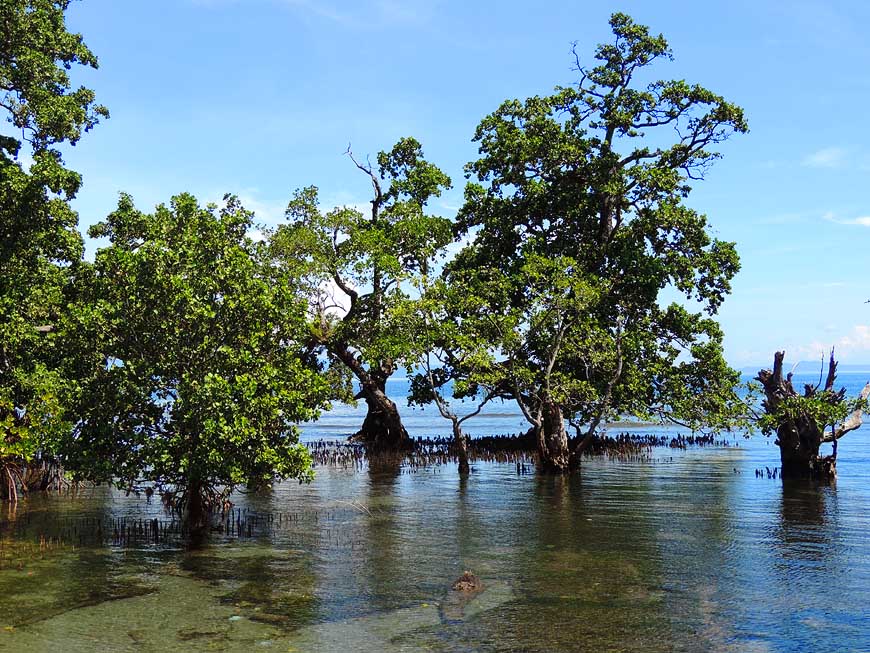
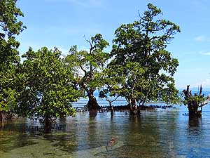
|
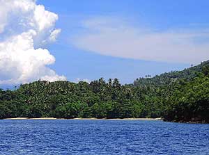
-
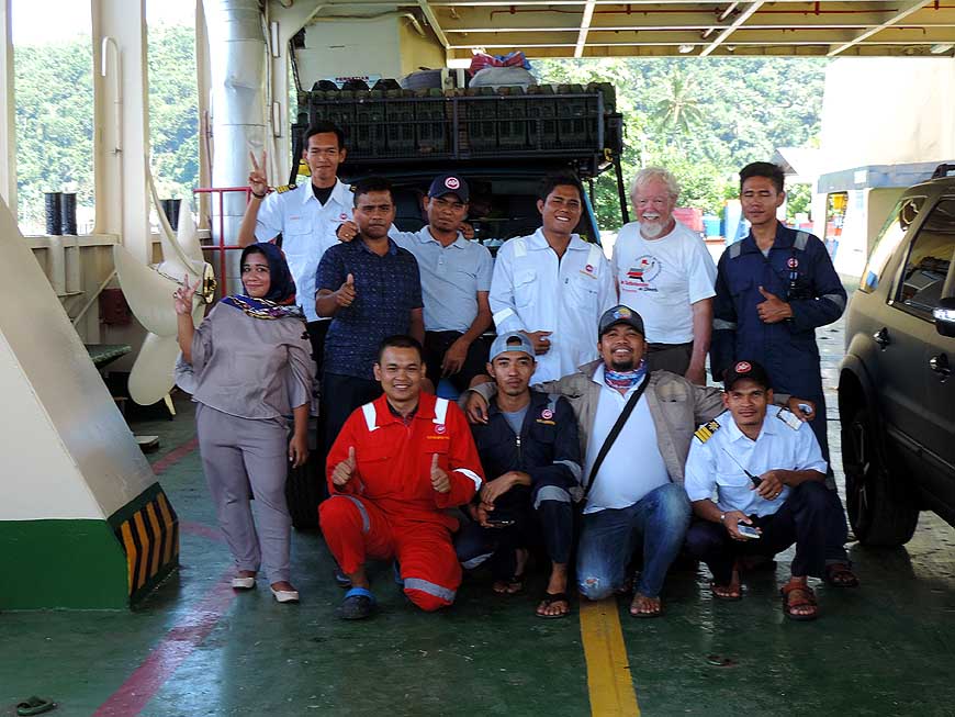
234 Ö.. An asphalted path
leads
- through the bizarre lava region
|
-
|
-
-
-
-
|
-
-
|
-
-
-
-

|
-
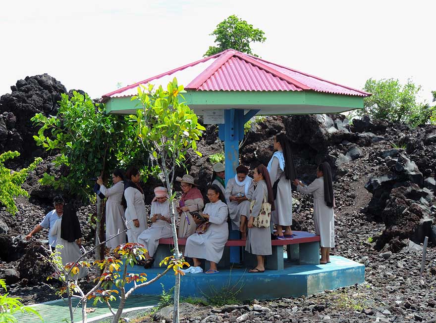
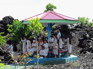
235
Christian sisters seek shade at one of
- the pavilions at ìBatu Angusî. Heat can get
- unbearable within the black lava formations
|
-
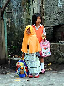
236
A Christian and a Muslim
- child on their way to the kindergarten
|
-
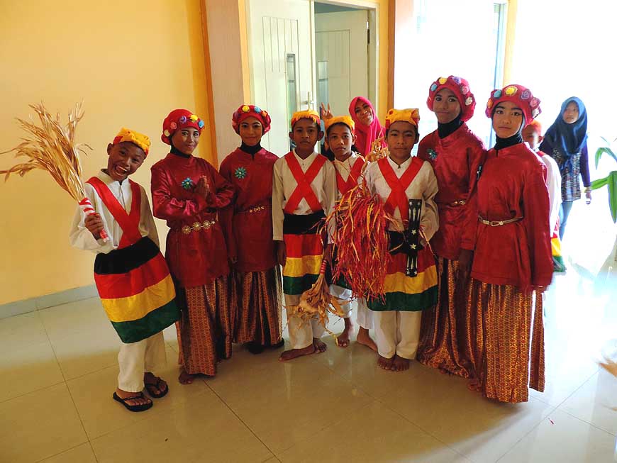
237
Children in special costumes are waiting
- to perform at the Muara Hotel in Ternate.
- Because of the black-red-yellow-green colors
- it's about a historic Soya-Soya dance, which is
- performed in honor of important personalities
|
-
|
-
-
-
-
|
-
-
|
-
-
-
-

|
-
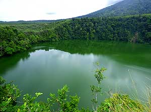
238
The calm, deep green ìTolireî crater lake
- on the foot of Mount Gamalama, surrounded by
- forest, is said to be infested by crocodiles
|
-
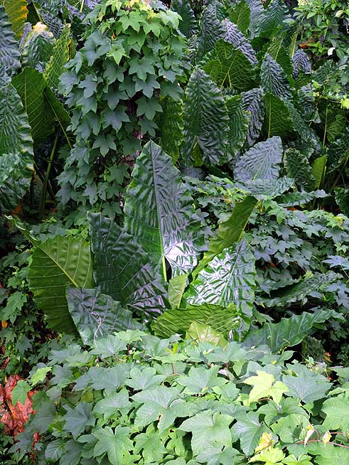
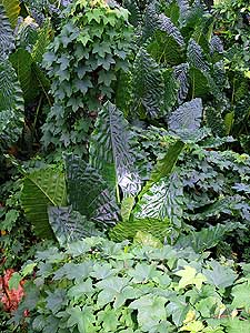
239
Jungle vegetation is growing rampant
- and engulfing everything around it
|
-
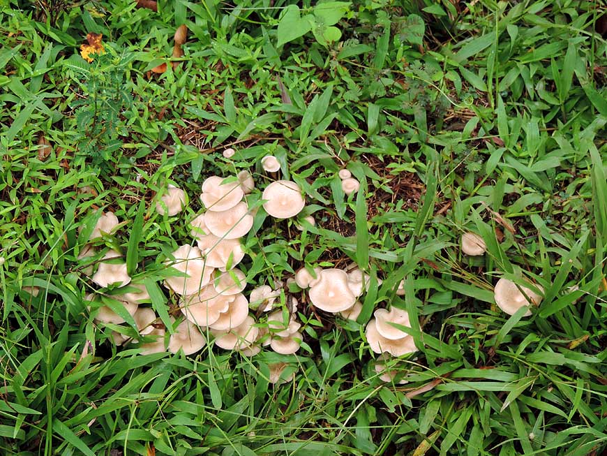
240
The humidity of the jungle benefits
- the growth of mushrooms and fungi
|
-
|
-
-
-
-
|
-
-
|
-
-
-
-
|
-
241
Danau Laguna ñ also called Lake Ngade,
- known for its lotus flowers and holy crocodiles
- that should bring luck when spotting them Ö..
|
-
242
Ö.. a blooming lotus flower
- (Nelumbo nucifera) with sparkling
- dewdrops on its large leaves Ö..
|
-
243
Ö.. view to the other
- lake side with fishermen huts
|
-
|
-
-

|
-
-
|
-
-
|
-
244 The branches of a dead tree tower
- ghostly at the Kastela beach into the sky. In the
- distance "our" ferry 'Portlink VIII' reappears,
- with which we arrived from Bintung
|
-
245 The kids from the kindergarten
- at the Kastela beach have a tea-brake
|
-
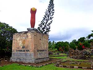
246 The crumbling
Portuguese fort Kastela
- southwest of Ternate, built 1522, was the first
- colonial fortification of the Moluccas. On
- 2/28/1570 Sultan Khairun of Ternate
- was killed by the Portuguese
|
-
|
-
-

|
-
-
|
-
-

|
-
247 On the north coast of Ternate lies
- Hiri Island (2'067 ft. [630m], also a
- volcano with its steep slopes
|
-
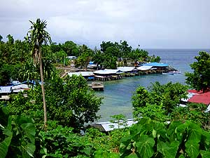
248 The small harbor of Sulamadaha,
- from where boats sail to Hiri Island
|
-
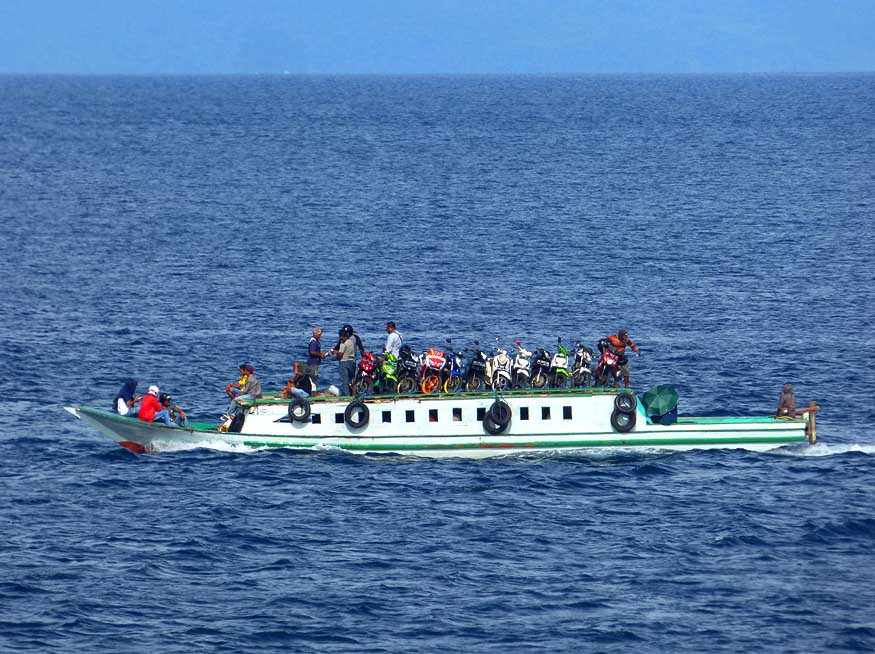
249 A boat is transporting
motorbikes
- across the sea to the island of Tidore
|
-
|
-
-
-
-
|
-
-
|
-
-
-
-
|
-
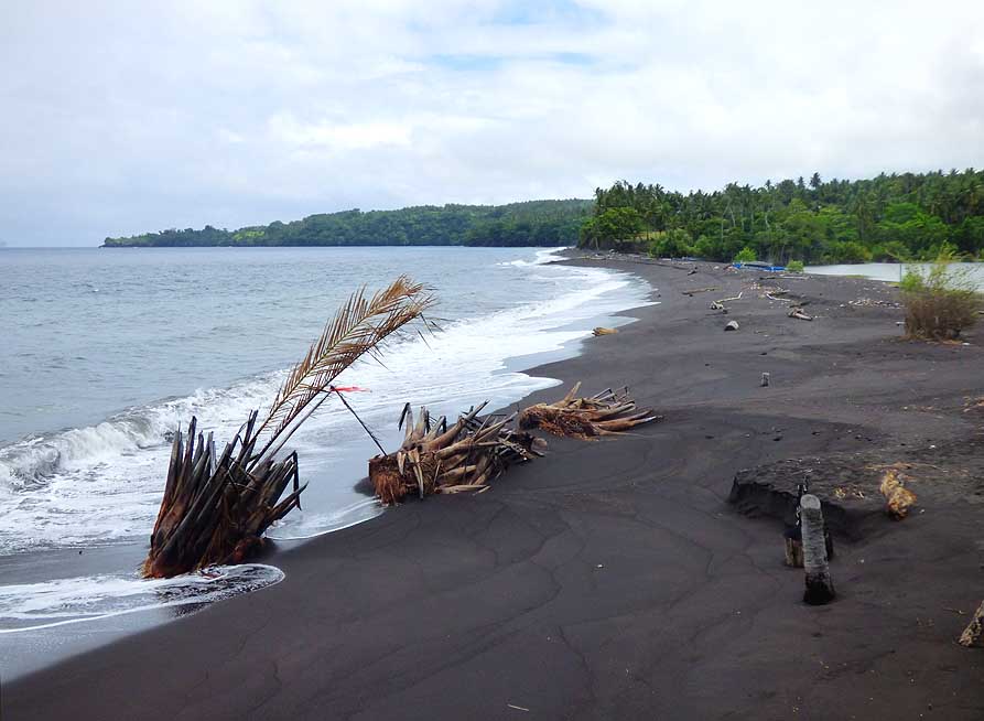
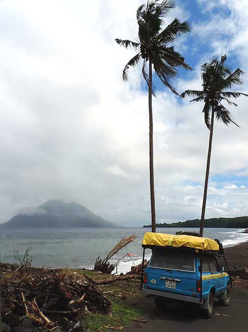
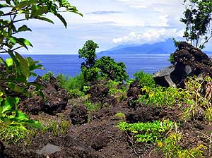
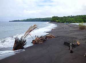
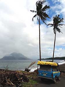
250
A deserted black sandy beach at Cape
- Dukomadihi near the "Little Tolire Lake"
- (at right) at the northwest coast of Ternate
|
-
251
A beautiful relaxed stop at the black
- sandy beach of Cape Dukomadihi with
- lovely view to the Hiri volcano
|
-
252
The skies see us off with a fantastic
- cloud set-up on our last night before leaving
- the island of Ternate after totally 10 days
|
-
|
-
Tidore
|
-
-

|
-
-
|
-
-

|
-
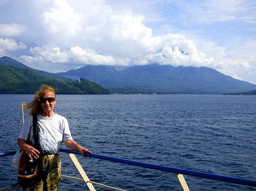
253 11/22/2017: Liliana is standing at the
railing
- of the ferry ìKMP Aeng Mas 1î that will sail with
- us in only 20 minutes from Bastiong on the island
- of Ternate to Rum on the island of Tidore,
- our second Maluku-island-destination
|
-
254 Promising mood over
Tidore ñ a
- volcanic island similar to the one of Ternate ñ with
- a size of 45 sq.mi [117km≤] but a population of
- only 60'000 people; its tallest peak, Mt. Kiematabu,
- is 5'676 ft. [1'730m] high. The circumnavigation
- road measures also barely 30 miles [50km]
|
-
255 The sun is rising
behind the big neighbor
- island of Halmahera (6,860 sq mi [17'780 km≤]).
- View from our homestay ìPenginapan Serojaî
- in the main town Soasio in the southeast
|
-
|
-
-
|
-
-
|
-
-
|
-
256 ìOld Soasioî the main town of Tidore's
- rich history, enchants by its abundance of
- flowers and plants. Even the sidewalks
- are adorned with flower pots
|
-
257 Our LandCruiser is allowed to park next
- to blooming orchids of every kind at the ìPengina-
- pan Serojaî homestay in ìOld Soasioî ñ a cozy
- place which however has seen better times
|
-
258 An empty motorbike
rickshaw is waiting
- for guests at the roadside of ìOld Soasioî ñ a
- nostalgic sight that reflects the sleepy island
- character of Tidore. There are no trike
- rickshaws on Ternate
|
-
|
-
-
|
-
|
-
-
|
-
259
An information sign in Soasio
- of a different kind
|
-
260
Friendly Tidore faces are smiling into
- our camera. The majority of Tidoreís population
- ñ an ancient sultanate that had also territory on
- Halmahera ñ is mainly Muslim
|
-
261
The flower pots on the sidewalks
- of Soasio don't only enjoy the eyes,
- they also serve as a seat
|
-
|
-
-
|
-
-
|
-
-
|
-
262 Fort ìBenteng Tahulaî is reigning over
- ìOld Soasioî. It is testimony of the short presence
- of the Spaniards in the early 17th century
|
-
263 School kids visiting Fort Tahula
- are taking a rest under a shady tree
- from the steep ascent
|
-
264 Not only plants and
flowers grow in
- the garden of Fort Tahula, but also a little
- maize field has been planted
|
-
|
-
-
-
-

|
-
-
|
-
-
-
-
|
-
265
View from Fort Tahula across the roofs
- of the sleepy seaside town of ìOld Soasioî
- in the southeastern corner of Tidore
|
-
266
A fig tree is spreading its large roots
- at the steep entrance stairway to the
- fortress ìBenteng Torreî in Soasio
|
-
267
The North Molucca island group is
- within sight of each other. Here the view
- southwards from Tidoreís Fort Tahula to the
- islands of Moti (3'120 ft. [950m]) and behind
- it Makian (ragged, 4'452 ft. [1'357m])
|
-
|
-
-
|
-
-
|
-
-
|
-
268 The entrance to Fort Torre in
- Soasio is surrounded by beautiful flowers. It
- was built by the Spaniards in the 17th century
|
-
269 Fort Torre lies amidst black
- lava rocks. Its overwhelming floral
- splendor sticks out everywhere
|
-
270 Due to the fertile
volcanic soil,
- flowers grow in abundance at Torre
- Fort and give it its special charm
|
-
|
-
-
|
-
-
|
-
-
|
-
271
Only Liliana interrupts the compact
- tropical picture at Fort Torre in Soasio
|
-
272
A blooming frangipani plant (Plumeria)
- within the fort area. It reminds us to
Tahiti in
- the Pacific, where women
stick this blossom
- as adornment behind their ears
|
-
273
The Christís thorn (Euphorbia milii)
- is one of the most frequently growing plants
- on the island of Tidore. The blossoms
- are of a surprising size
|
-
|
-
-
|
-
-

|
-
-

|
-
274 View from the walls of Fort Torre
- to the pretty pavilion and the southern part
- of the neighboring island of Halmahera
- in the far distance
|
-
275 Again and again high growing palm
- trees tower above the tropical vegetation
- of Tidore. The highest mountain of Tidore,
- Kiematabu, hides already at 8am in the clouds
|
-
276 A lovely villa at a
priviledged seaside
- spot at the foot of Fort Torre
|
-
|
-
-
|
-
-
|
-
-

|
-
277 A couple of mangroves interrupt
- the omnipresent colorful coastal houses
- on the north and northeast coast
|
-
278 A small ribbon of sand along the
- north coast before the village of Rum,
- Tidoreís ferry terminal from Ternate
|
-
279 With a group picture
on our ferry
- back to Ternate, we say good bye to Tidore.
- We will remember this tiny dot on the
- map as lovely ìflower islandî
|
-
|
-
More websites from the
"Borneo-Sulawesi-Moluccas-Papua" trip:
-
Part 1: Pictures from Sarawak-Kalimantan-North Sulawesi ñ Miri/Malaysia
via
Kuching and Balikpapan to
North Sulawesi from Aug. to Oct. 2017
- Part 2: Pictures
from the second part of North Sulawesi
ñ Tomohon and surroundings, Tangkoko NP
in October 2017
- Part 4: Pictures from the North Moluccas Part 2
ñ Halmahera in November/December
2017
- Part 5: Pictures
from West Papua Part 1 (Irian Jaya) ñ Sorong and westerly ëTrans Papua Roadí
in December 2017-February 2018
- Part 6: Pictures from
the Moluccas Part 1 (Central) ñ Seram in February 2018
- Part 7: Pictures from
the Moluccas Part 2 (Central) ñ Ambon in February/March 2018
- Part 8: Pictures from
Papua Part 1 ñ Yapen in March 2018
- Part 9: Pictures from
Papua Part 2 ñ Biak in April 2018
- Part 10: Pictures
from West Papua Part 2 (Irian
Jaya) ñ Manokwari and easterly ëTrans Papua Roadí
in April 2018
- Part 11: Pictures from South Sulawesi-Kalimantan-Sarawak
Part 2 ñ
South Sulawesi via Kalimantan to Kuching and Miri/Malaysia from May to
July 2018
|
- More websites from Indonesia and
Timor-Leste:
More websites from East Malaysia und
Brunei:
|