-
- Russian Map
|
-
- Map
of Central Asia
|
|
-
|
- latest picture:
November 4, 2016
|
-
-
|
-
-

|
-
-

|
-
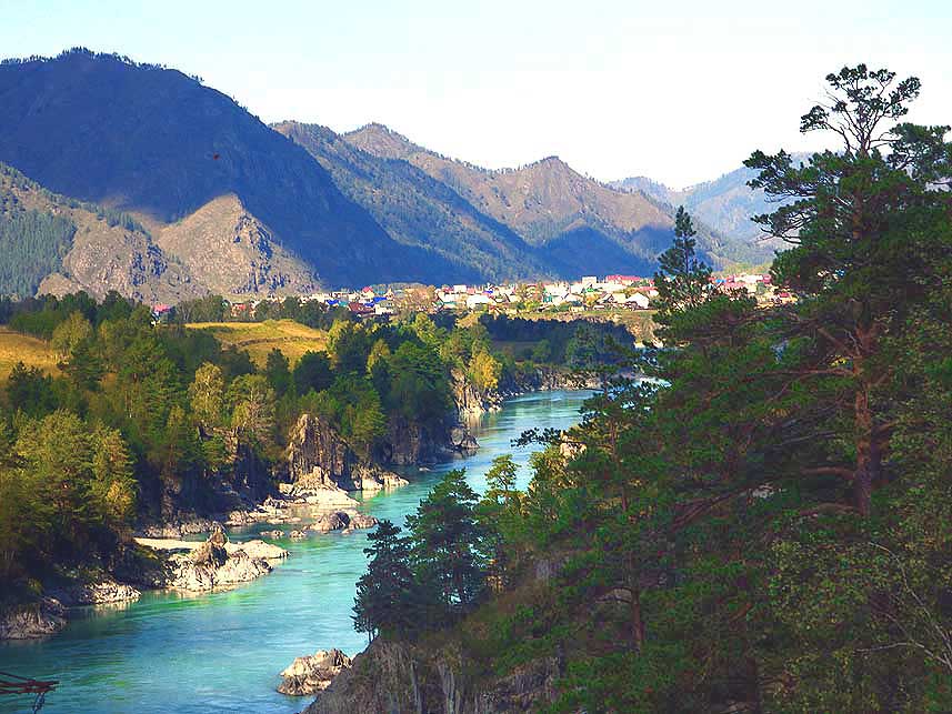
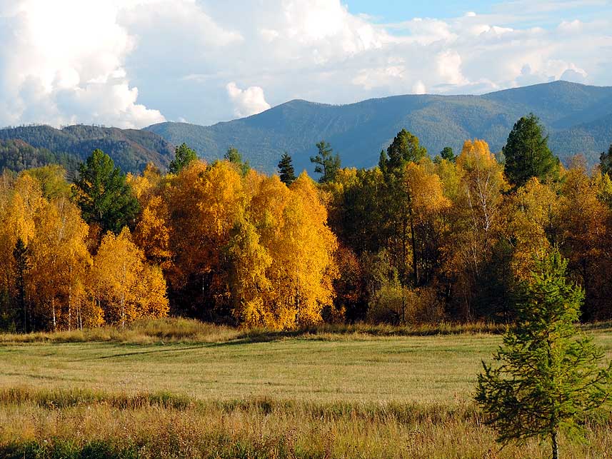
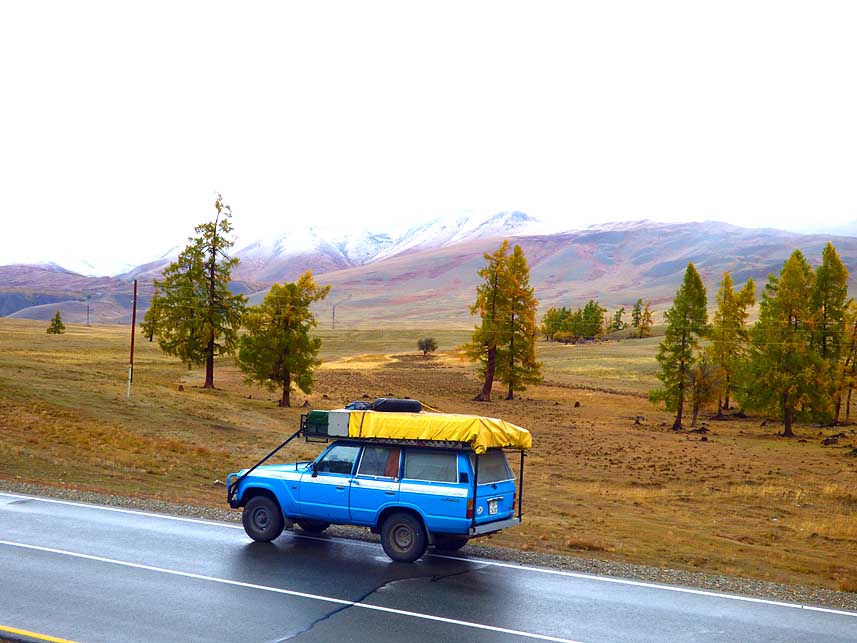
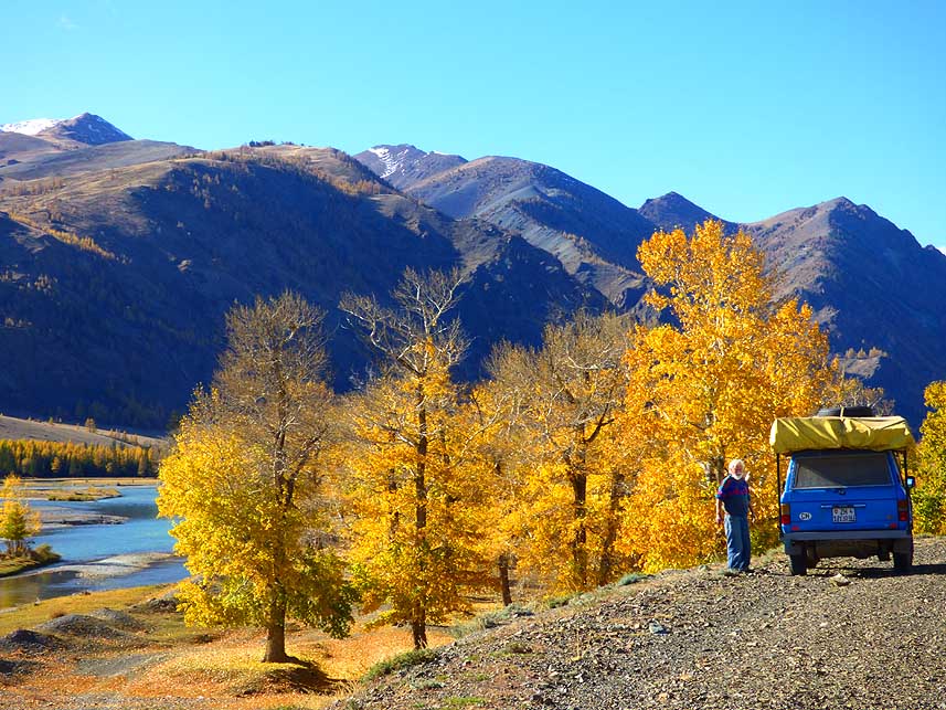
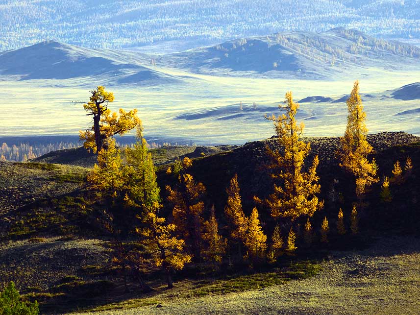
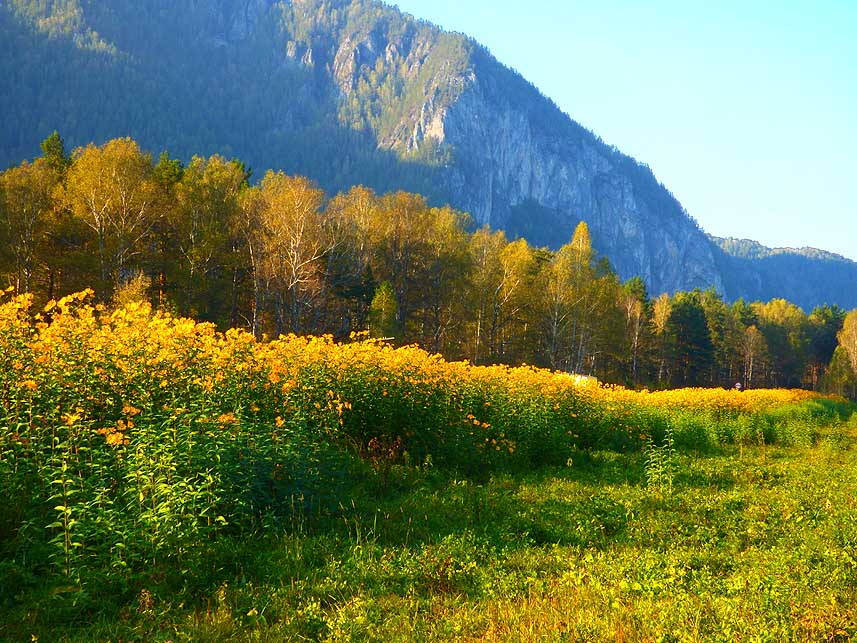
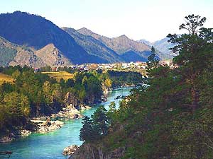
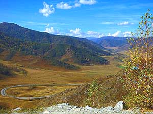
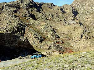
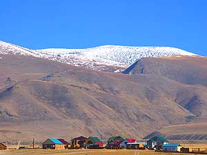
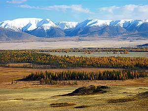
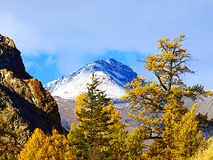
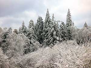
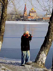
079 View from a hill near the
- ôVorota Sartakpaya
Gorgeö to the village
- of Chemal (~5Æ000 people), surrounded
- by the
Iolgo mountain range, about
- 60 miles south of Gorno-Altaysk
|
-
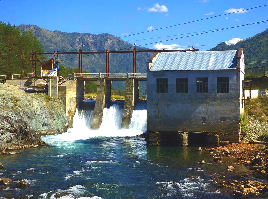
080 The former power station ôHPPö
- (1935-2011) û
today a museum û
- at the Chemal River just at the
- confluence of the
Katun River .....
|
-
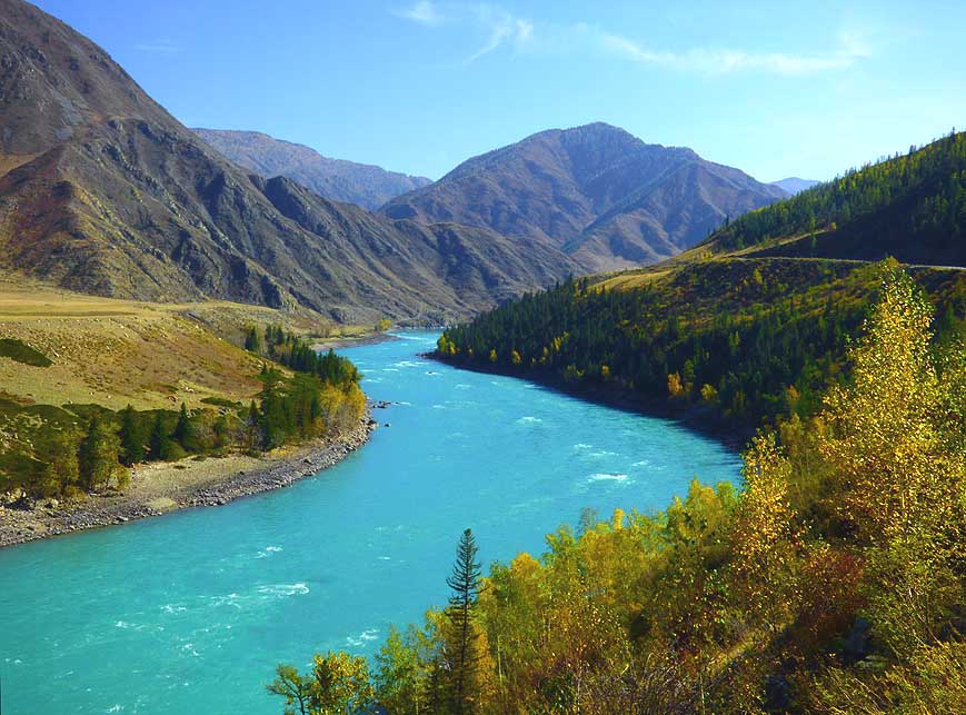
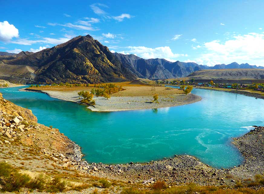
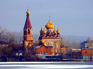
081 à.. the so-called
ôVorota Sartakpaya
- Gorgeö of the Katun River, which joins at
- Biysk
the Biya River from Lake Teletskoye
- and is called afterwards éObæ.
It is 7th-longest
- river of the world (3Æ364 miles [5Æ410km]
|
-
|
-
-
|
-
-
|
-
-
|
-
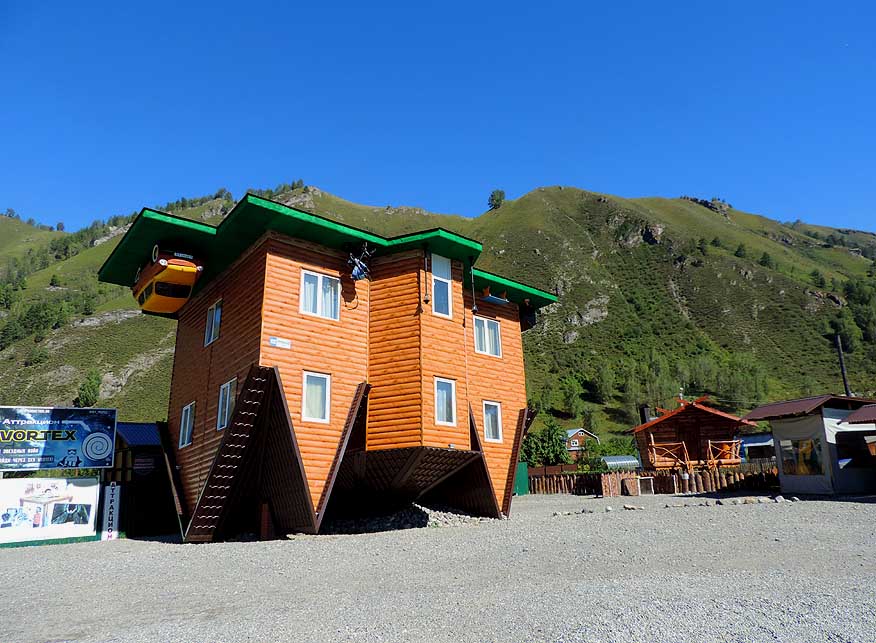
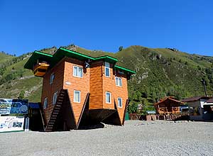
082 Upside down world: The Perevertysh-House
- in
Manzherok, 22 miles [36km] south of Gorno-
- Altaysk, is built in the
style of a typical European
- summerhouse, with one exception: It is
upside
- down, also inside. It now is a tourist attraction
|
-
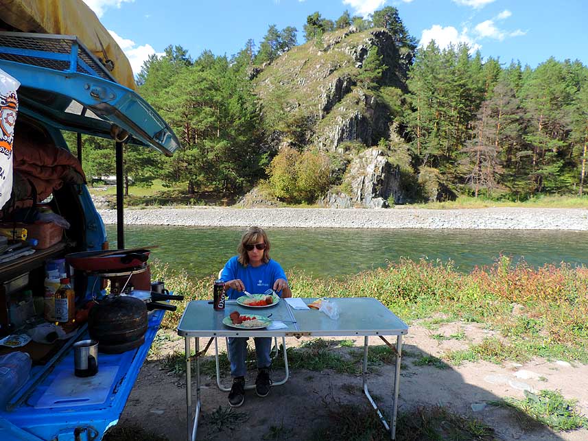
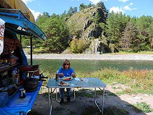
083 Lunch along the Chemal River in
- Chemal: Being
alone amidst the beautiful
- Siberian surrounding lunch tastes even
better!
|
-
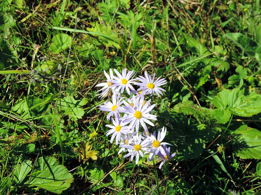
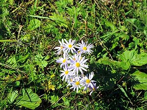
084 A couple of daisies
still brave the
- approaching autumn, which is changing mid-
- October
pretty abrupt into winter time
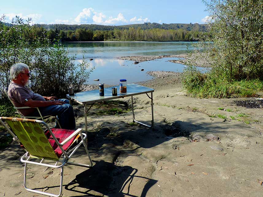
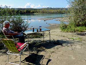
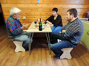
|
-
|
-
|
-
-
|
-
-
|
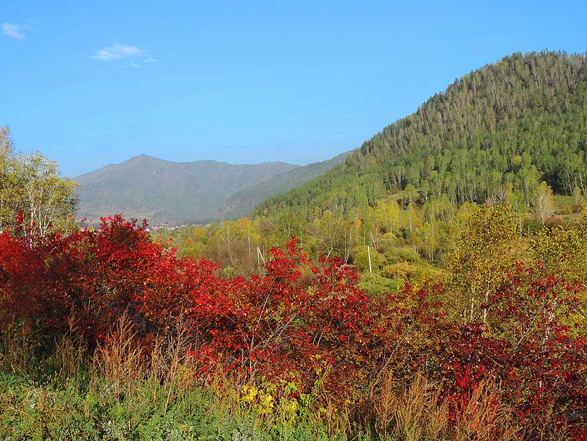
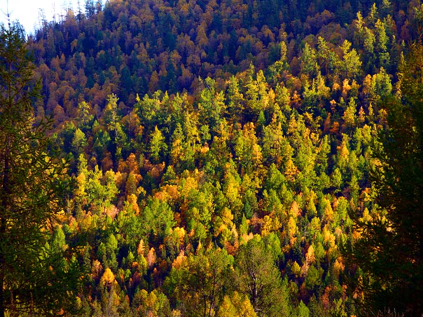
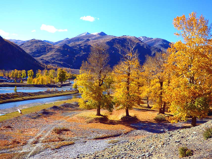
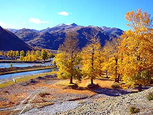
-
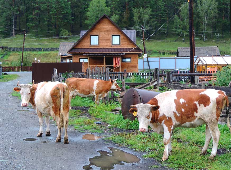
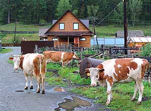
085
ôWho wants to drive past?ö Curious
- well-fed cows are gazing at
us at the ôDeja Vuö
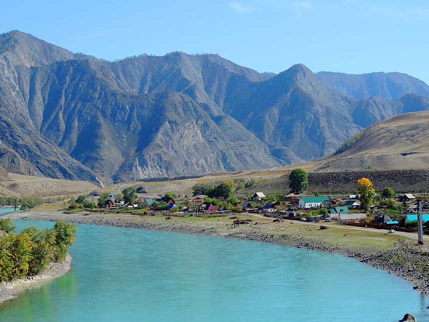
- Chalets in Uznezya along the Katun River
|
-
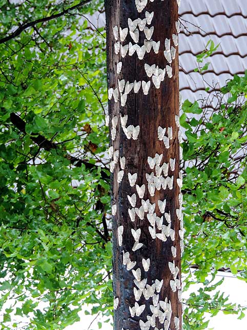
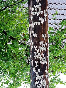
086
White nocturnal moths are settling
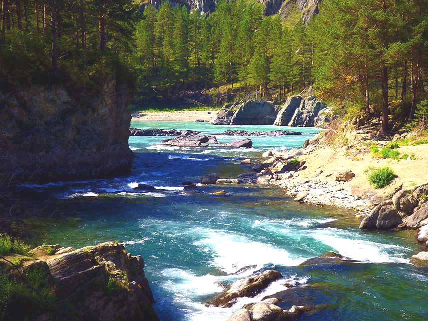
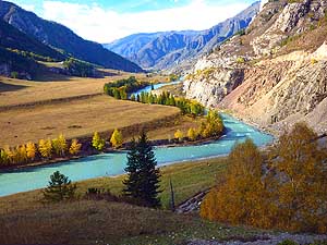
- down in their thousends on
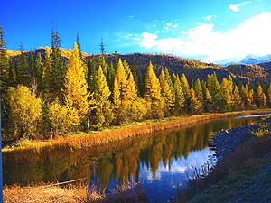
a high
- pole due to its light à..
|
-
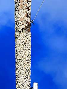
087
à. at the end the whole pole is
- ôplasteredö by them and many
lie dead
- on the ground. Artificial light kicks
- them completely out
of cadence
|
-
|
-
-

|
-
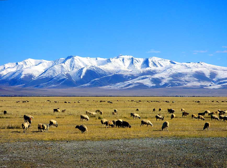
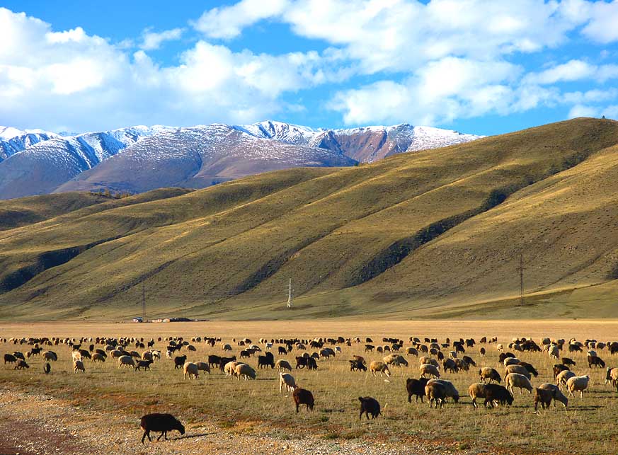
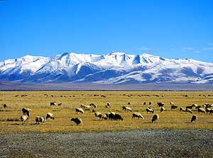
-
|
-
-
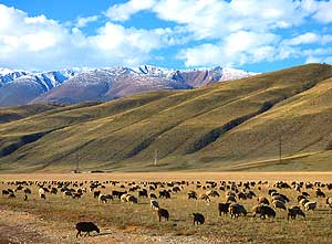
|
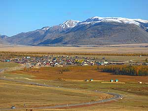
-
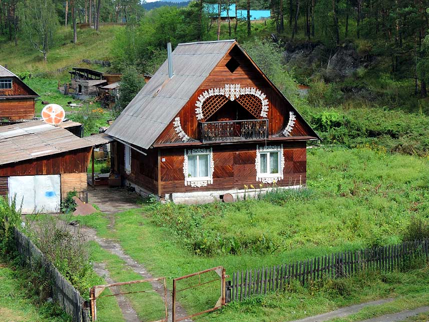
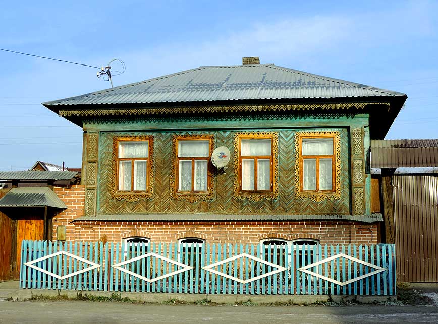
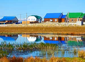
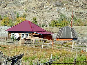
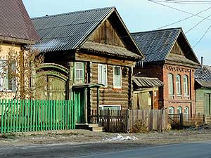
088 A cutely decorated Siberian
- home in the
village of Uznezya
|
-
089 The village of Shebalino along the
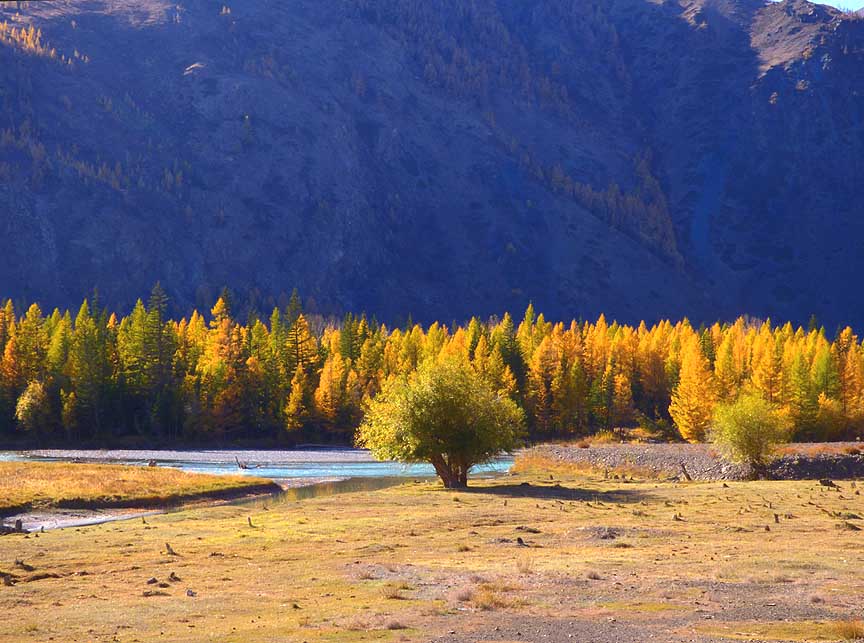
- Chuysky
Trakt. See also picture No. 145
- on the return journey
|
-
090 Enjoying his beer,
Emil is gazing
- into the quietly flowing Katun River
- while Liliana
prepares some lunch
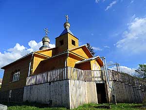
|
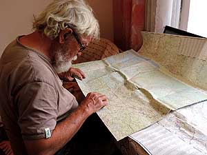
-
|
-
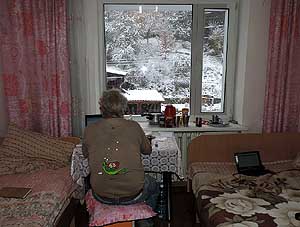
-
|
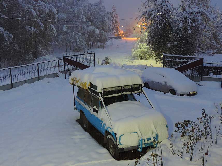
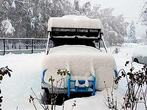
-
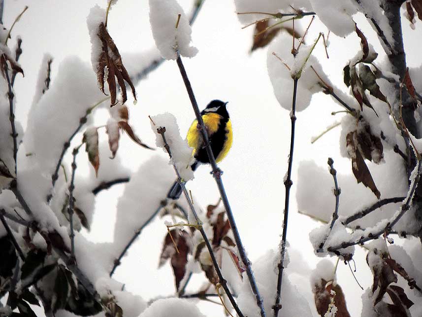
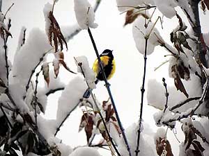
-

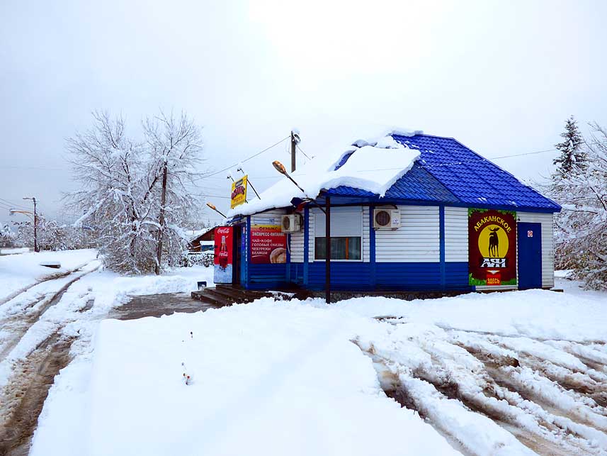
|
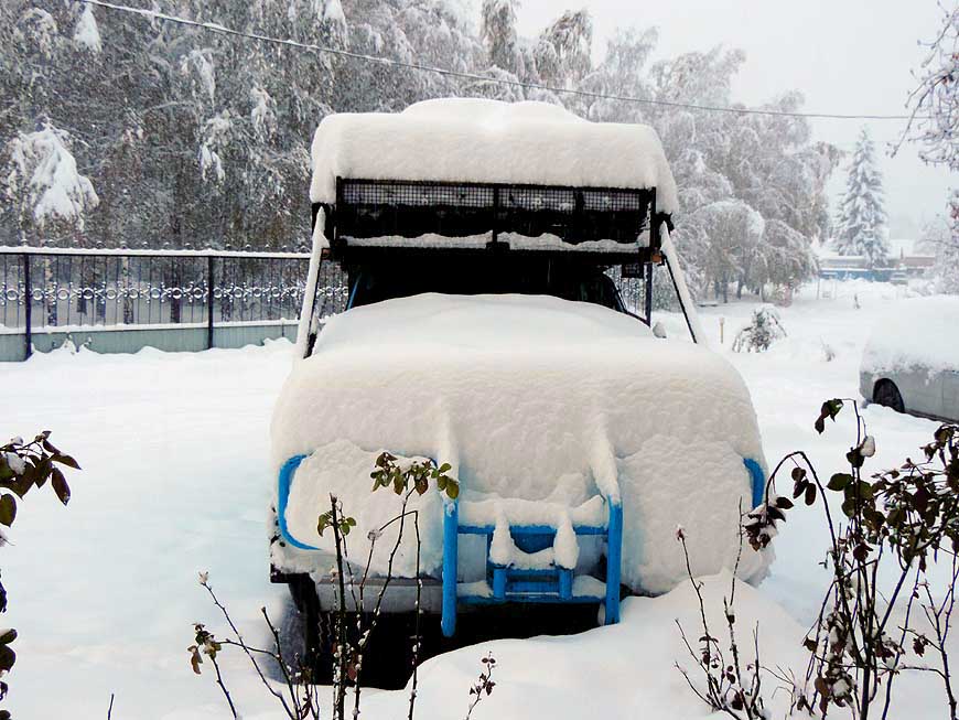
-
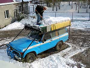
-
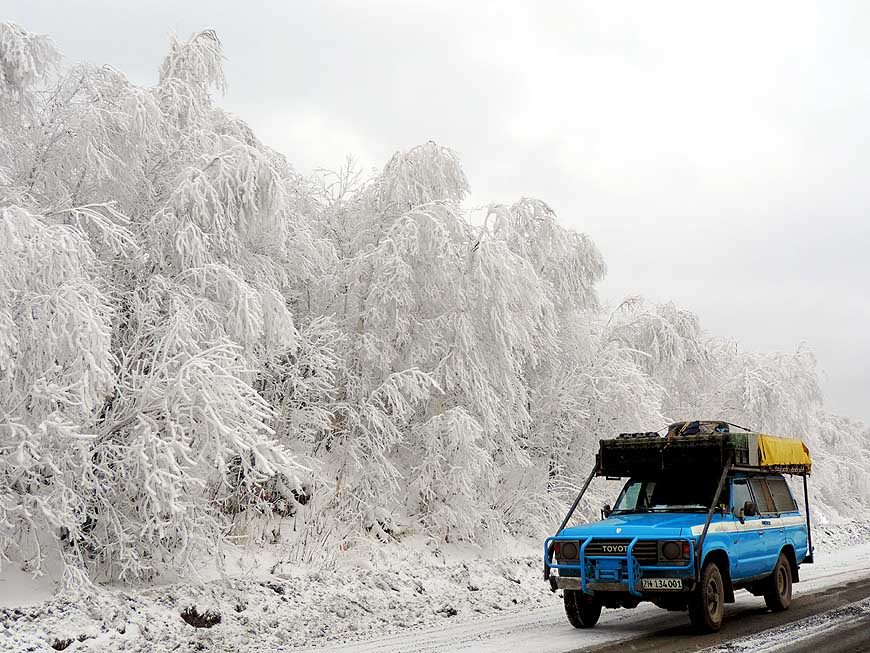
|
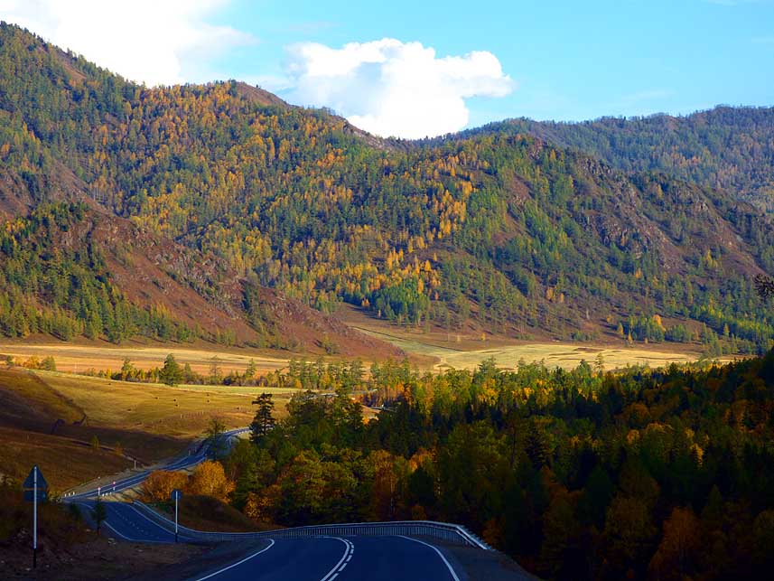
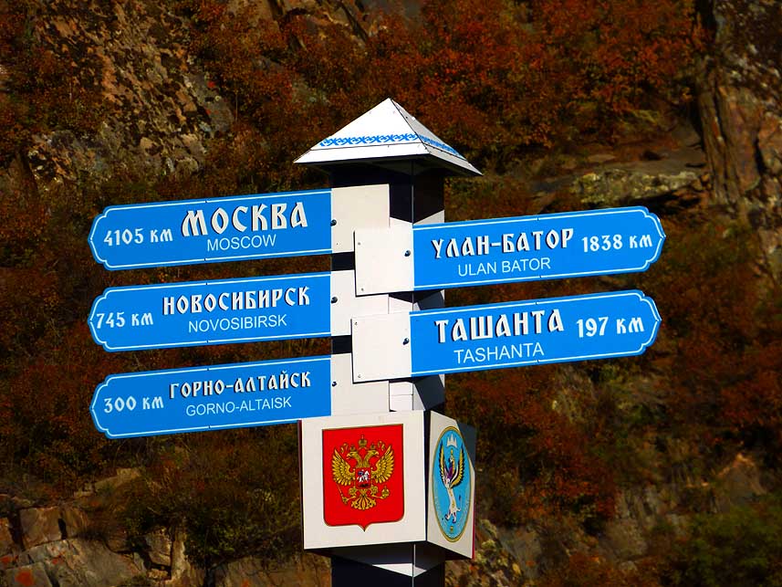
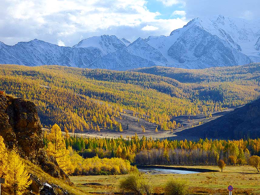
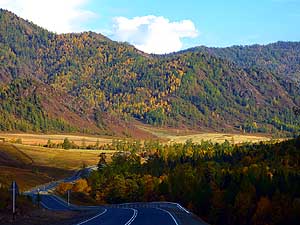
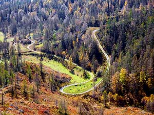
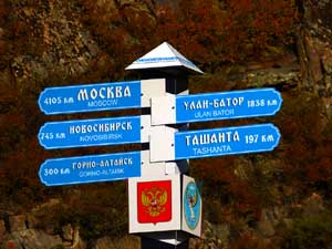
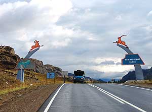
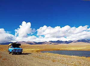
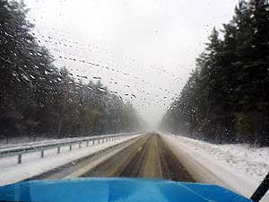
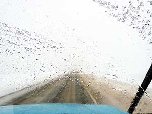
- Glorious natural scenery along the Chuysky Trakt û the Siberian
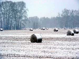
silk road that served initially as a major route from China to
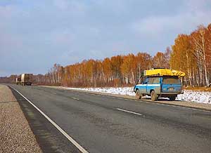
Europe.
- The Chuysky Trakt itself, former highway M52 û new R256, runs 600
miles [966km] from Novosibirsk via Barnaul, Biysk and
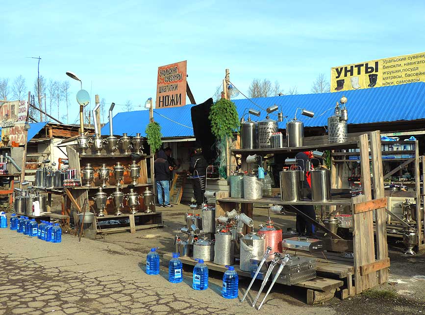
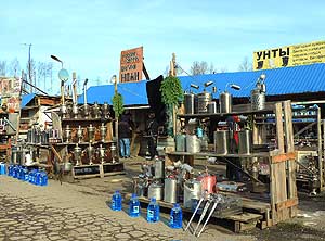
- Gorno-Altaysk to the Mongolian border at Tashanta. It is
completely sealed, 23 ft. [7m] wide and well-developed. The
construction
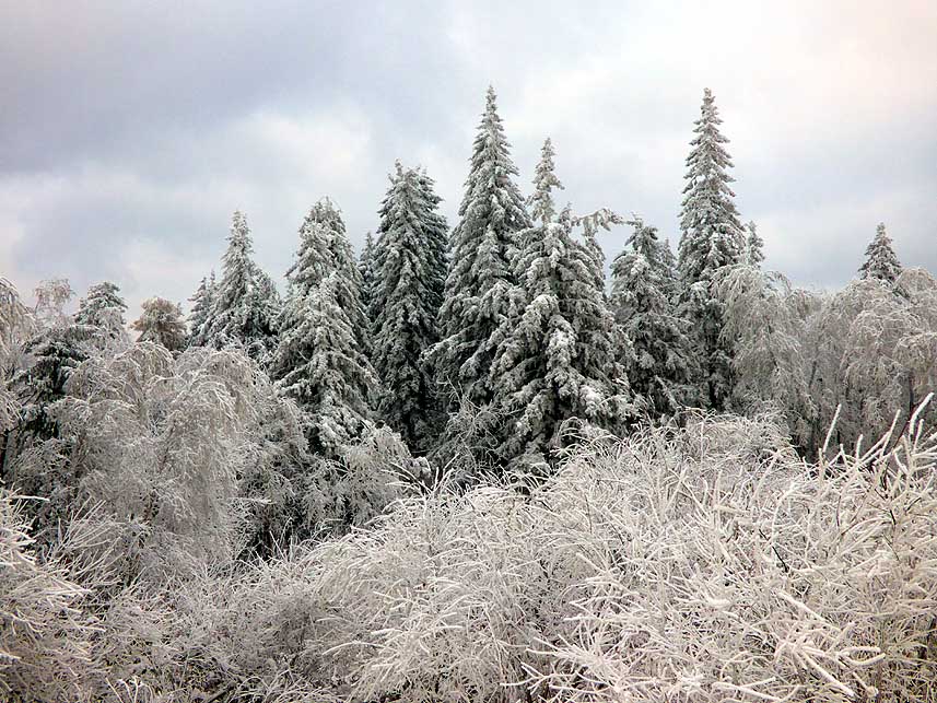
- was during the 1930's by Gulag inmates. The highest elevation is
8Æ153 ft. [2,485 m] on the Durbet-Daba pass on the Mongolia border,
- 12¢ miles [20km] southeast of the Tashanta border gate
|
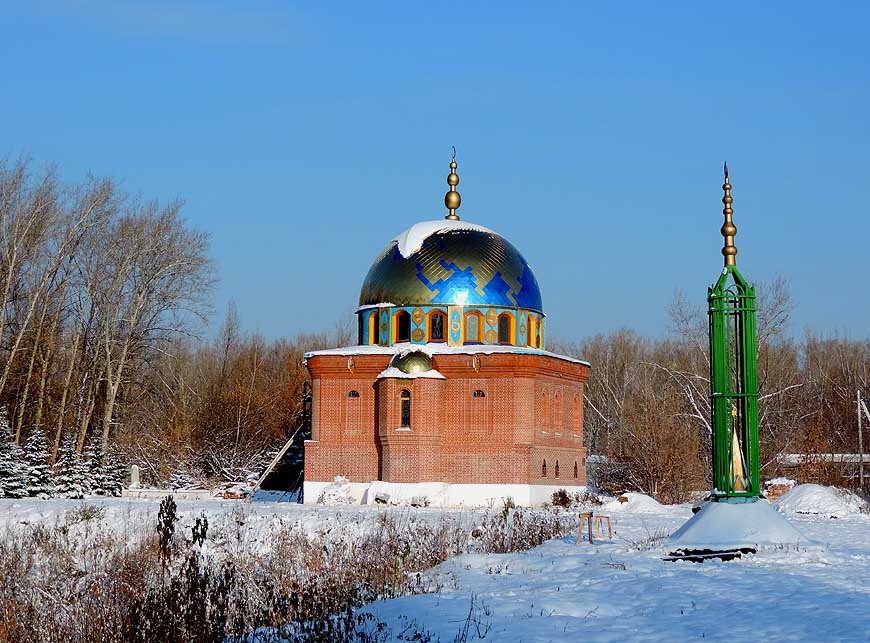
-
091
|
-
092
|
-
093
|
-
|
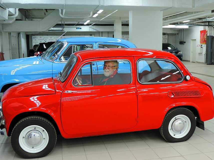
-
-

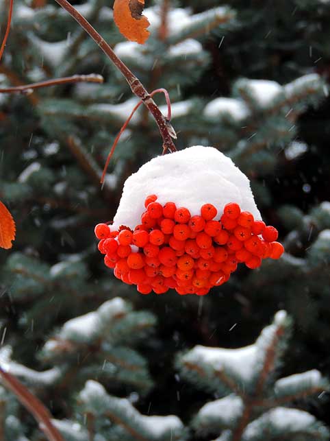
|
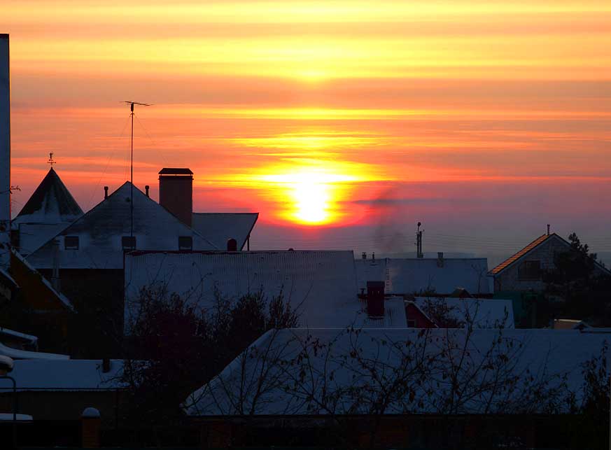
-
-
|
-
-
|
-
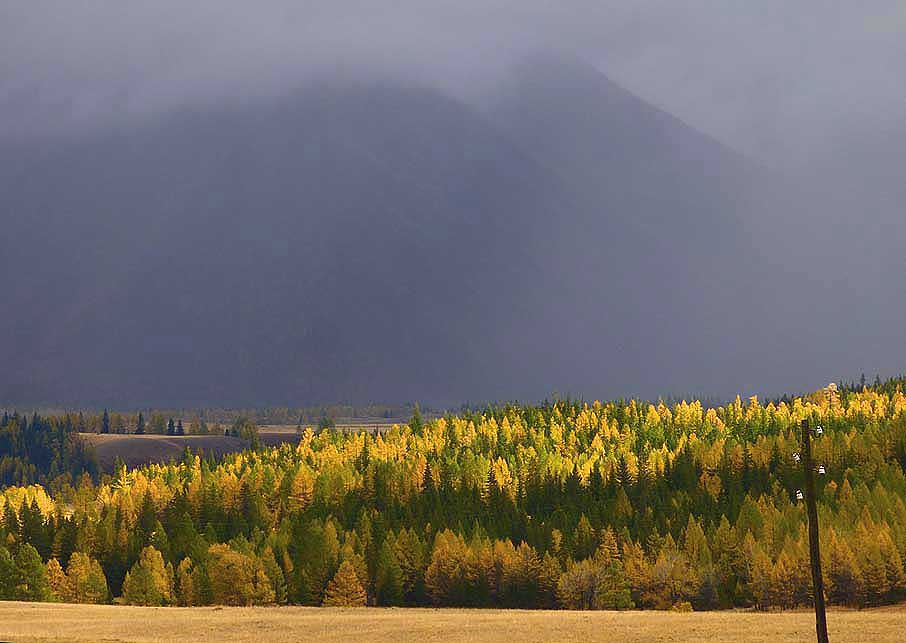
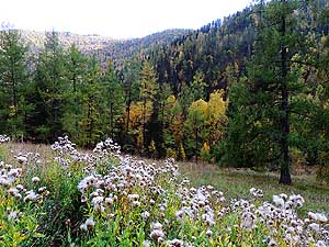
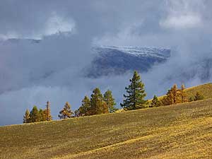
094 Autumn is announcing itself. The forests
- of
the Karakol region along the Chuysky
- Trakt are slowly changing the
colors à..
|
-
095 à.. partly the trees have already
- reached the
climax of their
- golden autumn color
|
-
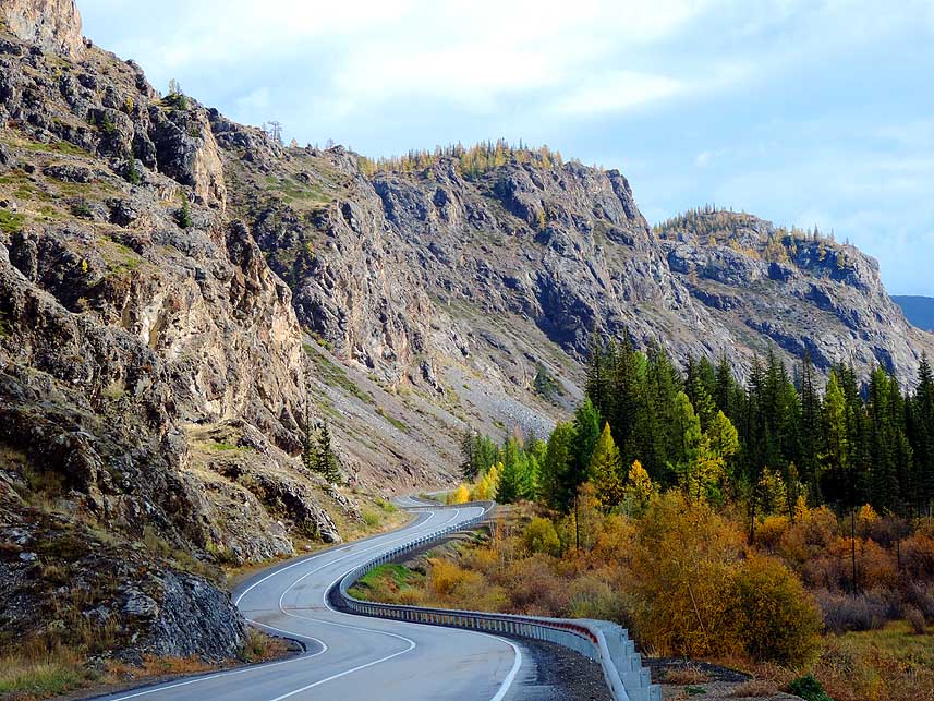
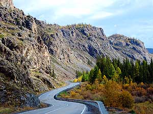
096 The Chike-Taman-Pass
(4Æ249 ft.
- [1Æ295m]) of the fine Chuysky Trakt
- runs through the
sweeping Karakol
- region, flanked by mountains
|
-
|
-
-
|
-
-

|
-
-
|
-
097 The old Chike-Taman mountain pass
- road is
visible. It worked until the opening
- of the new one in 1984. 25% of
the Altai
- territory is forested
|
-
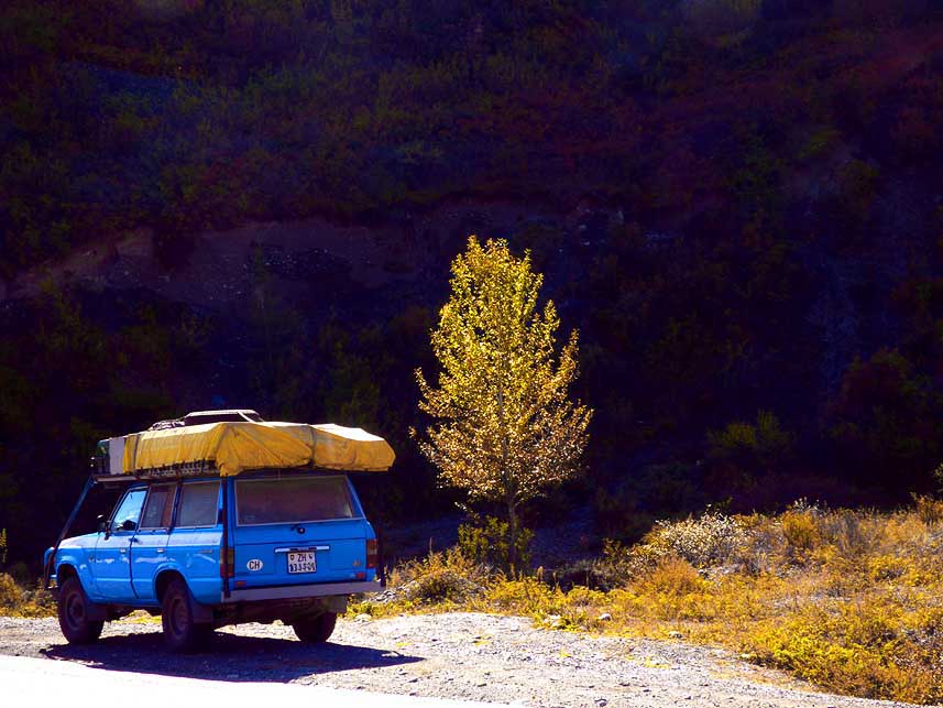
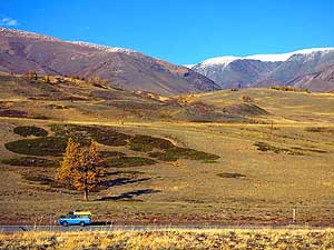
098 Doesn't our blue LandCruiser look
- good next
to the little autumn tree?
|
-
099 The Chuysky Trakt
meets 11 miles
- [18km] south of the Chike-Taman pass
- at Kordon Kur-Kechu again the
- mighty Katun River
|
-
|
-
-

|
-
-
|
-
-
|
-
100 The little 200-soul hamlet Malyy
- Yaloman at
the bank of the mighty
- Katun River with a sweeping view
- to the
Saldzhar (Saljar) mountains
|
-
101 ôWe are just taking a little napö à..
|
-
102 à.. we make also a
little break
- in that rather inhospitable place
|
-
|
-
-

|
-
-
|
-
-
|
-
103 Lunch break in the solitude of the
- ôGolden
Mountainsö, shortly before Inya
|
View from the Chuysky Trakt monument |
-
|
-
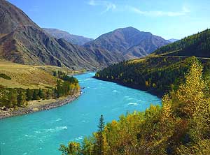
104 One of the most beautiful sights of the
- Altai
region: The turquoise shining Chuya
- River meandering down a stunning
valley
|
-
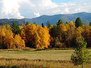
105 A row of autumn
colored trees
- lines the shore of the Katun River
|
-
|
-
-
|
-
-

|
-
-

|
- At the Chuysky Trakt monument:
|
-
108 Our LandCruiser is
rolling mile after
- mile on a good tarmac road through an
- untamed and
outstanding landscape. First
- snowfall set in on 9/22/2016 overnight at
- higher elevations (~6Æ600 ft. [~2Æ000m])
|
-
106 We did not reach Ulaanbaatar in Mongolia.
- We
turned back at the border because: 1st)
- Mongolia on a sudden
temporarily introduced
- a bond for old cars (US$12Æ232.50 for our
- 34-years old LandCruiser), 2nd) the
emergency
- repair of our front
pillars in Gorno-Altaysk did
- not prove to be sufficient and 3rd)
snow and
- freezing temperatures were announced on the
- weather
forecast
|
-
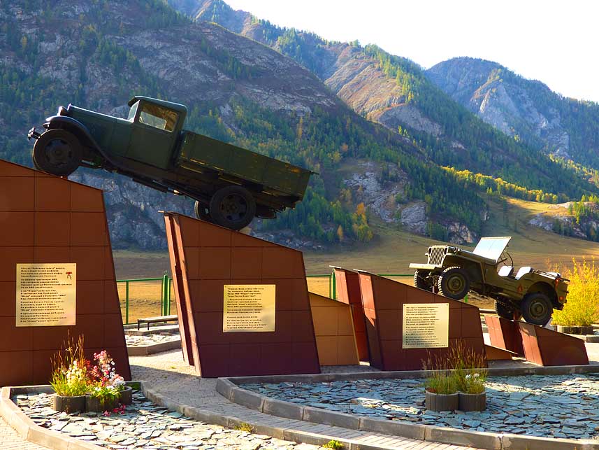
107 The Soviet truck AMO and ôFord jeepö
- at the
ôMonument to Driversö, in honor of
- those who died on the Chuysky
Trakt. The
- previous Trakt, constructed 1930, lies about
- 165 ft.
[50m] east and 65 ft [20m] higher
|
-
|
-
|
-
-
|
-
-
|
-
-
|
-
109 Ibexes mark 13 miles [21km] east of
- Aktach
the entry to the district of
- Kosh-Agach, AltaiÆs last outpost of any
- significance before the Mongolian border
|
-
110 On one side lined by bare rocks, on
- the other side by a
colored forest û the
- Chuysky Trakt never stops enchanting
us.
- Here shortly before Kuray
|
-
111 Patches of dark clouds
sail past
- revealing a glimpse to a snow covered
- mountain ridge û
another sign of
- the approaching winter
|
-
|
-
-
|
-
-

|
-
-
|
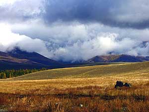
- Different moods at the ôGolden Mountainsö between Aktash and
Kosh-Agach conjure up
- unique sceneries over and over û they can
change within hours
|
-
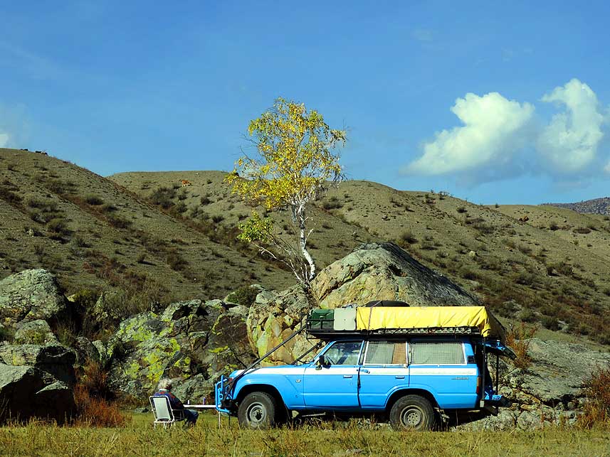
114 Our LandCruiser during a
break at a
- little pond in the dry Chuya Steppe,
- 4¢ miles [7¢km] before
the center of Kosh-
- Agach on an altitude of 5Æ768 ft. [1Æ758m]
|
-
112
|
-
113
|
-
|
-
|
-
-
-
-
|
-
-
|
-
-
-
-
|
-
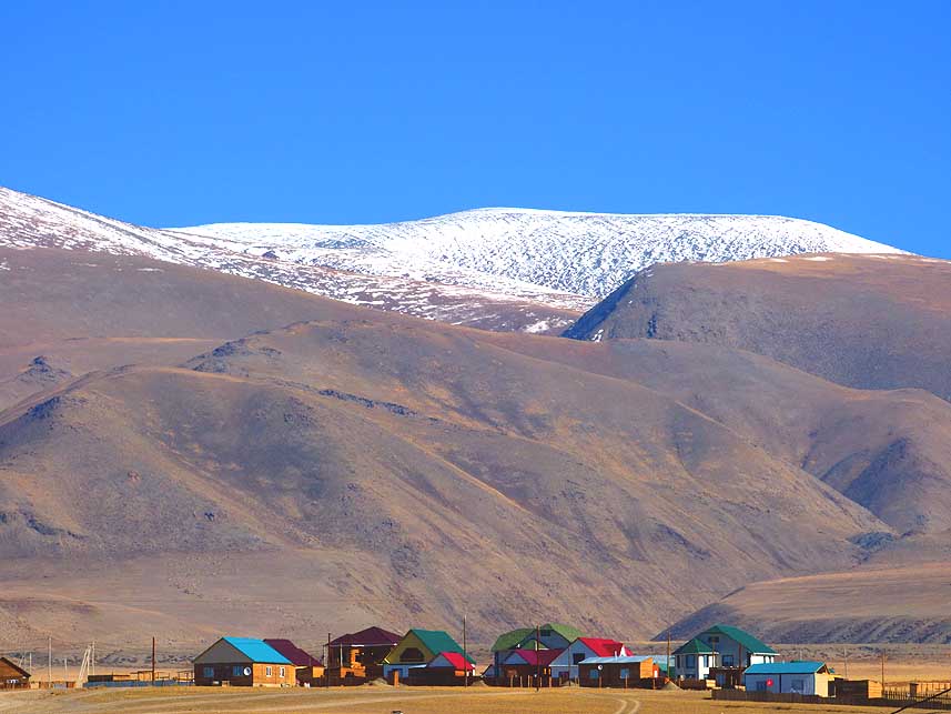
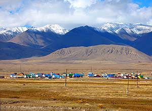
115
A colorful rural settlement in the flat
- Chuya Steppe on the
way to the Mongolia border,
- at the foot of the gorgeous northern
mountain
- scenery (Kuray Range) after Kosh-Agash
|
-
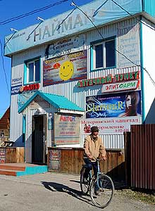
116
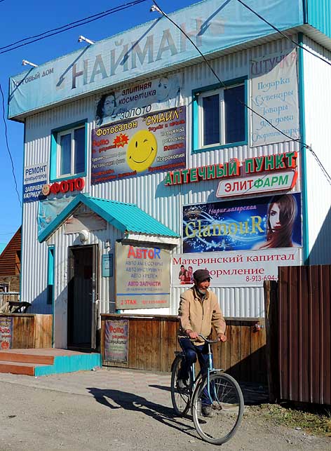
The little village store for everything
- (Photo, Car, Pharmacy,
etc.) in Kosh-Agash
- reflects the charm of the remote place
|
-
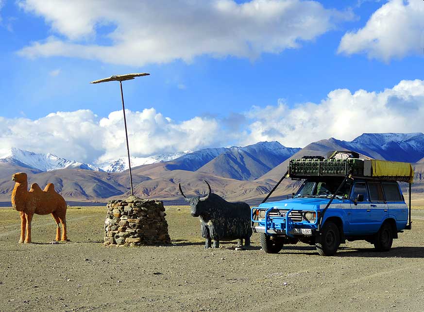
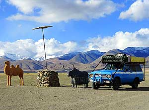
117
Our LandCruiser joins the famous
- ôcamel/eagle/yak trioö at the
northern
- entrance of Kosh-Agash
|
-
|
-
-
|
-
-
|
-
-
|
-
118 Red, blue and green rooftops û they
- give some
color to the small settlement
- in front of the Kuray Range in the
- Kosh-Agash district
|
-
119 A beautiful reflection
- picture in Kosh-Agash
|
-
120 Due to its outstanding
scenery, the
- Altai mountains are also called ôSiberiaÆs
- Switzerlandö
û here again the Kuray
- Range north of Kosh-Agach
|
-
|
-
-

|
-
-
|
-
-
|
-
121 A lovely farm sandwiched between
- one of the
countless water courses of the
- Chuya River and the imposing Kuray
Range
|
-
122 A Kazakh cemetery at the village
- of Kokorya
13¢ miles [22km] east of
- Kosh-Agash on the old Chuysky trakt.
- About
6% of the Altai population are
- Kazakhs (Coord.
49.90898/88.95641)
|
-
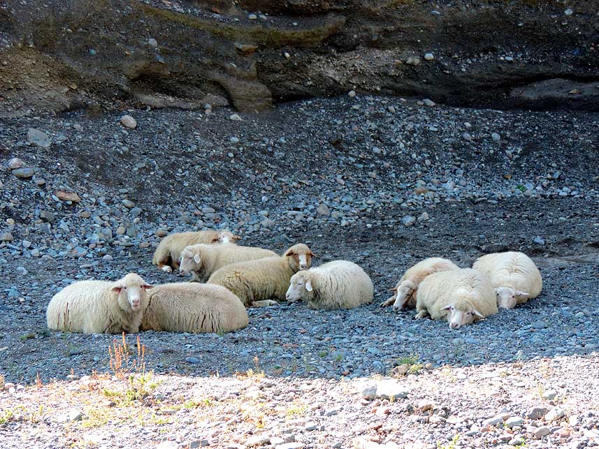
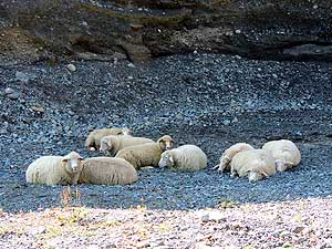
123 Sheep are grazing in
the dry Chuya
- Steppe as they have done it for decades.
- Here in front
of the snow covered Kuray
- Range, shot shortly before Tashanta
|
-
|
-
-
|
-
-

|
-
-

|
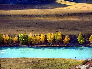
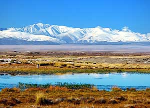
- A particularly beautiful golden autumn on the banks of the Chuya
River along the Chuysky Trakt, 1╝ miles northwest of Chagan-Uzun
|
-
124
|
-
125
|
-
126
|
-
|
-
-
|
-
-
|
-
-
|
-
127 Peacefully grazing sheep in the Kuray
- Steppe,
rolling hills and the snow coated
- Kuray Range û its beauty can hardly be
- outmatched (about 6 miles [10km] before
- the village of Kuray)
|
-
128 A typical picture of the Altai region:
- The
village of Kuray nestles between the
- Kuray Steppe and the eastern
foothills
- of the Severo-Chuyskiy Range
|
-
129 Towards the South:
Birch and fir
- forests crisscross the plain. In the
- background the
Severo-Chuyskiy
- Range rises towards the blue sky
|
-
|
-
-
-
-
|
-
-
|
-
-
-
-
|
-
130
Towards the North: Ascent to the Kuray
- Range û only our blue
LandCruiser disrupts the
- warm brown color of the pristine landscape
|
-
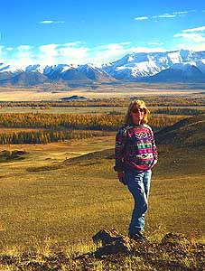
131
Liliana poses in front of the beautiful
- Severo-Chuyskiy
mountain scenery. The
- Altai region belongs to the Unesco
- World Heritage sites, which named it
- ôGolden Mountains of Altaiö
|
-
132
The brilliance of the golden birches
- appears especially
intensive in the barren
- strip of the steppe (view towards the South)
|
-
|
-
-
|
-
-

|
-
-
|
-
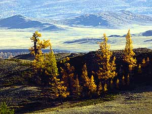
133 The
majestic Altai Mountains
- (here the Kuray
range)
|
-
134 Colorful autumn and glorious winter
- scene
side by side. In the front the Chuya
- River, behind it the 13Æ704 ft.
[4Æ177m] high
- Mt. Kara-Tash of the Severo-Chuyskiy range
|
-
135 Golden reflection: The
pristine pine
- forest along the banks of a branch of the
- Chuya River
in its golden autumn look
|
-
|
-
-
-
-
|
-
-
|
-
-
-
-
|
-
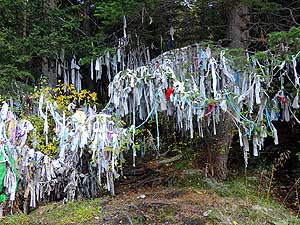
136
In Altai mythology the white ôJalamaö,
- the prayer ribbons hanging
from the lower
- branches of trees, are part of the AltaiÆs
- people
tradition of honoring their ancestors
|
-
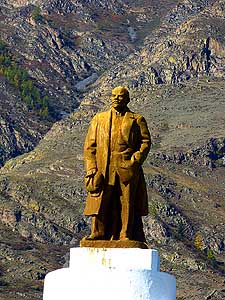
137
The Lenin Statue in Inya stands
- probably at one of the most
- memorable places in Russia
|
-
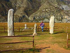
138
Liliana between standing stones from
- Bronze Age (2000-3000 BC)
in Inya left by
- nomads of ancient civilizations, presumably
- from
Turkic people
|
-
|
-
-
|
-
-

|
-
-
|
-
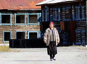
139 A babushka (Russian mommy) on
- the way to her
neighbor for a chat
|
-
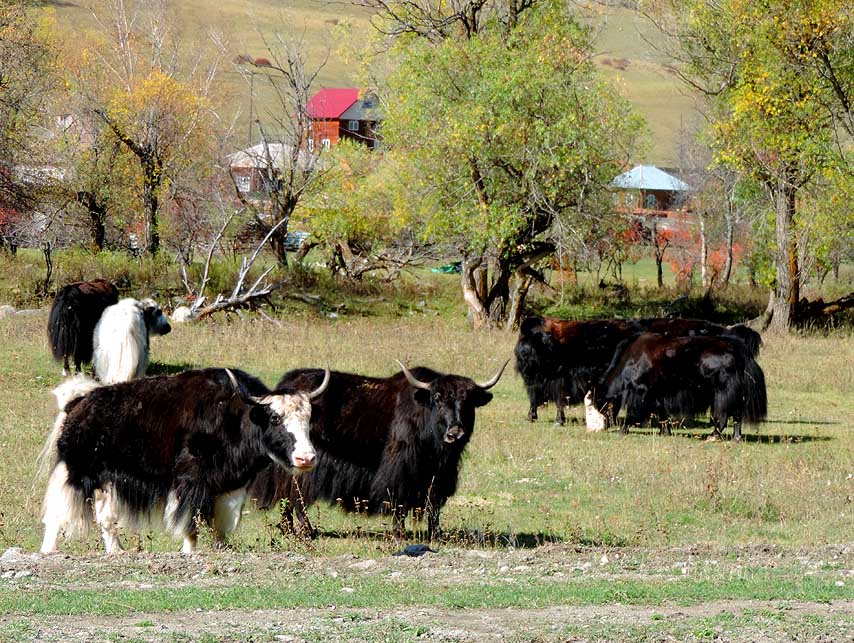
140 Yaks eying us. Yaks (Bos grunniens)
- can survive also in inhospitable lands above
- snowline and carry
loads of more than 100kg
|
-
141 A wooden house of
Altai people in
- Inya with an attached traditional six-sided
- Altai
home, called ôailö
|
-
|
-
-

|
-
-
|
-
-

|
-
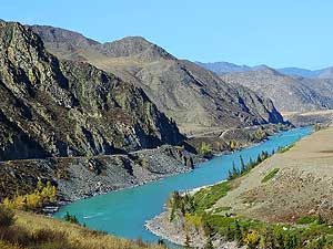
142 At the Chuysky Trakt along the Katun
- River. The clear water of Katun has been
- colored 11 miles [17¢km] earlier by the
- turquoise water of the Chuya River
|
-
143 The scenic Chuysky Trakt follows the
- banks of
the wide Katun and the somewhat
- narrower Chuya River, directly in
the heart
- of the Altai Mountains
|
-
144 Matching the golden
autumn,
- a golden flower meadow
- stretches along a cliff
|
-
|
-
-
|
-
-
|
-
-
|
-
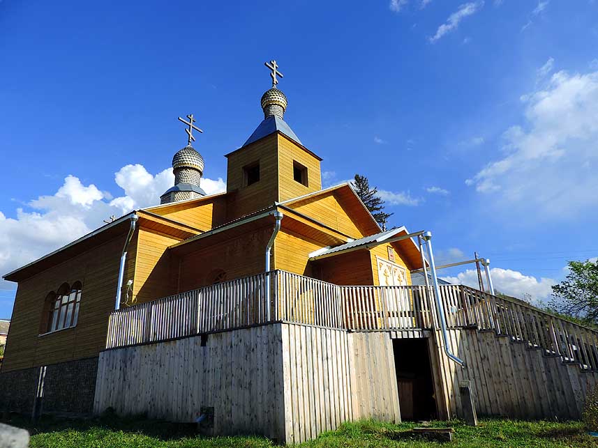
145 The attractive Russian Orthodox
- æChurch of
the Assumption of MaryÆ
- [Церковь
Успения Пресвятой Богородицы]
- of
Shebalino along the Chuysky Trakt
|
-
146 Shipping from Vladivostok (east) or
- Odessa/Ukraine (west)? Emil is studying the
- road map. From
Gorno-Altaysk the distance is
- even about 650 miles [1Æ000km] shorter
to
- Odessa. The freight from there to East Malaysia
- is also just
half. Thus, the decision is made!
|
-
147 The first snowflakes
fall on
- October 7th, 2016, in Gorno-Altaysk.
- View from the window of
our guesthouse
|
-
|
-
-
|
-
-
|
-
-

|
-
148 The winter season reached Gorno-
- Altaysk,
after we had been ôwarnedö on
- September 22nd, 2016, in Kosh Agach
(pic
- #108) û a joy missed for a very long time, the
- last time on
January 29th, 1999, in Turkey
|
-
149 Emil is enjoying the winter landscape
- through
the window of our guesthouse
- æGostinitsa TraktovayaÆ in
Gorno-Altaysk
- while doing some computer work
|
-
150 A deep wintry
landscape in Gorno-
- Altaysk û only Santa Claus is missing!
|
-
|
-
-
|
-
-
|
-
-

|
-
151 Covered with a layer of virgin snow,
- our
LandCruiser experiences the start of
- the Siberian winter in
Gorno-Altaysk
|
-
152 A great tit (Parus major) that can
- be
found from all of Europe and then
- between the 45th and 55th parallel
until
- Khabarovsk in the Far East of Russia
|
-
153 Our corner shop in
Gorno-Altaysk
- after the onset of winter
|
-
|
-
-

|
-
-
|
-
-
|
-
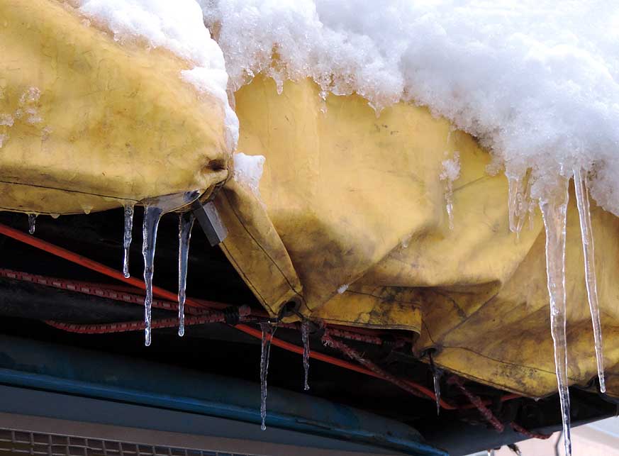
154 The icicles hanging from the Land-
- CruiserÆs
roof are a warning that it is
- high time for us to leave Siberia
|
-
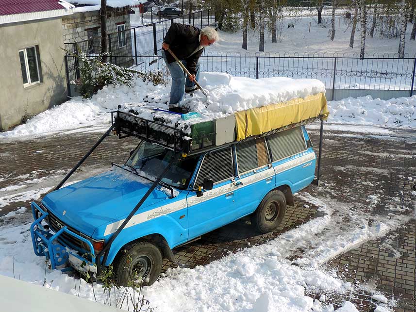
155 Before departure
Emil is shoveling
- the heavy
load of snow from our
- LandCruiserÆs roof rack in front of
- our
guesthouse in Gorno-Altaysk. There
- are 3Æ100 miles [5Æ000km] ahead
of us
|
-
156 10/19/2016: Escaping
the Siberian
- winter: Shortly after leaving Gorno-
- Altaysk to the
West, we run into
- an approaching new snow storm
|
-
|
-
-
|
-
-
|
-
-

|
- We are driving now from Gorno-Altaysk the following route to
Odessa in the
Ukraine (actual driven miles/kilometers):
- (M52)-R256: Gorno-Altaysk - Novosibirsk (Chuysky-Trakt) 289mi
[465km];
- (M51)-R254: Novosibirsk - Chelyabinsk 955mi [1Æ537km]
(through Kurgan, Ishim and Omsk);
- M5: Chelyabinsk -
Ufa - Samara 578mi
[930km]; R228: Samara -
Saratov 244mi [393km]; A144: Saratov
- Kursk
449mi [722km];
- R199/P44/M02: Kursk -
Rylsk - Hlukiv
- Kiev 318mi [512km];
M05: Kiev -
Odessa 303mi [488km]; total 3Æ136mi [5Æ047km]
|
-
157 We are caught in a Siberian snow storm:
- Clouds of snow sweep across the street. The
- visibility gets worse
and worse. Snow starts
- sticking on the road. Locals are already
- mounting spike tires and we are driving with
- summer tires and a
jammed windshield wiper!
|
-
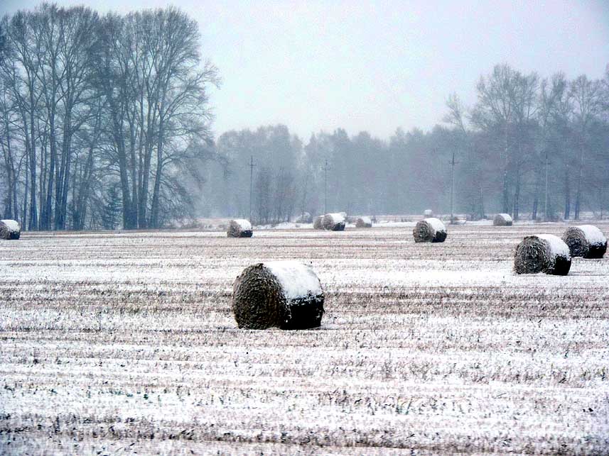
158 It is snowing and snowing. The hay
- bales that
are still laying on the meadows
- get a snow cap
|
-
159 Emil is enjoying the
wonderful mix
- of autumn and winter colors. We are now
- on the Trans
Siberian Highway, the former
- M51 û today R254. We left the
- Chuysky
Trakt in Novosibirsk
|
-
|
-
-
|
-
-
|
-
-
|
-
160 We drive westwards on the monotonous
- but
pretty smooth Trans-Siberian Highway
- through endless birch forests
|
-
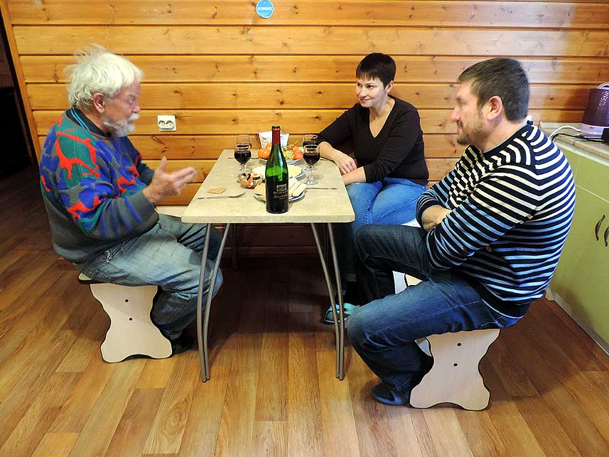
161 Anastasia and her husband of the
- Berkana
Backpacker in Chelyabinsk invite
- us to a cheese platter and wine û a
feast.
- Emil talks about our world trip
|
-
162 Among other stuff,
metal containers
- called ôsamovarö are sold along the street
- (on the
left side). In Russia they are traditionally
- used to heat and boil
water for tea
|
-
|
-
-
|
-
-
|
-
-
|
-
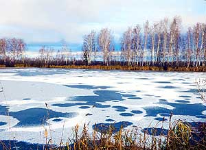
163 At 32░F [-5░C] temperatures, the
- pond along
the Trans Siberian Highway is
- already partly covered with a thin
coat of ice
|
-
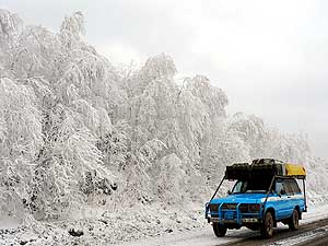
164 10/27/2016: A ôsugar coatedö winter
- wonderland at Urenga Pass, where we cross
- the Ural range for the
second time on our
- journey around the world. The first time was
- on
July 2nd, 1995. The Ural marks the
- geographical border between Asia
and Europe.
- So we are actually leaving Siberia too
|
-
165 Just fabulous: Each
tree, each branchlet
- bears the imprint of a deep winter
|
-
|
-
-
|
-
-
|
-
-
|
- Typical for Russia: Modest wooden houses along the road between
Satka and Ufa
|
-
166
|
-
167
|
-
168
|
-
|
-
-
-
-

|
-
-
|
-
-
-
-
|
-
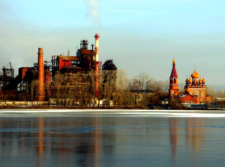
169
Side by side at the town pond:
- A smoking industrial chimney of
an iron
- smeltery and the beautiful golden domed
- church of St
Nicholas in Satka à..
|
-
170
à.. Emil taking pictures
- of the surroundings à..
|
-
171
à.. and of the Russian Orthodox
- Church of St. Nicholas the
Wonderworker
- [Храм Святителя Николая
Чудотворца]
- in Satka in its full splendor
|
-
|
-
-
|
-
-

|
-
-

|
-
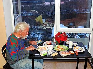
172 Emil at the breakfast table in our
- room of
the Hotel Europe in Ufa, enriched
- by various cheeses from our board
kitchen
- û just according to EmilÆs taste!
|
-
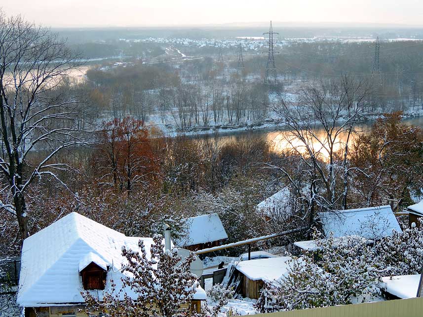
173 View from the room of our Hotel Europe
- in Ufa
over the wintry landscape and the Ufa
- River, which flows via the
Kama River into
- the Volga that ends in the Caspian Sea
|
-
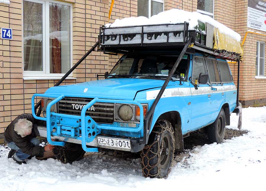
174 Around 4 inches [10cm]
of new snow
- fell in Ufa during the night. Emil is mounting
- our snow
chains in front of our Hotel, as the
- road slopes sharply. On our
world journey
- we only used them in mud (Zaire-Congo
+
- Guyana),
not yet in snow up to now
|
-
|
-
-
|
-
-
|
-
-

|
-
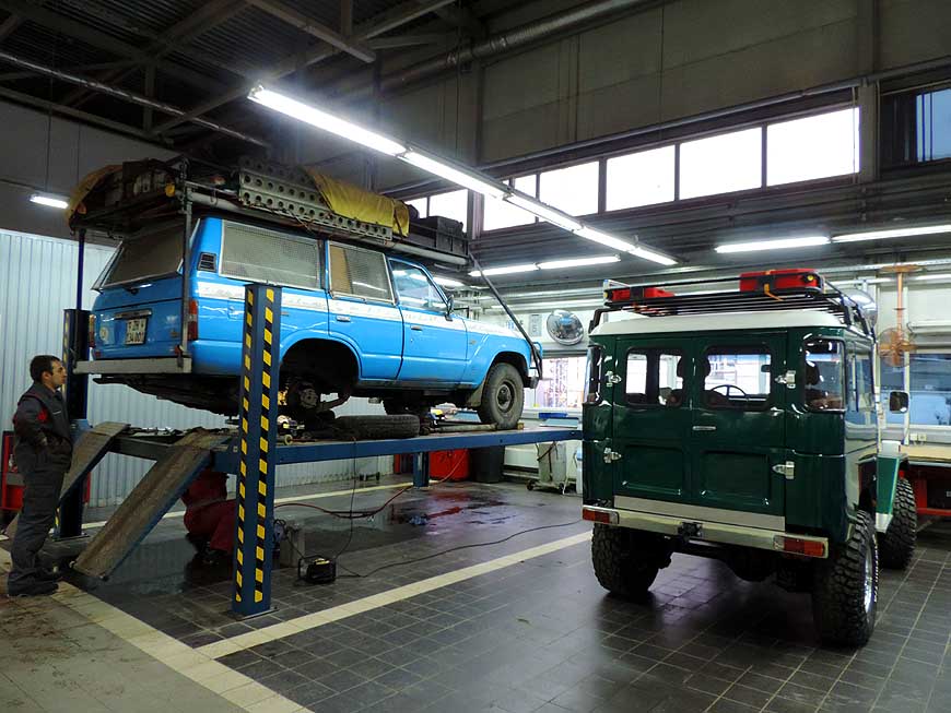
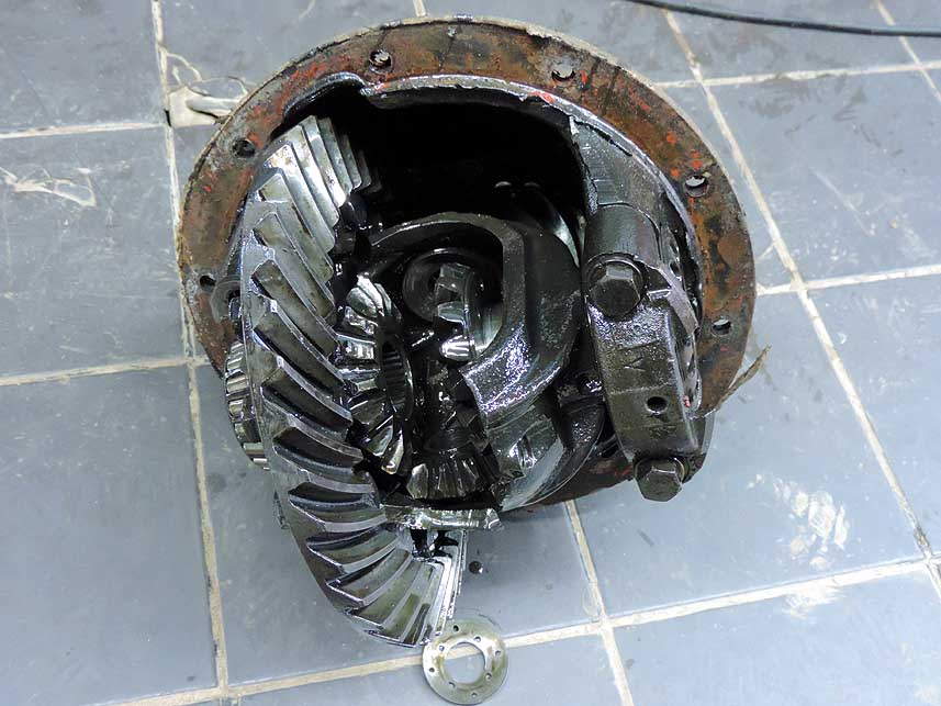
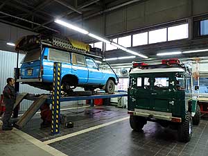
175 Our LandCruiser in the Toyota Ufa
- workshop:
The rear differential broke when
- leaving the hotel. It will be
replaced by the
- used spare one that we carried along on
- our roof
rack during 3Æ613 days, resp.
- 80Æ683 miles [129Æ846km] from
|
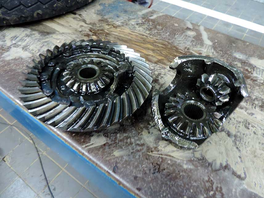
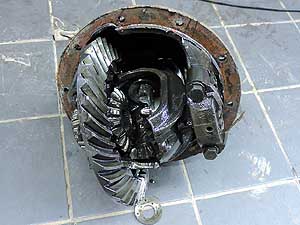
à.. the corpus delicti: the broken differential; the
differential case cracked |
-
-
176
|
-
-
177
|
-
|
-
-
-
-
|
-
-
|
-
-
-
-
|
-
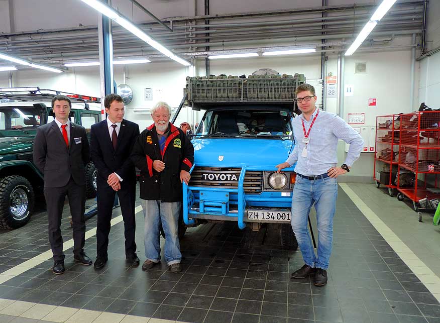
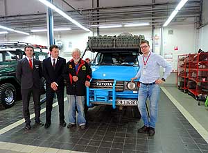
178
After the record time repair at Toyota
- Ufa the house
photographer takes a couple
- of pictures. In the picture is Dimitri,
our
- contact person (left of Emil). As a gift,
- we get a huge glass of
honey
|
-
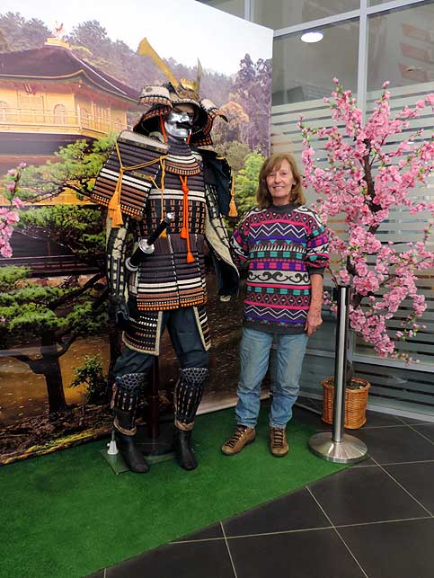
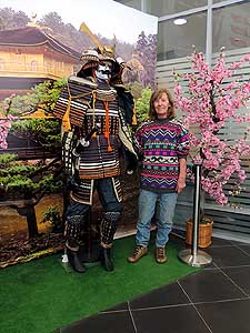
179
At Toyota Ufa Liliana is posing
- next to a Samurai. When
leaving, we
- get an already framed picture with the
- two of us with
the same scenery
|
-
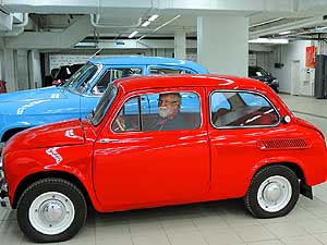
180
Toyota Ufa has an interesting museum
- with a collection of
nostalgic vehicles.
- Emil cannot help to sit behind the
- steering
wheel of a Fiat 500 vintage car
|
-
|
-
-
-
-

|
-
-
|
-
-
-
-

|
-
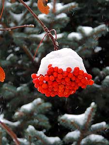
181
A mausoleum in a wintry landscape
- along the Ural Highway M5
(Trans-Siberian
- Highway) between Ufa and Oktyabrsky
|
-
182
The magic of wintertime: A bunch
- of Viburnum berries (Sorbus
aucuparia)
- covered with snow
|
-
183
A last sunset in snow-covered Russia:
- Our 3-months journey
comes to an end after
- 3Æ391 miles [6Æ423km] on Russian roads. On
- Nov.11th, 2016, at 11am, we reach Gorodishche
- near Krupets the exit
border to the Ukraine
|
-
|
- The African trip
2013-16:
- CapeVerde: Santiago/Praia
part 1 û November18th to December 13th, 2013
- CapeVerde: Fogo
û Dezember13th to 23rd, 2013
- CapeVerde: Brava
û December 23rd to 26th, 2013
- Cape Verde: Santiago/Praia
part 2 û December 26th, 2013 to February 28th, 2014
- Cape Verde: SÒo Nicolau û February
28th to March 13th, 2014
- Cape Verde: SÒo Vicente/Mindelo part 1
û March 13th to 20th, 2014
- Cape
Verde: Santo AntÒo/Eastern side part 1 û
March 20th to April 7th, 2014
- Cape
Verde: Santo AntÒo/Western side part 2 û
April 7th to 10th, 2014
- Cape
Verde: SÒo Vicente/Mindelo part 2 û
April 10th to 29th, 2014
-
Namibia Part 1 û
from Walvis Bay to Windhoek
- Angola Part 1
û
September 26th to October 4th, 2014
- Angola Part 2 û
October 4th to 22nd, 2014
-
Namibia Part 2 û
from Windhoek to the Angolan border, back again and on to
South Africa
-
South Africa
Part 1 û
from Namibia border to Capetown û
January 22nd to February 23rd, 2015
- 3rd Major Repair of our
LandCruiser FJ60 - 1982 (due to two broken sideshafts)
-
South Africa Part 2 û from Capetown to Tsitsikamma National Park û
February 24th to March 13th, 2015
- South Africa Part 3 û from
Addo National Park to the Lesotho border û March
13th to April 7th, 2015
-
Lesotho û April 7th to 15th, 2015
-
South Africa Part 4
û from the Lesotho to the Swaziland border û
April 15th to 23rd, 2015
-
Swaziland û April 23rd to 28th,
2015
-
South Africa Part 5
û from the Swaziland to the Botswana border
û April 28th to May 15th, 2015
-
Botswana
-
Zimbabwe
-
Mozambique
-
Malawi
-
Armed Robbery in Malawi on July
31st/August 1st, 2015
-
Tanzania
-
Kenya
-
Ethiopia Part 1 û from Kenya to
Djibouti –
October 25th to November 18th, 2015
-
Djibouti –
October 18th to 27th, 2015
-
Ethiopia Part 2 –
from
Djibouti to
Sudan –
November 27th to December 9th, 2015
- Sudan –
December 9th, 2015 to January 8th, 2016
|