-
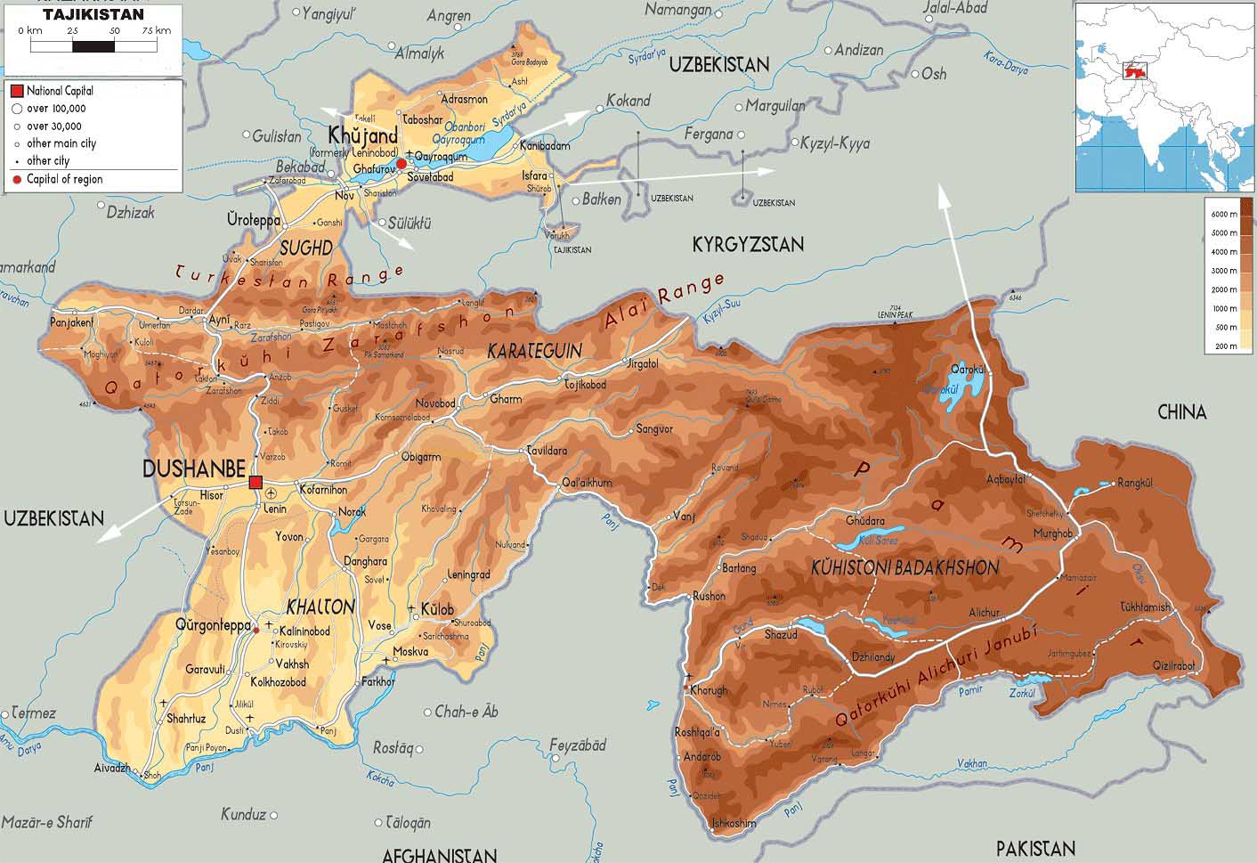
- Tajikistan Map
|
-
- Map
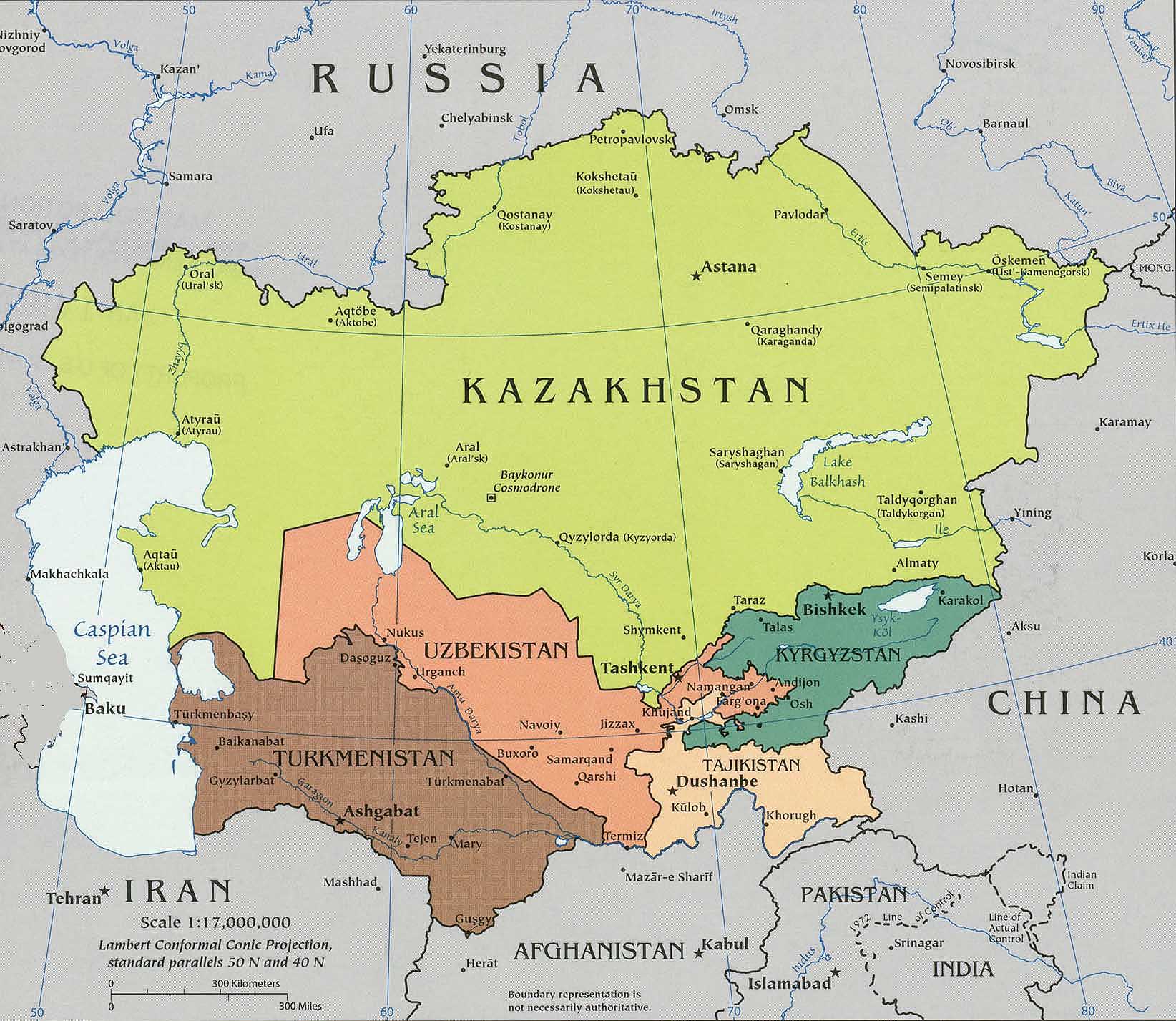
of Central Asia
|
|
-
|
- latest picture:
June 27, 2016
|
-
-

|
-
-
|
-
-
|
-
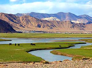
085 We have breakfast with view to the Nurek
- reservoir, situated about 50 miles [80km] from
- Dushanbe. We are on our ösouthernô way to the
- famous Pamir Highway, i.e. via Kulob because the
- Khaburabot Pass (Sagirdasht Pass) û the M41
- via Tavildara û is said to be in a miserable shape
|
-
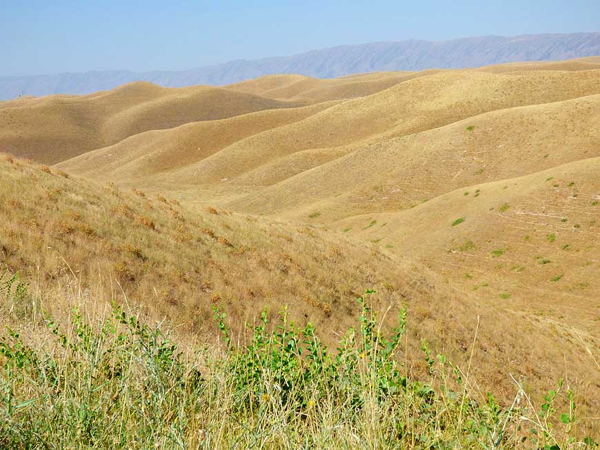
086 After Dangara we pass rolling
- heat-baked hills in the ösouthern Tajik
- wheatfieldsô for some miles
|
-
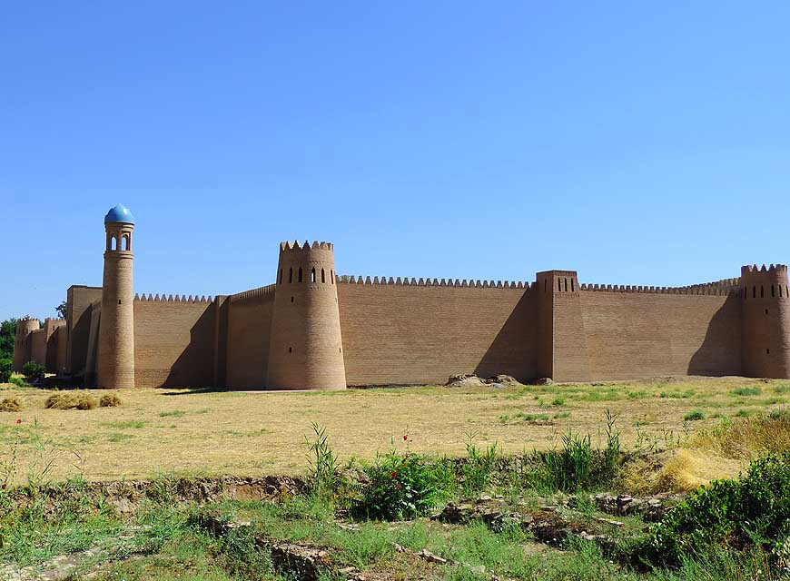
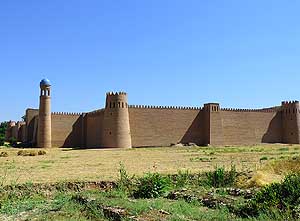
087 At Kurbon Shaid (Pingan),
about
- 18 miles [30km] before Kulob, lies the
- new looking Hulbuk Fortress Palace û
- a reconstruction from the 11th century
|
-
|
-
-

|
-
-
|
-
-

|
-
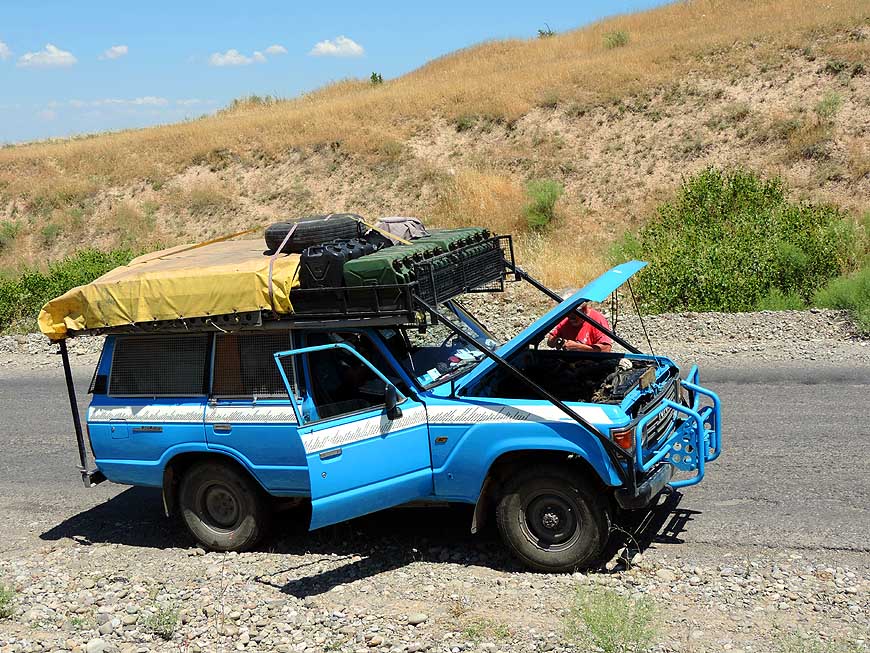
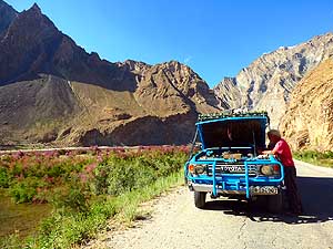
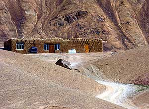
088 From Kulob the road climbs up to
- Shurabad, a crossover of 6'500 ft. [1Æ980m]
- to the very long Panj valley. This is where the
- overheating problem of our LandCruiser restarts.
- Emil sucks in fuel, cools the carburetor with water
- and fixes an additional fan next to the carburetor
|
-
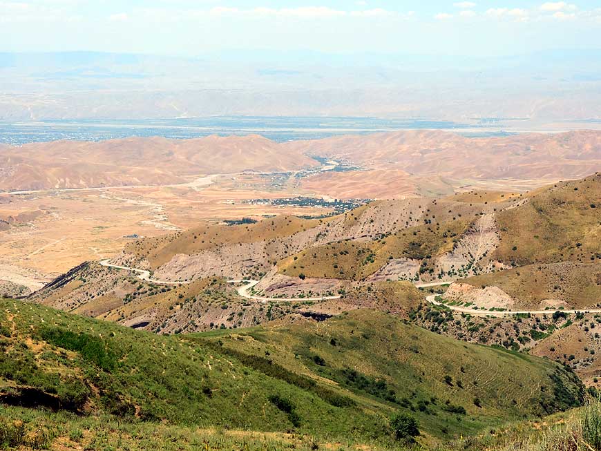
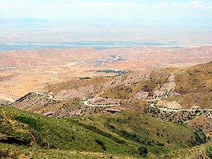
089 Sweeping view from the Shurabad
- mountain pass down to the valley
- towards Kulob (green left at the back)
|
-
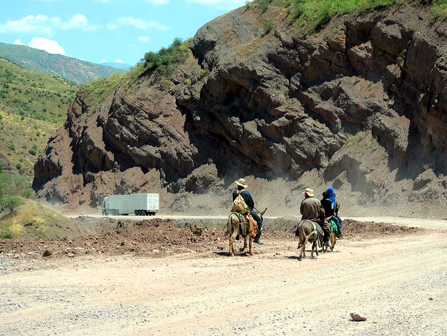
090 Huge trucks,
generating a lot of dust,
- and locals on donkeys are on the Shurabad
- pass ascent. Many trucks tow
- additionally a huge trailer
|
-
|
-
-
-
-
|
-
-
|
-
-
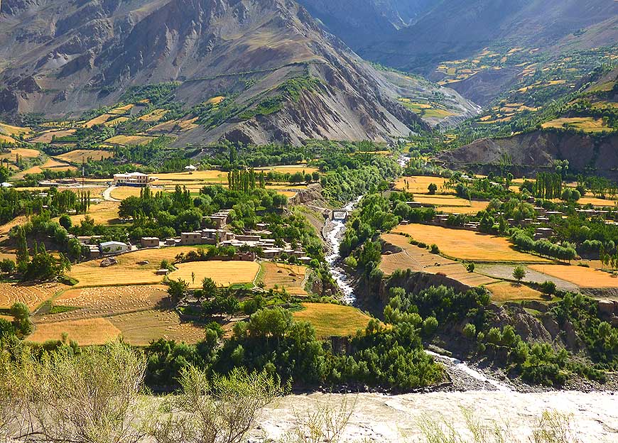
-
-

|
-
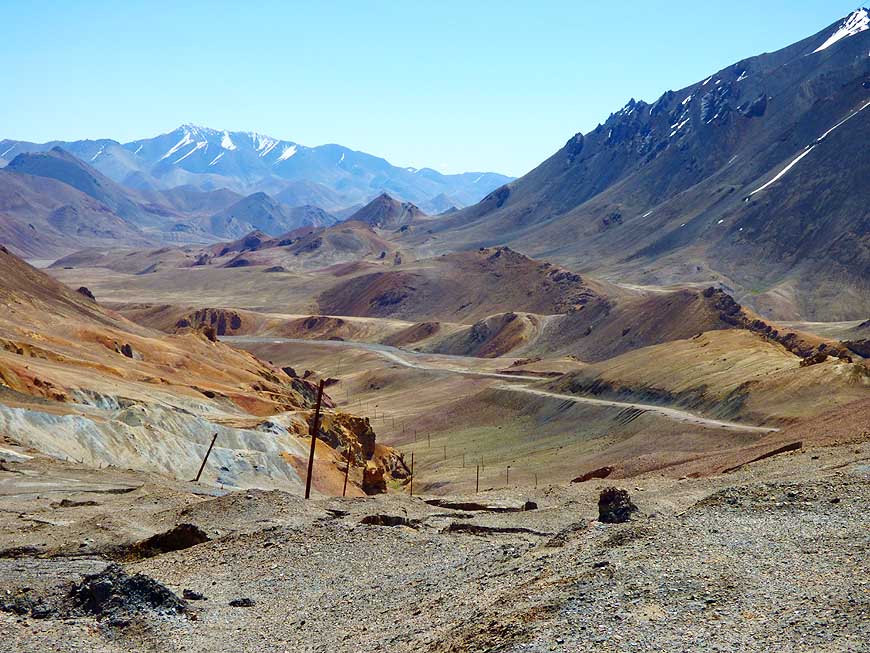
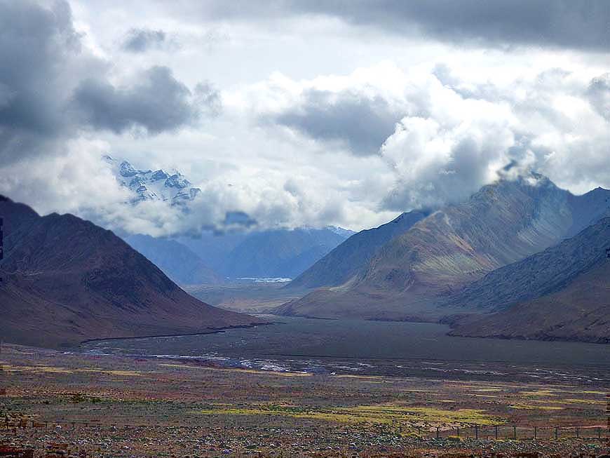
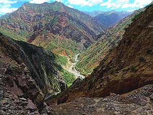
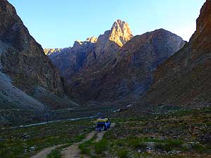
091
After the Shurabad pass we are
- encircled near Chilishtak by an imposing
- rocky mountain scenery
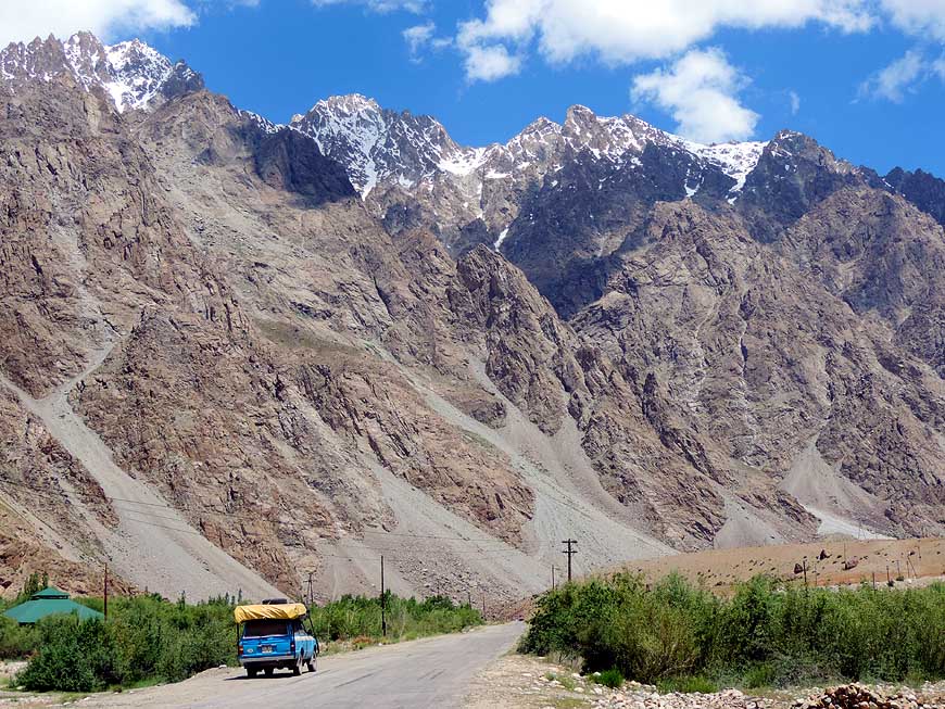
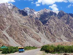
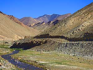
|
-
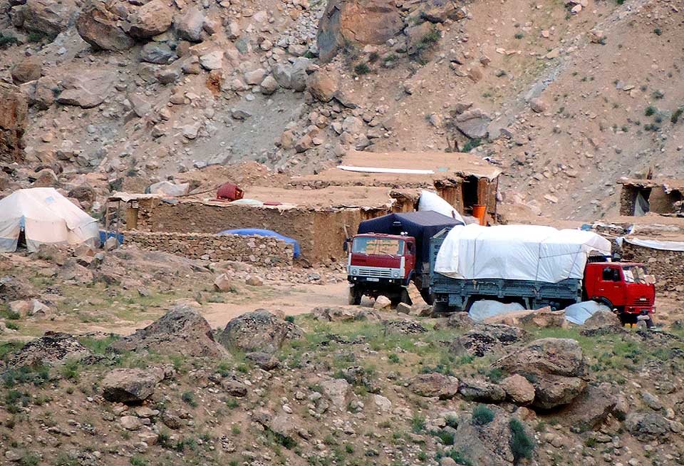
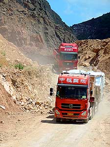
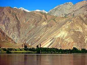
092
Chinese trucks, partly with trailers,
- cross us on the dusty road to the Panj river.
- They supply Tajikistan with goods from
- China and are real masters in managing
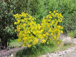
- the most critical passages
|
-
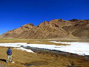
093
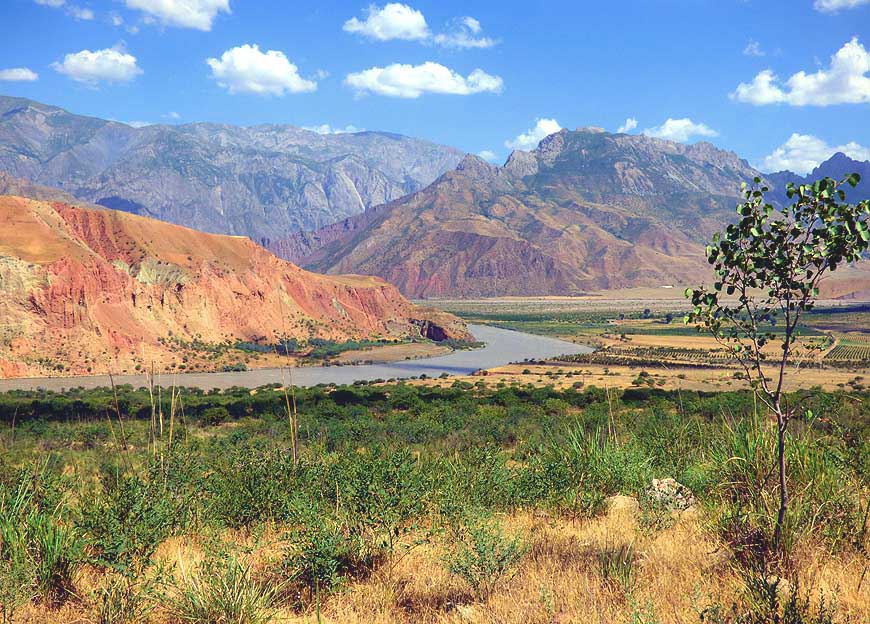
Scenery at the Panj river after descending
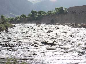
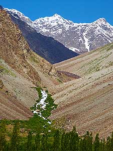
- from the height of 6'500 ft. [1Æ980m] in Shurabad
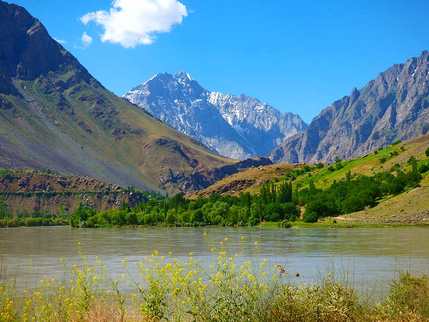
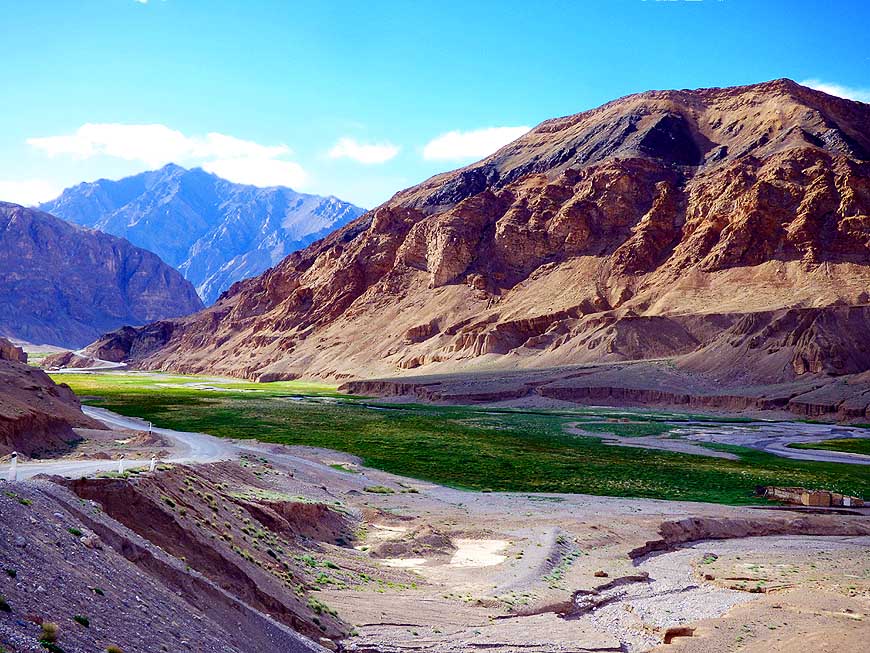
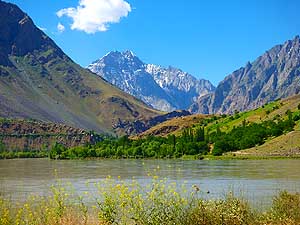
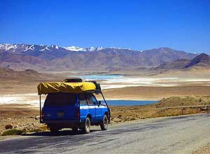
- to 2'700 ft. [825m]. On the other side of the
- relatively narrow river is Afghanistan. ItÆs possible
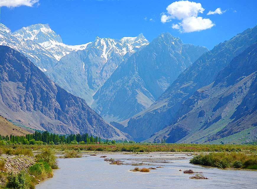
- to drive along the river for about 415 miles
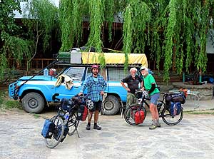
- [670km] (incl. Wakhan area) û in Khorog we
- have seen enough of it after 225 miles [360km]
|
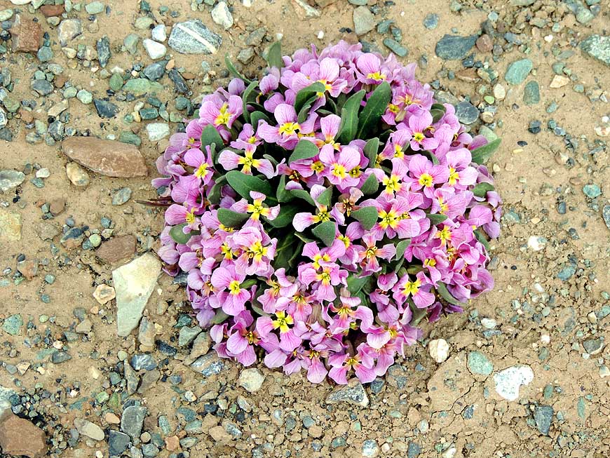
-
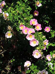
|
-
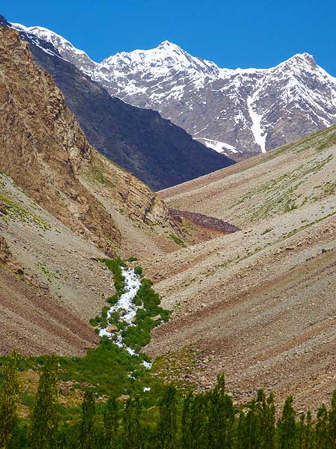
-
|
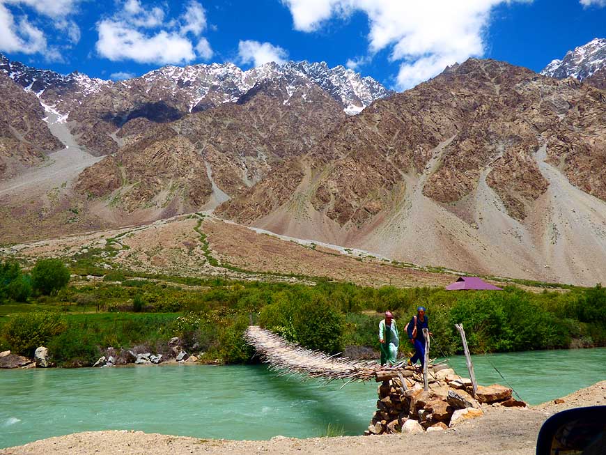
-
-
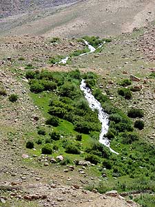
|
-
-

|
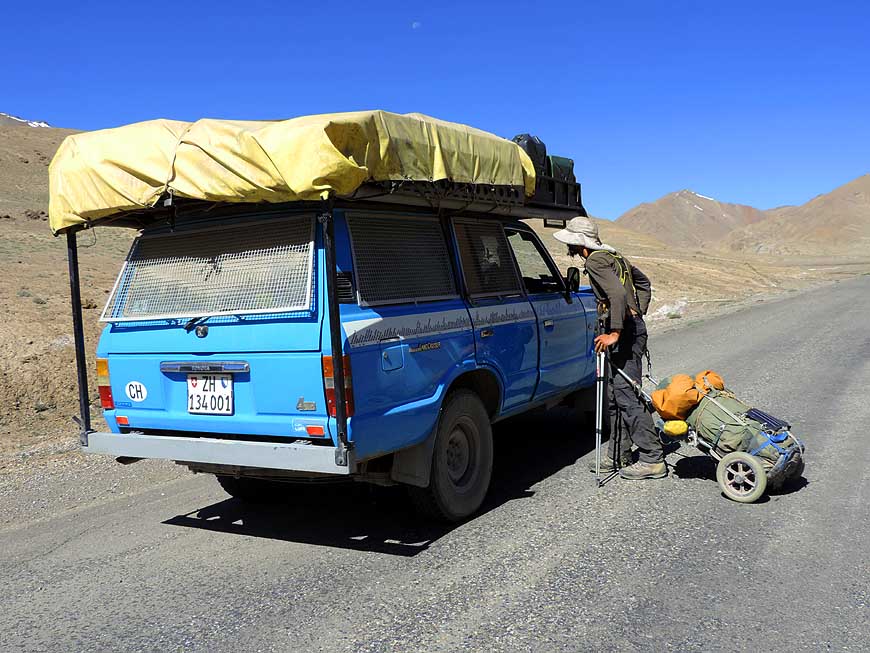
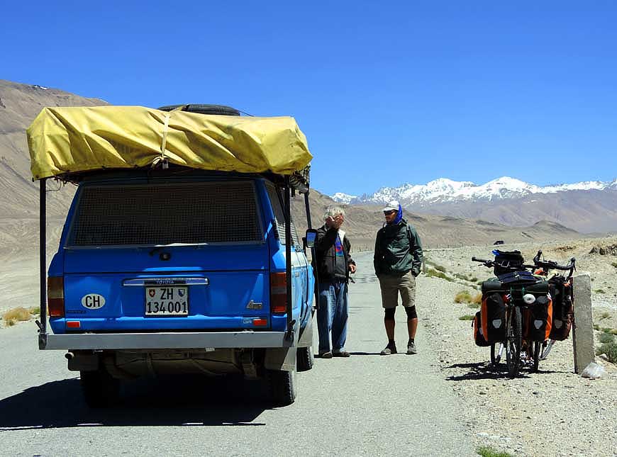
-
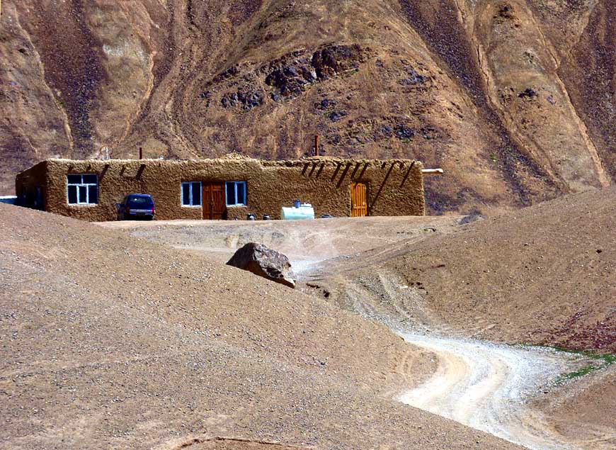
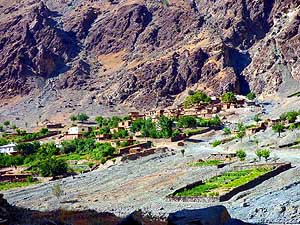
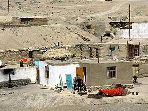
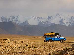
094 One of the adobe hamlets set among
- patches of greenery on the Afghanistan side
- during our 225 miles [360km] long drive along
- the Panj border river on a mostly dreadful
- track and through deep and narrow gorges
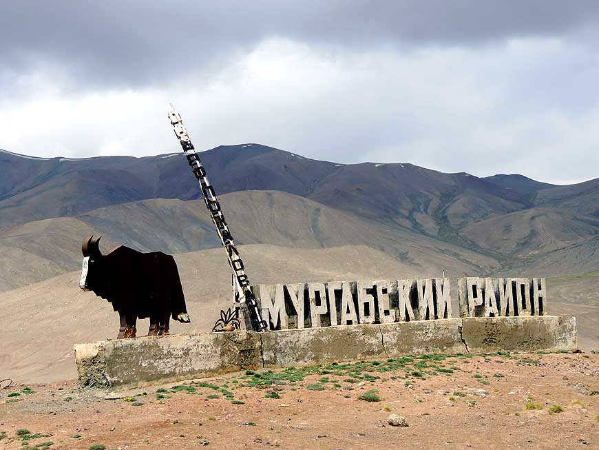
|
-
095 Part of the recreation center ôChorchamanö
- that was erected at the little village of Patkunob
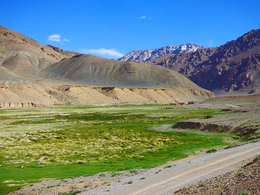
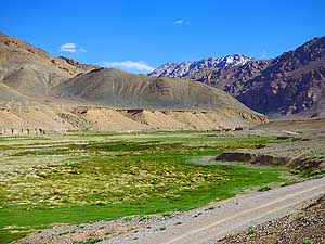
- before Kalaikhum. This is already since 43 miles
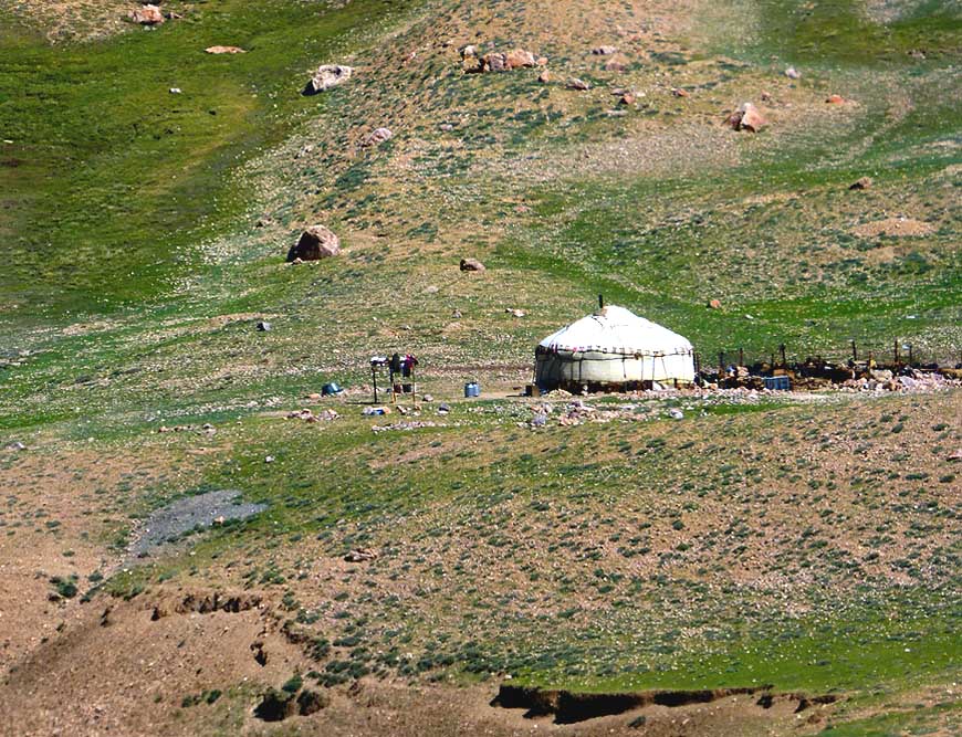
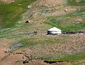
- [70km] (and will remain until the Kyrgyzstan
- border) the autonomous province of Gorno
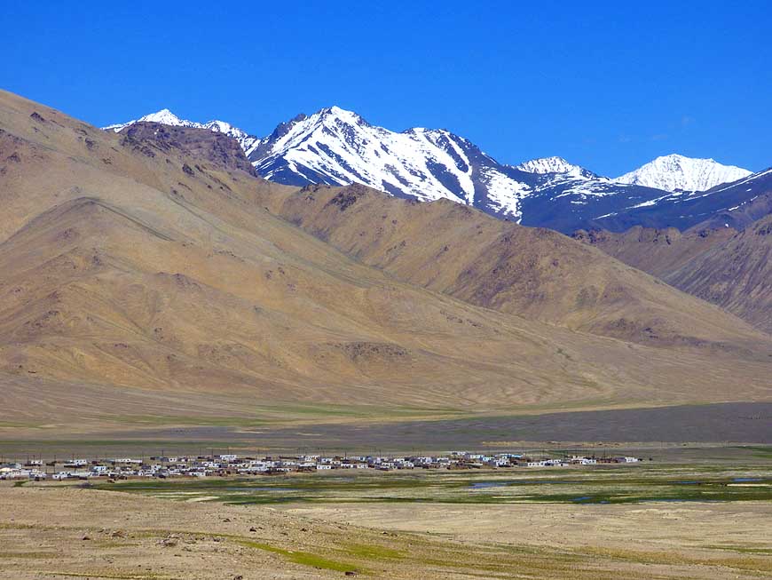
- Badakhshan (GBAO), where a permit is
- compulsory that is available either from the
- consulate together with the visa or otherwise
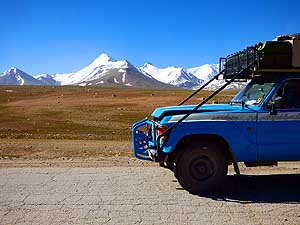
- from OVIR in Dushanbe (38.57126/68.79722)
|
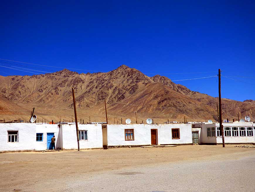
-
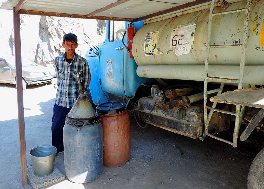
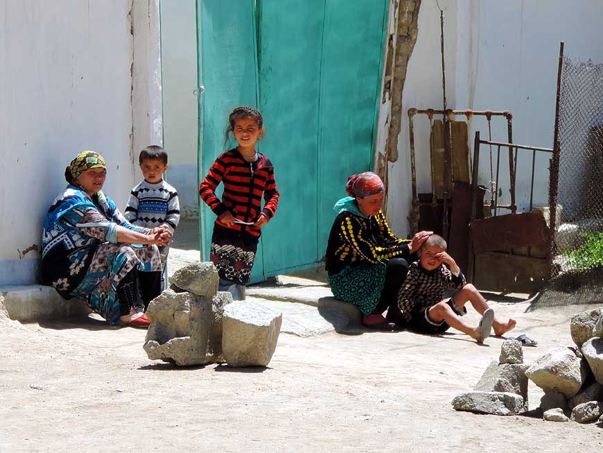
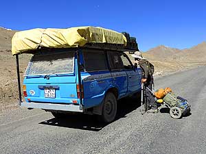
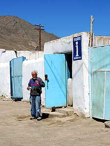
096 The fuel pumps in
Kalaikhum are
- empty or they donÆt work. Fuel is sold
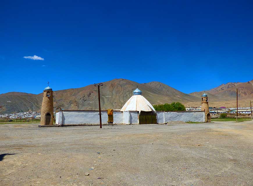
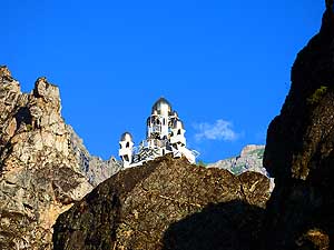
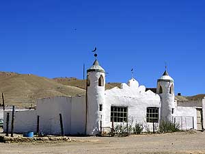
- along the road either from tankers,
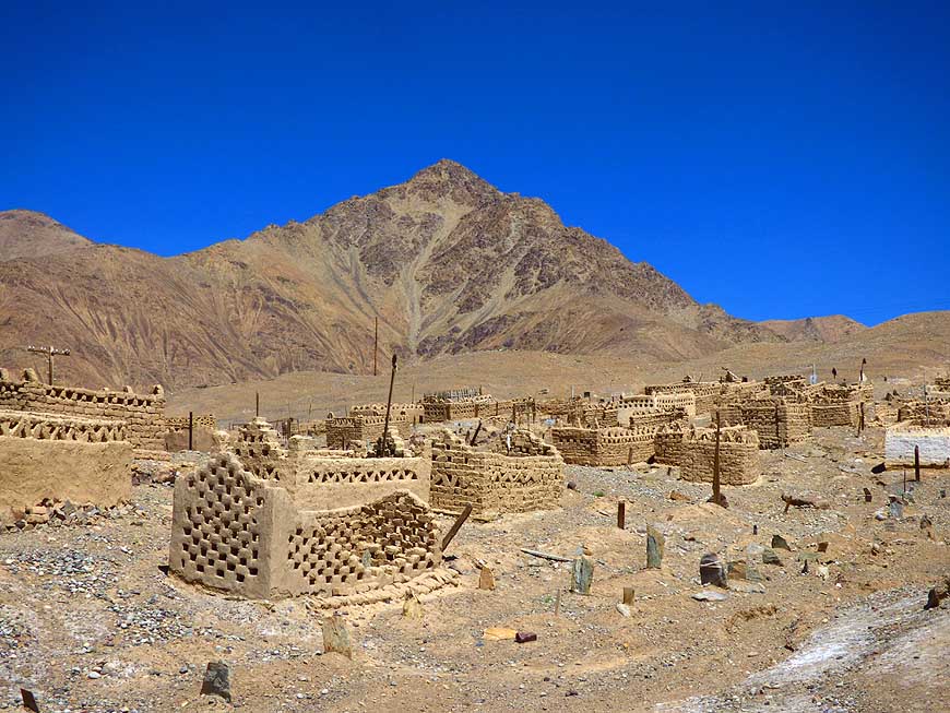
- jerrycans or barrels. We bunker
- 21 gallons [80 liters] from jerrycans
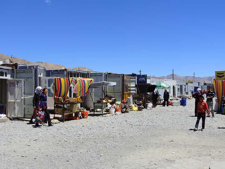
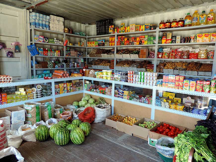
|
-
|
-
-
|
-
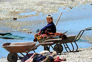
-

|
-
-
|
-
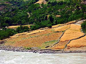
097 On the Afghanistan side of the Panj
- river grain harvesting is in full swing. The
- yellow grain fields are in sharp contrast to
- the deep green trees surrounding them
|
-
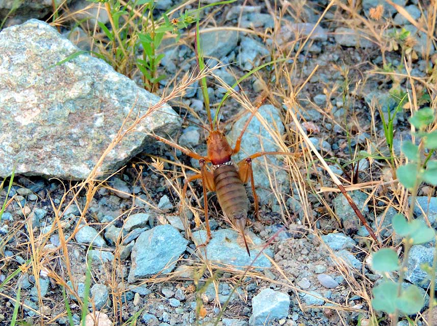
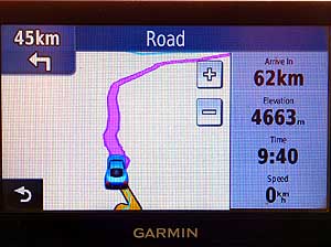
098 On her discovery tour Liliana almost
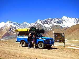
- steps on this well camouflaged cricket. The long
- spike at the back is for laying eggs (ovipositor)
|
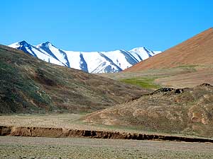
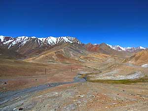
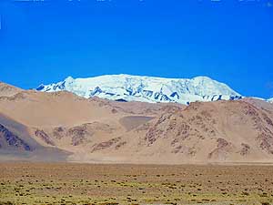
-
099 After the mouth of the
Vanj Valley into the
- Panj River û halfway between Kaleikhum and
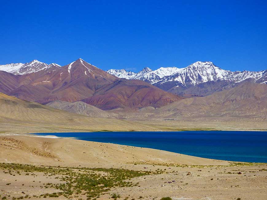
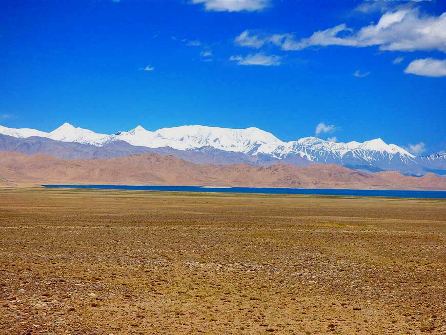
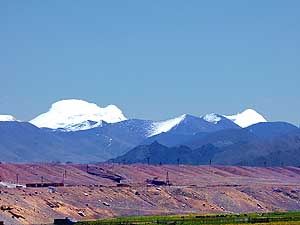
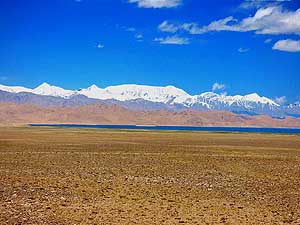
- Rushan û golden fields of grain reaching up to the
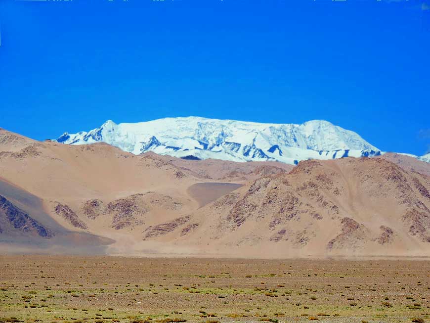
- slopes dominate the scenery on the Afghan side
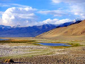
|
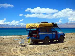
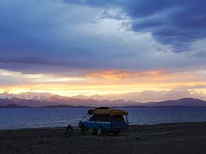
-
|
-
-

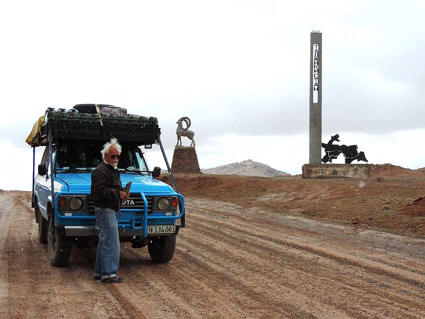
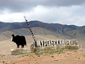
|
-
-
|
-
-
|
-
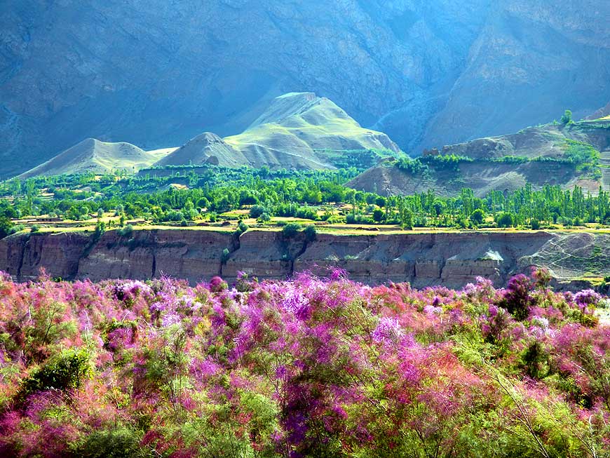
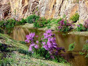
100 Nature is exploding along the water
- ways. Wherever we look, carpets of pink
- flowering bushes cover the plain à..
|
-
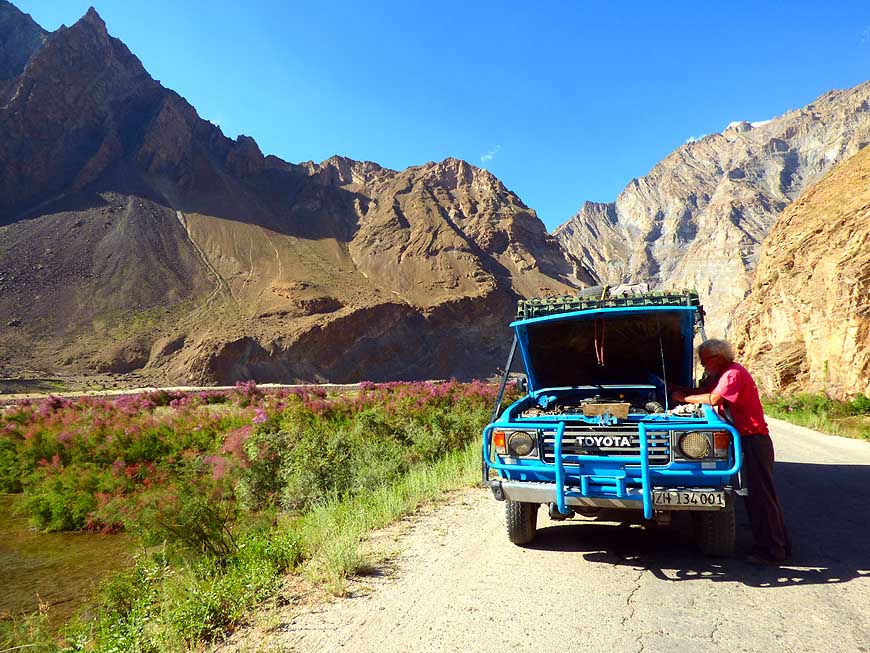
101 à.. on this idyllic spot our Land
- Cruiser gives us trouble once more.
- For the umpteenth time, Emil is cooling
- down the carburetor with water à..
|
-
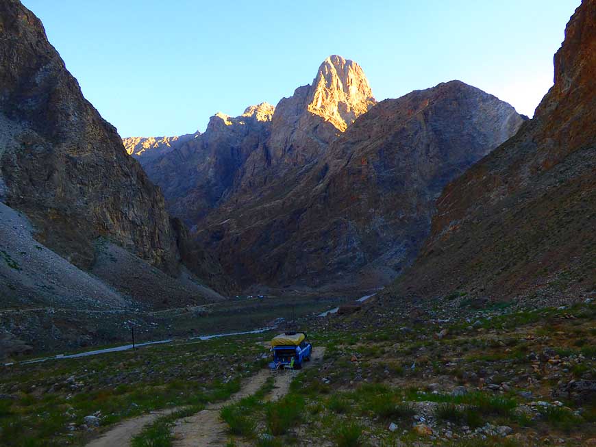
102 à.. while Liliana
takes the
- opportunity to explore the surroundings
- and enjoy the beauty of nature
|
-
|
-
-
|
-
-

|
-
-
|
-
103 About 9 miles [15km] before Yarkh
- Lake or 27 miles [44km] before the ôcityö of
- Rushan, the narrow valley opens slightly and
- we find a small and levelled camping spot
- squeezed between high rising mountain cliffs à..
|
-
104 à.. on the other side of the Panj river,
- on the Afghan side, stand two fully loaded
- trucks next to adobe dwellings and a white
- tent. A military camp? This road leads in
- 560 miles [900km] to Kabul
|
-
105 We follow further the
Panj river.
- Due to the snowmelt it became a
- dangerous looking brownish ômonsterö,
- carrying everything down
|
-
|
-
-
|
-
-

|
-
-
|
-
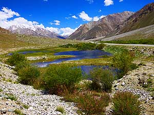
106 Short of Rushan, the road passes the
- idyllic treelined Yarkh Lake, formed naturally
- by the Panj river û probably the prettiest
- place to live in this otherwise forbidding region
|
-
107 View towards the remote, wild and
- adventurous Bartang Valley, which access
- is shortly after the big settlement of Rushan.
- ItÆs possible to drive from here by 4x4
- directly to Karakul lake
|
-
108 A landscape that could
be in
- Switzerland û at the continuation
- along the Panj river to Khorog
|
-
|
-
-
-
-
|
-
-

|
-
-
-
-
|
-
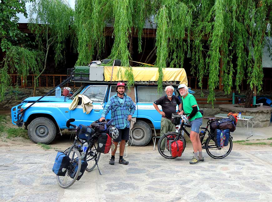
109 At the Pamir Lodge in Khorog, we
- meet the two cyclists Kaya and Lauro, father
- and son from Switzerland. They are ready
- to take off to the next Pamir Highway section
|
-
110 Two inseparable little friends from
- Khorog. Khorog ist the capital of the
- autonomous province Gorno Badakhshan
- (GBAO) with about 30Æ000 people (2003)
|
-
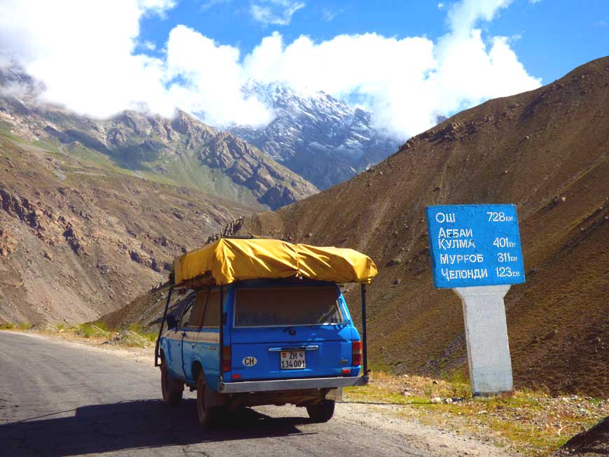
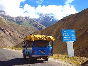
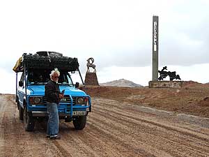
111 Road sign to Osh (452
miles)
- [728km] in Kyrgyzstan on the Pamir
- highway. Still a long way to go!
|
-
|
-
-
-
-
|
-
-
|
-
-
-
-

|
-
112
It is impressive how tall flowers
- can grow also in such alpine altitudes
- (above ▒10Æ000 ft.) [▒3Æ000m]
|
-
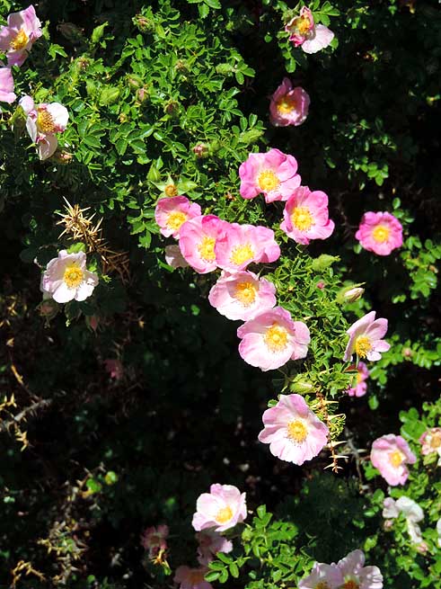
113
Also delicate bush roses seem
- comfortable on these heights
|
-
114
The pink flowers grow on the ground
- compactly around a garland of leaves
|
-
|
-
-
-
-
|
-
-
|
-
-
-
-

|
-
115
Our LandCruiser climbs along the
- barren high Rushan range to higher altitudes
|
-
116
A glittering mountain torrent makes its
- way downhill, producing greenery on its sides
- û a sight that appears over and over again
|
-
117
A suspension bridge of the old style, built
- only from twigs. Two courageous ladies cross the
- Gunt river to get from their home to the road
|
-
|
-
-
-
-

|
-
-
|
-
-
-
-

|
-
118
A timeless sight: Mountain
- scenery near Vankala
|
-
119
Where there is water, there is life. Patches
- of green along a little torrent in a field of scree
|
-
120
The dwelling is pretty modest, but the
- satellite disk on the roof is not missing
|
-
|
-
-
|
-
-
|
-
-

|
- The Pamir region attracts each year cyclists, bikers, car
travelers and hikers û it is still a real challenge.
- Here everyone stops when crossing each other and shares
information. This was still the case between 1989 and 1993 in
Africa
- when we crossed from North to South. Nowadays, this does not
happen anymore, nobody needs obviously the others advice
|
-
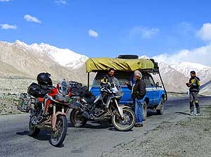
121 Two German bikers near Jelandy
- hotsprings. We spend one night together
- at an altitude of 11Æ800 ft. [3Æ600m]
|
-
122 A German hiker. He walks
- around 30 miles [50km] daily
|
-
123 Two English cyclists,
who are on their
- way from Osh via Pamir to Dushanbe. They have
- to deal constantly with the strong headwind
|
-
|
-
-
|
-
-

|
-
-
|
-
124 The idyllic alpine pond-dotted scenery
- before the ascent to the Koy-Tezek Pass
- (14Æ016 ft.) [4Æ272m] in direction Murgab
|
-
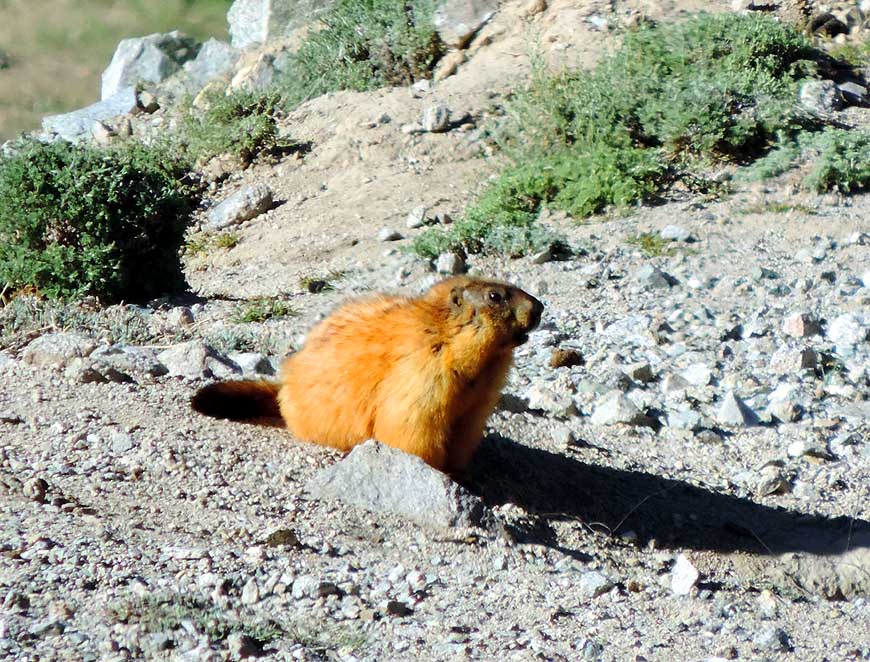
125 A marmot is warming up in the sun.
- It has not yet spotted us!
|
-
126 In a beautiful setting
between a clear
- mountain stream and snow covered peaks:
- The village of Jelandy with its hot springs
|
-
|
-
-
|
-
-
|
-
-
|
-
127 This virgin mountain scenery with its
- wide river valley remembers us of Alaska,
- which we explored in summer 1985
|
-
128 As our LandCruiser steadily gains height
- over the Koy-Tezek-Pass, glacier-wrapped
- mountains appear at every corner
|
-
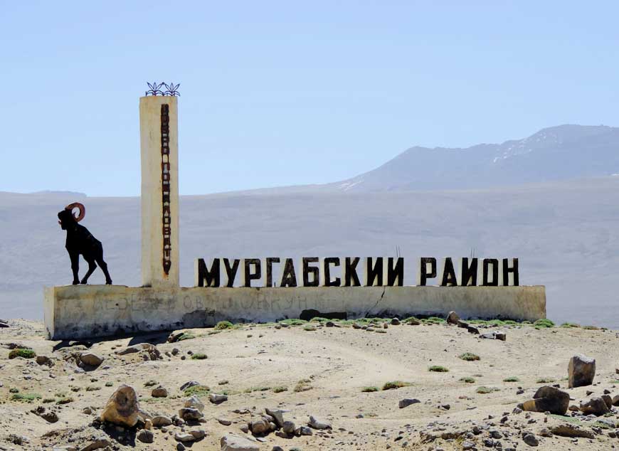
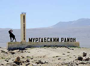
129 The monument at the
roadside of M41
- û Pamir Highway û says that we are entering
- on the eastern side of the Koy-Tezek Pass
- the district of Murgab
|
-
|
-
-
|
-
-

|
-
-
|
-
130
|
-
131
|
-
132
|
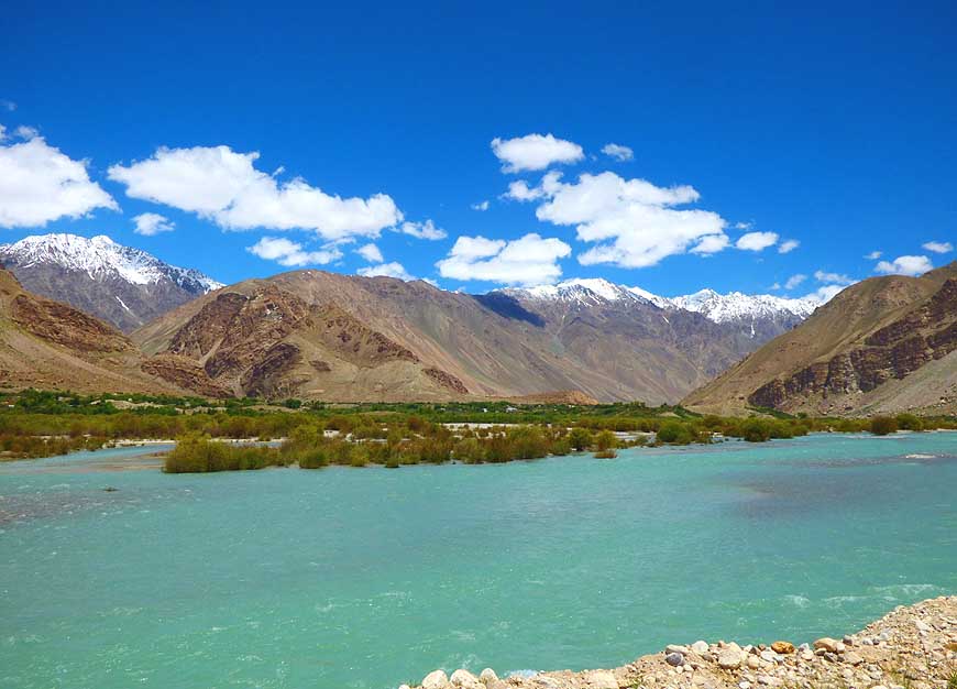
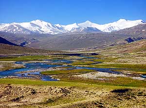
- Our LandCruiser is rolling towards the western Pamir high plateau
with its many lakes (Bulun-Kul,
- Yashil-Kul, Sassyk-Kul, Tuz-Kul, etc.), which lies on an altitude
of almost 13Æ000 ft. [4Æ000m]
|
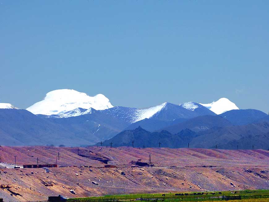
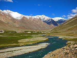
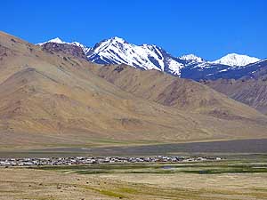
- The village of Alichur with its white washed
- flat houses, about 60 miles [100km] before
- Murgab, lies south of the North Alichur Range
|
-
|
-
-
|
-
-
|
-
-

|
-
133 It gets increasingly greener the closer
- we come to Murgab. Halfway between
- Alichur and Murgab, there is the Nayzatash
- Pass to cross: 13Æ573 ft. [4Æ137m]
|
-
134 Nomads have put up their yurt
- for the summer months in this isolated
- and harsh environment
|
-
135 Again ôgreeneryö
shortly before
- the final descent to Murgab
|
-
|
-
-

|
-
-
|
-
-

|
-
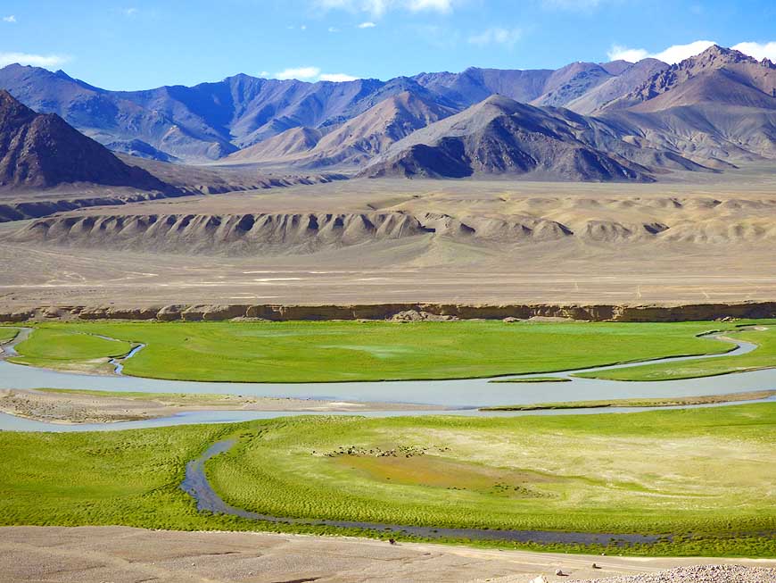
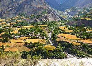
136 The Murgab valley with its green
- riverside pasture sets off vividly against
- the rugged rock walls
|
-
137 Postcard-perfect: Panoramic view
- across the green Murgab river valley with
- the first houses of Murgab and the bleak
- mountain range in the back
|
-
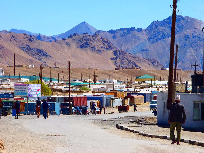
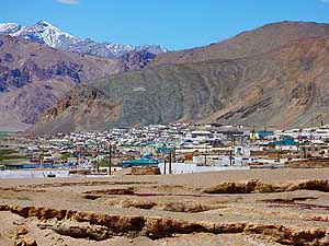
138 The small town of
Murgab, on an
- altitude of 11Æ732 ft. [3æ576m] with a
- population of 6æ500, where about 25%
- are Pamiris (Tajiks) and 75% Kyrgyz
|
-
|
-
-
-
-

|
-
-
|
-
-
-
-

|
-
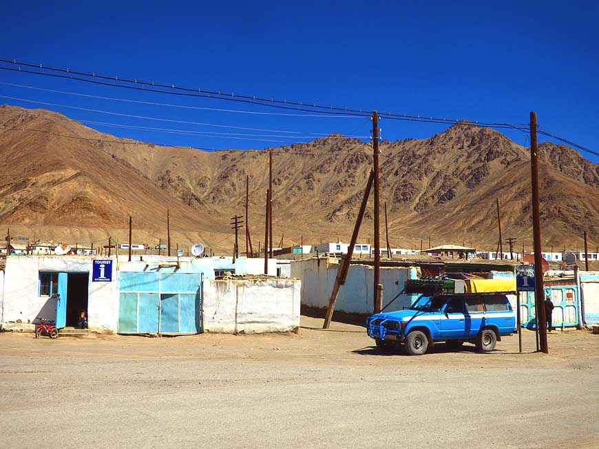
139
Our LandCruiser in front of the
- nondescript tourist office in Murgab
|
-
140
Emil is waiting outside of MurgabÆs
- tourist office for the English speaking lady
- who has been called by phone
|
-
141
MurgabÆs white washed ôbox housesô
- with the background of the bleak mountain
- ridge evoke a bit a feeling of Arabia
|
-
|
-
-

|
-
-
|
-
-
|
-
142 A woman from the mountain village
- of Murgab with her typical head scarf
|
-
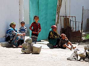
143 A family is sitting outside its home
- watching the village live, it is the only pass-time
|
-
144 They pass their time
on the street (what
- they are still able to do!): Children in Murgab
|
-
|
-
-
|
-
-
|
-
-

|
-
145 The most appealing village building in
- Murgab is its white washed mosque along
- the Murgab-Tashkurgan road
|
-
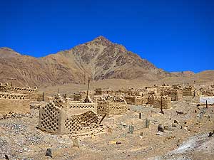
146 A cemetery of a special kind: The tombs
- in Murgab are made of adobe û also along the
- Murgab-Tashkurgan road (eastern end of village)
|
-
147 The stone mosque at
the river side
- in Murgab with its two brick minarets
|
-
|
-
-
|
-
-

|
-
-
|
-
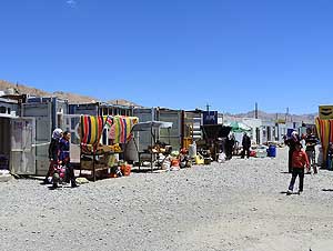
148 Not a colorful market: The bazaar in
- Murgab consists of a row of unattractive container
|
-
149 Clean, orderly and well-stocked:
- A food container at Murgabæs bazaar
|
-
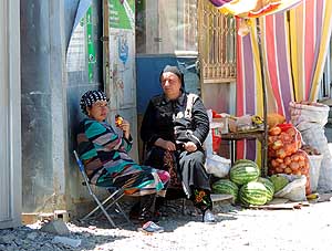
150 Two market women
gossiping at the
- Murgab bazaar while waiting for customers
|
-
|
-
-
-
-
|
-
-

|
-
-
-
-
|
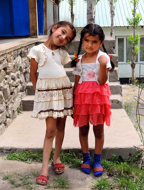
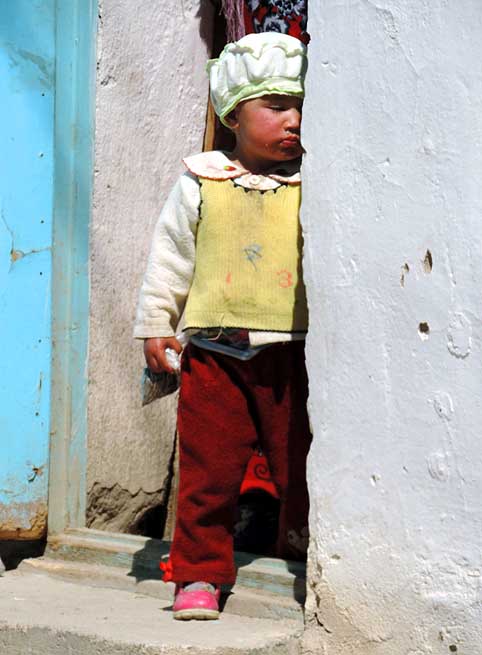
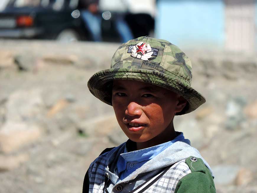
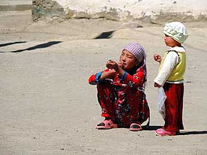
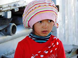
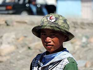
- Faces of children in Murgab
|
-
151
|
-
152
|
-
153
|
-
|
-
-

|
-
-
|
-
-
|
-
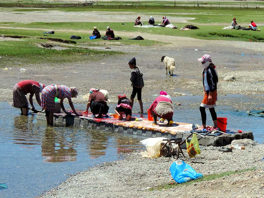
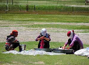
154 Saturday at the riverside in Murgab:
- Girls are busy scrubbing carpets à..
|
-
155 à.. ôSomebody has to supervise
- the ladies!ô says the boy on the pushcart
|
-
156 à.. laundry day: Work
is
- easier in company of friends
|
-
|
-
-
|
-
-
|
-
-
|
-
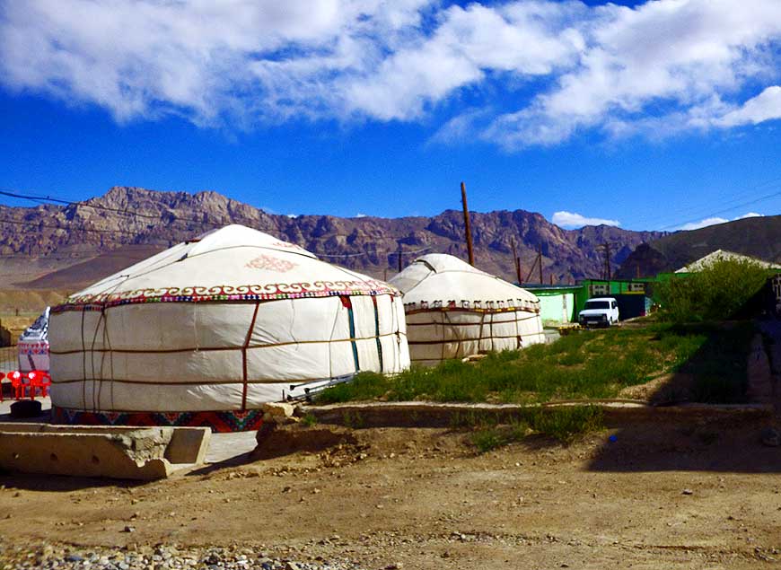
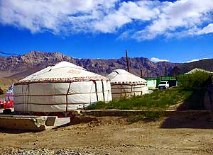
157 Two traditional guest yurts û dome
- tents used by nomads û in front of the
- Pamir Hotel in Murgab
|
-
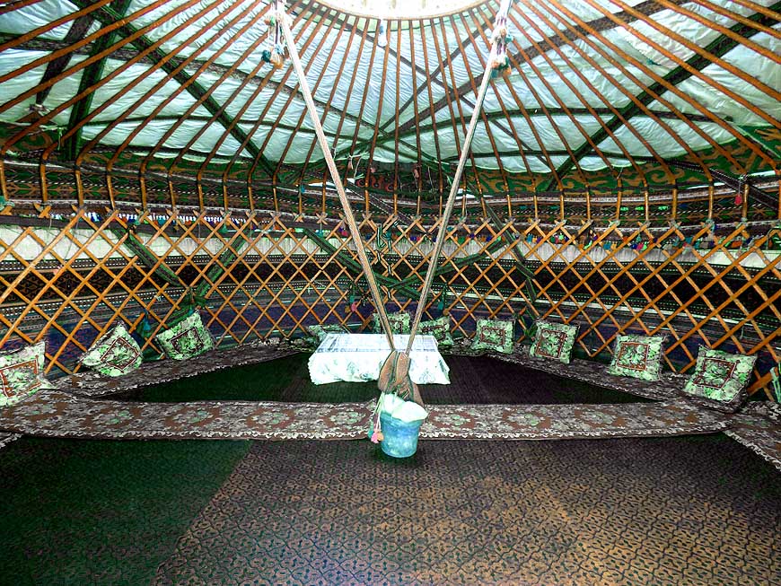
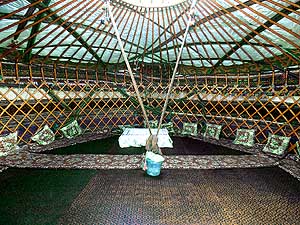
158 The appealing interior of a yurt: The
- framework is made from wood, the walls are
- covered with carpets with different motifs, the
- atmosphere is warm and welcoming à..
|
-
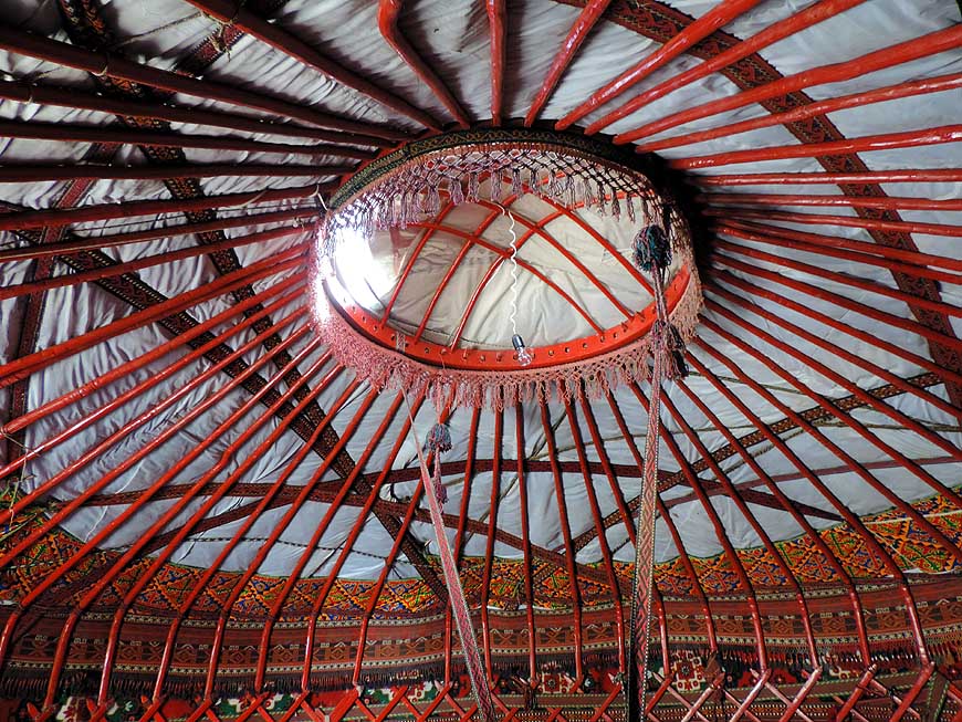
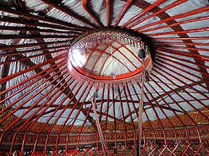
159 à.. the roof opening
of a yurt
|
-
|
-
-
|
-
-
|
-
-
|
-
160 Murgab seen from the river. There is
- no electricity in the village, therefore also any
- fuel pumps. Fuel is traded in barrels, buckets,
- jerrycans and with funnels. Only a few
- have a generator
|
-
161 There is no hectic in Mugab with
- its character of a ôpioneerô village. Daily life
- in the simple houses happens quietly always
- in the same framework
|
-
162 Matching entirely with
nature:
- An adobe house at the foot of the
- mountain range in Murgab
|
-
|
-
-
|
-
-
|
-
-
|
-
163 The white mountain peaks that rise
- east of Murgab belong already to China
|
-
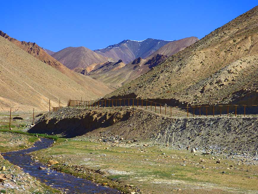
164 The fence along the high-altitude
- highway marks the ôneutral zoneô to China.
- It was built by China and forms a kind of
- security zone from China. The actual border
- however lies up to 12 miles [20km] more
- to the North resp. to the East of the fence
|
-
165 At the climb to the
- 15Æ272 ft. [4æ655m] high Ak-Baital
- pass we encounter snow for the first
- time again since Turkey
- (May 30th, 2013). Liliana wants
- once again to know how it feels
|
-
|
-
-
|
-
-
|
-
-

|
-
166 Before reaching Ak-Baital pass
- (= White Horse) on an altitude
- of 15Æ272 ft. [4æ655m]
|
-
167 We reached the highest drivable
- point of the Pamir Highway: The Ak-Baital
- pass with a height of 15Æ272 ft. [4æ655m]
- û GPS shows 15Æ299 ft. [4Æ663m]
|
-
168 Emil and our
LandCruiser on the
- ôRoof of the Tajikistan-Worldô, on the
- 15Æ272 ft. [4æ655m] high Ak-Baital pass
|
-
|
-
-

|
-
-
|
-
-
|
-
169 The high mountain region around Ak-Baital
- pass is bleak and entirely uninhabited. Not
a
- single plant is growing; view
in direction Murgab
|
-
170 We seal our achievement of having
- reached the highest point of the Pamirs
- with a remembrance picture
|
-
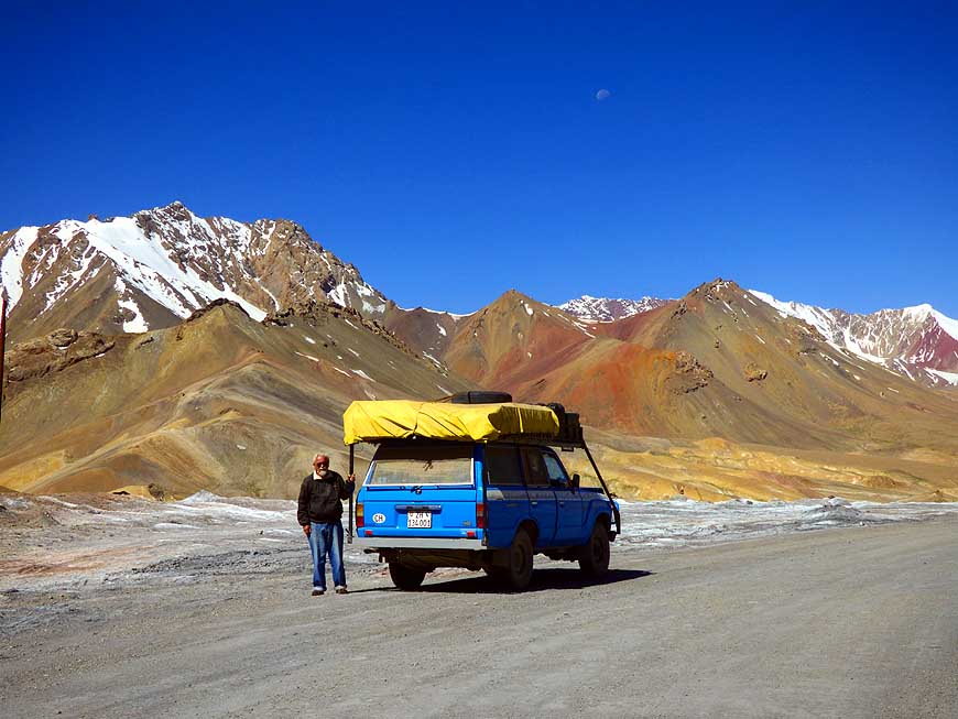
171 A range of colors in
brown-red pastel
- shades: The high mountain scenery of the
- Pamir Highway towards Lake Karakul
|
-
|
-
-
|
-
-
|
-
-
|
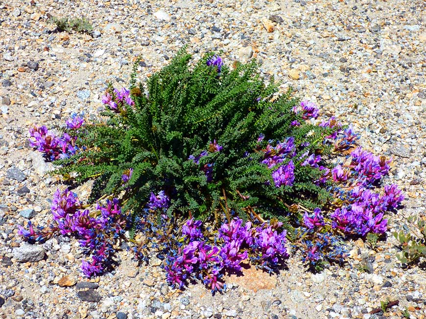
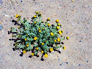
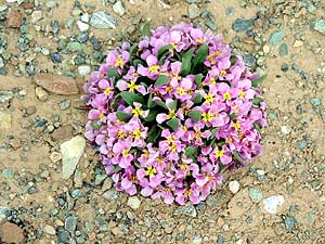
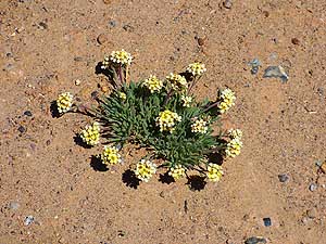
- The wonder of nature: Three flowers, which brave the harsh alpine
climate in all its forms, have unfold their full beauty
|
|
172 |
-
173
|
-
174
|
-
|
-
-
|
-
-
|
-
-
|
-
175 The azure-blue ribbon at the foot
- of the snow-capped mountain chain belongs
- to slightly salty Lake Karakul. It lies at
- 3æ914m altitude and is frozen until May
|
-
176 Glacier wrapped mountains of the
- Tanymas Range west of Lake Karakul
- (altitude 12Æ841 ft.) [3æ914m]
|
-
177 A little pond on the
eastern
- side of Lake Karakul
|
-
|
-
-
|
-
-
|
-
-
|
-
178 We set up camp in good weather at Lake
- Karakul at an altitude of 12Æ841 ft. [3æ914m],
- surrounded by the fascinating mountain peaks
- of North and East Pamir à..
|
-
179 à.. in the light of the setting sun
- our LandCruiser is shining beautifully
- against the backdrop of the white
- mountain peaks in the South à..
|
-
180 à.. then the sun sets
and
- simultaneously clouds approach from
- the south. ItÆs our last night in the
- remoteness of the alpine Pamir region
|
-
|
-
-

|
-
-
|
-
-
|
-
181 The sky is shrouded in clouds
- when we break off in the morning
- our camp at Lake Karakul
|
-
182 This road monument shows that
- we are now leaving Murgab and hence
- Tajikistan in direction Kyrgyzstan
|
-
183 With a couple of snow
flakes Tajikistan
- waves us good-bye on June 27th, 2016, û a
- country that became one of the highlights of our
- almost 32 years of around the world history
|
-
|
-
Next website of our 2nd
Central and North Asia trip 2016 to Russia:
-
Kyrgyzstan – from
Tajikistan border in Pamir to Kazakhstan
border at Karkara – June 27th to
August 9th, 2016
-
or:
- Back to the 1st part of the Tajikistan trip: Tajikistan Part 1
– May 31st to June 18th, 2016, from
Uzbekistan border to Dushanbe
|
- The African trip
2013-16:
- CapeVerde: Santiago/Praia
part 1 û November18th to December 13th, 2013
- CapeVerde: Fogo
û Dezember13th to 23rd, 2013
- CapeVerde: Brava
û December 23rd to 26th, 2013
- Cape Verde: Santiago/Praia
part 2 û December 26th, 2013 to February 28th, 2014
- Cape Verde: SÒo Nicolau û February
28th to March 13th, 2014
- Cape Verde: SÒo Vicente/Mindelo part 1
û March 13th to 20th, 2014
- Cape
Verde: Santo AntÒo/Eastern side part 1 û
March 20th to April 7th, 2014
- Cape
Verde: Santo AntÒo/Western side part 2 û
April 7th to 10th, 2014
- Cape
Verde: SÒo Vicente/Mindelo part 2 û
April 10th to 29th, 2014
-
Namibia Part 1 û
from Walvis Bay to Windhoek
- Angola Part 1
û
September 26th to October 4th, 2014
- Angola Part 2 û
October 4th to 22nd, 2014
-
Namibia Part 2 û
from Windhoek to the Angolan border, back again and on to
South Africa
-
South Africa
Part 1 û
from Namibia border to Capetown û
January 22nd to February 23rd, 2015
- 3rd Major Repair of our
LandCruiser FJ60 - 1982 (due to two broken sideshafts)
-
South Africa Part 2 û from Capetown to Tsitsikamma National Park û
February 24th to March 13th, 2015
- South Africa Part 3 û from
Addo National Park to the Lesotho border û March
13th to April 7th, 2015
-
Lesotho û April 7th to 15th, 2015
-
South Africa Part 4
û from the Lesotho to the Swaziland border û
April 15th to 23rd, 2015
-
Swaziland û April 23rd to 28th,
2015
-
South Africa Part 5
û from the Swaziland to the Botswana border
û April 28th to May 15th, 2015
-
Botswana
-
Zimbabwe
-
Mozambique
-
Malawi
-
Armed Robbery in Malawi on July
31st/August 1st, 2015
-
Tanzania
-
Kenya
-
Ethiopia Part 1 û from Kenya to
Djibouti –
October 25th to November 18th, 2015
-
Djibouti –
October 18th to 27th, 2015
-
Ethiopia Part 2 –
from
Djibouti to
Sudan –
November 27th to December 9th, 2015
- Sudan –
December 9th, 2015 to January 8th, 2016
|