-
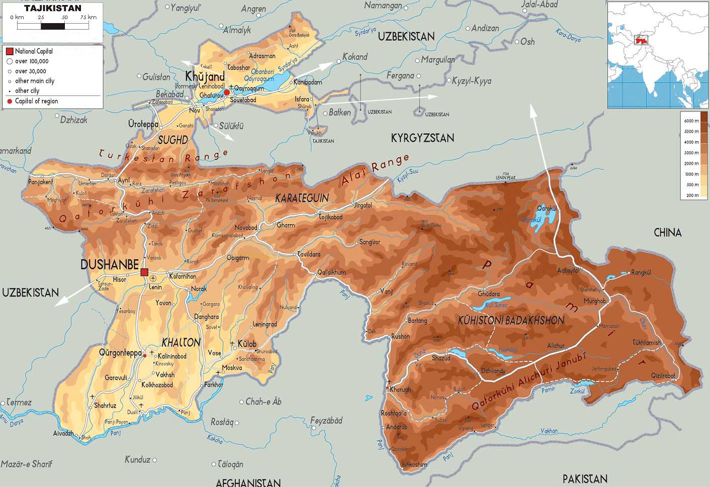
- Tajikistan Map
|
-
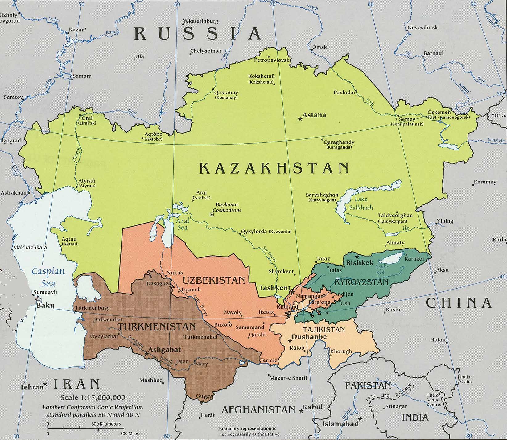
- Map
of Central Asia
|
|
-
|
- latest picture:
June 17, 2016
|
-
-
|
-
-
|
-
-
|
-
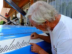
001 Emil adds Tajikistan to our country ribbon.
- It is May 31st, 2016, when we cross into our
- 186th country Tajikistan at the Uzbek border
- post of Oybek (Chanak). Tajikistan is bordering
- Uzbekistan, Kyrgyzstan, Afghanistan and China
|
-
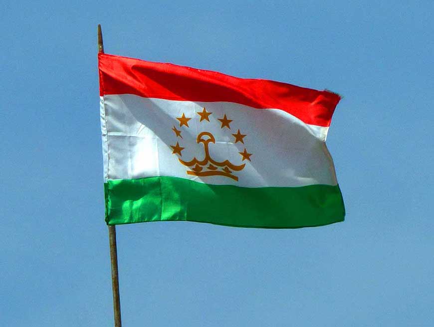
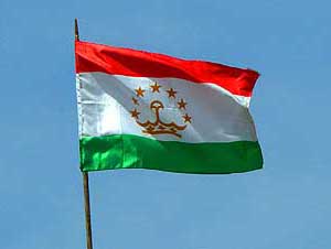
002 In Khujand, the second biggest city
- (metro 750'000 people), the Tajikistan flag
- is waving in the wind under a blue sky. During
- Soviet times the city was named Leninabad
|
-
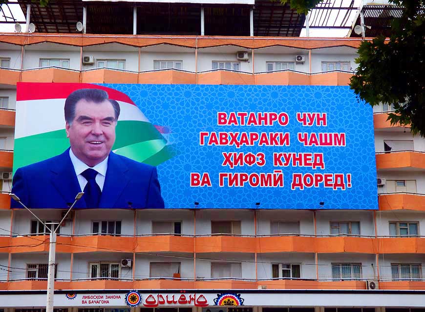
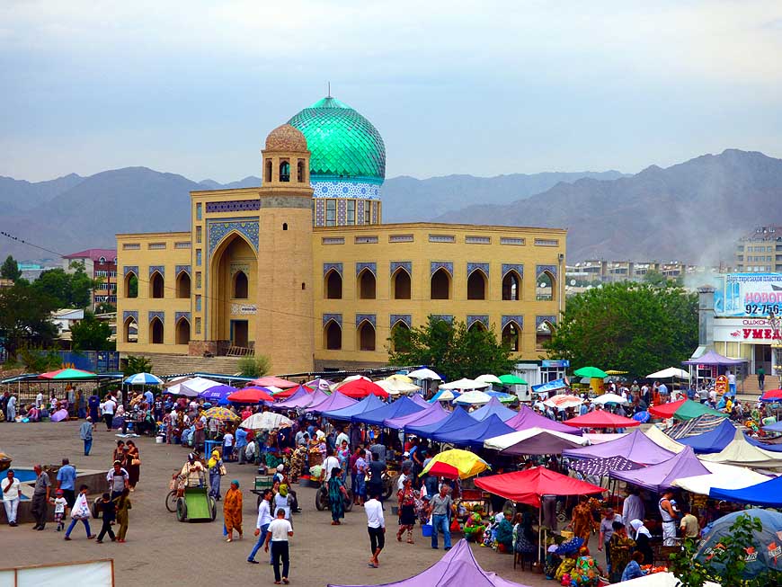
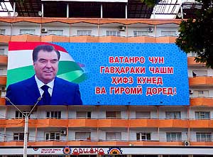
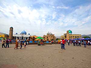
003 President Emomali
RahmonovÆs portrait
- is greeting at öevery cornerô, here at the big
- square at the Panchshanbe Bazaar in Khujand.
- He is President of the Republic of Tajikistan
- since November 16th, 1994
|
-
|
-
-
|
-
-
|
-
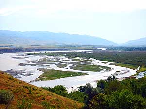
-
|
-
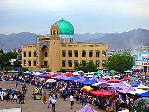
004 A striking contrast to the lively bazaar
- is the dome of the Sheikh Massal ad-Din
- complex (Sheikh Muslihiddin mausoleum)
- at the Panchshanbe Square in Khujand
|
-
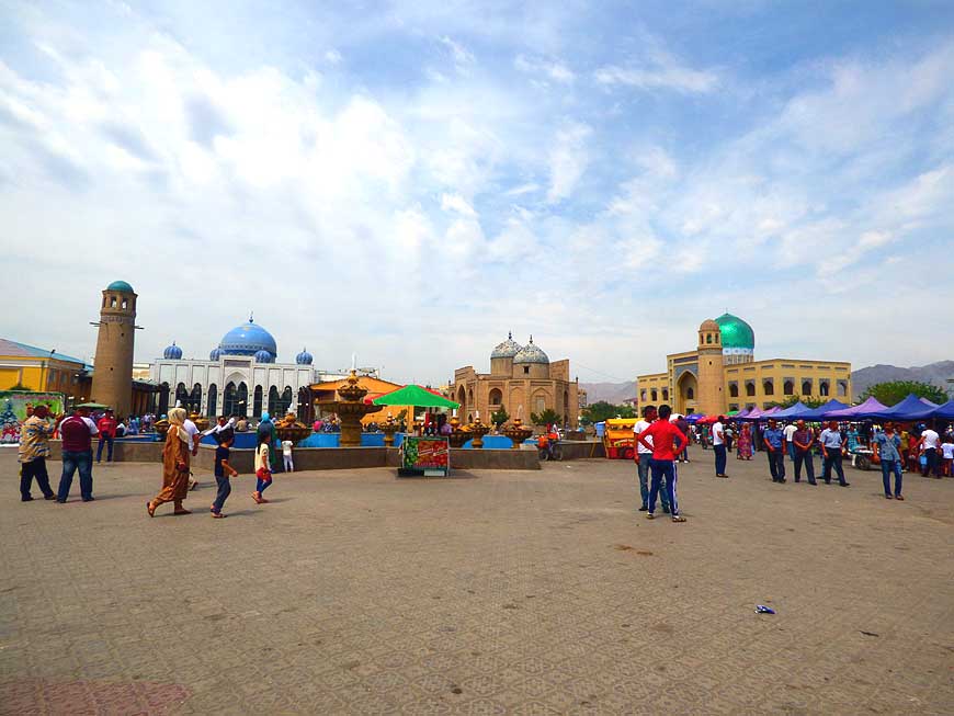
005 The impressive Sheikh Massal ad-Din
- Complex at Panchshanbe Square in Khujand
- with its mausoleum in the middle, flanked by
- two mosques with up to 69 ft. [21m] high
- brick minarets
|
-
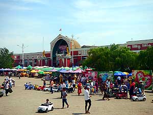
006 In front of the
pink-white painted
- market hall on Panchshanbe Square in
- Khujand small vendors and rentals of
- children electric cars are making business
|
-
|
-
-
|
-
-
|
-
-
|
-
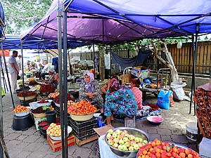
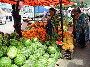
007 Cherries, apricots, apples and
- nectarines are waiting for buyers in
- front of the market hall in Khujand
|
-
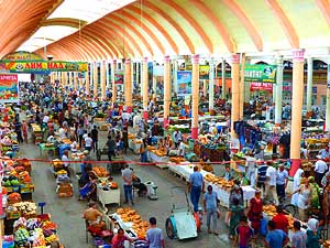
008 The Panchshanbe Bazaar in the elegant
- hall in Khujand, built in 1964, is said to be
- one of the biggest and best-stocked
- markets in Central Asia
|
-
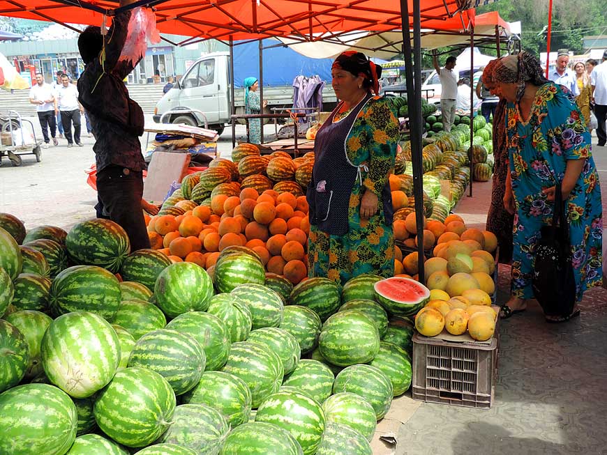
009 It is peak season for
water and
- honey melons. They are for sale in great
- quantities and are sold like hot cakes in
- the current heat wave of 97░F [36░C]
|
-
|
-
-
-
-
|
-
-
|
-
-
-
-
|
-
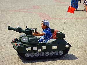
010
Early practice only makes the master
- (general): The boy is sitting proudly and fully
- concentrated on his electric tank and drives on
- Panchshanbe Square, navigated by his father à..
|
-
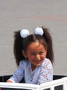
011
à.. the sweet little girl in her
- ônormal carô is also moving around
- and seems to fully enjoy it too
|
-
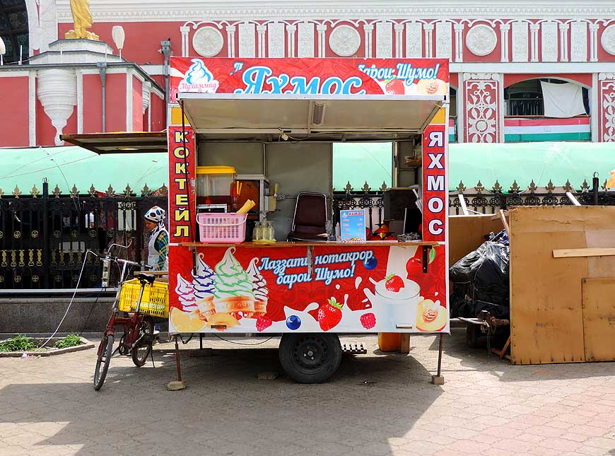
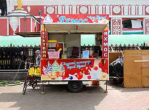
012
Also the ice cream seller is
- not missing at Panchshanbe Square
|
-
|
-
-
-
-
|
-
-

|
-
-
-
-
|
-
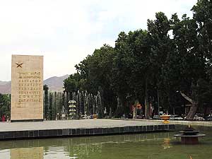
013
The ôEternal Flameö and a memorial
- ôin honorö of the Soviets in a small park
- along Lenin Street in Khujand
|
-
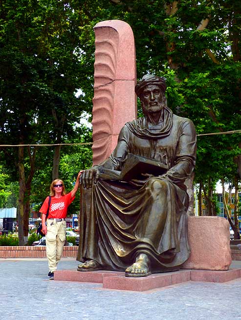
014
Liliana looks small in front of the
- imposing statue of Kamal Khujandi,
- a poet of the 14th century
|
-
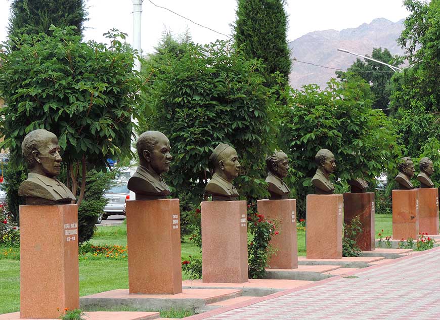
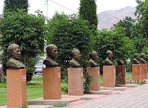
015
Busts of the ôStars of Khujandö
- line the way in the same-named park
|
-
|
-
-
|
-
-
|
-
-
|
-
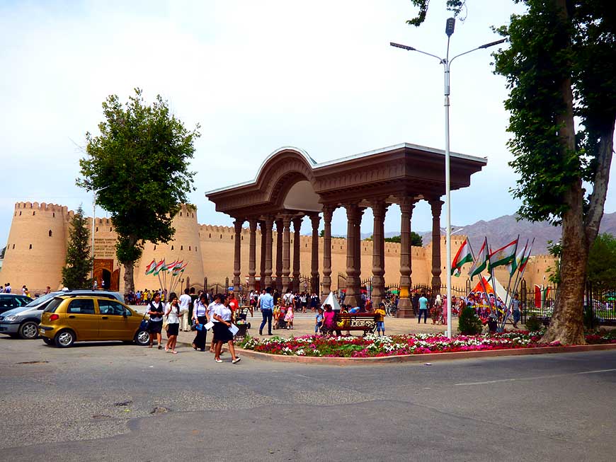
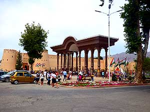
016 10th-century Citadel in Khujand: It once
- was 3¥ miles [6km] long with 7 gates. The main
- section remains occupied by the army, but houses
- museums and is still a popular place for recreation
|
-
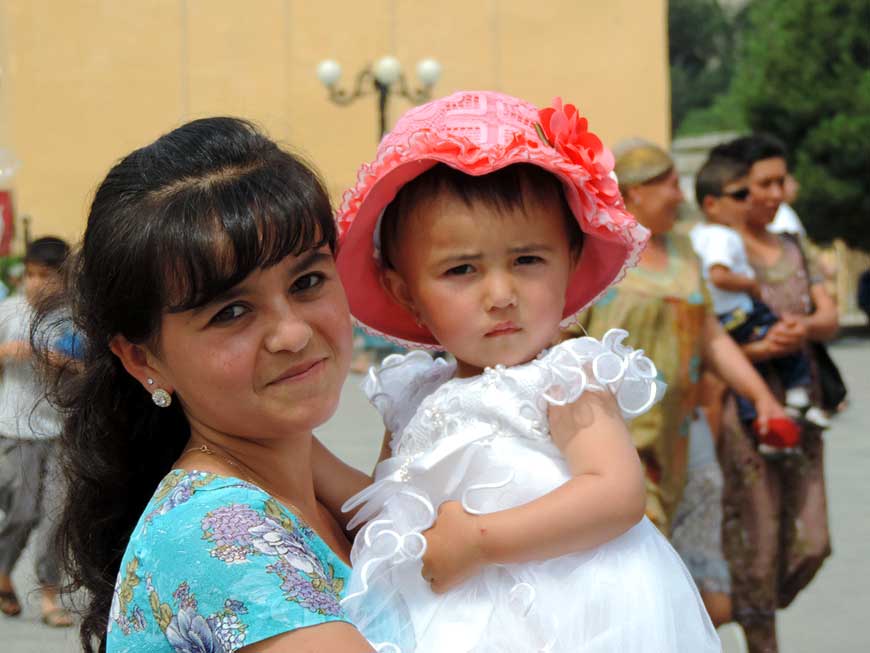
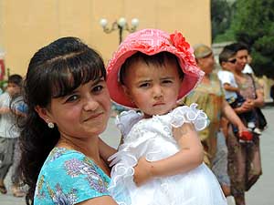
017 The young mother is carrying proudly
- her young festively dressed child in her arm
|
-
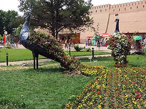
018 The rear of two
peacock figures in
- the small park near the citadel is filled with
- flower pots. They are a popular photo
- spot for families with small children
|
-
|
-
-
|
-
-
|
-
-
|
-
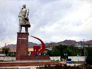
019 The 72 ft. [22m] tall statue of Lenin,
- moved in 1974 from Moscow to Leninabad
- (today Khujand), was transferred in 2011
- from its stand north of the Syr Darya river to
- its ôretirement spotô in an urban quarter that
- lies 0.7 miles [1.1km] more westerly
|
-
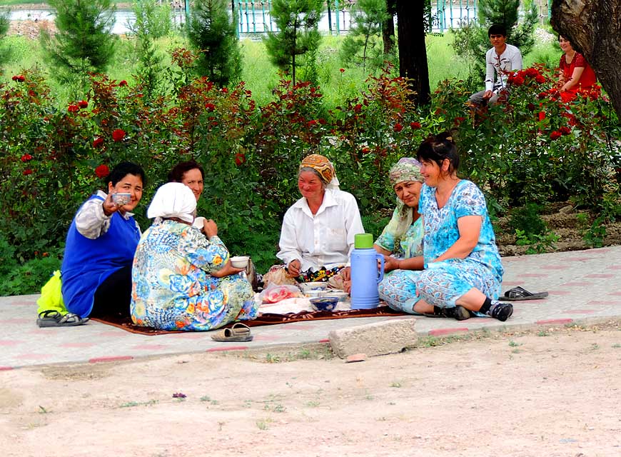
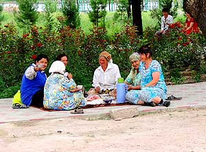
020 A group of women make a lunch
- break near the Lenin statue in Khujand.
- One of them makes us a sign to join
|
-
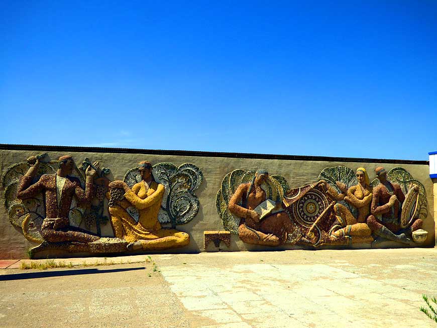
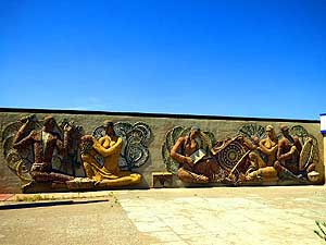
021 An interesting wall
relief made of
- mosaics depicts historic (?) scenes at
- an intersection north of Khujand
- (near Khamirabot)
|
-
|
-
-

|
-
-
-
-
|
-
-
|
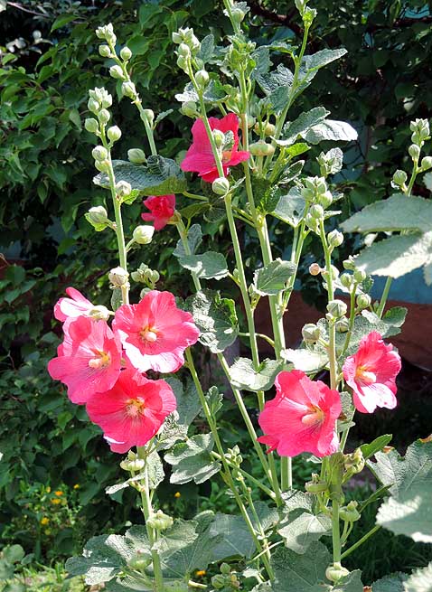
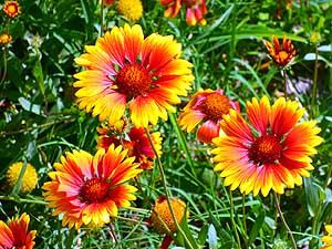
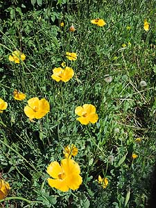
- What would the world be without blooming plants? Eye-catching
flowers in Khujand
|
-
022
|
-
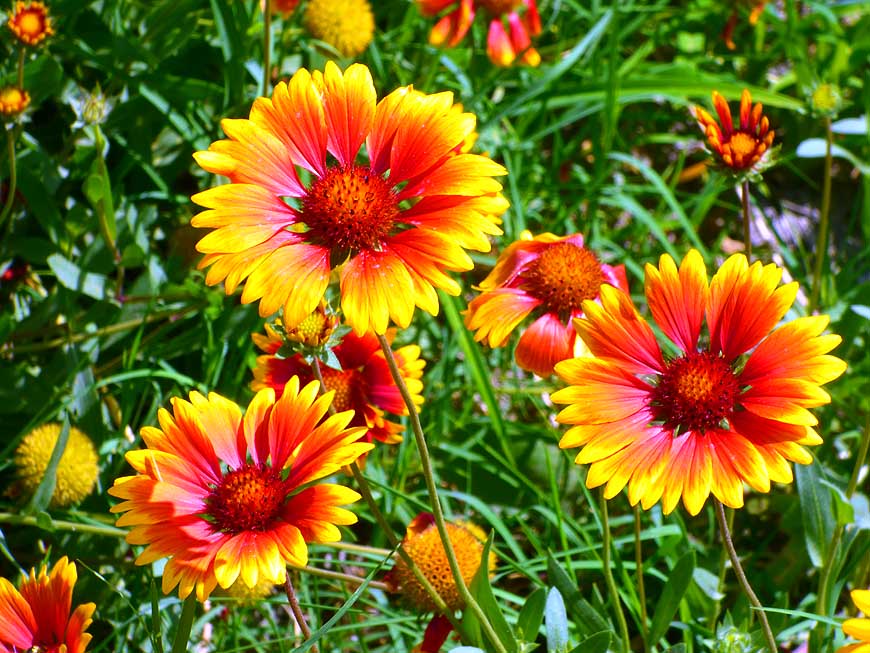
023 Firewheel (Gaillardia),
actually native
- to northern Mexico and Southern USA
|
-
024
|
-
|
-
-
|
-
-
|
-
-

|
-
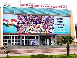
025 The self-display of the Tajik President is
- omnipresent. Here he poses in the middle of
- nicely costumed students along Lenin Street in
- Khujand, today called Ismoili Somoni Avenue
|
-
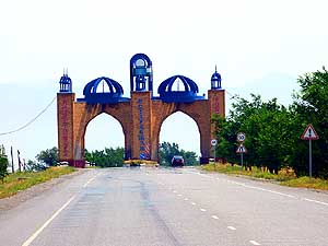
026 Gate to Istaravashan, 42 miles [68 km]
- southwest of Khujand along the road to
- Dushanbe. Each city in Tajikistan greets
- with such an imposing structure
|
-
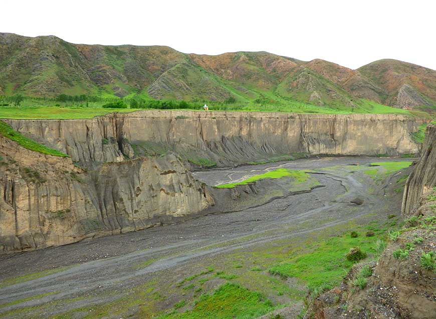
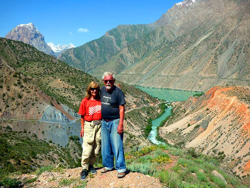
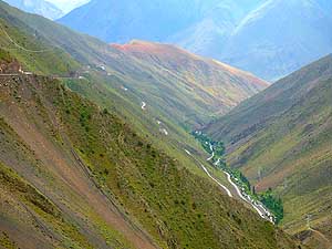
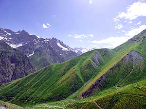
027 TajikistanÆs landscape
is wild and
- shaped by deep canyons û here between
- Shakhristan and Buragen along M34 highway
|
-
|
-
-
|
-
-
|
-
-
|
-
028 From the 17Æ234 ft. [5Æ253m] long
- Shakhristan-Pass-Tunnel the road is winding
- from an altitude of 9Æ022 ft. [2Æ750m] down
- to the narrow Zerafshan valley, where in
- Ayni, about 4Æ600 ft. [1Æ400m] lower,
- the road junction to the capital Dushanbe
- and to Samarkand/Uzbekistan lies
|
-
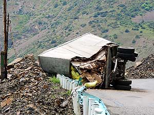
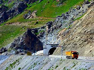
029 An overturned truck blocks
- half of the Shakhristan mountain road.
- Knowing the reckless driving,
- itÆs not surprising
|
-
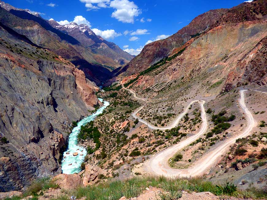
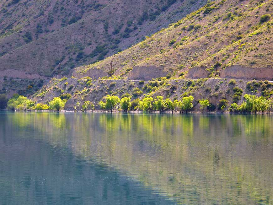
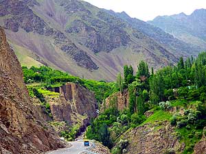
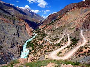
030 Between Ayni and
Penjikent û 56 miles
- [90km] û the road drops from the altitude of
- about 4Æ500 ft. [<1Æ400m] into the Zerafshan
- gorge to about 3Æ100 ft. [▒950m]. The new tar
- road runs through a very scenic landscape
|
-
|
-
-
|
-
-
|
-
-
|
-
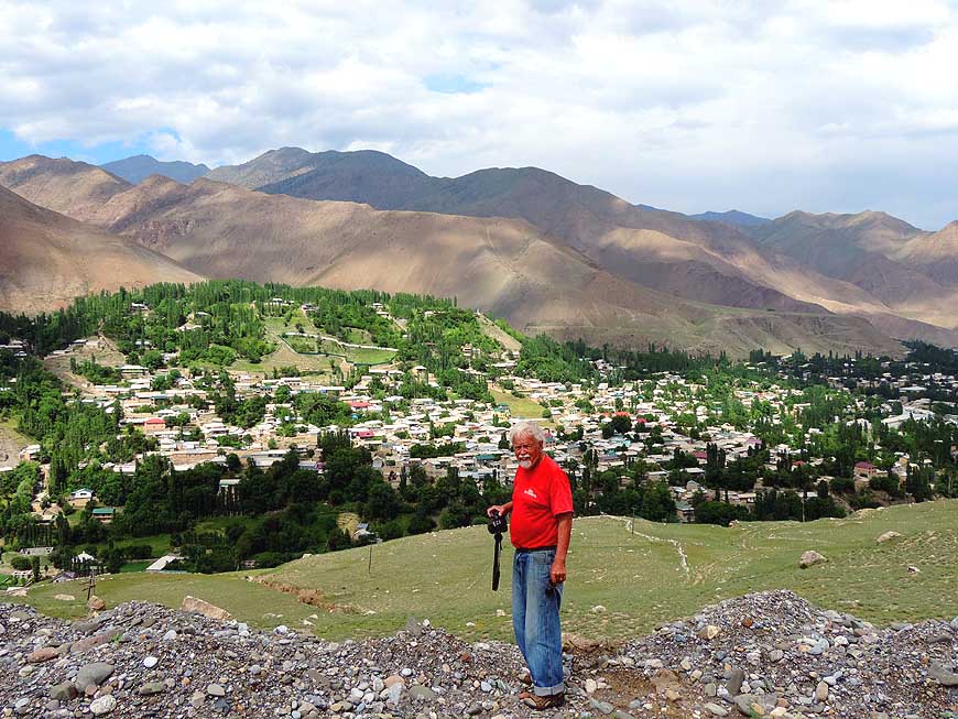
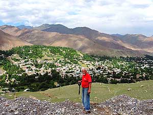
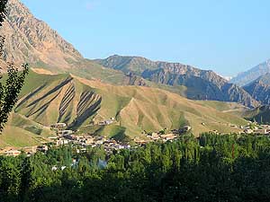
031 Between Ayni and Penjikent, Emil is
- taking a picture of the typical village
- Urmitan, embedded in a harsh mountain
- region. It gives the impression of an oasis
|
-
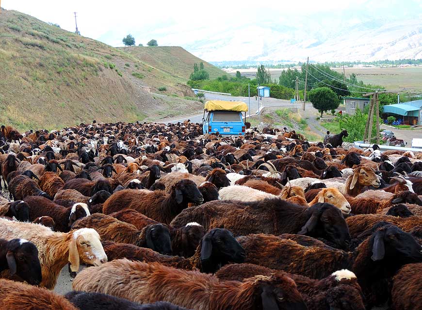
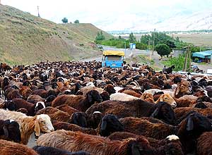
032 ôWhat a lively jam!ô On the Ayni-
- Penjikent route herdsmen are leading
- their sheep to the next pasture
|
-
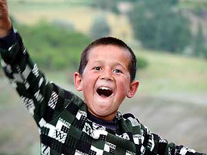
033 ôPhoto!ô shouts the
young herdsman
- and poses joyfully for the picture
|
-
|
-
-
|
-
-
|
-
-
|
-
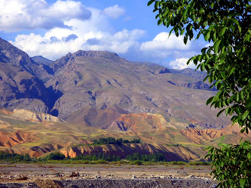
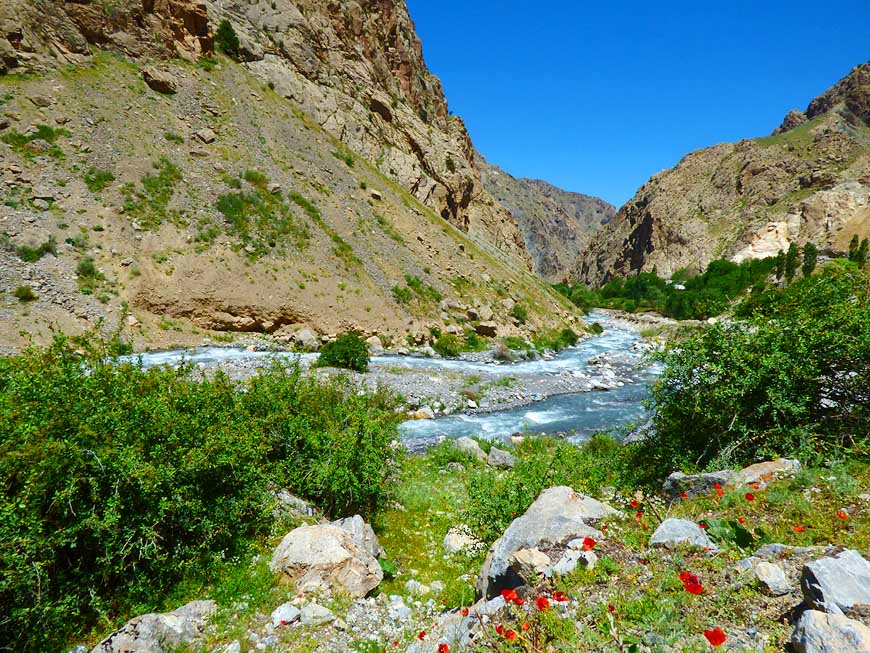
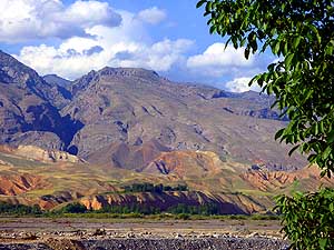
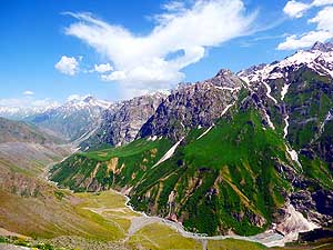
034 It turns green only along the river.
- Mountain scenery between Ayni and
- Penjikent û in the background the
- Turkestan mountain range
|
-
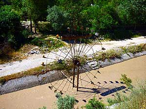
035 It doesnÆt turn in the wind but due to
- water: A water wheel at a village channel.
- In many places there is no running water.
- People have to carry it home single-handed or
- with their donkeys. Here before Novichornok,
- on the road to 7 Lakes (Haft-Kul)
|
-
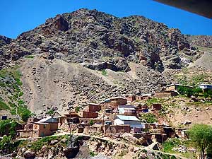
036 Isolated from the rest
of the world:
- A remote hamlet nestling on a stony slope
- of the Fan Mountains, reachable only
- by foot or donkey
|
-
|
-
-
-
-
|
-
-
|
-
-
-
-

|
-
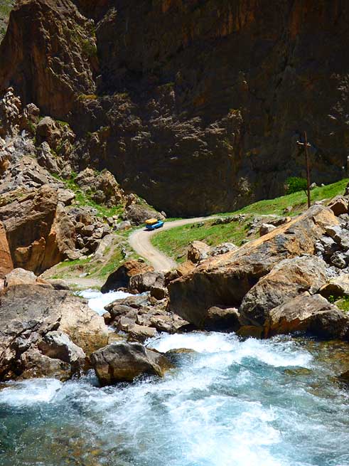
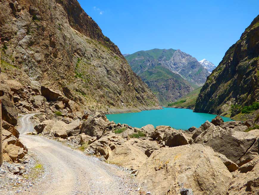
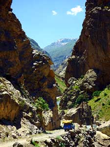
037
The æahaÆ experiences on the partly
- difficult 23 miles [37km] from Penjikent to
- Haft-Kul û the æ7 LakesÆ û follow at every turn.
- Here itÆs the passage through a narrow canyon
- shortly before reaching the first lake æMijonÆ à..
|
-
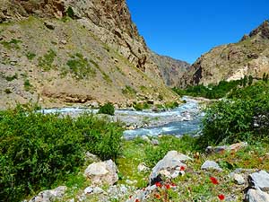
038
à.. once it is the attractive
- scenery of an alpine river à..
|
-
039
à.. another time itÆs a steep
- spectacular mountain climb
|
-
|
-
-

|
-
-

|
-
-

|
-
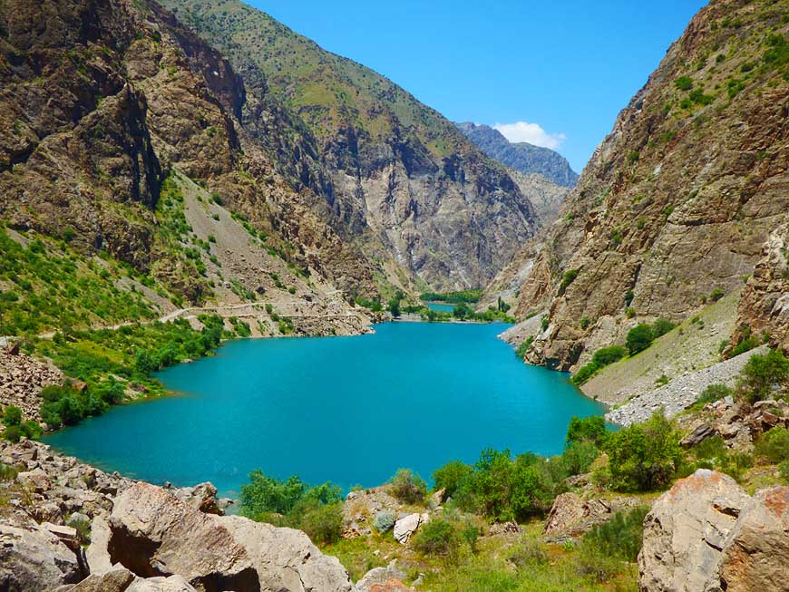
040 This is the first and most beautiful
- of the chain of 7 turquoise glinting ponds
- along the western end of the Fan mountain
- range. They extend for more than
- 12 miles [20km] towards the south à..
|
-
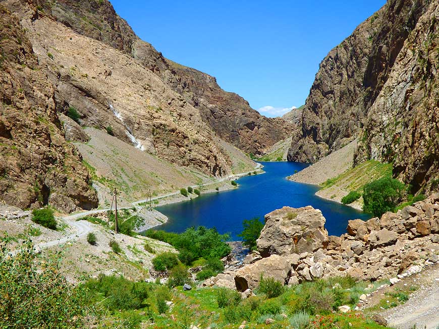
041 à.. the second lake æGushorÆ
- is separated from the third lake
- æNovinÆ only by a small
- ribbon of land à..
|
-
042 à.. the fifth lake
æHaft-KulÆ
- is also sandwiched into the
- dramatic mountain scenery
|
-
|
-
-
|
-
-
|
-
-
|
-
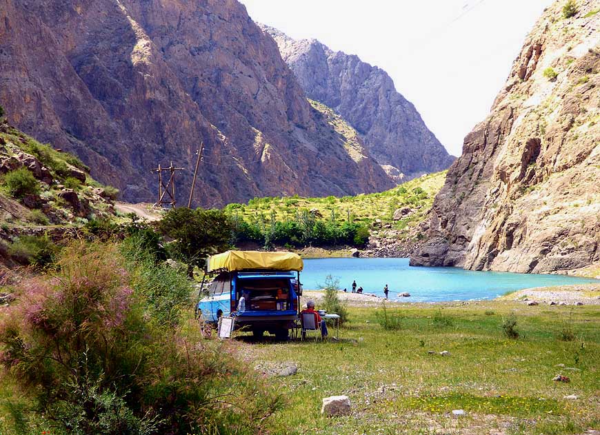
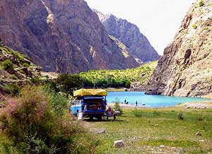
043 Camping joy at the 4th lake æKurdakÆ.
- We share the beautiful spot with some
- fishermen who, however, leave in the
- evening with empty hands
|
-
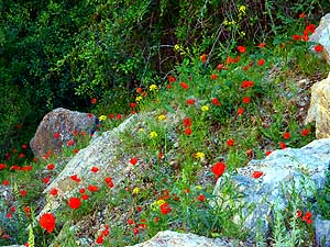
044 The mountain slopes around the
- Seven Lakes are flowering, adding to the
- charm of this magnificent mountain region
|
-
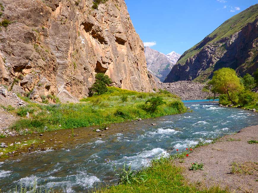
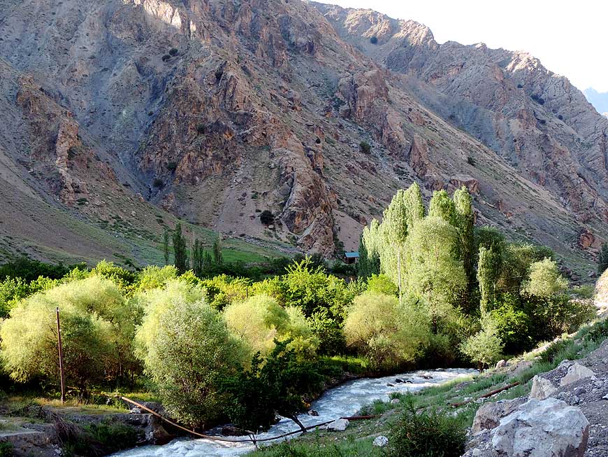
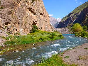
045 Alpine idyll pur: The
fast flowing
- mountain river rushes past our rough
- camping spot at the 7 Lakes. Tajikistan
- counts 1æ000 rivers and 2æ000 lakes
|
-
|
-
-

|
-
-

|
-
-
|
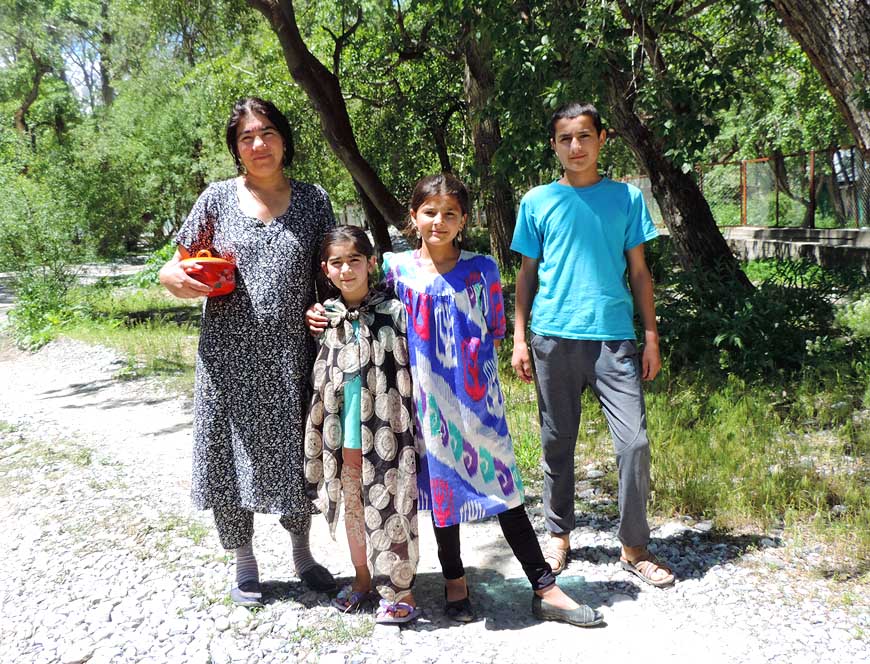
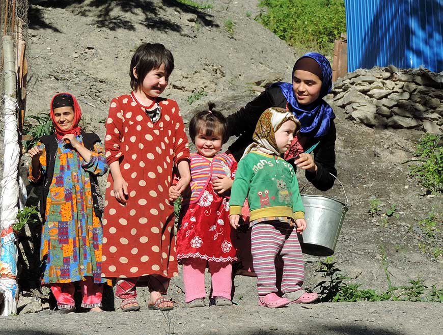
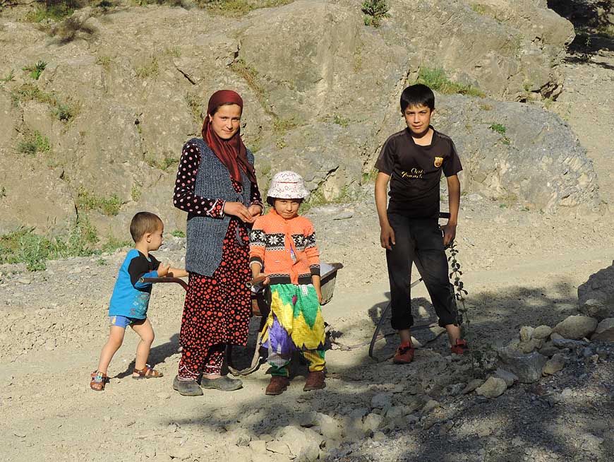
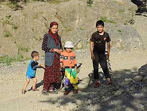
- Tajik people love to have taken their photos, giving us thus the
opportunity to a brief encounter
|
-
046
|
-
047
|
-
048
|
-
|
-
-

|
-
-
|
-
-

|
-
049 The stately trees that line the river are
- æablazeÆ by the warm evening light (on the
- way back between the 7 Lakes and Sujina)
|
-
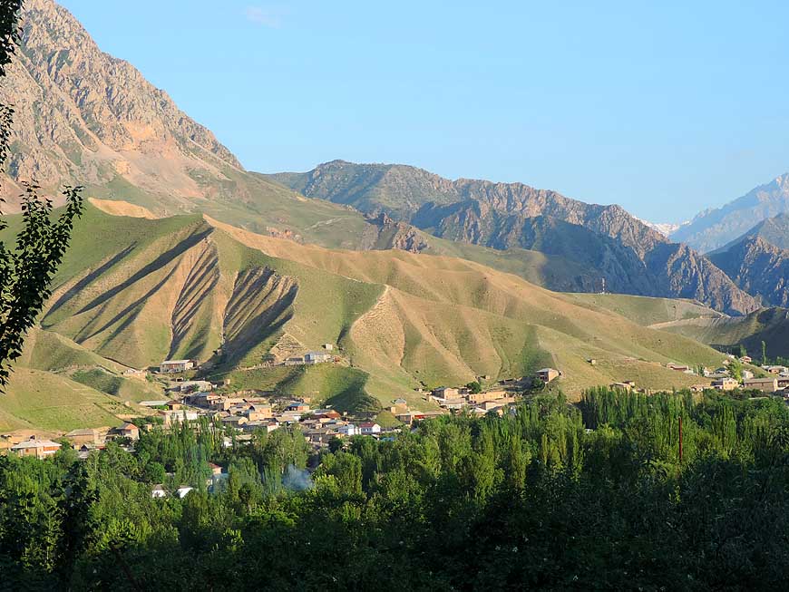
050 Scattered settlements nestle on the
- slopes of the Fan mountain range between
- the 7 Lakes and Penjikent
|
-
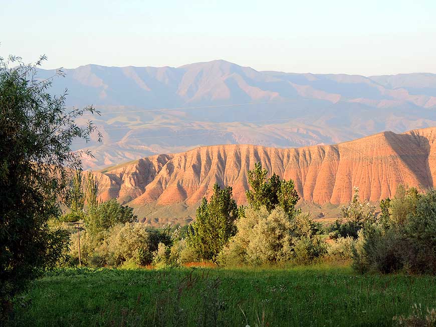
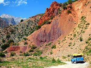
051 A reddish shimmering
eroded mountain
- wall northeast of Chorbog raises vertically from
- the plain and contrasts wonderfully with the green
- of the valley (between 7 Lakes and Penjikent)
|
-
|
-
-
-
-
|
-
-
|
-
-
-
-

|
-
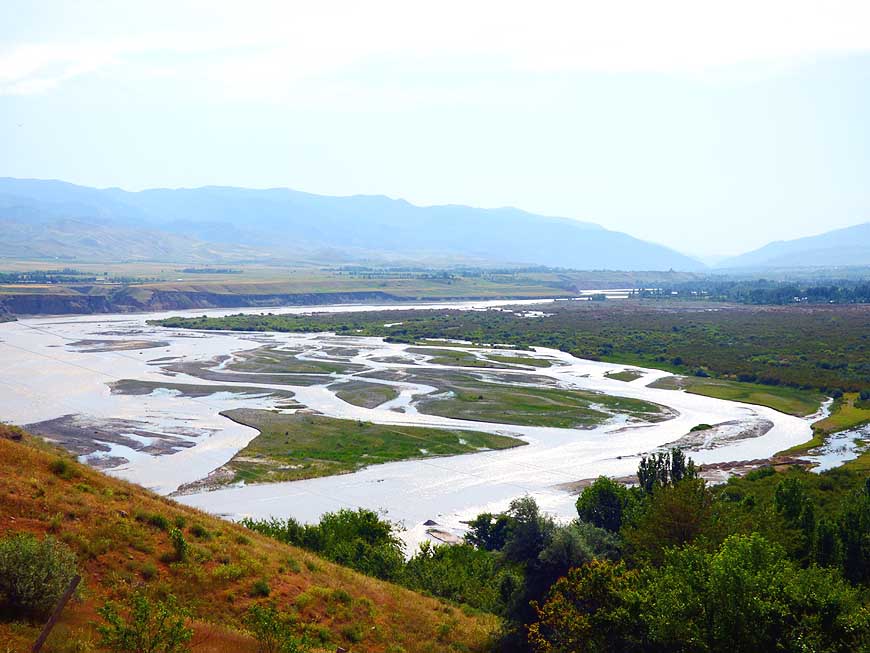
052
Near Gusar, east of Penjikent, the
- Zerafshan river flows in different pathways
- through the river bed before reuniting again
|
-
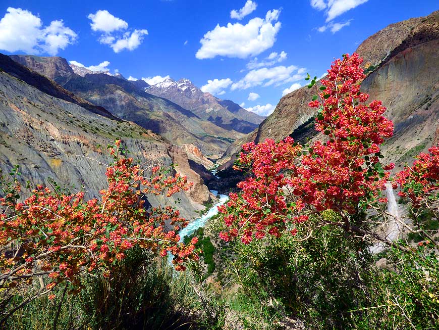
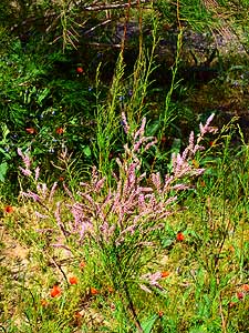
053
The bush with the delicate pink blossoms
- is another example of natureÆs beauty
|
-
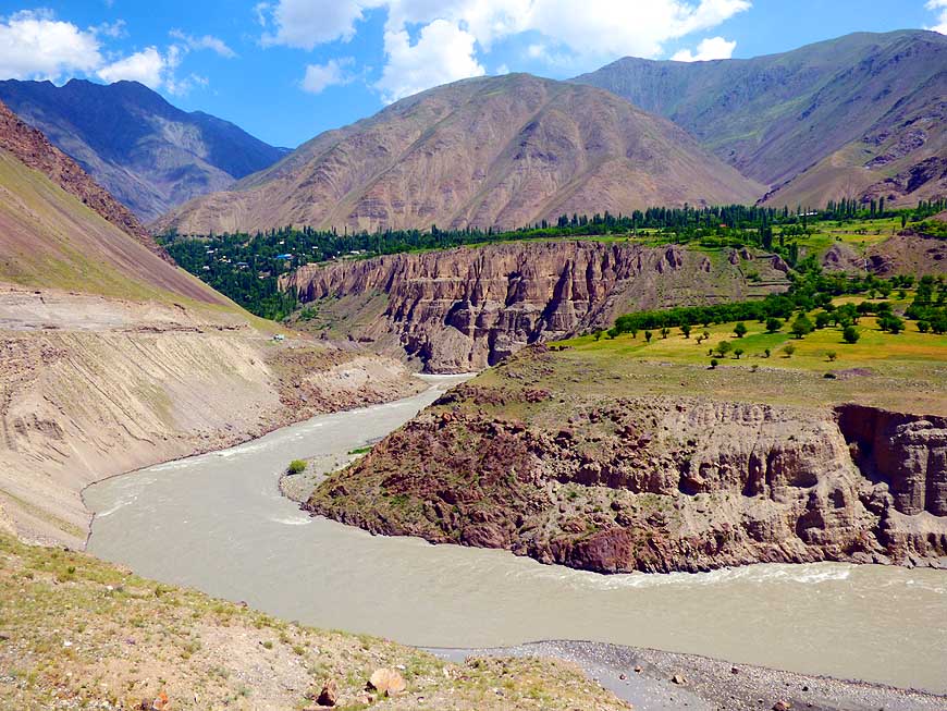
054
At Dardar, west of Ayni, the
- Zerafshan river is meandering in narrow
- bends through the canyon
|
-
|
-
-
 -
|
-
-
-
-
|
-
-
-
-

|
-
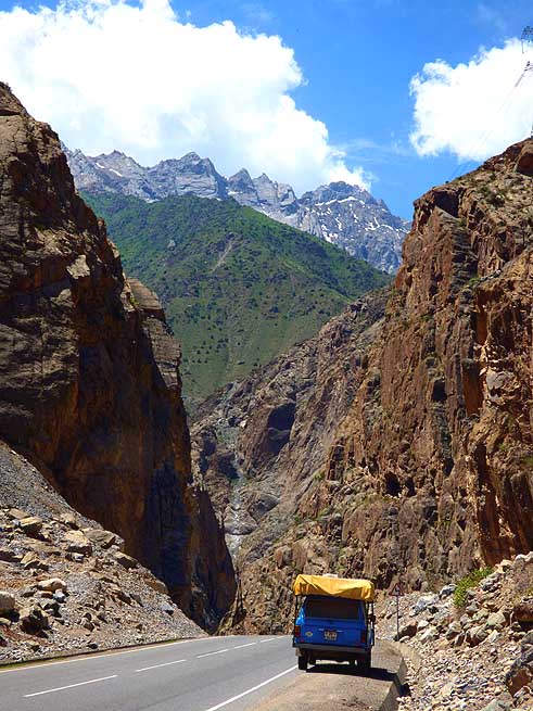
055
Between Ayni and Sarvoda û on the
- main Dushanbe highway û the good tarmac
- road runs through a narrow gorge flanked by
- steep mountains, leaving just enough space
- for the road and the river
|
-
056
Steep and partly washed-out switch-
- backs lead near Rabot from the Dushanbe
- highway to Iskander-Kul (-lake) on
- 7Æ200 ft. [2Æ195m] altitude à..
|
-
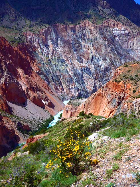
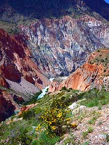
057
à.. view to the blue silverish river
- that is meandering through the narrow
- canyon deep below
|
-
|
-
-
-
-
|
-
-
|
-
-
-
-
|
-
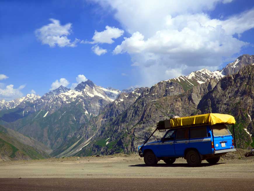
058
Simply beautiful: The color palette
- of the mountains rising into a deep blue sky
- could possibly not be more splendid. Our
- LandCruiser on its descent to Iskander-
- Kul, the lake in the Zerafshan range
|
-
059
On our descent to Iskander-Kul
- we enjoy another beautiful view into
- the great canyon scenery
|
-
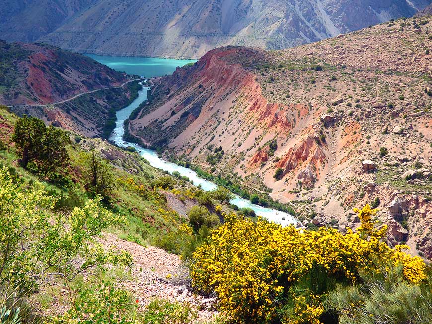
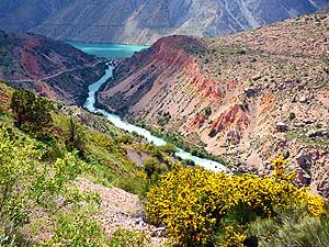
060
The opal-blue mountain lake Iskander-
- Kul comes into view. Along with the blue-
- silverish shining river, the reddish mountains
- and the luminous yellow bushes it is a most
- stunning picture
|
-
|
-
-
|
-
-
|
-
-

|
-
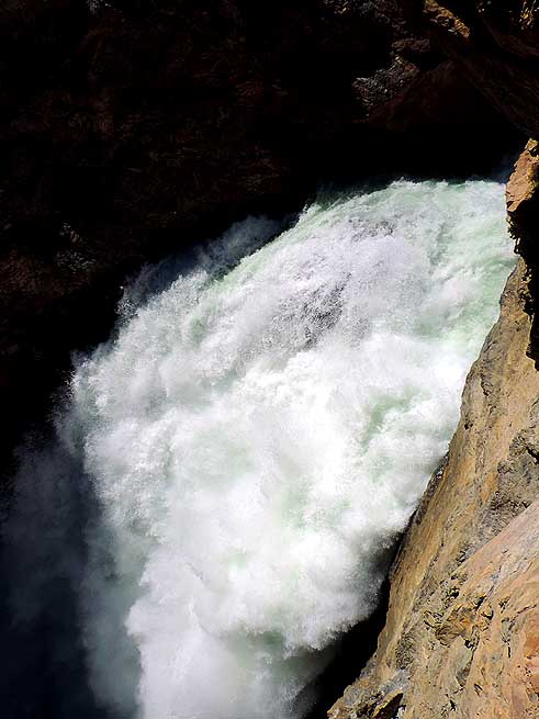
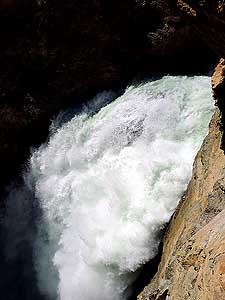
061
Only a short hike from Iskander-Kul,
- the river carrying big quantities of water
- from the melting of snow, rumbles down
- a rift to the valley à..
|
-
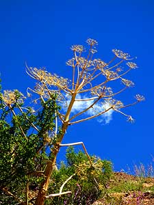
062
à.. Peculiar plants and huge
- boulders shape the alpine landscape
- around the waterfall à..
|
-
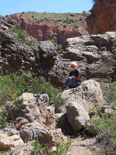
063
à.. Emil is relaxing on a
- boulder and enjoys the view
|
-
|
-
-
|
-
-
-
-
|
-
-
|
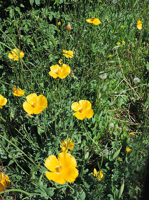
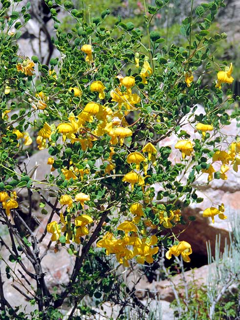
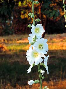
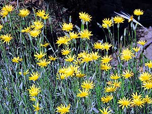
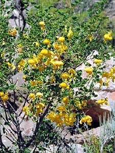
- Different flowers in shining yellow. With their intensive
luminosity they always convey a feeling of sun even if it is not
shining
|
-
064
|
-
065
|
-
066
|
-
|
-
-
|
-
-
|
-
-
|
-
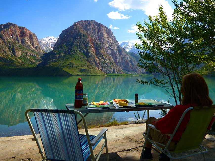
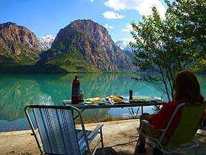
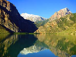
067 Liliana at our lunch table on the shore
- of Iskander-Kul. We enjoy our spot at the
- official forest campsite with view to the
- mountains reflecting in the calm waters
- of the mountain lake à..
|
-
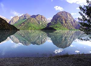
068 à.. more to the right (southwest),
- there is another almost perfect reflection
- of the Fan Mountains à..
|
-
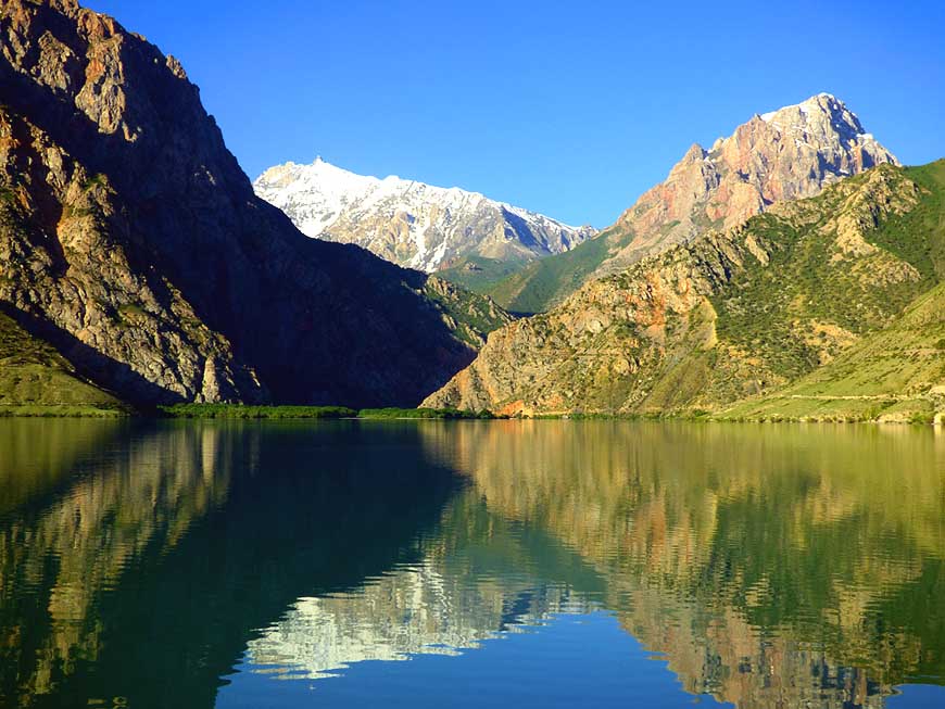
069 à.. another reflecting
picture: We
- cannot get enough of the spectacular view
|
-
|
-
-

|
-
-
|
-
-
|
-
070 Halfway around Iskander-Kul
- snow capped mountain peaks mirror
- from the southeast in the lake
|
-
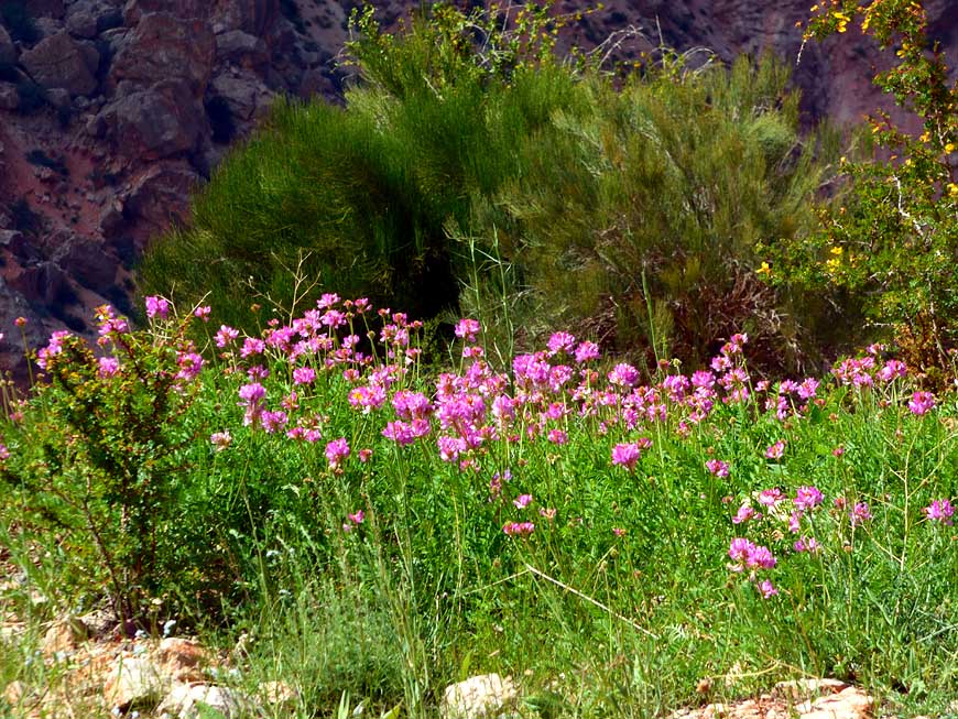
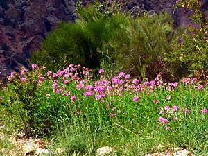
071 Carpets of pink flowers line
- the shore of Iskander-Kul at an
- altitude of 7Æ200 ft. [2Æ195m]
|
-
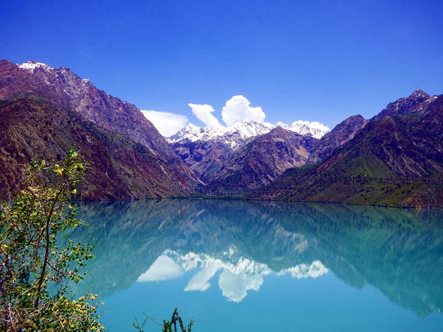
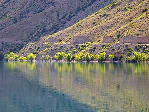
072 View across
Iskander-Kul lake with
- the tree-lined shore and the access road to
- the PresidentÆs Datcha (vacation house)
|
-
|
-
-
|
-
-
|
-
-
|
-
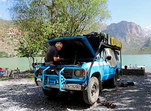
073 Working day for Emil at Iskander-Kul.
- He changes spark plugs and the distributor
- points. For that he has to sit uncomfortably
- under the hood as everything û though a
- lot of space û is not so easy to access
|
-
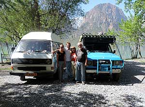
074 Last moment with our German-
- Dutch neighbors Anna and Reinier at the
- Iskander-Kul forest campsite. They are
- with their Volkswagen Bus T3 on a
- 4 months trip through Central Asia
|
-
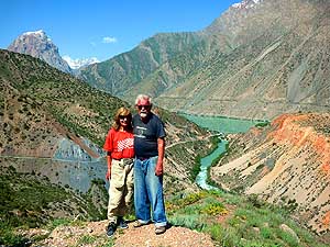
075 A remembrance photo of
the
- two of us with Iskander-Kul in the
- background when we (have to) leave
- this mountain region after three
- wonderful camping days for Dushanbe
|
-
|
-
-
|
-
-
|
-
-
|
-
076 A gasp of relief: Our overheating
- LandCruiser that stops over and over again,
- crossed the 16Æ535 ft. [5Æ040m] long, unlit
- and unventilated Anzob tunnel, also called
- ôdeath tunnelô without any breakdown
|
-
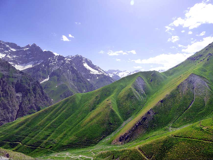
077 At the southern end of the Anzob
- tunnel, we are greeted not only by fresh
- air but also by lush green mountain slopes
- and snow capped mountain peaks à..
|
-
078 à.. the stunning
mountain
- scenery continues to delight us for
- quite some time as we roll downhill
- towards the capital Dushanbe
|
-
|
-
-
|
-
-

|
-
-
|
-
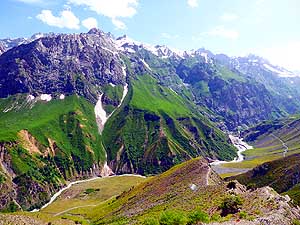
079 Panorama at the southern Anzob
- tunnel descent: Below the river is meandering
- down the valley, from the other side of the
- valley greets the spring like mountain scenery
|
-
080 From Anzob tunnel, our LandCruiser
- rolls from the coolness of the high mountain
- region (8Æ700 ft.) [2Æ650m] to the heat
- of the plain (2Æ316 ft.) [706m]
|
-
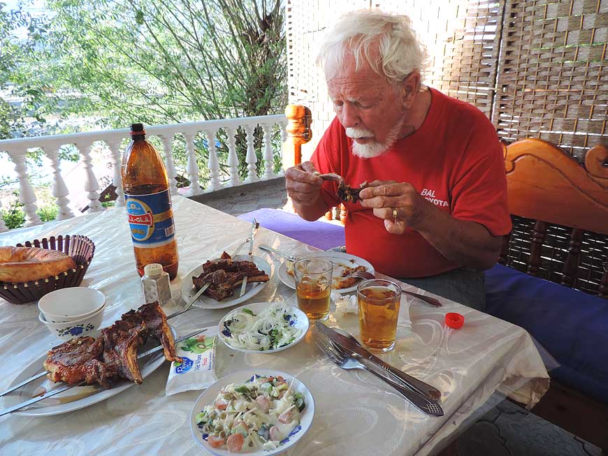
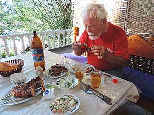
081 Emil feasting: We have
soup, boiled
- beef, roasted cutlets on a spit, salad, bread
- and two one 1¢-liter bottles of beer. For
- two it costs Somoni 150, about US$19.10
|
-
|
-
-
|
-
-
|
-
-

|
-
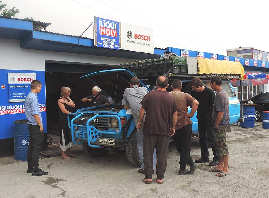
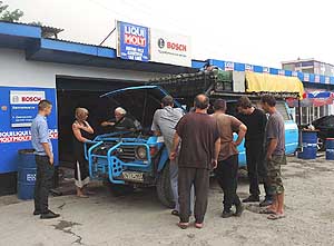
082 Discussion regarding the overheating
- problem of our LandCruiser in a workshop
- in Dushanbe, used also by diplomats. But
- they cannot help us because they never
- had this model à..
|
-
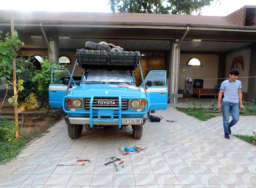
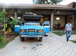
083 à.. in the compound of the ôHelloô
- Guesthouse in Dushanbe, Emil removes the
- winch and puts it on the roof rack hoping to
- reduce the overheating problem (more air
- for the radiator) à..
|
-
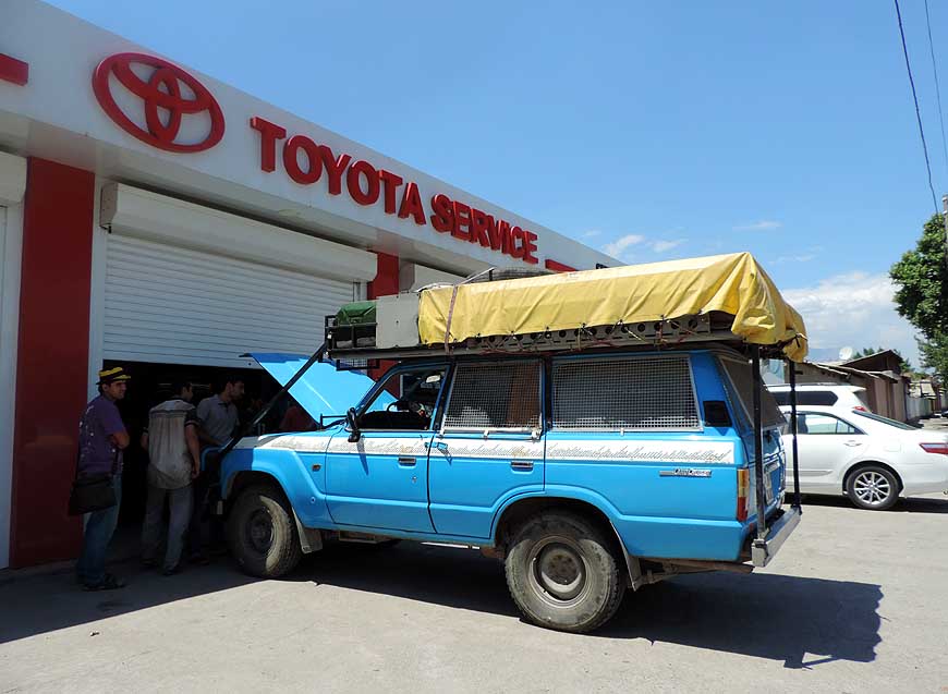
084 à.. as last hope we
visit TajikistanÆs
- Toyota distributor in Dushanbe, unfortunately
- with the same result as at the first workshop.
- What now? On June 18th, 2016, we decide as
- a ôhit or missö to take off to the Pamir Highway
|
-
|
-
Next website of our 2nd
Central and North Asia trip 2016 to Russia:
- Continuation to the next Tajikistan page: Tajikistan Part 2
û June 19th to 27th, 2016, from
Dushanbe to the Kyrgyzstan border
|
- The African trip
2013-16:
- CapeVerde: Santiago/Praia
part 1 û November18th to December 13th, 2013
- CapeVerde: Fogo
û Dezember13th to 23rd, 2013
- CapeVerde: Brava
û December 23rd to 26th, 2013
- Cape Verde: Santiago/Praia
part 2 û December 26th, 2013 to February 28th, 2014
- Cape Verde: SÒo Nicolau û February
28th to March 13th, 2014
- Cape Verde: SÒo Vicente/Mindelo part 1
û March 13th to 20th, 2014
- Cape
Verde: Santo AntÒo/Eastern side part 1 û
March 20th to April 7th, 2014
- Cape
Verde: Santo AntÒo/Western side part 2 û
April 7th to 10th, 2014
- Cape
Verde: SÒo Vicente/Mindelo part 2 û
April 10th to 29th, 2014
-
Namibia Part 1 û
from Walvis Bay to Windhoek
- Angola Part 1
û
September 26th to October 4th, 2014
- Angola Part 2 û
October 4th to 22nd, 2014
-
Namibia Part 2 û
from Windhoek to the Angolan border, back again and on to
South Africa
-
South Africa
Part 1 û
from Namibia border to Capetown û
January 22nd to February 23rd, 2015
- 3rd Major Repair of our
LandCruiser FJ60 - 1982 (due to two broken sideshafts)
-
South Africa Part 2 û from Capetown to Tsitsikamma National Park û
February 24th to March 13th, 2015
- South Africa Part 3 û from
Addo National Park to the Lesotho border û March
13th to April 7th, 2015
-
Lesotho û April 7th to 15th, 2015
-
South Africa Part 4
û from the Lesotho to the Swaziland border û
April 15th to 23rd, 2015
-
Swaziland û April 23rd to 28th,
2015
-
South Africa Part 5
û from the Swaziland to the Botswana border
û April 28th to May 15th, 2015
-
Botswana
-
Zimbabwe
-
Mozambique
-
Malawi
-
Armed Robbery in Malawi on July
31st/August 1st, 2015
-
Tanzania
-
Kenya
-
Ethiopia Part 1 û from Kenya to
Djibouti –
October 25th to November 18th, 2015
-
Djibouti –
October 18th to 27th, 2015
-
Ethiopia Part 2 –
from
Djibouti to
Sudan –
November 27th to December 9th, 2015
- Sudan –
December 9th, 2015 to January 8th, 2016
|