-
- Chile Map
|
-
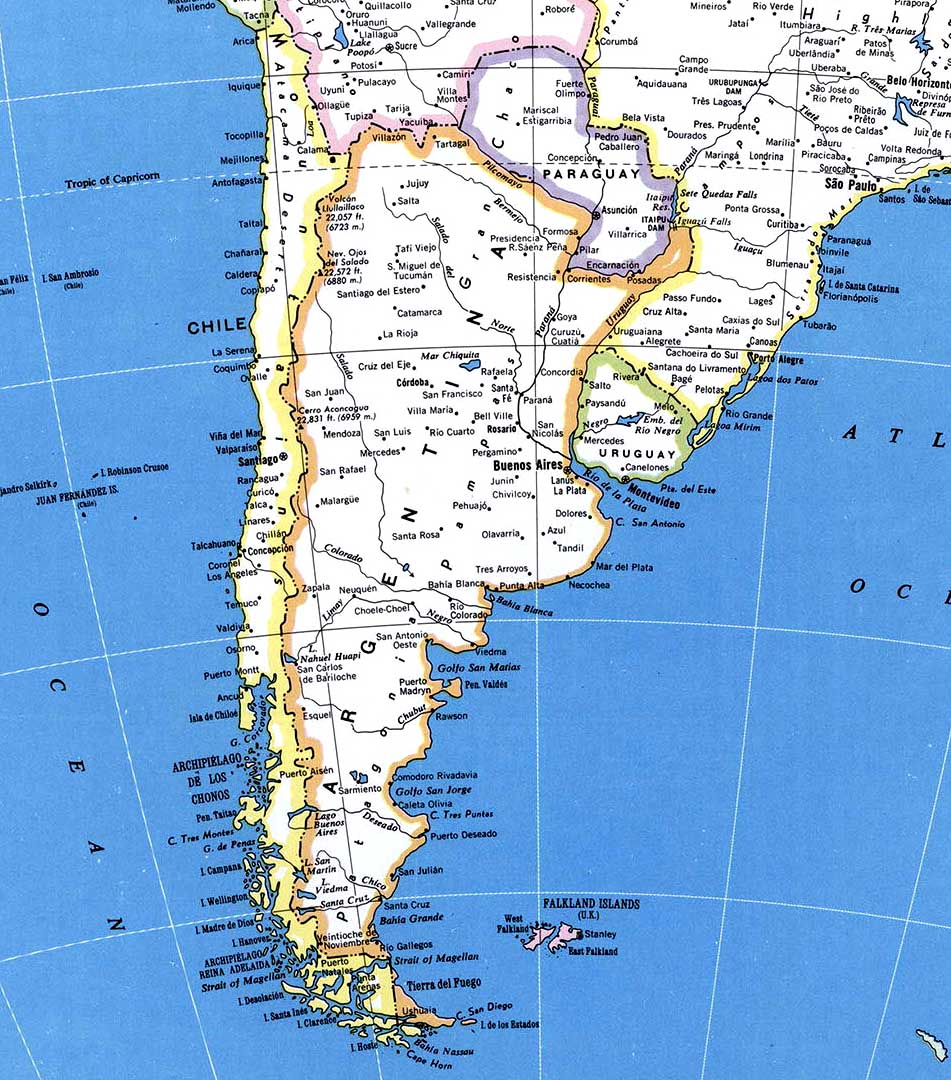
- Map from southern
South America
|
|
-
|
- latest picture:
February 6, 2019
|
-

|
-
-
|
-
|
-
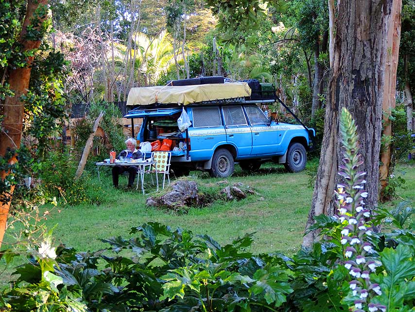
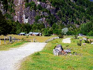
076 At Lake Puyehue, 5mi [8km] east
- of Entre Lagos, we set up camp at an
- idyllic spot at the Camping ôEl Manzanoö
- directly on the lakeshore à..
|
-
077 à.. surrounded by lovely lupines
- (Lupinus) amidst lush greenery
|
-
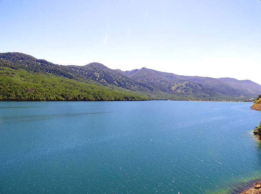
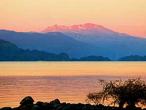
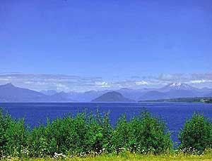
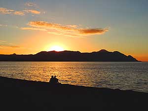
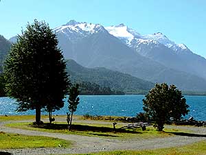
078 Lake Puyehue in the
sunset
- glow at the camping ôEl Manzanoö
- near Entre Lagos
|
-
|
-
|
-
-
|
-
|
-
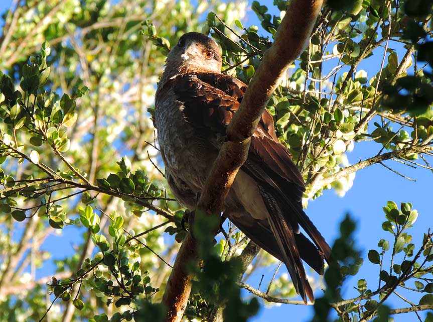
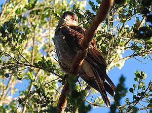
079 ôWho are those intruders?ö A
- buzzard (Buteo buteo) peers curiously
- from a tree to our camp near Entre Lagos
|
-
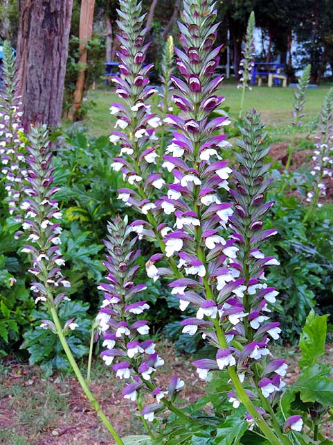
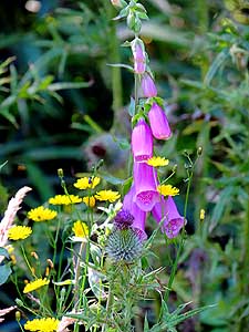
080 Delicate purple foxgloves
- (Digitalis purpurea) grow side
- by side with yellow daisies
|
-
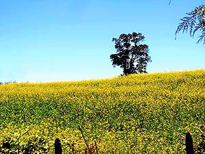
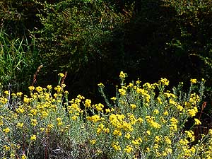
081 Magic spring spell in
South Chile:
- A yellow gleaming flower field as far as
- the eye can see
|
-
|
|
|
-
-
|
-
-
-
-
|
-
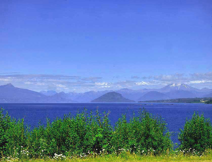
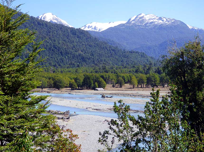
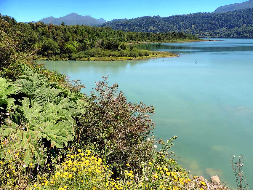
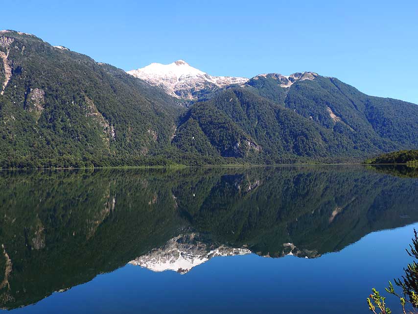
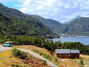
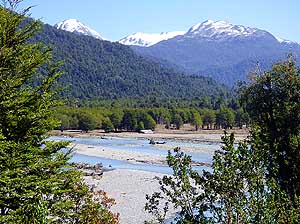
082 View across Lake Rupanco to the
- Andes of the Los Lagos region û a typical
- scenery in the Lake District of southern Chile
|
-
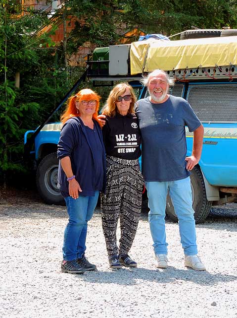
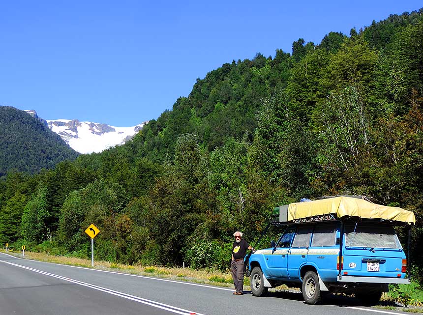
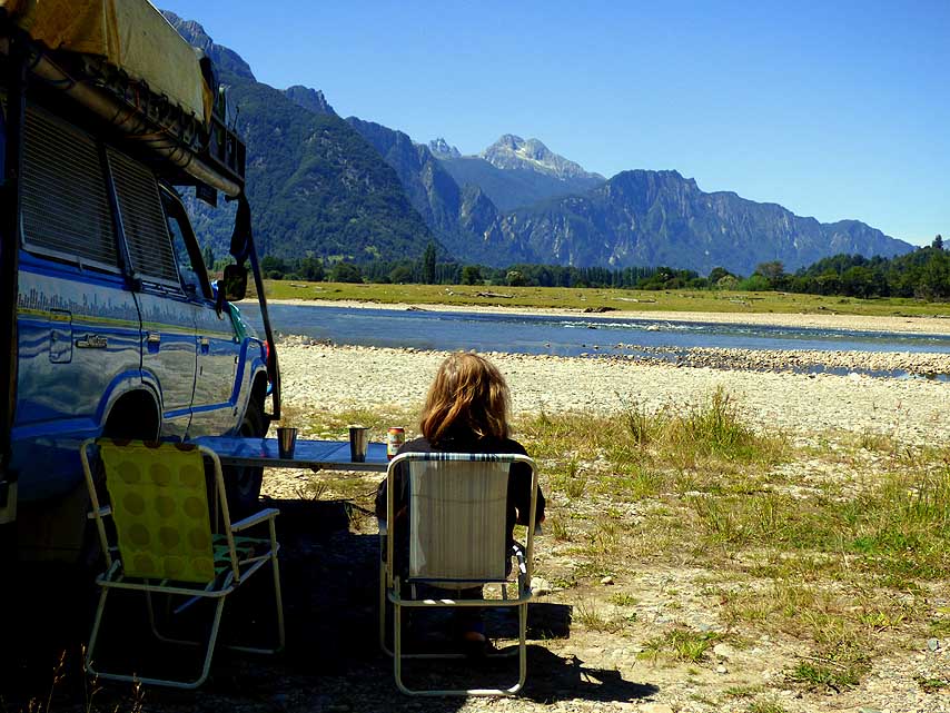
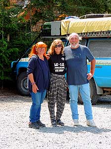
083 Encounter with longtime overlander
- at the Montana Camping in Ensenada in
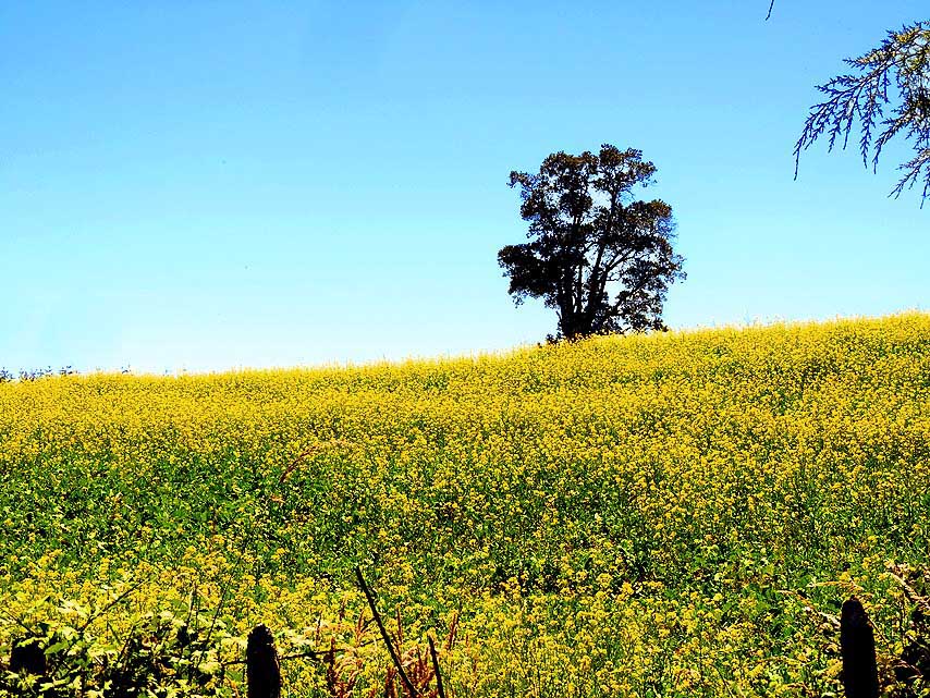
- the Southeast of Lake Llanquihue
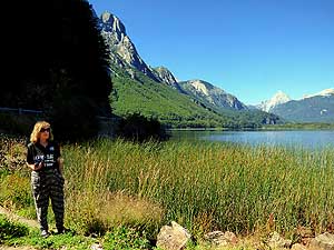
|
-
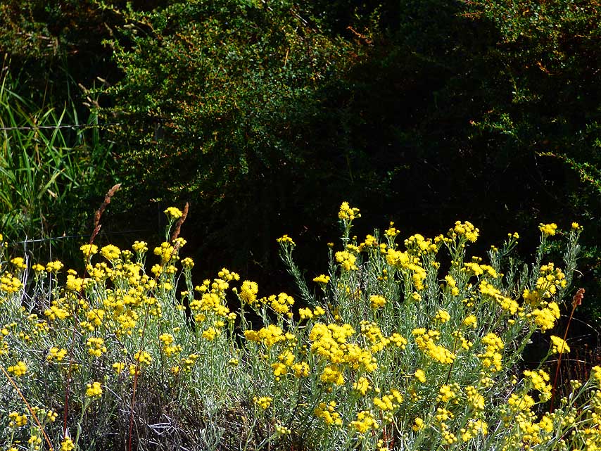
084 A wonderful contrast:
Yellow
- flowers, probably a kind of mimosas,
- against a dark background
|
-
|
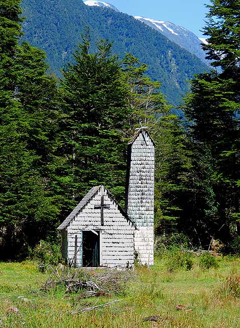
-
-
|
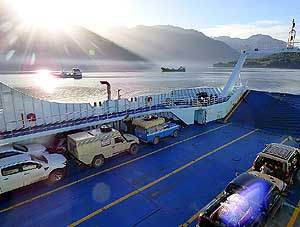
-
-

|
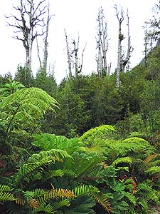
-
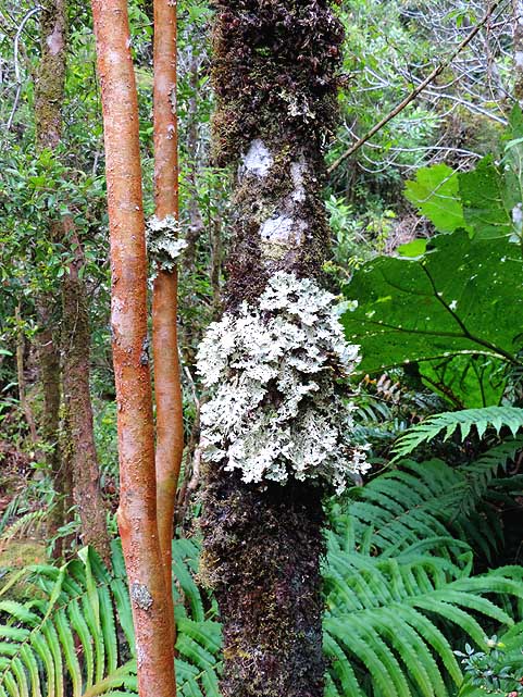
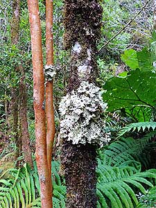
-
|
-
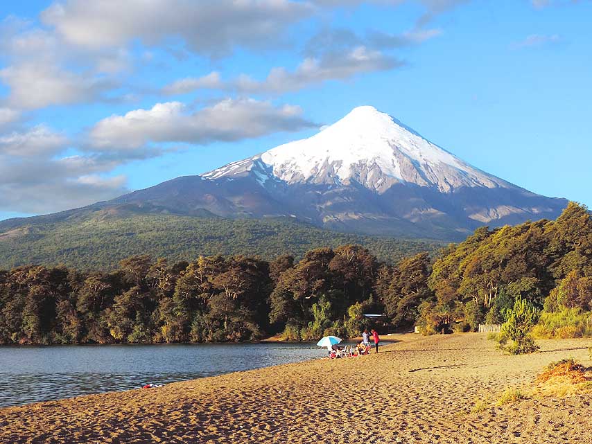
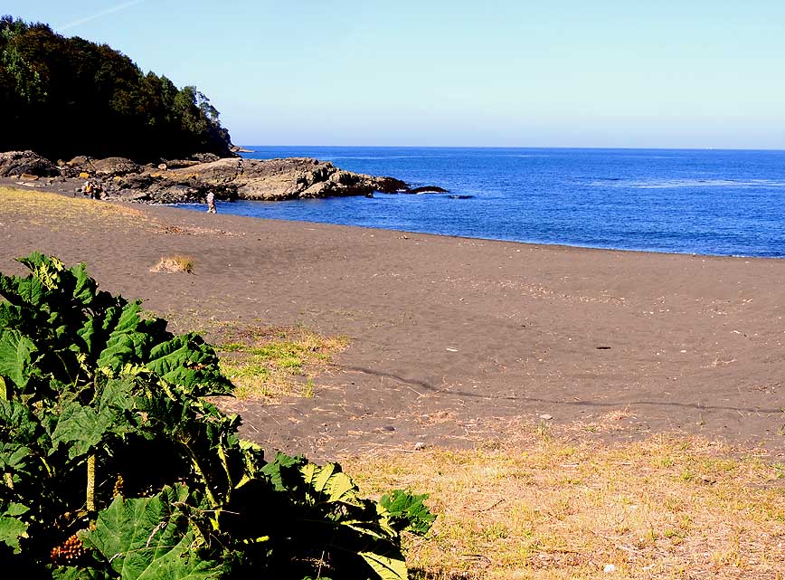
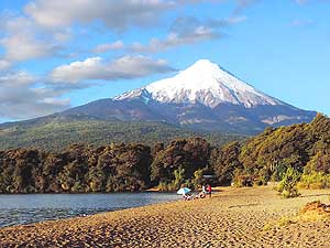
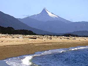
085 Sandy beach and close view of the
- 8'701 ft. [2'652m] high, ice-capped volcano
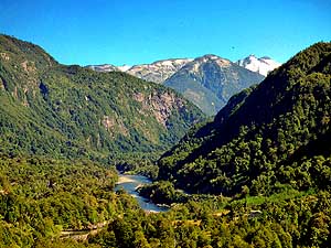
- Osorno from the ôMontanaö Camping in
- Ensenada along Lake Llanquihue
|
-
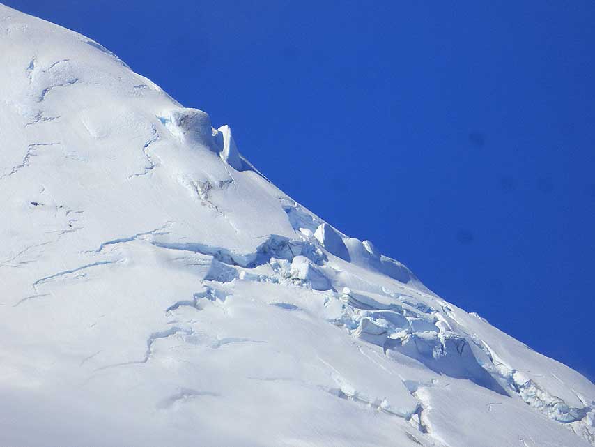
086 A glacier covered slope of the
- 8'701 ft. [2'652m] high volcano Osorno
|
-
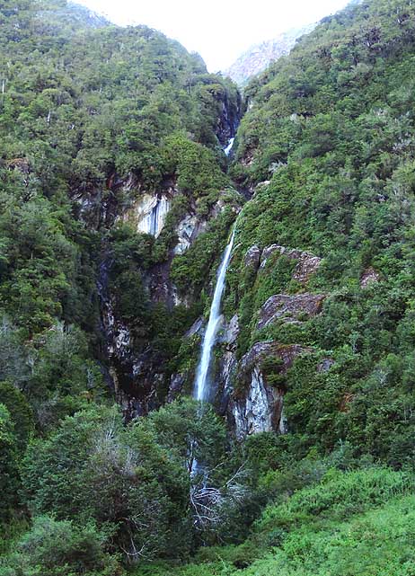
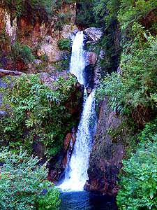
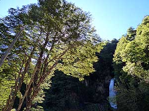
087 Sunset across Lake
Llanquihue
- in Ensenada. In the background
- the 1'640ft. [500m] high
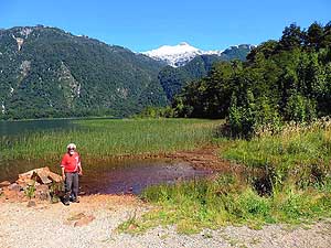
- Cordillera del Sarao
|
-
|
-
-
|
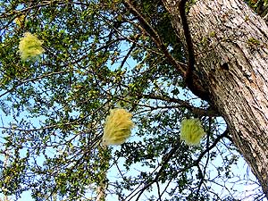
-
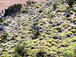
-
|
-
-
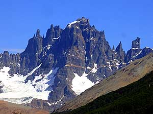
|
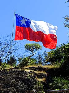
- The legendary Carretera Austral (Ruta 7) starts at the Hotel Ibis
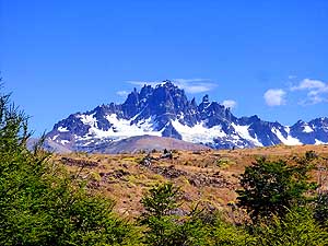
(-41.47657 -72.94970) in Puerto
Montt and runs for 772mi [1'242km]
- to Puerto Bahamondes (-48.51184
-72.60058) 5mi [8km] south of Villa O'Higgins. It
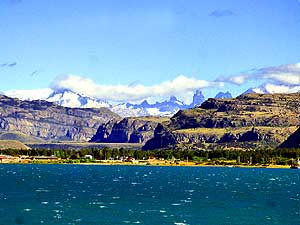
contains 3 ferries (see below), whereas the
- third û if there is no drive via
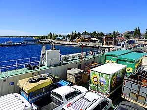
Chile Chico but straight to the South û lies between Puerto
Yungay and RÝo Bravo; website:
- (from Chile Chico or Paso Rodolfo
Roballes), or a fourth ferry from Puerto Yungay to Puerto
Natales; website:
- began in ChaitÚn and ended in Puerto Bertrand, 81mi [131km]
southwest of Chile Chico. Today's overview of
the paved roads:
|
-
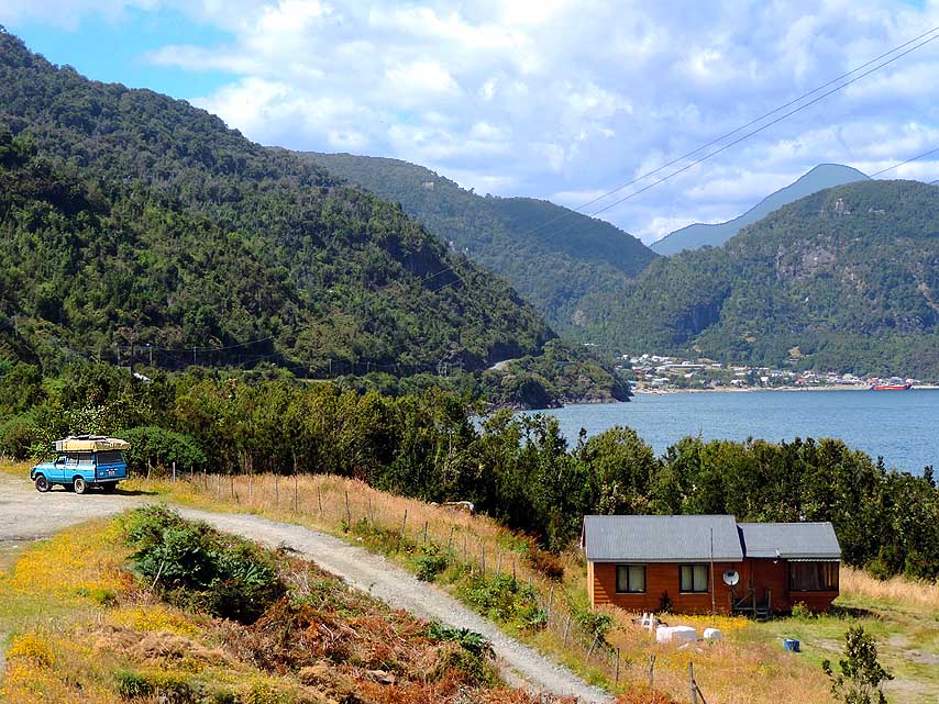
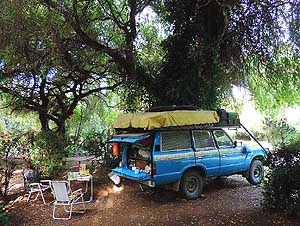
088 Our quiet camping ôParedes
- Chinquihueö (-41.49535 -72.98707)
is
- 2¥mi [4¢km] west from the Hotel Ibis
- in Puerto Montt
|
-
089 Nostalgic scene along the Carretera
- Austral, 2mi [3km] before the first ferry at
- Caleta La Arena: Seagulls crowd a little
- place of mooring fishing boats
|
-
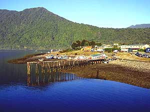
090 The ferry terminal of
Caleta La
- Arena, embedded between forested hills,
- is greeting from far. It's the first of three
- ferries on the long way to the South
|
-
|
-
|
-
-
|
-

|
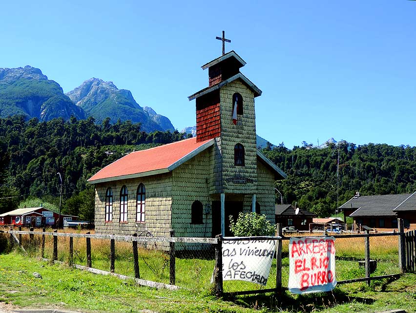
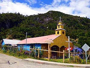
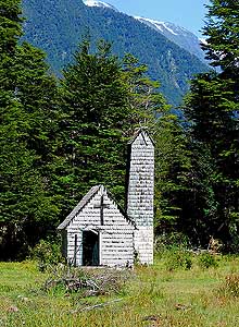
- Three different nostalgic building styles of churches along the
Carretera Austral in South Chile:
|
-
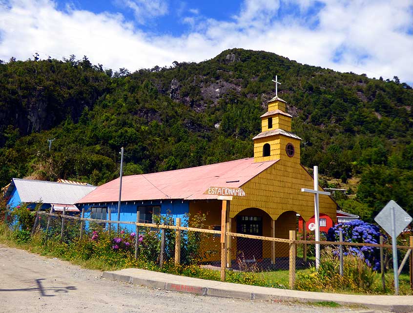
091 The Chapel Nuestra Se±ora de
- la Asunci¾n in Caleta La Arena à..
|
-
092 à.. a quaint little church built
- entirely out of plain tile cladding,
- north of Villa Vanguardia à..
|
-
093 à.. and the church San
JosÚ
- Obrero in Villa Santa LucÝa, built in
- the same style as pic #092 to the left
|
-
|
-
-
|
-
-
|
-
-
|
-
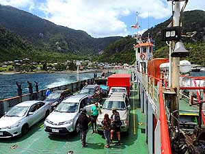
094 The ferry "Don Juan" brings us
- from Caleta La Arena to Caleta Puelche.
- Duration: 30 minutes; Total costs:
- 10Æ000 Pesos = about US$18;
- website:
http://testuario.cl/en/home/
|
-
095 A peaceful atmosphere lies
- over HornopirÚn while the second
- of the three ferries to the South
- is slowly loaded
|
-
096 Our LandCruiser on the
ferry
- ôAgiosö from HornopirÚn to Caleta
- Gonzalo. Duration: 5 hours; Total costs:
- 71Æ600 Pesos = about US$129;
- website:
https://www.taustral.cl/
|
-
|
-
|
-
-
|
-

|
-
097 The unpaved Carretera Austral
- meanders through a heavily forested
- area from Caleta Gonzalo to
- Santa Bßrbara à..
|
-
098 à.. where we found a nice rough
- camping place and discovered nearby
- impressive white lichens on a
- mossy tree trunk
|
-
099 The beach of Santa
Bßrbara
- (-42.85434 -72.79862) in
the Gulf of
- Corcovado, located 7¢mi [12km]
- northwest of ChaitÚn, is attracting
- also many overlander to camp
|
-
|
-
-

|
-
-
|
-
-
|
-
100 Lunch break near the ramp of ChaitÚn
- with view to the small village (4'000 people)
- that on May 2nd, 2008, was ravaged by a
- mudflow (lahar) of the 3'681ft. [1'122m]
- high volcano ChaitÚn
|
-
101 The 7'550ft. [2'300m] high volcano
- Corcovado lies in the ChaitÚn region, a
- volcanic very active zone of the
- South American Cordillera.
- 1935 was its last big eruption
|
-
102 The crystal clear Lake
Yelcho
- in Puerto Cßrdenas, surrounded by
- mountains, volcanos and glaciers,
- 31mi [50km] south of ChaitÚn
|
-
|
-
-
|
-
-

|
-
-
|
-
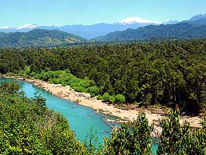
103 The turquoise blue ribbon of Rio
- Cisnes in the AysÚn region is carving its way
- through the impressive mountain scenery of
- the same named valley to Puerto Cisnes
|
-
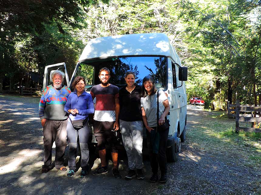
104 A nice encounter with a Swiss
- overlanding couple with their visiting mothers
- in the 'Camping Yelcho en la Patagonia'
- 4¢mi [7km] south of Puerto Cßrdenas
|
-
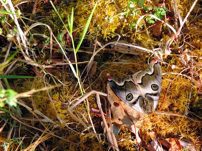
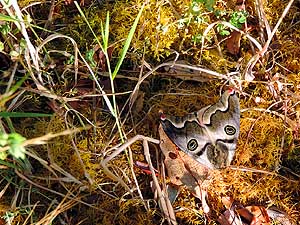
105 A stunning face of a
moth on a
- mossy ground in the Camping Yelcho
- near Puerto Cßrdenas
|
-
|
-
-
|
-
-
|
-
-
|
-
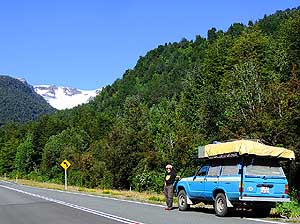
106 A short stop south of Puerto Cßrdenas
- near the glacier Yelcho on the Carretera
- Austral on our way south
|
-
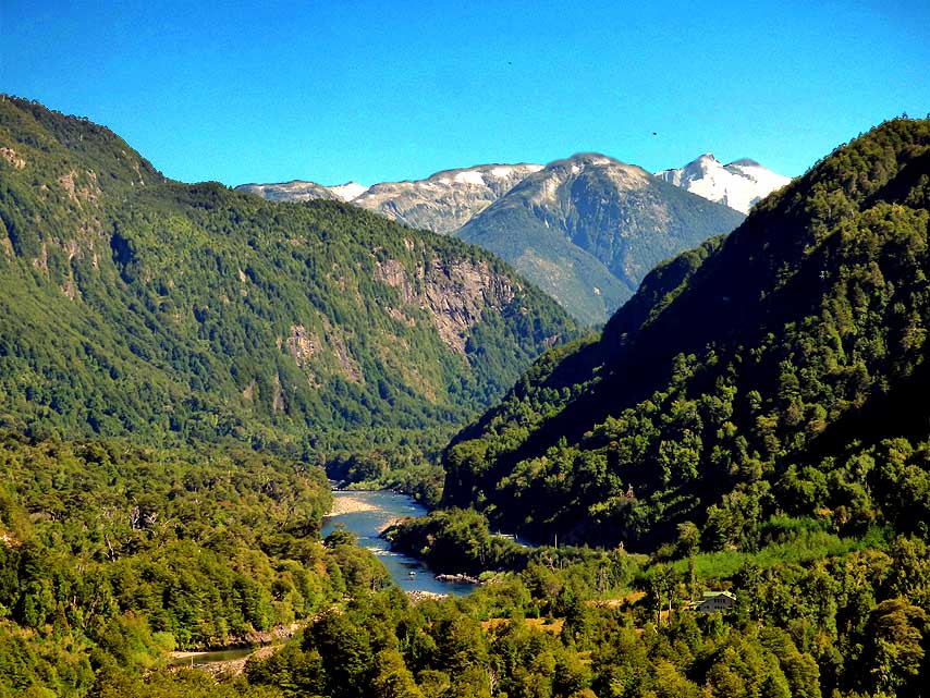
107 Mighty rivers û here RÝo Palena û deep
- forested hills and imposing glaciers are
- characteristic of Patagonia in South Chile
|
-
108 The wild beauty of
ChileÆs
- Patagonia with its exuberant vegetation
- became a tourist magnet
|
-
|
-

|
-
|
-

|
-
109 Along the Puyuhuapi Channel
- (viewing direction North). The whole
- region is canyoned by countless
- fjord-like estuaries
|
-
110 Puyuhuapi Channel (Seno
- Ventisquero) (viewing direction South):
- The flora looks also so far in the South
- (44░S) still pretty tropical thanks to
- the nearly constant precipitations
|
-
111 "El Condor" waterfall
lies
- just besides the Carretera Austral
- 3mi [4¢km] after the 1'970ft.
- [600m] high, unpaved Queulat pass
- into the southern Cisnes valley
|
-
|
-
-
|
-
-
|
-
-

|
-
112 Once more the Puyuhuapi Channel:
- In the background left 6'857ft. [2'090m]
- high volcano Cay and to the right 9'711ft.
- [2'960m] high volcano Cerro Macß
|
-
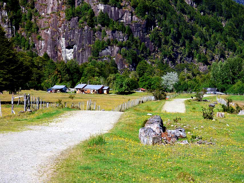
113 The relaxed rural setting of the
- 'RÝo Grande Camping' in El Carmen,
- 100mi [160km] north of Cohaique,
- where we spend one night
|
-
114 Laguna Esponja, a
reservoir
- in Villa Ma±ihuales, 26mi [42km]
- north of the road junction to
- Puerto AysÚn
|
-
|
-
-
|
-
-

|
-
-
|
-
115 Liliana at the reedy shore of
- beautiful Laguna Las Torres with
- stunning views towards the North
|
-
116 The majestic snow covered peak of the
- ~5'700ft. [~1'740m] Cerro Elefantes
- reflects wonderfully in Laguna Las Torres
|
-
117 Emil at the reedy
shore of
- beautiful Laguna Las Torres
- looking towards the South
|
-
|
-

|
-
-
|
-
|
-
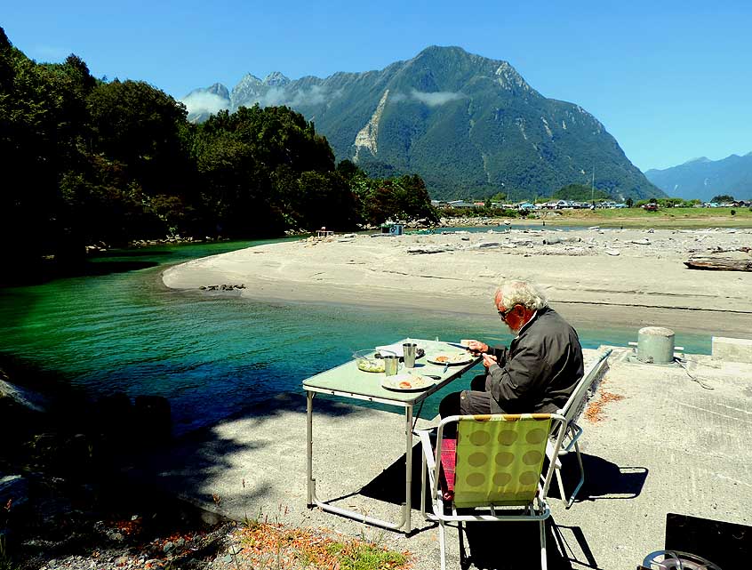
118 Liliana is enjoying from our lunch spot
- at the shore of the river AysÚn before
- Puerto AysÚn the eastern mountain view
|
-
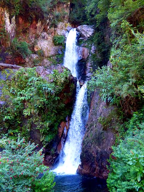
119 The waterfall ôLa Virgenö,
- surrounded by lush vegetation, on the
- way from Puerto AysÚn to Coyhaique
|
-
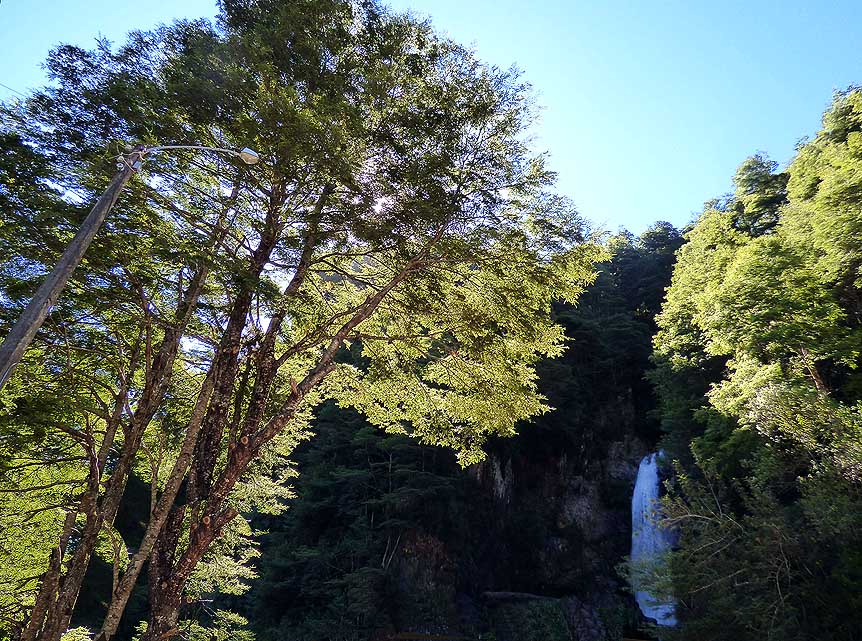
120 The upper fall of the
- Cascada La Virgen
|
-
|
-
-
|
-
-
|
-
-
|
-
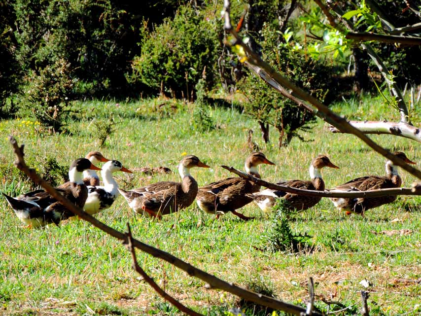
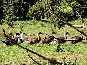
121 Always a refreshing sight:
- A duck family on the tramp
|
-
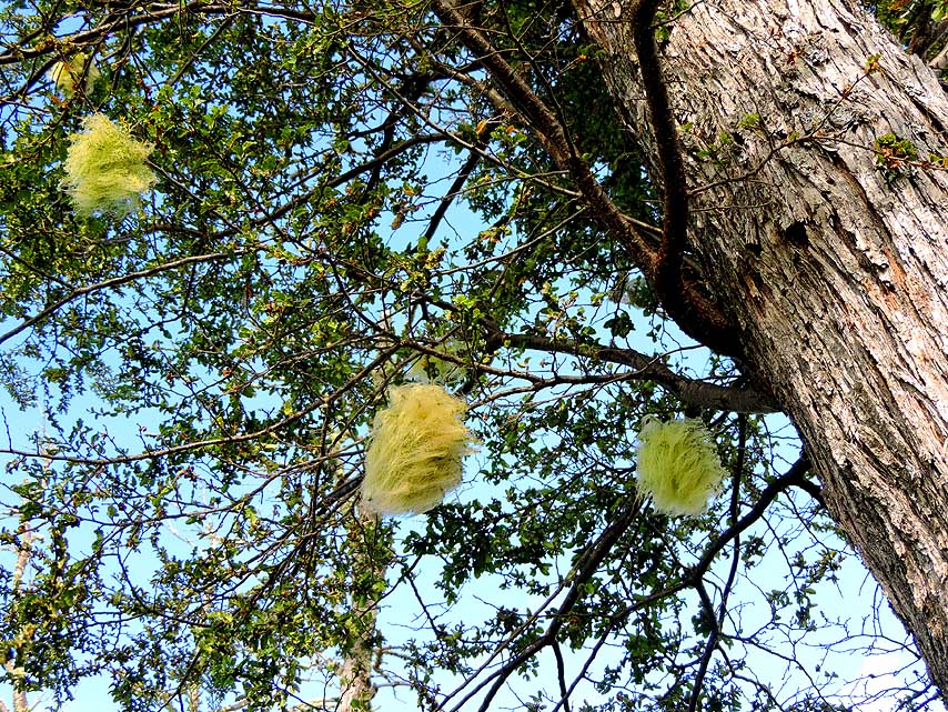
122 Spanish moss (Tillandsia usneoides);
- it exists and multiplies itself solely
- from rain and air
|
-
123 Low-growing scrubland
under-
- growth and shrubs, pushed by the
- humid climate of southern Chile: Near
- Laguna Sep·lveda, 6mi [10km north
- of Puerto Ingeniero Ibß±ez
|
-
|
-
-
|
-
-
|
-
-
|
-
124 A monolith along the Carretera Austral
- while bypassing the Cerro Castillo massif
|
-
125 View from the lookout
- ôCuesta del Diabloö to the
- 8'776ft. [2Æ675m] high Cerro Castillo
- massif, 7mi [11km] before the westerly
- village of Villa Cerro Castillo à..
|
-
126 à.. and down to the
valley and
- straight on where the Carretera Austral
- leads to Cochrane. During our first trip
- 1986, only turning left to the
- Chile Chico version was possible
|
-
|
-
|
-
-
|
-
|
-
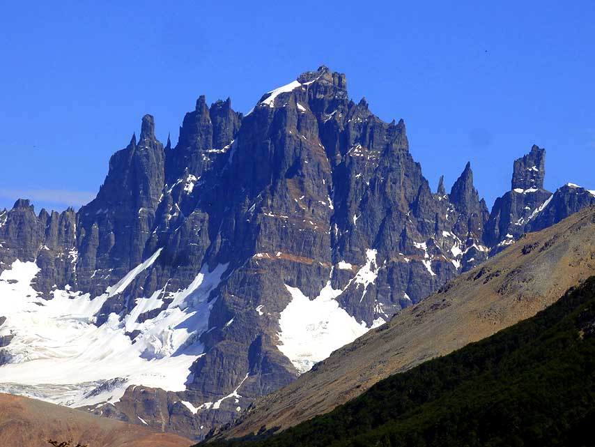
127 The sharp peaks of the imposing
- Cerro Castillo Massif, about 20mi [30km]
- beeline northwest of Puerto Ingeniero
- Ibß±ez û from another lookout
|
-
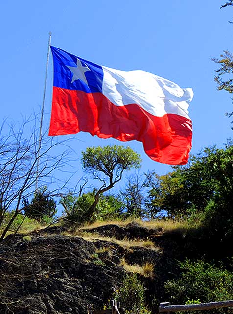
128 The Chilean flag is fluttering in the
- wind on a hill in the peaceful village of
- Villa Cerro Castillo with its 500 people
|
-
129 The impressive Cerro
Castillo
- Massif is visible from far and again
- and again an attractive photo motif.
- Here across Laguna Sep·lveda
|
-
|
-
|
-
-
|
-
|
-
130 We find protection between trees
- from the constantly cold and fierce
- blowing wind at the Agrocamping in
- Puerto Ingeniero Ibß±ez
|
-
131 View to the 5'719ft. [1'743m]
- high Cerro Pirßmide in the soft evening
- light from our Agrocamping in
- Puerto Ingeniero Ibß±ez à..
|
-
132 à.. it is our last
sight of
- South ChileÆs nature paradise before
- we embark next day to Chile Chico
- and drive onwards to Argentina
|
-
|
-
-
|
-
-

|
-
-
|
133 View back to the village of
- Puerto Ingeniero Ibß±ez (800 people)
- and the Cerro Castillo mountain
- range in the back
|
-
134 On the left (western) side of the
- rocky passage from Puerto Ingeniero
- Ibß±ez to Chile Chico the lake is called
- 'Lago General Carrera' (Chile) and on the
- right side 'Lago Buenos Aires' (Argentina)
|
-
135 Our LandCruiser on the
third ferry
- ôTehuelcheö from Pto. Ingeniero Ibß±ez
- to Chile Chico. Duration: 2╝ hours;
- Total costs: 24'350 Pesos = about
- US$43; website:
http://www.barcazas.cl/
-
barcazas/web/lago-general-carrera/
|
-
|
- 36 Nostalgic pictures from scanned slides of our
South American journey
in Chile from
10/20/1986 bis 10/16/1988
|
-
-
|
-
-
|
-
-
|
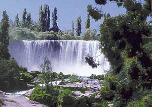
-
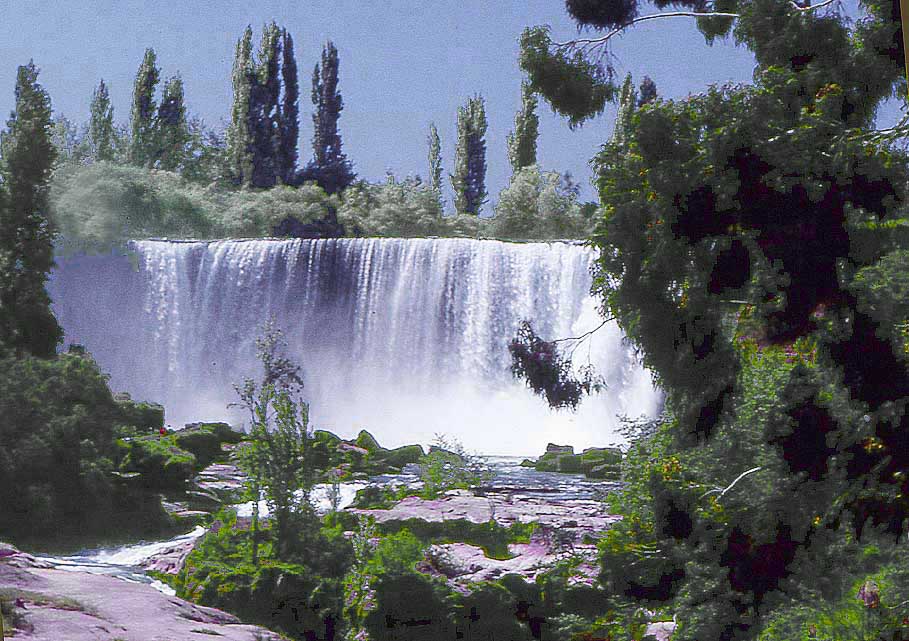
800 The
Laja waterfall along the
- Panamericana between Los ┴ngeles and
- Chillßn û a well known tourist destination
- with commercial campgrounds (see also
- picture #028 in
Chile 1)
|
-
801 The
10Æ153ft. [3Æ125m] high
- volcano Llaima in the Conguillio
- National Park, opened in 1950
|
-
802 The perfectly shaped
Osorno
- volcano raises 8Æ701ft. [2Æ652m]
- towards the deep blue sky
|
-
|
-
|
-
-
|
-

|
-
803 On the way from Ensenada to the
- Ski & Mountain Center of the volcano
- Osorno on an altitude of 4'000ft. [1'200m];
- below Lake Llanquihue
|
-
804 Liliana in front of a huge Chilean
- giant rhubarb (Gunnera tinctoria) in the
- rainforest of the Carretera Austral
|
-
805 A stop along the
gravel road
- of the Carretera Austral at the Puyuhuapi
- Channel to enjoy the view
|
-
|
-
-
|
-
-
|
-
-
|
-
806 Our LandCruiser in action:
- We tow a stranded Landrover
- out of a critical passage
|
-
807 On our way to Coyhaique on the
- Carretera Austral we experience a
- wonderful mystic mood. Weather in
- Patagonia can change on the same
- day from one season to the other
|
-
808 A distance sign
towards the North
- along the Carretera Austral. But there are
- also southwards many miles of gravel
- road ahead: 870mi [1'400km] until
- Punta Arenas, 300 more to Ushuaia!
|
-
|
-
-
|
-
-

|
-
-
|
-
809 Gauchos herding their cattle on the
- route to Puerto Aysen. There is a saying
- that they take their first lessons in riding
- before they are well able to walk
|
-
810 Encounter with a gaucho: The
- Gaucho û skilled horseman (cowboy) û is a
- national symbol in Argentina and Uruguay,
- but belongs also to the Chilean culture
|
-
811 Rural life: On their
way with
- a heavily loaded oxcart
- together with their dog
|
-
|
-
|
-
-
|
-
|
- The Torres del Paine National Park impresses with its soaring
mountains, bright blue icebergs that broke
- off from glaciers and golden grasslands. It's mainly also a
wonderful hiking area with many guanacos to spot
|
-
812 Reflection of the Torres del Paine
- peaks at its best: View from the PehoÚ area
- to the "Paine Horns", left the highest
moun-
- tain'Cerro Paine Grade (9'462ft. [2'884m])
|
-
813 The llama-related Guanacos (Lama
- guanicoe) in front of the three granite towers
- ("Towers of Paine") of the Torres del Paine
- National Park (~8'200ft. [~2'500m] high)
|
-
814 The pampa û the flat
grassland û
- with its warm shade of colors extend
- to the snow covered peaks of Torres
- del Paine National Park
|
-
|
-
|
-
-
|
-
|
-
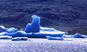
815 Drifting ice, broken off from glaciers
- at the northern end in the >9mi [>15km]
- long Lago Grey in Torres del Paine
- National Park; 32mi [52km] north
- of Serrano entrance station
|
-
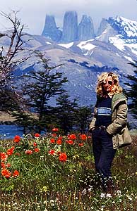
816 Liliana with the background of the
- 3 granite towers ("Towers of Paine") in
- the Torres del Paine National Park;
- Serrano entrance 33mi [53km] north
- of Puerto Natales
|
-
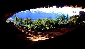
817 The Milod¾n cave,
660ft. [200m]
- long, is known for its rock formations
like
- ôDevilÆs Chairö. It lies 16¢mi [26¢km]
- northwest of Puerto Natales along the
- road Y-290
|
-
|
-
-

|
-
-
|
-
-
|
-
818 The Salar de Maricunga on an
- altitude of 12'303ft. [3'750m] is a large
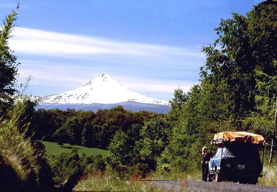
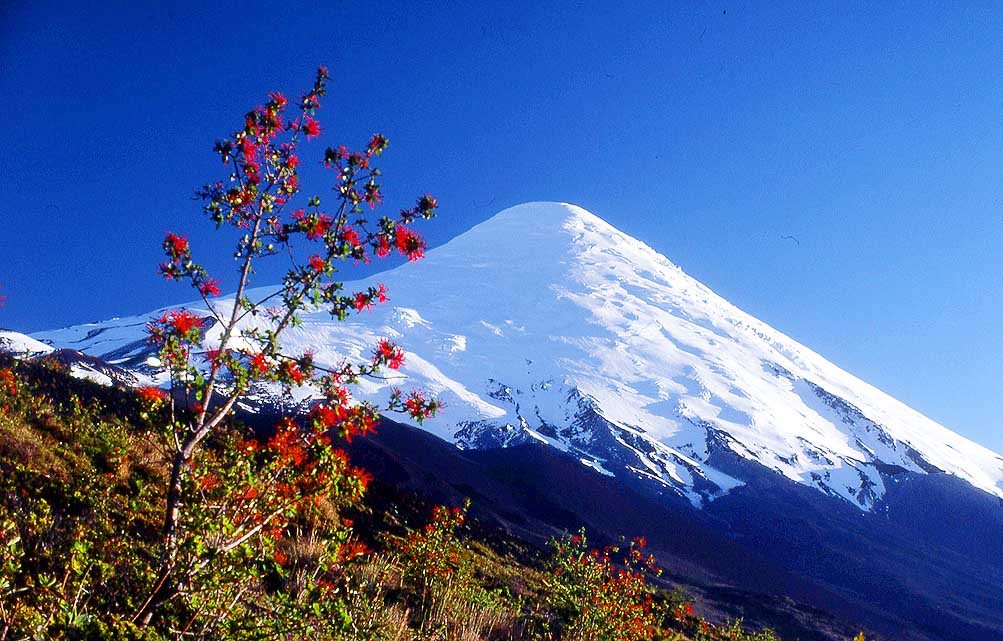
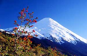
- salt flat in the Atacama region of
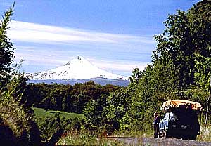
- Northern Chile and lies 62mi [100km]
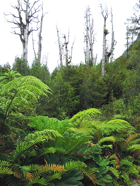
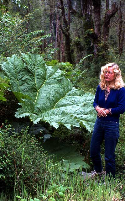
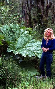
- before San Francisco Pass
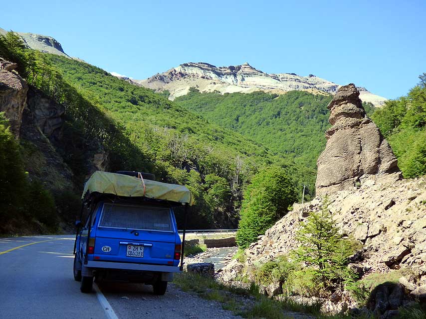
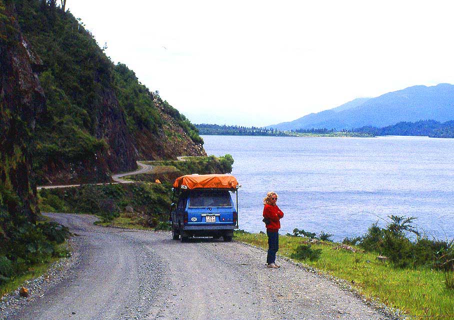
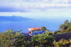
|
-
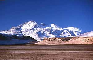
819 The volcano Ojos de Salado with its
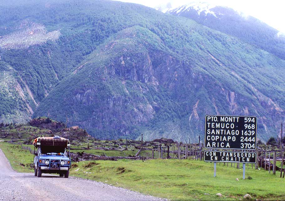
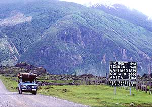
- height of 22'615ft. [6893m] is the highest
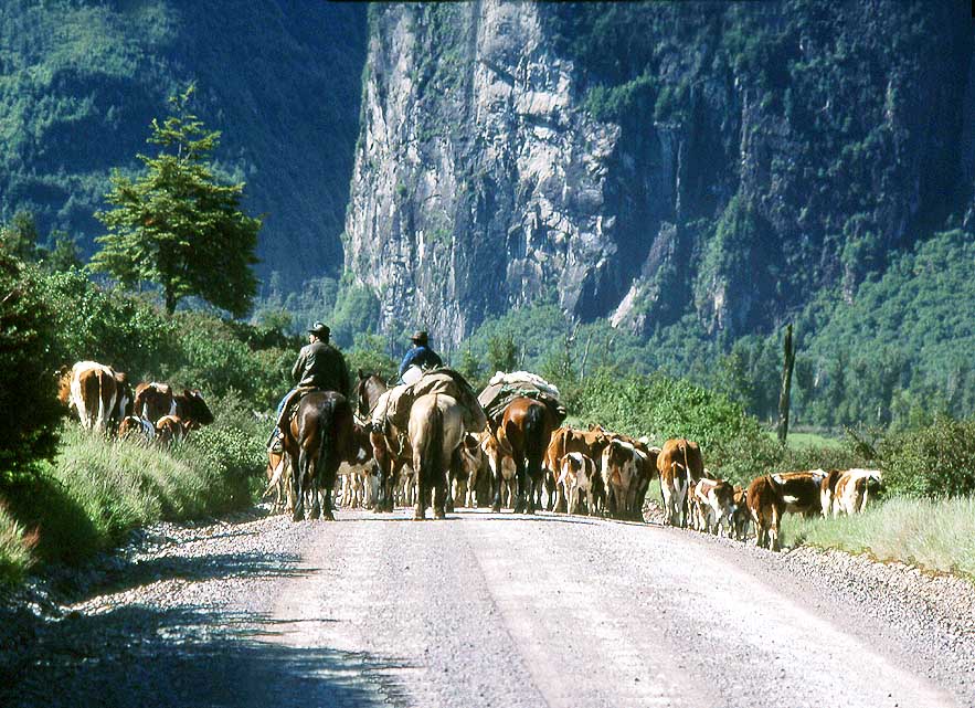
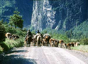
- volcano in the world, but after the 22'837ft.
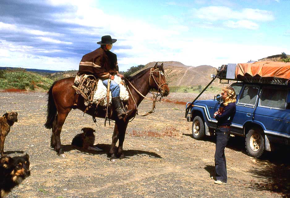
- [6'961m] Argentinean Aconcagua "only" the
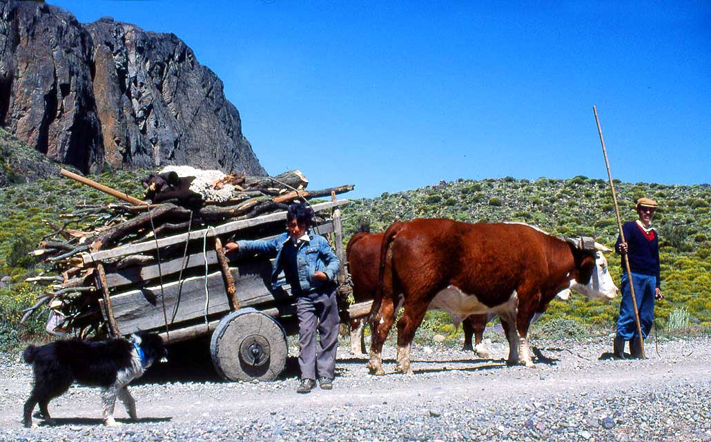
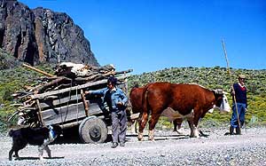
- second highest mountain in South America
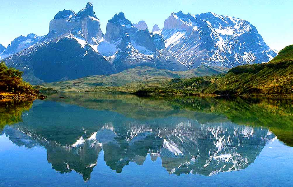
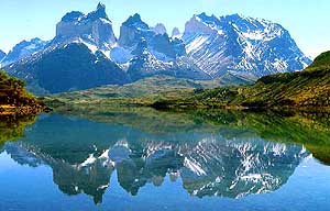
|
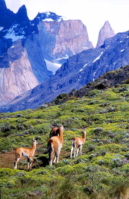
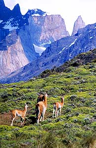
-
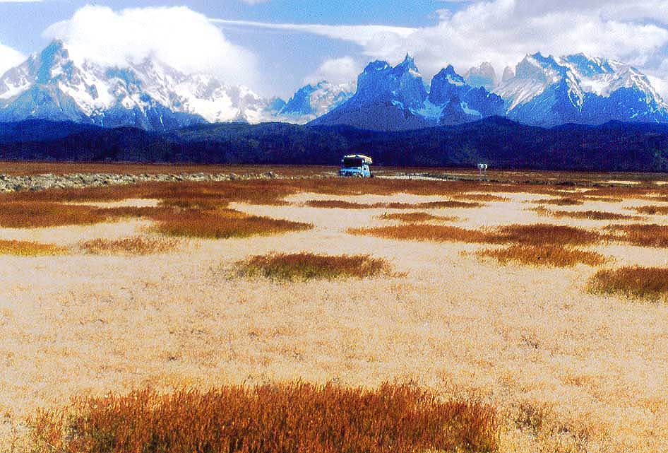
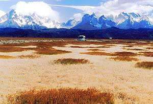
820 A jewel of the Andes:
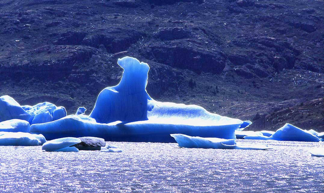
Laguna
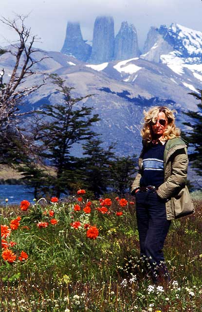
- Verde lies in Chile on 14'200ft. [4'328m]
- altitude, 11mi [18km] before the 15'505ft.
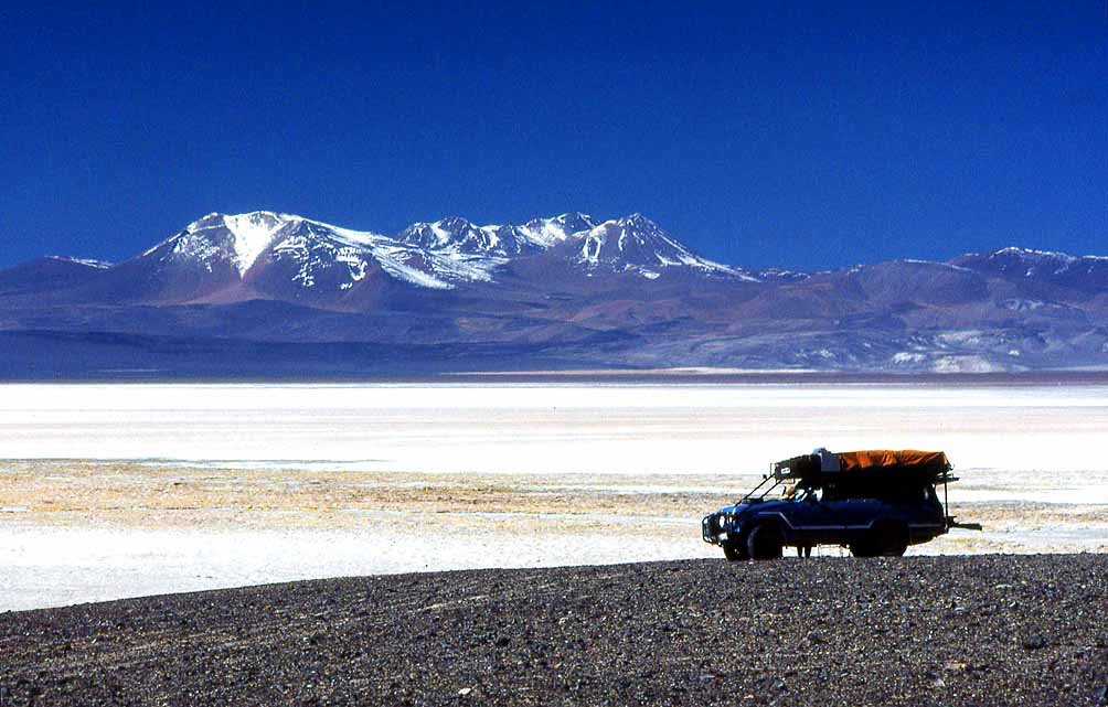
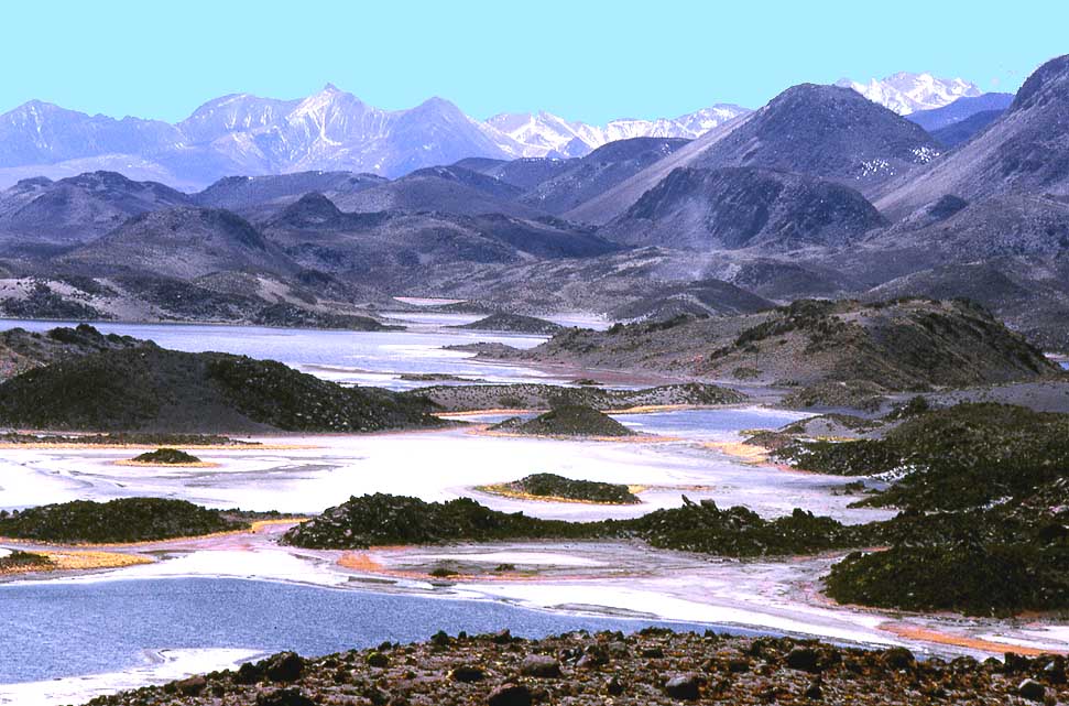
- [4'726m] high San Francisco Pass,
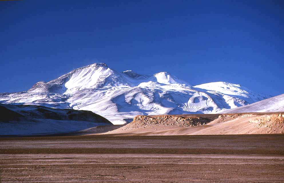
- the border to Argentina
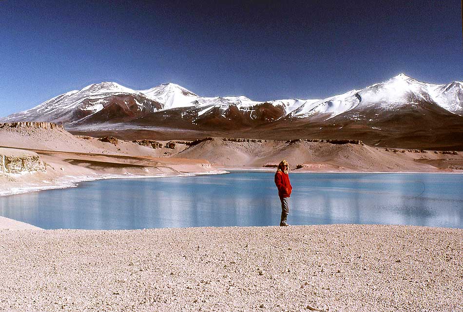
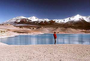
|
-
|
-
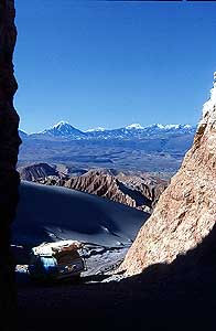
-
|
-
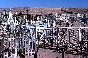
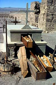
-
|
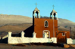
-
-
|
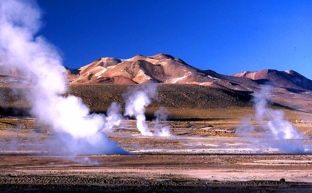
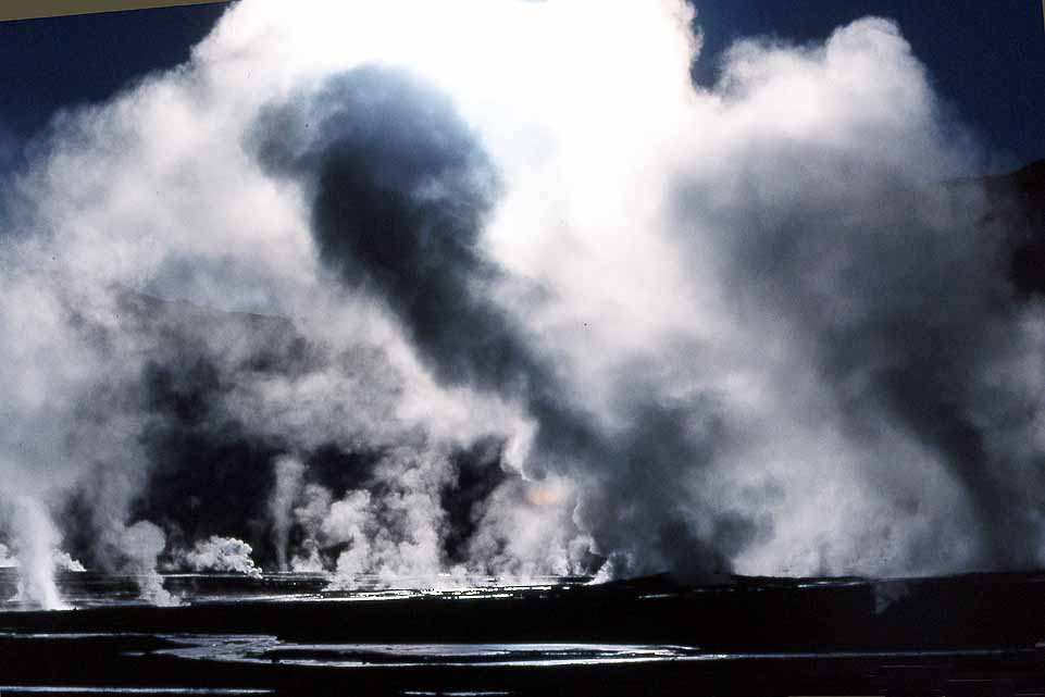
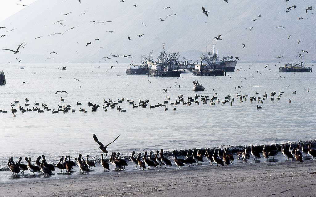
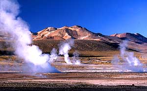
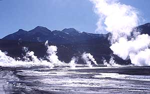
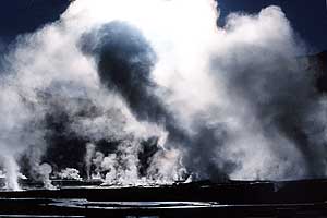
- Impressive steam blowouts at different times of the day in the
geyser field of ôEl Tatioö in the Antofagasta Province of northern
- Chile on 14Æ173ft. [4Æ320m] altitude. It is located 50mi [80
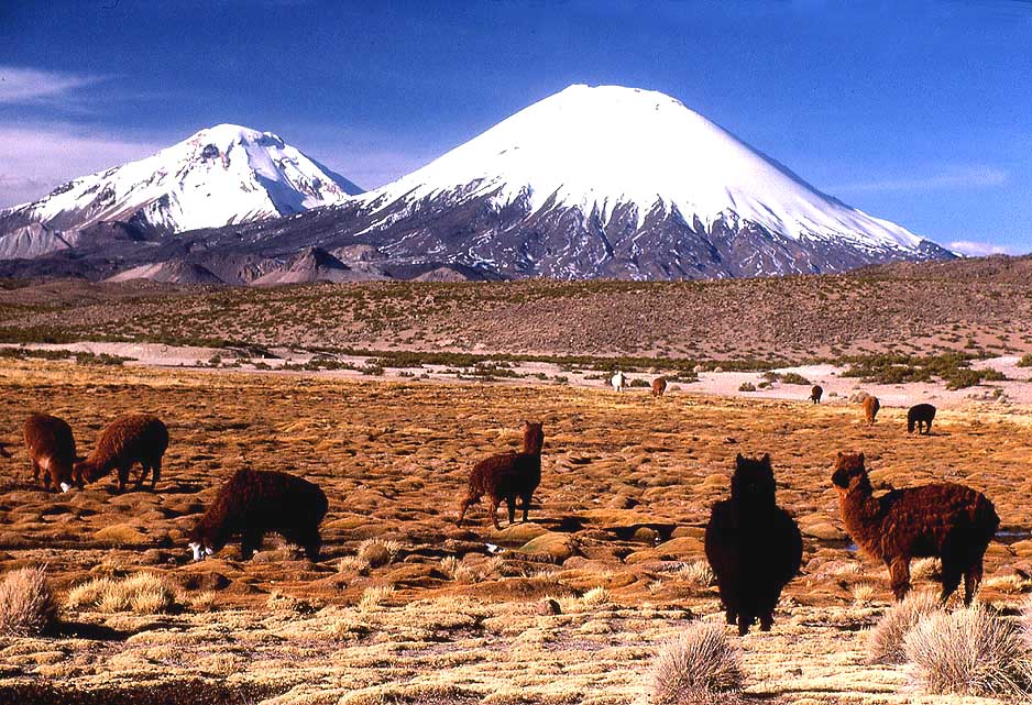
km] north of San Pedro de Atacama and 62mi [100km] east of
Calama
- and is the third-largest geyser field in the world and the
largest in South America. On 6/3/1987 we spent the night there
completely
- alone; there were no parking lot, no concrete walls, no
stone-lined and fenced-in footways, no places and hot water
pools, no stone
- shacks û only pure nature û what a difference!
|
-
821
|
-
822
|
-
823
|
-
|
-

|
-
-
|
-

|
-
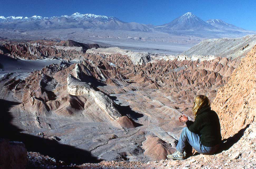
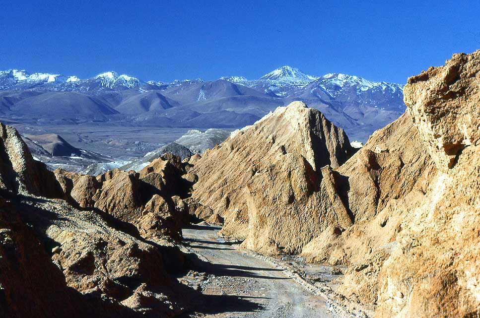
824 Liliana marvels at the play of colors
- of the bizarre moonscape at ôEl Valle de la
- Lunaö (Valley of the Moon) in the Atacama
- Desert, 8mi [13km] west of San Pedro de
- Atacama à..
|
-
825 à.. the distinctive stone and sand
- formations have been carved by eternal
- wind and water. In the background to the
- left the 19'623ft. [5'981m] high volcano
- Sairecabur at the Bolivia border à..
|
-
826 à.. the Atacama desert
is considered
- one of the driest places on earth; it's said
- that some places haven't received a single
- drop of rain in hundreds of years
|
-
|
-
|
-
-
|
-
|
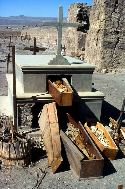
- On the place of the cemetery of the former saltpeter mine "Oficina
Salitrera Francisco
- Puelma" in La Chimba, 8mi [13km] north of Antofagasta, there
is today a residential area
|
|
-
827 The long abandoned cemetery of the
- saltpeter mining town ôOficina Puelmaö in
- northern Chile, which had its heyday
- between 1907 and1932 until a synthetic
- alternative to saltpeter was discovered à..
|
-
828 à.. coffins with remains of those
- buried within lie exposed. Due to the
- hot and dry climate of the Atacama
- Desert mummies are still well preserved
|
-
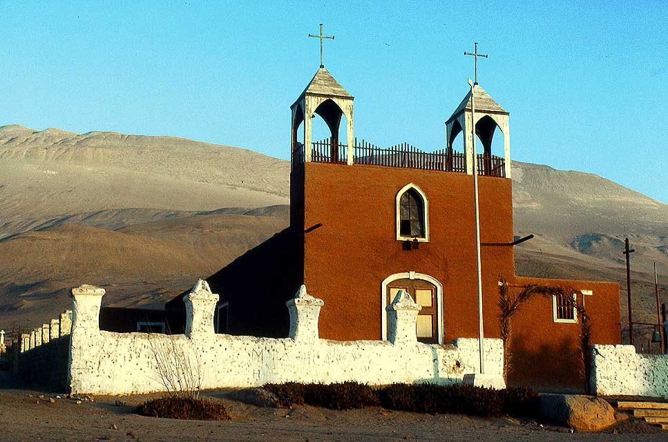
829 Adapted to the colors
of nature:
- The church San Jer¾nimo in Poconchile,
- 23¢mi [38km] east of Arica on the way to
- Lauca Pass and Bolivia in northern Chile
- (Oct. 2017 the church was white)
|
-
|
-
|
-
-

|
-
|
-
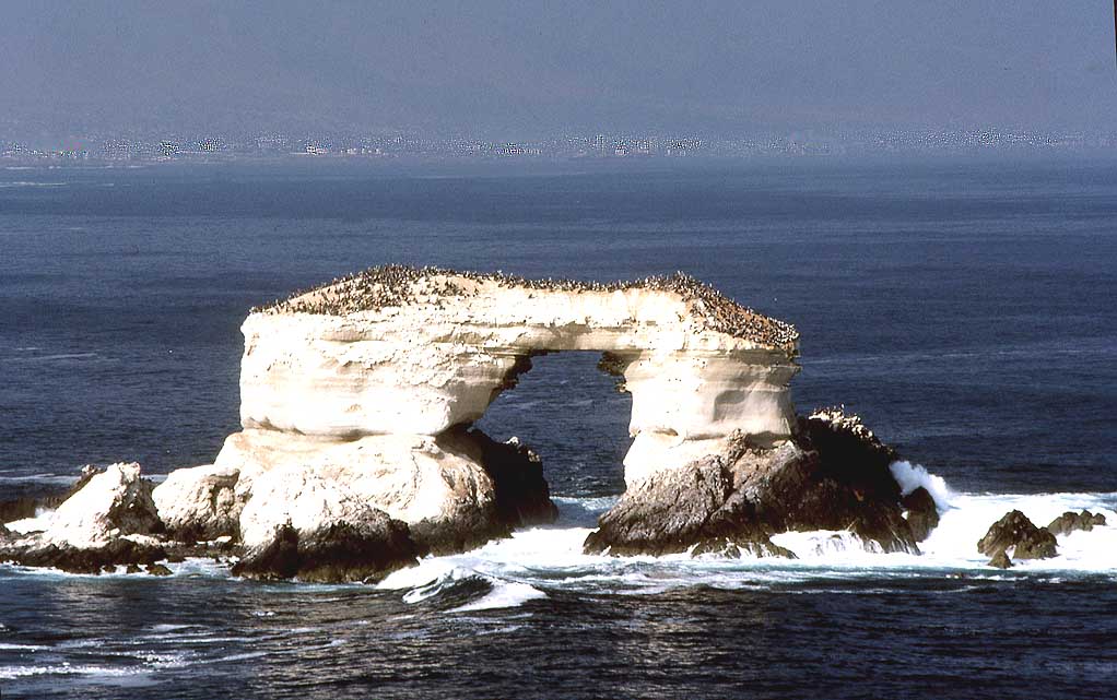
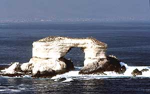
830 The offshore natural 141ft. [43m]
- tall arch ôLa Portadaö at the Pacific Coast
- is also home to seagulls and pelicans and
- is the landmark of the 13mi [21km] more
- southerly situated port town of
- Antofagasta in northern Chile
|
-
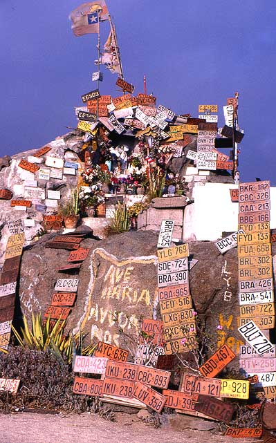
831 Altar along the Panamericana
- in the Atacama desert decorated with
- car number plates
|
-
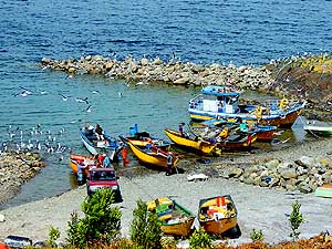
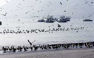
832 Fishing boats off La
Rinconada
- beach 20mi [32km] north of Antofagasta,
- which attract multitudes of pelicans. In
- the background Cerro Moreno
|
-
|
-
-
|
-
-

|
-
-
|
-
833 A (still) shaved Emil in front of the
- spectacular scenery of the 20Æ161ft.
- [6Æ145m] high San Pedro volcano north of
- Calama. It is a composite volcano that forms
- a twin volcano with San Pablo (19'987ft.
- [6'092m]) 3¢mi [6km] further northeast
|
-
834 The Cotacotani lagoons within
- the volcanically active Lauca National
- Park on an altitude of 14'747ft. [4'495m],
- separated by rows of rocky blocks
|
-
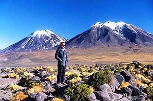
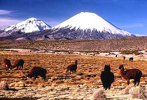
835 Northern ChileÆs
highlands: Grazing
- llamas in front of the snow covered
- Payachata twin volcanos. Parinacota
- (right=south 6'348m [20'827ft.]) and
- Pomerape (left=north 6'282m [20'610ft.])
- û viewed from Lauca National Park
|
-
|
-
Next website from
southern South America:
-
Argentina Part 1
û from
the
Chile border
at
Los Antiguos
to Lujßn de Cuyo near Mendoza
û February 7th to March 13th, 2019
|
- The African trip
2013-16:
- CapeVerde: Santiago/Praia
part 1 û November18th to December 13th, 2013
- CapeVerde: Fogo
û Dezember13th to 23rd, 2013
- CapeVerde: Brava
û December 23rd to 26th, 2013
- Cape Verde: Santiago/Praia
part 2 û December 26th, 2013 to February 28th, 2014
- Cape Verde: SÒo Nicolau û February
28th to March 13th, 2014
- Cape Verde: SÒo Vicente/Mindelo part 1
û March 13th to 20th, 2014
- Cape
Verde: Santo AntÒo/Eastern side part 1 û
March 20th to April 7th, 2014
- Cape
Verde: Santo AntÒo/Western side part 2 û
April 7th to 10th, 2014
- Cape
Verde: SÒo Vicente/Mindelo part 2 û
April 10th to 29th, 2014
-
Namibia Part 1 û
from Walvis Bay to Windhoek
- Angola Part 1
û
September 26th to October 4th, 2014
- Angola Part 2 û
October 4th to 22nd, 2014
-
Namibia Part 2 û
from Windhoek to the Angolan border, back again and on to
South Africa
-
South Africa
Part 1 û
from Namibia border to Capetown û
January 22nd to February 23rd, 2015
- 3rd Major Repair of our
LandCruiser FJ60 - 1982 (due to two broken sideshafts)
-
South Africa Part 2 û from Capetown to Tsitsikamma National Park û
February 24th to March 13th, 2015
- South Africa Part 3 û from
Addo National Park to the Lesotho border û March
13th to April 7th, 2015
-
Lesotho û April 7th to 15th, 2015
-
South Africa Part 4
û from the Lesotho to the Swaziland border û
April 15th to 23rd, 2015
-
Swaziland û April 23rd to 28th,
2015
-
South Africa Part 5
û from the Swaziland to the Botswana border
û April 28th to May 15th, 2015
-
Botswana
-
Zimbabwe
-
Mozambique
-
Malawi
-
Armed Robbery in Malawi on July
31st/August 1st, 2015
-
Tanzania
-
Kenya
-
Ethiopia Part 1 û from Kenya to
Djibouti –
October 25th to November 18th, 2015
-
Djibouti –
October 18th to 27th, 2015
-
Ethiopia Part 2 –
from
Djibouti to
Sudan –
November 27th to December 9th, 2015
- Sudan –
December 9th, 2015 to January 8th, 2016
-
The continuation in Asia 2016-18:
-
Saudi Arabia – January 9th
to 12th, 2016
- United Arab Emirates – January
12th to April 10th, 2016
- Iran – April 11th to
May 6th, 2016
- Turkmenistan – May 6th to
10th, 2016
-
Uzbekistan – May 10th to
31st, 2016
-
Tajikistan Part 1 – from
Uzbekistan border to Dushanbe û May 31st to June 18th, 2016
-
Tajikistan Part 2 – from
Dushanbe to the Kyrgyzstan border û June 19th to 27th, 2016
- Kyrgyzstan – June 27th to August 9th, 2016
-
Kazakhstan û August 9th to 21st, 2016
- Russia Part
2a û from Tretyakovo at
Kazakhstan border via Lake Teletskoye to Gorno Altaysk û August 21st to September
26th,
2016
- Russia Part 2b – from
Gorno Altaysk to the Mongolia border and back to the Ukraine border at Krupets
û Sept. 26th to Nov. 11th, 2016
-
Ukraine Part 3 û November
11th to December 8th, 2016
- 3rd Rejuvenation of our
LandCruiser FJ60/1982 in
Miri/Sarawak/East
Malaysia from 2/6 to 5/3/2017
-
Sarawak-Kalimantan-North Sulawesi Part 1 û Miri
- Kuching/Sarawak/Malaysia -
Balikpapan/Kalimantan, by
ferry to Sulawesi
-
North-Sulawesi Part 2 û
Tomohon and surroundings to Tangkoko NP and onwards to Bitung with ferry
to Ternate on North Moluccas
-
North-Moluccas Part 1
û Ternate and Tidore and onwards by ferry to
Sofifi on Halmahera on North Moluccas
-
North-Moluccas Part 2
û Halmahera and onwards by ferry to Sorong in
West Papua Part 1 (Irian Jaya)
on western Bird's Head Peninsula
-
West Papua (Irian Jaya)
Part 1
û Sorong, éTrans Papua RoadÆ and onwards by
ferry to
Seram in Moluccas (Central)
-
Moluccas (Central) Part 1 û Seram and onwards by ferry
to
Ambon in Moluccas
-
Moluccas (Central)
Part 2 û Ambon and onwards by ferry
to Serui on Yapen in Papua
-
Papua
Part 1 û
Yapen and onwards by ferry
to Biak in Papua
-
Papua
Part 2 û
Biak and onwards by ferry
to Manokwari in West Papua
Part 2
(Irian Jaya) on eastern Bird's Head Peninsula
- West Papua
(Irian Jaya)
Part 2 û Manokwari,
éTrans Papua RoadÆ and onwards by ferry
to Makassar
in South Sulawesi
-
South Sulawesi-Kalimantan-Sarawak
Part 2 û Makassar
South Sulawesi by ferry to Batulicin/South Kalimantan, Kuching - Miri in Sarawak
- Continuation of
3rd Rejuvenation of our LandCruiser FJ60/1982 in Miri/Sarawak/East
Malaysia
from 7/16
to 9/22/2018
|